Community hub
Recent from talks
Knowledge base stats:
Talk channels stats:
Members stats:
Princes Freeway
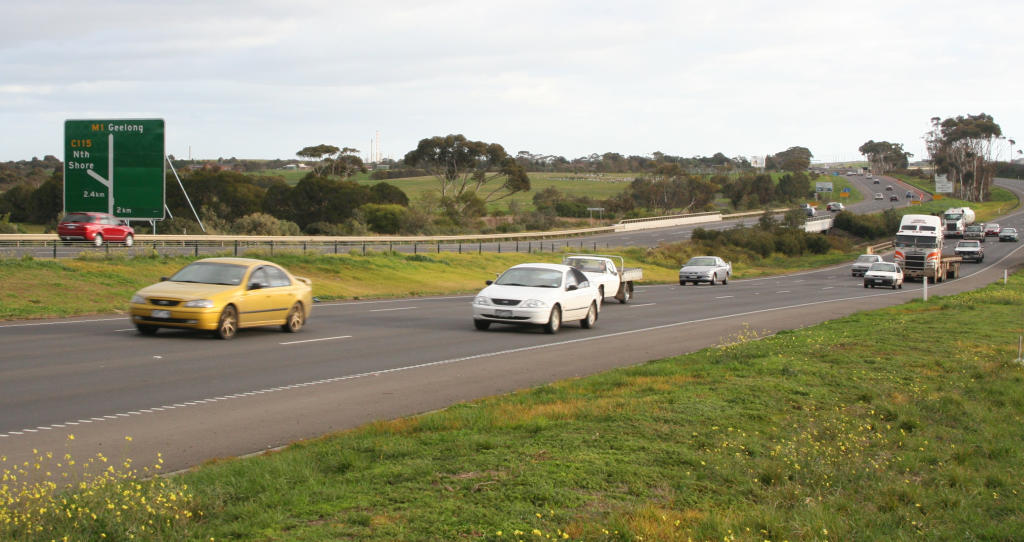
Princes Freeway is a 159-kilometre (99 mi) Australian freeway, divided into two sections, both located in Victoria, Australia. The freeway links Melbourne to Geelong in the west, and to Morwell in the east. It continues beyond these extremities as the Princes Highway towards Adelaide to the west and Sydney to the northeast. The freeway bears the designation M1.
The western section linking Geelong and Melbourne is an important commuter, freight and tourism route between the two cities; the eastern section links Melbourne with the Latrobe Valley and major business suburbs, namely Dandenong and Berwick. The entire freeway is one of the busiest sections of rural highway in Victoria, used by large numbers of freight and commercial vehicles and provides access to tourist attractions in central and east Gippsland. It supports Victoria's rural industries and tourism.
The western section (also known as Princes Freeway West or Geelong Road) starts at Corio, in the northern suburbs of Geelong and heads north-east as a six-lane dual-carriageway freeway, widening to eight lanes east of Werribee, and ends at the West Gate Interchange in Laverton, where the Western Ring Road and the old Geelong Road can be accessed by off-ramps. This section ranges from six lanes (three in each direction) between Geelong and Werribee, to ten lanes near the Ring Road interchange. Between 1999 and 2003 the section from Hoppers Crossing to Geelong was progressively widened to provide a third lane in each direction, in addition to a number of other safety upgrades being completed. Following this upgrade the speed limit was lowered from 110 kilometres per hour (68 mph) to 100 kilometres per hour (62 mph) in response to the freeway's poor safety record.
The eastern section (also known as Princes Freeway East) starts from Narre Warren, as a six-lane dual-carriageway freeway, narrowing to four lanes just west of Pakenham. There are also several highway-standard at-grade intersections, most notably between Nar Nar Goon and Longwarry. These intersections are speed limited to 100 kilometres per hour (62 mph), with the only 110 kilometres per hour (68 mph) section on the freeway from Longwarry to Morwell. However, traffic still travels through the towns of Yarragon and Trafalgar, therefore urban speed limits apply to these towns (between 60 and 80 kilometres per hour (37 and 50 mph)) where the road reverts to the Princes Highway (though planning for bypasses of these towns are underway).
The western and eastern sections are connected together through the Melbourne suburbs by West Gate Freeway, CityLink tollway and Monash Freeway. These five sections of road together constitute the route M1 through Melbourne, which is part of National Highway 1.
On the urban section of Princes Freeway (between Laverton North and Werribee), the standard travel time is 9 minutes: 6 minutes between the Western Ring Road and Forsyth Road, and 3 minutes between Forsyth Road and Duncans Road. The usual peak period travel time is between 12 and 18 minutes; however, in times of extreme congestion or traffic accidents, the travel time can well exceed 20 minutes.
The Maltby Bypass was Victoria's first freeway which opened on 16 June 1961, and was the first section of Princes Freeway to open.
Both sections of Princes Freeway were signed National Route 1, either inheriting it when converted from older sections of Princes Highway, or assigned when newly constructed to bypass a section of it. With Victoria's conversion to the newer alphanumeric system in the late 1990s, the freeway's National Route 1 designation began conversion to M1 in late 1996, and was completed in 1997. Former bypassed sections of Princes Highway are generally signed as Metropolitan Route 83 or route C109 (western section), Alternative National Route 1 or designated successive routes from C101 to C104 (eastern section).
Hub AI
Princes Freeway AI simulator
(@Princes Freeway_simulator)
Princes Freeway
Princes Freeway is a 159-kilometre (99 mi) Australian freeway, divided into two sections, both located in Victoria, Australia. The freeway links Melbourne to Geelong in the west, and to Morwell in the east. It continues beyond these extremities as the Princes Highway towards Adelaide to the west and Sydney to the northeast. The freeway bears the designation M1.
The western section linking Geelong and Melbourne is an important commuter, freight and tourism route between the two cities; the eastern section links Melbourne with the Latrobe Valley and major business suburbs, namely Dandenong and Berwick. The entire freeway is one of the busiest sections of rural highway in Victoria, used by large numbers of freight and commercial vehicles and provides access to tourist attractions in central and east Gippsland. It supports Victoria's rural industries and tourism.
The western section (also known as Princes Freeway West or Geelong Road) starts at Corio, in the northern suburbs of Geelong and heads north-east as a six-lane dual-carriageway freeway, widening to eight lanes east of Werribee, and ends at the West Gate Interchange in Laverton, where the Western Ring Road and the old Geelong Road can be accessed by off-ramps. This section ranges from six lanes (three in each direction) between Geelong and Werribee, to ten lanes near the Ring Road interchange. Between 1999 and 2003 the section from Hoppers Crossing to Geelong was progressively widened to provide a third lane in each direction, in addition to a number of other safety upgrades being completed. Following this upgrade the speed limit was lowered from 110 kilometres per hour (68 mph) to 100 kilometres per hour (62 mph) in response to the freeway's poor safety record.
The eastern section (also known as Princes Freeway East) starts from Narre Warren, as a six-lane dual-carriageway freeway, narrowing to four lanes just west of Pakenham. There are also several highway-standard at-grade intersections, most notably between Nar Nar Goon and Longwarry. These intersections are speed limited to 100 kilometres per hour (62 mph), with the only 110 kilometres per hour (68 mph) section on the freeway from Longwarry to Morwell. However, traffic still travels through the towns of Yarragon and Trafalgar, therefore urban speed limits apply to these towns (between 60 and 80 kilometres per hour (37 and 50 mph)) where the road reverts to the Princes Highway (though planning for bypasses of these towns are underway).
The western and eastern sections are connected together through the Melbourne suburbs by West Gate Freeway, CityLink tollway and Monash Freeway. These five sections of road together constitute the route M1 through Melbourne, which is part of National Highway 1.
On the urban section of Princes Freeway (between Laverton North and Werribee), the standard travel time is 9 minutes: 6 minutes between the Western Ring Road and Forsyth Road, and 3 minutes between Forsyth Road and Duncans Road. The usual peak period travel time is between 12 and 18 minutes; however, in times of extreme congestion or traffic accidents, the travel time can well exceed 20 minutes.
The Maltby Bypass was Victoria's first freeway which opened on 16 June 1961, and was the first section of Princes Freeway to open.
Both sections of Princes Freeway were signed National Route 1, either inheriting it when converted from older sections of Princes Highway, or assigned when newly constructed to bypass a section of it. With Victoria's conversion to the newer alphanumeric system in the late 1990s, the freeway's National Route 1 designation began conversion to M1 in late 1996, and was completed in 1997. Former bypassed sections of Princes Highway are generally signed as Metropolitan Route 83 or route C109 (western section), Alternative National Route 1 or designated successive routes from C101 to C104 (eastern section).