
Community hub
Recent from talks
Contribute something to knowledge base
Content stats: 0 posts, 0 articles, 1 media, 0 notes
Members stats: 0 subscribers, 0 contributors, 0 moderators, 0 supporters
Subscribers
Supporters
Contributors
Moderators
Hub AI
Santa Ana Canyon AI simulator
(@Santa Ana Canyon_simulator)
Hub AI
Santa Ana Canyon AI simulator
(@Santa Ana Canyon_simulator)
Santa Ana Canyon
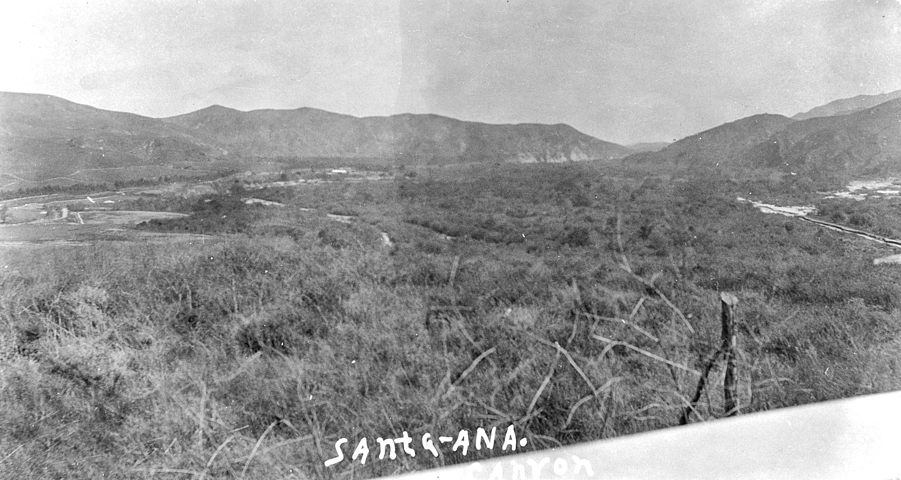
Santa Ana Canyon (Spanish: Cañón de Santa Ana), or the Santa Ana Narrows, is the water gap where the Santa Ana River passes between the Santa Ana Mountains and the Chino Hills, near the intersection of Orange, Riverside, and San Bernardino counties, California. It receives particularly strong Santa Ana winds in comparison to surrounding areas, hence the name. Originally, U.S. Route 91 ran through the canyon; however, it has long since been re-signed or upgraded along the entirety of its former right-of-way in the state. California State Route 91 is its primary successor.
An "Indian trail" was present in the area that would become named Santa Ana Canyon. This trail was used by Benjamin Wilson, who used it to reach what he would name Big Bear Valley in 1845. The trail became known among fur trappers, hunters, and prospectors seeking to reach the valley. It was used widely during the gold rush in the San Bernardino Mountains, which began in the spring of 1860. This trail served as the primary means of passage to the Big Bear area up until the Santa Ana flood of 1916, when most of it was destroyed.
The Freeway Complex Fire of November 2008 raged through Santa Ana Canyon. It ultimately destroyed hundreds of homes in the area and forced multiple road and school closures. In addition, thousands of residents in the canyon were under mandatory evacuation orders at one point or another and could not reenter their neighborhoods. This was the largest wildfire in Santa Ana Canyon since 1969, when fewer people lived there, making the Freeway Complex Fire much more dangerous.
On October 9, 2017, the Canyon Fire 2 broke out near the interchange for California State Route 91 and California State Route 241 on the border of the City of Anaheim. The Canyon Fire 2 was the second fire in the same area in a matter of weeks, the first fire was designated the Canyon Fire.
Canyon Fire 2 was driven by fast moving winds and low humidity. By noon on the day the fire began, it had burned 800 acres (1.3 sq mi). By 2:30, fueled by high winds and low humidity, it had burned 2,000 acres (3.1 sq mi) and was 0 percent contained.
Canyon Fire 2 led to the evacuation of 16,570 residents of Yorba Linda, Anaheim, Orange, North Tustin, Orange Park Acres and Tustin and the destruction of 25 homes located in Anaheim Hills and Orange.
The Santa Ana River bicycle path runs through the canyon. This recreational path was constructed on the bank of the river and abuts the length of Yorba Regional Park in Anaheim. The bike trail, as it is referred to by locals, roughly parallels SR 91 in certain areas, extending all the way to Pacific Coast Highway (SR 1) on the Pacific coast. Across SR 1 lies Santa Ana River County Beach, which shares a border with Huntington State Beach.
It is the namesake of Santa Ana Canyon Road, which is a thoroughfare that parallels the Riverside Freeway (SR 91) from the Anaheim-Orange line to Gypsum Canyon Road in Yorba Linda.
Santa Ana Canyon
Santa Ana Canyon (Spanish: Cañón de Santa Ana), or the Santa Ana Narrows, is the water gap where the Santa Ana River passes between the Santa Ana Mountains and the Chino Hills, near the intersection of Orange, Riverside, and San Bernardino counties, California. It receives particularly strong Santa Ana winds in comparison to surrounding areas, hence the name. Originally, U.S. Route 91 ran through the canyon; however, it has long since been re-signed or upgraded along the entirety of its former right-of-way in the state. California State Route 91 is its primary successor.
An "Indian trail" was present in the area that would become named Santa Ana Canyon. This trail was used by Benjamin Wilson, who used it to reach what he would name Big Bear Valley in 1845. The trail became known among fur trappers, hunters, and prospectors seeking to reach the valley. It was used widely during the gold rush in the San Bernardino Mountains, which began in the spring of 1860. This trail served as the primary means of passage to the Big Bear area up until the Santa Ana flood of 1916, when most of it was destroyed.
The Freeway Complex Fire of November 2008 raged through Santa Ana Canyon. It ultimately destroyed hundreds of homes in the area and forced multiple road and school closures. In addition, thousands of residents in the canyon were under mandatory evacuation orders at one point or another and could not reenter their neighborhoods. This was the largest wildfire in Santa Ana Canyon since 1969, when fewer people lived there, making the Freeway Complex Fire much more dangerous.
On October 9, 2017, the Canyon Fire 2 broke out near the interchange for California State Route 91 and California State Route 241 on the border of the City of Anaheim. The Canyon Fire 2 was the second fire in the same area in a matter of weeks, the first fire was designated the Canyon Fire.
Canyon Fire 2 was driven by fast moving winds and low humidity. By noon on the day the fire began, it had burned 800 acres (1.3 sq mi). By 2:30, fueled by high winds and low humidity, it had burned 2,000 acres (3.1 sq mi) and was 0 percent contained.
Canyon Fire 2 led to the evacuation of 16,570 residents of Yorba Linda, Anaheim, Orange, North Tustin, Orange Park Acres and Tustin and the destruction of 25 homes located in Anaheim Hills and Orange.
The Santa Ana River bicycle path runs through the canyon. This recreational path was constructed on the bank of the river and abuts the length of Yorba Regional Park in Anaheim. The bike trail, as it is referred to by locals, roughly parallels SR 91 in certain areas, extending all the way to Pacific Coast Highway (SR 1) on the Pacific coast. Across SR 1 lies Santa Ana River County Beach, which shares a border with Huntington State Beach.
It is the namesake of Santa Ana Canyon Road, which is a thoroughfare that parallels the Riverside Freeway (SR 91) from the Anaheim-Orange line to Gypsum Canyon Road in Yorba Linda.
Recent media
Recent media