Taunus
Taunus
Main page
2248630

Taunus

logo
Community Hub0 subscribers
Read side by side
from Wikipedia

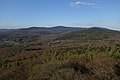
The Taunus (German pronunciation: [ˈtaʊnʊs] ) is a mountain range in Hesse and Rhineland-Palatinate, Germany, located north west of Frankfurt and north of Wiesbaden. The tallest peak in the range is Großer Feldberg at 878 m; other notable peaks are Kleiner Feldberg (825 m) and Altkönig (798 m).

Key Information

The range is bounded on three sides (west, north, and south) by the Rhine and its tributaries, namely the Lahn and the Main, and on the east by the plain of Wetterau. It spans the districts of Hochtaunuskreis, Main-Taunus-Kreis, Rheingau-Taunus, Limburg-Weilburg, and Rhein-Lahn. The range is known for its geothermal springs and mineral waters that formerly attracted members of the European aristocracy to its spa towns. The car line Ford Taunus is named after it.[1]

Location and boundary

[edit]

The Taunus is the southeastern part of the Rhenish Slate Mountains. The low mountain range is about 75 km long from southwest to northeast and about 35 km wide across it from northwest to southeast,it covers an area of about 2700 km2. In the west, the Upper Middle Rhine Valley borders the Taunus and separates it from the western Hunsrück. In the north, the valley of the Lahn (Giessen-Koblenzer Lahntal) with the Limburg Basin forms a very sharp scenic border to the northern Westerwald. In the east, the Giessen Basin (southernmost part of the West Hessian Uplands) with Dießenbach and Kleebach border to the north, the Wetterau with Wetter and Nidda to the south of the slate mountains; in the south, the Rheingau and the Main-Taunus foothills form natural borders. The last three landscapes are part of the Rhine-Main lowlands.

On the southern edge are the towns of Rüdesheim am Rhein, Wiesbaden, Hofheim am Taunus and Bad Homburg vor der Höhe at the junctions with the valleys of the Upper Rhine and Main; the towns of Bad Nauheim and Butzbach are on the eastern edge at the junction with the Wetterau; in the north on the Lahn the towns of Wetzlar, Weilburg, Bad Ems and Lahnstein border on the Hintertaunus; in the west in the Middle Rhine is, among other things, Lorch at the seam (each in an anti-clockwise direction).[2]

Natural structure

[edit]

The Taunus is a heterogeneous landscape area, but it is usually quite distinct from the surrounding landscapes and is classified as a main natural area unit group. The natural landscape is divided according to morphology, geological structure, climate and partly by the prevailing vegetation into sub-landscapes that are more uniform in themselves. The cultural landscape, i.e. the natural landscape shaped by man, shows the following structure in terms of land use, the location and distribution of settlements and the course of traffic routes.

In the south are the more wooded and higher parts, namely the Vordertaunus (naturally also called Vortaunus) and the Hohe Taunus (around Taunus main ridge), where in the Feldberg massif the highest heights not only of the Taunus but of the entire Rhenish Slate Mountains are reached. That is why the climate here is rougher than in the upstream landscape areas - it is colder on average, it rains and, in particular, it snows more. The turbulent relief offers little space for settlements and agricultural use. On the mostly shallow and fertile soils, which developed from acidic rock, there is mainly forest here. The Vortaunus is more inconsistent than the main ridge, it is morphologically more fragmented and the bays of the foothills divide it more.

Hintertaunus is the name given to the area north of the Hoher Taunus up to the Lahn valley. The landscape here is lower and less mountainous than in the southern Taunus. Between the valleys, some of which are quite deep, there are pronounced plateaus (leveled areas) with heavy agricultural use. Since mostly only the slopes of the valley are forested, the Hintertaunus is generally more open. The landscape of the Hintertaunus is more inconsistent because of its different elevations. This is clearly evident in the eastern Hintertaunus. Here, for example, there is a high-altitude landscape with dense forest cover, a harsher climate and poor soil in the Pferdskopf-Bergland; but also the Usinger basin, a gently undulating, open basin landscape with fertile soil and a balanced climate.

The Hintertaunus is divided into the Western and Eastern Hintertaunus by the Idstein Depression, which developed in the IdsteinBad Camberg area. The Idstein depression widens towards the Lahn valley towards the Limburg Basin and is also known as the Goldener Grund in the northern area, probably because agriculture found more favorable conditions here. The relief is gently undulating, the soil is fertile due to the high proportion of loess and the climate is milder due to the basin location.

The Taunus (main unit group 30) is subdivided in terms of natural space as follows:[3][4]

  • 300 Vortaunus (218.90 km2)
    • 300.0 Rheingau-Wiesbadener Vortaunus (47.04 km2)
      • 300.00 Rheingau-Vortaunus (28.00 km2)
      • 300.01 Wiesbaden Vortaunus (19.04 km2)
    • 300.1 Eppstein-Hornauer Vortaunus (101.66 km2)
      • 300.10 Eppsteiner Horst (82.98 km2)
      • 300.11 Hornau Bay (18.68 km2)
    • 300.2 Altkönig vorstufe (48.49 km2)
        • 300.20 Königstein foot of the Taunus (18.29 km2)
        • 300.21 Kronberg Taunus foot (30.20 km2)
    • 300.3 Homburg Vortaunus (21.71 km2)
  • 301 High Taunus (314.92 km2)
      • 301.0 Niederwald bei Rüdesheim(12.87 km2)
      • 301.1 Rheingau Mountains (76.47 km2)
      • 301.2 Wiesbaden High Taunus (71.43 km2)
      • 301.3 Feldberg-Taunus crest (96.95 km2)
      • 301.4 Winterstein-Taunuskamm (45.80 km2)
      • 301.5 Nauheimer Taunusspur (11.40 km2)
  • 302 Eastern Hintertaunus (825.66 km2)
    • 302.0 Wetzlar Hintertaunus (165.88 km2)
      • 302.1 Weilburger Hintertaunus (with Edelsberger Platte) (131.80 km2)
      • 302.2 Bodenroder Kuppen (52.70 km2)
      • 302.3 Hasselbacher Hintertaunus (169.83 km2)
      • 302.4 Münster-Maibach threshold (26.30 km2)
      • 302.5 Using Basin (87.50 km2)
      • 302.6 Pferdskopf-Taunus (81.47 km2)
      • 302.7 Steinfischbacher Hintertaunus (110.18 km2)
  • 303 Idstein Valley (82.63 km2)
    • 303.0 Golden Grund (31.74 km2)
      • 303.1 Idsteiner Grund (24.39 km2)
      • 303.2 Escher Grund (10.19 km2)
      • 303.3 Idstein Forest (16.31 km2)
  • 304 Western Hintertaunus (908.38 km2)
    • 304.0 Wispertaunus (145.05 km2)
      • 304.1 Western Aartaunus (82.66 km2)
      • 304.2 Bad Schwalbach-Hohensteiner Aartal (22.32 km2)
        • 304.20 Aar-Aubach-Grund (0.27 km2)
      • 304.3 Eastern Aartaunus (184.56 km2)
      • 304.4 Oberaarmulde (23.83 km2)
      • 304.5 Zorn plateau (41.64 km2)
      • 304.6 Middle Rhine Taunus (109.56 km2)
      • 304.7 Unterlahn Heights (38.19 km2)
      • 304.8 Nastätter Mulde (92.58 km2)
      • 304.9 Katzenelnbogen plateau (167.99 km2)
        • 304.90 Dörsbach/Mühlbach watershed (16.24 km2)
        • 304.91 Lower Dörsbach-Tiefenbach area (34.42 km2)
        • 304.92 Central Katzenelnbogen plateau (104.43 km2)
        • 304.93 Schiesheim Aartal widening (12.90 km2)

Geology and minerals

[edit]
Geological map of the Taunus

The Taunus is geologically divided from south to north into the units Vordertaunus unit (also northern phyllite zone or metamorphic southern edge zone), Taunus ridge unit and Hintertaunus unit. Finally, south of the Lahn, the Taunus natural region has a share in the Lahn trough and the Giessen nappe.

Vordertaunus

[edit]

The Vordertaunus Unit is a narrow zone of weakly metamorphic rocks such as phyllites, greenschists and sericite gneisses.[5] They are appear greenish through chlorite and epidote. The starting products of these rocks were mudstones and volcanic rocks. The rock strata occurring in the Vordertaunus are divided from north to south into the metavolcanic sequence, the Eppstein slate and the Lorsbach slate.[5]

The oldest sedimentary rocks of the Taunus are the phyllites of Bierstadt from the Early Ordovician epoch, known only from a borehole in Wiesbaden, with an age of about 480 million years determined by the evidence of spores. The volcanic rocks of the metavulcanite unit are younger, they could be dated to the Upper Ordovician and Silurian using uranium-lead dating. They are overlaid by the Eppstein slates of the Silurian and the Lower Devonian Lorsbach slates. At the very southern edge and in a small deposit near Mühlbach in the east of the Vordertaunus unit, limestones are exposed that are attributed to the Middle Devonian.[6]

Taunus crest

[edit]
Celtic rock rings on the ascent to Altkönig
Brunhildis rock at the summit of the Großer Feldberg

To the north of the Vordertaunus is the Taunuscrest, also known as the High Taunus, which mainly consists of Lower Devonian clastic rocks. It is composed of the stratigraphic sequences Graue Phyllite, Bunte Schiefer, Hermeskeilschichten and Taunusquarzit. The Lower Devonian sub-layer only appears in two small outcrops, metavolcanites of the type found in the Anterior Taunus rocks.[7]

The Graue Phyllite consist of slates and sandstones. They contain impressions of Upper Silurian brachiopods and corals and were deposited in shallow water. The clay slates of the Bunte Schiefer are greenish-grey or strikingly violet in color due to finely distributed hematite. Agnaths (jawless fish) found in the Bunte Schist are from the Gedinne (Lochkovian); just like the formation of the rock, they show a deposit of the colorful slate in rivers or lakes. The rocks of the colorful slate are found on the Großer Feldberg, where they were mined in tunnels to extract roofing slate (slate tunnel below the Red Cross). Quartzite sandstones are embedded in them, from which the Brunhildis rock on the summit of the Großer Feldberg consists. The Hermeskeil layers are exposed below the Großer Feldberg and consist of mudstones, weakly consolidated micaceous sandstones and quartzites of the Lower Siegen (Lower Pragian). They are covered by several 100 m thick layers of Taunus quartzite (Middle Siegen, Pragian/Emsian). The very weather-resistant rock forms many summits of the Taunus ridge (Altkönig, Kleiner Feldberg, Glaskopf), but also individual rock elevations (such as the Hohle Stein). The Celtic ring walls and the rubble heap on the "White Wall" on the Altkönig consist of Taunus quartzite. The fractured groundwater of the Taunus quartzite is of local interest for water extraction. They are dammed by the underlying Hermeskeilschichten and pumped through groundwater tunnels. Four such groundwater tunnels make a significant contribution to Wiesbaden's water supply.

Hintertaunus

[edit]

The largest unit of the Taunus in terms of area, the Hintertaunus unit, is mainly composed of the black rock series of the Hunsrück slate and the Singhofen layers of the lower Ems tier, often greywacke-like sandstones as well as siltstone and claystone. Younger rocks are only exposed here in small occurrences near Usingen and on the very eastern edge of the Hintertaunus in the Oberkleen area. The geology of the Hintertaunus is not as well known as that of the Vortaunus and Hochtaunus in the south or that of the Lahnmulde in the north due to the often monotonous sandy and slate rocks that form only a few continuous reference horizons and provide hardly any index fossils.

The Hunsrück slate refers to a rock facies occurring mainly in the Hunsrück and Hintertaunus, which is composed of pure, mostly black mudstone and embedded sandstone banks and occurs in stratigraphically different positions in the Upper Siegen and in the Ems. The bulk of the Hunsrück Slate is attributed to the Elm Lower Stage.[8] It is known for its exceptionally well-preserved fossils and is locally well suited for use as roofing slate. In the western Hintertaunus, the almost sand-free Hunsrück slate can be easily separated from the sandy rocks of the Singhofen layers, in the east, rocks in the facies of the Hunsrück slate recede. Transposed volcanic tuffes and ashes, the so-called porphyroides, are integrated into the Singhofen layers, they can be traced in some cases over several tens of kilometers.[9]

The Middle Devonian to Lower Carboniferous of the Usinger Mulde is only about 250 m thick and strongly tectonically disturbed, in the Lahnmulde and Dillmulde typical rocks of this time such as Schalstein, Massenkalk and deck diabase absent here. The greywacke occurring here and at other places in the eastern Hintertaunus cannot or can hardly be distinguished from the Carboniferous Kulm greywacke[10] and are considered by some scientists to be the remains of the ' Viewed 'Giessen Ceiling.[9]

Geological structure

[edit]

The strata of the Taunus were formed in the course of the Variscan orogeny foliated, scaled and in the southwest-northeast strike saddles and troughs folded. The folds are predominantly northwestvergent. Widespread to the northwest, the rock series were thrust onto younger ones. Thus, at the fault zone of the Taunuskamm overthrust, the entire length of the southern Taunus nappe-like was thrust over rocks of the Younger Lower Devonian. The overthrust of the Giessen Nappe, which lies flat today, on rocks from the Hintertaunus and the Lahn Mulde is of even greater extent. Their rocks are not otherwise found in the Taunus, they must have been deposited south of the Vortaunus and were thrust at least 25 km over the Taunus and Hintertaunus, possibly significantly more due to large-scale considerations. In addition to the deformation of the layers, these are clearly metamorphic in the Vordertaunus – the latter clearly decreases to the north.

In later uplift phases between the Late Jurassic and the Tertiary, cross-fractures were applied perpendicular to strike. The rift valley of the Idstein Depression divides the Hintertaunus into an eastern and western part, while the Limburg Basin divides the Lahn Mulde as it sinks. Some of the fractures are now filled with quartz. The free-standing rocks of the Eschbacher cliffs near Usingen are such a quartz vein (Härtling) exposed by erosion. This vein, also known as the Usinger quartz vein, can be traced over a length of about 12 km, making it one of the longest German quartz veins after the Bavarian Pfahl.

Mineral resources

[edit]

The northwestern part of the Eastern Hintertaunus (Langhecker Lahntaunus), which leads to the Weilburger Lahntalgebiet, belongs geologically to the Lahnmulde and is rich in magmatism. of mineral resources from the Middle Devonian such as iron in the form of red ironstone with up to 50 percent iron content, or river ironstone with up to 35% iron, as well as silver ore, roofing slate and diabase. The ore was mined in numerous mines here, as in the Montan area Lahn-Dill area; some have been converted to visitor mines. The mining that operated from the 17th to the 20th centuries has now ceased. In the eastern Taunus between Idstein in the west and Usingen in the east, from the late Middle Ages to the early 20th century, there was a large number of pits in which there was mining of varying intensity on post-varistic, i.e. only after the varistic orogeny ore veins formed in the late Jurassic and early Cretaceous. The last active lead and silver ore mine, the Heftrich pit with the Hannibal and Hasdrubal tunnels, was closed around 1924. Exploration drilling carried out by the Hessian State Office for Soil Research in the 1980s no longer provided any indication of deposits worth building.[11]

Due to its hardness, the Taunus quartzite was often mined in the past, currently only one quarry near Köppern is in operation. Some limestone and diabase quarries are still in operation in the part of the Lahnmulde that belongs to the Taunus. In addition, there are countless smaller quarries to supply the local population with building blocks.

History

[edit]
Porta Praetoria (Main Gate) at the Saalburg Roman Fort, Limes Germanicus

The Roman Limes was built across the Taunus. The Saalburg, a restored Roman castellum, now houses a museum.

After the fall of the Limes (in 259/260 AD), the Alamanni settled in the range and for this reason there are some Alemannic cemeteries in the southern foothills of the Taunus (Eschborn). This area of the Taunus became part of the Frankish confederation of Germanic tribes after the Battle of Tolbiac around 500 AD.[12]

Until the late 18th century, the mountain range was known simply as die Höhe ("the height"), a name that has been preserved in the place names Bad Homburg vor der Höhe and Rosbach vor der Höhe. The name Taunus comes from Tacitus's Annals, which mention a castellum in monte Tauno, probably in reference to today's Friedberg.

In past centuries the Taunus became famous among aristocrats for its therapeutic hot springs.[13]

Certain towns in the area, such as Bad Homburg vor der Höhe with its Kurpark, have geothermal spas that were formerly renowned. Other spa towns in the Taunus range are Bad Schwalbach (formerly Langenschwalbach) mentioned in documents dating back to the 16th century, Bad Ems, one of the most reputed therapeutic spas in Germany since the 17th century, as well as Bad Weilbach, where a spring reached wide fame for some time. By the 19th century the most famous spa towns in the area were Wiesbaden, Bad Homburg vor der Höhe, Bad Nauheim, and Bad Soden am Taunus.[14]

[edit]

References

[edit]
[edit]
Revisions and contributorsEdit on WikipediaRead on Wikipedia
from Grokipedia
The Taunus is a low mountain range in the German states of Hesse and Rhineland-Palatinate, located northwest of Frankfurt am Main and forming part of the Rhenish Slate Mountains.[1][2] It spans approximately 75 kilometers in length and 35 kilometers in width, bounded by the Rhine River valley to the west, the Main River valley to the south, and the Lahn River valley to the north, with elevations ranging from 200 to 880 meters, and covers about 2,700 square kilometers, encompassing the Taunus Nature Park.[3] The highest peak is the Großer Feldberg, reaching 879.5 meters above sea level, characterized by dense mixed forests, rolling hills, and a temperate climate conducive to outdoor activities.[4][5] Geologically, the Taunus consists primarily of sedimentary rocks from the Silurian and Devonian periods, including phyllites, quartzites, sandstones, and shales, shaped by the Variscan orogeny around 300 million years ago.[6] These formations contribute to its rugged terrain, mineral springs, and scenic valleys, supporting diverse flora such as beech and oak woodlands alongside fauna including deer, wild boar, and various bird species. The area also features therapeutic hot springs and is recognized as one of Germany's largest climatic health resorts.[1] Historically, the Taunus has been inhabited since prehistoric times, with significant Roman presence from the 1st to 3rd centuries AD, marked by the Upper German-Raetian Limes—a UNESCO World Heritage Site comprising forts, watchtowers, and walls along its ridges.[7] Medieval castles like Königstein and Kronberg dot the landscape, reflecting its role in regional defense and nobility. Today, the Taunus is a popular destination for hiking over 1,200 kilometers of trails, cycling, and cultural exploration, including the reconstructed Saalburg Roman fort and cider taverns showcasing local Hessian traditions.[8][1]

Geography

Location and Boundaries

The Taunus is a low mountain range situated in central-western Germany, primarily within the state of Hesse and extending into Rhineland-Palatinate. It measures approximately 75 km in length from northeast to southwest and 35 km in width from northwest to southeast, encompassing an area of about 2,700 km².[9][10] The range's natural boundaries are defined by prominent river valleys and plains: to the north by the Lahn River valley, to the east by the Wetterau plain and Nidda River, to the south by the Main River and the Upper Middle Rhine Valley, and to the west by the eastern bank of the Rhine River.[11][1] Administratively, the Taunus crosses multiple districts, including the Hochtaunuskreis, Main-Taunus-Kreis, and Rheingau-Taunus-Kreis in Hesse, along with the Rhein-Lahn-Kreis in Rhineland-Palatinate.[12] The region lies in close proximity to major urban centers, bordering Frankfurt am Main to the southeast and Wiesbaden to the southwest.[1]

Natural Divisions

The Taunus exhibits a diverse internal topography, subdivided into distinct natural regions that reflect its varied landforms ranging from rugged highlands to fertile basins. These divisions, delineated by the German natural landscape classification system, include the Vordertaunus in the north, the central High Taunus (also known as the Taunus Crest), the expansive Eastern and Western Hintertaunus, and the Idstein Valley.[13][14][15][16][17] The Vordertaunus, spanning ~209 km², forms the northern wooded highlands with rolling hills and forested ridges that transition gently into the broader lowlands.[14] South of the main ridge, this area features a fragmented terrain of schollen horsts and open bays, with elevations typically between 200 and 400 m. The High Taunus, covering ~313 km², represents the central plateau and crest of the range, characterized by a prominent 75 km-long ridge of steep southern slopes dropping sharply toward the Rhine-Main lowlands and more gradual northern inclines. This division hosts the highest elevations, including the Großer Feldberg at 879 m and the Kleiner Feldberg at 825 m within the Feldberg massif, alongside other peaks like the Altkönig at 798 m.[13][10][18] To the north of the crest lies the Hintertaunus, split into the Eastern Hintertaunus (~520 km²) with its rolling hills and dissected ridges, and the Western Hintertaunus (~414 km²), which incorporates the Wispertaunus subregion noted for deeper valleys and wavy plateaus. The Eastern portion gradually descends from around 600 m near the crest to 250 m at the Lahn valley, featuring narrow meadow valleys and erosion-formed rills, while the Western extends from 200 m in the northwest to 550 m in the southeast, with incised valleys and open muldes like the Nastätter Mulde. Finally, the Idstein Valley, part of the Limburger Becken und Idsteiner Senke (~266 km² basin known as the "Golden Grund" for its fertile loess-covered soils), occupies a low-lying area amid these uplands, providing a contrast in flat, agriculturally productive terrain.[15][16][17] Key landforms across the Taunus include broad plateaus in the High Taunus, prominent massifs such as the Feldberg, and incised valleys like the Usinger Becken in the Eastern Hintertaunus, which exemplifies the region's fluvial dissection. Elevations vary significantly, from 100–200 m in the lower valleys and basins to a maximum of 879 m at the Großer Feldberg, underscoring the Taunus's role as a transitional upland between the Rhine valley and northern plateaus. Over 70% of the Taunus is wooded, predominantly with mixed deciduous and coniferous forests that cloak the hills, ridges, and slopes, contributing to its status as a forest-rich landscape.[13][15]

Geology

Formation and Structure

The sedimentary rocks forming the Taunus were deposited during the Devonian period (approximately 419–359 million years ago), and the mountain range originated during the Variscan orogeny in the Late Devonian to Carboniferous periods (ca. 380–290 Ma), a major tectonic event involving the collision between the supercontinent Laurussia and Gondwana, which crumpled and metamorphosed the Central European crust.[19][20] This orogeny produced folded and thrusted structures, with subsequent uplift during the Tertiary period (approximately 66–2.6 million years ago) elevating the range to its present form through tectonic compression and erosion.[20] The Paleozoic rocks exposed in the Taunus date to the Silurian and primarily the Devonian periods, reflecting marine depositional environments in an ancient seaway.[19] The dominant rock types in the Taunus include metamorphosed Devonian sediments such as phyllites, greenschists, quartzites, and slates, formed under low-grade metamorphic conditions during the Variscan deformation.[20][19] Phyllites and greenschists prevail in the southern zones, while resistant quartzites create prominent ridges, and slates form more subdued terrains; these lithologies result from the compression and alteration of original siliciclastic and volcanic materials.[20] Structurally, the Taunus divides from south to north into the Vordertaunus, Taunus Crest, and Hintertaunus zones, each characterized by distinct Devonian rock assemblages.[20] The Vordertaunus consists mainly of phyllites and greenschists, including formations like the Bierstadt phyllite and associated meta-volcanics such as the Rossert metaandesite.[20] The central Taunus Crest features Lower Devonian quartzites and conglomerates that resist erosion, forming the range's highest summits like the Großer Feldberg.[20] The northern Hintertaunus includes slates and greywackes, such as the Hunsrück slate facies and Bunte slate, reflecting deeper marine basin deposits.[20] Tectonic features of the Taunus encompass intense folding and faulting from the Variscan orogeny, with major structures like the Taunussüdrandverwerfung—a northeast-southwest striking fault that offsets rocks by over 200 meters along the southern margin.[20][19] This fault system bounds the range against the Upper Rhine Graben, while post-orogenic erosion by the Rhine River has sculpted the steep southern escarpment, exposing these folded Paleozoic layers and contributing to the range's asymmetric profile.[20]

Minerals and Resources

The Taunus region hosts significant mineral deposits primarily within its Devonian rock formations, including iron ores such as hematite and goethite, as well as silver, copper, lead, and zinc occurrences.[21] These metallic minerals are found in hydrothermal vein systems, with lead-zinc-copper veins containing galena, sphalerite, and chalcopyrite, and silver-bearing phases like tetrahedrite-tennantite and native silver.[22] Iron and silver deposits are concentrated in the Vordertaunus and crest areas, where post-Variscan fluid circulation through faults facilitated mineralization in Devonian phyllites and greenschists.[21][22] Non-metallic resources include roofing slate derived from the Hunsrück series of Lower and Middle Devonian clay and silt slates, which are quarried in the Hintertaunus for their durability and low sand content.[23] Quartzite, formed from metamorphosed sandstones rich in quartz varieties like rock crystal, is extracted for use in construction aggregates and dimension stone due to its hardness and weathering resistance.[21] Volcanic intrusions contribute basalt and lava flows, notably 57-million-year-old basalt vents near Wiesbaden-Naurod, which represent Paleogene volcanic activity within the Rhenish Massif.[20] Geothermal springs emerge along deep faults such as the Taunus-Hunsrück master fault and Taunus border fault, where hot, mineralized waters rise from depths exceeding 1,000 meters, supporting potential energy extraction.[24][25] Extraction of metallic minerals has been largely historical, with modern activities limited to small-scale quarrying of slate and quartzite; geothermal resources remain underexploited but offer prospects for renewable energy development.[21][23][24]

Climate and Environment

Climate

The Taunus exhibits a temperate oceanic climate, classified as Cfb under the Köppen-Geiger system, characterized by mild temperatures and consistent precipitation influenced by its proximity to the Rhine Valley, which moderates extremes through westerly air flows. Annual average temperatures typically range from 7 to 9°C across the region, with lower elevations near the Rhine experiencing warmer conditions around 9–10°C, while the colder highlands drop to approximately 6°C at peaks like the Großer Feldberg.[26][27][28] Precipitation in the Taunus is moderate to high, averaging 800–1,200 mm annually, with amounts increasing in the western sectors and higher elevations due to orographic lift as moist Atlantic air rises over the range. Lower areas, such as Sulzbach, record about 730 mm per year, while uplands receive more, often exceeding 1,000 mm, particularly on windward slopes. Winters bring snowfall, especially above 600 m, where accumulations support seasonal snow cover lasting several weeks in colder years.[29][30] Seasonal variations are moderate, with mild winters where temperatures rarely fall below -5°C, even in the highlands, and average January highs around 3°C in valleys rising to 25°C during warm summer days in July and August. Valleys are prone to frequent fog, particularly in autumn and winter, due to cold air pooling, while exposed crests experience stronger winds, averaging 15–17 km/h in winter months. These patterns contribute to a relatively stable environment, though local topography amplifies variations in microclimates.[31][32]

Ecology and Biodiversity

The Taunus region is characterized by extensive forest cover, comprising approximately 60% of its landscape, primarily consisting of mixed deciduous woodlands. Beech forests account for about 33% of the wooded areas, featuring smooth gray bark and oval leaves that produce nutrient-rich beech nuts supporting local wildlife, while oak forests make up around 25%, identifiable by their corky bark and acorns that serve as a key food source for birds and mammals.[33] Higher slopes host mixed coniferous stands, including spruce (now reduced to roughly 10% due to damage and harvesting) with straight trunks and sharp needles, alongside birch trees noted for their distinctive white bark, and scattered mountain maples with multi-lobed leaves. Valleys feature nutrient-poor grasslands that harbor specialized plant communities adapted to low-fertility soils, contributing to the region's ecological diversity. These vegetation patterns are influenced by underlying geological substrates, such as quartzite formations on summits that support sparse, resilient flora on nutrient-scarce grounds.[34][35] Wildlife in the Taunus thrives across its varied habitats, with mammals including roe deer (up to 85 cm at the shoulder and 25 kg, with antlers on males), wild boar (up to 200 kg with prominent tusks), red foxes (5-8 kg with red-brown fur), wildcats, and the threatened hazel dormouse, a small nocturnal rodent reliant on hedgerows and forest edges for fruits, nuts, and insects.[33][36] Birds such as woodpeckers, owls, rare ground-nesting species, and the red-backed shrike in grasslands exemplify avian diversity, while reptiles like the fire salamander (up to 20 cm with black-yellow patterning) inhabit moist forest floors. Insects and bats, including the Bechstein’s bat, further enrich the fauna, particularly in undisturbed woodlands and meadows that provide essential foraging and breeding sites.[34][35][37] Conservation efforts in the Taunus focus on mitigating habitat fragmentation from urbanization and promoting biodiversity through protected areas like the Taunus Nature Park, spanning 1,350 km², and sub-regions such as the Wispertaunus, the largest unfragmented forest in Hesse. Initiatives emphasize renaturalizing streams, expanding natural forests by 1,000 hectares to create connected habitats for species like dormice and wildcats, and restricting off-path activities to protect sensitive flora such as orchids and rare birds. Post-2020 projects, including a 2023-2026 planning phase funded by the Federal Agency for Nature Conservation, address forest loss and biodiversity threats. As of 2025, ongoing forest damages from droughts, heatwaves, and bark beetle infestations continue to impact coniferous stands, prompting adaptive measures such as promoting resilient deciduous species and reforestation efforts.[38][39][37][40] Climate change poses risks to higher-elevation species by altering moisture levels and temperatures, prompting adaptive measures like reduced conifer reliance to bolster resilient deciduous ecosystems.

History

Ancient and Roman Period

The Taunus region exhibits evidence of human occupation dating back to the Neolithic period, around 4200–3500 BCE, during the Michelsberg culture. The fortified hilltop settlement at Kapellenberg near Hofheim am Taunus, excavated since 2008, housed up to 1,000 inhabitants and featured defensive structures, a large tumulus burial indicative of social hierarchy, and artifacts linked to long-distance trade networks exchanging jade axe blades from the Western Alps for salt.[41] This site underscores early economic complexity and potential inter-community conflict in the Rhine-Main area. By the Bronze Age, hill forts emerged as defensive strongholds, part of broader prehistoric conflict patterns documented in the LOEWE research project on sites between the Taunus and Carpathians.[42] Celtic influences became prominent in the late Iron Age, particularly during the early La Tène period around 400 BCE, when fortified settlements spread across the region. Archaeological evidence from hilltop sites in the Taunus reflects the adoption of Celtic cultural elements, including advanced ironworking and social organization, prior to Roman expansion. Nearby Celtic oppida like the Glauberg in Hesse further illustrate this phase, with burial mounds and elite artifacts signaling centralized authority and trade connections. Pre-Roman finds, including stone tools from silicified sandstone quarries and pottery shards, attest to sustained resource exploitation and settlement continuity in the Taunus.[43] Roman occupation intensified from the 1st century CE, transforming the Taunus into a frontier zone with the construction of the Limes Germanicus, a defensive barrier against Germanic tribes like the Chatti. Initiated under Emperor Domitian around 90 CE, the Taunus section included cohort forts such as the Saalburg, which housed 500–600 soldiers and featured stone walls, barracks, and a principia headquarters.[44] Emperor Hadrian reinforced this in 120 CE by ordering a continuous wooden palisade across the Taunus, Westerwald, and Odenwald, marking a shift to a more defined imperial boundary while reducing troop concentrations.[44] Watchtowers dotted the line for surveillance, with the Odenwaldlimes serving as a southern extension linking the Taunus defenses to the Neckar region.[45] Economic activities under Roman control included mining gold, silver, and iron in the Lahn valley adjacent to the Taunus, where military camps near Bad Ems supported extraction efforts from the 1st century CE.[46] Shaft-tunnels and slag heaps indicate processing, though yields were modest, leading to abandonment by 47 CE as noted by Tacitus.[46] A network of roads connected these operations to Mogontiacum (modern Mainz), with a key route crossing the Taunus mountains to interior outposts like Waldgirmes, facilitating troop movements and supply lines.[47] Archaeological discoveries at sites like Saalburg yield Roman pottery, tools, and inscriptions, highlighting the integration of the Taunus into Germania Superior's administrative and military framework until the 3rd century CE.[44]

Medieval to Modern Era

Following the collapse of Roman authority in the 5th century, the Taunus region experienced migrations and settlements by Germanic tribes, with the Franks establishing presence in the area before expanding under the kingdom in the early 6th century. The Franks incorporated the territory into Austrasia, fostering agricultural settlements and Christianization through missionary efforts, which laid the foundation for medieval communities in the hilly landscape. By the 8th century, under Carolingian rule, the area saw the establishment of early ecclesiastical centers that reinforced Frankish control. During the High Middle Ages (10th–15th centuries), the Taunus fell under the fragmented feudal structure of the Holy Roman Empire, with local lordships dividing the land among noble families amid imperial oversight. The construction of defensive castles exemplified this era's power dynamics; Kronberg Castle, initiated around 1170–1200 by the Lords of Eschborn as a Romanesque upper fortress with a keep, served to protect trade routes and assert feudal authority over surrounding villages.[48] In 1330, Holy Roman Emperor Louis IV granted the Lords of Kronberg rights to fortify and wall the adjacent settlement, elevating it to town status and integrating it into the empire's network of imperial fiefs.[48] These structures not only symbolized noble autonomy but also facilitated control over resources like timber from the Taunus forests. The early modern period (16th–19th centuries) brought religious upheaval and social tensions to the Taunus, exacerbated by the Protestant Reformation and subsequent conflicts. Hesse, encompassing the Taunus, aligned with Lutheranism early on, drawing the region into the Thirty Years' War (1618–1648), where Swedish and imperial forces ravaged local settlements; towns like Oberursel were destroyed multiple times, including by fire in 1645, leading to population decline and economic disruption.[49] Amid this turmoil, witch hunts intensified, particularly in the late 17th century; in Idstein, a Taunus town under Nassau counts, 31 women and 8 men were executed for alleged witchcraft between 1676 and 1677, reflecting widespread paranoia fueled by religious wars and crop failures.[50] Paralleling these conflicts, the mineral springs of Bad Homburg began attracting attention for therapeutic use from the 16th century, with early exploitation for salt production transitioning to health cures by the 17th century; the discovery and promotion of springs like the Elisabethenbrunnen in 1724 drew nobility seeking respite, establishing the foundations of spa culture that flourished under landgraves.[51] In the 20th century, the Taunus's rugged terrain constrained large-scale industrialization, limiting development to localized forestry, quarrying, and light manufacturing while nearby Frankfurt absorbed heavier industry; this preserved much of the landscape but slowed economic growth compared to Rhine Valley hubs.[11] World War II brought direct devastation, with Allied air raids targeting Frankfurt spilling over into the Taunus, damaging sites like Kronberg Castle's chapel via firebomb in 1944; the region also hosted Wehrmacht training in the mountains and intelligence operations at Kransberg Castle, which served as a Luftwaffe interrogation center before Allied capture in 1945.[52] [53] Post-war, the Taunus lay in the U.S. occupation zone, becoming part of West Germany's Hesse state in 1949, where it benefited from the economic miracle through tourism and commuter links to Frankfurt, though the national division indirectly strained cross-border trade until reunification in 1990 restored full economic integration without local border disruptions.[54]

Human Settlement and Economy

Settlements and Spa Towns

The Taunus region features a variety of settlements ranging from affluent suburbs integrated into the Frankfurt metropolitan area to picturesque rural towns preserving medieval architecture. Bad Homburg vor der Höhe, located in the Hochtaunuskreis district, serves as a prominent commuter hub just north of Frankfurt, renowned for its elegant Kurpark and historic castle, which reflect its status as a former summer residence for Prussian royalty.[1] Königstein im Taunus, another Frankfurt suburb in the Hochtaunuskreis, is noted for its extensive castle ruins atop a hill, offering panoramic views and underscoring its role as a climatic health resort with easy rail access to the city center.[1] Further into the rural interior, Usingen in the Hochtaunuskreis represents a quieter administrative center with Baroque-era buildings and proximity to forested trails, while Idstein, also in the Hochtaunuskreis, stands out for its well-preserved ensemble of half-timbered houses dating from the 15th to 18th centuries, concentrated around König-Adolf-Platz and featuring ornate carvings on structures like the 1615 Killingerhaus.[55] The Taunus is particularly celebrated for its spa towns, where mineral-rich springs have drawn visitors for centuries. Wiesbaden, the regional capital at the southern edge of the Taunus, boasts 26 thermal springs with water temperatures exceeding 65°C, originating from depths of up to 2,000 meters in deep aquifers of the Upper Rhine Graben region and emerging with high mineral content, including significant salt concentrations of 14-17 tons per day across all springs.[56] Bad Soden am Taunus, situated in the Main-Taunus-Kreis, is famed for its saline springs, such as the Solbrunnen, historically used for salt extraction since medieval times and later developed into therapeutic facilities in the 19th century, contributing to its designation as a spa town with a focus on brine-based treatments.[57] Schlangenbad in the Rheingau-Taunus-Kreis features iodine-bromine-saline springs discovered in the mid-17th century, now utilized in facilities like the Aeskulap-Therme for their low-mineral, skin-friendly properties at around 30°C, supporting a tradition of hydrotherapy.[58] These spa towns historically attracted European aristocracy seeking curative waters, including Russian tsars who frequented Bad Homburg—where Tsar Nicholas II and Empress Alexandra laid the foundation stone for an Orthodox chapel in 1896—and Wiesbaden, which hosted imperial visits amid its burgeoning 19th-century resort culture.[59] The region's settlement pattern exhibits a distinct urban-rural mix, with denser population centers clustered in the fertile valleys of the Usa, Kinzig, and Lahn rivers, where commuter towns like Bad Homburg and Königstein provide modern amenities and quick transport links to Frankfurt (often under 30 minutes by train), while the higher elevations remain sparsely populated with scattered rural hamlets amid thick forests and nature reserves.[1]

Economy and Tourism

The economy of the Taunus region features limited primary sectors, with agriculture primarily confined to the fertile valleys supporting small-scale farming and viticulture. Forestry remains significant due to the area's extensive woodlands, contributing to sustainable wood production and environmental management. Small-scale quarrying, especially of basalt from volcanic formations, provides materials for construction and road building, though it represents a minor portion of overall economic activity.[60][61] A dominant aspect of the local economy is the commuter belt dynamic, as Taunus residents frequently travel to nearby Frankfurt for employment in its major tech and finance sectors, which drive regional prosperity through high-wage jobs and infrastructure development. This integration into the FrankfurtRheinMain metropolitan area supports a service-oriented economy, with over 80% of the workforce in non-primary sectors.[60] Tourism serves as a vital economic pillar, attracting visitors through extensive hiking trails like the 70-kilometer Taunus Höhenweg, which traverses ridges and offers panoramic views of the Rhine Valley. Winter sports on the Feldberg, the highest peak at 879 meters, include skiing and snowshoeing on groomed slopes, drawing seasonal enthusiasts to the area's lifts and resorts. Spa wellness experiences, leveraging mineral springs in towns such as Bad Ems—a component of the UNESCO Great Spa Towns of Europe World Heritage Site—promote therapeutic bathing and health tourism.[62][63][64][65] The Wiesbaden Tourism Strategy 2026+, presented in 2022, prioritizes sustainable practices, including reduced environmental impact and digital enhancements to promote year-round visitation in the Taunus vicinity. Post-2020 recovery has bolstered the sector, with inbound tourism rebounding to pre-pandemic levels amid Germany's broader resurgence in visitor numbers as of 2024. Ecotourism is expanding, aligning with national projections for environmental tourism valued at USD 20.3 billion in 2025, emphasizing low-impact activities like guided nature walks and biodiversity preservation.[66][67] Recent developments include the utilization of geothermal energy from shallow and deep sources in the Wiesbaden district, supporting renewable heating for spas and residential areas while reducing reliance on fossil fuels. This aligns with Germany's push for baseload renewables, with pilot projects demonstrating economic viability through heat extraction at depths of 400 meters or more.[24][68][69]

References

User Avatar
No comments yet.