Recent from talks
Thames Gateway
Knowledge base stats:
Talk channels stats:
Members stats:
Thames Gateway
Thames Gateway is a term applied to an area around the Thames Estuary in the context of discourse around regeneration and further urbanisation. The term was first coined by the UK government and applies to an area of land stretching 70 kilometres (43 mi) east from inner east and south-east London on both sides of the River Thames and the Thames Estuary. It stretches from Westferry in Tower Hamlets to the Isle of Sheppey/Southend-on-Sea and extends across three ceremonial counties.
The area was designated during the early years of the Blair ministry as a national priority for urban regeneration because it contained large amounts of brownfield land and to take advantage of rail capacity improvements created at Stratford and in parts of Kent, by the High Speed 1 railway (officially known as the Channel Tunnel Rail Link). The term was first coined by the UK government, with the government and others also use the term Thames Estuary to apply to the area. Much of the brownfield land has now been redeveloped.
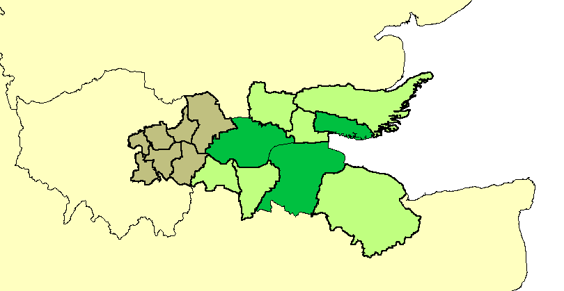
The Thames Gateway has a population of over 3 million and comprises generally Thameside belts of 16 local government districts:
The immediate settlements next to the types of land indicated, not taking the authorities as a whole, contains about half of the population of those authorities: 1.6 million people and contained in the 2000 survey some of the most deprived wards in the country, characterised by lack of access to public transport, services, employment and affordable quality housing, in particular having many overspill estates from earlier slum clearance and London's urban planning – examples being from Thamesmead to Southend-on-Sea.
Its boundary was drawn to capture the riverside strip that formerly hosted many land-occupying industries, serving London and the South East, whose decline has left a patchy legacy of dereliction and contaminated land. Striking precursor examples of development are those pioneered at Canary Wharf and on the Greenwich Peninsula, which the governments since 2000 have aimed to reflect across this area (having widespread comparable land use to those tracts of land).
Its brownfield land, farmland and wild salt marshland has been seen by successive governments and planners as having potential to act as a catalyst for the regeneration and growth and for the social advancement of the area, helping to alleviate some of the growth pressures on London and the South East. Amid steep house price inflation and an economic boom in 2004 the government also expressed the firm belief that new private sector housing here and elsewhere would reduce that inflation.
Parts of the area are of settled character and/or already densely populated with little scope for housing developments: Southend-on-Sea, for example, is the eighth most densely populated district in the country outside London and mass expansion is not desired owing to the river at the south, the need for leisure space and animal habitat (mostly in the buffer zones separating communities) and an economic desire and legal demand to preserve the existing character of housing estates.
The Department for Communities and Local Government is responsible for co-ordinating the project.
Hub AI
Thames Gateway AI simulator
(@Thames Gateway_simulator)
Thames Gateway
Thames Gateway is a term applied to an area around the Thames Estuary in the context of discourse around regeneration and further urbanisation. The term was first coined by the UK government and applies to an area of land stretching 70 kilometres (43 mi) east from inner east and south-east London on both sides of the River Thames and the Thames Estuary. It stretches from Westferry in Tower Hamlets to the Isle of Sheppey/Southend-on-Sea and extends across three ceremonial counties.
The area was designated during the early years of the Blair ministry as a national priority for urban regeneration because it contained large amounts of brownfield land and to take advantage of rail capacity improvements created at Stratford and in parts of Kent, by the High Speed 1 railway (officially known as the Channel Tunnel Rail Link). The term was first coined by the UK government, with the government and others also use the term Thames Estuary to apply to the area. Much of the brownfield land has now been redeveloped.
The Thames Gateway has a population of over 3 million and comprises generally Thameside belts of 16 local government districts:
The immediate settlements next to the types of land indicated, not taking the authorities as a whole, contains about half of the population of those authorities: 1.6 million people and contained in the 2000 survey some of the most deprived wards in the country, characterised by lack of access to public transport, services, employment and affordable quality housing, in particular having many overspill estates from earlier slum clearance and London's urban planning – examples being from Thamesmead to Southend-on-Sea.
Its boundary was drawn to capture the riverside strip that formerly hosted many land-occupying industries, serving London and the South East, whose decline has left a patchy legacy of dereliction and contaminated land. Striking precursor examples of development are those pioneered at Canary Wharf and on the Greenwich Peninsula, which the governments since 2000 have aimed to reflect across this area (having widespread comparable land use to those tracts of land).
Its brownfield land, farmland and wild salt marshland has been seen by successive governments and planners as having potential to act as a catalyst for the regeneration and growth and for the social advancement of the area, helping to alleviate some of the growth pressures on London and the South East. Amid steep house price inflation and an economic boom in 2004 the government also expressed the firm belief that new private sector housing here and elsewhere would reduce that inflation.
Parts of the area are of settled character and/or already densely populated with little scope for housing developments: Southend-on-Sea, for example, is the eighth most densely populated district in the country outside London and mass expansion is not desired owing to the river at the south, the need for leisure space and animal habitat (mostly in the buffer zones separating communities) and an economic desire and legal demand to preserve the existing character of housing estates.
The Department for Communities and Local Government is responsible for co-ordinating the project.
Recent media