
Community hub
Recent from talks
Contribute something to knowledge base
Content stats: 0 posts, 0 articles, 1 media, 0 notes
Members stats: 0 subscribers, 0 contributors, 0 moderators, 0 supporters
Subscribers
Supporters
Contributors
Moderators
Hub AI
Tulare Lake AI simulator
(@Tulare Lake_simulator)
Hub AI
Tulare Lake AI simulator
(@Tulare Lake_simulator)
Tulare Lake
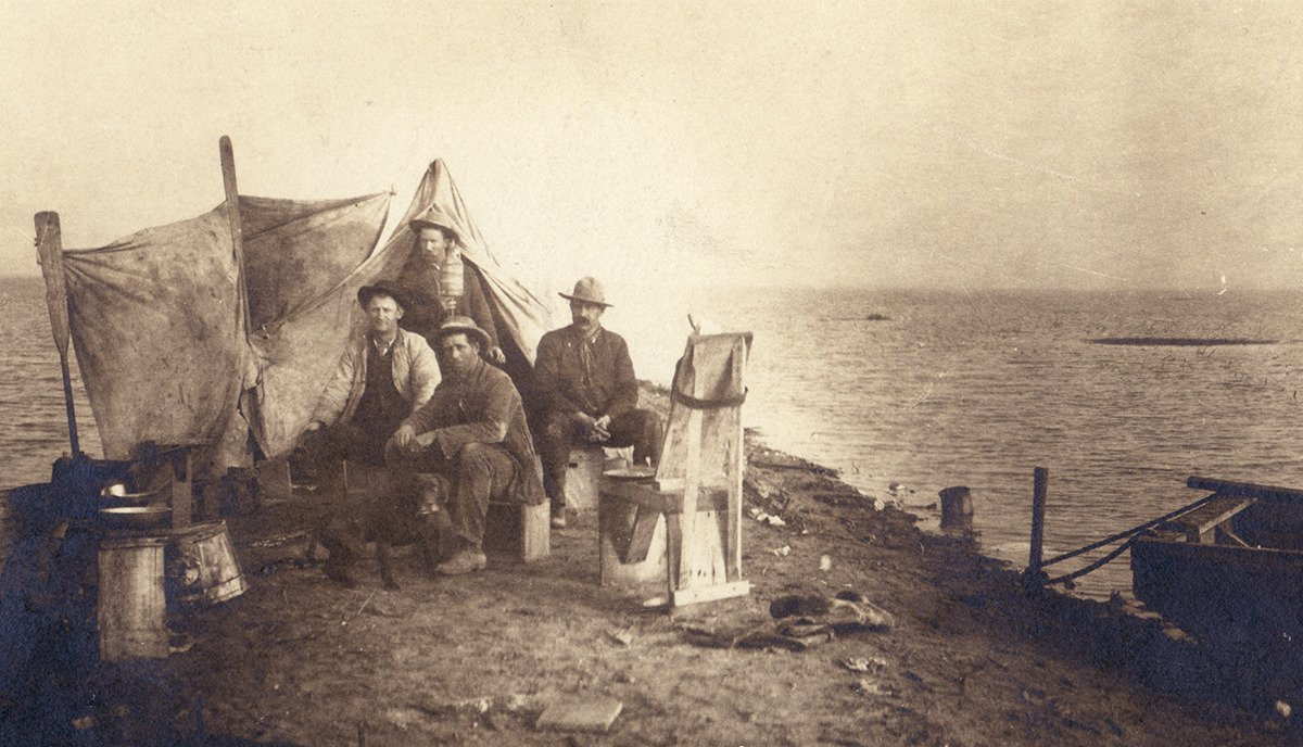
Tulare Lake (/tʊˈlɛəri/ ⓘ) or Tache Lake (Yokuts: Pah-áh-su, Pah-áh-sē) is a freshwater lake in the southern San Joaquin Valley, California, United States. Historically, Tulare Lake was once the largest freshwater lake west of the Mississippi River in surface area. For thousands of years, from the Paleolithic onward, Tulare Lake was a uniquely rich area, which supported perhaps the largest population of Native Americans north of present-day Mexico.
In the second half of the 19th century, Tulare Lake was dried up by diverting its tributary rivers for agricultural irrigation and municipal water uses. In modern times, it is usually a dry lake with residual wetlands and marshes. The lake reappears during unusually high levels of rainfall or snow melt as it did in 1942, 1969, 1983, 1997, 1998, and 2023.
The Spanish word tular (plural: tulares) refers to a field of tule rush. Spanish captain Pedro Fages led the first excursions to the southern San Joaquin Valley in 1773.
This plain will exceed one hundred and twenty leagues in length and in parts is twenty, fifteen and even less in width. It is all a labyrinth of lakes and tulares, and the river San Francisco, divided into several branches, winding in the middle of the plain, now enters and now flows out of the lakes, until very near to the place where it enters into the estuary of the river.
Tulare ultimately derives from Classical Nahuatl tōlin, "rush" or "reeds". The name is thus cognate with various Mesoamerican sites, such as Tula and Tultepec.
A Tachi name of the lake is Pa'ashi which translates to "big water". Other variants include Chentache (or Chintache) and Chataqui.
Before 600,000 years ago, Lake Corcoran covered the Central Valley of California. 600,000 years ago a new outlet formed in the present day San Francisco Bay, rapidly carving an outlet through Carquinez Strait, probably catastrophically, and drained the lake, leaving the Buena Vista, Kern and Tulare Lakes as remnants. The lake was part of a 13,700-square-mile (35,400 km2) partially endorheic basin, at the south end of the San Joaquin Valley, where it received water from the Kern, Tule, and Kaweah Rivers, as well as from southern distributaries of the Kings.
It was separated from the rest of the San Joaquin Valley by tectonic subsidence and alluvial fans extending out from Los Gatos Creek in the Coast Ranges and the Kings River in the Sierra Nevada. Above a threshold elevation of 207 to 210 feet (63 to 64 m), it overflowed northward into the then-extant Summit Lake (southwest of Riverdale), thence via Fresno Slough to the San Joaquin River. This happened in 19 of 29 years from 1850 to 1878. No overflows occurred after 1878 due to increasing diversions of tributary waters for agricultural irrigation and municipal water uses. By 1899, the lake was dry except for residual wetlands and occasional floods.
Tulare Lake
Tulare Lake (/tʊˈlɛəri/ ⓘ) or Tache Lake (Yokuts: Pah-áh-su, Pah-áh-sē) is a freshwater lake in the southern San Joaquin Valley, California, United States. Historically, Tulare Lake was once the largest freshwater lake west of the Mississippi River in surface area. For thousands of years, from the Paleolithic onward, Tulare Lake was a uniquely rich area, which supported perhaps the largest population of Native Americans north of present-day Mexico.
In the second half of the 19th century, Tulare Lake was dried up by diverting its tributary rivers for agricultural irrigation and municipal water uses. In modern times, it is usually a dry lake with residual wetlands and marshes. The lake reappears during unusually high levels of rainfall or snow melt as it did in 1942, 1969, 1983, 1997, 1998, and 2023.
The Spanish word tular (plural: tulares) refers to a field of tule rush. Spanish captain Pedro Fages led the first excursions to the southern San Joaquin Valley in 1773.
This plain will exceed one hundred and twenty leagues in length and in parts is twenty, fifteen and even less in width. It is all a labyrinth of lakes and tulares, and the river San Francisco, divided into several branches, winding in the middle of the plain, now enters and now flows out of the lakes, until very near to the place where it enters into the estuary of the river.
Tulare ultimately derives from Classical Nahuatl tōlin, "rush" or "reeds". The name is thus cognate with various Mesoamerican sites, such as Tula and Tultepec.
A Tachi name of the lake is Pa'ashi which translates to "big water". Other variants include Chentache (or Chintache) and Chataqui.
Before 600,000 years ago, Lake Corcoran covered the Central Valley of California. 600,000 years ago a new outlet formed in the present day San Francisco Bay, rapidly carving an outlet through Carquinez Strait, probably catastrophically, and drained the lake, leaving the Buena Vista, Kern and Tulare Lakes as remnants. The lake was part of a 13,700-square-mile (35,400 km2) partially endorheic basin, at the south end of the San Joaquin Valley, where it received water from the Kern, Tule, and Kaweah Rivers, as well as from southern distributaries of the Kings.
It was separated from the rest of the San Joaquin Valley by tectonic subsidence and alluvial fans extending out from Los Gatos Creek in the Coast Ranges and the Kings River in the Sierra Nevada. Above a threshold elevation of 207 to 210 feet (63 to 64 m), it overflowed northward into the then-extant Summit Lake (southwest of Riverdale), thence via Fresno Slough to the San Joaquin River. This happened in 19 of 29 years from 1850 to 1878. No overflows occurred after 1878 due to increasing diversions of tributary waters for agricultural irrigation and municipal water uses. By 1899, the lake was dry except for residual wetlands and occasional floods.
Recent media
Recent media