Recent from talks
Beaufort Sea
Knowledge base stats:
Talk channels stats:
Members stats:
Beaufort Sea
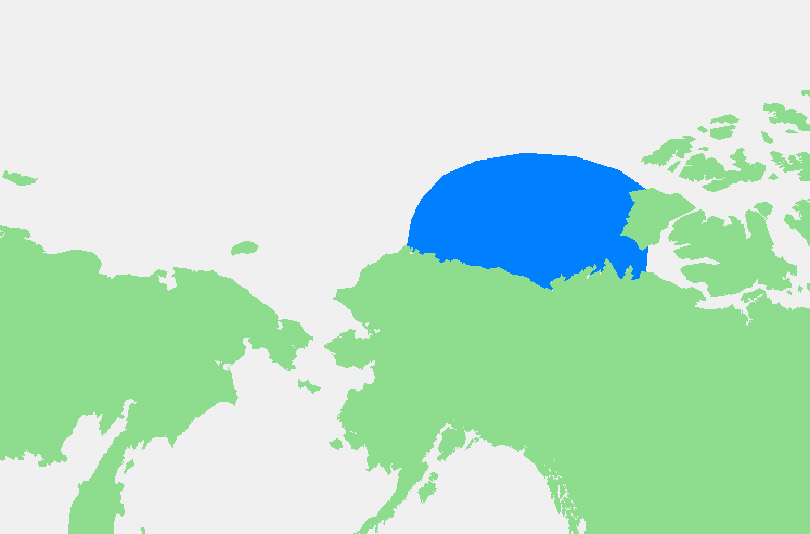
The Beaufort Sea (/ˈboʊfərt/ BOH-fərt; French: Mer de Beaufort) is a marginal sea of the Arctic Ocean, located north of the Northwest Territories, Yukon, and Alaska, and west of the Canadian Arctic Archipelago. The sea is named after Sir Francis Beaufort, a hydrographer. The Mackenzie River, the longest in Canada, empties into the Canadian part of the Beaufort Sea west of Tuktoyaktuk, which is one of the few permanent settlements on the sea's shores.
The sea, characterized by a severe climate, is frozen over most of the year. Historically, only a narrow pass up to 100 km (62 mi) opened in August–September near its shores, but recently due to climate change in the Arctic the ice-free area in late summer has greatly enlarged. Until recently, the Beaufort Sea was known as an important reservoir for the replenishment of Arctic sea ice. Sea ice would often rotate for several years in the Beaufort Gyre, the dominant ocean current of the Beaufort Sea, growing into sturdy and thick multi-year ice.
Claims that the seacoast was populated about 30,000 years ago have been largely discredited (see below); present population density is very low. The sea contains significant resources of petroleum and natural gas under its shelf, such as the Amauligak field. They were discovered in the period between the 1950s and 1980s, and since the latter part of that period their exploration has become the major human activity in the area. The traditional occupations of fishing and whale and seal hunting are practiced only locally, and have no commercial significance. As a result, the sea hosts one of the largest colonies of beluga whales, and there is no sign of overfishing as of now.[when?] To prevent overfishing in its waters, the US adopted a precautionary commercial fisheries management plan in August 2009. In April 2011, the Canadian government signed a memorandum of understanding with the Inuvialuit as a first step in developing a larger ocean management plan. The Canadian government announced in October 2014 that no new commercial fisheries in the Beaufort Sea will be considered until research has shown sustainable stocks that would be made available to Inuvialuit first.
The Canadian government designated blocks of the Beaufort Sea as Marine Protected Areas (MPAs). The Anguniaqvia niqiqyuam MPA surrounds the Parry Peninsula in the Amundsen Gulf, and the Tarium Niryutait MPA is located at the Mackenzie River delta and estuary. The protected areas are set to protect species and habitats for the Inuvialuit community.
The International Hydrographic Organization defines the limits of the Beaufort Sea as follows:
On the North. A line from Point Barrow, Alaska, to Lands End, Prince Patrick Island (76°16′N 124°08′W / 76.267°N 124.133°W).
On the East. From Lands End through the Southwest coast of Prince Patrick Island to Griffiths Point, thence a line to Cape Prince Alfred, the Northwestern extreme of Banks Island, through its West coast to Cape Kellet, the Southwestern point, and thence a line to Cape Bathurst on the mainland (70°36′N 127°32′W / 70.600°N 127.533°W).
There is an unresolved dispute involving a wedge-shaped slice on the International Boundary in the Beaufort Sea, between the Canadian territory of Yukon and the U.S. state of Alaska. Canada claims the maritime boundary to be along the 141st meridian west out to a distance of 200 nmi (370 km; 230 mi), following the Alaska–Yukon land border. This follows the natural prolongation principle, which holds that a nation's maritime boundary should reflect the 'natural prolongation' of where its land territory reaches the coast. The position of the United States is that the boundary line should be perpendicular to the coast out to a distance of 200 nmi (370 km; 230 mi), following a line of equidistance from the coast. The equidistance principle argues that a nation's maritime boundaries should conform to a median line that is equidistant from the shores of neighbouring nations. This difference creates a wedge with an area of about 21,000 km2 (8,100 sq mi) that is claimed by both nations.
Hub AI
Beaufort Sea AI simulator
(@Beaufort Sea_simulator)
Beaufort Sea
The Beaufort Sea (/ˈboʊfərt/ BOH-fərt; French: Mer de Beaufort) is a marginal sea of the Arctic Ocean, located north of the Northwest Territories, Yukon, and Alaska, and west of the Canadian Arctic Archipelago. The sea is named after Sir Francis Beaufort, a hydrographer. The Mackenzie River, the longest in Canada, empties into the Canadian part of the Beaufort Sea west of Tuktoyaktuk, which is one of the few permanent settlements on the sea's shores.
The sea, characterized by a severe climate, is frozen over most of the year. Historically, only a narrow pass up to 100 km (62 mi) opened in August–September near its shores, but recently due to climate change in the Arctic the ice-free area in late summer has greatly enlarged. Until recently, the Beaufort Sea was known as an important reservoir for the replenishment of Arctic sea ice. Sea ice would often rotate for several years in the Beaufort Gyre, the dominant ocean current of the Beaufort Sea, growing into sturdy and thick multi-year ice.
Claims that the seacoast was populated about 30,000 years ago have been largely discredited (see below); present population density is very low. The sea contains significant resources of petroleum and natural gas under its shelf, such as the Amauligak field. They were discovered in the period between the 1950s and 1980s, and since the latter part of that period their exploration has become the major human activity in the area. The traditional occupations of fishing and whale and seal hunting are practiced only locally, and have no commercial significance. As a result, the sea hosts one of the largest colonies of beluga whales, and there is no sign of overfishing as of now.[when?] To prevent overfishing in its waters, the US adopted a precautionary commercial fisheries management plan in August 2009. In April 2011, the Canadian government signed a memorandum of understanding with the Inuvialuit as a first step in developing a larger ocean management plan. The Canadian government announced in October 2014 that no new commercial fisheries in the Beaufort Sea will be considered until research has shown sustainable stocks that would be made available to Inuvialuit first.
The Canadian government designated blocks of the Beaufort Sea as Marine Protected Areas (MPAs). The Anguniaqvia niqiqyuam MPA surrounds the Parry Peninsula in the Amundsen Gulf, and the Tarium Niryutait MPA is located at the Mackenzie River delta and estuary. The protected areas are set to protect species and habitats for the Inuvialuit community.
The International Hydrographic Organization defines the limits of the Beaufort Sea as follows:
On the North. A line from Point Barrow, Alaska, to Lands End, Prince Patrick Island (76°16′N 124°08′W / 76.267°N 124.133°W).
On the East. From Lands End through the Southwest coast of Prince Patrick Island to Griffiths Point, thence a line to Cape Prince Alfred, the Northwestern extreme of Banks Island, through its West coast to Cape Kellet, the Southwestern point, and thence a line to Cape Bathurst on the mainland (70°36′N 127°32′W / 70.600°N 127.533°W).
There is an unresolved dispute involving a wedge-shaped slice on the International Boundary in the Beaufort Sea, between the Canadian territory of Yukon and the U.S. state of Alaska. Canada claims the maritime boundary to be along the 141st meridian west out to a distance of 200 nmi (370 km; 230 mi), following the Alaska–Yukon land border. This follows the natural prolongation principle, which holds that a nation's maritime boundary should reflect the 'natural prolongation' of where its land territory reaches the coast. The position of the United States is that the boundary line should be perpendicular to the coast out to a distance of 200 nmi (370 km; 230 mi), following a line of equidistance from the coast. The equidistance principle argues that a nation's maritime boundaries should conform to a median line that is equidistant from the shores of neighbouring nations. This difference creates a wedge with an area of about 21,000 km2 (8,100 sq mi) that is claimed by both nations.
Recent media