Hubbry Logo
search
logo
1794214

High Green

logo
Community Hub0 Subscribers
Read side by side
from Wikipedia

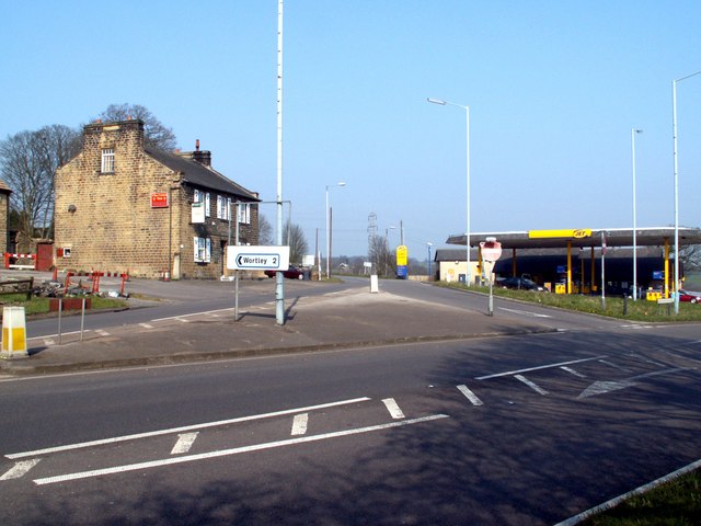
High Green is a village situated approximately 6 miles from Barnsley, the nearest major town. It is located to the north of Chapeltown and is served by bus services; the nearest railway station is in Chapeltown, 1 mile away. The suburb falls within the West Ecclesfield ward of the city Council. Wharncliffe Crags are nearby, as is Westwood Country Park.Until April 1974 High Green was part of the Wortley Rural District, in the West Riding of Yorkshire.

Key Information

High Green has five primary schools: four mainstream schools (Angram Bank Primary, High Green Primary, Greengate Lane Primary, and St. Mary's Primary) and one non-maintained special school, Paces School—formerly High Green Secondary—for both primary and secondary age children. High Green does not have a mainstream secondary school. Pupils typically attend Ecclesfield School, located approximately 2 miles away in the Ecclesfield area. Other secondary schools in the vicinity include Stocksbridge or Notre Dame.

References

[edit]
Revisions and contributorsEdit on WikipediaRead on Wikipedia
from Grokipedia
High Green is a suburban village and the northernmost suburb of Sheffield, South Yorkshire, England, located approximately 8 miles north of the city centre and historically part of Ecclesfield parish in the West Riding of Yorkshire until its transfer to Sheffield in 1974.[1][2] It lies on the edge of the Peak District National Park and is part of the West Ecclesfield ward, which had a population of 17,324 according to the 2021 census.[3][4] Originally a rural area with fields and small settlements, High Green developed significantly in the 19th and 20th centuries, with key infrastructure including St. Saviour's Church established in 1872 and the opening of High Green Primary School, which has over 150 years of history.[2] By the late 19th century, it featured a post office and a British school, reflecting its growth as a village community.[1] The area underwent further expansion with housing estates in the post-war period, transforming its landscape while retaining green spaces and a sense of community.[5] In modern times, High Green is known for its amenities, including local shops such as a Co-op, butchers, and a chip shop, as well as essential services like a GP surgery, dentist, primary schools, and veterinary practices.[5] The village has gained cultural prominence as the birthplace of the Arctic Monkeys, the internationally acclaimed rock band formed there in the early 2000s.[5] Community efforts are supported by the High Green Development Trust, founded in 2004, which operates The Campus—a hub for sports, learning, and local events—and partners with schools and businesses to empower residents.[6] Recent changes include the closure of most pubs, leaving only the High Green Club, amid ongoing residential development that some long-term residents note has altered the area's traditional character.[5]

Geography

Location and Boundaries

High Green is located in South Yorkshire, England, at approximately 53.471°N 1.488°W, serving as the northernmost suburb of Sheffield.[7][5] It forms part of the West Ecclesfield electoral ward within the City of Sheffield metropolitan borough and lies within the historical Ecclesfield civil parish.[8] The area's boundaries border Chapeltown to the south, while extending northward and westward into more rural landscapes on the edge of the Peak District National Park.[9][3] High Green encompasses several smaller neighborhoods, including Mortomley, Newbiggin, and Thorncliffe, which contribute to its semi-rural character amid transitioning urban and countryside settings.[10] Positioned about 6 miles south of Barnsley and roughly 8 miles north of Sheffield city center, High Green maintains convenient transport links by bus to both cities.[11][7] Administratively, it falls under the S35 postcode district and uses the 0114 dialling code, aligning with Sheffield's broader communications framework.[12]

Topography and Landmarks

High Green occupies a gently rolling landscape on the northeastern outskirts of Sheffield, blending suburban residential areas with expansive green fields and pockets of woodland that reflect its semi-rural character. The terrain rises gradually from around 80 meters above sea level in lower sections to approximately 150 meters in higher parts, forming part of the transitional zone between the urban sprawl of South Yorkshire and the upland fringes of the Peak District National Park. This topography supports a mix of built environments and open spaces, with streams like the Charlton Brook contributing to the area's natural drainage patterns.[13][3] The region experiences a temperate maritime climate, marked by mild summers with average highs around 19°C and cool winters where temperatures rarely drop below freezing, typical of inland South Yorkshire locations. Annual precipitation averages about 830 mm, distributed fairly evenly throughout the year, with wetter conditions in autumn supporting the lush vegetation in surrounding fields and parks. This climate fosters a verdant environment that enhances the area's appeal for outdoor activities.[14][15] Key landmarks define High Green's physical and recreational profile, including Wharncliffe Crags, a prominent gritstone escarpment roughly 5-6 miles northwest, renowned for rock climbing and panoramic views over the countryside. Westwood Country Park encompasses diverse woodland trails, a fishing reservoir, and open common land, providing accessible natural habitats just south of the village. Mortomley Hall stands as a historic estate amid parkland, featuring mature trees and paths that connect to nearby woods. Packhorse Lane, an ancient packhorse trail running through the area, traces a historic route lined with stone walls and offering glimpses of traditional rural scenery. These features, alongside local parks and common lands, underscore High Green's walkable layout and dog-friendly green spaces.[16][17][18][19]

History

Early Settlement and Medieval Period

The area encompassing High Green, part of the broader Ecclesfield parish in South Yorkshire, shows traces of prehistoric human activity dating back to the Mesolithic and Bronze Age periods, particularly near Wharncliffe Crags to the northwest. Archaeological evidence includes a Mesolithic camp site near Deepcar and a prehistoric settlement at the northern end of the crags, along with over 2,000 quern stones discovered on the crags themselves from the Iron Age, indicating extensive grinding and processing activities by later prehistoric communities.[20] Additionally, Bronze Age barrows have been identified on Wharncliffe Crags, suggesting ritual or burial practices in the landscape that would later influence settlement patterns in the region. During the Roman period, the Ecclesfield area, including vicinity to High Green, featured remnants of Romano-British settlements and field systems, notably in Greno Wood within the parish boundaries, pointing to agricultural exploitation under Roman influence.[21] Potential Roman road networks may have indirectly shaped local connectivity, as broader routes like the Roman Ridge traversed nearby parts of South Yorkshire, facilitating trade and movement through the Don Valley.[22] By the Anglo-Saxon era, settlement solidified with the establishment of a Christian church in a cleared field amid wooded surroundings, as reflected in the place name "Ecclesfield," derived from Old English "eccles" (church) and "feld" (open land).[8] This indicates an organized Anglo-Saxon community focused on agrarian life within the parish, with High Green emerging as an early nucleated settlement pattern tied to the parish's ecclesiastical center. The medieval period marked formal recognition and feudal organization of the area, with Ecclesfield—and by extension High Green—recorded in the Domesday Book of 1086 as "Eclesfeld," a manor held under the lordship of Roger de Busli, encompassing arable land, meadow, and extensive woodland totaling over 2,000 acres.[23] By the 13th century, the de Ecclesfield family had risen to prominence, claiming hereditary rights over the manor, including the advowson (right to appoint the parson) and control of landed estates, which reinforced feudal agricultural practices centered on crop cultivation and livestock rearing.[24] Small hamlets like High Green developed around key routes such as Wortley Road, serving as dispersed agricultural outposts within the manor, supporting the manorial economy through tenant farming and common grazing on the green. Key ecclesiastical developments included the establishment of St Mary's Church in Ecclesfield, first documented in 1141, which acted as the parish hub, with later grants by William de Lovetot in the early 12th century funding a Benedictine priory cell there to oversee spiritual and temporal affairs.[8] These foundations laid the groundwork for a stable medieval rural society in the parish, transitioning gradually toward broader economic shifts in later centuries.[25]

Industrial Era and 19th Century Development

The Industrial Era in High Green began in 1793 when George Newton and Thomas Chambers leased land in the nearby Thorncliffe Valley from Earl Fitzwilliam to expand their ironworks operations from central Sheffield.[8] This establishment of the Thorncliffe Ironworks marked a shift from the area's predominantly agricultural character, with the foundry initially employing 12 workers in 1794 and growing to 300 by 1800, focusing on cast iron goods and heavy castings.[8] The works also incorporated local ironstone mining, laying the foundation for broader industrial activity in the region, including the development of associated steel trades that supported Sheffield's burgeoning cutlery industry.[26] During the 19th century, High Green's growth accelerated due to the expansion of coal mining and the Thorncliffe Ironworks, which by the late 1800s employed nearly 8,000 workers and produced items such as gas lighting equipment.[8] The influx of laborers transformed the small hamlet into a burgeoning suburb, with the population expanding significantly as it became part of the West Riding of Yorkshire's industrial belt, serving as a dormitory settlement for Sheffield's steel and cutlery workers who commuted along routes like Wortley Road.[8] Housing developments proliferated along main roads, including terraced rows built to accommodate miners and ironworkers, reflecting the social shifts driven by industrialization.[8] Infrastructure improvements accompanied this expansion, including the opening of a British school in 1843, which served as both a day school and an evening institute for young miners and artisans.[27] A post office, subordinate to Sheffield, was also established by the mid-19th century to support the growing community.[1] By 1872, High Green had developed into a distinct ecclesiastical district, underscoring its evolution from rural outpost to integral component of the industrial landscape.[8]

20th Century and Modern Changes

In the early 20th century, High Green experienced growth in educational infrastructure, with the establishment of High Green Secondary Modern School on Pack Horse Lane to serve the expanding local population amid industrial development. This school, which later became High Green Comprehensive School in the post-war period, catered to secondary education needs until its closure in 1995, after which the site was repurposed as Paces School for Conductive Education, a specialist institution for children with neurological conditions. The World Wars significantly influenced local industry, particularly around the nearby Thorncliffe area, where steel and coal production surged to support wartime efforts, employing thousands and temporarily boosting the economy before post-war rationalization led to initial contractions.[28][29][30] A major administrative shift occurred in 1974 under the Local Government Act 1972, when High Green transferred from the Wortley Rural District in the West Riding of Yorkshire to the newly formed metropolitan county of South Yorkshire, falling under Sheffield City Council's jurisdiction. This reorganization integrated the area more closely with urban Sheffield, facilitating coordinated planning and services. In the late 20th and early 21st centuries, High Green underwent suburban expansion through council housing developments and private builds, reflecting the broader decline of heavy industry in Sheffield—where steel output fell by over 80% between 1970 and 1990—shifting the local economy toward residential commuting to city-center jobs. The formation of the High Green Development Trust in 2004 marked a community-driven response, providing support for local initiatives including youth programs and economic revitalization.[31][6] Recent developments in High Green have emphasized environmental enhancements, with investments in green spaces such as community gardens and trails managed by the Development Trust, aligning with Sheffield's broader Green and Open Space Strategy to improve accessibility and biodiversity. The fame of the Arctic Monkeys, all originating from High Green, has subtly boosted local identity, fostering pride in the suburb's cultural contributions.[32][33]

Demographics

High Green, as part of the broader Ecclesfield parish, began the 19th century as a small rural village within a parish that had a population of 5,114 in 1801, reflecting the limited settlement in the area at that time.[1] By 1901, industrial expansion in South Yorkshire, including coal mining and steel production in nearby areas, drove significant growth, with the parish population reaching 33,808.[1] In the modern era, High Green is encompassed within the Chapeltown and High Green ward of Sheffield City Council, which recorded a population of 22,185 at the 2021 census—a slight annual decline of 0.22% from 2011 (when the built-up area stood at 22,699).[34] The ward's average age is 43 years, higher than Sheffield's median of 37, indicating an older demographic profile with stronger representation in the 40-59 age groups.[35] The ward's population has followed Sheffield's overall citywide trend of modest expansion, with the city growing 0.7% from 2011 to 2021.[35] Housing in the ward reflects a high rate of homeownership at 66%, consistent with suburban patterns in northern Sheffield, though average house prices remain below the city average at approximately £199,000 (as of October 2025) compared to Sheffield's £221,000 (as of January 2025).[36][37] As of mid-2024, Sheffield's population was estimated at 582,493, with projections indicating continued modest growth.[38]

Ethnic Composition and Religion

High Green, as part of the Chapeltown and High Green Middle Layer Super Output Area (MSOA), exhibits a demographic profile characterized by low ethnic diversity compared to the Sheffield average. According to the 2021 Census, 96.1% of residents identified as White, encompassing White British, White Irish, Gypsy or Irish Traveller, and Other White categories, reflecting a predominantly White British population that exceeds 90% when accounting for the primary subcategory. This figure is notably higher than Sheffield's overall White population of 79.1%.[34] Minority ethnic groups remain small, with Asian or Asian British residents comprising 1.15% (256 individuals), primarily from South Asian backgrounds such as Pakistani or Indian origins, marking a modest increase from earlier censuses amid minor immigration from Asia. Mixed or multiple ethnic groups account for 1.4% (310 residents), while Black, Black British, Caribbean or African groups represent 0.91% (201 residents), and Other ethnic groups 0.33% (74 residents). Arab residents form the smallest proportion at 0.10% (23 individuals). These percentages underscore the area's lower diversity relative to Sheffield's citywide figures, where Asian residents constitute 9.6% and Black residents 4.6%.[34] Religiously, the area aligns with broader South Yorkshire trends, showing a Christian majority of 51.2% (11,349 residents), down from higher levels in previous decades but still dominant. No religion is the second-largest affiliation at 41.9% (9,290 residents), indicative of secularization patterns in working-class northern English communities. Muslim residents make up 0.7% (164 individuals), with other faiths minimal: Hindu 0.2% (35), Sikh 0.1% (12), Buddhist 0.2% (37), Jewish 0.1% (17), and Other religion 0.4% (81). This composition reflects the area's working-class heritage, supplemented by limited recent immigration from Eastern Europe (captured within Other White) and Asia, contributing to subtle cultural diversity in local events.[34]

Government and Administration

Local Governance Structure

High Green is part of the West Ecclesfield ward within Sheffield City Council, which elects three councillors to represent the area. As of November 2025, the ward is represented by Liberal Democrats Alan Hooper (Chair of the North Local Area Committee), Mike Levery (Deputy Chair of the Finance Committee), and Ann Whitaker.[39] The ward forms part of the North Local Area Committee, which coordinates local decision-making across four wards including West Ecclesfield.[40] At the regional level, High Green falls under the South Yorkshire Mayoral Combined Authority (SYMCA), led by Mayor Oliver Coppard, which brings together the councils of Barnsley, Doncaster, Rotherham, and Sheffield to deliver strategic policies on transport, economic development, and skills.[41] The SYMCA manages devolved powers including bus franchising and the region's growth plans, influencing local infrastructure in areas like High Green.[42] Core services such as planning permissions, waste collection, and social housing are delivered by Sheffield City Council, which oversees these functions city-wide through departments like City Development and Housing Services. Local amenities, including the maintenance of parks, community events, and grant funding for voluntary groups, are handled by Ecclesfield Parish Council, which covers High Green among its wards and operates from offices on Mortomley Lane in the area.[43] The parish council also supports initiatives like heritage preservation and anti-social behaviour reduction through community grants up to £2,000 for small projects.[44] While West Ecclesfield has seen competitive elections between Liberal Democrats and Labour, with Lib Dems holding all seats since 2022, community input shapes governance through organizations like the High Green Development Trust, a not-for-profit founded in 2004 that manages The Campus community hub and advocates for local empowerment.[6][45] Ward-level policies emphasize community engagement to combat social isolation and digital exclusion, support for young people's education and recreation to reduce anti-social behaviour, and environmental improvements such as park enhancements and traffic calming.[46] Broader efforts align with SYMCA's focus on sustainable transport, including bus network enhancements, and Sheffield City Council's initiatives for affordable housing amid regional growth pressures.[42][47]

Administrative History

Prior to the 19th century, High Green formed part of the township and parish of Ecclesfield in the West Riding of Yorkshire, governed under the traditional manor system centered on the lordship of Ecclesfield, which oversaw local land tenure, courts, and agricultural obligations.[1][8] From 1894 to 1974, High Green was incorporated into the Wortley Rural District, established under the Local Government Act 1894, which administered rural areas including parts of Ecclesfield parish, though the area's proximity to expanding Sheffield introduced urban influences on local planning and services during this period.[2][48] The Local Government Act 1972, effective from April 1, 1974, abolished Wortley Rural District and reorganized High Green into the new metropolitan county of South Yorkshire, specifically within the City of Sheffield metropolitan borough, marking a transition from rural district governance to urban metropolitan authority.[2][48] Following the 1974 reforms, High Green was integrated into Sheffield City Council's wards, initially under East Ecclesfield and later encompassing parts of West Ecclesfield, while the Ecclesfield Parish Council was retained to provide local autonomy on community matters such as amenities and planning consultations.[39]

Economy and Employment

Local Economy Overview

High Green serves as a primarily residential suburb within the Ecclesfield parish of Sheffield, functioning largely as a commuter area where residents travel to nearby urban centers like Sheffield and Barnsley for work in advanced manufacturing, professional services, and other sectors. This economic profile reflects its transition from an industrial past to a more suburban role, with local employment opportunities supplemented by the broader South Yorkshire economy. The area's integration into Sheffield's labor market supports a stable but dependent economic structure, emphasizing accessibility via road and public transport links.[49][50] According to estimates based on 2021 Census data for Ecclesfield Parish, which encompasses High Green, approximately 57.5% of residents aged 16 and over are economically active, comprising 55.1% in employment and a low unemployment rate of 2.4%—below Sheffield's overall rate of 2.8%. Median household income in the surrounding West Ecclesfield ward stood at approximately £30,200 annually as of 2015, indicative of below-average earnings compared to national figures. Key employment sectors draw from a legacy of steel and ironworks, with manufacturing accounting for about 9.9% of jobs across Sheffield, alongside dominant areas like public administration, education, and health (31.2% as of 2011 locally) and growing opportunities in services and digital roles. High Green aligns with South Yorkshire's Strategic Economic Plan for a "stronger, greener, fairer" region and Sheffield's vision of a "global, green and growing" economy, promoting sustainable job creation.[50][51][52][49][53][54][35][55] Despite these strengths, challenges persist, including reliance on public sector jobs and lower household incomes ranging from £30,000 to £35,000 for many working-age households, which lag behind UK averages. Recent initiatives emphasize sustainable development, such as green energy transitions and inclusive growth strategies, to mitigate these issues and enhance local economic resilience within the regional framework.[49][56]

Key Industries and Businesses

High Green's economy features residual manufacturing activities, particularly engineering and industrial operations at the Thorncliffe Business Park, a repurposed historical industrial site originally developed by Newton Chambers in the 19th century. The park now hosts modern warehousing, distribution, and light manufacturing firms, including companies like Blossom Day Opportunities Sheffield Limited, supporting ongoing employment in skilled trades and process operations.[57][58] Retail and service sectors dominate local employment, with small shops such as Go Local High Green, Central Stores, and BST Retail providing essential goods and contributing to community commerce. The High Green Health Centre, encompassing practices like Chapelgreen Practice and Hoyland Medical Practice, serves as a major employer in healthcare services, offering roles in clinical and administrative support to the area's residents.[59][60][61][62] Small enterprises in construction and agriculture further bolster the local business landscape, exemplified by firms like A & SJ Charlesworth Farmers and Contractors, which provide agricultural services and rural contracting in the vicinity. According to the 2021 Census for Ecclesfield Parish, employment reflects a mix of occupations, with a shift toward service-oriented roles; retail employment aligns with broader Sheffield trends.[63][50] The High Green Development Trust drives local entrepreneurship through its management of The Campus, a community and business hub that offers workspace, networking events, and support for startups, fostering job creation and sustainable enterprise in the area. This initiative emphasizes environmental priorities, aligning with the region's proximity to the Peak District, though specific green technology ventures remain nascent.[6]

Education

Primary and Secondary Education

High Green is served by four mainstream primary schools catering to children aged 3-11, each with capacities typically ranging from 210 to 300 pupils. Angram Bank Primary School, a community school located on Kinsey Road, enrolls 212 pupils (as of 2024/2025) and includes nursery provision along with specialized support for hearing impairment.[64] High Green Primary School, another community institution on Wortley Road, serves 196 pupils (as of 2024/2025) aged 4-11, emphasizing outdoor learning through its woodland, allotment, and forest school programs.[65][66] Greengate Lane Academy, an academy converter on Greengate Lane, accommodates 201 pupils (as of 2024/2025) aged 3-11 in a nurturing environment with excellent grounds for play and learning.[67] St Mary's Primary School, a Catholic voluntary academy on Pack Horse Lane, educates 176 pupils (as of 2024/2025) aged 5-11 within a capacity of 210, fostering an inclusive faith-based community.[68] Collectively, these schools enroll around 785 primary pupils (as of 2024/2025), mirroring the area's family-oriented demographics.[69] The primary schools feature modernized buildings and prioritize community engagement, with programs integrating sustainability, music, physical education, and outdoor activities to support holistic development. Attendance rates across these institutions generally exceed the national average for primary schools, with Angram Bank Primary achieving 93.8% (2023/2024) and High Green Primary recording an absence rate of 5.3% (2023/2024), contributing to strong pupil outcomes.[70][71] While specific STEM initiatives vary, the schools emphasize practical learning experiences that align with broader educational priorities in Sheffield. Brief provisions for special educational needs, such as hearing support at Angram Bank, complement mainstream offerings without dedicated special schools in the area. For secondary education, High Green lacks a local mainstream secondary school, so most pupils aged 11-16 attend Ecclesfield School, a comprehensive academy approximately 2 miles away in the Ecclesfield suburb. Alternatives include Stocksbridge High School (now part of Bradfield School) to the west or Notre Dame High School, a Catholic option in the city center, depending on family preferences and transport access. These arrangements ensure continuity in education while reflecting the suburb's integration into Sheffield's wider school network.

Special and Further Education

In High Green, special education is primarily provided through Paces School for Conductive Education, a specialist institution catering to children and young people aged 3 to 19 with cerebral palsy and other neurological motor disorders.[29] The school emphasizes conductive education, a holistic approach that integrates physical, cognitive, and emotional development through small group settings, typically with ratios of around 1:2 staff to students, enabling personalized support for motor skills, communication, and learning challenges.[72] Originally based in the former High Green Secondary School building on Pack Horse Lane since 1997, the school relocated in 2021 to a refurbished 8,000 square foot facility at Thorncliffe Hall in nearby Chapeltown to accommodate growth and better meet community needs, while continuing to serve pupils from High Green and surrounding areas; it received a Good rating in its Ofsted inspection in June 2024.[73][74][75] Further education opportunities for High Green residents are accessible via nearby institutions such as The Sheffield College, whose campuses—including those in the Ecclesfield area approximately 3 miles away—offer vocational programs in fields like engineering, health and social care, and construction.[76] These courses, ranging from Level 2 certificates to higher apprenticeships, prepare students for local employment in Sheffield's manufacturing and healthcare sectors, with flexible options for part-time study to support working adults.[77] Additionally, the Ann Reresby Trust provides targeted grants for female residents aged 16-25 pursuing further education, focusing on access to higher-level qualifications.[78] Adult learning in High Green is facilitated through community initiatives by the High Green Development Trust (HGDT), which runs programs at The Campus community center to enhance literacy, digital skills, and employability.[6] These include partnerships with local libraries for basic literacy workshops and collaborative efforts like the Grow Programme, a four-week course for 16-24 year olds emphasizing wellbeing, social skills, and job readiness through practical activities such as gardening.[79] HGDT's education priorities align with broader community empowerment, offering low-cost or pay-what-you-can sessions in areas like basic IT and personal development to address local needs.[80] Recent developments in inclusive education have expanded capacity in the area, exemplified by Paces School's 2021 relocation and facility upgrade, which increased spaces for specialized support while integrating with Sheffield's commitment to equitable access.[73] This aligns with the South Yorkshire Strategic Economic Plan 2021-2041, which prioritizes inclusive growth through enhanced skills training and education infrastructure to foster fairer economic opportunities across the region.[81]

Transport

Road Network

The road network in High Green primarily revolves around Wortley Road, classified as the A6102, which serves as the main arterial route connecting the area to Sheffield city centre to the south and Barnsley to the north.[82] This road facilitates daily commuting and commercial traffic, passing through residential zones and linking to broader regional pathways. Nearby, the A61 (Penistone Road) provides additional access to the northwest, enabling connectivity to Rotherham and further afield without entering central Sheffield.[82] The local road network consists of smaller classified and unclassified streets designed for residential access, such as Mortomley Lane (C47), which branches off Wortley Road and supports pedestrian and cycling movement.[82] Packhorse Lane, an unclassified route intersecting Mortomley Lane, contributes to the area's internal connectivity and has origins as a historical packhorse trail. Improvements to this junction in 2016 enhanced accessibility, incorporating pedestrian-friendly features like better signage and pathways to nearby leisure facilities.[83] Cycle paths along these local roads promote green travel, integrating with bus routes for multimodal options.[83] Traffic congestion in High Green often arises from commuter flows along Wortley Road during peak hours, exacerbated by the area's proximity to employment hubs in Sheffield and Barnsley.[84] To address safety concerns and encourage sustainable transport, Sheffield City Council introduced 20mph zones across High Green in 2024, reducing speeds on residential streets like Mortomley Lane and improving conditions for cyclists and pedestrians.[85] These measures align with broader efforts to mitigate congestion through enhanced green infrastructure. High Green's road network offers strong regional connectivity, with a typical drive to M1 motorway junctions 35 or 36 taking 5-10 minutes via Wortley Road or nearby link roads, approximately 3.9 km from the village centre.[86] This access supports efficient links to the national motorway system, aiding both local and through traffic. Public transport in High Green primarily consists of bus services, with rail access available via the nearby Chapeltown station. Frequent bus routes connect the area to Sheffield city centre, taking approximately 45-55 minutes, as well as to Chapeltown, Ecclesfield, and further afield to Barnsley and Penistone.[11][87] Key bus services include the route 1, operated by Stagecoach Yorkshire, which runs from High Green through Chapeltown, Ecclesfield, and Shiregreen to Sheffield city centre and onward to Jordanthorpe and Batemoor; services operate every 10-15 minutes during peak times.[88][87] Additionally, route 44, operated by South Pennine Community Transport, connects Chapeltown (adjacent to High Green) to Rotherham via Harley and Wentworth, offering further links northward with services every 30-60 minutes.[89][90] These routes emphasize High Green's accessibility to nearby towns, supporting daily commutes and local travel. Rail services are accessed at Chapeltown station, located approximately 1.5 miles south of High Green, with no dedicated station within the village itself. The station lies on the Hallam Line, served by Northern Trains with regular half-hourly services to Sheffield (13-16 minutes journey time) and hourly services to Leeds (around 50 minutes).[91][92][93] This provides indirect rail connectivity for longer-distance travel, though residents typically combine it with local buses for access. Recent improvements include integrated ticketing through the Travel South Yorkshire system, allowing seamless use of a single ticket across buses, Supertram, and local trains, including the Hallam Line services.[94] Additionally, demand-responsive transport options are available for the more rural edges of High Green, supplementing fixed-route buses under South Yorkshire's broader public transport enhancement plans. High Green residents show a notable reliance on bus services for routine travel, given the limited direct rail options, with public transport forming a key part of local mobility despite higher car usage for work commutes (around 55% drive, compared to 7% by bus, as of the 2011 census).[95]

Culture and Community

Community Facilities and Events

High Green boasts several key community facilities that serve as hubs for social interaction and support. The Campus, managed by the High Green Development Trust, functions as an inclusive community centre and business hub on Pack Horse Lane, offering spaces for meetings, sports, leisure activities, learning, and business support.[6] Chapeltown Library, located nearby, provides essential resources including books, digital access, and community programs that extend to High Green residents.[96] The High Green Health Centre on Thompson Hill delivers primary medical care, accepting new patients and focusing on comprehensive health services for the local population.[62] Recreational opportunities include sports clubs such as the High Green Gymnastics Academy, which offers training for all ages, the Thorpe Hesley and High Green Cricket Club for matches and community gatherings, and the Valley Hill Runners group for local fitness enthusiasts; these are complemented by access to parks for general recreation.[97][98][99] Community organizations play a vital role in fostering engagement and preservation efforts. The High Green Development Trust, founded in 2004 as a not-for-profit entity, works to empower residents through partnerships with schools, charities, and local businesses, managing facilities like The Campus to promote community well-being.[6] The Heritage High Green group, established in 2012, focuses on recording, discussing, and preserving local history through talks and archival activities.[100] Recurring events strengthen social bonds in High Green. The High Green Development Trust hosts regular craft groups and fairs, providing materials and social opportunities for participants of all ages and abilities.[101] Annual remembrance services, such as those at St Saviour's Church, honor local veterans with prayers and wreath-laying ceremonies.[102] Summer fetes, including the 105th Sheffield (High Green) Scout Group's event at their Pack Horse Lane headquarters, feature family-friendly activities like games and stalls.[103] Youth groups organize engaging sessions, with the High Green Youth Club offering free multi-sports, crafts, gaming, and music for ages 11-16, while the 105th Scout Group provides adventurous programs for 4- to 14-year-olds.[104][105] Community choirs, often linked to broader Sheffield initiatives, perform at local events to promote harmony and participation.[106] The area's social fabric emphasizes friendliness and accessibility, with walkable neighborhoods supporting daily interactions and green spaces enhancing community cohesion.[107] Support for vulnerable residents is prioritized through initiatives like dementia-friendly events and the Growing Memories Garden at the High Green Development Trust, alongside broader programs addressing isolation and health needs.[108][109]

Notable Landmarks and Green Spaces

High Green features several notable built landmarks that serve as focal points for community and historical identity. The Campus, a modern community hub and business centre located on Pack Horse Lane, provides facilities including a nursery, fitness classes, and meeting spaces, fostering local social and economic activities. Originally developed as an inclusive venue for residents, it supports diverse groups such as children with disabilities and after-school programs, enhancing accessibility within the suburb. St. Mary's Church, a lancet Gothic-style Roman Catholic structure built in the 1880s on Mortomley Lane, was constructed with support from the Duke of Norfolk to serve the growing Irish immigrant labouring community in the area.[110] The church, along with its attached school and presbytery, remains a key historical site, offering worship spaces and community extensions added in 2010-11 for improved facilities like meeting rooms and toilets.[111][112] The suburb's green spaces offer recreational opportunities and contribute to its natural appeal. Mortomley Park, situated on Mortomley Lane, includes secure playgrounds, flower borders, and wooded areas ideal for family outings and dog-walking on local commons.[113] Managed by Sheffield City Council, the park features community-maintained elements such as wildlife gardens and willow structures that support biodiversity conservation efforts.[114] Adjacent to High Green, Westwood Country Park provides extensive trails through woodland, open common land, and waterside paths around a fishing reservoir, offering scenic views and low-impact exploration for visitors.[113] These spaces are integrated into broader walking routes, such as the 2-mile path from Mortomley Park to Thorncliffe Woods via Westwood Dam, promoting active recreation.[18] Culturally, High Green's landmarks and green spaces tie into local heritage, including informal tours inspired by the Arctic Monkeys, the globally renowned band formed by childhood friends from the suburb in the early 2000s.[5] Sites like childhood homes and nearby pubs in High Green have become points of interest on fan-led routes tracing the band's origins and influences.[5] Conservation initiatives in these areas, as outlined in the Ecclesfield Parish Neighbourhood Plan, emphasize enhancing biodiversity through habitat improvements and green corridor connections, ensuring the sustainability of local woodlands and commons.[115] All these landmarks and spaces provide free public entry, encouraging inclusive use and integration with Sheffield's extensive network of pedestrian paths.

References

User Avatar
No comments yet.