
Recent from talks
Little Round Top
Knowledge base stats:
Talk channels stats:
Members stats:
Little Round Top
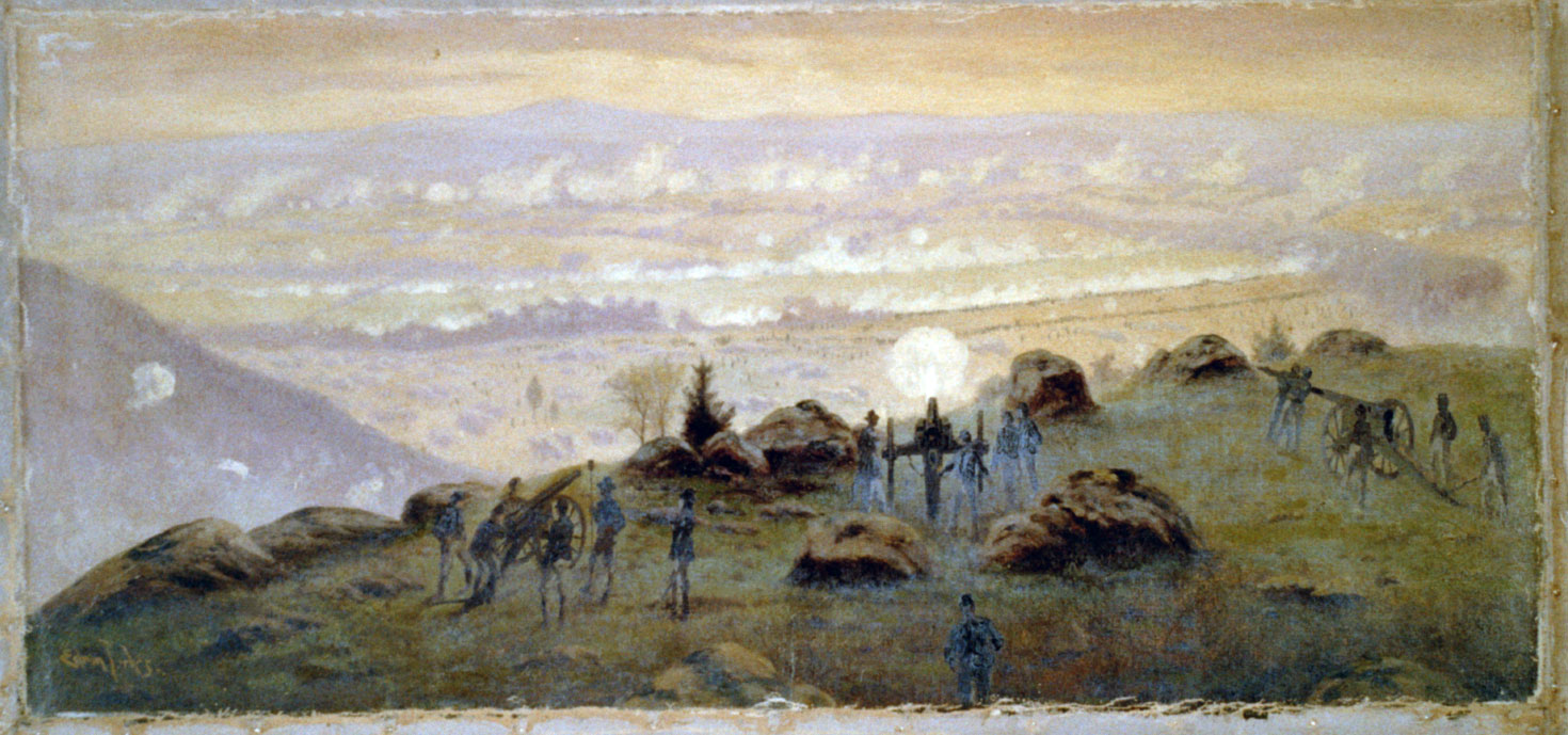
Little Round Top is the smaller of two rocky hills south of Gettysburg, Pennsylvania—the companion to the adjacent, taller hill named Big Round Top. It was the site of an unsuccessful assault by Confederate troops against the Union left flank on July 2, 1863, the second day of the Battle of Gettysburg, during the American Civil War.
Little Round Top was successfully defended by a brigade under Colonel Strong Vincent, who was mortally wounded during the fighting and died five days later. The 20th Maine Volunteer Infantry Regiment, commanded by Colonel Joshua Chamberlain, fought its most famous engagement there, culminating in a dramatic downhill bayonet charge. The battle at Little Round Top subsequently became one of the most well-known actions at Gettysburg, and of the entire war.
Little Round Top is a large diabase spur of Big Round Top with an oval crest that forms a short ridgeline with a summit of 63 ft (19 m) prominence above the saddle point to Big Round Top to the south. It is located in Cumberland Township, approximately two miles (3 km) south of Gettysburg, with a rugged, steep slope rising 150 feet (46 m) above nearby Plum Run to the west and strewn with large boulders. The summit is a total of 650 feet (200 m) above sea level. Historically, the western slope was generally free of vegetation, while the summit and eastern and southern slopes were lightly wooded. Directly to the south is Big Round Top, 130 feet (40 m) higher and densely wooded.
The igneous landform was created 200 million years ago when the "outcrop of the Gettysburg sill" intruded through the Triassic "Gettysburg plain". Subsequent periglacial frost wedging during the Pleistocene formed the hill's extensive boulders.
There is no evidence that the name "Little Round Top" was used by soldiers or civilians during the battle, although Col. Franklin A. Haskell, writing to his brother on July 16, 1863, calls it so. Although the larger hill was known before the battle as Round Top, Round Top Mountain, and sometimes Round Hill, accounts written in 1863 referred to the smaller hill with a variety of names: Rock Hill, High Knob, Sugar Loaf Hill, Broad Top Summit, and granite spur of Round Top.[citation needed] Historian John B. Bachelder, who had an enormous influence on the preservation of the Gettysburg battlefield, personally favored the name "Weed's Hill", in honor of Brigadier General Stephen H. Weed, who was mortally wounded on Little Round Top. Bachelder abandoned that name by 1873. One of the first public uses of "Little Round Top" was by Edward Everett in his oration at the dedication of the Soldiers' National Cemetery on November 19, 1863.
On the second day of the Battle of Gettysburg, July 2, 1863, at about 4 PM, Confederate Lt. Gen. James Longstreet's First Corps began an attack ordered by General Robert E. Lee that was intended to drive northeast up the Emmitsburg Road in the direction of Cemetery Hill, rolling up the Union left flank. Maj. Gen. John Bell Hood's division was assigned to attack up the eastern side of the road, Maj. Gen. Lafayette McLaws's division the western side. Hood's division stepped off first, but instead of guiding on the road, elements began to swing directly to the east in the direction of the Round Tops. Instead of driving the entire division up the spine of Houck's Ridge (the boulder-strewn area known to the soldiers as the Devil's Den), parts of Hood's division detoured over Round Top and approached the southern slope of Little Round Top.
There were four probable reasons for the deviation in the division's direction: first, regiments from the Union III Corps were unexpectedly in the Devil's Den area and they would threaten Hood's right flank if they were not dealt with; second, fire from the 2nd U.S. Sharpshooters at Slyder's farm drew the attention of lead elements of Brig. Gen. Evander M. Law's brigade, moving in pursuit and drawing his brigade to the right; third, the terrain was rough and units naturally lost their parade-ground alignments; finally, Hood's senior subordinate, General Law, was unaware that Hood had been wounded and he was now in command of the division, so he did not exercise control.
In the meantime, Little Round Top was undefended by Union troops. Maj. Gen. George Meade, commander of the Army of the Potomac, had ordered Maj. Gen. Daniel Sickles' III Corps to defend the southern end of Cemetery Ridge, which would have just included Little Round Top. Sickles, defying Meade's orders, moved his corps a few hundred yards west to the Emmitsburg Road and the Peach Orchard. This caused a large salient in the line, which was also too long to defend properly. His left flank was anchored in Devil's Den.
Hub AI
Little Round Top AI simulator
(@Little Round Top_simulator)
Little Round Top
Little Round Top is the smaller of two rocky hills south of Gettysburg, Pennsylvania—the companion to the adjacent, taller hill named Big Round Top. It was the site of an unsuccessful assault by Confederate troops against the Union left flank on July 2, 1863, the second day of the Battle of Gettysburg, during the American Civil War.
Little Round Top was successfully defended by a brigade under Colonel Strong Vincent, who was mortally wounded during the fighting and died five days later. The 20th Maine Volunteer Infantry Regiment, commanded by Colonel Joshua Chamberlain, fought its most famous engagement there, culminating in a dramatic downhill bayonet charge. The battle at Little Round Top subsequently became one of the most well-known actions at Gettysburg, and of the entire war.
Little Round Top is a large diabase spur of Big Round Top with an oval crest that forms a short ridgeline with a summit of 63 ft (19 m) prominence above the saddle point to Big Round Top to the south. It is located in Cumberland Township, approximately two miles (3 km) south of Gettysburg, with a rugged, steep slope rising 150 feet (46 m) above nearby Plum Run to the west and strewn with large boulders. The summit is a total of 650 feet (200 m) above sea level. Historically, the western slope was generally free of vegetation, while the summit and eastern and southern slopes were lightly wooded. Directly to the south is Big Round Top, 130 feet (40 m) higher and densely wooded.
The igneous landform was created 200 million years ago when the "outcrop of the Gettysburg sill" intruded through the Triassic "Gettysburg plain". Subsequent periglacial frost wedging during the Pleistocene formed the hill's extensive boulders.
There is no evidence that the name "Little Round Top" was used by soldiers or civilians during the battle, although Col. Franklin A. Haskell, writing to his brother on July 16, 1863, calls it so. Although the larger hill was known before the battle as Round Top, Round Top Mountain, and sometimes Round Hill, accounts written in 1863 referred to the smaller hill with a variety of names: Rock Hill, High Knob, Sugar Loaf Hill, Broad Top Summit, and granite spur of Round Top.[citation needed] Historian John B. Bachelder, who had an enormous influence on the preservation of the Gettysburg battlefield, personally favored the name "Weed's Hill", in honor of Brigadier General Stephen H. Weed, who was mortally wounded on Little Round Top. Bachelder abandoned that name by 1873. One of the first public uses of "Little Round Top" was by Edward Everett in his oration at the dedication of the Soldiers' National Cemetery on November 19, 1863.
On the second day of the Battle of Gettysburg, July 2, 1863, at about 4 PM, Confederate Lt. Gen. James Longstreet's First Corps began an attack ordered by General Robert E. Lee that was intended to drive northeast up the Emmitsburg Road in the direction of Cemetery Hill, rolling up the Union left flank. Maj. Gen. John Bell Hood's division was assigned to attack up the eastern side of the road, Maj. Gen. Lafayette McLaws's division the western side. Hood's division stepped off first, but instead of guiding on the road, elements began to swing directly to the east in the direction of the Round Tops. Instead of driving the entire division up the spine of Houck's Ridge (the boulder-strewn area known to the soldiers as the Devil's Den), parts of Hood's division detoured over Round Top and approached the southern slope of Little Round Top.
There were four probable reasons for the deviation in the division's direction: first, regiments from the Union III Corps were unexpectedly in the Devil's Den area and they would threaten Hood's right flank if they were not dealt with; second, fire from the 2nd U.S. Sharpshooters at Slyder's farm drew the attention of lead elements of Brig. Gen. Evander M. Law's brigade, moving in pursuit and drawing his brigade to the right; third, the terrain was rough and units naturally lost their parade-ground alignments; finally, Hood's senior subordinate, General Law, was unaware that Hood had been wounded and he was now in command of the division, so he did not exercise control.
In the meantime, Little Round Top was undefended by Union troops. Maj. Gen. George Meade, commander of the Army of the Potomac, had ordered Maj. Gen. Daniel Sickles' III Corps to defend the southern end of Cemetery Ridge, which would have just included Little Round Top. Sickles, defying Meade's orders, moved his corps a few hundred yards west to the Emmitsburg Road and the Peach Orchard. This caused a large salient in the line, which was also too long to defend properly. His left flank was anchored in Devil's Den.
Recent media