
Community hub
Recent from talks
Contribute something
Nothing was collected or created yet.
Veruela
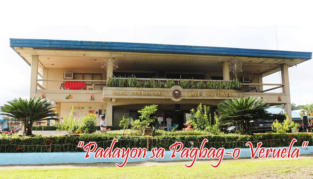
View on WikipediaVeruela, officially the Municipality of Veruela (Cebuano: Lungsod sa Veruela; Tagalog: Bayan ng Veruela), is a municipality in the province of Agusan del Sur, Philippines. According to the 2020 census, it has a population of 39,708 people.[5]
Key Information


.svg)
History
[edit]Veruela is considered the oldest town of upper Agusan del Sur. It is believed the name "Veruela" derives from the word "virus", as the area suffered from smallpox and cholera in the late 18th century when Spanish missionaries encountered the indigenous Manobo tribes.[6]
The Manobo later moved to Manning, also known as Linongsuran, along the Agusan River. In 1916, an earthquake destroyed the settlement, forcing the survivors to evacuate and reorganize themselves into another place, now the barangay poblacion of the municipality.[6]
In the 18th century, Muslim tribes in Davao invaded the Manobos in Agusan, and the two sides fought. The first known leader of the Manobo was the datu Eladio Manguyod, who drove the Muslims out after a hard-fought battle. During this period, the tribe converted to Christianity and adopted Saint John as their patron.[6]
Veruela became a municipality through Executive Order No. 147, which was proclaimed by President Diosdado Macapagal on March 31, 1965[7] during the term of Congressman Guillermo Sanchez, who once also served as mayor of the town. Since its formal creation as a municipality, Veruela has seen eight different administrations.
The municipality of Veruela has a silent dispute with the nearby province of Compostela Valley regarding the boundary between the two in Barangay Del Monte.[citation needed]
Geography
[edit]Veruela is located at 8°04′N 125°58′E / 8.07°N 125.96°E.
According to the Philippine Statistics Authority, the municipality has a land area of 385.45 square kilometres (148.82 sq mi) [8] constituting 3.86% of the 9,989.52-square-kilometre- (3,856.98 sq mi) total area of Agusan del Sur.
Climate
[edit]| Climate data for Veruela, Agusan del Sur | |||||||||||||
|---|---|---|---|---|---|---|---|---|---|---|---|---|---|
| Month | Jan | Feb | Mar | Apr | May | Jun | Jul | Aug | Sep | Oct | Nov | Dec | Year |
| Mean daily maximum °C (°F) | 27 (81) |
27 (81) |
27 (81) |
29 (84) |
29 (84) |
29 (84) |
30 (86) |
30 (86) |
30 (86) |
30 (86) |
29 (84) |
28 (82) |
29 (84) |
| Mean daily minimum °C (°F) | 22 (72) |
22 (72) |
22 (72) |
23 (73) |
23 (73) |
23 (73) |
23 (73) |
23 (73) |
23 (73) |
23 (73) |
23 (73) |
22 (72) |
23 (73) |
| Average precipitation mm (inches) | 105 (4.1) |
80 (3.1) |
58 (2.3) |
39 (1.5) |
62 (2.4) |
75 (3.0) |
69 (2.7) |
62 (2.4) |
59 (2.3) |
71 (2.8) |
69 (2.7) |
69 (2.7) |
818 (32) |
| Average rainy days | 15.8 | 15.4 | 14.8 | 13.8 | 19.7 | 22.5 | 22.9 | 22.7 | 22.0 | 23.0 | 18.1 | 15.0 | 225.7 |
| Source: Meteoblue[9] | |||||||||||||
Barangays
[edit]Veruela is politically subdivided into 20 barangays.[10] Each barangay consists of puroks while some have sitios.
| PSGC | Barangay | Population | ±% p.a. | |||
|---|---|---|---|---|---|---|
| 2024[11] | 2010[12] | |||||
| 160313013 | Anitap | 1.4% | 595 | 560 | 0.42% | |
| 160313014 | Bacay II | 2.5% | 1,085 | 994 | 0.61% | |
| 160313001 | Binongan | 4.0% | 1,735 | 1,477 | 1.12% | |
| 160313015 | Caigangan | 2.4% | 1,029 | 726 | 2.44% | |
| 160313016 | Candiis | 1.5% | 655 | 553 | 1.18% | |
| 160313002 | Del Monte | 5.5% | 2,375 | 2,260 | 0.34% | |
| 160313003 | Don Mateo | 3.4% | 1,452 | 1,269 | 0.93% | |
| 160313017 | Katipunan | 2.2% | 958 | 922 | 0.26% | |
| 160313004 | La Fortuna | 14.9% | 6,418 | 6,045 | 0.41% | |
| 160313005 | Limot | 2.3% | 973 | 1,104 | −0.87% | |
| 160313006 | Magsaysay | 3.8% | 1,628 | 1,563 | 0.28% | |
| 160313007 | Masayan | 4.0% | 1,726 | 1,430 | 1.31% | |
| 160313008 | Poblacion | 13.7% | 5,891 | 5,643 | 0.30% | |
| 160313009 | Sampaguita | 13.8% | 5,950 | 5,581 | 0.44% | |
| 160313010 | San Gabriel | 6.0% | 2,569 | 2,115 | 1.35% | |
| 160313018 | Santa Cruz | 2.5% | 1,059 | 1,021 | 0.25% | |
| 160313011 | Santa Emelia | 3.4% | 1,483 | 1,463 | 0.09% | |
| 160313019 | Sawagan | 2.6% | 1,099 | 1,214 | −0.69% | |
| 160313012 | Sinobong | 8.6% | 3,706 | 3,206 | 1.01% | |
| 160313020 | Sisimon | 3.1% | 1,320 | 1,311 | 0.05% | |
| Total | 43,085 | 40,457 | 0.44% | |||
Demographics
[edit]| Year | Pop. | ±% p.a. |
|---|---|---|
| 1903 | 2,623 | — |
| 1918 | 1,522 | −3.56% |
| 1939 | 1,381 | −0.46% |
| 1948 | 1,528 | +1.13% |
| 1960 | 2,914 | +5.53% |
| 1970 | 6,626 | +8.55% |
| 1975 | 9,915 | +8.42% |
| 1980 | 13,991 | +7.13% |
| 1990 | 20,129 | +3.71% |
| 1995 | 35,706 | +11.34% |
| 2000 | 36,222 | +0.31% |
| 2007 | 36,862 | +0.24% |
| 2010 | 40,457 | +3.44% |
| 2015 | 43,706 | +1.48% |
| 2020 | 39,708 | −2.00% |
| 2024 | 43,085 | +1.98% |
| Source: Philippine Statistics Authority[13][14][12][15][16] | ||
In the 2020 census, Veruela had a population of 39,708.[17] The population density was 100 inhabitants per square kilometre (260/sq mi).
Economy
[edit]Poverty incidence of Veruela
10
20
30
40
50
60
70
80
2000
63.72 2003
70.58 2006
63.00 2009
58.48 2012
48.74 2015
47.23 2018
39.86 2021
39.36 Source: Philippine Statistics Authority[18][19][20][21][22][23][24][25] |
References
[edit]- ^ Municipality of Veruela | (DILG)
- ^ "2015 Census of Population, Report No. 3 – Population, Land Area, and Population Density" (PDF). Philippine Statistics Authority. Quezon City, Philippines. August 2016. ISSN 0117-1453. Archived (PDF) from the original on May 25, 2021. Retrieved July 16, 2021.
- ^ "2024 Census of Population (POPCEN) Population Counts Declared Official by the President". Philippine Statistics Authority. 17 July 2025. Retrieved 18 July 2025.
- ^ "PSA Releases the 2021 City and Municipal Level Poverty Estimates". Philippine Statistics Authority. 2 April 2024. Retrieved 28 April 2024.
- ^ "2024 Census of Population (POPCEN) Population Counts Declared Official by the President". Philippine Statistics Authority. 17 July 2025. Retrieved 18 July 2025.
- ^ a b c "Municipality of Veruela". Province of Agusan del Sur. Provincial Information Management Office (PIMO). Archived from the original on 9 May 2013. Retrieved 19 October 2016.
- ^ "Executive Order No. 147; Declaring Certain Municipal Districts in the Province of Agusan as Municipalities". Official Gazette of the Republic of the Philippines. 31 March 1965. Retrieved 19 October 2016.
- ^ "Province:". PSGC Interactive. Quezon City, Philippines: Philippine Statistics Authority. Retrieved 25 August 2025.
- ^ "Veruela: Average Temperatures and Rainfall". Meteoblue. Retrieved 29 April 2020.
- ^ "Municipal: Veruela". PSGC Interactive. Quezon City, Philippines: Philippine Statistics Authority. Retrieved 8 January 2016.
- ^ Census of Population (2020). "Caraga". Total Population by Province, City, Municipality and Barangay. Philippine Statistics Authority. Retrieved 8 July 2021.
- ^ a b Census of Population and Housing (2010). "Caraga" (PDF). Total Population by Province, City, Municipality and Barangay. National Statistics Office. Retrieved 29 June 2016.
- ^ "2024 Census of Population (POPCEN) Population Counts Declared Official by the President". Philippine Statistics Authority. 17 July 2025. Retrieved 18 July 2025.
- ^ Census of Population (2015). "Caraga". Total Population by Province, City, Municipality and Barangay. Philippine Statistics Authority. Retrieved 20 June 2016.
- ^ Censuses of Population (1903–2007). "Caraga". Table 1. Population Enumerated in Various Censuses by Province/Highly Urbanized City: 1903 to 2007. National Statistics Office.
- ^ "Province of". Municipality Population Data. Local Water Utilities Administration Research Division. Retrieved 17 December 2016.
- ^ "2024 Census of Population (POPCEN) Population Counts Declared Official by the President". Philippine Statistics Authority. 17 July 2025. Retrieved 18 July 2025.
- ^ "Poverty incidence (PI):". Philippine Statistics Authority. Retrieved December 28, 2020.
- ^ "Estimation of Local Poverty in the Philippines" (PDF). Philippine Statistics Authority. 29 November 2005.
- ^ "2003 City and Municipal Level Poverty Estimates" (PDF). Philippine Statistics Authority. 23 March 2009.
- ^ "City and Municipal Level Poverty Estimates; 2006 and 2009" (PDF). Philippine Statistics Authority. 3 August 2012.
- ^ "2012 Municipal and City Level Poverty Estimates" (PDF). Philippine Statistics Authority. 31 May 2016.
- ^ "Municipal and City Level Small Area Poverty Estimates; 2009, 2012 and 2015". Philippine Statistics Authority. 10 July 2019.
- ^ "PSA Releases the 2018 Municipal and City Level Poverty Estimates". Philippine Statistics Authority. 15 December 2021. Retrieved 22 January 2022.
- ^ "PSA Releases the 2021 City and Municipal Level Poverty Estimates". Philippine Statistics Authority. 2 April 2024. Retrieved 28 April 2024.
External links
[edit]Places adjacent to Veruela | |
|---|---|
Prosperidad (capital) | |
| Municipalities | |
| Component city | |