Hubbry Logo
Walker, Newcastle upon TyneWalker, Newcastle upon TyneMain
Open search
Walker, Newcastle upon Tyne
Community hub
Walker, Newcastle upon Tyne
logo
8 pages, 0 posts
0 subscribers
Be the first to start a discussion here.
Walker, Newcastle upon Tyne
from Wikipedia

Walker is a residential suburb and electoral ward in the south-east of Newcastle upon Tyne, in the county of Tyne and Wear, England.

Key Information

History

[edit]

The place-name 'Walker' is first attested in 1242, where it appears as Waucre. This means 'wall-carr', that is to say, 'the marsh by the Roman wall', a reference to Hadrian's Wall.[1] Today, a small fragment of the wall can be found in neighbouring Byker[2] to the west, and Segedunum, a major site at the end of the Wall can be found in Wallsend to the east.

Large-scale coal-mining began in the area in the early 1700s, with up to ten collieries in operation in the Walker area. A wagon-way was constructed during this period to facilitate transportation of coal to the riverside staithes.[3]

Walker used to have a large shipbuilding industry, particularly the yard of Armstrong Whitworth[4] at High Walker, but this has declined over the past 50 years and the area has suffered as a result, with many jobs being taken away from the community.

From 1809 to 1883, Walker was home to an iron-making company, Losh, Wilson and Bell (known towards the end as Bells, Goodman and finally as Bells, Lightfoot).[5]

Walker was formerly a township and chapelry in the parish of Longbenton,[6] on 30 September 1894 Walker became a separate civil parish[7] from 1894 to 1904 Walker was urban district,[8] on 1 April 1974 the parish was abolished.[9] In 1951 the parish had a population of 32,346.[10] In 1974 it became part of the metropolitan district of Newcastle upon Tyne.

Walkerville

[edit]

Walkerville was developed as a model housing exhibition along the lines of the Garden city movement held under the auspices of the National Housing Reform Council in 1908 and is an early example of small-scale town planning prior to the Housing, Town Planning, &c. Act 1909.[11] One of the prime campaigners behind the exhibition was Councillor David Adams (1871-1943), who later became an MP and Lord Mayor of Newcastle.[12] The chosen site was Corporation estate, Walker, and the gold medal for the horseshoe layout of the site was awarded to Watson and Scott of Newcastle.[13] The exhibition was of a range of 'model cottages' for working people of different types from two to three bedrooms, by different architects and backed by a range of patrons including Wallsend Cooperative Society, at that time a provider of mortgage capital for its members. Newcastle Corporation also built homes as part of the exhibition. The Gold medal-winning architects were AT Martindale, White & Stephenson, Edward Cratney and TE Davidson.[14] David Adams described the planning and development of the Walker and Willington estates in a series of articles for The Northern Echo.[15]

Description

[edit]

Walker is an area between Welbeck Road and the banks of the River Tyne, although the modern electoral ward of Walker incorporates Pottery Bank and St Anthony's. When most Geordies refer to Walker they also incorporate the areas of Daisy Hill and Eastfield. Walkergate, located between Welbeck Road and the Network rail line are sometimes considered parts of Walker. Other parts of Walker are Walkerdene (which is situated south of 'Fossway' and north of 'Welbeck Road', west of 'Waverdale Avenue' and east of 'Scrogg Road') and Walkerville (which is located under the railway bridge and to the right, these houses are mainly private stock whereas other areas of Walker are council and ex-council stock). Other areas included are Daisy Hill and Eastfield which help make up the city Ward of Walkergate.

The area is notable for Walker Park,[16] the Walker Riverside Park,[17] and the Lady Stephenson Library (now known as 'Walker Library') as well as the Lightfoot Sports Centre, which is set to undergo a £2.5m refurbishment. Alderman Sir William Haswell Stephenson, built the library in 1908[18] in memory of his wife Eliza, who died in 1901.[19] The library closed on 29 June 2013 and contents have been relocated into a purpose built area within Walker Activity Dome in July 2013 (The Lightfoot Sports Centre).[20] Walker Park received a Green Flag Award in 2019.[21]

Walker is served by the Tyne and Wear Metro, with a station at Walkergate, and has a main bus terminus on Walker Road, although this is quite dilapidated and badly serviced.

Most children attend a local primary school, These are St Vincent's RC, Tyneview,[22] Welbeck Academy, West Walker,[23] Walkergate, and Central Walker.[24] The two main Secondary Schools which service the area are Benfield School, a specialist Sports College, and Walker Riverside Academy, a high performing specialist technology and visual arts school for 11- to 18-year-olds.

Future

[edit]

Newcastle City Council's Walker Riverside regeneration scheme launched in 2003 aims to revitalise the area with new houses, schools, jobs and community facilities, environmental improvements, and a new neighbourhood centre to be known as the Heart of Walker.[25] The scheme has its own newsletter known as the "Walker Eye", which goes to almost 7,000 homes and businesses locally.

Much of the older and run-down housing stock along Walker Road is in the process of being demolished and replaced with new homes which are a mixture of council and private housing. The stated aim was to build 1,600 new and replacement homes over a 15-year period.[26]

As part of the new Heart of Walker development, plans have recently been unveiled to open a new state-of-the-art primary school on a site next door to the redeveloped Lightfoot Centre, where the old Wharrier Street Primary School was. The £7.5m project merged Wharrier Street and St Anthony's Primary Schools in Autumn 2012 to create the new Central Walker Church of England Primary.[27]

Plans for the area's regeneration were approved by the then Secretary of State for Communities and Local Government, Ruth Kelly.

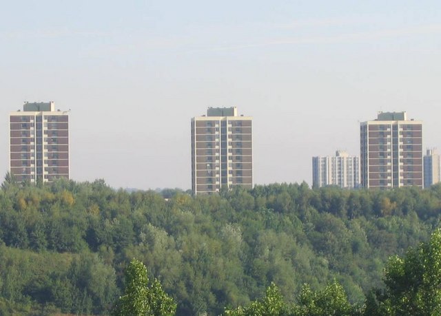
In August 2018 it was announced that two high-rise blocks, Titan House and Hexham House were to be demolished. The flats and neighbouring Church Walk shopping centre will be replaced by a new housing development and shops.[28]

Notable people

[edit]

Cheryl Cole, singer, born on 30 June 1983,[29] lived in Walker and Heaton, attending Walker Comprehensive School, Middle Street,[30] before she found fame with Girls Aloud.[31]

Walker is the birthplace of Eric Burdon, lead singer of The Animals, who later recorded with War at the beginning of that band's career. The Animals recorded a song called "Gonna Send You Back to Walker", a repurposed version of a song by American R&B singer Timmy Shaw, "Gonna Send You Back to Georgia (A City Slick)."[32]

Another Walkerite, the author, journalist and broadcaster Keith Topping, titled one of the chapters in his novel The Hollow Men, The St. Anthony's Chinese Takeaway Massacre. The novelist is co author on Dr Who: The Hollow Men (1998) with Martin Day.

FA Cup-winning Newcastle United defender, Charlie Crowe, was born in Walker.The former Newcastle United striker Shola Ameobi grew up in Walker, where he played for Walker Central F.C.; which was launched in 1988 by the Wallsend-born former Newcastle United footballer Lee Clark, and ex-club scout Brian Clark (no relation).

Stan Anderson, rugby union player who made one Test match appearance for England in the 1899 Home Nations Championship.

David MacBeth, an English pop music singer was born in Walker.[33] Despite releasing a string of singles on three record labels between 1959 and 1969, MacBeth's only chart success was with his version of "Mr. Blue", which peaked at number 18 in the UK Singles Chart.[34] MacBeth took part in the 1963 Roy Orbison/The Beatles Tour.[35]

Geordie Shore stars Marty McKenna and Chantelle Conelly are both also from Walker.

References

[edit]
[edit]
Revisions and contributorsEdit on WikipediaRead on Wikipedia
from Grokipedia
Walker is a residential suburb and electoral ward situated on the eastern fringe of Newcastle upon Tyne, , along the south bank of the River Tyne. Encompassing neighborhoods such as Walkergate, Walkerville, and St. Anthony's, it spans approximately 3 square kilometers with a population of 11,825 as of recent estimates. Historically known as "Waucre" in medieval records, possibly deriving from , the area developed through from the 1700s and heavy industry including yards like those of and iron production by firms such as Losh, Wilson and Bell. The suburb's economy once thrived on these sectors, with multiple collieries and naval yards contributing to regional prosperity, but post-industrial decline has resulted in persistent challenges including high , elevated crime rates, and deprivation rankings placing much of Walker among England's more disadvantaged locales. Socio-economic indicators reveal a skewed toward elementary occupations and caring roles, with significant reliance on social rented housing and an average household income around £32,700. Notable features include Walker Park and Riverside Park for recreation, the Walker Library, and transport links via the at Walkergate station, alongside ongoing regeneration efforts such as the Walker Riverside scheme aiming to deliver 1,600 new homes over 15 years.

Geography and Demographics

Location and Physical Features

Walker occupies the southeastern portion of , situated directly on the north bank of the River Tyne, east of the city center and adjacent to areas such as across the river. The electoral ward of Walker is delimited by neighboring wards including to the northwest and Walkergate to the northeast, encompassing a compact urban-residential zone along the riverside. The terrain consists of a relatively flat elevated plateau rising to approximately 30 meters above the River Tyne, which facilitated early development while limiting steep gradients typical of other parts of Newcastle. This low-lying positioning relative to surrounding higher ground contributes to environmental vulnerabilities, including flood risks from fluvial and tidal surges along the Tyne, as identified in regional assessments of lower reaches. Legacy industrial activities have left brownfield sites and contamination issues, such as and hydrocarbons in soils near the riverbank, prompting remediation efforts at locations like the former St. Anthony's Tar Works. Limited green spaces punctuate the , including Walker Park with its sports pitches, greens, and multi-use games area, and Walker Riverside Park, established in the on reclaimed land featuring , wildflower meadows, and footpaths. These areas provide modest recreational buffers amid predominantly residential and post-industrial landscapes.

Population Statistics and Socioeconomic Profile

According to the 2021 United Kingdom census, the Walker ward had a of 11,825 residents across an area of 2.810 s, resulting in a of 4,208 inhabitants per . The average age of residents was 38.5 years. Ethnically, the is overwhelmingly , comprising 10,347 individuals or approximately 87.5% of the total, with residents numbering 505, Asian 411, 215, and the remainder in mixed or other categories. Socioeconomic conditions in Walker are marked by significant deprivation, as measured by the English Indices of Multiple Deprivation (IMD) 2019, with domain scores indicating 22.5% income deprivation and 22.5% employment deprivation relative to national averages. Specific neighbourhoods, such as the area around Merton Road, rank as the most deprived in the North East region under the IMD framework. These metrics underscore patterns of economic disadvantage, including elevated reliance on social benefits and lower rates of homeownership compared to Newcastle and national norms, though precise ward-level figures for the latter vary by lower super output area. Family structures feature a higher incidence of single-parent households than in less deprived areas, contributing to social and economic pressures amid a relatively youthful demographic profile. Intergenerational persists, driven by limited upward mobility in low-skilled employment sectors historically dominant in the ward.

Historical Development

Origins and Early Settlement

The medieval village of Walker emerged within the barony of Morpeth in during the 12th century, functioning as a modest characterized by limited settlement. By 1296, records from the lay subsidy roll indicate it supported only five taxpayers, underscoring its sparse population and primarily agrarian character along the River Tyne. Walker's early economy relied on small-scale and opportunistic from the Tyne's banks, with no evidence of substantial pre-medieval occupation or organized exploitation of local resources. The area's isolation from central Newcastle contributed to its rural persistence, lacking the defensive or commercial prominence that drove development in nearby settlements. Into the early 19th century, Walker remained predominantly rural, though proximity to coalfields began influencing land use through informal enclosures and basic road improvements, setting the stage for later changes without triggering immediate urbanization. The establishment of Christ Church in 1848 marked one of the first dedicated religious structures, consecrated amid gradual population stirrings tied to regional trade rather than industrial influx.

Industrial Expansion and Peak

The shipbuilding industry fueled Walker's industrial expansion from the mid-19th century onward, with Charles Mitchell establishing a yard at Low Walker in 1852 to construct iron-hulled vessels amid the Tyne's burgeoning maritime economy. This development complemented earlier efforts, such as John Coutts' Walker Shipyard from 1842, which produced early steam , and integrated with export activities that supported riveting, , and trades. By the late , facilities like the Slipway and Company—formed in 1871 for repairs and later new builds—drew thousands into specialized labor, amplifying the area's role in heavy and . High Walker emerged as a focal point for advanced in the early under , transitioning to naval specialization. During , Walker's yards contributed to the Tyne's output of warships and merchant vessels, leveraging the river's established prowess in iron and steel fabrication to meet wartime demands. The interwar era saw the Walker Naval Yard complete 37 warships, 29 merchant ships, and 30 tankers between 1913 and 1928, demonstrating peak productivity in diverse vessel types. marked the zenith, with the yard launching 72 ships—including one , one monitor, four aircraft carriers, three cruisers, 22 destroyers, 15 submarines, and support craft—highlighting scaled-up workforce mobilization and output efficiency. Paternalistic responses to labor influx included the 1908 creation of Walkerville, a model housing enclave developed under garden city principles by the National Housing Reform Council to accommodate shipyard workers with improved sanitary and communal facilities. This enclave exemplified company-driven to retain skilled employees amid rapid industrialization, though it remained a modest enclave compared to the yards' expansive operations.

Post-War Decline and Deindustrialization

The industry in Walker, a key employer since the , began its contraction in the amid mergers and rationalization efforts, as yards struggled with outdated infrastructure and falling orders. Local facilities, including the Neptune Yard, were absorbed into the & Tyne Shipbuilders in 1968, but output dwindled as global demand shifted toward faster, cheaper production from Asian competitors like and , which captured over 50% of world by the through superior efficiency and lower labor costs. In Walker, this manifested in reduced workforce and partial closures, exacerbated by domestic factors such as frequent strikes and restrictive union practices that inflated costs and delayed projects, contrasting with rivals' streamlined operations. Nationalization under in 1977, intended to consolidate and subsidize the sector, failed to reverse the tide, as state-directed investments prioritized short-term job preservation over modernization, yielding persistent productivity gaps—UK yards produced ships at 20-30% higher cost per ton than Japanese equivalents by the late 1970s. Subsidies, totaling hundreds of millions in the North East, propped up uncompetitive yards temporarily but could not offset automation advances abroad or the automation-resistant work rules enforced by unions, leading to further contractions. Key closures followed, including elements of the Hawthorn Leslie operations linked to yards by the early 1980s, culminating in the effective end of major in Walker by 1986, with cumulative job losses exceeding 10,000 across Tyne yards from the 1960s to 1980s. These losses triggered ripple effects, including automation and downsizing at adjacent docks and factories, which relocated or shuttered as supply chains collapsed, while outmigration of skilled workers accelerated depopulation. Unemployment in surged to over 95,000 claimants by February 1984—peaking at rates approaching 30% in shipbuilding-dependent locales like Walker—fostering chronic as alternative sectors failed to absorb the displaced labor force reliant on skills. This structural shift entrenched economic stagnation, with local productivity lags rooted in pre-existing inefficiencies rather than isolated policy failures.

Economy and Industry

Traditional Industries and Employment

Walker's economy was historically anchored in , with emerging as a cornerstone from the mid-19th century onward, centered on major yards such as those operated by at High Walker and at Low and High Walker. These facilities specialized in constructing merchant vessels, warships, and engineering components, leveraging the River Tyne's strategic position for assembly and launch. Shipbuilding operations involved intricate processes, including the fabrication of hulls from plates sourced from regional mills and the integration of propulsion systems, fostering a workforce proficient in riveting, plating, and outfitting. Complementing shipbuilding was a robust engineering sector, where skills in boilermaking, pattern-making, and heavy fabrication supported vessel construction and repair, often drawing on local and supplies from Tyneside collieries and foundries. This created a tightly integrated , with powering forges and providing for boilers and engines, resulting in a predominantly male labor force trained through apprenticeships in specialized trades that emphasized precision craftsmanship over general labor. The added another pillar, initiated with the establishment of Losh, Wilson & Bell's alkali works in 1807 at Walker-on-Tyne, which pioneered the —the first such application in —for producing soda ash and bleaching powder essential to textiles, glassmaking, and production. These operations scaled through the , employing workers in caustic soda extraction and purification, with processes reliant on local salt and inputs, contributing to Walker's reputation for industrial chemistry tied to broader regional extraction industries. Notable achievements included wartime efficiencies, as Armstrong Whitworth's High Walker yard ramped up armaments and vessel production during conflicts, integrating innovations like engines developed regionally by figures such as Parsons, whose designs enhanced in Tyneside-built ships. Swan Hunter's Walker yards alone contributed to over 1,600 vessels launched across the Tyne, demonstrating operational prowess in modular construction and rapid fitting-out that supported naval demands.

Modern Economic Challenges

In Walker, unemployment and underemployment rates substantially exceed national figures, with residents largely confined to low-wage roles in retail and service industries amid persistent structural barriers. The UK's unemployment rate hovered around 4% in 2023-2024, while recorded 5.3% for those aged 16 and over in the year ending December 2023; in highly deprived wards such as Walker, employment deprivation affects 22.5% of the population according to the 2019 Index of Multiple Deprivation, reflecting localized rates often 10-15% or higher due to legacy industrial loss and limited local opportunities. Underemployment is exacerbated by reliance on zero-hour contracts, which are prevalent in the accommodation, food, and retail sectors dominating Walker's job market, comprising up to 28.8% of contracts in nationally and contributing to income instability without guaranteed hours. Economic inactivity in the area surpasses 20%, with Newcastle's overall rate at 29.4% for working-age residents as of 2022, including over 14,400 on long-term sickness benefits linked to conditions and gaps that hinder transitions to available roles in higher-skill sectors. Public sector employment provides some stability but fosters dependency, as low rates—below the Newcastle average where growth has risen 9.8% since 2019—limit alternatives in this low-capital environment. mismatches persist, with Walker's historical low qualification levels (e.g., only 12.2% at Level 2+ in earlier assessments) failing to align with regional demands for technical competencies. Demographic disparities compound these challenges: males face entrenched from shipbuilding decline, while females encounter higher "hidden" unemployment through economic inactivity, a pattern amplified in Newcastle where women's labor market detachment exceeds regional norms. Youth rates in deprived wards like Walker exceed 15%, far above the city's 6.9% for 16-17-year-olds in 2024-2025, signaling acute barriers in education-to-employment pathways amid health and skills deficits.

Recent Regeneration Initiatives

The Walker Riverside Area Action Plan, adopted by in 2007, served as a long-term framework for regenerating the area through mixed-use developments, including new housing provision, commercial spaces, and environmental improvements aimed at reversing industrial decline and population loss exceeding 40% since the mid-20th century. The plan built on the broader Going for Growth initiative launched in 2000, which prioritized east-end neighborhoods like Walker for via public-private partnerships, yet implementation faced constraints from low private investment and protracted . Subsequent efforts in the , including regional development funds channeled through council-led projects, focused on brownfield remediation and temporary job creation but drew criticism for failing to generate enduring business stability or counter resident displacement amid uneven redifferentiation. These initiatives underscored a of heavy dependence on subsidies rather than organic market signals, with outcomes marked by modest residential builds—such as those under the 2023 Brownfield Fund approval for Walker Riverside—amid persistent challenges in occupancy and enterprise retention. In June 2025, Walker North was designated one of 25 national "trailblazer neighbourhoods," securing up to £20 million in funding over 10 years to target upgrades and brownfield , with an emphasis on addressing entrenched deprivation through coordinated local delivery. This allocation, confirmed amid Newcastle's broader £40 million package including Elswick, represents the latest public intervention but highlights ongoing skepticism regarding scalability beyond grant dependency, as prior cycles have yielded incremental rather than transformative economic metrics.

Infrastructure and Amenities

Transportation and Connectivity

Walker maintains strong transport links to Newcastle city centre, primarily via the Tyne and Wear Metro system, with Walkergate station offering services every 10 minutes and journeys to central stations taking approximately 9 minutes. Frequent bus routes, such as those operated by Stagecoach North East from Welbeck Road to John Dobson Street, operate every 10 minutes, enabling commutes of 10-15 minutes to the centre at a cost of £2-3 per ticket. Road access is facilitated by the A193, which runs through Walker and Walkergate, connecting directly to Newcastle via Shields Road and linking to major arterials like the A1 and A19, with proximity to the Tyne Tunnels for south bank crossings. The area's riverside position historically supported dock facilities for freight and shipbuilding on the River Tyne, contributing to , but commercial freight volumes declined sharply post-1990s amid , leaving many sites underused despite limited ongoing operations at yards like High Walker for heavy lifts. Active travel options include National Cycle Route 72, which traverses Walker along the riverside, providing pedestrian and cycle paths amid regeneration efforts. However, poor pedestrian linkages in residual industrial zones exacerbate , despite Walker's , as highlighted in local planning documents seeking to promote walking and to reduce reliance on private vehicles.

Key Landmarks and Public Spaces

Walker Park, a Victorian-era public green space in central Walker, was opened in 1891 on land leased from Newcastle Corporation to the Walker Board, providing recreation for colliery and shipyard workers amid rapid industrialization. The approximately 20-acre site features large open lawns interspersed with mature trees, supporting sports, exercise, and activities historically tied to the local working-class . Walker Riverside Park, developed in the 1980s on reclaimed land from former tar and lead works along the River Tyne, includes accessible riverside paths suitable for pedestrian recreation and wildlife viewing, such as wading birds and occasional grey seals. These paths form part of broader green corridors designated for walking and cycling under local planning policies. The Church of St. Anthony of Egypt represents a surviving ecclesiastical landmark in Walker, reflecting the area's historical religious infrastructure amid industrial growth. Walkerville, a sub-district within Walker, retains examples of 19th-century terraced housing originally built for industrial laborers, though many properties now require refurbishment.

Housing and Urban Layout

The housing stock in Walker predominantly consists of terraced houses from the 19th and early 20th centuries, built to accommodate industrial workers near shipyards and factories, alongside later council estates developed post-1919 under the Addison Act. Approximately 50% of properties are terraced, 32% , with smaller proportions of detached homes and flats or other types, reflecting the area's working-class origins and limited suburban expansion. Urban layout features compact grid patterns stemming from industrial-era , where residential streets were aligned closely to employment sites along the River Tyne, resulting in higher densities compared to rural greenfield areas lost to expansive yards. This configuration prioritized proximity to work over spacious open spaces, leaving a legacy of narrow streets and tightly packed dwellings. Derelict sites persist from selective demolitions of outdated structures, contributing to localized vacancies higher than Newcastle's city-wide average in southern Walker Riverside areas. Social housing comprises around 69% of tenure, managed largely by across approximately 4,400 properties in Walker and adjacent wards, enabling affordability with average property values around £155,000 but raising concerns over and quality in aging stock. Private ownership remains low at about 15%, underscoring the dominance of rented accommodations amid historical .

Social Dynamics and Issues

Community Life and Culture

Walker's residents embody the resilient working-class identity rooted in Newcastle's industrial heritage, emphasizing camaraderie through local dialects and shared traditions that reinforce community bonds amid economic pressures. Pubs remain integral to social life, serving as venues for gatherings that sustain informal networks and cultural continuity in the area. Local events such as bonfire celebrations during contribute to communal rituals, drawing on longstanding British customs adapted to neighborhood scales. Community centres like Walkerville Community Centre organize activities including pantomimes, nights, and classes, providing spaces for intergenerational engagement and mutual support. Grassroots groups, such as the Walker Community Group, facilitate neighborly aid through online coordination for events and assistance, exemplifying informal solidarity. The area's cultural outputs include a music scene that has nurtured talents influencing national pop, with singer emerging from Walker's environment to achieve prominence via groups like . Sports clubs, including Pacesetters Walker, tie into historical community recreation, promoting athletics and local pride linked to Tyneside's sporting traditions from industrial eras. Shifts toward declining formal volunteerism and church participation reflect broader UK patterns, with Walker's networks compensating via mutual aid initiatives in nearby areas like Walkergate, prioritizing direct peer support over institutional structures.

Crime, Safety, and Anti-Social Behavior

Walker, within the Byker and Walker policing area, records elevated violent crime rates approximately 21% higher than the Newcastle upon Tyne average, contributing to heightened safety concerns for residents. Overall crime incidence in the Walker ward stands at 148 offences per 1,000 residents annually, exceeding the city-wide rate of 91 per 1,000 reported in 2025. Anti-social behaviour reports number 112 in recent monthly data for the area, ranking as the second most common category after violence and sexual offences (166 incidents). Youth involvement in gangs exacerbates anti-social trends, including vandalism and intimidation, with residents citing fears of groups congregating in parks and shopping areas, deterring nighttime outings. A notable 2025 incident involved teenagers Jonas Barry and Lee Sweeting, part of a masked gang that conducted a machete attack on a family home, prompting residents to flee after 35 years in the property. Such events underscore persistent risks from unstructured youth activity, often linked to idleness amid local unemployment, fostering extortion-like harassment and property damage. Drug-related incidents compound security threats, with multiple 2025 cases involving Walker residents in trafficking operations, including a trusted cocaine distributor jailed as part of a North Shields-linked network and a teenager convicted for cultivating and dealing from a garden shed. have prioritized drug dealing since June 2025, pursuing intelligence-led disruptions and community bans for persistent offenders. Despite these efforts, critiques highlight ongoing community erosion, with policing responses viewed as insufficient against entrenched patterns of low-level disorder and violence.

Health, Education, and Welfare Dependencies

Residents of Walker experience significantly poorer health outcomes compared to national averages, with male at the local Walker Medical Group averaging 74.5 years against a male average of 78.8 years, a gap of over four years attributable in part to elevated rates of chronic conditions like . rates stand at 47% in Walker, far exceeding the 18.9% in more affluent Newcastle wards such as North , correlating with dietary patterns heavy in processed foods and low levels that exacerbate metabolic diseases. Drug misuse contributes further, as Newcastle's overall rate of drug-related deaths surpasses regional and national figures, with local patterns reflecting higher and polydrug involvement tied to socioeconomic stressors rather than isolated pharmacological factors. Educational attainment remains low, exemplified by Walker Riverside Academy where only 19% of pupils achieve grade 5 or above in both English and GCSEs, compared to the national rate of approximately 45% for this benchmark. This disparity persists despite policy interventions, linking to foundational issues such as irregular attendance and limited parental engagement, which hinder from early years. metrics underscore how such outcomes perpetuate cycles of , as low qualifications restrict access to skilled trades dominant in the region's economy. Welfare dependencies are pronounced, with Walker's deprivation affecting 22.5% of residents and deprivation impacting another 22.5%, rates over twice the national averages and indicative of substantial reliance on out-of-work benefits. Intergenerational patterns are evident in Index of Multiple Deprivation data, where household structures marked by single parenthood—often 40-50% in such wards—correlate with sustained claims spanning parents and children, compounded by barriers like skills deficits rather than mere economic downturns. Debates center on whether entrenched state dependency fosters passivity, as evidenced by prolonged benefit tenures amid stable national job availability, or if instability and cultural norms prioritizing immediate gratification over long-term investment in and represent primary causal blocks to . Empirical correlations favor the latter, with studies showing stable two-parent households yielding 20-30% higher educational and health metrics even controlling for , suggesting policies emphasizing personal agency and familial reform could mitigate outcomes more effectively than expanded entitlements alone.

Notable Residents

Prominent Figures from Walker

Cheryl Ann Tweedy, professionally known as , was born on 30 June 1983 in and raised on council estates in the Walker district, where she attended Walker Comprehensive School on Middle Street. She achieved international fame as a member of the girl group , formed through the ITV talent show Popstars: The Rivals in 2002, which produced 20 consecutive UK top-ten singles, including four number ones. Transitioning to a solo career in 2009, Cheryl released albums such as and Messy Little Wishes, with lead singles like "" topping the UK charts and selling over 1 million copies in the UK alone. Her success marked one of the few high-profile breakthroughs from Walker's working-class environment, characterized by limited upward mobility in later decades. Eric Burdon, born on 11 May 1941 in Walker, became a prominent figure in as the lead singer of , whose 1964 hits "" and "" topped charts worldwide and exemplified the sound. From a working-class family—his father a tinsmith and mother with engineering ties—Burdon's early exposure to American blues in Walker's industrial setting influenced his raw vocal style. He later fronted the funk-rock band , contributing to their 1970 number-one single "," and has released over 15 solo albums, maintaining a career spanning six decades with sales exceeding 20 million records. Shola Ameobi, born 12 October 1981 in Zaria, Nigeria, but raised from childhood in Walker, developed his football skills through local clubs like Walker Central F.C., founded in 1988. Joining Newcastle United's academy at age 13, he debuted for the first team in 2000 and played 14 seasons, appearing in 370 matches and scoring 48 goals, including key contributions in Premier League and UEFA Cup campaigns. Representing Nigeria internationally from 2005 with 13 caps, Ameobi's loyalty to his adopted hometown club underscored rare local talent emergence amid Walker's post-industrial economic challenges.

Prospects and Debates

Ongoing Developments

In June 2025, Walker North was designated one of 25 "trailblazer neighbourhoods" eligible for up to £20 million in funding over the next decade to support community-led regeneration efforts, focusing on long-term improvements in deprived areas. This allocation, confirmed as part of a £40 million package for Newcastle in September 2025, empowers local residents to prioritize initiatives such as site enhancements and infrastructure, though specific spending details remain under development via resident input and council frameworks. A key early project tied to broader renewal is the July 2025 approval of a 42-home development by Keepmoat Homes at Pottery Bank, a long-vacant site, incorporating garden village principles with emphasis on and community amenities like enhanced landscaping. This pilot addresses housing shortages through mixed-tenure rentals and shared ownership, with construction advancing amid local support for tackling derelict land. As of October 2025, implementation metrics are preliminary, with residents and charities expressing cautious optimism but highlighting risks of insufficient long-term impact given Walker's entrenched challenges; no quantifiable data on job creation or startup rates has emerged yet, underscoring the fund's decade-long horizon over immediate transformations. Local persists, as prior investments have yielded mixed results, though the resident-driven model aims to align spending with empirical needs like site clearance and basic revitalization.

Criticisms of Policy Responses

Despite multiple rounds of government-funded regeneration initiatives from the 2000s onward, including the Single Regeneration Budget and local area action plans, Walker's socioeconomic indicators have shown limited structural improvement, with the ward consistently ranking among the most deprived in . For instance, in the 2019 Index of Multiple Deprivation, the area around Merton Road in Walker was identified as the most deprived neighbourhood in the North East, reflecting persistent high , low incomes, and despite targeted interventions. Critics argue that these efforts, often property-led and subsidy-heavy, have yielded primarily symbolic outcomes such as enhancements rather than fostering sustainable private enterprise or skills development, with over £8 billion invested nationally in subsidized business spaces in deprived areas producing negligible long-term gains. In Walker specifically, local commentary on the 2025 announcement of up to £20 million in "trailblazer" funding over a decade has highlighted risks of misallocation to consultants and short-term projects rather than vocational training or enterprise incentives, echoing patterns where prior funds failed to reverse deindustrialization's legacy. Broader analyses of post-industrial policy contend that heavy reliance on subsidies and propped up inefficient industries like on the Tyne, delaying adaptation to global market shifts and stifling growth that dynamism could have encouraged elsewhere. While stemmed partly from inevitable technological and changes, points to regulatory overreach and interventionist failures exacerbating local agency deficits, as subsidies often prioritized preservation over , contrasting with self-reliant models in less subsidized regions. Academic critiques of Walker's housing-led approaches further warn against "planned " that displaces residents without addressing root .

References

Add your contribution
Related Hubs
User Avatar
No comments yet.