Recent from talks
Nothing was collected or created yet.
Warrap (state)
View on WikipediaWarrap is one of the ten states in South Sudan with its Headquarters at Kuajok. Warrap state is located in the Bahr el Ghazal region. The state was established in 2005 following the signing of the Comprehensive Peace Agreement between the Sudan People Liberation Movement (SPLM) led by Dr. John Garang de Mabior the Government of Sudan under the leadership of president Omar Hassan El Bashir. It subsequently became part of South Sudan after a successful secession from Sudan on 9 July 2011. Warrap State comprises six counties, Tonj South County, Tonj North County, Tonj East county, Gogrial East County, Gogrial West County and Twic County.
Key Information
Wanhalel, where Jieng Customary law initiated and hometown to prominent politician Hon. Nhial Deng Nhial, is located in Tonj South County of Warrap State[3] The current governor is H.E.Amb. Bol Wek Agoth who replaced Gen. Magok Magok Deng after his relief .[4]
History
[edit]In 2015, a presidential decree established a new system of 28 states, replacing the previously established 10. Warrap State was replaced by the states of Twic, Gogrial and Tonj.[5] Warrap State was re-established by a peace agreement signed on 22 February 2020.[6]
List of Governors
[edit]Overview
[edit]
Warrap State comprises an area of 31,027 km². Kuajok is the capital of Warrap state. All states in South Sudan are divided into counties, each headed by a County Commissioner appointed by the President of the Republic of South Sudan
| County | Area (km2) | Population Census 2008 |
County Commissioner |
|---|---|---|---|
| Gogrial East | 3,890.55 | 103,283 | Maluach Malueth |
| Gogrial West | 4,754.37 | 243,921 | Makuc Aruol Luach |
| Tonj South | 7,449.73 | 86,592 | Nhial Deng Nhial (Acting) |
| Tonj North | 11,012.05 | 165,222 | Kuol Akoon Kuol |
| Tonj East | 3,990.61 | 116,122 | John Deng Kok |
| Twic | 3,922.65 | 204,905 | Deng Tong Goch |
Location
[edit]Warrap State is in the Bahr el Ghazal region. To its north lies the disputed region of Abyei, to its east lies Unity State. To the west is Western Bahr el Ghazal and Northern Bahr el Ghazal, and to its south lies the Lakes State.[10]
Government
[edit]The state constitution was adopted in 2008. Lewis Anei Madut-Kuendit was the first governor of the state and Bol Wek Agoth is the current governor of Warrap state .[11]
Religion
[edit]
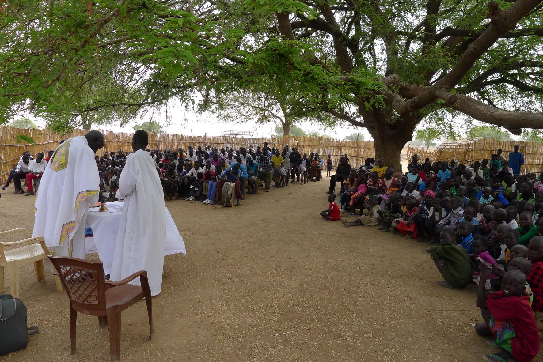
The main religions in Warrap State are the African Traditional Religion, Christianity (Catholicism, Protestantism). A sizable proportion of the population practices African traditional religions.[12]
Notable figures
[edit]- Kerubino Kuanyin Bol (1948-1999), rebel commander who was one of the founders of SPLA/M
- Manute Bol (1962–2010), tallest NBA player of all time[13]
- Salva Kiir Mayardit (born 1951) president of South Sudan since 2011[14]
- Peter Mayen, politician
- Slate Nation, musician[15]
- Nhial Deng Nhial (politician)
- Salva Kiir Mayardit (president of South Sudan)
- Mayiik Ayii Deng (politician)
- Awut Deng Acuil (politician)
- Madut Kon Awan, politician
- Alek Wek (born 1977), model[16]
References
[edit]- ^ "South Sudan: States and counties". www.citypopulation.de. Retrieved 2024-02-14.
- ^ "Sub-national HDI - Area Database - Global Data Lab". hdi.globaldatalab.org. Retrieved 2020-04-18.
- ^ "From Unwritten to Written: Transformation of Jieeng Customary Law into Qanun Wanh-alel" (PDF). Australasian Review of African Studies. 43 (1). 2022. doi:10.22160/22035184/ARAS-2022-43-1/41-55.
- ^ a b "President Kiir relieves three ministers, Warrap Governor". Eye Radio. 2023-11-28. Retrieved 2023-12-16.
- ^ "New decree creates ethnic enclaves for Nuer". Radio Tamazuj. 2 October 2015. Archived from the original on 22 February 2017. Retrieved 21 February 2017.
- ^ "After 6 years of war, will peace finally come to South Sudan?".
- ^ "Gen. Aleu Ayieny's sacking draws mixed reactions in Warrap State". Radio Tamazuj. Retrieved 2024-03-23.
- ^ "Newly appointed Warrap governor urged to prioritize peace". The Radio Community. 2022-11-17. Retrieved 2024-03-23.
- ^ Chang, Koang (2023-12-25). "Warrap and WBG governors agree to settle 'Manyang' dispute peacefully". Eye Radio. Retrieved 2024-03-23.
- ^ Map of South Sudan
- ^ Deng, Madot. "Speaker of the State Assembly".
- ^ "Warrap state calls on religious leaders to be models of peace". Sudan Tribune. 31 October 2010. Retrieved 2024-03-23.
- ^ "Basketball star Bol buried in south Sudan". July 5, 2010. Archived from the original on June 1, 2012. Retrieved October 3, 2019 – via af.reuters.com.
- ^ "President Salva Kiir Comes From Warrap State". Archived from the original on 2011-11-21. Retrieved 2011-11-22.
- ^ "Slate Nation". hotinjuba.com. 2018-12-13.
- ^ Campbell, Roy H. "Refugee from Sudan takes runways by storm Fashion: 19-year-old Alek Wek's regal carriage and exotic face may begin to change the Western concept of beauty". baltimoresun.com. Retrieved October 3, 2019.
Warrap (state)
View on GrokipediaGeography
Location and Borders
Warrap State occupies the northwestern portion of South Sudan, within the Greater Bahr el Ghazal region, and is positioned centrally among the country's northern states.[8] Its capital, Kuajok, serves as the administrative hub, reflecting its role in connecting northern and central areas of the nation.[1] The state lies entirely within South Sudan's landlocked territory, sharing no direct international borders but interfacing with Sudan's disputed Abyei region along its northwestern periphery.[8] To the north, Warrap borders Northern Bahr el Ghazal State, facilitating ethnic and trade linkages among Dinka communities predominant in both areas.[1] Eastern boundaries adjoin Unity State to the northeast and Lakes State to the southeast, where seasonal migrations and resource disputes, such as over cattle grazing lands, have historically influenced inter-state relations.[9] Western limits connect with Western Bahr el Ghazal State, encompassing shared ecological zones prone to flooding from the Lol River system.[10] The northwestern edge interfaces with the Abyei Administrative Area, a contested zone under United Nations oversight due to overlapping claims by Sudan and South Sudan, complicating border security and resource access.[8] These boundaries, delineated post-independence in 2011 and adjusted during the 2015 administrative reorganization, span approximately 6,017 square miles, though exact demarcations remain fluid amid ongoing communal conflicts.[10]Physical Features and Climate
Warrap State occupies low-lying plains and floodplains at elevations ranging from 428 meters in the north to 456 meters above sea level in the south.[10] The terrain is predominantly flat to gently undulating, forming part of the western floodplains of South Sudan, with soils dominated by black cotton clays that are prone to waterlogging during wet periods.[11] Seasonal rivers traverse the state, leading to periodic flooding in lowland areas such as Twic County, while the absence of significant mountains or highlands characterizes the landscape as open savanna with scattered wooded areas and grasslands.[10] Vegetation aligns with tropical savanna ecosystems, featuring open grasslands interspersed with acacia trees and other drought-resistant species adapted to the region's variable hydrology.[12] The state experiences a tropical wet and dry savanna climate (Köppen Aw), marked by distinct wet and dry seasons driven by the seasonal migration of the Intertropical Convergence Zone.[13] The wet season spans approximately 7 to 8 months, from late March to November, delivering the bulk of annual precipitation, while the dry season from December to March features minimal rainfall and heightened drought risk.[14] Average annual rainfall hovers around 900 mm, consistent with central South Sudan's sub-humid zones, though northern areas of Warrap receive slightly less due to proximity to drier Bahr el Ghazal regions.[15] Temperatures remain consistently warm year-round, with average highs reaching 36°C and lows around 24°C; diurnal ranges are moderate, but heat stress intensifies during the dry season.[13]History
Pre-Colonial and Colonial Era
The territory now comprising Warrap State was settled primarily by Dinka pastoralists, belonging to subgroups such as the Rek (dominant in Tonj areas), Aguok (around Gogrial), and Twic, who migrated into the Bahr al-Ghazal grasslands over centuries as part of broader Nilotic expansions beginning around 1000–1500 AD.[16] These societies centered on transhumant cattle herding, with wealth, status, and rituals measured in livestock; millet farming and fishing supplemented livelihoods during dry seasons. Social structure followed segmentary lineages without centralized authority, relying on kinship networks, age-sets for warfare and initiation, and mediators like kuaar muon (leopard-skin chiefs) to resolve cattle raids and resource disputes via bloodwealth compensation under customary ruk law.[16] Religious life emphasized Nhialic (the divine sky creator) and ancestor spirits, with cattle sacrifices integral to healing, fertility, and prophecy by beny bith (masters of the fishing spear). Inter-group alliances formed transiently for defense against external threats, but chronic feuds over pastures perpetuated low-level violence without standing armies or fortified settlements.[17] British-led Anglo-Egyptian forces reconquered Sudan after 1898, extending patrols into Bahr al-Ghazal by 1900–1905 via river routes, establishing initial outposts like those near Wau and confronting Dinka resistance through punitive expeditions with machine guns and Sudanese battalions.[18] In the Warrap area, pacification entailed suppressing localized Dinka revolts—such as early 1900s uprisings led by prophets invoking spiritual power against foreign intrusion—resulting in thousands of livestock seizures and executions to enforce tribute by 1910–1920.[19] Administrative control solidified under the Condominium's provincial structure, with Warrap's territories falling within Bahr al-Ghazal province; district commissioners applied indirect rule by elevating cooperative clan heads as sub-chiefs and later paramount chiefs (e.g., in Gogrial by the 1920s) to levy taxes in cattle (up to 10–20 per chief annually) or grain, while prohibiting slavery raids and mandating labor for roads.[18] The 1922 ordinance formalized the Southern Policy, prohibiting northern Arab traders and clerks from southern districts like Bahr al-Ghazal to shield Nilotic groups from Islamization and economic dominance, a measure driven by British ethnographic views of southerners as "pagan Negroes" akin to East Africans rather than Arabized northerners.[20] [21] Reaffirmed in 1930 and 1946 memos amid nationalist pressures, it restricted Arabic use in administration and courts, favored missionary-led vernacular schooling (e.g., Dinka-language texts introduced post-1920s), and limited cotton exports to curb northern capital, fostering self-sufficiency but stunting infrastructure—Bahr al-Ghazal had fewer than 100 km of roads by 1940 and minimal rail links.[20] Chiefs gained coercive powers via government backing, altering traditional balances and sowing seeds for post-colonial patronage, though resistance persisted through tax evasion and ritual defiance until nominal stability by the 1940s.[19]Second Sudanese Civil War and Independence
The Second Sudanese Civil War (1983–2005) devastated the region encompassing present-day Warrap State, which lies within the historically Dinka-dominated Bahr el Ghazal area. The conflict ignited on May 16, 1983, with the mutiny of Sudanese army units in Bor, prompted by Khartoum's imposition of Islamic law and economic marginalization of the south. In Bahr el Ghazal, including Warrap's territories, the Sudan People's Liberation Movement/Army (SPLM/A), led by John Garang—a Dinka from the region—gained a firm foothold among local ethnic groups opposed to northern Arab-Muslim dominance. Warrap specifically became a key SPLM/A stronghold, facilitating recruitment, logistics, and guerrilla operations against government forces, as the area's pastoralist communities provided manpower and sustenance for the insurgency.[22][23][24] Throughout the war, Warrap's landscape of savannas and riverine corridors saw sporadic but fierce clashes, with Sudanese government offensives targeting SPLM/A positions and displacing populations through scorched-earth tactics and induced famines, contributing to an estimated 2 million deaths across southern Sudan. Local Dinka militias aligned with the SPLM/A clashed with pro-government PDF forces and Arab militias, exacerbating ethnic tensions while bolstering the rebels' control over rural strongholds like Kuajok. The SPLM/A's dominance in the area stemmed from shared ethnic ties and grievances over land and resources, though internal factionalism—such as Nasir splinter groups—occasionally disrupted unity. By the late 1990s, SPLM/A consolidation in Bahr el Ghazal, including Warrap, shifted the balance, pressuring Khartoum toward negotiations amid international sanctions and Eritrea's support for the rebels.[25][23] The war concluded with the Comprehensive Peace Agreement (CPA), signed on January 9, 2005, between the Sudanese government and SPLM/A, establishing southern autonomy, power-sharing, and a 2011 referendum on self-determination.[26] Under the CPA's interim period, Warrap's territories integrated into the Government of Southern Sudan, with SPLM/A veterans playing central roles in administration and demobilization efforts. The independence referendum, held January 9–15, 2011, saw southern Sudanese vote 98.83% for secession, reflecting unified regional aspirations forged in the war's crucible.[27] South Sudan declared independence on July 9, 2011, incorporating Warrap as one of its original ten states, marking the culmination of the SPLM/A's territorial and ideological struggle for sovereignty.[28][24]State Formation and Administrative Reorganization
Warrap State was established on 9 July 2011 as one of the ten original states of independent South Sudan, carved from the historic Bahr el Ghazal region that had previously formed a province under Sudanese administration.[29][30] This formation aligned with the transitional constitution, which divided the new republic into states to decentralize governance and reflect ethnic and regional identities post-independence referendum.[31] On 29 December 2015, President Salva Kiir issued a decree restructuring South Sudan into 28 states, later expanded to 32 in 2017, which subdivided Warrap into three entities: Gogrial State, Tonj State, and Twic State.[30][31] The reorganization, motivated by demands for greater ethnic representation and local control amid escalating civil war tensions, disrupted established administrative boundaries and exacerbated inter-communal conflicts over resources and authority.[31] Warrap State was reconstituted on 29 June 2020 through the merger of Gogrial, Tonj, and Twic, restoring the 10-state framework as stipulated in the 2018 Revitalized Agreement on the Resolution of the Conflict in South Sudan.[30][31] This reversal addressed criticisms of the 32-state system's impracticality, including weakened service delivery and heightened fragmentation, though it reignited debates over equitable power-sharing.[31]Recent Political Developments
In February 2025, President Salva Kiir Mayardit called for an immediate cessation of inter-communal conflicts in Warrap State and the Abyei Administrative Area, highlighting ongoing clashes that had displaced thousands and disrupted local governance.[29] Inter-communal violence surged in Tonj East County during March 2025, with over 200 fatalities reported amid disputes over cattle raiding and land resources, exacerbating ethnic tensions between Dinka sub-clans.[7][32] By June 2025, the United Nations Mission in South Sudan (UNMISS) documented hundreds of additional deaths from escalating clashes in Tonj East, urging the national government to deploy security forces and mediate peace committees to halt the cycle of retaliatory attacks.[33][34] In the April to June 2025 period, UNMISS recorded 438 civilian casualties nationwide from conflict-related incidents, including killings, rapes, and abductions, with Warrap State among the hardest hit due to persistent sub-clan rivalries that undermined state-level administrative efforts.[35][36] These developments occurred against a backdrop of delayed national elections—postponed from December 2024 to 2026—leaving Warrap's governance reliant on transitional structures prone to local power vacuums and militia influence.[37] Over 20,000 people remained internally displaced in Warrap as of September 2025, complicating efforts by state authorities to restore order.[5]Government and Administration
Structure and Governance
Warrap State is administered as one of South Sudan's ten states under a decentralized system, with executive power concentrated in the office of the governor, who is appointed by the President of the Republic.[28][30] The governor serves as the chief executive, chairs the state security council, and appoints a cabinet of ministers responsible for sectors including parliamentary and legal affairs, ensuring coordination with the state legislature and enforcement of laws.[38] This structure aligns with South Sudan's Transitional Constitution, which vests states with authority over local services, security, and development, though national oversight remains significant.[39] The state maintains a legislative assembly that convenes to debate security issues, pass budgets, and provide oversight, as demonstrated by sessions addressing peace and fiscal planning.[40] In practice, assembly functions integrate with executive directives, reflecting the centralized tendencies in South Sudan's governance amid ongoing instability.[39] Administratively, Warrap comprises six counties—Tong North, Tong South, Tong East, Gogrial East, Gogrial West, and Twic—each governed by a county commissioner appointed by the state governor.[10] These counties are further divided into 42 payams, the basic administrative units where statutory officials collaborate with traditional chiefs on dispute resolution, land matters, and community policing under a hybrid system blending formal and customary law.[10][39] This layered structure aims to extend state authority to rural areas, though effectiveness is constrained by intercommunal conflicts and limited resources.[39]List of Governors
The governors of Warrap State since its formal establishment as a state in the autonomous Government of Southern Sudan following the 2005 Comprehensive Peace Agreement are listed below. Terms prior to South Sudan's independence in July 2011 were under the Government of Southern Sudan, while subsequent governance was affected by national administrative reorganizations, including the 2015 division into 28 states (during which Warrap's territory was partially subdivided before partial reintegration) and the 2020 return to 10 states.[41]| Name | Term Start | Term End | Notes |
|---|---|---|---|
| Lewis Anei Madut Kuendit | 30 September 2005 | 5 September 2006 | First governor post-CPA; also known as Luis Ani Madut Kondit.[41][42] |
| Anthony Bol Madut | 5 September 2006 | 27 March 2008 | Succeeded Kuendit.[41] |
| Tor Deng Mawien | 27 March 2008 | 24 February 2010 | Oversaw pre-election period.[41] |
| Salva Mathok Gengdit | 24 February 2010 | 25 May 2010 | Interim governor ahead of 2010 elections.[41] |
| Nyandeng Malek Deliech | 25 May 2010 | c. June 2015 | First female elected state governor in South Sudan; term extended amid protests and political tensions before removal by SPLM leadership.[41][43][44] |
| Name | Term Start | Term End | Notes |
|---|---|---|---|
| Francis Marial Abur | c. May 2021 | c. February 2025 | Lt. Gen.; focused on state assembly addresses and governance amid security challenges.[45][29] |
| Magok Magok Deng | c. February 2025 | 5 June 2025 | Lt. Gen.; dismissed by President Kiir amid surge in communal violence.[46][47] |
| Bol Wek Agoth | 5 June 2025 | Incumbent | Ambassador; sworn in by President Kiir to address peace and stability; efforts include county visits and reconciliation facilitation.[48][49] |
