Hubbry Logo
search
logo
Aswan
Aswan
current hub
2327135

Aswan

logo
Community Hub0 Subscribers
Read side by side
from Wikipedia

Aswan (/æsˈwɑːn, ɑːs-/, also US: /ˈæswɑːn, ˈɑːs-, ˈæz-/;[2][3][4][5] Arabic: أسوان, romanizedʾAswān [ʔɑsˈwɑːn]) is a city in Southern Egypt, and is the capital of the Aswan Governorate.

Key Information

Aswan is a busy market and tourist centre located just north of the Aswan Dam on the east bank of the Nile at the first cataract. The modern city has expanded and includes the formerly separate community on the island of Elephantine.

Aswan includes five monuments within the UNESCO World Heritage Site of the Nubian Monuments from Abu Simbel to Philae; these are the Old and Middle Kingdom tombs of Qubbet el-Hawa, the town of Elephantine, the stone quarries and Unfinished Obelisk, the Monastery of St. Simeon and the Fatimid Cemetery.[6] The city's Nubian Museum is an important archaeological center, containing finds from the International Campaign to Save the Monuments of Nubia before the Aswan Dam flooded all of Lower Nubia.

The city is part of the UNESCO Creative Cities Network in the category of craft and folk art.[7] Aswan joined the UNESCO Global Network of Learning Cities in 2017.

Other spellings and variations

[edit]

Aswan was formerly spelled Assuan or Assouan. Names in other languages include (Arabic: أسوان, romanizedʾAswān; Ancient Egyptian: Swenett; Coptic: Ⲥⲟⲩⲁⲛ, romanized: Souan; Ancient Greek: Συήνη, romanizedSuēnē; proposed Biblical Hebrew: סְוֵנֵה Sǝwēnê). The Nubians also call the city Dib which means "fortress, palace" and is derived from the Old Nubian name ⲇⲡ̅ⲡⲓ.[8]

History

[edit]
swn
n
t
niwt
swnt[9]
in hieroglyphs
Era: Late Period
(664–332 BC)

Aswan is the ancient city of Swenett, later known as Syene, which in antiquity was the frontier town of Ancient Egypt facing the south. Swenett is supposed to have derived its name from an Egyptian goddess with the same name.[10] This goddess later was identified as Eileithyia by the Greeks and Lucina by the Romans during their occupation of Ancient Egypt because of the similar association of their goddesses with childbirth, and of which the import is "the opener". The ancient name of the city also is said to be derived from the Egyptian symbol for "trade",[11] or "market".[12]

Because the Ancient Egyptians oriented themselves toward the origin of the life-giving waters of the Nile in the south, and as Swenett was the southernmost town in the country, Egypt always was conceived to "open" or begin at Swenett.[10] The city stood upon a peninsula on the right (east) bank of the Nile, immediately below (and north of) the first cataract of the flowing waters, which extended to it from Philae. Navigation to the delta was possible from this location without encountering a barrier.

The stone quarries of ancient Egypt located here were celebrated for their stone, and especially for the granitic rock called syenite. They furnished the colossal statues, obelisks, and monolithic shrines that are found throughout Egypt, including the pyramids; and the traces of the quarrymen who worked (alongside domesticated draft animals) in these 3,000 years ago are still visible in the native rock. They lie on either bank of the Nile, and a road, 6.5 km (4.0 mi) in length, was cut beside them from Syene to Philae.

Swenett was equally important as a military station and for its position on a trade route. Under every dynasty it was a garrison town; and here tolls and customs were levied on all boats passing southwards and northwards. Around 330, the legion stationed here received a bishop from Alexandria; this later became the Coptic Diocese of Syene.[13] The city is mentioned by numerous ancient writers, including Herodotus,[14] Strabo,[15] Stephanus of Byzantium,[16] Ptolemy,[17] Pliny the Elder,[18] Vitruvius,[19] and it appears on the Antonine Itinerary.[20] It may also be mentioned in the Book of Ezekiel and the Book of Isaiah.[21]

View from the west bank of the Nile, islands, and Aswan

The Nile is nearly 650 m (0.40 mi) wide above Aswan. From this frontier town to the northern extremity of Egypt, the river flows for more than 1,200 km (750 mi) without bar or cataract. The voyage from Aswan to Alexandria usually took 21 to 28 days in favorable weather.

Archaeological findings

[edit]

In April 2018, the Egyptian Ministry of Antiquities announced the discovery of the head of the bust of Roman Emperor Marcus Aurelius at the Temple of Kom Ombo during work to protect the site from groundwater.[22][23][24]

In September 2018, the Egyptian Antiquities Minister Khaled el-Enany announced that a sandstone sphinx statue had been discovered at the temple of Kom Ombo. The statue, measuring approximately 28 cm (11 in) in width and 38 cm (15 in)) in height, probably dates to the Ptolemaic Dynasty.[25][26][27]

Archaeologists discovered 35 mummified remains of Egyptians in a tomb in Aswan in 2019. Italian archaeologist Patrizia Piacentini and El-Enany both reported that the tomb, where the remains of ancient men, women and children were found, dates back to the Greco-Roman period between 332 BC and 395 AD. While the findings assumed belonging to a mother and a child were well preserved, others had suffered major destruction. Other than the mummies, artifacts including painted funerary masks, vases of bitumen used in mummification, pottery and wooden figurines were revealed. Thanks to the hieroglyphs on the tomb, it was detected that the tomb belongs to a tradesman named Tjit.[28][29][30]

Piacentini commented "It's a very important discovery because we have added something to the history of Aswan that was missing. We knew about tombs and necropoli dating back to the second and third millennium, but we didn't know where the people who lived in the last part of the Pharaonic era were. Aswan, on the southern border of Egypt, was also a very important trading city".[28][29][30]

Stan Hendrick, John Coleman Darnell and Maria Gatto in 2012 excavated petroglyphic engravings from Nag el-Hamdulab in Aswan which featured representations of a boat procession, solar symbolism and the earliest depiction of the White Crown with an estimated dating range between 3200BC and 3100BC.[31]

In February 2021, archaeologists from the Egyptian Ministry of Antiquities announced significant discoveries at an archaeological site called Shiha Fort in Aswan, namely a Ptolemaic period temple, a Roman fort, an early Coptic church and an inscription in hieratic script. According to Mostafa Waziri, the crumbling temple was decorated with palm leaf carvings and an incomplete sandstone panel that described a Roman emperor. Researcher Abdel Badie states more generally that the church contained ovens used to bake pottery, four rooms, a long hall, stairs, and stone tiles.[32][33]

In July 2024, a joint Egyptian–French archaeological expedition conducting an underwater photographic survey between the old Aswan Dam and the Aswan High Dam uncovered a trove of rock carvings, stelae, inscriptions, and miniature royal images submerged in the Nile near Aswan. The discoveries include representations of New Kingdom pharaohs Amenhotep III and Thutmose IV and Late Period rulers Psamtik II and Apries. Initial research suggests these finds, dating back to the Eighteenth Dynasty (c. 1550–1295 BC) through the Late Period (c. 747–332 BC), may shed new light on shifting political and religious practices in southern Egypt. These artifacts were initially discovered during the Nubian Monuments Rescue Campaign in the 1960s.[34]

In June 2025, archaeologists announced the discovery of three Old Kingdom tombs at the Qubbet el-Hawa necropolis. The tombs, dated to the late 6th Dynasty (circa 2300–2100 BCE), consist of vertical shafts, small courtyards, false doors, offering tables, and pottery vessels. Human remains were also recovered, with evidence suggesting that the tombs were later reused during the Middle Kingdom. Although some of the tombs lacked inscriptions, they still exhibited traditional burial architecture and customs, which, according to the archaeologists, may indicate that the individuals buried there had limited economic means.[35][36]

Geography

[edit]

Northern Tropic boundary

[edit]

The latitude of the city that would become Aswan – located at 24° 5′ 23″ – was an object of great interest to the ancient geographers and mathematicians.[37] They believed that it was seated immediately under the tropic, and that on the day of the summer solstice, a vertically positioned staff cast no shadow.[37] They noted that the sun's disc was reflected in a deep well (or pit) at noon.[37] This statement is only approximately correct.[37] At the summer solstice, the shadow was only 1400 of the staff, and so could scarcely be discerned, and the northern limb of the Sun's disc would be nearly vertical.[citation needed] Around 240 BC, Greek polymath Eratosthenes used this information to calculate Earth's circumference.[37]

Climate

[edit]

Aswan has a hot desert climate (Köppen climate classification BWh) like the rest of Egypt. Aswan and Luxor have the hottest summer days of any city in Egypt. Aswan is one of the hottest, sunniest and driest cities in the world. Average high temperatures are consistently above 40 °C (104.0 °F) during summer (June, July, August and also September) while average low temperatures remain above 25 °C (77.0 °F). Average high temperatures remain above 23 °C (73.4 °F) during the coldest month of the year while average low temperatures remain above 8 °C (46.4 °F). Summers are very prolonged and extremely hot with blazing sunshine although desert heat is dry. Winters are brief and pleasantly mild, though nights may be cool at times.

The climate of Aswan is extremely dry year-round, with less than 1 mm (0.04 in) of average annual precipitation. The desert city is one of the driest ones in the world, and rainfall does not occur every year; in early 2001, the last rain in Aswan had been seven years earlier. When heavy precipitation does occur, as in a November 2021 rain and hail storm, flash flooding can drive scorpions from their lairs to deadly effects.[38] Aswan is one of the least humid cities on the planet, with an average relative humidity of only 26%, with a maximum mean of 42% during winter and a minimum mean of 16% during summer.

The weather of Aswan is extremely clear, bright and sunny year-round in all seasons, with low seasonal variation and almost 4,000 hours of annual sunshine – very close to the maximum theoretical sunshine duration. Aswan is one of the sunniest places on Earth.

The highest record temperature was 51 °C (124 °F) on July 4, 1918, and the lowest record temperature was −2.4 °C (27.7 °F) on January 6, 1989.[39]

Climate data for Aswan (1991–2020, extremes 1918–present)
Month Jan Feb Mar Apr May Jun Jul Aug Sep Oct Nov Dec Year
Record high °C (°F) 35.3
(95.5)
38.5
(101.3)
44.0
(111.2)
46.1
(115.0)
47.8
(118.0)
50.9
(123.6)
51.0
(123.8)
48.6
(119.5)
47.8
(118.0)
45.4
(113.7)
42.2
(108.0)
38.6
(101.5)
51.0
(123.8)
Mean daily maximum °C (°F) 23.2
(73.8)
25.9
(78.6)
30.3
(86.5)
35.5
(95.9)
39.5
(103.1)
41.6
(106.9)
41.9
(107.4)
41.9
(107.4)
40.0
(104.0)
36.4
(97.5)
29.8
(85.6)
24.5
(76.1)
34.2
(93.6)
Daily mean °C (°F) 16.3
(61.3)
18.6
(65.5)
22.9
(73.2)
28.0
(82.4)
32.2
(90.0)
34.4
(93.9)
35.1
(95.2)
35.0
(95.0)
32.7
(90.9)
29.2
(84.6)
22.7
(72.9)
17.6
(63.7)
27.0
(80.6)
Mean daily minimum °C (°F) 10.0
(50.0)
11.7
(53.1)
15.5
(59.9)
20.1
(68.2)
24.6
(76.3)
26.7
(80.1)
27.8
(82.0)
27.9
(82.2)
25.5
(77.9)
22.3
(72.1)
16.2
(61.2)
11.4
(52.5)
20.0
(68.0)
Record low °C (°F) −2.4
(27.7)
3.8
(38.8)
5.0
(41.0)
7.8
(46.0)
13.4
(56.1)
18.9
(66.0)
20.0
(68.0)
20.0
(68.0)
16.1
(61.0)
12.2
(54.0)
6.1
(43.0)
0.6
(33.1)
−2.4
(27.7)
Average rainfall mm (inches) 0.1
(0.00)
0.0
(0.0)
0.6
(0.02)
0.3
(0.01)
0.1
(0.00)
0.0
(0.0)
0.0
(0.0)
0.0
(0.0)
0.1
(0.00)
0.7
(0.03)
0.0
(0.0)
0.1
(0.00)
2.0
(0.08)
Average rainy days (≥ 1 mm) 0.0 0.0 0.1 0.1 0.0 0.0 0.0 0.0 0.0 0.1 0.0 0.0 0.4
Average relative humidity (%) 40 32 24 19 17 16 18 21 22 27 36 42 26.2
Average dew point °C (°F) 1.4
(34.5)
0.1
(32.2)
0.0
(32.0)
0.5
(32.9)
2.2
(36.0)
3.1
(37.6)
5.7
(42.3)
7.2
(45.0)
6.5
(43.7)
6.4
(43.5)
4.6
(40.3)
3.1
(37.6)
3.4
(38.1)
Mean monthly sunshine hours 298.2 281.1 321.6 316.1 346.8 363.2 374.6 359.6 298.3 314.6 299.6 289.1 3,862.8
Source 1: NOAA (humidity, dew point, sun 1961–1990)[40][41]
Source 2: Meteo Climat (record temperatures)[39][42][43]

Education

[edit]

In 2012, the Aswan University was inaugurated, which is headquartered in the city. Aswan is also home to the Aswan Higher Institute of Social Work, which was established in 1975.

Transport

[edit]

The city is crossed by the Cape to Cairo Road, which connects it to Luxor and Cairo to the north, and Abu Simbel and Wadi Halfa to the south. Also important is the Aswan-Berenice highway, which connects with the ports of the Red Sea.

Aswan is linked to Cairo by the Cape to Cairo Railway, which also connects it with Wadi Halfa. The railway is incomplete towards the south.

Other key transport infrastructures are the Port of Aswan, the largest river port in the region, and Aswan International Airport.

International relations

[edit]

Twin towns/Sister cities

[edit]

Aswan is twinned with:

[edit]

See also

[edit]

References

[edit]
[edit]
Revisions and contributorsEdit on WikipediaRead on Wikipedia
from Grokipedia
Aswan is a city in southern Egypt located on the eastern bank of the Nile River at the First Cataract, approximately 899 kilometers south of Cairo, serving as the capital of Aswan Governorate and a historical gateway to Nubia and Sudan. With an estimated population of 379,000 in 2025, it functions as a commercial, industrial, and tourist center in Upper Egypt.[1][2][3]
Anciently known as Swenet or Syene, Aswan marked the southern frontier of pharaonic Egypt and was a key trading post and quarrying site, providing rose granite for numerous monuments, obelisks, and statues throughout the kingdom, with operations continuing into modern times.[4][3]
In the 20th century, the city became synonymous with the Aswan High Dam, constructed between 1960 and 1970 with Soviet assistance to regulate Nile floods, generate hydroelectric power supplying over 10% of Egypt's electricity, and create Lake Nasser for irrigation storage, though its building necessitated the relocation of Nubian populations and ancient temples like Philae, while causing ecological drawbacks such as sediment trapping that diminishes downstream soil fertility.[5][6][7]
Contemporary Aswan attracts visitors with its Nile islands, Nubian heritage, archaeological sites including the Unfinished Obelisk, and the ongoing importance of granite extraction, alongside its mild climate and role in regional trade.[4][1]

Names and Etymology

Historical and Alternative Names

Aswan's ancient Egyptian name was Swenet (Egyptian swnt or swnw), denoting a place associated with trade or commerce, consistent with its position as a southern frontier market facilitating exchanges between Egypt and Nubia at the Nile's First Cataract.[8][9] This name appears in Old Kingdom records and reflects the city's economic function, as evidenced by archaeological finds of trade goods like ivory and gold from Nubian routes.[10] During the Ptolemaic and Roman periods, the city was referred to in Greek as Syene (Συήνη), a transliteration of the Egyptian term, notably in Herodotus' accounts of Egyptian geography and Eratosthenes' third-century BCE measurement of Earth's circumference, where Syene's position relative to Alexandria allowed noon solar observations without shadows.[10] The name Syene persisted in Latin sources, marking the site as Egypt's southern boundary in imperial records.[11] In Coptic, the name evolved to ⲥⲟⲩⲁⲛ (Souan or Swān), used in early Christian texts from the region, bridging late antique Egyptian usage into the Islamic era.[11] The contemporary Arabic name أسوان (Aswān) derives directly from this Coptic form, with phonetic adaptations evident in medieval Arabic geographies; in English, it was anglicized as Assuan until the early twentieth century, as seen in British colonial maps and reports from the 1890s onward.[11] These successive names underscore Aswan's enduring role as a Nile trade nexus, unaltered by linguistic shifts.

History

Ancient and Pre-Islamic Periods

Syene, the ancient Egyptian name Swenet rendered in Greek as Syene, marked Egypt's southern frontier at the First Cataract of the Nile, facilitating control over Nubian trade routes and serving as a base for expeditions southward.[12] Human activity in the region traces to the Paleolithic era, but systematic settlement and economic exploitation emerged during the Old Kingdom (c. 2686–2181 BC), particularly through large-scale quarrying of syenite granite for monumental architecture.[13][14] The quarries yielded hard stones essential for obelisks, statues, and temple linings, with extraction methods involving stone tools and wooden wedges to split blocks along natural fissures.[14] As a gateway to Nubia, Syene enabled exchanges of Egyptian grain and textiles for Nubian gold, ivory, ebony, and incense, often combined with military raids during the Sixth Dynasty (c. 2345–2181 BC). Governors such as Harkhuf, operating from southern outposts including Elephantine adjacent to Syene, documented four expeditions around 2200 BC, returning with exotic goods and captives to pharaohs like Pepi II.[15] In the New Kingdom (c. 1550–1070 BC), intensified Egyptian dominance over Nubia bolstered Syene's strategic role, with administrative oversight of southern territories and enhanced fortifications to secure the border against incursions. Ptolemaic rulers (305–30 BC) further developed the area, integrating it into Hellenistic administrative structures; notably, Eratosthenes (c. 276–194 BC), chief librarian at Alexandria, calculated Earth's circumference using Syene's unique solar phenomenon—on the summer solstice, the sun cast no shadow, indicating it lay directly below the zenith, contrasting with a 7.2-degree angle observed 800 kilometers north in Alexandria, yielding an estimate of 39,690 kilometers when scaled.[16] Under Roman rule from 30 BC, Syene formed part of the Thebaid province, with papyri evidencing a military garrison, including the Legio I Maximiana, stationed to defend against Blemmye nomads raiding from the eastern desert.[17] Byzantine administration in the 6th century AD maintained frontier defenses, as documented in Syene papyri detailing troop movements and logistics amid Persian threats.[17] Christianity permeated the region in late antiquity, with Coptic communities emerging by the 4th–5th centuries AD, evidenced by early Christian texts and structures predating the Arab conquest of 642 AD, though major monasteries like that of St. Simeon likely postdated initial evangelization.[18]

Islamic Era to Ottoman Rule

The Arab Muslim conquest of Egypt, initiated in 639 CE under Amr ibn al-As, reached completion by 642 CE, establishing Aswan as the southern frontier garrison of the newly incorporated province. Positioned at the First Cataract of the Nile, the city functioned as a military and administrative outpost overseeing interactions with the Christian Nubian kingdoms to the south.[19] In 652 CE, following an expedition into Nubia, Muslim authorities negotiated the Baqt treaty with the kingdom of Makuria, formalizing a non-aggression pact that mandated annual tribute payments from Nubia—primarily slaves—in exchange for Egyptian goods, ensuring relative stability along the border for centuries. This arrangement underscored Aswan's pivotal role in regulating trade, tribute collection, and defense against potential incursions, with the city serving as the primary staging point for enforcement.[20][21] Under the Fatimid Caliphate from 969 to 1171 CE, Aswan retained its strategic significance, as demonstrated by the extensive Fatimid Cemetery in the south necropolis, which includes tombs of caliphal officials, soldiers, and settlers, reflecting administrative presence and Shi'i influence in Upper Egypt. Successive Sunni dynasties, the Ayyubids (1171–1250 CE) and Mamluks (1250–1517 CE), reinforced Aswan's function as a trade nexus for Nile commerce and a bulwark against Nubian autonomy, though relations periodically strained, leading to renewed military pressures on the Baqt system.[22][23] The Ottoman conquest of the Mamluk Sultanate in 1517 CE integrated Aswan into the Eyalet of Egypt, transforming it into a provincial outpost within the empire's decentralized administration. Local Mamluk elites persisted in exerting influence over Upper Egypt, managing trade routes and security, while Aswan's position facilitated oversight of declining Nubian polities, which fragmented amid internal strife and external invasions by the mid-16th century.[24]

Modern Developments and Decolonization

The British occupation of Egypt from 1882 facilitated infrastructural advancements in Aswan, including the extension of the Sudan Railway to the city by 1898 and the construction of the Aswan Low Dam between 1899 and 1902, which stored water for irrigation and generated initial hydroelectric power to support cotton exports from the Nile Valley.[5][25] These projects enhanced Aswan's role as a southern administrative and trade hub bordering Nubia, though they primarily served British economic interests in stabilizing agriculture for export markets. The town also emerged as a winter resort for European elites and British officials, drawn by its subtropical climate and Nile scenery, with luxury hotels and steamship services promoting it as a sanatorium destination until the mid-20th century.[26] Post-World War II nationalist pressures intensified across Egypt, fueled by resentment over continued British military presence despite the 1936 Anglo-Egyptian Treaty, which had allowed bases in the Canal Zone and indirectly affected southern garrisons near Aswan. The 1952 Free Officers Revolution, led by Gamal Abdel Nasser and colleagues, overthrew King Farouk on July 23, abolishing the monarchy and initiating agrarian reforms that expropriated large estates exceeding 200 feddans (about 210 acres) in regions like Aswan's fertile Nile strips, redistributing land to tenant farmers to address rural inequality rooted in colonial-era latifundia systems.[27][28] These measures, enacted via Law 178 in 1952, boosted smallholder productivity in Aswan's periphery but faced implementation challenges due to limited water control pre-dating major hydraulic works. Nasser's administration further pursued full sovereignty, negotiating the 1954 Anglo-Egyptian Agreement for British troop withdrawal by June 1956, which extended to evacuating all foreign bases and symbolized Egypt's break from informal empire.[28] The 1956 Suez Crisis, precipitated by Nasser's July 26 nationalization of the Suez Canal Company to fund southern infrastructure, prompted a failed Anglo-French-Israeli invasion from October 29 to November 7, resulting in international condemnation and the invaders' withdrawal by December 22, decisively ending British colonial leverage in Egypt.[28] In Aswan, this victory accelerated a reorientation from colonial outpost to nationalist development node, with early socialist policies promoting labor migration and modest urbanization; the city's population rose from roughly 33,000 in 1950 to around 50,000 by 1960, driven by administrative expansion and anticipation of industrial projects amid Egypt's broader shift to state-led modernization.[29] Nubian communities in Aswan's vicinity, long marginalized under both Ottoman and British rule, experienced heightened integration pressures through these reforms, though cultural autonomy persisted amid pan-Arabist rhetoric.[30]

Construction of the Aswan Dams

The Old Aswan Dam, constructed by British engineers during the colonial administration of Egypt, began foundation work in 1898 and was completed in 1902 to regulate seasonal Nile flooding and enable year-round irrigation for agricultural expansion.[31] Built primarily of rubble masonry faced with red ashlar granite quarried locally, it measured 1,980 meters in length and 54 meters in height upon completion, making it the world's largest masonry dam at the time.[32] The structure incorporated 180 vertical sluices in its base to control water flow, which were later sealed during heightening projects in 1907–1912 and 1929–1934 to increase reservoir capacity amid growing irrigation demands.[33] These modifications raised the crest by approximately 9 meters in the first phase and 10 meters in the second, extending the dam's utility but revealing limitations in flood control during extreme inundations.[5] Planning for a taller high dam upstream began in the early 20th century but gained urgency post-World War II due to Egypt's population growth and need for hydroelectric power.[34] Initial funding commitments from the United States and World Bank in 1956 were withdrawn following President Nasser's nationalization of the Suez Canal, prompting Egypt to secure technical and financial aid from the Soviet Union in 1958.[6] Construction commenced on January 9, 1960, involving over 25,000 workers who excavated 72 million cubic meters of material and placed 17 million cubic meters of clay and rock fill for the 3,830-meter-long, 111-meter-high rock-fill embankment.[34] Engineers diverted the Nile via a 55-kilometer bypass canal and temporary cofferdams in 1964 to allow foundation work on the alluvial bedrock, sealed with a grout curtain to prevent seepage.[35] The project's scale necessitated international collaboration, with Soviet-supplied heavy machinery and expertise accelerating progress despite logistical challenges in the desert environment.[35] Reservoir filling began in 1964 after the initial closure, reaching full capacity by 1976 following the dam's topping out in 1970.[6] Formal inauguration occurred on January 15, 1971, marking the completion of a structure designed to store 169 billion cubic meters of water annually for irrigation, flood mitigation, and generation of 2,100 megawatts of electricity via integrated turbines.[34]

Geography

Location and Topography

Aswan is positioned in southern Upper Egypt, serving as the capital of Aswan Governorate, on the eastern bank of the Nile River about 680 kilometers south of Cairo by river distance.[36] Its coordinates are approximately 24°05′N 32°54′E.[37] The city lies at the northern edge of ancient Nubia, historically marking the frontier where navigability of the Nile becomes impeded by the First Cataract, a series of rocky rapids formed by granite intrusions.[38] The topography of Aswan features a narrow Nile floodplain flanked by desert plateaus and low rocky hills, with the river widening to nearly 650 meters upstream of the city.[36] The urban area occupies relatively flat terrain at elevations ranging from 90 to 100 meters above sea level, rising to surrounding arid highlands dotted with granite quarries that supplied stone for ancient Egyptian monuments.[39] [40] Islands such as Elephantine and Kitchener punctuate the river, contributing to a varied landscape of alluvial soils amid crystalline bedrock exposures.[38] The governorate extends southward in a long, narrow strip along the Nile, encompassing floodplain agriculture zones bordered by the Eastern Desert to the east and Nubian Desert to the west.[36]

Climate and Environmental Features

Aswan exhibits a hot desert climate (Köppen BWh), marked by intense solar radiation, extreme diurnal temperature ranges, and virtually no precipitation. Average annual temperatures reach 26.6 °C, with July highs averaging 41 °C and January lows around 11 °C; late January to early February brings mild, dry conditions with daytime highs averaging 23–26 °C (74–78 °F) and nighttime lows of 11–12 °C (51–54 °F), predominantly sunny and clear skies, and virtually no precipitation, yielding pleasant warm days and cool nights. Extremes have surpassed 45 °C in summer and dipped below 5 °C in rare winter events. Rainfall totals less than 1 mm yearly, concentrated in brief winter flashes, rendering the area reliant on the Nile for moisture and sustaining a stark contrast between the lush riverine corridor and enveloping arid expanses.[41][37][42] The region's environmental profile centers on the Nile Valley amid the Nubian Desert, where granite hills and rocky plateaus dominate, punctuated by the river's first cataract—a stretch of turbulent rapids and boulders that historically impeded navigation. Vegetation is sparse, confined to phreatophytic species like acacia and tamarisk along the Nile banks and islands such as Elephantine, with therophytes comprising over 45% of flora in reservoir-adjacent zones due to seasonal flooding patterns. Soil outside irrigated areas remains infertile, sandy, and prone to erosion, underscoring the oasis-like dependency on fluvial inputs.[43][44][45] Wildlife adapts to this hyper-arid setting, with avifauna thriving in riparian habitats—species including grey herons, little egrets, bee-eaters, and kingfishers exploit insect and fish resources—while reptiles like Nile monitors and desert lizards inhabit rocky terrains. Mammalian presence is minimal, limited to occasional foxes and rodents; aquatic life centers on Nile perch and tilapia, though dam-regulated flows have reduced natural variability. Overall biodiversity lags behind mesic ecosystems, constrained by water scarcity and thermal extremes, with conservation efforts focusing on wetland fringes amid anthropogenic pressures.[46][44]

Aswan High Dam

Engineering and Historical Context

The Aswan High Dam's historical roots trace to earlier efforts to harness the Nile, including the Aswan Low Dam constructed between 1899 and 1902, which was subsequently raised in phases from 1907–1912 and 1929–1934 to expand storage capacity amid recurring floods.[33] Planning for a taller structure intensified after a severe 1946 flood highlighted the Low Dam's limitations, leading Egyptian authorities under President Gamal Abdel Nasser to propose the High Dam in 1952 as a means to achieve perennial irrigation and flood control.[47] Initial funding negotiations involved the United States and World Bank, but these collapsed in 1956 when the U.S. withdrew support, citing Egypt's arms purchases from the Soviet bloc, diplomatic overtures to communist China, and the nationalization of the Suez Canal, which precipitated the Suez Crisis.[6] Egypt then secured loans and technical aid from the Soviet Union, enabling construction to commence in 1960 with an estimated cost of $1 billion financed partly through Suez Canal revenues.[6][34] The project advanced amid Cold War geopolitics, with Soviet Premier Nikita Khrushchev joining Nasser in May 1964 to ceremonially divert the Nile around the construction site, marking a pivotal shift in Egypt's alignment toward the Eastern Bloc.[48] Involving approximately 25,000 workers, the effort displaced over 100,000 people, primarily Nubians, and required relocating ancient monuments like the Abu Simbel temples to prevent inundation.[49] The main Nile channel closure occurred in 1964, with the dam reaching completion on July 21, 1970, after 11 years of work, and formal inauguration following in January 1971.[5][6] Engineered as a rock-fill embankment dam, the structure spans 3,600 meters in length, rises 111 meters above the riverbed, and features a base thickness of 980 meters, utilizing 57 million cubic yards of earth and rock for stability against the Nile's hydraulic forces.[6][50] It incorporates 180 sluice gates to regulate downstream flow and mitigate floods, alongside a powerhouse equipped with 12 Francis turbines generating an installed capacity of 2,100 megawatts, sufficient to support Egypt's electrification.[51] The dam impounds Lake Nasser, a reservoir extending 500 kilometers with a storage volume of 162 billion cubic meters, enabling year-round water management but necessitating ongoing siltation monitoring due to the Nile's sediment load.[51]

Benefits and Economic Impacts

The Aswan High Dam regulates the Nile River's flow, providing reliable water storage that has controlled annual flooding since its completion in 1970, thereby safeguarding downstream agricultural lands, settlements, and infrastructure from inundation that previously caused substantial economic losses and loss of life.[5] This flood mitigation, combined with drought protection through Lake Nasser's reserves, ensures a predictable water supply exceeding 55 billion cubic meters annually for irrigation, enabling perennial cropping rather than seasonal dependence on floods.[52] Expanded irrigation capacity has supported the reclamation of approximately 1.3 million acres of arable land, facilitating year-round agriculture and a shift toward higher-value summer crops like cotton and maize, which boosted agricultural productivity and output in Egypt's Nile Valley and Delta regions.[52] These enhancements have sustained Egypt's food security and export revenues, with the steady water availability underpinning the expansion of irrigated areas to over 3 million hectares nationwide.[53] The dam's hydroelectric facility, equipped with twelve 175-megawatt turbines for a total installed capacity of 2.1 gigawatts, generates roughly 10 terawatt-hours of electricity per year, historically accounting for up to 15% of Egypt's national power supply by the late 1990s and continuing to contribute around 7% as of 2023.[54][55] This reliable, low-cost energy has fueled industrial development, rural electrification, and urban growth, reducing reliance on imported fuels and enabling manufacturing sectors to expand. Computable general equilibrium modeling of the Egyptian economy, based on 1997 data, estimates the dam's overall economic value at EGP 7.1 to 10.3 billion annually—equivalent to 2.7% to 4.0% of GDP—arising from static productivity gains in agriculture and navigation (EGP 4.9 billion), induced investments in related sectors (EGP 1.1 billion), and a risk premium from stabilized water flows (EGP 1.1 to 4.4 billion under varying aversion assumptions).[56] These impacts reflect causal links from water security to enhanced transport efficiency, crop diversification, and reduced economic volatility tied to Nile variability.

Criticisms and Long-Term Consequences

The Aswan High Dam has faced significant criticism for its environmental impacts, particularly the trapping of nutrient-rich silt that previously enriched downstream soils. Prior to the dam's completion in 1970, the Nile carried approximately 134 million tons of sediment annually to the delta, supporting agricultural fertility and counteracting subsidence; post-dam, this sediment is largely retained in Lake Nasser, leading to increased soil erosion and degradation in the Nile Delta, where subsidence rates now exceed sediment replenishment, rendering about one-third of the delta's land area vulnerable to sea-level rise at elevations below one meter.[57][58] This has necessitated heavy reliance on artificial fertilizers, escalating agricultural costs and contributing to long-term soil salinity issues in irrigated areas.[59] Ecological consequences include the proliferation of waterborne diseases such as schistosomiasis, facilitated by stagnant waters in irrigation canals and the reservoir, which replaced the river's natural flushing; incidence rates surged post-construction, with the parasite's intermediate host thriving in the altered hydrology.[60] Additionally, the dam's interception of sediments has diminished nutrient flows to the Mediterranean, correlating with a collapse in sardine fisheries off the Egyptian coast, where catches dropped from peaks of 20,000-45,000 tons annually in the 1950s-1960s to near zero by the 1980s.[7] Evaporation from Lake Nasser's expansive surface—estimated at 10 to 16 cubic kilometers per year—represents a substantial water loss, equivalent to 10-16% of the Nile's annual flow to Egypt, exacerbating scarcity in an arid region despite the dam's storage capacity.[61] Socially, the reservoir's filling displaced approximately 100,000 Nubian residents from ancestral lands submerged between 1960 and 1970, severing ties to cultural heritage sites and traditional agriculture; resettlement to areas like Kom Ombo often lacked adequate compensation or infrastructure, resulting in doubled infant mortality rates and persistent livelihood disruptions.[62][63] Long-term, this has fueled Nubian activism for repatriation rights, highlighting failures in development-induced displacement policies.[64] Geologically, the reservoir has induced seismicity, with over 7,800 events recorded from 1982 to 2016, including a magnitude 5.4 earthquake in 1981 linked to water level fluctuations; seismicity clusters correlate with rapid reservoir filling or drawdown, posing risks to the dam's stability in a previously low-seismic zone.[65][66] These effects underscore ongoing debates over whether the dam's benefits, such as flood control and hydropower, justify irreversible ecological and social costs, with some analyses indicating sustained dependency on imported nutrients and vulnerability to upstream water developments.[59][67]

Demographics

Population and Growth

The population of Aswan city reached an estimated 378,578 in 2025, reflecting steady urban expansion in southern Egypt.[29] This figure marks a significant increase from 33,241 residents recorded in 1950, driven primarily by natural population growth, internal migration, and economic opportunities tied to infrastructure projects and tourism.[29] The city's annual growth rate stood at 1.92% in the preceding year, aligning with broader Egyptian urbanization trends where rural-to-urban migration contributes to denser settlements along the Nile.[29][68] Historical census data indicate accelerated growth during the mid-20th century, coinciding with the construction of the Aswan High Dam in the 1960s, which drew temporary laborers from across Egypt and beyond, many of whom established permanent residences. By the 2017 national census, the broader Aswan governorate—encompassing the city and surrounding areas—had a population of approximately 1.44 million, with the urban core absorbing a disproportionate share due to improved irrigation and employment in quarrying and services. Growth rates in the governorate averaged around 2% annually from 2006 to 2017, outpacing the national average amid Egypt's overall demographic pressures, including high fertility rates that have since moderated through government family planning initiatives.[68] Recent trends show moderated expansion, influenced by national declines in birth rates—from 2.044 million births in 2023 to 1.9 million in 2024—and outward migration for opportunities in northern cities like Cairo.[69] Aswan's urbanization rate mirrors Egypt's 1.9% annual increase, with the urban population proportion rising as agricultural mechanization reduces rural labor needs, prompting settlement in the city for tourism-related jobs and public services. Despite these dynamics, the city's density remains lower than northern hubs, at about 28 persons per square kilometer in the governorate, sustaining environmental strains on Nile-dependent resources.[70]

Ethnic Composition and Nubian Presence

The ethnic composition of Aswan reflects its location in Upper Egypt, where the majority of residents are Muslim Arabs of Sa'idi (Upper Egyptian) descent, comprising the predominant group in the city's estimated 365,000 metro area population as of 2023.[71] A notable minority consists of Nubians, an indigenous ethnic group with roots in the historical region of Nubia spanning southern Egypt and northern Sudan, who differ culturally and genetically from the Arab majority through their Nilotic linguistic and ancestral ties.[72] Nubians in Aswan primarily belong to subgroups such as the Kenuz (Kunuz) and Fadija (Fedijja-Mohas), traditionally inhabiting distinct villages along the Nile, though many have experienced partial Arabization in language and customs while retaining elements of their heritage.[73] Nubian presence in Aswan intensified following the construction of the Aswan High Dam in the 1960s, which displaced approximately 50,000 to 100,000 Egyptian Nubians from their ancestral lands south of the city, leading to resettlement in "New Nubia" areas about 20 miles north of Aswan and other sites within the governorate.[74] This relocation affected around 120,000 Nubians overall from inundated villages, contributing to their concentration in peri-urban and rural communities around Aswan, where they maintain vibrant traditions including colorful architecture, music, and the Nobiin language—spoken by a small but persistent fraction (about 0.3% in local linguistic surveys).[73] [75] Despite comprising a minority in the broader Aswan Governorate (population approximately 1.65 million in 2023), Nubians form a significant portion of certain locales, with estimates for Egypt-wide Nubians ranging from 3 to 4 million, many tracing origins to this region. [72] Other minor ethnic elements include Beja nomads in peripheral areas and smaller communities of Domari speakers, but these do not rival the Nubian footprint in cultural visibility.[75] Nubian identity persists through community organizations and activism focused on land rights and cultural preservation, amid challenges like marginalization and loss of traditional territories post-dam era.[72]

Economy

Agriculture and Irrigation Systems

Agriculture in Aswan is confined to the Nile Valley floodplains and islands like Elephantine, where irrigation from the river sustains cultivation on alluvial soils amid an arid environment receiving negligible rainfall.[76] Traditional basin irrigation methods, practiced since ancient times, captured seasonal Nile floods to inundate fields, depositing silt and enabling a single annual crop cycle primarily of cereals and legumes.[76] [77] The Aswan High Dam, operational since 1970, revolutionized irrigation by storing floodwaters in Lake Nasser and enabling perennial cropping through regulated releases via canals and pumps, allowing two to three harvests per year and expanding irrigated area by providing drought protection and flood control.[53] [78] This shift has supported cash crops like sugarcane, alongside staples such as wheat, maize, and vegetables including tomatoes and potatoes, with sugarcane thriving due to consistent water availability in Upper Egypt's warmer climate.[79] [80] However, the dam's interception of nutrient-laden silt has compelled heavier reliance on synthetic fertilizers, elevating farming costs and contributing to environmental degradation, while stagnant water pooling has exacerbated soil salinization and waterlogging, particularly in poorly drained lowlands.[81] [7] In response, modernization initiatives promote efficient technologies like drip and center-pivot systems to curb water waste, as return flows from traditional flooding enable reuse but strain overall Nile allocations.[53] [82] In 2020, water releases from the Aswan Dam for agricultural irrigation totaled 46.4 billion cubic meters, supporting downstream production including Aswan's fields, though local statistics reflect broader challenges in water productivity amid expanding demands.[83]

Tourism and Cultural Attractions

Tourism constitutes a vital economic sector in Aswan, drawing visitors to its ancient monuments, Nile River landscapes, and Nubian heritage sites, contributing to regional recovery post-COVID-19 with Upper Egypt's tourism, including Aswan, recording a 22% increase in the first quarter of 2023.[84] Key attractions encompass relocated Ptolemaic temples, granite quarries revealing ancient engineering, and ethnographic museums preserving indigenous cultures. Access often involves felucca sailboats or short cruises, enhancing the experiential appeal amid the Nile's first cataract. The Philae Temple complex, dedicated primarily to the goddess Isis, represents a major Ptolemaic sanctuary that served as the final stronghold of ancient Egyptian religion until the 6th century CE.[12] Constructed starting under Ptolemy II Philadelphus around 280 BCE and expanded by Roman emperors, it was dismantled and relocated from Philae Island to nearby Agilkia Island between 1972 and 1980 as part of UNESCO's campaign to salvage monuments threatened by Lake Nasser's rising waters from the Aswan High Dam.[85] [12] The site's well-preserved pylons, hypostyle halls, and inscriptions attract tourists for their architectural harmony and mythological significance, accessible only by boat, underscoring the interplay of preservation efforts and modern engineering.[12] In Aswan's northern granite quarries, the Unfinished Obelisk lies abandoned, providing direct evidence of ancient Egyptian stone-working techniques from the New Kingdom period, likely commissioned by Queen Hatshepsut around 1500 BCE.[86] Carved from a single bedrock outcrop, it measures approximately 42 meters in intended length and would have weighed over 1,200 metric tons if completed, making it the largest known obelisk attempt, but a crack during extraction halted progress, leaving diagonal tool marks visible on its sides.[87] [88] These quarries supplied material for iconic structures like obelisks in Karnak and Luxor, offering visitors insight into the labor-intensive pounding and chiseling methods predating iron tools.[12] Elephantine Island, situated opposite Aswan's east bank, features archaeological remains spanning pharaonic to Ptolemaic eras, including the ruins of the Temple of Khnum, the ram-headed god of the Nile's source, and an ancient nilometer—a rock-cut staircase with inscriptions tracking annual floods for agricultural planning.[89] The island's southern tip houses the Aswan Museum, displaying local artifacts, while colorful Nubian villages provide cultural immersion through traditional mud-brick architecture and hospitality customs.[90] Nearby, Kitchener's Island, or El Nabatat, hosts the Aswan Botanical Garden
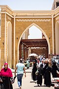
, established in 1898 by British Lord Kitchener on 6.8 hectares of reclaimed land, featuring exotic flora from Asia and Africa, such as papyrus and date palms, alongside diverse bird species, serving as a serene contrast to monumental sites.[91] The Nubian Museum, opened in 1997, curates over 90 exhibits chronicling 6,500 years of Nubian civilization, from prehistoric settlements to Islamic influences, with halls dedicated to mummies, jewelry, pottery, and reconstructed traditional houses illustrating social structures, languages, and rituals distinct from mainstream Egyptian norms.[92] Outdoor displays include rock art and folkloric elements, emphasizing the Nubians' historical role as intermediaries in Nile Valley trade and their displacement due to dam-induced flooding, fostering appreciation for this ethnic minority's resilience.[93] These attractions collectively highlight Aswan's blend of antiquity and ethnography, sustaining visitor interest despite broader Egyptian tourism fluctuations.[94]

Industry, Trade, and Quarrying

Aswan's quarrying sector centers on granite extraction from extensive deposits in the region, with approximately 100 active granite quarries operating in Aswan and adjacent areas as of the early 2010s, producing varieties such as Red Aswan, Black Aswan, and medium red granite.[95] These quarries yield high-quality stone used for slabs, tiles, countertops, flooring, and cladding, supporting Egypt's natural stone exports to international markets including Europe and the Middle East.[96] Modern operations continue ancient traditions but employ mechanized cutting and polishing, with Red Aswan granite noted for its deep red hue, black speckles, and durability suitable for high-traffic applications.[97] Industrial development in Aswan remains limited compared to northern Egypt, focusing primarily on mining-related activities and small-scale processing supported by hydroelectric power from the Aswan High Dam, which generates approximately 10 billion kilowatt-hours annually and enables energy-intensive operations.[5] Egyptian government plans emphasize expanding mining industries in Aswan due to its geological potential, including granite and other minerals, though heavy manufacturing like steel or chemicals is minimal and often reliant on raw material transport to facilities elsewhere, such as iron ore shipments to Helwan.[98] Recent investments, including EGP 12.8 billion allocated in the 2024/2025 fiscal year for developmental projects, aim to bolster industrial infrastructure, but output data specific to Aswan's non-quarrying sectors is sparse, reflecting a economy dominated by agriculture and tourism.[99] As a Nile River port and border gateway to Sudan, Aswan facilitates regional trade in goods such as agricultural products, minerals, and informal commodities like gold, with cross-border exchanges historically linking Egypt to Nubian and African markets via land routes and limited fluvial transport.[100] Trade volumes with Sudan have underperformed potential due to political instability, logistical barriers, and regulatory hurdles, yet Aswan remains a commercial hub for southern Egyptian exports and imports, including Sudanese refugees engaging in mineral trading activities as of 2024.[101] Local markets handle Nile-sourced goods and crafts, contributing to the governorate's economy amid broader Egyptian efforts to position Upper Egypt as a logistics node.

Infrastructure

Transportation and Connectivity

Aswan serves as a key transportation hub in southern Egypt, facilitating connectivity to the rest of the country and access to Nubian regions via multiple modes including air, rail, road, and river transport. The city's infrastructure supports tourism, trade, and regional travel, with the Nile River playing a central role in local crossings.[102] Aswan International Airport, located approximately 16 kilometers southwest of the city center, handles both domestic and international flights, primarily serving tourist traffic to archaeological sites. The facility underwent renovations in the 2000s that expanded its capacity and incorporated modern infrastructure, including a 3,400-meter runway suitable for larger aircraft. In recent years, the airport has seen growth in passenger traffic, with a reported 30.6% increase in March 2025 compared to prior periods, driven by tourism recovery.[103][104] Rail connectivity is provided through Aswan Railway Station, part of the Egyptian National Railways network linking the city to Cairo, Luxor, and other northern destinations. Overnight sleeper trains from Cairo to Aswan typically take 10 to 13 hours, offering cabins for passengers and operating daily via operators like Abela Trains. Faster Talgo trains are also available on the route, providing an alternative to sleeper services for daytime travel between major cities.[105][106][107] Road infrastructure includes national highways connecting Aswan northward to Luxor and southward toward Sudan, integrated into Egypt's expanding road network. Key Nile crossings feature bridges such as the Aswan Cable-Stayed Bridge, a 977-meter-long structure with a 250-meter main span located about 10 kilometers downstream from the Aswan Dams, enabling vehicular traffic across the river. Additional projects, including the 2,050-meter Low Dam Aswan Bridge and alternative routes to the Old Aswan Dam bridge, enhance local and regional access.[108][109][110] River transport relies on ferries for short crossings, with public ferries operating between the east and west banks, including routes to Nubian villages and sites like the Tombs of the Nobles for a fare of around 10 Egyptian pounds per person. While larger Nile cruises connect Aswan to Luxor for tourism, everyday connectivity uses smaller boats and feluccas rather than extensive scheduled passenger services.[111][112]

Education and Public Services

Aswan Governorate maintains a network of 1,360 public schools as of 2023, reflecting an increase of 22 schools from the previous year to accommodate growing enrollment in primary and secondary education.[113] Primary education enrollment approaches near-universal levels consistent with national trends, though secondary enrollment lags behind at rates below the Egypt-wide 86% figure reported for 2021. The governorate's adult literacy rate stands at approximately 80.9%, corresponding to an illiteracy rate of 19.1% among those aged 10 and older, marking the lowest illiteracy figure among Upper Egypt governorates based on 2017 Central Agency for Public Mobilization and Statistics (CAPMAS) data.[114][115] Aswan University, established as an independent institution in 2012 after operating as a branch of South Valley University since 1995, serves as the primary higher education provider with 18 faculties and around 1,418 academic staff.[116][117] The university enrolls approximately 30,785 undergraduate and 4,778 graduate students as of 2022, offering programs in fields such as engineering, medicine, education, and arts across its main campus in Sahary City and additional sites.[118] Its Faculty of Medicine operates Aswan University Hospital, the sole facility serving patients across the entire governorate and neighboring areas.[119] Public healthcare in Aswan is delivered through the Egypt Healthcare Authority's network, encompassing 87 primary care units and family medicine centers alongside four specialized hospitals: Aswan Specialized Hospital, Al-Masalla Specialized Hospital, and two others focused on regional needs.[120] The Universal Health Insurance System (UHIS) expanded to Aswan in July 2025, providing coverage for over one million medical tests, 400,000 emergency services, and 100,000 outpatient visits in its initial rollout, integrating with national efforts to achieve universal access.[121] A Central Emergency and Crisis Management Operations Room was inaugurated in January 2025 to enhance response capabilities amid occasional health concerns, such as unverified reports of water-related outbreaks in 2024, though official testing confirmed drinking water safety.[122][123] Utilities in Aswan benefit from the Aswan High Dam's contributions to national electricity generation, which supplies roughly half of Egypt's total power needs, supporting near-universal coverage without reported widespread shortages.[124] Drinking water access reaches high levels, aligning with Upper Egypt's 98% coverage rate achieved by recent infrastructure expansions from 85% in 2014, while sanitation services continue to improve through local development projects funded at EGP 2.3 billion in fiscal year 2021/2022.[125][126] These services face challenges from Nile-dependent supply variability, but dam-regulated irrigation and storage mitigate flood and drought risks effectively.[56]

Culture and Heritage

Monuments, Temples, and Archaeology

Aswan's archaeological landscape encompasses pharaonic quarries, temples, and later Christian structures, reflecting its role as Egypt's southern frontier and a source of rose granite used in monuments like obelisks at Luxor and Heliopolis.[127] The site's significance extends from Old Kingdom extraction techniques to Ptolemaic and Roman temple constructions, with ongoing excavations revealing trade and religious practices.[127] The Unfinished Obelisk, located in Aswan's northern granite quarries, represents an aborted project from the reign of Hatshepsut around 1479–1458 BCE, intended to stand 42 meters tall and weigh approximately 1,168 tons if completed.[128] Abandoned due to internal cracks during extraction, it demonstrates ancient quarrying methods involving pounding trenches with dolerite balls to isolate the stone, a technique evidenced by tool marks and surrounding debris.[128] Elephantine Island, opposite central Aswan, hosts ruins of temples dedicated to Khnum, Satet, and Anuket from the Old Kingdom onward, serving as a cult center for Nubian-Egyptian deities and featuring a Nilometer for measuring river levels to predict floods.[129] Archaeological layers reveal Middle Kingdom houses, Persian-period Jewish mercenary settlements with papyri documenting a Yahweh temple destroyed in 410 BCE, and Greco-Roman overlays, underscoring Elephantine's function as a border trading post for ivory and gold.[129] The Philae Temple complex, primarily Ptolemaic and Roman in construction with earlier roots, was dedicated to Isis and relocated block-by-block to Agilika Island between 1972 and 1980 as part of UNESCO's Nubian Monuments rescue campaign to avert submersion by Lake Nasser following the Aswan High Dam's completion in 1970.[130] This serial UNESCO World Heritage site, extending from Abu Simbel to Philae, preserves Ptolemaic reliefs and inscriptions attesting to Isis worship persisting into the 6th century CE.[12] On the west bank, the Monastery of St. Simeon (Anba Hatre), a 7th-century Coptic fortress-monastery rebuilt in the 10th century, spans two terraces with a church, refectory, and cells, dedicated initially to Bishop Anba Hedra who evangelized Nubia.[131] Abandoned by the 12th century due to Bedouin raids, its mud-brick architecture exemplifies early monastic isolation in the desert, with fresco fragments and water cisterns indicating self-sufficiency.[131]

Nubian Traditions and Social Structure

Nubian society in the Aswan region is organized around matrilineal kinship systems, where descent and inheritance are traced primarily through the female line, fostering strong maternal lineage ties.[132] This structure emphasizes extended family networks and clan affiliations, with women traditionally holding influential roles in household decision-making and social reproduction, contrasting with more patrilineal norms prevalent in mainstream Egyptian society.[132] Social stratification exists but remains fluid, often tied to land ownership and labor roles, particularly among communities affected by relocation from the Aswan High Dam in the 1960s, which displaced over 50,000 Nubians northward to areas like Kom Ombo.[133] Despite these disruptions, core familial bonds persist, with cross-cousin marriages preferred to maintain endogamy within subgroups and reinforce alliances between kin groups.[134] Traditional Nubian practices in Aswan revolve around rites of passage, religious observances, and communal rituals that sustain cultural identity amid Arabization pressures.[73] Marriage ceremonies, a cornerstone of social cohesion, typically span three to seven nights—or up to 40 days in more elaborate forms—featuring sequential events such as Lelet el-Henna (henna night) for bridal preparation, followed by processions, feasting, and music with instruments like the duff drum and tambura lyre.[135] These weddings prioritize cousin unions, with negotiations handled by maternal uncles, reflecting matrilineal authority, and serve to unite families while displaying wealth through livestock and hospitality.[134][136] Other customs include naming rituals shortly after birth and funeral practices blending Islamic elements with ancestral veneration, though pre-dam agricultural festivals linked to Nile inundation have largely vanished due to modern irrigation.[73] Nubian communities in Aswan exhibit egalitarian tendencies in daily interactions, described as inherently peaceful with minimal hierarchical conflict resolution relying on elders' mediation rather than formal authorities.[137] Gender roles allow women greater public visibility, including in markets and festivals, supported by historical precedents of female agency in Nubian art and lore depicting queens and divine mothers.[132] However, urbanization and intermarriage with non-Nubians have introduced hybrid elements, such as simplified wedding scales, yet core traditions endure as markers of ethnic resilience against assimilation.[135] These practices, preserved in villages west of Aswan and through institutions like the Nubia Museum, underscore a social fabric adapted yet rooted in pre-modern Nile Valley lifeways.[138]

Recent Developments

Archaeological Discoveries

In 2024, excavations at the Qubbet el-Hawa necropolis on Aswan's west bank uncovered a vast Greco-Roman burial complex recognized as one of the year's top archaeological discoveries, featuring over 400 tombs housing remains of thousands from elite families spanning the Late Period through Roman eras.[139] A standout find was a multi-chambered tomb containing skeletons of 46 individuals—men, women, and children—dated between the second century B.C. and second century A.D., accompanied by pottery, jewelry, and tools indicating high social status and diverse burial practices.[139] These upper-level tombs, reserved for provincial elites, contrast with deeper Old and Middle Kingdom noble burials below, revealing layered necropolis evolution and Egyptian-Nubian interactions.[139] Continuing work at Qubbet el-Hawa in June 2025 yielded three previously unknown Old Kingdom rock-cut tombs (circa 2686–2181 B.C.), each equipped with false doors for spirit access, offering tables inscribed with hieroglyphs, and child burials suggesting family continuity in elite governance roles.[140] These tombs, hewn into cliffs near earlier princely burials, contained fragmented human remains and artifacts underscoring Aswan's role as a frontier administrative hub linking Egypt to Nubia.[140] In July 2025, nearby Greco-Roman tombs (circa 332 B.C.–A.D. 395) were excavated close to the Aga Khan Mausoleum, including a 2-meter limestone sarcophagus on a carved platform adorned with hieroglyphs naming deities like Osiris and Anubis, plus adobe offering chapels and staircases evidencing syncretic burial rites blending Egyptian and Hellenistic elements.[141] On Elephantine Island, a 2025 study confirmed deliberate arsenical bronze production during the Middle Kingdom (circa 2050–1710 B.C.), with metallurgical analysis of workshop slags revealing intentional arsenic alloying for harder tools, marking Egypt's earliest such evidence and highlighting Aswan's quarrying economy's technological sophistication.[142] Complementing this, the Aswan-Kom Ombo Archaeological Project documented a Nile west-bank rock art panel in 2025 publications, depicting possible predynastic or early dynastic motifs of a ruler with standards, dated via context to before 3000 B.C., suggesting ritual frontier marking amid Egyptian expansion.[143] These findings, drawn from joint Egyptian-international teams, underscore Aswan's enduring significance in tracing metallurgical, administrative, and cultural exchanges without reliance on biased institutional narratives.[144]

International Forums and Diplomacy

The Aswan High Dam project became a focal point of Cold War-era diplomacy in the 1950s. In July 1956, the United States, United Kingdom, and World Bank withdrew pledged financing for the dam, citing Egypt's arms purchases from Czechoslovakia, its overtures to communist China, and concerns over the project's economic feasibility and regional stability.[145] This decision prompted Egyptian President Gamal Abdel Nasser to nationalize the Suez Canal Company on July 26, 1956, triggering the Suez Crisis, in which Israel, France, and the United Kingdom invaded Egypt, only to withdraw under U.S. and Soviet pressure.[146] The episode underscored Egypt's pivot toward non-alignment and highlighted tensions between Western powers and emerging postcolonial states seeking infrastructure for development.[147] Following the crisis, the Soviet Union extended financial and technical support, signing agreements with Egypt in 1958 and 1960 to fund and construct the dam, which was completed in 1970 at a cost exceeding $1 billion (equivalent to over $8 billion in 2023 dollars).[148] This collaboration symbolized Arab-Soviet friendship, commemorated by the Lotus Tower near the dam, erected in 1971 as a gift from the USSR.[149] The project's international dimensions extended to cultural diplomacy, with UNESCO coordinating a global "Nubian salvage campaign" from 1960 to 1980, relocating monuments like Abu Simbel Temple through contributions from over 50 countries, averting their submersion by Lake Nasser.[149] In contemporary diplomacy, Aswan serves as host to the Aswan Forum for Sustainable Peace and Development, an African-led platform initiated by Egypt during its 2019 African Union chairmanship to address peace, security, and development challenges.[150] The forum convenes African heads of state, regional organization leaders, and international partners annually; its fifth edition, held October 19–20, 2025, under the theme "A World in Flux, A Continent in Motion: Navigating Africa's Progress," focused on re-envisioning global governance amid geopolitical shifts, with sessions on migration, border governance, and economic integration.[151] [152] Prior editions, such as the fourth in July 2024, emphasized Africa's role in multilateral reform, drawing over 1,000 participants including UN representatives.[153] The event underscores Egypt's strategic positioning of Aswan as a bridge for North-South and intra-African dialogue, leveraging its proximity to Sudan and the Nile Basin.[154]

References

User Avatar
No comments yet.