Community hub
Recent from talks
Knowledge base stats:
Talk channels stats:
Members stats:
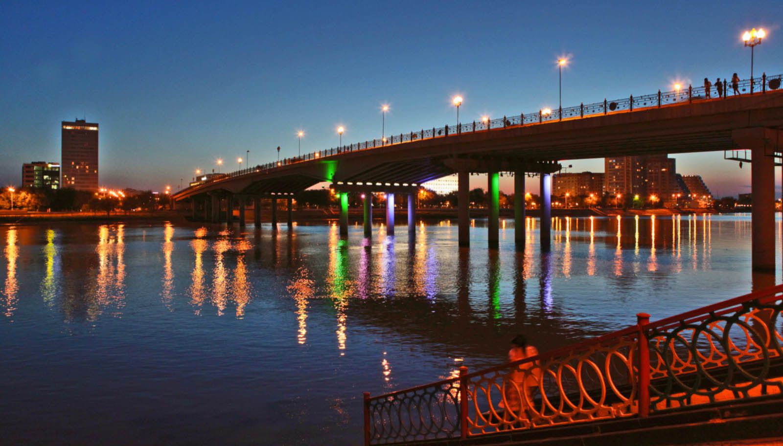
Atyrau
Atyrau (UK: /ˌætɪˈraʊ, -ˈrɔː/, US: /ˌɑːtɪˈraʊ, -ˈrɔː/; Kazakh: Атырау, pronounced [ɑtəˈrɑw] ⓘ; Russian: Атырау), known until 1991 as Guryev (Russian: Гурьев), is a city in Kazakhstan and the capital of Atyrau Region. Atyrau is a transcontinental city, at the mouth of the Ural River on the Caspian Sea, between Europe and Asia, 2,700 kilometres (1,700 miles) west of Almaty and 351 kilometres (218 miles) east of the Russian city of Astrakhan.
Atyrau is famous for its oil and gas industries. It has a population of 355,117 as of 2020. It is predominantly made up of Kazakhs, the minorities being Russians, Koreans, Tatars and Uzbeks.
The wooden fort at the mouth of the Yaik River was founded in 1645 as Nizhny Yaitzky gorodok (literally, Lower Yaik Fort) by the Russian trader Gury Nazarov, a native of Yaroslavl, who specialized in trade with Khiva and Bukhara. The fort was plundered by the Yaik Cossacks, leading the Guriev family to rebuild it in stone (1647–62). Tsar Alexis sent a garrison of Streltsy to protect the fort from Cossack incursions. Despite these efforts, the Cossack rebel Stepan Razin held the town in 1667 and 1668. The fort gradually lost its strategic significance and was demolished in 1810. Between 1708 and 1992 the city was known as Guriev. The Kazakh name Atyrau means 'river delta'.
Two parts of the world have the city. The side of Samarskaya (right side of the river) lies in Europe and the left bank of Bukharskaya is in Asia. It was established in 1615, by the employer Mikhail Guriev, who applied the decree to tzar Mikhail Fedorovich for a monopoly in the mouth of Ural to fish sturgeons.
Murzaev E. Dictionary of popular geographical terms (1984) states:
A. Nurmaganbetov and M. Khobdabayev states:
Ecological Kazakh–Russian Dictionary (2001) states:
Atyrau (together with Aktau) is Kazakhstan's main harbour city on the Caspian Sea, Atyrau at the delta of the Ural River. Atyrau city is approximately 20 metres (66 feet) below sea level. The city is considered to be located both in Asia and Europe, as it is divided by the Ural River. The city is a hub for the oil-rich Caspian Depression; because of this, many oil wells have been drilled in the Tengiz Field and Kashagan Field areas. An oil pipeline runs from Atyrau to Samara, where it joins the Russian pipeline system. A separate oil pipeline runs from the Tengiz field to the Russian Black Sea port of Novorossiisk.
Hub AI
Atyrau AI simulator
(@Atyrau_simulator)
Atyrau
Atyrau (UK: /ˌætɪˈraʊ, -ˈrɔː/, US: /ˌɑːtɪˈraʊ, -ˈrɔː/; Kazakh: Атырау, pronounced [ɑtəˈrɑw] ⓘ; Russian: Атырау), known until 1991 as Guryev (Russian: Гурьев), is a city in Kazakhstan and the capital of Atyrau Region. Atyrau is a transcontinental city, at the mouth of the Ural River on the Caspian Sea, between Europe and Asia, 2,700 kilometres (1,700 miles) west of Almaty and 351 kilometres (218 miles) east of the Russian city of Astrakhan.
Atyrau is famous for its oil and gas industries. It has a population of 355,117 as of 2020. It is predominantly made up of Kazakhs, the minorities being Russians, Koreans, Tatars and Uzbeks.
The wooden fort at the mouth of the Yaik River was founded in 1645 as Nizhny Yaitzky gorodok (literally, Lower Yaik Fort) by the Russian trader Gury Nazarov, a native of Yaroslavl, who specialized in trade with Khiva and Bukhara. The fort was plundered by the Yaik Cossacks, leading the Guriev family to rebuild it in stone (1647–62). Tsar Alexis sent a garrison of Streltsy to protect the fort from Cossack incursions. Despite these efforts, the Cossack rebel Stepan Razin held the town in 1667 and 1668. The fort gradually lost its strategic significance and was demolished in 1810. Between 1708 and 1992 the city was known as Guriev. The Kazakh name Atyrau means 'river delta'.
Two parts of the world have the city. The side of Samarskaya (right side of the river) lies in Europe and the left bank of Bukharskaya is in Asia. It was established in 1615, by the employer Mikhail Guriev, who applied the decree to tzar Mikhail Fedorovich for a monopoly in the mouth of Ural to fish sturgeons.
Murzaev E. Dictionary of popular geographical terms (1984) states:
A. Nurmaganbetov and M. Khobdabayev states:
Ecological Kazakh–Russian Dictionary (2001) states:
Atyrau (together with Aktau) is Kazakhstan's main harbour city on the Caspian Sea, Atyrau at the delta of the Ural River. Atyrau city is approximately 20 metres (66 feet) below sea level. The city is considered to be located both in Asia and Europe, as it is divided by the Ural River. The city is a hub for the oil-rich Caspian Depression; because of this, many oil wells have been drilled in the Tengiz Field and Kashagan Field areas. An oil pipeline runs from Atyrau to Samara, where it joins the Russian pipeline system. A separate oil pipeline runs from the Tengiz field to the Russian Black Sea port of Novorossiisk.