Hubbry Logo
search
logo
1601770

Balestier

logo
Community Hub0 Subscribers
Read side by side
from Wikipedia

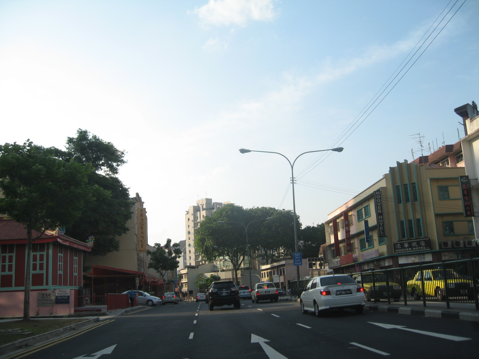
Balestier (traditional Chinese: 馬里士他; simplified Chinese: 马里士他) is a sub zone located in the planning area of Novena in the Central Region of Singapore. The main road, Balestier Road, links Thomson Road to Serangoon Road and the road continues on as Lavender Street. The area is home to rows of shophouses, such as the Sim Kwong Ho shophouses, the Balestier Art Deco shophouses, 412-418 Balestier Road, and 601-639 Balestier Road, low-rise apartments and commercial buildings as well as a shopping mall known as Shaw Plaza. Balestier also has another mall, Zhongshan Mall. There are several lighting and electrical shops along Balestier Road, which is also home to the Ceylon Sports Club and the Indian Association. The area is known for its food such as bak kut teh and chicken rice. In the area, there are several apartments, condominiums, and budget hotels.

Key Information

Etymology and history

[edit]
Balestier and Sungei Whampoa aerial panorama taken in February 2023

The precinct was named after Joseph Balestier. As new settlers populated Balestier Road from the late 19th century, they established villages and grew crops such as taro.

Balestier hired a number of immigrants on his estates.[2][3] Chinese and Indian workers laboured these crops. When Balestier left Singapore due to a health breakdown after the deaths of his son and wife in 1844 and 1847, he sold his plantation to Singapore authorities and the land was leased out to Chinese farmers. Another portion was turned into a burial site for paupers and lepers. During the 19th century, many prisoners from India were sent to Singapore, where they were employed as labourers and builders. After serving their term, many of these convicts remained in Singapore as traders, artisans or skilled craftsmen. With a large diversity of people, different skills, culture, techniques and practices were shared and exchange within Balestier.[4]

Balestier and the NKF centre aerial panorama taken in February 2023

For instance, the nickname “Recreation Road” is made popular with the growth of many sporting and recreational buildings within the vicinity in 1920s.[5] Other examples of names given in view of activities included the Cantonese names such as Wu-hap Thong was given to the Taro pond, which is to depict the semi aquatic crops grown within the neighbourhood.[6] The area that surrounds Balestier and Serangoon road also adopts the Malay language name of “Pauper House”, to acknowledge the presence of Tan Tock Seng pauper's Hospital to provide treatment for the under-privileged. Many more streets took on Malay names in acknowledgement to the existence of Malay kampong villages within the area.[7]

Both the Singapore Improvement Trust and the Housing and Development Board built flats in the area known as St. Michael's Estate. Modern shophouses were erected in the 1960s as well including walk-up apartments. In the late 20th century, several buildings made way for newer buildings such as high-rise condominiums, shopping malls and new commercial buildings.[8]

The Sultan of Sulu used to own a house along Balestier Road purchased in 1903.[9]

Places of Worship

[edit]

The Chinese labourers, who settled in the area, built a temple in 1847 which still exists known as Goh Chor Tua Pek Kong Temple (梧槽大伯公廟), with the area having one of the last free-standing wayang stage in Singapore that was built in 1906 by Tan Boo Liat, a wealthy Hokkien Peranakan philanthropist and community leader.[10]

Apart from the century-old Goh Chor Tua Pek Kong Temple (梧槽大伯公廟), Balestier area also consisted of various prominent temples including Balestier Kwan Im Tng Temple (坤德觀音堂), Leng Ern Jee (靈隱寺), Feeha Cheng Seah (飛霞精舍), Chan Chor Min Tong (陳佐勉堂), Tai Pei Yuen Temple (大悲院) along Jalan Kemaman and Burmese Buddhist Temple at Tai Gin Road.[11] Thong Teck Sian Tong Lian Sin Sia Temple (同德善堂念心社), a Teochew charitable temple whose mission is the practice of compassion through the provision of free medical consultation, funeral services, and assistance to the poor and needy. The temple is also known for its tradition of setting up water and tea kiosks for thirsty passers-by at the junction of Boon Teck Road and Balestier Road since 1950s.[12]

Notable landmarks

[edit]

Malay Film Productions

[edit]

In the 1940s, a film studio, Singapore Film Studios, was set up by Shaw Brothers to produce Malay films in Singapore for their local clients.[13][14][15] The studio was later renamed as Malay Film Productions[16] and had played a significant role in the film industry and produced hundreds of film.[17][16] During World War II, this place was utilized by the Japanese to broadcast propaganda films. It was later reopened after the war in 1947, but was eventually closed in 1967 due to the falling demand for Malay language films.[18][19] This place is considered one of the most iconic places in Singapore in the early days as a form of local entertainment.

Shaw Plaza

[edit]

Until the early 1980s, this site was located by the old Ruby Theatre, the first movie theatre in the area that opened in 1958 that showed mainly Chinese films. In the past, many would travel to area for movies and food carts would be present to provide some street food for the movie goers. The Shaw Towers' twin height used to sit two cinemas, the President and Hoover theaters. Hoover Theatre is a favourite for fans of the Shaw Brothers’ gong-fu films during the sixties and seventies that was opened in 1960. In 1973, President Theatre was built too. However, in 1996, both Hoover and President Theatre were demolished to make way for the Shaw Plaza that is a mixed development consisting of restaurant, departmental stall and residential apartment.

Art deco shophouses

[edit]

Shophouses in Singapore are constructed beginning in the nineteenth century by Chinese and other communities. There is the use of brick “party walls”. A further characteristic of this urban form was the width of the shophouses were generally determined by the distance it could span due to the use of timber beams between brick party walls.[20]

Unadorned shophouses went from simple looking to elaborate and sophisticated structures. A rapid spread of classical architecture began during the Industrial Revolution. There are the Early Shophouse style, First transitional style, late shophouse style, second transitional style, Art Deco style, and Modern shophouse style. Unlike the traditional or 2nd transitional shophouses style which have abundance ornamentation, art deco evolves from it into a new style of architecture. The primary stylistic features of an art deco shophouse are the vertical emphasis and concrete as a common material in construction to achieve smooth surfaces.

The shophouse's internal spatial layout is consistent despite the change in style during the 19th century.

Balestier Market

[edit]

Balestier Market, also commonly known as Or Kio ('Black Bridge' in Hokkien) due to its similarity to a dark timber bridge spanning across Sungei Whampoa, is located in the centre of Balestier Road. It was constructed in the early 1920s to provide local vendors and hawkers with an allocated space to sell their harvested crops and cooked food. In 1924, before the start of major developments in Balestier Road, the open market was known to be a bustling site despite being located a distance from other more prominent landmarks and streets. Later, rows of small huts with a pitched zinc roof were added in 1925 to shelter users from the frequent rain and the sun. The market then served as a food ration distribution centre, in the mid-1940s during World War 2. Balestier Market is now the only 'rural' market conserved and in operation in Singapore.

The government obtained Balestier's estate and leased a portion of it to Chinese farmers[21] while another segment was turned into a burial area for patients from Tan Tock Seng Hospital. Due to the good condition of the soil and a proper irrigation system left over from the previous plantation, the new residents who moved into Balestier were able to establish their villages and new plantations such as taro, lime, and sugarcane.[22] As Balestier became more reputable, tradesmen and merchants started to emerge, operating shophouses and selling their wares along the main road, turning Balestier Road into one of the busiest streets in Singapore.

The rise in hawkers present on Balestier Road resulted in the sidewalks constructed for pedestrians being transformed into a makeshift market selling vegetables, fruits, cooked food, and beverages. The hawkers and their customers spilled over onto the main road and created traffic obstructions, which caused motorists to drive on the opposite side of the road and increased the likelihood of accidents occurring. Residents even claimed that the hawkers were hostile when motorists asked them to shift their stalls.

Hence, many residents wrote to the authorities regarding the legalization of hawkers and related road safety concerns. These issues not only occurred in Balestier but also in other parts of Singapore. In response, the government designated marketplaces for hawkers to alleviate the road issues and to facilitate the legalization of hawkers. Balestier Market is one of the first few wet markets in Singapore which was established as the result of this government measure. However, even with such measures, police officers were still needed to patrol the area and ensure that hawkers who possessed a hawker license do not sell their products out of their allocated area.

One highly publicized example of this problem occurred in Balestier Market and arose due to the unavailability of pork in the market – three pork vendors possessing hawker licenses elsewhere were arrested and fined for illegally selling their products outside the market premises. In effect, the establishment of Balestier Market did not completely eradicate the traffic complaints from residents as there were still makeshift stalls along the road outside the market. Furthermore, residents wrote to the newspapers, expressing their difficulty in obtaining pork from the market and requesting the government to take action. Therefore, despite having an allocated space for hawkers to sell their products, Balestier Market failed to gain popularity amongst residents.

Whampoa Wet Market and Hawker Centre also known as the Tua Pah Sat (big market in Hokkien), located a few streets away from Balestier Market was constructed in the 1980s to provide food for the rising population of Whampoa and to replace Raymond Market located at Jalan Tenteram. As the new market supplied both raw produce and cooked food, it became more popular among the residents in both Balestier and Whampoa. Moreover, the new market operated both during the day and at night, with an allocated car park – making the market highly accessible for both drivers and residents.

In 1999, even after Balestier Market underwent a renovation, it ultimately still failed to compete with her "neighboring brother" because, during that period, most of the residential developments were situated around Whampoa Market. Meanwhile, Balestier was still in the phase of redevelopment into a commercial, industrial and private residential district, resulting in existing residents relocating elsewhere. Furthermore, after the upgrading, a handful of vendors decided to relocate or to discontinue their business resulting in patrons from Balestier Market shifting over to Whampoa Market instead. Consequently, the business of remaining hawkers in Balestier Market continued to deteriorate, causing many stall owners who had been serving for decades to cease their operation entirely when the market closed for redevelopment in 2004. Due to its historical and cultural significance, Balestier Market was placed under the Conservational Act by the Urban Redevelopment Authority and subsequently, plans were made by the authority to further modernize the market. After the closure, Balestier Market was bought over by Banquet Holdings Pte Ltd and was then opened in June 2008 after the latest renovation which converted the market into a food center. This is likely because operating as a wet market would not be economically viable, especially with the competition from the neighboring big markets.

Today, Balestier Market is home to many stallholders who were from markets which were either demolished, undergoing renovation or relocated. Many of these stallholders were from Upper Thomson's Long House and Lavender Food Square. Similarly to Balestier Market's resilience through the evolution of the Balestier area, these hawkers try their best to maintain their business operations despite the changing needs of society that diminish the need for hawkers and the service they provide. By providing a space for these valuable hawkers, Balestier Market is able to preserve the hawker heritage while preventing itself from becoming obsolete. Balestier Market also provides a home for two lion statues previously from the Oasis Restaurant next to the former National Stadium, both of which were demolished in 2010 – a further example of how Balestier Market serve as a repository of cultural elements.

Architectural features and issues

[edit]

The most iconic feature of Balestier Market is its rows of pitched zinc roof which were later installed with lighting elements to make the roof structure prominent even at night. However, in the past, the roof design was built to shelter the wet market without considering its possibility to be converted into a food centre. After the transformation from a wet market into a food centre, the ceiling is too low to adequately contain the exhaust pipes which radiate heat throughout the interior of the place. Furthermore, as the roof is made of zinc, it conducts heat when it is exposed to direct sunlight, making it uncomfortable for customers to eat within the space, especially in the afternoon.

The only way to access the front entrance into Balestier Market is through the flight of stairs beside the main signage. The elevation of the market is a measure to deter flooding due to high surface runoff and typology of the site which occurred quite frequently in the past. A disadvantage of this feature is that the stairs cause difficulties for patrons in entering the market, as a majority of such patrons are from the older generation.

Publicity of Balestier Market

[edit]

Many of these architectural issues are left unresolved to retain the structural integrity and original ambience of the market. There are a handful of heritage trails and guides that introduce users to the market, promoting the last and only rural market of Singapore, in light of its historical and cultural significance.

From a humble wet market for farmers to a food ration distribution centre and finally to a food centre selling local cuisine and delights, Balestier Market is one of the few markets that have survived through the rapid transformation of Singapore. Its value and identity as an example of vernacular infrastructural design, preserved for the newer generations as an educational tool to illustrate the phenomenon of wet markets and hawker centres in the past.

Timeline of events in Balestier Market and surroundings

  • 1830s – Establishment of Balestier Plantation by Joseph Balestier
  • 1849 – Balestier and his family leased a large plantation outside town
  • The early 1890s – Establishment of Taro, lime and sugar cane plantations
  • The 1920s – Balestier Market was constructed for the residents to sell their produce
  • 1925 – Rows of small huts with pitched zinc roof was then added to the market
  • 1942 – Balestier Market turned into food ration distribution centre during World War II
  • 1958 – The landscape of Balestier was changed into mixed tree cultivation, coconut plantation, and grassland. Sungei Whampoa had already been canalised
  • 1967 – Great changes in the landscape of Whampoa. Low dilapidated houses were pulled down, mainly high-rise housings were constructed
  • 1950s–1970s – public housing was developed by Singapore Improvement Trust and the Housing and Development Board in the Balestier area at St Michael's Estate
  • 1971 – Balestier Estate was built
  • The 1980s – Demolition of Raymond market and construction of Whampoa Market
  • 1999- Renovated.
  • 2004 – Many stallholders decided to retire when the market closed in 2004. Balestier Market bought over by Banquet Holdings. Underwent major development work and was converted into a food centre.

References

[edit]
[edit]
Revisions and contributorsEdit on WikipediaRead on Wikipedia
from Grokipedia
Balestier is a sub-zone and major arterial road in the Novena planning area of Singapore's Central Region, stretching approximately 2 kilometers from Thomson Road to Serangoon Road and serving as a historic gateway between the city center and northern suburbs.[1] Named after Joseph Balestier, the first United States Consul to Singapore appointed in 1836 who developed the area as a sugarcane plantation in the mid-19th century, it evolved from swampland into a diverse residential and commercial district by the 1840s, attracting settlers from Hokkien Chinese communities and supporting industries such as rattan weaving and sugar production.[2][3][4] Today, Balestier is renowned for its vibrant food scene, featuring iconic local dishes like Hainanese chicken rice and bak kut teh at 24-hour hawker centers such as Balestier Market, which was established in 1922 as a produce hub and later served as a World War II ration distribution point.[1][3] The area blends pre-war architecture with modern developments, including conserved two-storey shophouses in Chinese Baroque style along Balestier Road and high-rise complexes like Balestier Point, with the district gazetted for conservation in 2003 to preserve its heritage character.[3] Key landmarks highlight Balestier's multicultural and revolutionary past, such as the Sun Yat Sen Nanyang Memorial Hall at 12 Tai Gin Road, a national monument since 1994 that was originally built in 1905 as a villa for Dr. Sun Yat Sen's Southeast Asian operations during the 1911 Chinese Revolution.[1][3] Religious sites further define its diversity, including the Goh Chor Tua Pek Kong Temple founded in 1847 for Hokkien immigrants, the Church of St. Alphonsus (also known as Novena Church) completed in 1950, and the Masjid Hajjah Rahimabi Kebun Limau established in 1984.[1] The former Shaw Brothers film studio on Jalan Ampas, operational from 1947 to 1967, underscores Balestier's role in early Southeast Asian cinema.[1] Additionally, the area hosts clusters of lighting and furniture shops, reflecting its commercial evolution, while the 1.7-kilometer Balestier Heritage Trail offers a self-guided exploration of these sites, emphasizing colonial villas, traditional shophouses, and the Maha Sasanaramsi Burmese Buddhist Temple.[5][1]

Geography and Demographics

Location and Boundaries

Balestier is a subzone within the Novena planning area in Singapore's Central Region, covering an area of 1.927 square kilometers.[6] The subzone's boundaries are demarcated to the northwest by Toa Payoh Central, to the northeast by Kim Keat, to the south by the Orchard planning area and areas within the Kallang planning region (including Bendemeer to the east), and to the west by Bukit Timah.[7][8] Balestier is positioned along Balestier Road, a primary arterial route that links central Singapore to northern suburbs via connections to Thomson Road and beyond.[9][10] As part of the broader Novena district, Balestier benefits from its integration with nearby infrastructure, including proximity to major thoroughfares like Serangoon Road, facilitating connectivity across the urban landscape.[11][12]

Population and Ethnic Composition

As of 2025, Balestier subzone has an estimated resident population of approximately 32,800, marking a modest increase from 32,430 recorded in the 2020 Census.[13][6] This growth reflects an annual rate of about 0.23% between 2020 and 2025, consistent with steady urban expansion in Singapore's central areas.[6] The ethnic composition of Balestier's residents is predominantly Chinese at 82%, followed by Indians at 9%, Malays at 5%, and others at 4%, based on 2020 Census data that remains indicative for recent years.[13][6] This distribution underscores the lasting impact of colonial-era migrations, which brought diverse groups to the area for trade and settlement. The current makeup is influenced by those early diverse settlers, as explored in Balestier's historical development. Housing in Balestier features a mix of low- to mid-rise apartments, freehold condominiums, and budget hotels, catering to both long-term residents and short-term visitors.[14] Post-2020, there has been a trend toward increasing high-rise developments, including projects like Verticus and De Royale, which introduce modern condominiums up to 30 storeys to accommodate urban growth.[15] These additions enhance the area's density, reaching about 17,025 persons per square kilometer in 2025.[6] Demographic shifts since 2020 include an aging population, with residents aged 65 and above comprising 22% in 2020—a proportion higher than the national average—and continuing to rise amid Singapore's broader super-aging trends.[13][6][16] Urban densification has accompanied this, driven by new residential builds and infrastructure upgrades that support a more compact living environment.[17]

History

Etymology

The name Balestier originates from Joseph Balestier, an American merchant and diplomat who arrived in Singapore in 1834 and served as the first United States consul to the island from 1836 to 1852.[1] He acquired significant land holdings in the area, leasing approximately 1,000 acres in 1835 for agricultural purposes.[18][19] Balestier played a key role in early 19th-century colonial land grants aimed at promoting agriculture in Singapore, reflecting broader British efforts to develop the island's economy through cash crop cultivation.[19] His plantation focused on sugar cane as the primary crop, but he also experimented with other valuable plants such as cotton.[19] The road adjacent to his estate was named Balestier Road in his honor, establishing the area's enduring association with his pioneering endeavors.[19] Over time, the district developed local colloquial names in the Hokkien dialect, particularly for its market areas. "Or Kio," meaning "black bridge" in Hokkien, referred to a dark wooden bridge that spanned Sungei Whampoa near the Thomson Road end of Balestier Road, a name in use by the early 20th century.[1] This evolved into "Or Kio Pa Sat" for the local market, combining the bridge reference with "pa sat" (market), highlighting the area's growing commercial identity among Chinese settlers.[20]

Early Settlement and Development

Following the death of his wife in 1847, Joseph Balestier placed his extensive sugarcane plantation in Singapore up for sale in 1848 due to deteriorating health, leading to its acquisition by colonial authorities.[1] The land, previously known as Balestier Plain and spanning over 1,000 acres of former swampland, was subsequently leased to Chinese farmers who shifted cultivation from sugarcane to taro, lime, and vegetables, establishing small-scale agricultural operations along waterways like Sungei Whampoa.[1][21] These leases facilitated the transformation of the rural estate into productive vegetable gardens, supporting the growing immigrant population in mid-19th-century Singapore.[19] By the late 19th century, villages began emerging along Balestier Road, populated by diverse immigrants drawn to the area's agricultural opportunities and proximity to the town center. Chinese settlers primarily focused on farming and related cottage industries, such as rattan processing, while Indian laborers contributed skilled trades and artisanal work, including construction and early commerce that supported plantation life.[1][21] This multicultural influx laid the foundation for a vibrant rural community, with shophouses appearing by the 1880s to serve local needs like provisioning and basic services.[22] Portions of the former plantation were also repurposed for burials, serving as a pauper and leper ground to address public health demands in the expanding colony.[21] Basic infrastructure, including the extension of Balestier Road to Thomson Road by 1848, improved accessibility and encouraged further settlement, though the area retained its rural character.[23] The wild environment persisted, exemplified by frequent tiger attacks on plantation workers; in the 1840s, Balestier himself noted spots near his estate where tigers had killed at least two laborers, underscoring the perils of pre-urbanization life.[24]

20th Century and Modern Developments

During World War II, Balestier played a significant role in sustaining the local community amid wartime hardships, with Balestier Market serving as a key distribution center for food rations under Japanese occupation from 1942 to 1945.[25] The market, originally built in 1922 as a rural wet market, facilitated the allocation of essential supplies like rice and vegetables to residents in the area, reflecting Balestier's adaptation to scarcity during the Sook Ching massacres and food shortages.[3] Following the war, the area experienced rapid post-colonial growth, particularly through the establishment of the Malay Film Productions (MFP) studio by the Shaw Organisation in 1940 at Jalan Ampas.[26] Reopening in 1947 after wartime disruptions, the studio produced over 150 Malay films until its closure in 1967, employing hundreds of local workers and stimulating economic activity in Balestier through related industries like set construction and talent scouting.[27] In the 1990s and 2000s, Balestier underwent substantial urban renewal as part of Singapore's broader modernization efforts, transitioning from low-rise residential zones to mixed-use developments with high-rise condominiums.[3] Projects such as Balestier Regency, completed in 1990, exemplified this shift, introducing freehold condominiums that intensified land use and attracted middle-class residents to the precinct.[28] Balestier Market was conserved in 2003 to preserve its historical facade and underwent a major renovation, reopening as a hawker centre in June 2008 to better serve contemporary needs while retaining its role as a community hub. In 2025, Balestier Market's tenancy was extended for two years following a planned closure, preserving its role as a community hub.[29][30] Heritage preservation gained momentum with the refresh of the Balestier Heritage Trail in 2018 by the National Heritage Board, adding 30 new sites to highlight the area's evolution, followed by updates in 2023 that incorporated digital elements for broader accessibility.[20][5] Recent developments in Balestier emphasize sustainable tourism centered on its historical and culinary heritage, with initiatives like the Balestier Food Trail launched in 2020 promoting local eateries and cultural narratives to draw visitors.[31] This focus has contributed to population growth, reaching an estimated 32,800 residents by 2025, driven by improved connectivity and appeal as a residential-tourism node.[6] Ongoing efforts balance modernization with conservation, ensuring Balestier's multicultural legacy endures amid urban expansion.[3]

Culture and Religion

Places of Worship

Balestier hosts several historic places of worship that highlight the area's multicultural heritage, particularly from the 19th century when immigrant laborers from China and Burma established communities around sugar plantations. These sites, including Taoist and Buddhist temples, served as spiritual centers and social hubs for early settlers, fostering rituals and gatherings that reinforced ethnic ties.[21] The Goh Chor Tua Pek Kong Temple, established in 1847 by Hokkien workers employed at Joseph Balestier's sugar cane estate, stands as the oldest religious site in Balestier. Dedicated to Tua Pek Kong, a guardian deity revered for protection and blessings among Chinese communities, the temple was built in a traditional southern Chinese style with a low tiled roof adorned by ornate ridges featuring dragons, birds, fish, phoenixes, and flowers crafted using the cut-tile technique. Red-painted plaster mimics Hokkien terracotta wall tiles, and the structure underwent renovations in 1920 and 1928. Managed by the Singapore Hokkien Huay Kuan, it remains a focal point for community festivals such as Zhong Yuan Jie (Hungry Ghost Festival), where adjacent wayang stages host performances, underscoring its enduring role in preserving Hokkien traditions.[32] The Balestier Kwan Im Tng Temple, located at 525 Balestier Road, is a Buddhist sanctuary dedicated to Guanyin, the Goddess of Mercy, who embodies compassion and is central to Mahayana worship. This temple facilitates community rituals, including offerings and prayers that draw local devotees seeking solace and mercy, reflecting the spiritual needs of Balestier's Chinese residents. Its serene layout with statues and gardens provides a space for reflection, aligning with broader practices in Singapore's Chinese Buddhist traditions.[33][34] The Maha Sasanaramsi Burmese Buddhist Temple, originally founded in 1878 at Kinta Road by Burmese immigrant U Thar Hnin (also known as Tang Sooay Chin), exemplifies Theravada Buddhism's architectural and cultural influence from Myanmar. Relocated in 1988 due to urban redevelopment and completed in 1991 at 14 Tai Gin Road, the temple features traditional Burmese elements like teak carvings blended with modern design, including a prominent golden pagoda. It houses Singapore's largest pure white marble Buddha statue outside Myanmar—a 3.3-meter-high, 10-tonne figure carved in 1918 and enshrined in 1921—serving the Burmese community through festivals such as Vesak Day, Abhidhamma Day, and Hta Ma Ne Pwe, as well as educational talks on Buddhism.[35] Balestier's religious diversity extends to Christian and Muslim sites. The Church of St. Alphonsus, commonly known as Novena Church, is a Roman Catholic parish church completed in 1950 at 300 Thomson Road. Built in a basilica-style architecture, it serves as a major pilgrimage site, particularly during the Novena to Our Lady of Perpetual Help, drawing thousands of devotees weekly.[36][1] The Masjid Hajjah Rahimabi Kebun Limau, established in 1984 at 21 Jalan Arnap, reflects the Malay Muslim community's presence in the area. Named after Hajjah Rahimabi, it features modern architecture with traditional Islamic elements and serves as a place of worship and community activities for local Muslims.[1] These temples and other sites collectively illustrate Balestier's 19th- and 20th-century religious diversity, shaped by Hokkien Chinese, Burmese, Christian, and Muslim immigrants, as noted in demographic patterns of early plantation labor. They continue to host festivals and gatherings that promote inter-community harmony, preserving immigrant heritage amid urban growth.[20]

Cuisine and Food Culture

Balestier's cuisine reflects the area's rich immigrant heritage, particularly from Hokkien, Hainanese, and Teochew communities who settled in the early 20th century, establishing hawker stalls and markets that blended traditional recipes with local adaptations. Pre-war migrants contributed to a vibrant street food scene, where vendors sold affordable dishes using fresh ingredients from nearby markets, fostering a culture of communal dining that persists today. The Balestier Food Trail, organized by the National Heritage Board, highlights this legacy by guiding visitors through eateries tied to these historical trades, emphasizing the role of hawkers in shaping Singapore's multicultural food identity.[31][19] A hallmark of Balestier's food culture is bak kut teh, a herbal pork rib soup originating from Hokkien influences in the 19th century, which gained prominence in the area through family-run stalls. Founder's Bak Kut Teh, established in the 1970s by former pig farmer Chua Chwee Whatt using his proprietary recipe, opened its flagship outlet at 347 Balestier Road in the 1980s and remains a staple for its peppery broth simmered with traditional spices. This dish exemplifies Balestier's hawker tradition, drawing crowds for its ties to immigrant labor and post-war economic growth.[37][19] Hainanese chicken rice also defines the locale's culinary scene, with Boon Tong Kee starting as a modest Chinatown street stall in 1979 under Thian Boon Hua, who poached chickens Cantonese-style before expanding to its first restaurant at 399/401/403 Balestier Road in 1983. The outlet's succulent steamed chicken served over fragrant rice, accompanied by chili and ginger dips, has become iconic, evolving from selling just six chickens daily to a chain while preserving its hawker roots. This reflects the Hainanese migrants' contributions to Balestier's pre-war food economy.[38][19][39] Other specialties include beef hor fun and san lou hor fun, stir-fried flat rice noodles with tender beef or a mix of fish slices, bean sprouts, and prawns in savory gravy, popularized at eateries like Bee Kia Seafood near Balestier Road since the mid-20th century. Bean paste pastries, known as tau sar piah, trace to historic bakeries such as Loong Fatt, founded in 1948, where Teochew-style flaky pastries filled with sweet mung bean paste evoke the area's traditional trades. These dishes, featured on the heritage trail, underscore Balestier's enduring hawker culture and immigrant-driven innovations.[40][19]

Landmarks and Economy

Balestier Market

Balestier Market, constructed in 1922 as a wet market to accommodate street-side fresh food vendors and prevent traffic obstruction, stands as Singapore's only surviving rural market building. Originally consisting of a simple concrete platform, a roof was added in 1925 to provide shelter. Known locally in Hokkien as Or Kio Pa Sat ("Black Bridge Market"), Tee Pa Sat ("Iron Market"), or Tua Pa Sat ("Big Market"), it served the area's farming community by offering space for selling produce, pork, poultry, and other goods, with around two dozen stalls by the mid-20th century.[25][3] During the Japanese Occupation in World War II, the market was repurposed as a distribution center for food rations, supporting local residents amid wartime shortages. Post-war, it was upgraded in 1952 to improve hygiene and expand stall capacity, maintaining its role as a vital community hub. In 2003, it received conservation status to protect its historical significance, followed by a major renovation and conversion to a hawker food centre in 2008, which preserved its original structure while adapting it for modern use as a 24-hour eatery with cooked food and drink stalls.[3][25][41] Architecturally, the market exemplifies early 20th-century utilitarian design with its concrete base, pitched zinc roof, and open-air layout featuring high ceilings for ventilation in Singapore's tropical climate. Access to the main entrance requires ascending a flight of stairs, which has raised concerns about accessibility for those with mobility challenges, though no ramps or elevators have been added to maintain heritage integrity. As of 2025, the centre houses around 18-20 cooked food stalls and a few beverage outlets, following tenancy renewals and some relocations amid earlier closure concerns in early 2025.[25][3][42] The market's enduring role in daily community life has garnered publicity through the National Heritage Board's Balestier Heritage Trail, launched in 2018 and refreshed to highlight its transformation from rural outpost to conserved landmark, as well as features in media outlets emphasizing conservation efforts and nostalgic appeal.[20][43]

Film and Entertainment Sites

Balestier played a pivotal role in the development of Malay cinema through the Malay Film Productions (MFP) studio, established by the Shaw Organisation in 1940 at 8 Jalan Ampas. Founded by brothers Runme Shaw and Run Run Shaw, the studio marked the Shaw family's expansion into local film production, aiming to cater to the Malay-speaking audience across Southeast Asia.[26] The studio operated until 1967, producing over 150 films during what is known as the Golden Age of Malay Cinema from 1941 to 1967. It featured extensive facilities, including large sets mimicking kampongs and urban scenes, and employed hundreds of workers, from directors like B.S. Rajhans and Jamil Sulong to stars such as P. Ramlee, who appeared in more than 60 films there. Operations halted during the Japanese Occupation (1942–1945), with the site closing temporarily, before reopening in 1947 to resume post-war production with films like Singapura Di-Waktu Malam. The studio's output included diverse genres, from dramas to musicals, reflecting evolving Malay narratives and drawing talent from across the region.[26][44] This era significantly boosted Balestier's local economy by creating jobs in production, technical roles, and support services, transforming the area into a bustling hub that supported families and ancillary businesses. Culturally, the films promoted Malay language and identity, fostering a sense of community among audiences in Singapore and Malaya while introducing innovative storytelling techniques adapted from Indian and Hollywood influences. The studio's success helped elevate Singapore as the center of Malay filmmaking in Southeast Asia during the post-war period, influencing regional entertainment until competition from television and Malaysian studios led to its closure.[44][45] The legacy of MFP endures through the Balestier Heritage Trail, launched by the National Heritage Board, which highlights the former studio site as a key landmark in the "Faith, Film and Food" route. Surviving buildings at Jalan Ampas serve as reminders of this cinematic history, with guided tours and occasional heritage events, such as those during Singapore HeritageFest, featuring film memorabilia and discussions on Malay cinema's golden age. These initiatives preserve the area's entertainment heritage, connecting visitors to Balestier's contributions to Southeast Asian cultural output.[46][47]

Commercial and Architectural Features

Shaw Plaza, a prominent mixed-use development in Balestier, opened in November 1999 after the demolition of the historic Ruby, Hoover, and President cinemas in 1996.[48][49] The complex underwent major renovations from 2019 to 2023 and reopened in April 2023 with new features including an outdoor play area and upgraded cinema facilities. This retail and residential complex, also known as Shaw Plaza-Twin Heights, incorporates the six-screen Balestier Cineplex, blending commercial spaces with residential units to revitalize the area's entertainment and shopping landscape.[50][51] Balestier's architectural landscape features distinctive Art Deco shophouses from the 1930s and 1940s, which mark an evolution from earlier traditional Peranakan and Chinese Baroque styles characterized by ornate motifs and colorful tiles.[3] These later structures emphasize verticality through full-height fins and streamlined concrete facades, as seen in examples at 224-250 Balestier Road with reinforced concrete elements and geometric ventilation blocks.[3][1] Additional features include sun-shading ledges, steel-framed windows, and subtle Buddhist symbols like deer figurines on some facades, such as those at 230 and 246 Balestier Road, reflecting a fusion of modernist influences with local adaptations.[21][1] These preserved Art Deco elements contribute significantly to Balestier's local economy by supporting small businesses, such as lighting shops and eateries, housed in the ground-floor units along the five-foot ways.[1] The area also hosts numerous budget hotels, including Value Hotel Balestier and Fragrance Hotel - Rose, catering to cost-conscious travelers and fostering tourism drawn to the heritage facades and nearby attractions like the Balestier Heritage Trail.[1][52] Low rental rates in these shophouses enable a vibrant mix of retail and hospitality operations, enhancing the district's appeal as an affordable urban hub.[1] Conservation efforts by the Urban Redevelopment Authority (URA) have played a crucial role in maintaining these features, with the gazetting of the Balestier Conservation Area on 1 December 2003 to protect pre-war shophouses and Art Deco structures between Thomson Road and Moulmein Road.[1][53] Specific initiatives include the preservation of shophouses at 1-11 Balestier Road, announced in 2018, ensuring the retention of geometric designs and concrete elements amid ongoing urban development.[54] These measures not only safeguard architectural integrity but also sustain economic vitality through heritage tourism.[3]

Infrastructure and Education

Transportation Access

Balestier lacks a dedicated Mass Rapid Transit (MRT) station, requiring residents and visitors to rely on nearby stations for rail access. The closest is Novena MRT (NS20) on the North South Line, approximately 1 km away, offering connections to the city center and northern suburbs. Other proximate stations include Toa Payoh MRT (NS19), about 2 km east, and Farrer Park MRT (NE8) on the North East Line, roughly 800 meters southeast, both facilitating quick transfers to major hubs like Orchard Road and Little India.[55][56] Public bus services provide extensive coverage along Balestier Road, serving as the primary mode of transport in the area. Major routes operated by SBS Transit include services 21, 124, 130, 131, 145, and 186, which stop at key points such as Shaw Plaza and opposite Balestier Point, linking Balestier to the central business district, eastern suburbs like Pasir Ris and Tampines, and western areas including HarbourFront. These services run frequently during peak hours, with fares integrated into Singapore's contactless EZ-Link system for seamless travel.[57][58][56] Balestier Road functions as a primary arterial route within Singapore's inner-ring road network, facilitating efficient vehicular flow between Thomson Road and the Pan Island Expressway. Taxis are readily available along the road and at nearby hotels, with metered fares providing a convenient option for short trips to MRT stations or the city center, typically costing SGD 5-10. Several hotels in the area, such as the Ramada by Wyndham and Value Hotel Balestier, offer complimentary shuttle services to Novena MRT, enhancing accessibility for guests.[59][60][61] Despite these options, Balestier faces accessibility challenges due to the absence of a local rail station, leading to greater dependence on buses, which can be affected by traffic congestion during rush hours. However, ongoing expansions in the MRT network, including nearby Downtown Line extensions, are improving overall connectivity; for instance, the Downtown Line Stage 2 Extension (DTL2e), set for completion by 2035, will add two stations between Tampines and Sungei Kadut, enhancing links to the North South Line near Yew Tee and indirectly benefiting Balestier commuters through improved network integration.[62][63]

Educational Institutions

Balestier has a rich history of educational development, particularly in the post-war era, reflecting Singapore's efforts to expand access to schooling amid rapid urbanization. In the 1940s, Balestier Mixed School was established on the former site of the Singapore Polo Club (1914–1941), serving as one of the area's earliest co-educational institutions and catering to local children's basic education needs during the post-war reconstruction period.[64] By the 1960s, the area saw the growth of specialized schools, including vocational training facilities that evolved into modern technical education hubs. Primary education in Balestier traces back to institutions like Balestier Hill Primary School, which originated from mergers of earlier schools such as Balestier Hill West Primary (established 1965) and Balestier Hill East Primary. Formed in 1986 through their consolidation, Balestier Hill Primary operated until 2019, when it merged with Bendemeer Primary School due to declining enrollment and Ministry of Education (MOE) rationalization efforts.[65] Nearby, Hong Wen School, a government-aided Special Assistance Plan (SAP) primary school founded in 1920 by the Singapore Hokkien Huay Kuan, supports bilingual education in English and Mandarin, drawing students from the Balestier vicinity since its founding and subsequent relocations within central Singapore, including to Victoria Street in 1981 and Towner Road in 2009.[66][67] Secondary education featured Balestier Hill Secondary School, which began as a technical school in 1964 before becoming a full secondary institution in 1992, focusing on academic and vocational streams until its 2017 merger with Beatty Secondary School as part of MOE's school consolidation to optimize resources.[68] The former Global Indian International School Balestier campus, operational from the early 2000s, provided international curricula including CBSE and Cambridge programs for expatriate and local students before closing in 2018 to consolidate with the school's SMART Campus in Punggol.[69] Vocational training has been prominent through the ITE Balestier Campus, which opened in 1997 on the site of the historic Government Trade School (1930s) and Singapore Vocational Institute (1963), offering Nitec and Higher Nitec courses in fields like engineering and business until its closure in 2010 amid ITE's shift to centralized mega-campuses; the site has since housed Northlight School, a specialized secondary school for students with moderate learning difficulties, since 2014. Today, early childhood education persists with institutions like Little Woods Montessori at 330 Balestier Road, a co-educational preschool for ages 1½ to 6 following the Montessori method with emphases on practical life skills, sensorial learning, and multilingual instruction.[70][19] These evolutions highlight Balestier's transition from localized, post-war schooling to integrated regional education amid demographic shifts, with current options including nearby primaries like Bendemeer Primary (post-2019 merger) and secondary institutions accessible via public transport as of 2025.[71]

References

User Avatar
No comments yet.