
Community hub
Recent from talks
Contribute something
Nothing was collected or created yet.
Biharinath
View on Wikipedia
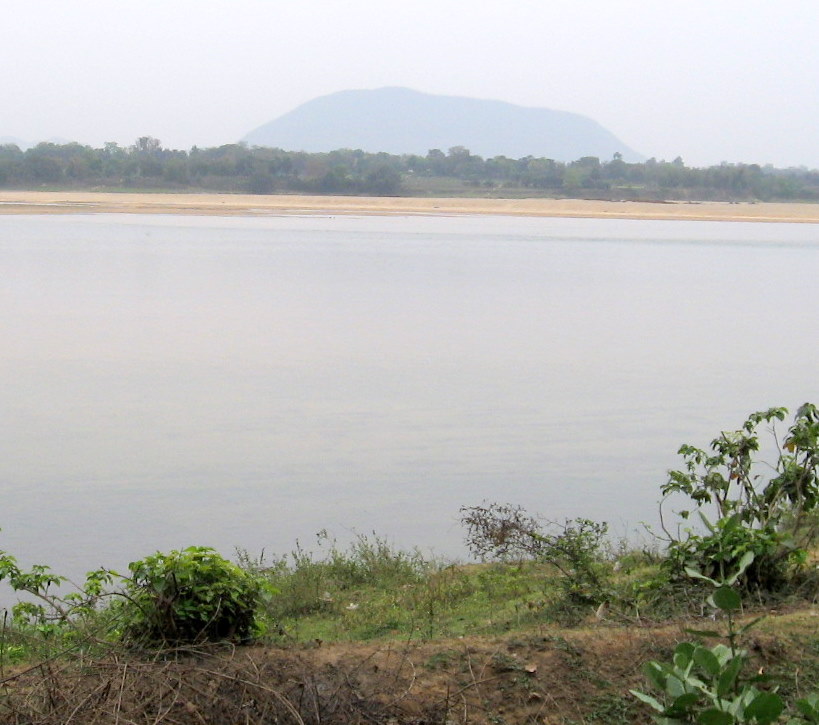
Biharinath is the tallest hill of Bankura District, in the Indian state of West Bengal., and one of the dense forest areas of the district. It is a part of the Eastern Ghats. It is 451 metres (1,480 ft) high.[1] It is situated about 60 kilometres (37 mi) north-west of Bankura town and 8 kilometres (5 mi) north-east of Saltora village in Saltora block.
Key Information


Geography
[edit]Location
[edit]Biharinath is located at 23°34′29.65″N 86°55′57.68″E / 23.5749028°N 86.9326889°E.
Area overview
[edit]The map alongside shows the Bankura Sadar subdivision of Bankura district. Geographically, this area is part of the Bankura Uplands in the west gradually merging with the Bankura-Bishnupur Rarh Plains in the north-east. The western portions are characterised by undulating terrain with many hills and ridges. The area has a gradual descent from the Chota Nagpur Plateau. The soil is laterite red and hard beds are covered with scrub jungle and sal wood. Gradually it gives way to just uneven rolling lands but the soil continues to be lateritic. There are coal mines in the northern part, along the Damodar River.[2] It is a predominantly rural area with 89% of the population living in rural areas and only 11% living in the urban areas.[3]
Archaeological importance
[edit]With the discovery of Paleolithic tools in the Biharinath area, the hill and the surrounding areas have come into focus of archaeologists.[4]
Tourism
[edit]The base of Biharinath hill is a popular tourist spot. A small lake measuring 0.5 ha (1.2 acres) provides facilities for angling. There is an old Shiva temple of Biharinath nearby.[5]
Biharinath offers pollution-free green surroundings where water is a panacea. This place has hills, dense forests with abundant flora and fauna, spring, water bodies, Damodar River, and a renowned Shiva temple. Susunia hill, Joychandi Pahar, Garh Panchkot, Baranti, Panchet Dam, and Maithon Dam are all located at short distances. Government of West Bengal has already taken a 150 crore mega tourism project for Biharinath.
Economy
[edit]The area also has coal deposits. Biharinath block represents south central part of Raniganj Coalfield in Trans Damodar region. The entire area is covered with alluvial soil.[6] Employment for many was mostly dependent on the coal mines or immigration to the Asansol/Durgapur area to find a job. As tourism is flourishing at Biharinath opportunities in tourism are gradually expanding.
References
[edit]- ^ "Biharinath". West Bengal. india9.com. Retrieved 17 March 2008.
- ^ "District Census Handbook Bankura" (PDF). pages 13-17. Directorate of Census Operations West Bengal. Retrieved 23 April 2020.
- ^ "District Statistical Handbook 2013 Darjeeling". Table 2.4b. Department of Statistics and Programme Implementation, Government of West Bengal. Retrieved 23 April 2020.[permanent dead link]
- ^ "Status of Prehistoric studies in the twenty first century in India" (PDF). C01-13 Progress of Prehistory in Bengal: a cultural overview. UISPP / IUPPS │ XV Congress. Retrieved 13 March 2008.
- ^ "Biharinath". District administration. Archived from the original on 25 September 2012. Retrieved 19 March 2008.
- ^ "Salient Features". Coal ministry. Archived from the original on 5 December 2007. Retrieved 19 March 2008.
External links
[edit]![]() Media related to Biharinath Hill at Wikimedia Commons
Media related to Biharinath Hill at Wikimedia Commons
Cities, towns and locations in Bankura District, Medinipur division | ||||||||
|---|---|---|---|---|---|---|---|---|
| Cities, municipal and census towns |
|  | ||||||
| Locations other than cities and towns |
| |||||||
| Related topics | ||||||||