

County of Moray
View on Wikipedia
The County of Moray, (Scottish Gaelic: Moireibh [ˈmɤɾʲəv]) or Morayshire, called Elginshire until 1919, is a historic county in Scotland. The county town was Elgin. The historic county ceased to be used for local government purposes in 1975. Since 1996 most of the historic county's area has been included in the Moray council area. The historic county boundaries are still used for certain functions, being a registration county. There is also a Moray lieutenancy area, covering a slightly smaller area than the historic county. The historic county borders Nairnshire to the west, Inverness-shire to the south, and Banffshire to the east, and has a coast onto the Moray Firth to the north.
Key Information


History
[edit]Moray was a province in the Middle Ages, covering a much larger area than the later county. It lay to the north of the Kingdom of Alba (early Scotland), sometimes functioning as a vassal of the Scottish crown, and at other times operating as a separate kingdom. Moray was finally absorbed into the Kingdom of Scotland during the 12th century.[1]

In order to secure the Scottish crown's authority over the area, it was divided into shires, being areas administered by a sheriff. The old earldom of Moray was broadly split into the three shires of Elginshire, Nairnshire, and the mainland parts of Inverness-shire.[3]
There is some evidence that these shires were established under David I (reigned 1124–1153), but the earliest documented Sheriff of Elgin was in the 13th century.[4] There was also a short-lived shire centred on Forres, which in the early 14th century was grouped with Nairn, before later being united instead with Elgin.[5] The shire of Elgin was therefore sometimes called the shire of 'Elgin and Forres'.[6]
The shire of Elgin, or Elginshire, was seen as the core of the old territory of Moray and so was informally sometimes called Moray or Morayshire.[4][7] 'Murrayshire' and 'Morrowshire' were sometimes used historically as alternate spellings.[8][9]
Over time, Scotland's shires became more significant than the old provinces, with more administrative functions being given to the sheriffs. In 1667 Commissioners of Supply were established for each shire, which would serve as the main administrative body for the area until the creation of county councils in 1890. Following the Acts of Union in 1707, the English term 'county' came to be used interchangeably with the older term 'shire'.[10]
The population of Elginshire in 1841 was 35,012.[11]
There were occasional adjustments to county boundaries. For example, in 1870, an exclave of Inverness-shire (surrounded by Nairnshire, Elginshire and Banffshire), including Cromdale and Grantown-on-Spey, was transferred to Elginshire,[12] while the Elginshire's southern exclave around Abernethy and Duthil went to Inverness-shire.

Elected county councils were established in 1890 under the Local Government (Scotland) Act 1889, taking most of the functions of the commissioners (which were eventually abolished in 1930). The burgh of Elgin was deemed capable of providing its own county-level local government functions, and so it was excluded from the administrative area of the county council, although the county council still chose to base itself there.[14][15] Elginshire County Council held its first meeting on 22 May 1890 at the Old Courthouse (built 1837) which adjoined Elgin Sheriff Court. The Old Courthouse also served as the meeting place for the commissioners.[16]
The 1889 Act also led to a review of boundaries, with exclaves being transferred to a county they actually bordered, and parish and county boundaries being adjusted to eliminate cases where parishes straddled county boundaries. There were several such changes affecting the boundaries of Elginshire, notably absorbing three detached parts of Nairnshire which were surrounded by Elginshire.[17]
At a meeting on 7 May 1919, Elginshire County Council voted to change the name of the county from the County of Elgin or Elginshire to Moray.[18] The government responded by directing all departments to use Moray, but noted that the legal name would remain Elgin until such time as it could be changed by statute.[19] The statutory change of name from Elgin to Moray eventually took place in 1947 under the Local Government (Scotland) Act 1947.[6][20]
Reforms in 1930 under the Local Government (Scotland) Act 1929 saw the burgh of Elgin brought within the administrative area of the county council, and merged the county councils of Moray and neighbouring Nairnshire for most purposes. The two county councils continued to be elected as separate bodies, but operated together as the "Joint County Council of Moray and Nairn", serving the combined area of the two counties.[21][22]
Moray County Council was initially based at the Old Courthouse adjoining Elgin Sheriff Court on the High Street in Elgin. By the 1930s it was too small and so was demolished and replaced by a new headquarters on the same site, called the 'County Buildings'. Work began on the new building in 1938 but was paused due to the Second World War.[23] The new building was eventually completed in 1952.[24]
In 1975 the Local Government (Scotland) Act 1973 reorganised local government in Scotland into a two-tier system of regions and districts. The burgh of Grantown-on-Spey and district of Cromdale which surrounded it (which area had been in Inverness-shire prior to 1870), was included in the Badenoch and Strathspey district of the Highland region. The rest of the pre-1975 county of Moray was included in a new district called Moray in the Grampian region, which also took in significant territory from the western part of Banffshire.[25]
In 1996 the Scottish local government system was reorganised again, this time into single-tier council areas. The Moray district became one of the new council areas.[26] The boundaries of the pre-1975 county of Moray are still used for some limited official purposes connected with land registration, being a registration county.[27] The pre-1975 county of Moray excluding Cromdale and Grantown-on-Spey also serves as a lieutenancy area.[28]
Coat of arms
[edit]Granted in 1927 by the Lord Lyon, Moray County Council's coat-of-arms was: Quarterly: 1st and 4th Azure, three mullets argent; 2nd and 3rd Argent, three cushions gules within a tressure flory-counter-flory of the last. The motto was SUB SPE, Latin for "In Hope", a pun on the River Spey, which flows through the county. The coat of arms, described by Thomas Innes of Learney, a future Lord Lyon, in the Elgin Courant of 6 May 1927 as "the most beautiful county arms in Scotland", represented the clan Murray and Randolph, Earl of Moray, the two main landowners.[29]
Geography
[edit]
Moray consists of a flattish coastal section, containing the main towns, with a hilly interior, extending into the Grampian Mountains in the far south. Notable features of the coast are Findhorn Bay and the broad arc of Burghead Bay. The coast around Lossiemouth is somewhat rockier, and includes the small islands of Covesea Skerries and Halliman Skerries offshore.
There are several lochs in the county, none of which are particularly large. They include Loch Dallas, Loch Noir, the Lochs of Little Benshalag, Loch of the Cowlatt, Lochanan a' Ghiubhais, Loch an Salich, Loch Trevie, Loch Tutach, Loch Allan, Loch Stuart, Loch Mhic Leòid, Loch Ille Mhòr, Lochan Dubh, Loch nan Stuirteag, Loch an t-Sithein and Lochindorb.
Settlements
[edit]Prior to 1975, there were six burghs in the county. Burghs were abolished as part of the 1975 local government reforms. The burghs were:[30]
Other settlements include:
-
 Burghead
 -
 Dallas
 -
 Elgin
Elgin -
 Findhorn
 -
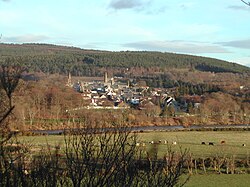 Fochabers
 -
 Forres


Civil parishes
[edit]_%26_NAIRNSHIRE.jpg)

Civil parishes are still used for some statistical purposes, and separate census figures are published for them. As their areas have been largely unchanged since the 19th century this allows for comparison of population figures over an extended period of time.[31] From 1845 to 1930, parishes formed part of the local government system of Scotland, having parochial boards from 1845 to 1894.
In 1861 there were 15 civil parishes entirely in Moray:[32]
- Alves
- Birnie
- Dallas
- Drainie[33]
- Duffus
- Edinkillie (see List of listed buildings in Edinkillie, Moray)
- Elgin
- Forres
- Kinloss
- Knockando
- Lhanbryde
- Rafford
- Speymouth
- Spynie
- Urquhart
In 1861 Morayshire shared various civil parishes with three surrounding counties. Five with Banffshire:
three with Inverness-shire:
- Abernethy
- Cromdale
- Duthill
and one with Nairnshire:
Flag
[edit]In 2023, the Lord Lieutenant of Moray organised a competition to design a flag for the lieutenancy area. The winning design is green, gold and blue, representing the area's agriculture and links to the sea.[35]
See also
[edit]References
[edit]- ^ Turnock, David (2005). The Historical Geography of Scotland since 1707. Cambridge University Press. p. 19. ISBN 9780521892292. Retrieved 21 August 2024.
- ^ Rampini, Charles (1897). A History of Moray and Nairn. Edinburgh.
{{cite book}}: CS1 maint: location missing publisher (link) - ^ Shaw, Lachlan (1882). The History of the Province of Moray: Volume 1. London / Glasgow: Hamilton, Adams and Co. / Thomas D. Morison. p. 47. Retrieved 21 August 2024.
- ^ a b Chalmers, George (1894). Caledonia: Volume 7. Paisley: Alexander Gardner. pp. 257–262. Retrieved 21 August 2024.
- ^ Publications of the Scottish History Society. 1928. p. 361. Retrieved 21 August 2024.
- ^ a b "Local Government (Scotland) Act 1947, Section 127". legislation.gov.uk. The National Archives. Retrieved 4 August 2024.
- ^ "Morayshire County". Scotland's Places. Historic Environment Scotland, the National Records of Scotland and the National Library of Scotland. Retrieved 25 June 2021.
- ^ McWillie, Robert (1999). The McWillie Diaries: The Diary of a Scottish Tenant Farm (1826 to 1876) (PDF). Keith and District Heritage Group. pp. 252, 219. Retrieved 22 August 2024.
- ^ Stewart, Douglas G. J. (2016). Allowances to Wives and Family of Militiamen Elgin 1810–1812 (PDF). Moray and Nairn Family History Society. p. 15. Retrieved 22 August 2024.
- ^ Brown, Keith. "Act of the convention of estates of the kingdom of Scotland etc. for a new and voluntary offer to his majesty of £72,000 monthly for the space of twelve months, 23 January 1667". Records of the Parliament of Scotland. University of St Andrews. Retrieved 25 February 2023.
- ^ The National Cyclopaedia of Useful Knowledge. Vol. V (First ed.). London: Charles Knight. 1848. p. 783.
- ^ The Inverness and Elgin County Boundaries Act 1870 (33 & 34 Vict c. 16). 1870. Retrieved 21 August 2024.
- ^ Historic Environment Scotland. "Elgin Sheriff Court including boundary wall and railings, High Street and Glover Street, Elgin (LB30778)". Retrieved 18 July 2021.
- ^ Guide to local government in parishes, counties and burghs. Edinburgh: Royal College of Physicians. 1892. pp. xxiii–xxx. Retrieved 31 December 2022.
- ^ "Preparing for the elections in Scotland". The County Council Magazine. London: F. Warne and Company. 1890. p. 284. Retrieved 31 December 2021.
- ^ "Elginshire County Council: Getting into harness". Moray and Nairn Express. 24 May 1890. p. 5. Retrieved 21 August 2024.
- ^ Shennan, Hay (1892). Boundaries of counties and parishes in Scotland as settled by the Boundary Commissioners under the Local Government (Scotland) Act 1889. Edinburgh: W. Green. p. 155. Retrieved 20 August 2024.
- ^ "Morayshire County Council: Official name of the county". Aberdeen Daily Journal. 8 May 1919. p. 8. Retrieved 21 August 2024.
- ^ "County of Elgin or Moray? Mr Munro and the proposed change of name". Aberdeen Daily Journal. 5 November 1919. p. 4. Retrieved 21 August 2024.
- ^ "1.3 History of Counties". Scottish Counties and Parishes: their history and boundaries on maps. National Library of Scotland. Retrieved 25 June 2021.
- ^ "Local Government (Scotland) Act 1929: Section 10", legislation.gov.uk, The National Archives, 1929 c. 25 (s. 10), retrieved 1 August 2024
- ^ "No. 19664". The Edinburgh Gazette. 9 May 1975. p. 652.
- ^ "Elgin". Aberdeen Press and Journal. 29 March 1938. p. 6. Retrieved 22 August 2024.
- ^ "Mr Stuart opens new County Buildings: Elgin ceremony". The Scotsman. 19 April 1952. p. 5. Retrieved 22 August 2024.
- ^ "Local Government (Scotland) Act 1973", legislation.gov.uk, The National Archives, 1973 c. 65, retrieved 17 April 2023
- ^ "Local Government etc. (Scotland) Act 1994", legislation.gov.uk, The National Archives, 1994 c. 39, retrieved 17 April 2023
- ^ "Land Mass Coverage Report" (PDF). Registers of Scotland. Archived from the original (PDF) on 3 March 2016. Retrieved 16 May 2015.
- ^ "The Lord-Lieutenants (Scotland) Order 1996", legislation.gov.uk, The National Archives, SI 1996/731, retrieved 3 August 2024
- ^ Urquhart, R.M. Scottish Burgh and County Heraldry (1973 ed.). Heraldry Today. pp. 77–78. consulted 20 December 2013.
- ^ "Quarter-inch Administrative Areas Maps: Scotland, Sheet 5, 1969". National Library of Scotland. Ordnance Survey. Retrieved 22 August 2024.
- ^ "Elginshire: Old and New Statistical Accounts". Old Roads of Scotland. Archived from the original on 2 June 2021.
- ^ Wilson, John Marius (1854–1857). The Imperial gazetteer of Scotland; or, Dictionary of Scottish topography. Edinburgh: A. Fullarton. p. 460 – via Archive.org.
- ^ "Map of the Parish of Drainie in the Historical County of Moray". Gazetteer for Scotland.
- ^ "Map of the Parish of Inveravon in the Historical County of Banff". Gazetteer for Scotland.
- ^ "Moray's new flag is launched". Lieutenancy of Moray. 3 November 2023. Retrieved 24 August 2024.
Further reading
[edit]- Lachlan Shaw and James Frederick Skinner Gordon (1882) The History of the Province of Moray: Comprising the Counties of Elgin and Nairn, the Greater Part of the County of Inverness and a Portion of the County of Banff, Published by Hamilton, Adams & co.,
- Hogan, C. Michael (2008). "The Modern Antiquarian". Longman Hill.
- R.M. Urquhart (1973) Scottish Burgh and County Heraldry, published by Heraldry Today
External links
[edit]- Morayshire Photographs from the George Washington Wilson 1904 Catalogue of Landscape and Architectural Views in Scotland

County of Moray
View on GrokipediaEtymology
Name origin and historical designations
The name Moray derives from Scottish Gaelic Moireabh (alternatively spelled Moireibh), a term possibly of Pictish origin denoting "seashore" or "coastal settlement," which aligns with the region's extensive shoreline along the Moray Firth.[5] [6] Linguistic reconstruction links it further to Proto-Celtic elements mori ("sea") and trebā ("dwelling" or "settlement"), underscoring a maritime connotation rooted in the area's geography rather than later administrative impositions.[7] In medieval records, the territory appeared as Moravia in Latin sources, preserving the Gaelic form while adapting to ecclesiastical and chronicle documentation.[7] By the 19th century, the county's official designation shifted to Elginshire, reflecting the centrality of Elgin as the sheriffdom's seat and county town, a convention common in Scottish counties named for judicial hubs.[8] This name persisted formally until 1919, when the Elginshire County Council adopted Moray to revive the pre-medieval provincial title, prioritizing etymological and historical fidelity over locality-based convenience.[9] The reversion highlighted a deliberate distinction between transient administrative labels and enduring regional identity, with Moray evoking the ancient coastal province documented in early Gaelic usage, independent of 19th-century sheriffdom reforms.[10] Subsequent mappings, such as Blaeu's 1654 atlas rendering it as Moravia, reinforced this continuity in cartographic tradition.[11]History
Prehistoric and Pictish foundations
Evidence of human occupation in the Moray region dates to the Mesolithic period, with flint implements and flakes discovered at Culbin Sands indicating hunter-gatherer activity along the coastal margins.[12] Subsequent Neolithic developments include timber hall structures, such as one uncovered near Port Gordon, suggesting organized communal activities around 3000 BCE.[13] Bronze Age evidence encompasses ritual cremation cemeteries and mortuary practices in coastal caves like Covesea, where mummified remains and artifacts point to maritime-oriented communities utilizing sea caves for burial rites from approximately 1200–800 BCE.[14] By the early historic period, the area fell under Pictish influence, with Moray forming part of the kingdom of Fortriu, identified through toponymic and archaeological correlations as centered in the Moray Firth region from the 6th to 9th centuries CE.[15] Fortriu's prominence is evidenced by fortified promontory sites like Burghead, a major Pictish stronghold featuring ramparts and ritual wells that likely served defensive roles against Norse incursions starting in the late 8th century.[16] Pictish symbol stones, such as the Class II Rodney's Stone at Dyke bearing crescent, V-rod, and Christian motifs, alongside others at Inveravon and Mortlach, mark territorial claims and cultural practices, with over a dozen examples concentrated in Moray attesting to dense settlement networks.[17][18] The Pictish foundations laid the groundwork for regional identity through these defended coastal and inland sites, which provided strategic advantages in trade and warfare. Transition to Gaelic linguistic dominance emerged in the 9th–10th centuries, as indicated by Gaelic place-name elements overlaying Pictish substrates—such as 'earn' forms potentially denoting early Irish-Gaelic settlements—and annals recording migrations following the Pictish defeat at the hands of Óengus II's forces and subsequent Scots' consolidation under Kenneth mac Alpin.[19][20] This shift, driven by political unification rather than wholesale replacement, preserved Pictish infrastructural legacies like hillforts amid Gaelic nomenclature adoption.[21]Kingdom and Province of Moray (10th-12th centuries)
The province of Moray succeeded the Pictish kingdom of Fortriu in the 10th century, forming a Gaelic-Pictish hybrid polity under mormaers who maintained semi-autonomy from the emerging kingdom of Alba.[22] These rulers, often designated in Irish annals as rí Moray or equivalent to kings, leveraged Moray's strategic northern position to assert influence in succession disputes.[23] Findláech mac Ruaidrí, mormaer of Moray, exemplified this power; he ruled until assassinated by rivals in 1020, as recorded in the Annals of Ulster, which describe him explicitly as "king of Moray."[23] His son, Mac Bethad (Macbeth), inherited the mormaerdom around 1029–1032 and extended Moray's reach by defeating and killing King Duncan I in 1040, seizing the Scottish throne until his own defeat in 1057.[23] This episode underscored Moray's capacity to project force southward, rooted in a martial tradition honed against Norse threats and internal kin-strife.[23] Resistance to centralizing kings intensified in the early 12th century. Under Alexander I (r. 1107–1124), Moraymen orchestrated a failed ambush around 1116, culminating in the killing of Ladhmann mac Domnaill, a royal grandson, as noted in the Annals of Ulster.[24] Later, Óengus, the final native mormaer, allied with the claimant Malcolm MacHeth to invade in 1130, but David I's forces crushed them at Stracathro, slaying Óengus and prompting the crown's direct annexation of Moray.[25] Repeated royal expeditions, necessitated by Moray's frontier volatility and entrenched local loyalties, thus curtailed its provincial independence by the 1130s.[25]Medieval integration and earldom
The recreation of the Earldom of Moray in 1312 under Thomas Randolph marked a pivotal phase in the region's integration into the centralized feudal framework of the Kingdom of Scotland. King Robert I granted the title and extensive lands in free regality to his nephew between 12 April and 29 October that year, reviving an earldom extinct since 1130 and strategically securing northern territories following the Wars of Independence.[26] This charter emphasized feudal obligations, aligning Moray's administration with royal sheriffdoms and imposing lowland-style land tenure, which curtailed the semi-autonomous mormaer traditions of prior provincial rulers.[27] While fostering stability through defined hierarchies, the arrangement subordinated local power to crown imperatives, evident in the regality's dependence on royal patronage for enforcement. Thomas Randolph's tenure until his death on 20 July 1332 exemplified feudal consolidation's dual edges: military prowess, including leadership at Bannockburn in 1314, bolstered Scottish sovereignty, yet entrenched dependency on central campaigns.[26] Infrastructure gains included fortified ecclesiastical sites like Spynie Palace, the bishops' residence from the 12th century onward, which symbolized integrated governance blending secular and religious authority under feudal norms.[28] However, 14th-century Anglo-Scottish conflicts eroded earl autonomy, as exemplified by John Randolph's fatal command at Neville's Cross (also known as the Battle of Durham) on 17 October 1346, leaving the title vulnerable to succession disputes and royal intervention.[29] Subsequent holders faced intensified noble rivalries and forfeitures that fragmented Moray's cohesion. The earldom passed via female inheritance to figures like Thomas Dunbar before vesting in Archibald Douglas around 1371, whose "Black" Douglas kin clashed with royal authority amid civil strife.[30] Archibald's forfeiture in 1455 after the Battle of Arkinholm exemplified punitive crown measures against perceived threats, redistributing lands and prioritizing loyalty over hereditary local control.[30] Charters from these eras document the transition to primogeniture and service-based tenures, supplanting Gaelic customs and embedding Moray within Scotland's feudal realm, albeit at the expense of indigenous autonomy.[31] This process yielded administrative predictability but invited external interference, balancing regional development against diminished self-rule.Early modern developments (16th-18th centuries)
In the 16th century, the County of Moray remained a hotspot for clan rivalries, dominated by the powerful Gordon family as Earls of Huntly, who controlled much of the region's lands and resources. The Gordons engaged in prolonged feuds with neighboring clans, notably the Forbes, resulting in numerous battles and massacres across Aberdeenshire and into Moray's borders; these conflicts, driven by territorial disputes and religious tensions between Catholic Gordons and Protestant Forbes, exemplified the instability of Highland lordship structures.[32] Further east, Gordon forces under the 6th Earl clashed with Campbell-led armies from Argyll in the late 1590s, culminating in victories that reinforced Huntly's influence but highlighted the fragility of royal authority under James VI. Witchcraft accusations also surfaced locally, as part of Scotland's broader 1590s panic influenced by King James's own obsessions; while records for Elgin are fragmentary, Moray saw at least 29 documented cases across the period, predominantly against women, underscoring judicial overreach absent empirical validation of supernatural claims.[33] The 17th century brought external upheavals from the Wars of the Three Kingdoms, with Moray's lowland fringes suffering indirect ravages as royalist and covenanting forces maneuvered northward. Oliver Cromwell's invasion following the 1650 Battle of Dunbar extended English control over eastern Scotland, imposing garrisons and fines that disrupted trade in burghs like Elgin and Forres, though direct burnings were more pronounced in central regions. Local economies, reliant on fishing, small-scale farming, and illicit distilling, adapted through resilient kinship networks amid these fiscal impositions. The Act of Union in 1707 integrated Moray into Britain's wider market, enabling 18th-century agricultural reforms that shifted from subsistence infield-outfield systems to enclosed rotations and lime manuring, boosting yields in fertile Speyside soils. These changes, promoted by enlightened lairds amid post-Union capital inflows, stabilized rural populations at around 30,000 by mid-century despite early enclosures displacing some tenants—precursors to later clearances—while fisheries expanded along the Moray Firth. Jacobite sympathies persisted, manifesting in local skirmishes during the 1745 rising, such as the government victory at Keith where Hanoverian dragoons repelled Highlanders retreating from Culloden, curtailing rebel foraging but affirming Moray's peripheral role in the failed insurgency.[34][35]19th-20th century administrative evolution
The introduction of railway infrastructure in the Victorian era marked a significant administrative and economic shift for the County of Elgin (later Moray), facilitating centralized oversight of trade and transport. The Morayshire Railway, authorized by act of Parliament in 1857 and operational from 1862, connected key settlements such as Elgin and Lossiemouth, enabling efficient movement of agricultural produce and goods to broader markets, which stimulated local commerce but also integrated the county more firmly into national networks under Westminster-regulated companies.[36] This expansion, extending to lines like the Keith and Dufftown Railway by the 1860s, supported population growth in trading hubs but highlighted emerging tensions between local priorities and centralized railway monopolies, with boundary adjustments for infrastructure often overriding parish-level input.[37] Administrative innovations under the Poor Law (Scotland) Amendment Act 1845 established parochial boards across Moray's parishes, replacing kirk session dominance with elected bodies responsible for relief distribution, including the construction of poorhouses like that in Elgin by the late 19th century to house indigents, lunatics, and children.[38] Complementing this, the Education (Scotland) Act 1872 created school boards in each parish, funding compulsory elementary education through local rates and central grants, which standardized curricula but imposed fiscal strains on rural areas, critiqued for diluting community-specific governance in favor of uniform national standards.[39] These bodies exemplified incremental centralization, as county councils—formed under the Local Government (Scotland) Act 1889—gained supervisory roles, altering boundaries slightly in 1891 to align with revised parliamentary divisions and enhancing oversight of poor relief and education amid industrial shifts.[8] In 1919, Elginshire County Council formally resolved to rename the county Moray, reverting to its historic designation to emphasize cultural continuity over the town-centric "Elginshire" label, a decision ratified by the council on 7 May without immediate boundary changes but signaling administrative self-assertion amid post-World War I reforms.[37] The interwar period saw traditional sectors like fishing decline due to overfishing, market shifts, and competition from distant-water fleets, with Moray's coastal ports such as Lossiemouth experiencing reduced herring catches by the 1930s.[40] This downturn was offset during World War II by the establishment of RAF Lossiemouth in 1939 as a Coastal Command base, which injected employment and infrastructure investment, sustaining local economies through wartime operations despite the broader erosion of autonomous county-level resource management. The Local Government (Scotland) Act 1973 abolished the County of Moray effective 16 May 1975, dissolving its council and redistributing functions to new districts within the Grampian Region, including a Moray District that retained much of the historic territory but subordinated local decision-making to regional tiers, reducing granular control over services like roads and welfare.[41] This centralization fragmented historic boundaries—such as detaching southern areas into Badenoch and Strathspey—and eroded parochial autonomy, with data showing a net loss in localized fiscal powers; for instance, pre-1975 county rates funded targeted initiatives like agricultural drainage, now diluted under broader regional budgets.[42] While administratively obsolete, the county's framework persisted in lieutenancy areas and cultural identity, underscoring how such reforms prioritized efficiency over rooted governance, often at the expense of community-specific adaptations evidenced in persistent regional disparities post-abolition.[43]Geography
Physical landscape and boundaries
The historical County of Moray, also known as Elginshire, encompassed approximately 500 square miles of northeastern Scotland's terrain, bounded to the north by the Moray Firth, to the east and southeast by Banffshire, to the south and southwest by Inverness-shire, and to the west by Nairnshire.[11] This configuration positioned Moray as a transitional zone between the North Sea coast and the elevated Grampian Highlands, with its southern limits abutting the rising slopes of these mountains, which reach elevations exceeding 1,000 meters in adjacent areas.[44] The physical landscape features a low-lying coastal plain known as the Laich of Moray, comprising fertile alluvial soils deposited by major rivers such as the Spey and Findhorn, which drain southward from the Highlands into the Moray Firth and sustain agricultural productivity through sediment enrichment.[45] These rivers carve through undulating terrain rising gradually inland to hilly moorlands, with the plain's sandy and silty composition derived from Devonian Old Red Sandstone and glacial deposits, fostering barley cultivation as the dominant land use due to the nutrient-rich, well-drained conditions.[44] However, the exposed sandy coasts remain vulnerable to erosion, exemplified by the Culbin Sands event, where a severe north-westerly storm on October 19, 1694, mobilized dunes and buried over 1,500 hectares of farmland, transforming viable estates into a shifting desert through wind-driven sand accumulation.[46] Geological resources include granitic intrusions in the southern uplands, quarried historically for building stone amid the region's metamorphic Moine and Dalradian schists, while the coastal plain's fertility directly causal to sustained agrarian economies by enabling reliable crop yields in an otherwise marginal northern latitude.[47][44]Rivers, coast, and natural resources
The River Spey, Scotland's second-longest river at approximately 98 miles, forms a vital hydrological artery through eastern Moray, originating in the Monadhliath Mountains before entering the county and discharging into the Moray Firth near Kingston; it has historically sustained premier Atlantic salmon fisheries, with commercial netting documented since at least the 16th century and rod fishing emerging by the mid-19th century.[48][49] The River Findhorn, rising in the Grampian highlands and spanning about 70 miles, parallels the Spey in draining southern peat moors and fertile plains northward to the firth, contributing to seasonal flooding risks due to its steep gradient and high rainfall catchment of over 400 square miles.[50] The shorter River Lossie, meandering 20 miles from central Moray to the coast at Lossiemouth, historically enabled small-scale ports for local trade, though silting limited larger vessel access by the early 19th century.[51] Moray's coastline, spanning roughly 50 miles along the southern Moray Firth from Burghead westward to Buckie eastward, features indented bays and natural shingle harbors formed by glacial deposits and longshore drift, facilitating historical herring and whitefish landings while exposing vulnerabilities to erosion.[52] These coastal formations, including submerged forests and shifting sands like those at Culbin, empirically constrained inland expansion by encroaching arable land, with records noting progressive burial of medieval settlements under dunes by the 17th century.[53] Natural resources included timber harvested from native birch, oak, and pine woodlands covering upland areas, exported via coastal ports, alongside peat extraction from extensive mosses that once blanketed lowlands and provided fuel until agricultural drainage reduced their extent post-18th century.[54] In the 17th century, Moray Firth ports conducted direct maritime trade with Baltic states, shipping salted fish, hides, and timber in exchange for Swedish iron and Norwegian deals, as evidenced by customs ledgers showing annual voyages from harbors like Findhorn.[55] Significant hazards arose from fluvial dynamics, exemplified by the "Muckle Spate" flood of August 3-4, 1829, when 6-10 inches of rain over 48 hours swelled the Findhorn to a peak discharge estimated at 20,000 cubic meters per second, destroying bridges, mills, and over 1,000 homes across 100 square miles of Moray and Nairn, with at least 105 confirmed deaths in the affected districts.[56] Coastal shifting sands and storm surges further amplified risks, periodically reshaping harbors and limiting permanent infrastructure, as observed in recurrent silting episodes documented in 18th-century estate records.[44]Administration and Subdivisions
Historical governance structures
The sheriffdom of Moray, known historically as the sheriffdom of Elgin or Elginshire, was centered at Elgin, serving as the principal seat for royal justice and administration from the 12th century onward, with the sheriff court convening there for civil and criminal matters.[11] The sheriff, appointed by the Crown, held responsibility for enforcing law, collecting revenues, and overseeing local inquiries, reflecting the extension of royal authority into former provincial territories following David I's reforms around 1124–1153.[57] This structure marked a shift from mormaer-led governance to centralized judicial oversight, though heritable sheriffships often persisted until the 18th century, blending royal and local influences.[58] Local autonomy persisted through burghs of barony and regality, which granted landowners rights to hold markets, fairs, and limited trade under charters from the Crown, as seen in Fochabers, erected as a burgh of barony in the parish of Bellie with privileges for local commerce.[1] Similarly, the barony of Muirton near Forres included the burgh of barony of Findhorn, where lairds exercised judicial roles via baronial courts, handling minor civil disputes and criminal cases within their lands, independent of the sheriff unless appealed to royal courts.[59] These mechanisms allowed lairds to maintain economic and quasi-judicial powers, rooted in feudal tenures, but subject to overarching Crown supremacy. This provincial framework eroded decisively after 1230, when Crown forces under Alexander II suppressed the final Meic Uilleim uprising—claimants to Moray's native kingship—with the killing of Guthred MacWilliam, annexing the region fully and eliminating rival dynasties through conquest, colonization, and expulsion.[60] Subsequent interventions, including direct royal appointments of sheriffs and earls loyal to the Canmore dynasty, dismantled semi-independent mormaer structures, integrating Moray via charters that prioritized fiscal and military obligations to Edinburgh over local customs.[61] By the 17th century, this centralization culminated in bodies like the Commissioners of Supply, established in 1667 for each shire to levy the national land tax (cess), functioning as key administrative organs for revenue collection until modern county councils.[62]Civil parishes and burghs
In the 19th and early 20th centuries, the County of Moray was subdivided into civil parishes that functioned as primary units for local administration, including the management of poor relief via parochial boards under the Poor Law (Scotland) Act 1845, which empowered elected heritors and ministers to assess and distribute aid to the indigent, typically restricting support to the infirm and excluding able-bodied claimants.[39] [63] These parishes also underpinned valuation rolls, annual assessments of property values compiled by assessors to levy rates for local taxes and infrastructure, ensuring fiscal accountability at the community level.[64] By 1911, Moray encompassed approximately 20 civil parishes, with examples including Elgin Landward—a rural extension beyond the burgh boundaries for administrative separation of urban and agricultural lands—and Drainie, which handled coastal and inland relief distributions.[65] [66] Civil parishes further served empirical purposes in census enumeration, where boundaries defined enumeration districts for population counts, occupations, and housing data as recorded in the 1911 Census of Scotland, facilitating demographic analysis without modern geopolitical distortions.[67] They aligned closely with ecclesiastical parishes for mapping religious affiliations and vital events, though civil functions diverged post-Reformation to prioritize secular governance over kirk sessions.[68] Burghs within Moray contrasted with parishes by emphasizing urban privileges and autonomy. Royal burghs, such as Elgin—erected by charter from Alexander II in 1234—and Forres, an ancient foundation with trading rights predating the 12th century, enjoyed crown-granted monopolies on commerce, markets, and self-elected councils, distinct from feudal barony burghs.[69] Following the Burgh Police (Scotland) Act 1833, police burghs proliferated for towns exceeding 700 inhabitants, introducing statutory commissions for street lighting, scavenging, and policing to address industrial-era sanitation and order, without the hereditary privileges of royal status.[70] This system delineated burghal responsibilities from parish poor law, preventing overlap in urban fiscal burdens until local government reforms in the 20th century.[37]Major settlements and their roles
Elgin functioned as the primary administrative center of the County of Moray, serving as the county town with key institutions such as sheriff courts handling judicial matters. Its role was bolstered by the founding of Elgin Cathedral in 1224 by Bishop Andrew de Moravia, which established it as a focal point for ecclesiastical administration within the diocese.[71] As an inland market town, Elgin supported regional trade in agriculture and goods, with its population expanding to 8,460 by the 1901 census, indicative of its economic and service hub status.[72] Forres, established as a royal burgh around 1150 during the reign of David I, played a crucial role in facilitating trade and economic development through royal charters that granted market privileges.[73] Its status was reaffirmed in 1496 by King James IV, emphasizing its function as a trading post with activities including salmon fishing and export along the Findhorn River.[74] By the early 19th century, Forres supported inland commerce and had a population of approximately 5,241 in 1901, connecting to broader networks via historic roads like the old route to Elgin, which aided defensive movements and goods transport.[75] Coastal settlements such as Buckie and Fochabers emphasized maritime roles, particularly fishing and port activities. Buckie emerged as a major herring fishing center in the 19th century, with its harbor expanded in 1877 by John Gordon of Cluny at a cost of £60,000, supporting 333 fishing vessels by 1881 and employing over 1,300 individuals.[76] Fochabers, located near the River Spey estuary, contributed to coastal trade and fishing through nearby ports like Garmouth, facilitating the movement of goods and fish to inland markets while linking to defensive coastal paths.[11] These ports contrasted with inland towns by prioritizing sea-based economies, with interconnections via early roads enhancing regional defense and commerce post-Jacobite era.Heraldry and Symbols
Coat of arms design and symbolism
The coat of arms of the County of Moray, formally Morayshire, was granted by the Lord Lyon King of Arms to the county council on July 20, 1927.[77] The blazon reads: Quarterly: 1st and 4th, Azure, three mullets Argent; 2nd and 3rd, Argent, three cushions Gules buttoned Or, within a double tressure flory-counter-flory of the last. This design integrates heraldic charges long associated with the region's provincial and noble heritage, quartered to represent both the ancient mormaerdom and the later earldom.[77] The first and fourth quarters feature azure, three mullets argent, depicting three silver five-pointed stars on a blue field. These mullets derive from attributions to the pre-Norman mormaers of Moray, symbolizing the Celtic provincial rulers who governed the area from at least the 10th century until the earldom's integration into the Scottish crown's structure around 1130. Heraldic records trace this simple azure-and-argent composition to medieval rolls and seals linked to Moray's territorial identity, predating formalized Scottish heraldry but adopted in later civic arms to evoke the region's distinct pre-feudal autonomy.[77] The blue tincture aligns with early provincial symbolism, while the mullets—distinct from the six-pointed estrellas used elsewhere—underscore local differentiation without overlaying national emblems like thistles or lions.[78] The second and third quarters display argent, three cushions gules buttoned or, within a double tressure flory-counter-flory of the last, showing three red pillows with gold tassels or buttons on a silver field, encircled by the ornate royal bordure. The cushions reference the arms of the Earls of Moray from the Randolph and subsequent Stewart lines, who held the title from the 14th century onward; this charge appears in peerage grants as early as the 1310s, tied to Thomas Randolph's elevation after Bannockburn.[77] The double tressure, a uniquely Scottish royal augment, was added under James Stewart, 1st Earl of Moray (executed 1421), signifying crown loyalty and feudal elevation, though its use here avoids claiming sovereignty. This quartering distinguishes the county's arms from burgh-specific variants, such as Elgin's, which incorporate cathedral crosses rather than earldom cushions.[79] No standard motto accompanied the 1927 grant for the county council, though later district adaptations referenced familial devices like the Dunbars' In spe ("In hope"), punning on the region's agricultural bounty without historical seal precedence. Empirical evidence from 13th-century Moray seals, such as those of the bishopric of Moray circa 1208, prioritizes unadorned charges like keys or croziers over inscribed mottos, emphasizing functional territorial authentication over symbolic phrasing.[77] The overall design thus privileges verifiable blazons from Lyon registers over speculative lore, ensuring heraldic continuity with Moray's mormaer-era roots while demarcating county authority from royal or burgh precedents.Flag and other emblems
The flag of the historic County of Moray, also known as Morayshire, emerged from a public competition launched by the Moray Lieutenancy on 24 January 2023, with the winning design unveiled at Elgin Town Hall on 2 March 2023.[80] Created by Aila Gibson, a pupil at Dallas Primary School, the flag incorporates a green hoist bearing a golden wheatsheaf to evoke the county's agricultural heritage, wavy blue and yellow fields signifying coastal sands and sea, and white stars drawn from longstanding provincial associations. Registered with the Flag Institute in October 2023, this emblem postdates the county's administrative era, which ended in 1975, and functions mainly for ceremonial promotion of historic identity rather than reflecting pre-20th-century traditions.[81] Other emblems tied to the County of Moray include seals utilized by the pre-1975 county council, featuring a wheatsheaf motif that underscored the area's farming prominence in official documentation.[80] These practical symbols, lacking the antiquity of heraldic grants, supported administrative functions without establishing broader iconic status. No evidence indicates formal adoption of distinct flags or seals with precise minute-recorded dates predating the 20th century, highlighting their utilitarian rather than deeply rooted symbolic role.Economy
Agricultural and fishing base historically
The Laich of Moray, the fertile coastal plain comprising sandy, clay, and loam soils across approximately 103,820 Scots acres, supported intensive cultivation of oats and barley as primary staples from the medieval period onward.[54] Oats yielded around 4 quarters per acre on average, serving as the main food grain processed into oatmeal, while barley averaged 5 quarters per acre and provided malt precursors essential for early distillation activities, though large-scale whisky production remained limited by excise restrictions until later.[54] Crop rotations typically integrated oats following barley or fallow, with sowing in March-April and harvest from late August, enabling consistent output that positioned Moray as a regional grain supplier during 16th-century shortages, when oatmeal exports to famine-struck areas like Angus fetched £1.10s per boll (150 lb).[54] [53] Enclosures, initiated mid-18th century under acts like that of 1695 and accelerated by landowners such as the Earl of Fife, transformed open fields into managed farms, tripling yields in cases like the 1781 division of Lughteen lands near Elgin, where rents rose from £1 to £3 per acre through improved hedging, drainage, and longer leases of 19-38 years.[54] These reforms boosted overall agricultural rents and exports, with annual grain and cattle trade valued at £10,000-£13,000 by the late 18th century, including 8,000-10,000 quarters of wheat alongside oats and barley.[54] However, reliance on these cereals exposed the economy to climatic risks, as crop failures in upland Moray triggered severe privations, underscoring agriculture's role in providing baseline seasonal stability via diversified rotations but vulnerability to floods and droughts without modern irrigation.[53] Complementing agriculture, coastal fishing centered on herring, with ports like Lossiemouth emerging as hubs after initial trials in 1819 amid the broader east-coast boom from the 1790s.[82] By the mid-19th century, Moray's fisheries contributed to Scotland's cured herring exports, which surged from 100,000 barrels in 1820 to over 1 million by 1840, primarily salted for European markets including Germany and the Baltic, though specific Moray catches remained tied to migratory shoals and seasonal drifter fleets.[83] This sector offered economic surges during peak seasons but amplified instability through overdependence on variable stocks and weather, contrasting agriculture's steadier land-based yields while collectively underpinning pre-industrial rents and trade in the county.[51] [54]| Crop | Average Yield (quarters/acre) | Primary Use |
|---|---|---|
| Oats | ~4 | Oatmeal, animal feed[54] |
| Barley | ~5 | Malt for distillation, meal[54] |
Industrial shifts including whisky and military
The whisky industry emerged as a key driver of industrial diversification in Moray during the 19th century, transitioning from widespread illicit distillation to licensed production following the Excise Act of 1823. The Glenlivet Distillery, located in the broader Speyside region encompassing parts of Moray, received the first legal license in 1824 under George Smith, marking the onset of legitimate operations in the area and encouraging others to follow despite initial risks from smugglers.[84][85] This shift capitalized on the region's pure water sources from the River Spey and surrounding glens, fostering a boom that saw Speyside, including Moray's distilleries such as Glen Moray established in 1897 near Elgin, contribute to over 50 operational sites by the late 19th and early 20th centuries, concentrating the highest density of Scotch whisky production in Scotland.[86] Military infrastructure provided another pivotal industrial layer, with RAF Kinloss and RAF Lossiemouth commissioned in 1939 amid pre-World War II expansions, injecting employment and economic activity into local communities through airfield construction and operations. During WWII, these bases supported Coastal Command with torpedo bombers and anti-submarine patrols, sustaining wartime demand for labor and supplies that bolstered Moray's economy beyond agriculture. Post-war, the stations adapted to Cold War roles, including Nimrod maritime patrol at Kinloss until its 2010 phase-out, while Lossiemouth hosted fast-jet squadrons, maintaining a combined economic footprint equivalent to about 11% of local full-time equivalent jobs as of early 2000s assessments.[87][88][89] Critiques of these sectors highlight structural vulnerabilities, including the whisky industry's consolidation under fewer large operators by the mid-20th century, which limited small-scale distillers and tied rural labor to seasonal or precarious roles amid fluctuating global markets. Similarly, Moray's "defence-dependent" economy faced risks from base rationalizations, as seen in post-Cold War threats to Kinloss in 2011, where potential closures were projected to devastate local employment and spending, prompting campaigns emphasizing over-reliance on military contracts rather than diversified growth.[90][91]Cultural and Social Aspects
Architectural and ecclesiastical heritage
Elgin Cathedral, constructed primarily in the 13th century after its founding in 1224 under Bishop Andrew de Moray, exemplifies Gothic architecture in northern Scotland with features including a cruciform plan, octagonal chapter house, and paired west towers.[71] It served as the spiritual center of the Diocese of Moray until severe damage from a 1390 sack by Alexander Stewart, known as the Wolf of Badenoch, precipitated its decline into ruin, exacerbated by subsequent neglect and Reformation-era iconoclasm.[71] Pluscarden Abbey, established in 1230 by King Alexander II for Valliscaulian monks from Burgundy, represents another key ecclesiastical site with medieval cloister and church elements; it fell into disuse after the 16th-century Reformation but was restored in 1948 by Benedictine monks, preserving its role in regional monastic tradition.[92] Spynie Palace, the fortified residence of the Bishops of Moray from the 12th to 17th centuries, stands as Scotland's largest surviving medieval bishop's house, featuring a 15th-century tower house and defensive moat that underscored the bishops' temporal power amid feudal conflicts.[28] Its socio-political significance lay in centralizing episcopal authority near the diocese's heart, though abandonment followed the 1686 revocation of bishops' lands under James VII.[28] Secular architecture in Moray includes castles reflecting defensive needs during the medieval period's turbulence. Darnaway Castle retains a 14th-century banqueting hall from its origins as a royal manor granted to Thomas Randolph, Earl of Moray, evolving into the Earls' seat with 19th-century expansions while symbolizing noble continuity.[93] Duffus Castle transitioned from a Norman motte-and-bailey in the 12th century to a stone hall-house by the 1300s, functioning as a stronghold for local lords until abandonment in the 1700s amid sieges and economic shifts.[94] These structures highlight Gothic and fortified designs adapted to Moray's strategic position, though many suffered decay from Wars of Independence raids and clan feuds, limiting full realization of architectural ambitions.[94]Demographic patterns and notable figures
The population of the County of Moray, also known as Elginshire, exhibited relative stability in the early 19th century before modest growth, reflecting its rural agricultural character and lesser exposure to the disruptive Highland Clearances that affected western Scotland more severely. According to census records, the population stood at 23,647 in 1801, rising gradually to 30,745 by 1851, and reaching 43,453 by 1891, with minimal net emigration compared to Highland regions where clearances prompted significant outflows to North America and Australia. [53] This pattern stemmed from localized improvements in farming and fishing rather than wholesale displacement, maintaining a predominantly rural demographic with small burgh populations in towns like Elgin and Forres.| Year | Population |
|---|---|
| 1801 | 23,647 |
| 1811 | 25,753 |
| 1821 | 28,393 |
| 1831 | 30,081 |
| 1841 | 30,981 |
| 1851 | 30,745 |
| 1861 | 31,152 |
| 1871 | 30,997 |
| 1881 | 31,136 |
| 1891 | 31,252 |
| 1901 | 30,981 |