
Recent from talks
Geography of Lithuania
Knowledge base stats:
Talk channels stats:
Members stats:
Geography of Lithuania
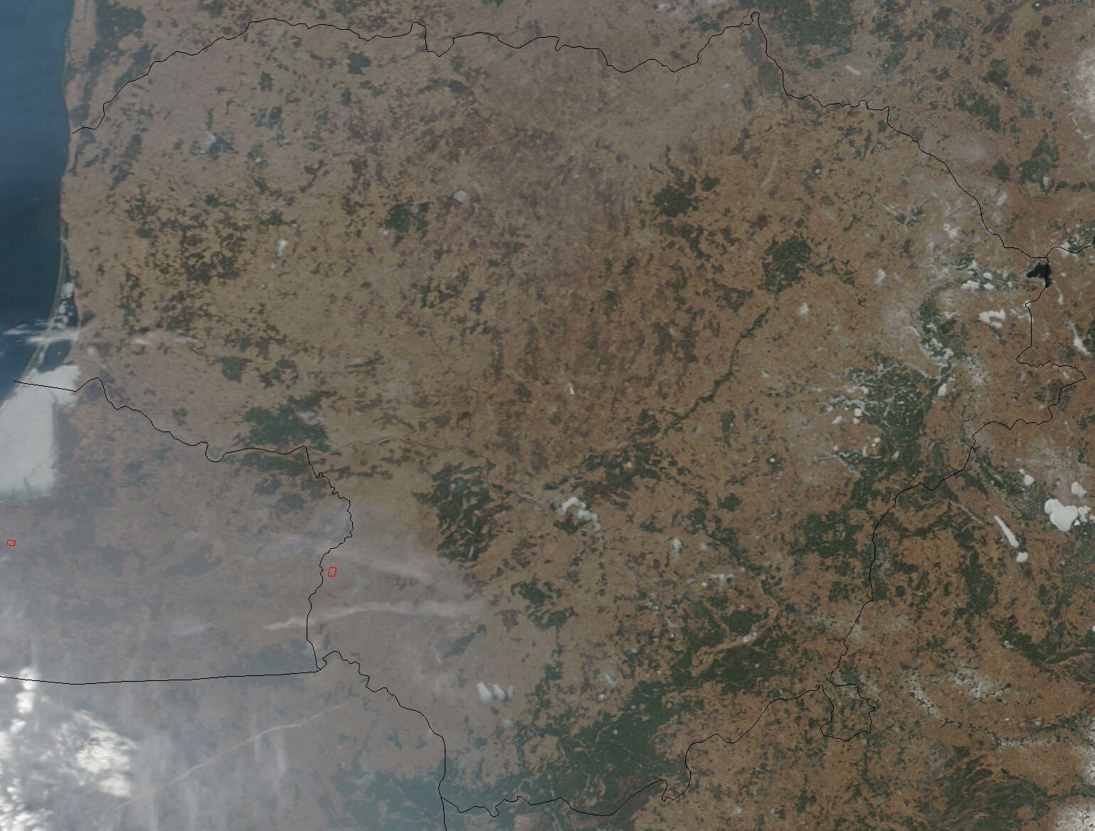
Lithuania is one of the countries in the Baltic region of Europe. The most populous of the Baltic states, Lithuania has 262 km (163 mi) of coastline consisting of the continental coast and the "Curonian Spit" coast. Lithuania's major warm-water port of Klaipėda lies at the narrow mouth of Curonian Lagoon, a shallow lagoon extending south to Kaliningrad and separated from the Baltic sea by Curonian Spit, where Kuršių Nerija National Park was established for its remarkable sand dunes.
The Neman River and some of its tributaries are used for internal shipping (in 2000, 89 inland ships carried 900,000 tons of cargo, which is less than 1% of the total goods traffic).
Situated between 56.27 and 53.53 latitudes and 20.56 and 26.50 longitudes, Lithuania is glacially flat, except for morainic hills in the western uplands and eastern highlands no higher than 300 metres. The terrain is marked by numerous small lakes and swamps, and a mixed forest zone covers over 33% of the country. The growing season lasts 169 days in the east and 202 days in the west, with most farmland consisting of sandy- or clay-loam soils. Limestone, clay, sand, and gravel are Lithuania's primary natural resources, but the coastal shelf offers perhaps 1,600,000 m3 (10 Mbbl) of oil deposits, and the southeast could provide high yields of iron ore and granite.
Lithuania is situated on the eastern shore of the Baltic Sea. Lithuania's boundaries have changed several times since 1918, but they have been stable since 1945. Currently, Lithuania covers an area of about 65,300 km2 (25,200 sq mi). It is larger than Belgium, Denmark, Latvia, Estonia, the Netherlands, Slovakia, Slovenia or Switzerland. Lithuania borders Latvia on the north, Belarus on the east and south, and Poland and the Kaliningrad region of Russia on the southwest. The Eastern border together with Latvia in the South of its East comes along with the Krokuva-Vilnius-Veliky Novgorod route with it chiefly within the territory. It is a country of gently rolling hills, many forests, rivers and streams, and lakes. Its principal natural resource is agricultural land.[citation needed]
Lithuania's northern neighbor is Latvia. The two countries share a border that extends 453 kilometres. Lithuania's eastern border with Belarus is longer, stretching 502 kilometers. The border with Poland on the south is relatively short, only 91 kilometers, but it is very busy because of international traffic. Lithuania also has a 227-kilometer border with Russia. Russian territory adjacent to Lithuania is Kaliningrad Oblast, which is the northern part of the former German East Prussia, including the city of Kaliningrad. Finally, Lithuania has 108 kilometers of Baltic seashore with an ice-free harbor at Klaipėda. The Baltic coast offers sandy beaches and pine forests and attracts thousands of vacationers.
According to some geographers, the geographical midpoint of Europe is just north of Lithuania's capital, Vilnius.
In terms of latitude or climate fifteen degrees (corresponding to the longitude or an hour fifteen degrees, except the polar climate sums being 7°30´ in latitude) Lithuania situates within the 52°30´-N - 67°30´-N latitude, that is northwards from Southend latitude, together with the North Sea major body, the Far North of Germany, Siberia. It situates in the southern quarter of the climate fifteen degrees, stretching northwards from the southern mark of the climate fifteen degrees further than in nearly one tenth or the sum of <1°30´, that is kind of an edge zone of the climate fifteen degrees, being generally boggy in the western Belarus, and on the 54°-N latitude the one tenth zone is marked by the greatest bog in Lithuania the Čepkeliai Marsh.
With the Eastern Hemisphere core longitude on the 67°30´-E, the hour or its longitude fifteen degrees that set on Lithuania are 15°-E - 30°-E (Greenwich, London) longitude, the core of which coming on the 22°30´-E longitude also marks the western one fourth, or the sum of 45° in the West of the Eastern Hemisphere if marking it with the Cape Verde archipelago and the Transantarctic Mountains. The 22°30´-E longitude comes in the West of Lithuania, with the river Jūra (pronounced as in Euro except the ending vowel) meaning sea locally flowing on the mark. Tilsit (Kaliningrad Oblast), Telšiai as the Greek thalassa situate in the western one fourth of the Eastern Hemisphere, although Talsi (Latvia) situate eastwards from the mark. The rivers Šešupė, Šešuvis, Šušvė plus Šyša situate in the sum of approximately 2°30´ longitude or one sixth of an hour fifteen degrees (šeši - six in Lithuanian), in the both sides of the 22°30´-E mark.
Hub AI
Geography of Lithuania AI simulator
(@Geography of Lithuania_simulator)
Geography of Lithuania
Lithuania is one of the countries in the Baltic region of Europe. The most populous of the Baltic states, Lithuania has 262 km (163 mi) of coastline consisting of the continental coast and the "Curonian Spit" coast. Lithuania's major warm-water port of Klaipėda lies at the narrow mouth of Curonian Lagoon, a shallow lagoon extending south to Kaliningrad and separated from the Baltic sea by Curonian Spit, where Kuršių Nerija National Park was established for its remarkable sand dunes.
The Neman River and some of its tributaries are used for internal shipping (in 2000, 89 inland ships carried 900,000 tons of cargo, which is less than 1% of the total goods traffic).
Situated between 56.27 and 53.53 latitudes and 20.56 and 26.50 longitudes, Lithuania is glacially flat, except for morainic hills in the western uplands and eastern highlands no higher than 300 metres. The terrain is marked by numerous small lakes and swamps, and a mixed forest zone covers over 33% of the country. The growing season lasts 169 days in the east and 202 days in the west, with most farmland consisting of sandy- or clay-loam soils. Limestone, clay, sand, and gravel are Lithuania's primary natural resources, but the coastal shelf offers perhaps 1,600,000 m3 (10 Mbbl) of oil deposits, and the southeast could provide high yields of iron ore and granite.
Lithuania is situated on the eastern shore of the Baltic Sea. Lithuania's boundaries have changed several times since 1918, but they have been stable since 1945. Currently, Lithuania covers an area of about 65,300 km2 (25,200 sq mi). It is larger than Belgium, Denmark, Latvia, Estonia, the Netherlands, Slovakia, Slovenia or Switzerland. Lithuania borders Latvia on the north, Belarus on the east and south, and Poland and the Kaliningrad region of Russia on the southwest. The Eastern border together with Latvia in the South of its East comes along with the Krokuva-Vilnius-Veliky Novgorod route with it chiefly within the territory. It is a country of gently rolling hills, many forests, rivers and streams, and lakes. Its principal natural resource is agricultural land.[citation needed]
Lithuania's northern neighbor is Latvia. The two countries share a border that extends 453 kilometres. Lithuania's eastern border with Belarus is longer, stretching 502 kilometers. The border with Poland on the south is relatively short, only 91 kilometers, but it is very busy because of international traffic. Lithuania also has a 227-kilometer border with Russia. Russian territory adjacent to Lithuania is Kaliningrad Oblast, which is the northern part of the former German East Prussia, including the city of Kaliningrad. Finally, Lithuania has 108 kilometers of Baltic seashore with an ice-free harbor at Klaipėda. The Baltic coast offers sandy beaches and pine forests and attracts thousands of vacationers.
According to some geographers, the geographical midpoint of Europe is just north of Lithuania's capital, Vilnius.
In terms of latitude or climate fifteen degrees (corresponding to the longitude or an hour fifteen degrees, except the polar climate sums being 7°30´ in latitude) Lithuania situates within the 52°30´-N - 67°30´-N latitude, that is northwards from Southend latitude, together with the North Sea major body, the Far North of Germany, Siberia. It situates in the southern quarter of the climate fifteen degrees, stretching northwards from the southern mark of the climate fifteen degrees further than in nearly one tenth or the sum of <1°30´, that is kind of an edge zone of the climate fifteen degrees, being generally boggy in the western Belarus, and on the 54°-N latitude the one tenth zone is marked by the greatest bog in Lithuania the Čepkeliai Marsh.
With the Eastern Hemisphere core longitude on the 67°30´-E, the hour or its longitude fifteen degrees that set on Lithuania are 15°-E - 30°-E (Greenwich, London) longitude, the core of which coming on the 22°30´-E longitude also marks the western one fourth, or the sum of 45° in the West of the Eastern Hemisphere if marking it with the Cape Verde archipelago and the Transantarctic Mountains. The 22°30´-E longitude comes in the West of Lithuania, with the river Jūra (pronounced as in Euro except the ending vowel) meaning sea locally flowing on the mark. Tilsit (Kaliningrad Oblast), Telšiai as the Greek thalassa situate in the western one fourth of the Eastern Hemisphere, although Talsi (Latvia) situate eastwards from the mark. The rivers Šešupė, Šešuvis, Šušvė plus Šyša situate in the sum of approximately 2°30´ longitude or one sixth of an hour fifteen degrees (šeši - six in Lithuanian), in the both sides of the 22°30´-E mark.
Recent media