Community hub
Recent from talks
Contribute something
Nothing was collected or created yet.
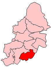
Hall Green
View on Wikipedia
Hall Green is an area in southeast Birmingham, England. It is also a council constituency of Birmingham City Council, managed by its own district committee. Historically it lay within the county of Worcestershire. The 2001 Population Census found that there were 25,921 people living in Hall Green with a population density of 4,867 people per km2, this compares with 3,649 people per km2 for Birmingham.
Key Information


The Shire Country Park runs past Sarehole Mill and along the course of the River Cole to Small Heath. Millstream Way passes through the park. Wildlife present at the country park include otters and water voles and many types of birds. The old village of Sarehole (now on the border of Hall Green and Moseley) is where J. R. R. Tolkien lived as a child and gained inspiration for the Hobbit's home "The Shire" as well as the book, The Lord of the Rings.
Hall Green was the home to Moor Green F.C., prior to an arson attack on the club's original Moorlands stadium in 2005, leading to the club moving their home games to Solihull Borough's Damson Park stadium, with the two clubs subsequently merging to become Solihull Moors. The local Moorlands stadium has since been demolished to make way for 'The Moorlands' housing estate.[2][3]
Hall Green was also the home to the popular greyhound racing stadium and race course situated on the former Olympia Sports Ground, York Road called Hall Green Stadium; the stadium having won the BGRB Midlands and Western Region Racecourse of the Year for four consecutive years between 2000 and 2003. The stadium was closed by its owners Euro Property Investments Limited in July 2017 to make way for the 'Olympia' housing estate.[4][5]
History
[edit]
On School Road is the Church of the Ascension, formerly the Job Marston Chapel, which was built in 1704 and is believed to have been designed by Sir William Wilson. The chancel and transepts were added in 1860. The brick building consists of an exterior with a stone entablature and balustrade supported by Doric pilasters and the window architraves are of moulded stone. At the west end is a tower with an octagonal upper storey with a copper cupola. The interior of the nave is covered by a coved plaster ceiling. It is the earliest classical church to survive within the city boundary.[6] Other historic buildings in Hall Green include Sarehole Mill, one of only two watermills in the city.
Highfield House was another historical building. It was built in 1850, making it the oldest house and the third oldest building in Hall Green. It was the farm house for Highfield Farm. The house was built in Georgian style with Neo-Classical features. It also retained the original sash windows. In March 2008, in the face of much public opposition, petitions, articles in local newspapers and items on radio stations, Birmingham City Council's Planning Committee approved plans for its demolition and the building of four houses and six apartments.[citation needed]

A private development named "The Hamlet" was built between 1883 and 1893. It consists of fourteen villas on Hamlet and Fox Hollies Roads, along with the Friends Meeting House on the Stratford Road. The architectural style of these brick and tile properties is typified by massive chimneys and timbers, leaded casements, and bracketed bays. It is believed that initially all the properties carried a moulded plaque bearing the initials 'MS' along with the date of construction but few of these plaques now remain. Whilst there is not a definite explanation for the 'MS' monogram, the most likely interpretation is that they stand for Marian Severne whose families land they were built on.
Petersfield Court, an Art Deco housing block containing 14 flats, was built in 1937. Built out of brick, it has rounded corner windows, made possible by the introduction of reinforced concrete.[6] Later examples of architecture include the original Hall Green Technical College on the Stratford Road. It was designed by S. T. Walker and Partners in association with Alwyn Sheppard Fidler, the City architect for Birmingham. Built in 1958, it consists of a reinforced concrete framed classroom and an administration block clad with cedar boards and aluminium windows. Boarding was rarely used on educational buildings of this size at the time.[6]
Otherwise, housing is largely inter-war. There are still a small number of independent locally run shops.
Politics
[edit]Hall Green is part of the parliamentary constituency of Birmingham Hall Green and Moseley, which also includes the wards of Moseley and Kings Heath, Sparkbrook and Springfield; the Member of Parliament for the constituency is Tahir Ali, of the Labour Party.
Hall Green ward is represented by three Labour councillors; Sam Burden (Hall Green's first elected Labour Councillor, elected in the 2011 May elections) with Barry Bowles (elected in May 2012) and is the Executive Member for Local Services Hall Green and Kerry Jenkins who was elected in May 2014 and is the Chair of the Hall Green Ward Committee.
Education
[edit]Primary schools in Hall Green include Chilcote Primary School, Hall Green Infant School, Hall Green Junior School, Lakey Lane Primary School, St Ambrose Barlow RC Primary School, Robin Hood Academy and Yorkmead School. Rosslyn School is a private primary school located in the area.
Hall Green School is the main secondary school for the area, while South and City College Birmingham has a campus in Hall Green.
Transport
[edit]Hall Green railway station is on the Birmingham to Stratford Line with some services also running between Kidderminster & Worcester Foregate Street and Stratford-Upon-Avon & Whitlocks End. It opened in 1908 and is currently operated by West Midlands Railway. National Express West Midlands and Diamond Bus operate a number of bus routes through the area, terminating in, Acocks Green, Digbeth, Erdington, Lyndon, Northfield, Perry Barr, Shirley, and Solihull.
Famous residents
[edit]Hall Green has been a home to comedian Tony Hancock, who lived at 41 Southam Road until the age of three (the house contains a plaque commemorating this), racing commentator Murray Walker, who was born at 214 Reddings Lane (which is now a dentist's surgery), 1992 Formula One world champion Nigel Mansell, who though born in Upton-upon-Severn spent most of his childhood and early adult years in the area,[7] comedian Joe Lycett who is believed to have later settled in Kings Heath in his own residence,[8] and J. R. R. Tolkien, who lived near Sarehole Mill, Birmingham's only working water mill.
References
[edit]- ^ "Birmingham Ward population 2011". Retrieved 14 December 2015.[permanent dead link]
- ^ "Football club hit by arson attack". BBC News. 27 January 2005. Retrieved 21 August 2007.
- ^ townscapesolutions.co.uk: 'The Moorlands'
- ^ Jones, Tamlyn (5 June 2017). "This greyhound stadium has announced a closing date". BirminghamLive. Retrieved 4 August 2021.
- ^ "This is how Hall Green Greyhound Stadium will look in just two years". 31 March 2019.
- ^ a b c Douglas Hickman (1970). Birmingham. Studio Vista Limited.
- ^ Bob Haywood (16 June 2013). "Magician Mansell sets fire to his wallet - and spooks Princess Royal". Birmingham Mail.
- ^ "The lord mayor, a comedian and a kitchen". BBC News. Retrieved 1 June 2022.
Further reading
[edit]- J R R Tolkien - A Biography, Humphrey Carpenter ISBN 0-261-10245-1
External links
[edit]

Birmingham UK parliamentary constituencies (left) and city council wards | ||
| Edgbaston |  | |
| Erdington | ||
| Hall Green | ||
| Hodge Hill |
| |
| Ladywood | ||
| Northfield | ||
| Perry Barr | ||
| Selly Oak | ||
| Sutton Coldfield | ||
| Yardley | ||
Hall Green
View on GrokipediaGeography and Demographics
Location and Physical Features
Hall Green is a district and electoral ward located in the southeastern part of Birmingham, within the West Midlands metropolitan county of England.[6] It forms part of the southern boundary of the city, adjacent to areas such as Moseley, Kings Heath, and Acocks Green.[6] The district's central area aligns along the Stratford Road, a key transport route connecting Birmingham to Stratford-upon-Avon.[7] Geographically, Hall Green occupies a position on the Birmingham Plateau, an upland expanse generally rising above 125 meters above sea level, situated between the River Avon to the south and the River Severn to the west.[8] The terrain exhibits gently undulating topography typical of the region's superficial deposits over bedrock, with average elevations around 135 meters and specific points reaching approximately 143 meters.[9][10] Underlying geology consists of sandstones, clays, and coal measures, contributing to a landscape historically shaped by glacial drift and fluvial processes.[11] The physical character of Hall Green is predominantly suburban, characterized by residential neighborhoods developed extensively during the inter-war period between 1918 and 1939, transforming open greens and farmland into semi-detached housing estates.[12] Open spaces persist in the form of parks and greens, remnants of earlier rural features like Hawe Green, which lent the area its name.[7] The district lacks significant natural watercourses but benefits from proximity to the River Rea to the north, influencing local drainage patterns.[11]
Population Trends and Composition
The population of the Birmingham Hall Green parliamentary constituency was recorded at 115,904 in the 2011 Census. Following boundary revisions for the 2024 general election, the successor Birmingham Hall Green and Moseley constituency had a population of 109,093 according to 2021 Census data.[13] Ward-level data within the Hall Green area indicate modest growth from 2011 to 2021: Hall Green North increased at an annual rate of 1.3% to reach 24,553 residents, while Hall Green South grew at 0.53% annually to 10,986.[14][15] This contrasts with Birmingham's overall 6.7% population rise over the decade.[16] Ethnically, Hall Green features a substantial non-White British majority. In Hall Green North ward, Asians (predominantly Pakistani) comprise 59.49% of residents, followed by Whites at 28.03% and Blacks at approximately 3.8%.[17][14] Hall Green South has 46.8% from Black, Asian, and minority ethnic groups.[2] Across the broader Hall Green district, 86.1% of the 121,900 residents identify as BAME.[18] Religiously, Muslims constitute 57.5% of the population in the Hall Green and Moseley constituency, with Christians at 20.2%.[13] The age profile skews younger than the national average, with 68% of the constituency population under 45 years old in 2011 data.[19] This youthful demographic aligns with higher birth rates among South Asian communities prevalent in the area.[20]History
Origins and Early Settlement
Hall Green, located in southeast Birmingham, originated as a rural hamlet known as Hawe Green, named after the medieval Hawe family and the adjacent common pasture or "green" used for grazing.[7][21] The earliest recorded reference to the area appears in 1562 as Hawe Green, reflecting its ties to the family's moated hall, a typical feature of medieval manorial settlements indicating defensive and agricultural functions.[21][7] The Hawe Hall, of medieval origin, stood at the junction of what are now School Road and Fox Hollies Road, near the communal green that gave the locale its descriptive suffix.[7] This positioning suggests early settlement centered on manorial lands within the broader Anglo-Saxon framework of the region, though specific pre-medieval occupation in Hall Green remains undocumented, unlike central Birmingham's 7th-century roots on the Forest of Arden's edge.[7] The area's rural character persisted through the medieval period, with the green serving as open common land amid enclosures and agricultural holdings typical of Warwickshire's pebble clay soils.[7] Settlement patterns indicate small-scale farming communities under manorial oversight, with the Hawe family's hall functioning as the administrative and residential core until at least the post-medieval era, when the name evolved to Hall Green by common linguistic simplification.[7][21] No evidence points to significant urban or industrial activity in this phase; instead, the locale embodied the dispersed, agrarian hamlets surrounding early Birmingham, reliant on local agriculture and proximity to trade routes like the Stratford Road.[7]Industrial and Suburban Growth
Hall Green, initially a rural hamlet within the parish of Yardley, experienced limited industrial development compared to central Birmingham, remaining primarily agricultural until the late 19th century with only minor nailmaking and metalworking activities that declined due to competition from urban centers.[22] Suburban expansion accelerated in the early 20th century, driven by improved transport links, as the area transitioned from scattered farmsteads to a residential commuter suburb for Birmingham's workforce.[7] [22] The opening of Hall Green railway station in 1907 on the Stratford-upon-Avon line provided direct access to Birmingham, spurring population growth and housing development along Stratford Road and adjacent areas; Yardley's population, encompassing Hall Green, rose from 5,360 in 1871 to 59,165 by 1911.[3] [22] Incorporation into Birmingham under the Greater Birmingham Act of 1911 further integrated the area into the city's urban framework, enabling coordinated infrastructure like tram services that supported a 1913 shopping parade but reinforced its residential character over industrial use.[22] [3] Interwar suburbanization intensified between 1911 and 1937, with private developers such as H. Dare & Sons constructing around 400 semi-detached homes on estates like Severne (1933–1936), alongside municipal housing at Fox Hollies and Gospel Farm, transforming former farmland into low-density neighborhoods while preserving green spaces like the Cole Valley parkway established in 1909.[7] [3] This growth reflected broader post-World War I demand for affordable housing amid Birmingham's industrial boom, though Hall Green's lack of factories positioned it as a dormitory suburb rather than a manufacturing hub.[22] By the mid-20th century, the area's suburban fabric was largely complete, with amenities like Hall Green Stadium (opened 1927 for greyhound racing, closed 2017) adding limited commercial activity but underscoring its non-industrial orientation.[7]Post-War Developments and Modern Era
Following the end of World War II, Hall Green continued its suburban expansion with the construction of additional housing to accommodate growing demand, supplementing the interwar municipal estates at Fox Hollies, Gospel Lane, and Highfield Road.[7] In the 1950s and 1960s, further developments included maisonettes and tower blocks, particularly in the Fox Hollies area, as part of Birmingham's broader post-war housing initiatives to address shortages and support population influx.[23] These efforts reflected national trends in public housing under acts like the Housing Act 1949, which prioritized rebuilding and modernization in urban peripheries.[24] Demographic shifts in the latter half of the 20th century were influenced by post-war immigration from Commonwealth countries, contributing to increased ethnic diversity in Birmingham's suburbs, including Hall Green.[25] By the late 20th century, the area featured a mix of established residential communities and economic activity slightly above the city average, with 70% economic activity rate and 58% employment in the constituency.[6] Infrastructure, such as the Hall Green railway station operational since 1907, supported commuter patterns, while local amenities evolved, including expansions at Hall Green Stadium with added facilities like restaurants and a hotel.[7] In the modern era, key changes include the 2017 closure of Hall Green Stadium, a greyhound racing venue that had been a local landmark, followed by its redevelopment into residential housing completed in 2018.[7] The constituency's population reached approximately 120,130 by 2017 estimates, reflecting steady growth amid Birmingham's urban evolution.[19] Recent housing projects, such as Tenchlee Place, continue to add new dwellings near existing transport links like Spring Road Station, emphasizing proximity to amenities and Solihull.[26]Governance and Politics
Local Council Structure
Hall Green is administered as part of Birmingham City Council, the unitary local authority responsible for the metropolitan borough of Birmingham, which encompasses services such as housing, planning, education, and social care across its 69 wards. The area specifically falls within the Hall Green North and Hall Green South wards, established under the Local Government Boundary Commission for England's 2023 electoral review that reconfigured Birmingham's wards into a mix of single- and two-member districts to achieve electoral equality while reflecting community identities.[27] Each of these two-member wards elects two councillors for four-year terms, providing four representatives in total for Hall Green residents on the full council of 101 members.[28] Local decision-making is further supported by the Hall Green District Committee, a devolved body comprising councillors from the relevant wards, which holds delegated powers from the full council to address area-specific priorities.[29] This committee focuses on commissioning local services, allocating resources for community initiatives, overseeing environmental improvements, and coordinating responses to issues like anti-social behavior and public realm maintenance, enabling more responsive governance than city-wide decisions alone.[30] District committees operate under the council's constitution, meeting periodically to scrutinize executive actions and recommend policies tailored to their geographic scope, which for Hall Green aligns closely with the North and South wards while potentially incorporating adjacent areas for operational efficiency.[31] Councillors in these wards handle constituent casework, participate in council scrutiny, and contribute to the district committee's agenda, with elections synchronized across Birmingham occurring every four years—the most recent in May 2022, determining representation until 2026.[32] The structure emphasizes ward-level accountability, as councillors are directly elected to represent localized interests within the broader metropolitan framework, without a separate parish or town council tier.[33]Parliamentary Constituency
Birmingham Hall Green served as a parliamentary constituency from 1950 until its abolition in 2024, encompassing the Hall Green area in south Birmingham and electing one Member of Parliament (MP) to the House of Commons.[34] The seat was characterized by consistent Labour Party dominance, with the party holding it in all but one election since creation, reflecting the area's urban, working-class demographics and diverse electorate including significant South Asian communities.[35] Tahir Ali, a Labour MP, represented the constituency from the 2019 general election until boundary changes took effect, having previously served as a Birmingham City councillor for Nechells ward.[36] [37] In 2019, Ali secured victory with 24,076 votes (55.5% of the total), defeating the Liberal Democrat candidate by a majority of 6,779 votes.[36] As part of the 2023 Periodic Review of Westminster constituencies, which aimed to equalize electorate sizes across seats, Birmingham Hall Green was merged with elements of the neighbouring Birmingham Moseley and Kings Heath constituency to form Birmingham Hall Green and Moseley, effective for the 2024 election.[38] The new constituency includes six Birmingham wards: Hall Green North and South, Moseley and Kings Heath, Brandwood and Kings Heath, Sparkbrook and Balsall Heath East, Sparkhill, and Springfield, maintaining a focus on south and southeast Birmingham suburbs.[5] In the July 2024 general election, Tahir Ali retained the reformed seat for Labour with 12,798 votes (30.8% share), a sharp decline from 2019 attributed to vote splits among independent candidates critical of Labour's stance on the Israel-Gaza conflict; his majority fell to 5,656 over the nearest rival.[39] [40] The election saw unusually high independent turnout, with Shakeel Afsar receiving 7,142 votes and Mohammad Hafeez 6,159, highlighting local divisions over foreign policy that overshadowed traditional party lines.[39]| Party | Candidate | Votes | % Share | Change from 2019 |
|---|---|---|---|---|
| Labour | Tahir Ali | 12,798 | 30.8 | -24.7 |
| Independent | Shakeel Afsar | 7,142 | 17.2 | N/A |
| Independent | Mohammad Hafeez | 6,159 | 14.8 | N/A |
| Liberal Democrats | Izzy Knowles | 4,711 | 11.3 | -10.2 |
| Conservative | Matthew Carrington | 3,885 | 9.3 | -32.1 |
| Green | Jonathan Melwyn | 3,424 | 8.2 | +3.5 |
| Workers Party | Akiba Alibhai | 2,970 | 7.1 | N/A |
| Others | Various | 482 | 1.2 | N/A |