

Ohio State Route 2
View on Wikipedia
 State Route 2 | ||||
|---|---|---|---|---|
 Route of SR 2 highlighted in red | ||||
| Route information | ||||
| Maintained by ODOT (outside of cities) | ||||
| Length | 227.13 mi[1] (365.53 km) | |||
| Existed | 1912[2]–present | |||
| Tourist routes |  Lake Erie Circle Tour Lake Erie Circle Tour | |||
| Major junctions | ||||
| West end |  SR 37 near Hicksville SR 37 near Hicksville | |||
| East end |  US 20 in Painesville Township US 20 in Painesville Township | |||
| Location | ||||
| Country | United States | |||
| State | Ohio | |||
| Counties | Defiance, Williams, Fulton, Lucas, Ottawa, Erie, Lorain, Cuyahoga, Lake | |||
| Highway system | ||||
| ||||
| ||||
| ||||

State Route 2 (SR 2), formerly known as Inter-county Highway 2 until 1921[3] and State Highway 2 in 1922,[4] is an east–west highway crossing most of northern Ohio and the fourth longest state route. Its western terminus is at the Indiana state line near Hicksville where the route becomes Indiana State Road 37 which continues to Fort Wayne, Indiana. The eastern terminus of the route is in Painesville Township in Lake County at U.S. Route 20 (US 20).
Route description
[edit]It passes through Bryan, Wauseon (where it briefly becomes a couplet[5]), and enters greater Toledo west of its interchange with the Ohio Turnpike. It continues east from greater Toledo and soon parallels Lake Erie, becoming a freeway near Port Clinton. From Oregon to Sandusky SR 2 is part of 293 miles (472 km) of the highway designated the "Lake Erie Coastal Ohio Trail".[6] and on September 22, 2005, was designated a National Scenic Byway.[7] From Toledo to Sandusky the highway is also part of and designated the Lake Erie Circle Tour that is also part of the 6,500-mile (10,500 km) "Great Lakes Circle Tour".[8] It then passes Sandusky, where it meets U.S. Route 250 (US 250) and US 6, and separates from the lakeshore as a freeway, and traverses rural Erie County before entering Lorain County. Near Elyria, it joins Interstate 90 (I-90), whose route it shares to Rocky River, where it follows SR 254 along Detroit Road into Lakewood. Here it again joins US 6, as well as US 20 on Clifton Boulevard. It then becomes part of the Cleveland Memorial Shoreway in Cleveland, joining I-90 again near Burke Lakefront Airport. These two highways split near Euclid, and SR 2 continues along the Lakeland Freeway to Painesville, feeding into US 20 eastbound. SR 2 serves as an access route to lakeshore attractions on Lake Erie from Toledo and Cleveland and as an alternative to the Ohio Turnpike.
The stretch of SR 2 from Toledo to Sandusky passes several attractions. The Ottawa National Wildlife Refuge is just east of SR 19 in Carroll Township. It sits on 733 acres (297 ha) along with the Davis–Besse Nuclear Power Station.
While Ohio state-numbered routes within cities are usually maintained by those cities (see Numbered highways in Ohio), SR 2 within the cities in the section in Lake County is maintained by the county.[9]
SR 2 is the lowest numbered state route in Ohio. The SR 1 designation was removed in 1965.
Cleveland Memorial Shoreway
[edit]The Cleveland Memorial Shoreway,[10] often shortened to "the Shoreway", is a limited-access freeway in Cleveland and Bratenahl. It closely follows the shore of Lake Erie and connects the east and west sides of Cleveland via the Main Avenue Bridge over the Cuyahoga River. The entire length of the Shoreway is part of SR 2 and the Lake Erie Circle Tour; the Shoreway also carries parts of I-90 and SR 283 on its eastern side and parts of US 6 and US 20 on its western side. The Cleveland neighborhood of Detroit-Shoreway is named after the two roads that form the northern border, the Shoreway and Detroit Avenue.
The Shoreway was originally constructed in 1936 under the Works Progress Administration (WPA) and was extended in both directions during the 1930s and 1940s, finally completed and widened in 1953. Later in the 1950s, it was connected with additional freeways. It was named in honor of the city's war veterans during World War II.[10] Between 2014[11][12][13] and 2018,[14] the West Shoreway, the portion of the Shoreway from the Cuyahoga River westward, was reconstructed in order to increase ease of access to Lake Erie; the project included a speed limit reduction[15][16] and various other feature modifications, though not as many as originally planned.[14] Since the reconstruction, this section is also called Edgewater Parkway.[17]
Lakeland Freeway
[edit]The Lakeland Freeway links Cleveland and Cuyahoga County to the suburban areas of Lake County. It begins at the east end of the Cleveland Memorial Shoreway and passes through the municipalities of Euclid, where I-90 diverges from SR 2; Wickliffe; Willowick; Willoughby; Eastlake; Mentor; Painesville; and Painesville Township. The freeway was extensively rebuilt in Lake County west of SR 44 between 2006 and 2012, which included the extension of one lane in each direction between SR 640 and SR 44.[18][19][20] The Lake County section of freeway was authorized by Lake County Commissioners in 1957,[19] and constructed and opened to traffic in the early 1960s. It was blended into the Cleveland Memorial Shoreway at the western end in Cuyahoga County, roughly as planned in 1944;[21] because of that, the "Shoreway" name is often applied to the Lakeland Freeway from its west end to the I-90/SR 2 interchange.[22]
.jpg)
Honorary names
[edit]- The section of SR 2 that runs through Erie County is called the "Jackie Mayer Miss America Highway"[23] and is named for Jackie Mayer, a former Miss America who was raised in Sandusky.[24]
- The Cleveland Memorial Shoreway West is named the "Governor Richard F. Celeste Highway" for former governor Dick Celeste.[25]
- The section of SR 2 that runs through Willoughby is named "Brian Montgomery Memorial Highway"[26] in honor of a Marine lance corporal who was killed in the Iraq War in August 2005.[27]
History
[edit] | This article has multiple issues. Please help improve it or discuss these issues on the talk page. (Learn how and when to remove these messages)
|


Established in 1912 as Intercounty Highway 2, the route initially connected Cleveland to the Pennsylvania state line.[28]
By 1923, it extended westward, aligning with what is now US 6 from the Indiana border to Bryan, and following current SR 51 and US 20 from Toledo to Pennsylvania.
Between 1926 and 1927, SR 2 was rerouted from Toledo to Cleveland, utilizing the former SR 23 alignment to Port Clinton, an unnumbered stretch to two miles (3.2 km) west of Sandusky, and the previous SR 12 into Cleveland. Concurrently, the segment from Cleveland to Pennsylvania was designated as US 20.
In 1931, the route extended east to Willoughby via St. Clair Avenue. However, by 1932, its western terminus was shortened to Bryan, with the segment from Bryan to the Indiana state line reclassified as US 6.
In 1936, the route was extended to the Indiana state line via the former SR 108 alignment from Hicksville to Bryan, and the former SR 18 alignment from the Indiana state line to Hicksville, with which it was dually certified along this route until 1940.[29]
In 1939 SR 18 alignment was removed from SR 2 alignment west of Hicksville.[29] Additionally, the route extended east to Lost Nation Road in Willoughby. Two years later, in 1941 SR 2 from West 6th to East 9th moved from Lakeside Avenue to the Lakefront Highway, later called the Cleveland Memorial Shoreway. Lakeside certified as SR 2 temporarily.
In 1962 the route was extended east to SR 283 in Painesville; Euclid-to-Painesville alignment upgraded to freeway.[29]
In 1967 the portion of the route from nine miles (14 km) west of Sandusky to four miles (6.4 km) west of Sandusky was upgraded to freeway, and rerouted on the bypass around Sandusky on former US 6 alignment.[29] Additionally, the route was extended to its current eastern terminus at US 20 in Painesville Township. A year later in 1968, the portion of the route from SR 163 to nine miles (14 km) west of Sandusky upgraded to freeway.[29]
In 1970 the portion of the route from two miles (3.2 km) west of Amherst to SR 83 (SR 76 at that time) upgraded to freeway; from 4 miles (6.4 km) east of Amherst to SR 83 dually certified with I-90.[29]
From 1973 to 1975, SR 2 Alt. was deleted as discontinuous sections of SR 2 are moved from US 6 to I-90.
In 1976, the portion of the route from Ceylon to two miles (3.2 km) west of Amherst upgraded to freeway.[29] And in 1977, the portion from SR 83 to Rocky River was upgraded to freeway and dually certified with I-90.[29]
On August 30, 1990, the portion from Huron to Ceylon was upgraded to freeway.[30]
Future
[edit]As of 2025[update] a project is underway to convert the East Shoreway west of I-90 into an at-grade boulevard, including relocating the east landing of the Main Avenue Bridge southward to a T-intersection at West Third Street. The project is related to North Coast Harbor redevelopment.[31]
Cultural references
[edit]In the 2014 film Captain America: The Winter Soldier, the Cleveland Memorial Shoreway is used to depict a freeway in Washington, D.C.[32]
Gallery
[edit]-
 Lakeland Freeway in Mentor
 -
 Wide variant of State Route 2 signage at US 6 in Bryan
 -
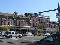 SR 2 in Bryan
 -
 SR 2 in Farmer
 -
 US 20A / SR 2 in Delta
 -
 US 20A / SR 2 along the North Star BlueScope Steel mill located southwest of Delta
 -
 US 127 / SR 2 / SR 15 in Bryan
 -
 Davis–Besse Nuclear Power Station viewed from Ohio State Route 2
 -
 Cleveland Memorial Shoreway in 2013
 -
 Cleveland Memorial Shoreway in 1973
 -
![Abandoned stretch of SR 2[citation needed] in Gordon Park](//upload.wikimedia.org/wikipedia/commons/thumb/2/2f/Oh2_-_Gordon_Park.jpg/250px-Oh2_-_Gordon_Park.jpg) Abandoned stretch of SR 2[citation needed] in Gordon Park
Abandoned stretch of SR 2[citation needed] in Gordon Park -
 Edgewater Park overpass in Cleveland
 -
 West Shoreway in 2022
 -
 East Shoreway from Huntington Bank Field


.JPG)


![Abandoned stretch of SR 2[citation needed] in Gordon Park](https://en.wikipedia.org/wiki/File:Oh2_-_Gordon_Park.jpg)


Major intersections
[edit]| County | Location | mi[1] | km | Old exit | New exit | Destinations | Notes |
|---|---|---|---|---|---|---|---|
| Defiance | Hicksville Township | 0.00 | 0.00 |  SR 37 south / Ohio Indiana State Line Road – Fort Wayne SR 37 south / Ohio Indiana State Line Road – Fort Wayne | Continuation into Indiana | ||
| Hicksville | 2.34 | 3.77 |  SR 49 south (Antwerp Drive) / Spencerville Street – Antwerp SR 49 south (Antwerp Drive) / Spencerville Street – Antwerp | Southern end of SR 49 concurrency | |||
| 2.65 | 4.26 |   SR 18 west (Main Street) SR 18 west (Main Street) | Southern end of SR 18 concurrency | ||||
| 3.06 | 4.92 |  SR 18 east (Defiance Avenue) SR 18 east (Defiance Avenue) | Northern end of SR 18 concurrency | ||||
| 3.71 | 5.97 |  SR 49 north – Edgerton SR 49 north – Edgerton | Northern end of SR 49 concurrency | ||||
| Farmer Township | 11.16 | 17.96 |  SR 249 west / Ridenour Road SR 249 west / Ridenour Road | Western end of SR 249 concurrency | |||
| 13.17 | 21.20 | SR 249 east / Farmer Mark Road – Ney | Eastern end of SR 249 concurrency | ||||
| Williams | Center Township | 16.54 | 26.62 |  SR 576 north SR 576 north | Southern terminus of SR 576 | ||
| 17.79 | 28.63 |   US 6 west / CR 12C – Edgerton US 6 west / CR 12C – Edgerton | Western end of US 6 concurrency | ||||
| Pulaski Township | 20.23 | 32.56 | US 6 east – Napoleon  US 127 south / SR 15 south – Sherwood US 127 south / SR 15 south – Sherwood | Eastern end of US 6 concurrency; southern end of US 127/SR 15 concurrency | |||
| Bryan | 22.50 | 36.21 | US 127 north / SR 15 north (North Main Street) SR 34 west (West High Street) SR 34 west (West High Street) | Northern end of US 127/SR 15 concurrency; western end of SR 34 concurrency | |||
| Springfield Township | 29.78 | 47.93 | SR 34 east – Napoleon SR 191 south SR 191 south | Eastern end of SR 34 concurrency; southern end of SR 191 concurrency | |||
| Stryker | 31.66 | 50.95 | SR 191 north (Lynn Street) | Northern end of SR 191 concurrency | |||
| Fulton | Archbold | 38.02 | 61.19 |  SR 66 south (Defiance Street) SR 66 south (Defiance Street) | Southern end of SR 66 concurrency | ||
| German Township | 39.52 | 63.60 | SR 66 north / Township Road E – Fayette | Northern end of SR 66 concurrency | |||
| Wauseon | 48.30 | 77.73 | SR 2D east (Fulton Street) | Western terminus of SR 2D; eastbound unsigned | |||
| 48.67 | 78.33 |  SR 108 south (North Shoop Avenue) / East Elm Street SR 108 south (North Shoop Avenue) / East Elm Street | Southern end of SR 108 concurrency | ||||
| 49.27 | 79.29 |  SR 2D west (East Linfoot Street) SR 2D west (East Linfoot Street) | Eastern terminus of SR 2D; signed as SR 2 westbound | ||||
| 50.27 | 80.90 |       US 20A west / SR 108 north to Ohio Turnpike / CR 14 – West Unity, Ottokee, Fulton County Airport US 20A west / SR 108 north to Ohio Turnpike / CR 14 – West Unity, Ottokee, Fulton County Airport | Northern end of SR 108 concurrency; western end of US 20A concurrency | ||||
| York Township | 55.30 | 89.00 |  SR 109 north to Ohio Turnpike – Adrian SR 109 north to Ohio Turnpike – Adrian | Western end of SR 109 concurrency | |||
| Delta | 57.06 | 91.83 | SR 109 south (Madison Street) | Eastern end of SR 109 concurrency | |||
| Swanton | 63.42 | 102.06 |   SR 64 north (South Main Street) / CR 1-1 SR 64 north (South Main Street) / CR 1-1 | Western end of SR 64 concurrency | |||
| Lucas | Swanton Township | 63.96 | 102.93 | SR 64 south (Waterville–Swanton Road) – Neapolis, Whitehouse | Eastern end of SR 64 concurrency | ||
| 65.71 | 105.75 |  US 20A east / SR 295 south (Wilkins Road) – Maumee, Whitehouse, Oak Openings Preserve Metropark US 20A east / SR 295 south (Wilkins Road) – Maumee, Whitehouse, Oak Openings Preserve Metropark | Eastern end of US 20A concurrency; western end of SR 295 concurrency | ||||
| 66.50 | 107.02 | SR 295 north (Berkey–Southern Road) – Berkey | Eastern end of SR 295 concurrency | ||||
| Monclova Township | 67.41 | 108.49 |   I-80 / I-90 / Ohio Turnpike / Toledo Express Airport Main Terminal – Toledo, Chicago I-80 / I-90 / Ohio Turnpike / Toledo Express Airport Main Terminal – Toledo, Chicago | Exit 52 on I-80/I-90/Ohio Tpk. | |||
| Springfield Township | 73.60– 73.93 | 118.45– 118.98 |    I-475 / US 23 to I-80 / I-90 – Maumee, Ann Arbor I-475 / US 23 to I-80 / I-90 – Maumee, Ann Arbor | Exit 8 on I-475/US 23 | |||
| Toledo | 75.37 | 121.30 | US 20 (Reynolds Road) | ||||
| 79.21 | 127.48 |  US 24 (Detroit Avenue / Fearing Boulevard) US 24 (Detroit Avenue / Fearing Boulevard) | Former US 25 | ||||
| 80.76 | 129.97 |   SR 25 (Anthony Wayne Trail) to I-75 SR 25 (Anthony Wayne Trail) to I-75 | Former US 24 | ||||
| 82.08 | 132.09 |   SR 51 north / SR 65 north (Clayton Street) / Broadway Street SR 51 north / SR 65 north (Clayton Street) / Broadway Street | Western end of SR 51/SR 65 concurrency | ||||
| 82.08– 82.78 | 132.09– 133.22 | Anthony Wayne Bridge over Maumee River | |||||
| 82.88 | 133.38 | SR 65 south (Oak Street) | Eastern end of SR 65 concurrency | ||||
| 83.33 | 134.11 | SR 51 south (Woodville Road) / Navarre Avenue | Eastern end of SR 51 concurrency | ||||
| Oregon | 84.69– 84.76 | 136.30– 136.41 |    I-280 / LECT north / Dearborn Avenue / Munding Drive I-280 / LECT north / Dearborn Avenue / Munding Drive | Western end of LECT concurrency; exit 7 on I-280 | |||
| Ottawa | Benton Township | 99.12 | 159.52 |  SR 579 west (Williston Road) – Williston SR 579 west (Williston Road) – Williston | Eastern terminus of SR 579 | ||
| 100.88 | 162.35 |  SR 590 south – Rocky Ridge SR 590 south – Rocky Ridge | Northern terminus of SR 590 | ||||
| Carroll Township | 104.84 | 168.72 |  SR 19 south – Oak Harbor SR 19 south – Oak Harbor | Northern terminus of SR 19 | |||
| Erie Township | 111.05 | 178.72 |  SR 358 south / Camp Perry SR 358 south / Camp Perry | Northern terminus of SR 358 | |||
| 114.23 | 183.84 | Rest Area (at grade intersection) | |||||
| 114.82 | 184.78 | Western end of freeway section | |||||
| 115.66 | 186.14 | 115 |  SR 163 – Oak Harbor, Genoa SR 163 – Oak Harbor, Genoa | Eastbound entrance and westbound exit | |||
| Bay Township | 117.07– 117.59 | 188.41– 189.24 | 117 |  SR 53 south (West Fremont Road) to I-80 / I-90 – Fremont SR 53 south (West Fremont Road) to I-80 / I-90 – Fremont | Western end of SR 53 concurrency | ||
| Portage Township | 120.96– 121.62 | 194.67– 195.73 | 121 | SR 163 – Port Clinton, Catawba Island | Double trumpet interchange; signed as 121A (west) and 121B (east); via unsigned SR 2C | ||
| 123.38– 123.90 | 198.56– 199.40 | 124 | SR 53 north – Catawba Island | Eastern end of SR 53 concurrency | |||
| Danbury Township | 124.25– 124.88 | 199.96– 200.97 | 125A |  SR 269 north – Lakeside, Marblehead SR 269 north – Lakeside, Marblehead | Northern end of SR 269 concurrency | ||
| 125B | Bay Shore Road | Access to Bay Shore Road from SR 269 | |||||
| Sandusky Bay | 126.05– 126.51 | 202.86– 203.60 | Thomas A. Edison Memorial Bridge | ||||
| Erie | Margaretta Township | 127.82– 128.52 | 205.71– 206.83 | 128 | SR 269 south / Martins Point Road – Castalia, Bay View | Southern end of SR 269 concurrency | |
| Sandusky | 130.29– 130.99 | 209.68– 210.81 | 131 |  US 6 / LECT east – Sandusky, Fremont US 6 / LECT east – Sandusky, Fremont | Eastern terminus of LECT concurrency | ||
| Margaretta Township | 132.18– 132.91 | 212.72– 213.90 | 133 |  SR 101 – Castalia, Sandusky SR 101 – Castalia, Sandusky | Eastern terminus of SR 101 | ||
| Perkins Township | 134.07– 134.85 | 215.76– 217.02 | 134 |  SR 4 to Ohio Turnpike – Bucyrus, Sandusky SR 4 to Ohio Turnpike – Bucyrus, Sandusky | |||
| 137.87– 138.72 | 221.88– 223.25 | 138 |  US 250 – Norwalk, Sandusky US 250 – Norwalk, Sandusky | ||||
| Huron | 141.41– 142.12 | 227.58– 228.72 | 142 |  US 6 / LECT west (Rye Beach Road) US 6 / LECT west (Rye Beach Road) | Western end of US 6 concurrency | ||
| 142.28– 142.34 | 228.98– 229.07 | 143 | US 6 / LECT east – Huron | Eastern end of US 6 concurrency; eastbound exit and westbound entrance | |||
| Huron Township | 144.37– 144.97 | 232.34– 233.31 | 145 |  SR 13 – Huron, Norwalk SR 13 – Huron, Norwalk | |||
| Berlin Township | 146.72– 147.53 | 236.12– 237.43 | 147 | Berlin Road | |||
| 148.16– 148.90 | 238.44– 239.63 | 148 |  SR 61 – Berlin Heights SR 61 – Berlin Heights | ||||
| Vermilion Township | 155.52– 156.21 | 250.29– 251.40 | 156 |  SR 60 – Wakeman, Vermillion SR 60 – Wakeman, Vermillion | |||
| Lorain | Brownhelm Township | 157.17– 157.69 | 252.94– 253.78 | Lorain Service Plaza / Rest Area | |||
| Vermillion | 158.24– 158.55 | 254.66– 255.16 | 158 | Vermilion Road / Sunnyside Road | Exit numbered only on eastbound side | ||
| 160.05– 160.40 | 257.58– 258.14 | 160 | To Ohio Turnpike Baumhart Road | Exit numbered only on westbound side | |||
| Amherst | 162.54– 162.93 | 261.58– 262.21 | 163 | North Lake Street / Oak Point Road | |||
| 164.11– 164.52 | 264.11– 264.77 | 164 |  SR 58 – Amherst, Lorain SR 58 – Amherst, Lorain | ||||
| Lorain | 166.37– 166.75 | 267.75– 268.36 | 10[33] | 166 | Middle Ridge Road / Broadway | ||
| Elyria Township | 168.02 | 270.40 | — |   I-90 west (Ohio Turnpike Connector) to I-80 / Ohio Turnpike west – Toledo I-90 west (Ohio Turnpike Connector) to I-80 / Ohio Turnpike west – Toledo | Western end of I-90 concurrency; westbound exit and eastbound entrance; I-90 exit 144 | ||
| Elyria | 169.03– 169.61 | 272.03– 272.96 | 145 |  SR 57 to I-80 / Ohio Turnpike – Elyria, Lorain SR 57 to I-80 / Ohio Turnpike – Elyria, Lorain | Exit numbers follow I-90 east of the turnpike | ||
| Sheffield | 171.49– 171.89 | 275.99– 276.63 | 148 |  SR 254 – Sheffield, Avon SR 254 – Sheffield, Avon | |||
| Avon | 174.71– 175.10 | 281.17– 281.80 | 151 |  SR 611 – Avon, Sheffield SR 611 – Avon, Sheffield | |||
| 176.41– 176.75 | 283.90– 284.45 | 153 |  SR 83 – Avon, Avon Lake SR 83 – Avon, Avon Lake | ||||
| 179.09– 179.56 | 288.22– 288.97 | 155 | Nagel Road – Avon Lake, North Ridgeville, Avon | ||||
| Cuyahoga | Westlake | 180.02– 180.64 | 289.71– 290.71 | 156 | Crocker Road / Bassett Road – Bay Village, Westlake, North Olmsted | ||
| 182.68– 183.28 | 293.99– 294.96 | 159 |  SR 252 (Columbia Road) SR 252 (Columbia Road) | ||||
| 183.92– 184.23 | 295.99– 296.49 | 160 | Clague Road | Westbound exit, eastbound entrance | |||
| Rocky River | 185.16– 185.43 | 297.99– 298.42 |  I-90 east (Northwest Freeway) / SR 254 west (Detroit Road) – Cleveland I-90 east (Northwest Freeway) / SR 254 west (Detroit Road) – Cleveland | Eastern end of I-90 concurrency; western end of SR 254 concurrency; no access to I-90 eastbound from SR 2 westbound; I-90 exit 161 | |||
| Eastern end of freeway section | |||||||
| 186.50 | 300.14 | SR 254 east (Detroit Road) | Eastern end of SR 254 concurrency; SR 254 continues along SR 2 unsigned while SR 254-D (signed as SR 254) continues along Detroit Road | ||||
| 186.82 | 300.66 | — | US 6 west (Lake Road) / LECT | Interchange; western end of US 6 and LECT concurrency; westbound left exit and eastbound left entrance | |||
| Lakewood | 187.68 | 302.04 |   US 20 west / SR 113 west / SR 237 south (West Clifton Boulevard) / SR 254 ends US 20 west / SR 113 west / SR 237 south (West Clifton Boulevard) / SR 254 ends | Western end of US 20 concurrency; eastern terminus of SR 113; northern terminus of SR 237; unsigned eastern terminus of SR 254 | |||
| Cleveland | 191.83– 191.98 | 308.72– 308.96 | 191 | — | Lake Avenue / West Boulevard | Westbound exit and eastbound entrance; exit numbered during mid 2010s | |
| 192.36– 192.69 | 309.57– 310.10 | 192 | — | West 73rd Street | Access to West 73rd Street opened December 12, 2015;[34] exit formerly known as Edgewater Park, Whiskey Island; exit numbered during mid 2010s | ||
| 193.30– 193.38 | 311.09– 311.21 | 193A | — | West 45th Street | Eastbound exit and entrance; exit numbered during mid 2010s | ||
| 193.28– 193.40 | 311.05– 311.25 | 193 | West 49th Street | Westbound exit and entrance; exit numbered only on westbound side | |||
| 193.73 | 311.78 | Western end of freeway | |||||
| 193B |    US 6 east / US 20 east to US 6 Alt. / US 42 / SR 3 US 6 east / US 20 east to US 6 Alt. / US 42 / SR 3(West 25th Street) | Eastern end of US 6/US 20 concurrency; eastbound exit and westbound entrance; eastbound entrance in planning stages[35] | |||||
| 194.01 | 312.23 | 194 | West 28th Street – Flats West | Westbound exit and eastbound entrance; entrance to be closed to reroute entrance traffic via 45th.[35] | |||
| 194.19– 194.65 | 312.52– 313.26 | Main Avenue Bridge over the Cuyahoga River | |||||
| 194.65 | 313.26 | 194 | Lakeside Avenue / West 6th Street | Eastbound exit and westbound entrance | |||
| 195.14– 195.18 | 314.05– 314.11 | 195B | West 3rd Street | Westbound exit and eastbound entrance | |||
| 195.17– 195.51 | 314.10– 314.64 | 195A | East 9th Street – Rock and Roll Hall of Fame | ||||
| 195.51 | 314.64 | City of Cleveland Parking | Eastbound entrance; former exit removed after 1979[36] | ||||
| 195.65– 195.79 | 314.87– 315.09 | 195B | City of Cleveland Parking | Eastbound exit and entrance, first exit | |||
| 196.05– 196.08 | 315.51– 315.56 | 195A | City of Cleveland Parking – Amtrak Station | Eastbound exit and entrance, second exit; erroneous exit number (196A) | |||
| 196.24 | 315.82 | 196B |    I-90 west to I-71 / I-77 south – Toledo, Columbus I-90 west to I-71 / I-77 south – Toledo, Columbus | Eastbound exit | |||
| 196.23– 196.34 | 315.80– 315.98 | 196 | South Marginal Road | Westbound exit and entrance | |||
| 196.61– 196.86 | 316.41– 316.82 | — | I-90 west to I-71 / I-77 south – Toledo, Columbus | Western end of I-90 westbound concurrency; westbound exit and entrance from I-90 via exit 174B; eastbound entrance via eastbound I-90 from the Innerbelt | |||
| 196.78 | 316.69 | 196C | South Marginal Road | Eastbound exit | |||
| 196.86 | 316.82 | Western end of eastbound concurrency with I-90 | |||||
| 197.78– 198.36 | 318.30– 319.23 | 175 | East 55th Street / Marginal Roads | Exit numbers west of Dead Man's Curve follow I-90 | |||
| 198.76– 199.13 | 319.87– 320.47 | 176 |  SR 283 west (East 72nd Street) SR 283 west (East 72nd Street) | Western end of SR 283 concurrency | |||
| 199.16– 199.51 | 320.52– 321.08 | 177 | Martin Luther King Jr. Boulevard / University Circle | ||||
| Bratenahl | 200.76– 201.20 | 323.09– 323.80 | 178 | Eddy Road – Bratenahl | |||
| 201.97 | 325.04 | 179 | SR 283 east / LECT (Lakeshore Boulevard) | Eastern end of SR 283 and LECT concurrencies; eastbound exit and westbound entrance | |||
| Cleveland | 202.20– 202.82 | 325.41– 326.41 | 180 | East 140th Street / East 152nd Street | Signed as exits 180A (East 140th Street) and 180B (East 152nd Street) eastbound | ||
| 203.08– 203.21 | 326.83– 327.03 | 181 | East 156th Street | Westbound entrance and exit | |||
| 204.22– 204.95 | 328.66– 329.84 | 182A | East 185th Street | ||||
| 204.64– 205.75 | 329.34– 331.12 | 182B | East 200th Street | ||||
| Euclid | 205.14– 206.41 | 330.14– 332.18 | 183 | East 222nd Street | |||
| 206.80– 207.16 | 332.81– 333.39 | 184 |  SR 175 (East 260th Street) / Babbitt Road SR 175 (East 260th Street) / Babbitt Road | Signed as exits 184A (Babbitt Rd.) and 184B (E. 260th) eastbound | |||
| 207.58– 208.16 | 334.07– 335.00 | 207 |  I-90 east to I-271 south – Erie Pa. I-90 east to I-271 south – Erie Pa. | Left exit westbound; exit numbers follow SR 2 in Lake County; eastern end of I-90 concurrency; exit 185 on I-90 westbound | |||
| Lake | Wickliffe | 208.70– 209.01 | 335.87– 336.37 | 208 | Lloyd Road (SR 633) – Wickliffe | Access via Lakeland Boulevard | |
| Willowick–Wickliffe municipal line | 209.83– 210.38 | 337.69– 338.57 | 210 | East 305th Street – Willowick | |||
| Eastlake | 211.30– 211.64 | 340.05– 340.60 | 211 |  SR 91 – Eastlake SR 91 – Eastlake | |||
| Willoughby | 212.35– 212.48 | 341.74– 341.95 | 212 |  SR 640 (Vine Street) – Willoughby SR 640 (Vine Street) – Willoughby | |||
| 213.32– 214.02 | 343.31– 344.43 | 213 | Lost Nation Road | ||||
| Mentor | 214.94– 215.56 | 345.91– 346.91 | 215 |  SR 306 to US 20 – Kirtland, Mentor-on-the-Lake SR 306 to US 20 – Kirtland, Mentor-on-the-Lake | |||
| 217.68– 217.96 | 350.32– 350.77 | 217 |  SR 615 – Mentor SR 615 – Mentor | ||||
| 220.67– 221.09 | 355.13– 355.81 | 220 |  SR 44 north (Heisley Road) – Grand River SR 44 north (Heisley Road) – Grand River | Western end of SR 44 concurrency | |||
| Painesville Township | 221.55– 222.07 | 356.55– 357.39 | 221 | SR 44 south to I-90 – Chardon | Eastern end of SR 44 concurrency | ||
| Painesville | 223.20– 223.33 | 359.21– 359.41 | 223 |  SR 283 / LECT to SR 535 – Painesville, Fairport Harbor SR 283 / LECT to SR 535 – Painesville, Fairport Harbor | |||
| Painesville Township | 225.69– 225.78 | 363.21– 363.36 | 225 | SR 535 (Fairport Nursery Road) | Eastbound exit and westbound entrance | ||
| 227.13 | 365.53 | 227 | US 20 / LECT east – Ashtabula | ||||
1.000 mi = 1.609 km; 1.000 km = 0.621 mi
| |||||||
Auxiliary routes
[edit]SR 2 Temporary
[edit] .svg) State Route 2 Temporary | |
|---|---|
| Location | Cleveland |
| Existed | 1941–1958 |
State Route 2 temporary was a designation that ran from West 6th to East 9th along Lakeside Avenue in downtown Cleveland. The designation was added when the final alignments of SR 2 were moved to the then new Lakeside Highway, later referred to as the Cleveland Memorial Shoreway. The route's eastern terminus was moved to Public Square via Ontario St. in 1957.
SR 2C
[edit]State Route 2C | |
|---|---|
| Location | Port Clinton |
| Length | 0.798 mi[1] (1,284 m) |
| Existed | 1967–present |
State Route 2C is an unsigned connecting road that runs from State Route 163 to State Route 2 and State Route 53 near Port Clinton in Ottawa County, Ohio. State Route 2C was constructed as an access road for the SR 2–SR 163 interchange.[37]
References
[edit]- ^ a b c "Data Download - ODOT TIMS (Road Inventory shapefile)". Ohio Department of Transportation. Retrieved April 14, 2019.
- ^ Ohio State Highway Department (1912). Map of Ohio Showing Inter-County Highways (PDF) (Map). c. 1:563,200. Columbus: Ohio State Highway Department. OCLC 13716556.
- ^ Ohio Department of Highways and Public Works (September 1921). Highway Map of Ohio Showing Conditions for Travel (PDF) (Map). c. 1:563,200. Columbus: Ohio Department of Highways and Public Works.
- ^ Ohio Department of Highways and Public Works (April 1922). Map of Ohio State Highways Showing All Improved Roadways and Indicating System Constructed Under Administration of Gov. Harry L. Davis (PDF) (Map). c. 1:563,200. Columbus: Ohio Department of Highways and Public Works.
- ^ Ohio Department of Transportation. "Technical Services Straight Line Diagrams: SR 2D, Fulton County" (PDF). Retrieved October 12, 2013.
- ^ "Lake Erie Ohio Coastal Trail".[full citation needed]
- ^ "National Scenic Byway". Archived from the original on June 21, 2010. Retrieved March 16, 2010.[full citation needed]
- ^ "Great Lakes Circle". Archived from the original on July 25, 2010.[full citation needed]
- ^ Merrell, Amanda (July 1, 2025). "New developments in quest to 'let there be light' along State Route 2 in Lake County". WEWS-TV. Retrieved July 4, 2025.
A statement from ODOT spokesperson Brent Kovak reads: 'Anytime a State Route goes through a City, the City is responsible to maintain that route. Cities along SR 2 have an agreement with the Lake County Engineers to perform this work.'
- ^ a b "Memorial Shoreway". The Encyclopedia of Cleveland History. Case Western Reserve University.
- ^ "Connecting Cleveland: The Waterfront District Plan". City of Cleveland City Planning Commission. Retrieved June 28, 2011.
- ^ "Cleveland Urban Core Projects: Lakefront West". Ohio Department of Transportation. Retrieved September 6, 2014.
- ^ Grant, Alison (September 24, 2013). "West Shoreway Conversion to Boulevard with Lake Erie Access Gets Funding, Is Set to Begin in the Spring". The Plain Dealer. Retrieved September 25, 2013.
- ^ a b Litt, Steven (August 23, 2017). "West Shoreway $100M re-do brings benefits, but falls short of original vision". The Plain Dealer. Retrieved August 25, 2017.
- ^ "Lakefront West: Speed Limit Change & Herman Ave Bridge to Reopen to 2-Way Traffic" (Press release). Ohio Department of Transportation District 12. September 29, 2015. Retrieved October 5, 2015.
- ^ Grant, Alison (June 6, 2015). "West Shoreway Speed Limit Drops to 35 mph in the Fall as Boulevard Conversion Begins". The Plain Dealer. Retrieved June 7, 2015.
- ^ Bullard, Stan (February 3, 2019). "Prime West Shoreway Property is in Play". Crain's Cleveland Business. Retrieved June 7, 2020.
- ^ "State Route 2 Modernization & Lane Addition, Lake County". Ohio Department of Transportation District 12.
- ^ a b Improving State Route 2 Project Plan Archived July 21, 2011, at the Wayback Machine (Lake County Engineer's Web Site)
- ^ Purpose and Need Statement to Improve State Route 2 (Lake County Engineer's Web Site) from ARCADIS FPS via Archive.org
- ^ Regional Association of Cleveland (February 29, 1944). An Express Highway Plan for the Cleveland Metropolitan Area (Map). Reproduced in: Rose, William Ganson (1990) [Previously published in 1950]. Cleveland: The Making of a City. Kent, Ohio: Kent State University Press. p. 1019. ISBN 0873384288.
- ^ Example: John, Andrew (June 27, 2011). "Wind Turbine Starts Up in Euclid above Lincoln Electric Co". The Plain Dealer. Retrieved June 28, 2011.
The sprawling blades on Ohio's largest wind turbine started turning 278 feet above the headquarters of Lincoln Electric this weekend in Euclid...located a few hundred yards from the Shoreway....
- ^ Ohio Rev. Code §5533.66
- ^ Higgins, Norma (July 23, 2000). "New challenge for Sandusky's Miss America". The Morning Journal. Retrieved June 19, 2026.
- ^ Ohio Rev. Code §5534.53
- ^ Ohio Rev. Code §5533.632
- ^ "Willoughby Family Mourns Loss of Marine Son". Cleveland: WEWS-TV. August 3, 2005. Archived from the original on November 5, 2005. Retrieved November 11, 2015.
- ^ "Pages: Official Transportation Maps". Ohio Department of Transportation.
- ^ a b c d e f g h Simpson, John. "Route 2". The Unofficial Ohio State Highways Web Site. Archived from the original on February 5, 2005.[self-published source]
- ^ Thoma, Pauline (August 31, 1990). "Celeste opens Huron Bypass". The Plain Dealer. Cleveland. Retrieved October 7, 2012.
- ^ Exner, Rich (July 6, 2025). "Lakefront plus, or traffic headache? – What to make of Cleveland's Shoreway to boulevard conversion?". The Plain Dealer. Retrieved July 7, 2025.
- ^ O'Connor, Clint (March 28, 2014). "Cleveland Is All Over 'Captain America: The Winter Soldier'". The Plain Dealer. Cleveland. Retrieved August 28, 2016.
- ^ "State Rte 2, Lorain, Ohio". Google Street View. September 2007.
- ^ District 12 (December 12, 2015). "West 73rd St Extension Opens link to Lake Erie on Cleveland's West Side" (Press release). Ohio Department of Transportation. Retrieved December 16, 2015.
- ^ a b "Pages - West Shoreway & W 28th/W 45th Streets". Archived from the original on January 15, 2015.
- ^ "Cleveland Historical Maps (1979)". peoplemaps.esri. Archived from the original on March 16, 2016. Retrieved March 18, 2016.
- ^ Ohio Department of Transportation Technical Services Straight Line Diagram for SR 2C Archived October 14, 2013, at the Wayback Machine
External links
[edit] Media related to Ohio State Route 2 at Wikimedia Commons

Ohio State Route 2
View on GrokipediaSR 2 begins in rural northwest Ohio, passing through agricultural areas and small communities in Defiance, Williams, and Fulton counties before reaching the Toledo metropolitan area in Lucas County.[1] In Toledo, it crosses the Maumee River via the Anthony Wayne Bridge and intersects major routes such as Interstate 75 (I-75) and US 24.[1] East of Toledo, the highway enters Wood and Ottawa counties, running along the Lake Erie shoreline through Port Clinton and providing access to the Lake Erie Islands via ferries.[1] It continues through Erie County, serving Sandusky—a hub for amusement parks and coastal tourism—and intersects US 6 and the Ohio Turnpike (I-80/I-90).[1] In Lorain County, SR 2 passes through Lorain and Elyria, where it briefly joins I-90.[1] The route then enters Cuyahoga County, forming the Cleveland Memorial Shoreway as a limited-access freeway concurrent with I-90 through downtown Cleveland, crossing the Cuyahoga River and connecting to I-71, I-77, and I-490.[1] Beyond Cleveland, SR 2 separates from I-90 and proceeds through suburban areas in Lake County, intersecting SR 91 and SR 306 before terminating at US 20 near Painesville.[1] Throughout its length, the highway facilitates freight transport, commuter traffic, and tourism along the Lake Erie coast, with segments designated as part of the Lake Erie Coastal Ohio Trail National Scenic Byway.[2] History
Established in 1923 as part of Ohio's initial state highway numbering system, SR 2 largely followed the alignment of the pre-existing Inter-County Highway 2, an early 20th-century road connecting northwest Ohio communities.[1] Over the decades, the route has undergone significant upgrades, including the construction of the Cleveland Memorial Shoreway in the 1940s and 1950s to bypass urban congestion, and realignments in the Toledo and Sandusky areas to improve safety and capacity.[1] Modern improvements continue, such as bridge rehabilitations and interchange expansions, to handle growing traffic volumes near industrial and recreational zones.[3]
Route description
Western segment
The western segment of Ohio State Route 2 begins at the Indiana state line west of Hicksville in Defiance County, where it continues westward as Indiana State Road 37.[1] This portion of SR 2 spans approximately 100 miles (160 km) through Defiance, Williams, Fulton, Lucas, and Ottawa counties, primarily as a two-lane rural highway that parallels Lake Erie while traversing agricultural farmlands, small communities, and suburban areas near Toledo.[4] The route features occasional four-lane divided sections, particularly in more populated areas, and includes bridges over major waterways such as the Tiffin River in Williams County and the Maumee River near Defiance.[4] Entering Ohio near Hicksville in Defiance County, SR 2 proceeds eastward, crossing into Williams County and passing the town of Bryan before entering Fulton County near Wauseon.[1] In Defiance, the highway serves the city of the same name, intersecting U.S. Route 24 (US 24) and U.S. Route 6 (US 6) while bridging the Maumee River.[4] Continuing east through Fulton County, SR 2 remains a predominantly two-lane road through flat, farm-dominated terrain, with limited development until it reaches Lucas County and the Toledo metropolitan area, including communities like Oregon. Average daily traffic volumes range from 5,000 to 15,000 vehicles, reflecting its role in regional commuting and freight movement.[5] After the Toledo area in Lucas County, SR 2 enters Ottawa County, following closer to Lake Erie's southern shore through communities like Oak Harbor and Port Clinton.[1] Key intersections include SR 53 in Port Clinton, providing access to inland areas, and SR 269 north of Port Clinton, which connects to ferry services for the Lake Erie islands such as South Bass Island.[4] This coastal stretch supports tourism, including brief access to attractions like Cedar Point amusement park in nearby Sandusky via connecting routes. The segment from Port Clinton eastward is designated as part of the Lake Erie Circle Tour, a scenic route highlighting the lake's shoreline and promoting regional heritage and natural features.[6]Central segment
The central segment of Ohio State Route 2 spans approximately 60 miles from Sandusky eastward through Erie and Lorain counties, passing communities including Huron, Vermilion, Lorain, and Avon before reaching the western outskirts of Cleveland.[1] This portion transitions from a coastal highway to a partial freeway standard, providing efficient access along Lake Erie's southern shore while serving as a key corridor for tourism and regional travel.[7] The route begins in Sandusky as a four-lane divided highway and upgrades to full freeway conditions near the city, featuring limited-access interchanges that facilitate movement toward inland destinations.[7] Key interchanges along this segment include the connection to State Route 4 southwest of Sandusky, which links to the Ohio Turnpike (Interstate 80/Interstate 90) at Exit 110, and U.S. Route 250 north of Sandusky at Turnpike Exit 118, supporting freight and commuter flows from the lakeshore to central Ohio.[7] Further east, SR 2 intersects the Turnpike at Exit 142 near Lorain before concurring briefly with I-90.[7] This freeway alignment bypasses the more congested U.S. Route 6 to the south, offering a straighter path for through traffic while maintaining proximity to Lake Erie.[8] The route parallels the shoreline, granting direct access to recreational areas such as beaches in Huron and Vermilion, fishing spots along the coast, and East Harbor State Park via connecting roads like SR 163.[9] Designated as a segment of the Lake Erie Coastal Ohio Trail, a National Scenic Byway, this stretch highlights scenic views of the lake and supports activities like boating and birdwatching.[10] Traffic volumes on this central segment reflect its role as a vital lakeshore artery, with annual average daily traffic (AADT) ranging from about 25,700 vehicles near Vermilion in Erie County to 20,000–40,000 vehicles approaching Lorain (as of circa 2018), driven by seasonal tourism and industrial access.[5] The highway passes through the Firelands region, underscoring its path through areas settled in the early 19th century as compensation for Revolutionary War losses. As it nears Avon, SR 2 shifts toward suburban development, setting the stage for denser urban connections eastward.[1]Eastern segment
The eastern segment of Ohio State Route 2 (SR 2) traverses approximately 67 miles through urban and suburban areas of Cuyahoga and Lake counties, beginning in Cleveland and extending to its eastern terminus at U.S. Route 20 (US 20) in Painesville Township. This portion primarily consists of limited-access freeways that integrate with the Interstate Highway System, serving as a vital corridor for local commuters, industrial access, and suburban travel while paralleling the southern shore of Lake Erie. The route passes through key communities including Cleveland, Euclid, Willowick, Wickliffe, Willoughby, and Mentor, providing connections to residential neighborhoods, commercial districts, and recreational sites such as Edgewater Park near the western start of the segment.[11] In Cleveland, SR 2 follows the Cleveland Memorial Shoreway, a historic limited-access freeway extending from its interchange with Interstate 90 (I-90) near the city's western boundary eastward to downtown via the Main Avenue Bridge over the Cuyahoga River. Constructed in phases between 1936 and 1953 using Works Progress Administration labor, the Shoreway originated as a lakeside road from East 9th Street to East 55th Street and was expanded to connect the city's east and west sides, marking Greater Cleveland's first east-west freeway. The segment was extensively reconstructed from 2014 to 2018, enhancing safety and urban integration; the western portion from the Cuyahoga River to the I-90 interchange was renamed Edgewater Parkway, and the posted speed limit was reduced to 35 mph to accommodate denser city traffic and multimodal use. Annual average daily traffic (AADT) on this urban freeway exceeds 127,000 vehicles between Coit Road and East 152nd Street (as of 2010s), reflecting its role as a high-volume artery for commuters avoiding the Ohio Turnpike.[12][13][14] East of downtown Cleveland, SR 2 transitions into the Lakeland Freeway at the East 55th Street interchange, continuing as a six- to eight-lane divided highway through the suburb of Euclid, where I-90 diverges northward. The freeway maintains its lakeshore alignment, offering views of Lake Erie while serving industrial zones along the waterfront and providing access to residential suburbs via interchanges such as those at Bratenahl Road and Lakeshore Boulevard. Further east, in Lake County, SR 2 intersects Interstate 271 (I-271) near Willoughby Hills, facilitating regional connectivity before narrowing to four lanes approaching its end. The Lakeland Freeway underwent major reconstruction from 2006 to 2012, including lane additions and pavement rehabilitation west of SR 306 to improve capacity and safety amid growing suburban demand. Beyond the freeway's eastern limit near Painesville, SR 2 briefly follows surface streets like Lakeshore Boulevard before terminating at US 20, supporting local traffic as an alternative to the tolled Ohio Turnpike for east-west travel along the lakeshore without significant environmental disruption from direct coastal encroachment.[15][16]History
Establishment and early alignments
Ohio State Route 2 originated as part of the broader push for improved roadways during the Good Roads Movement, which sought to modernize rural and interurban connections in response to increasing automobile traffic in the early 20th century. The foundational legislation came with the McGuire Bill, passed by the Ohio General Assembly on May 31, 1911 (effective June 9, 1911), establishing the Inter-County Highway System to link county seats and facilitate commerce across the state.[17] This system placed selected roads under state jurisdiction for maintenance and improvement, marking a shift from local to statewide responsibility for key arteries.[2] Inter-County Highway 2 was designated in 1912 as one of the system's primary routes, spanning approximately 100 miles along the Lake Erie shoreline as a two-lane gravel and early paved road from Cleveland eastward to the Pennsylvania state line near Conneaut.[18] It served as an essential alternative to emerging north-south connectors, supporting local travel and early tourism along the lakeshore while connecting industrial centers like Cleveland with rural communities. The route's alignment closely paralleled Lake Erie, emphasizing scenic and economic ties to the Great Lakes region. In 1921, as part of preliminary state highway reorganization, it was temporarily redesignated State Highway 2.[2] The modern numbering system for Ohio's state highways was adopted in 1923, officially redesignating State Highway 2 as SR 2 and extending its reach westward along alignments that would later align with U.S. Route 6, from the Indiana state line through Toledo and Sandusky to Cleveland, bringing the total length to about 200 miles.[2] This expansion reflected ongoing efforts to integrate the route into a cohesive statewide network, enhancing connectivity for freight and passenger movement. By the mid-1920s, following the 1926 establishment of the U.S. Highway system, the eastern terminus was truncated to an intersection with US 20 in Painesville Township, Lake County, as US 20 assumed the alignment eastward to Pennsylvania.[8] These adjustments solidified SR 2's role as a vital east-west corridor across northern Ohio. During the 1930s, improvements to SR 2 focused on boosting tourism along the Lake Erie coast, including paving upgrades and signage to attract visitors to resorts in Sandusky and Cleveland's lakefront.[19] The decade also saw the initiation of the Cleveland Memorial Shoreway in 1936, constructed under the Works Progress Administration as the first limited-access segment of the route to support the Great Lakes Exposition and alleviate urban congestion.[20] World War II in the 1940s brought challenges to maintenance, with material shortages for rubber, petroleum, and construction supplies leading to restricted speeds (limited to 35 mph statewide) and deferred repairs amid wartime priorities for industrial transport.[21] These early developments positioned SR 2 as a foundational lakeside artery before later freeway transformations.Freeway expansions
The transformation of Ohio State Route 2 into freeway segments accelerated in the 1960s, driven by the need to improve connectivity along the Lake Erie lakeshore and integrate with the developing interstate system under the influences of the Federal-Aid Highway Act of 1956.[12] In the central segment near Sandusky, construction of the SR 2 bypass began in the early 1960s to alleviate congestion in the urban area, with the section from the US 250 interchange to SR 101 completed and opened by September 1963, featuring grade-separated interchanges for enhanced safety and flow.[22] This upgrade marked an early step in converting the two-lane rural highway into a limited-access freeway, connecting to the Ohio Turnpike (I-80/I-90) and facilitating faster travel between Toledo and Cleveland. Further expansions in the 1960s focused on the eastern segment, where the Lakeland Freeway—designated as SR 2—was constructed as a key lakeshore corridor. The initial phase opened to traffic on November 2, 1962, extending the Memorial Shoreway eastward from East 152nd Street to East 260th Street in Cleveland, providing a six-lane divided highway with interchanges to support suburban growth and regional commerce.[23] By 1963, additional construction linked the Memorial Shoreway directly to the Lakeland Freeway, extending it toward Painesville and incorporating it into the I-90 alignment for seamless interstate connectivity.[12] These developments, funded partly through federal interstate programs, added approximately 10 miles of new freeway in the immediate Cleveland area, emphasizing engineering innovations like elevated structures to navigate the shoreline terrain.[12] In the 1970s and 1980s, eastern expansions continued to refine the Lakeland Freeway's integration with I-90, with upgrades including additional interchanges and pavement reinforcements to handle rising traffic volumes along the lakeshore. The Shoreway portion of SR 2, originally built in the 1930s and 1940s, underwent enhancements for higher design speeds, such as barrier additions and lane widenings, to align with modern freeway standards while maintaining its role in the interstate network.[12] By the late 1980s, these improvements had solidified about 50 miles of SR 2 as freeway, from near Vermilion eastward to Painesville, boosting average daily traffic from under 15,000 vehicles in the early 1960s to over 40,000 by the 1990s in key segments and enhancing economic ties between Cleveland and its suburbs.[12]Modern reconstructions
In the early 2000s, the Ohio Department of Transportation (ODOT) initiated major upgrades to State Route 2 (SR 2) to address growing traffic demands and safety concerns stemming from 1990s freeway expansions. These modern reconstructions focused on enhancing capacity, incorporating advanced technologies, and mitigating environmental impacts along the route's alignment near Lake Erie.[24] A significant project occurred from 2006 to 2012 on the Lakeland Freeway segment of SR 2 in Lake County, east of Cleveland, where ODOT rebuilt and widened the roadway west of the SR 44 interchange. This effort extended one lane in each direction between SR 84 and SR 44 to improve traffic flow and reduce congestion identified in 2010s studies, which highlighted bottlenecks in the eastern corridor with average annual daily traffic (AADT) volumes exceeding 80,000 vehicles in high-density freeway sections. The reconstruction, costing approximately $200 million, included pavement rehabilitation and structural enhancements to support increased loads.[25][26] Further west, in the 2020s, ODOT undertook bridge replacements in Lorain County as part of ongoing maintenance to SR 2's aging infrastructure. These projects targeted structures over rail lines and local roads, such as the SR 2 overpass near the I-90 split, replacing deteriorated components to ensure structural integrity amid rising AADT and weather-related wear near Lake Erie. Environmental mitigations during these works incorporated measures to control stormwater runoff into the lake, aligning with broader state efforts to reduce nutrient pollution through sediment barriers and erosion controls.[27][28] In 2024, ODOT completed pavement resurfacing on SR 2 in Lorain County from west of the SR 58 interchange to the Murray Ridge Road bridge, a $10-15 million project involving milling, overlaying with new asphalt, and shoulder repairs to extend service life and improve ride quality on the four-lane divided highway.[3] In the central urban area, the Shoreway portion of SR 2 underwent a comprehensive reconstruction from 2014 to 2018, transforming the three-mile West Shoreway from the Cuyahoga River to near Edgewater Park. Key features included new bridge decks on overpasses, upgraded lighting for better nighttime visibility, and full pavement replacement to address deterioration from heavy urban traffic. In 2016, this section was renamed Edgewater Parkway to reflect its enhanced role in lakefront access, with the speed limit reduced from 50 mph to 35 mph to prioritize safety and multimodal use. Intelligent Transportation Systems (ITS), such as closed-circuit television (CCTV) cameras and dynamic message signs, were integrated to monitor congestion and provide real-time alerts, responding to 2010s studies that documented frequent delays in Cleveland's north coast corridor. These upgrades not only alleviated bottlenecks but also included bioswales and permeable surfaces to minimize Lake Erie runoff during construction.[13][29][24] As of 2025, additional improvements include LED lighting upgrades along SR 2 in Lake County from SR 615 to the western county line and interchange enhancements at SR 2/US 250 in Sandusky, continuing ODOT's focus on safety and efficiency.[30][31]Future plans
Shoreway boulevard conversion
The Shoreway boulevard conversion project is a key component of Cleveland's Shore-to-Core-to-Shore initiative, aimed at transforming the Cleveland Memorial Shoreway—a segment of Ohio State Route 2—into a lower-speed, at-grade boulevard to improve urban connectivity and access to Lake Erie.[32] The plan focuses on reconfiguring approximately 0.6 miles of the elevated freeway between Interstate 90 and downtown Cleveland, reducing the speed limit from 55 mph to 35 mph, and introducing signalized intersections to prioritize multimodal transportation and pedestrian safety.[33] This reconfiguration seeks to eliminate barriers that currently separate neighborhoods from the waterfront, fostering economic redevelopment and enhancing livability in the area.[34] Planning for the project began in the 2010s as part of broader lakefront revitalization efforts, with construction scheduled to start in 2027 and completion targeted for 2030.[32] In September 2025, federal officials released $59.9 million for the project. As of July 2025, funding includes $130 million from the federal government (including a $60 million INFRA Grant secured in 2024), $20 million from the state, with the remainder covered by the city, for a total estimated cost of $284 million.[33][35] Engineering features include the demolition and relocation of the Main Avenue Bridge span between West 9th Street and Erieside Avenue, the addition of protected multi-modal pathways for pedestrians and cyclists, and the removal of elevated sections to reconnect urban fabric, such as extending East 18th Street northward and creating at-grade intersections at East 9th Street.[34] The Ohio Department of Transportation (ODOT) is coordinating closely with the city, supporting the boulevard design due to the highway's outdated infrastructure and history of safety issues like short-weave ramps.[34] Traffic studies indicate the conversion will add approximately 4 to 5 minutes to cross-town commutes due to the lower speeds and added signals (2–3 westbound and 4–5 eastbound), potentially leading some drivers to detour via Lakeside Avenue or I-90.[33] Public reactions have been mixed, with over 1,700 comment cards and 5,000 survey responses since 2022 highlighting support for improved lakefront access and livability alongside concerns about traffic congestion; for instance, a survey by Councilman Charles Slife showed 80% opposition to closing the Shoreway bridge section near the stadium among 1,400 respondents.[33] The project integrates with the North Coast Connector, a proposed multimodal transit hub combining Greater Cleveland RTA stations with Amtrak services, to promote sustainable transportation options.[34] Environmentally, it emphasizes green space creation and pedestrian-friendly design, which are expected to contribute to reduced vehicle emissions through slower speeds and decreased reliance on high-speed freeway travel.[32]Other proposed improvements
In the western segment of Ohio State Route 2, the Ohio Department of Transportation (ODOT) plans to rehabilitate the Robert Craig Memorial Bridge over the Maumee River in Toledo, with construction scheduled to begin in spring 2027. This project will upgrade the bridge's internal electrical and mechanical systems to enhance structural integrity and safety for the crossing that connects downtown Toledo to the east side.[36] As of November 2025, ODOT is seeking public comments on the project until December 7, 2025, with completion expected in fall 2028.[37] Central segment improvements include resurfacing and bridge rehabilitation efforts in Ottawa County, extending from State Route 163 to the Edison Bay Bridge, aimed at addressing pavement deterioration and structural needs along the Lake Erie shoreline. These works will improve traffic flow and durability for regional and tourism-related travel near Port Clinton.[38] In the eastern suburbs, ODOT proposes rehabilitating the State Route 535 bridge over SR 2 in Painesville Township, Lake County, to maintain the integrity of this key overpass and support growing suburban traffic volumes, with construction scheduled to begin in summer 2027. Additionally, deck replacement is planned for the SR 2/SR 254 (Detroit Road) bridge over Interstate 90 in Rocky River, Cuyahoga County, to prevent further deterioration and ensure safe integration with the interstate system.[39] Statewide, resurfacing initiatives for SR 2 are programmed through 2027 and beyond as part of ODOT's annual maintenance cycles, focusing on pavement preservation to extend the route's service life amid increasing usage. Climate resilience upgrades are also prioritized under ODOT's Resilience Improvement Plan, targeting vulnerabilities to Lake Erie flooding and erosion for coastal highways like SR 2; these include embankment reinforcements and drainage enhancements to minimize closures during extreme weather events.[3][40]Junctions and connections
Major intersections
Ohio State Route 2 features several major intersections that facilitate regional connectivity along northern Ohio's Lake Erie coast, bypassing the urban cores of Toledo and Cleveland while linking to key interstates and U.S. routes for freight and tourist traffic. These junctions handle significant volumes, with some exceeding 100,000 vehicles per day, supporting commerce from agricultural areas in the west to industrial hubs in the east. The route's interchanges with the Ohio Turnpike and I-90 are particularly vital for long-distance travel, while at-grade crossings in rural segments aid local access but pose safety challenges during peak seasons near tourist destinations like Sandusky.| Location | Routes Involved | Type | Notes |
|---|---|---|---|
| Maumee (Lucas County) | SR 2 and Ohio Turnpike (I-80/I-90) | Interchange (Exit 59) | Provides access to the Ohio Turnpike for east-west travel; part of the corridor connecting Toledo to western Ohio and beyond.[7] |
| Holland (Lucas County) | SR 2 (Airport Highway) and I-475/US 23 | Interchange (Exit 8) | High-traffic junction serving Toledo International Airport and industrial areas; ongoing feasibility study for improvements to reduce congestion.[41] |
| Oregon (Lucas County) | SR 2 and I-280 | Interchange | Connects to the Lake Erie Connector Trail and provides access to eastern Toledo suburbs and I-75; supports regional freight movement.[42] |
| Port Clinton (Ottawa County) | SR 2 and SR 53 | Interchange | Key link for traffic to Lake Erie islands and Cedar Point; proposed improvements include roundabout and signal upgrades for better flow.[43] |
| Huron (Erie County) | SR 2 and Rye Beach Road (US 6 Connectivity Corridor) | Interchange | Facilitates access to Lake Erie beaches and US 6; part of corridor enhancements for tourism and local connectivity.[44] |
| Sandusky (Erie County) | SR 2 and SR 4 | At-grade intersection with ramps | Busy junction near tourist attractions; coordinated signal system includes ramps from SR 2, handling seasonal high volumes. |
| Danbury Township (Ottawa County) | SR 2 and SR 163/SR 269 | At-grade | Supports rural and lakeside access; recent closures for bridge construction highlight maintenance needs.[45] |
| Elyria (Lorain County) | SR 2 and I-90 | Interchange and concurrency start | SR 2 joins I-90 eastbound for 18 miles, improving connectivity to Cleveland; high-volume link for lakefront travel.[46] |
| Cleveland (Cuyahoga County) | SR 2/I-90 and I-71 | Interchange (Exit 177) | Critical urban junction in the Inner Belt; handles commuter and freight traffic with ongoing reconstruction for added lanes.[47] |
| Cleveland (Cuyahoga County) | SR 2 (Main Avenue Bridge) over Cuyahoga River | Bridge with connections | Carries SR 2 over the river and rail lines; inspected for load capacity to ensure safety for downtown access. |
| Euclid (Cuyahoga County) | SR 2 and I-90 concurrency end | Split | SR 2 separates from I-90 near Burke Lakefront Airport, continuing as Lakeland Freeway to eastern suburbs.[47] |
| Painesville (Lake County) | SR 2 eastern terminus and US 20 | At-grade | Ends at US 20, connecting to the Lake Erie Circle Tour and providing final link for eastbound traffic to Pennsylvania. |