Hubbry Logo
search
logo
1903885

Ganges Canal

logo
Community Hub0 Subscribers
Read side by side
from Wikipedia

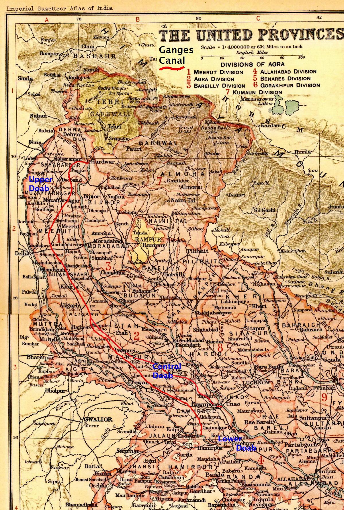
The Ganges Canal highlighted in red stretching between its headworks off the Ganges river in Hardwar and its confluence with the Jumna river below Cawnpore (now Kanpur).
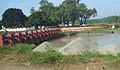
Photograph of an old bridge on the Ganges Canal (constructed before 1854 during East India Company rule in India). The photograph was taken from a moving car.

The Ganges Canal or Ganga Canal is a canal system that irrigates the Doab region between the Ganges River and the Yamuna River in India.

The canal is primarily an irrigation canal, although parts of it were also used for navigation, primarily for its construction materials. Separate navigation channels with lock gates were provided on this system for boats to negotiate falls. Originally constructed from 1842 to 1854, for an original head discharge of 6000 ft³/s, the Upper Ganges Canal has since been enlarged gradually for the present head discharge of 10,500 ft³/s (295 m³/s). The system consists of the main canal of 272 miles and about 4,000 miles long distribution channels. The canal system irrigates nearly 9,000 km² of fertile agricultural land in ten districts of Uttar Pradesh and Uttarakhand. Today the canal is the source of agricultural prosperity in much of these states, and the irrigation departments of these states actively maintain the canal against a fee system charged from users.

There are some small hydroelectric plants on the canal capable of generating about 33 MW if running at full capacity; these are at Nirgajini, Chitaura, Salawa, Bhola, Jani, Jauli and Dasna.[1][2]

Structure

[edit]
Photograph (1860) of the head works of the Ganges Canal in Haridwar, by Samuel Bourne.
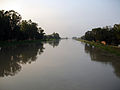
Photograph (2008) of the head works of the Ganges Canal in Haridwar, taken from the opposite side.

The canal is administratively divided into the Upper Ganges Canal from Haridwar to Aligarh, with some branches, and the Lower Ganges Canal which constitutes several branches below Aligarh.

Upper Ganges Canal

[edit]

The Upper Ganges canal is the important and the original Ganges Canal, which starts at the Bhimgoda Barrage near Har ki Pauri at Haridwar, traverses Roorkee, Purquazi, Sardhana (Meerut district), Muradnagar, Dasna, Bulandshahr, Khurja, Harduaganj and continues to Nanau (near Akrabad) in Aligarh district, where it bifurcates into the Kanpur branch and Etawah branch.

Lower Ganges Canal

[edit]

A channel from Chaudhary Charan Singh barrage at Narora (Bulandshahr district) intersects the canal system 48 km downstream from Nanau (Aligarh district), and continues past the Sengar River and Sersa River, past Shikohabad in Firozabad District to become the Bhognipur branch which was opened in 1880. This branch, starting at Jera village in Mainpuri district, runs for 166 km to reach Kanpur.

At kilometre 64 the Balrai escape carries excess water through a 6.4 km. channel through the ravines to discharge into the Yamuna. This branch has 386 km. of distributary channels.

The Bhognipur branch, together with the Kanpur and Etawah branches, is known as the Lower Ganges Canal. The old channels of the old Kanpur and Etawah branches between Nanau and the point of intersection by the channel from Narora, are known as "stumps", and are utilized only when the supply of water in the lower Ganges system runs low.[3] The main branch of the river passes Kanpur (behind IIT Kanpur campus) before breaking into several branches. A branch of it terminates Kanpur Jal Sansthan which comes from behind J. K. Temple.

History

[edit]
Watercolor (1863) titled, "The Ganges Canal, Roorkee, Saharanpur District (U.P.)." The canal was the brainchild of Sir Proby Cautley; construction began in 1840, and the canal was opened by Governor-General Lord Dalhousie in April 1854.
Photograph (2008) of an East India Company-era (1854) bridge on the Ganges Canal near Roorkee

An irrigation system was felt necessary after the disastrous Agra famine of 1837–38, in which nearly 800,000 people died, and nearly ten million rupees was spent on relief works, resulting in considerable loss of revenue to the British East India Company. One of the moving forces behind the canal was Colonel Proby Cautley, who was confident that a 500-kilometre canal was feasible. There were many obstacles and objections to his project, mostly financial, but Cautley persevered and after spending six months walking and riding through the area taking measurements, he managed to persuade the British East India Company to sponsor the project.

Digging of the canal began in April 1842.[4] Cautley had to make his own bricks, brick kiln and mortar. Initially, he was opposed by the Hindu priests at Haridwar, who felt that the waters of the holy river Ganges would be imprisoned but Cautley pacified them by agreeing to leave a gap in the dam from where the water could flow unchecked. He further appeased the priests by undertaking the repair of bathing ghats along the river. He also inaugurated the dam by the worship of Lord Ganesh, the god of good beginnings. The dam was faced with many complications- among them was the problem of the mountainous streams that threatened the canal. Near Roorkee, the land fell away sharply and Cautley had to build an aqueduct to carry the canal for half a kilometre. As a result, at Roorkee the canal is 25 metres higher than the original river. When the canal formally opened on 8 April 1854,[4] its main channel was 348 miles (560 km) long, its branches 306 miles (492 km) long and the various tributaries over 3,000 miles (4,800 km) long. After irrigation was commenced in May 1855,[4] over 767,000 acres (3,100 km2) in 5,000 villages were irrigated.

In 1877 the whole canal system of the lower Doabs underwent radical alteration. The Lower Ganges Canal, with a feed from a channel from Narora, was constructed into the ghar tract of Etawah, and became the Bhognipur branch. Around 1900, according to the Nuttall Encyclopedia of 1907, it had a total extent of 3,700 miles (6,000 km), of which 500 miles (800 km) were navigable. Building of this canal also eventually led to the establishment of first engineering college in India,[5] the College of Civil Engineering at Roorkee (Now Indian Institute of Technology, Roorkee).[6]

Further reading

[edit]

References

[edit]
[edit]
Revisions and contributorsEdit on WikipediaRead on Wikipedia
from Grokipedia
The Ganges Canal, also known as the Ganga Canal or Upper Ganges Canal, is an extensive irrigation system in northern India that diverts water from the Ganges River at the Bhimgoda Barrage in Haridwar, Uttarakhand, to nourish the fertile Doab region between the Ganges and Yamuna rivers in Uttar Pradesh and Uttarakhand.[1][2] Spanning approximately 560 kilometers in its main channel, with an additional 492 kilometers of branches and 4,800 kilometers of distributaries, it was engineered primarily for agricultural irrigation to mitigate recurring famines in the arid plains.[2][3] Completed in 1854 after over a decade of construction, the canal remains one of the world's largest hand-dug waterways and a cornerstone of India's water management infrastructure.[1][2] The project originated in response to devastating droughts, notably the 1837–1838 famine that ravaged the Doab, prompting British East India Company officials to prioritize large-scale irrigation.[3] Construction began in April 1842 under the leadership of Major (later Sir) Proby Thomas Cautley, a pioneering civil engineer who surveyed the route, overcame significant engineering challenges—including the construction of India's first aqueduct at Solani near Roorkee and the use of a steam engine for excavation in 1851—and secured funding despite initial skepticism and financial hurdles.[2][3] The canal was formally inaugurated on 8 April 1854 by Governor-General Lord Dalhousie, at a total cost of around 1.5 crore rupees, marking it as the most ambitious public works project in British India at the time.[2][3] Beyond irrigation, the canal initially facilitated navigation, linking Haridwar to Kanpur and boosting trade until steam-powered rail and road alternatives rendered this function obsolete by the 1930s.[3] Its development spurred the establishment of Thomason College in Roorkee in 1847 (now IIT Roorkee), India's first engineering institution, to train local talent for the project and future infrastructure endeavors.[2] As of 2023, the canal irrigates a culturable command area of approximately 2.28 million acres (924,000 hectares) across thousands of villages in Uttar Pradesh and Uttarakhand, supporting food security for millions. In addition to irrigation, it supplies drinking water to several towns and supports hydroelectric power generation while facing modern challenges like siltation, water allocation disputes, and environmental impacts on the Ganges ecosystem.[2][1][4]

Overview

Route and Dimensions

The Ganges Canal system primarily covers the Doab region, the fertile alluvial plain situated between the Ganges and Yamuna rivers in the northern Indian states of Uttarakhand and Uttar Pradesh. This geographical expanse enables the canal to serve as a vital conduit for water distribution across a diverse landscape of agricultural lands, supporting cultivation in areas that would otherwise be arid. The system's layout emphasizes a linear progression through key districts, facilitating efficient water conveyance over long distances.[5] The main canal measures 272 miles (437 km) in length and commences at the Bhimgoda Barrage in Haridwar, Uttarakhand, where it draws water from the Ganges River. From there, it flows southwestward, passing through Saharanpur, Muzaffarnagar, Meerut, and Bulandshahr districts before reaching Aligarh in Uttar Pradesh. This upper segment forms the core of the system, designed to navigate the gently sloping terrain of the Indo-Gangetic Plain with a consistent southward trajectory. The lower segment diverges from the Narora Barrage on the Ganges River, extending southward through additional districts such as Hathras, Mathura, Agra, Etawah, Firozabad, and Kanpur, where its branches ultimately discharge into the Ganges and Yamuna rivers.[6][5][7] Complementing the main canal, the extensive network of distribution channels totals approximately 4,000 miles (6,435 km), branching out to reach remote farmlands and villages across the Doab. These include major branches spanning 562 km and numerous distributaries and minors covering over 5,700 km combined, ensuring broad areal coverage. The overall system irrigates an area of about 9,000 km², equivalent to a culturable command area of roughly 907,690 hectares, primarily benefiting rabi and kharif crop cycles in the region.[6][5]

Purpose and Capacity

The Ganges Canal serves primarily as an irrigation system designed to mitigate famines in the Doab region, the fertile alluvial plain between the Ganges and Yamuna rivers, by providing reliable water to arid farmlands vulnerable to monsoon failures.[8] Its construction was spurred by the devastating Agra famine of 1837–38, which claimed over 80,000 lives due to crop failures from insufficient rainfall, prompting British colonial authorities to develop perennial irrigation infrastructure to stabilize agriculture and prevent future food shortages.[8] The canal's route traverses this Doab area, channeling water from the upper Ganges to support intensive cropping in historically drought-prone districts.[8] Upon its completion in 1854, the Upper Ganges Canal had an original head discharge capacity of 6,000 cubic feet per second (170 cubic meters per second), designed to irrigate a culturable command area of approximately 1,000,000 acres across more than 5,000 villages in the Doab.[2] This capacity marked a significant engineering achievement, transforming semi-arid lands into productive agricultural zones focused on staple crops like wheat and sugarcane, thereby enhancing food security in northern India. Over time, upgrades have increased the canal's head discharge to 10,500 cubic feet per second (295 cubic meters per second), allowing for expanded irrigation coverage that now supports nearly 9,000 square kilometers (approximately 2.2 million acres) of farmland across 10 districts in Uttar Pradesh and Uttarakhand.[9][5] These enhancements, implemented gradually since the late 19th century, have adapted the system to growing demands from population increases and intensified farming practices. As of 2025, the system undergoes annual maintenance, including a typical 20-day closure for desilting, with water flow restored in October.[10] In addition to irrigation, the canal facilitates secondary uses such as navigation along designated channels equipped with locks, domestic water supply for urban centers like Delhi and various Uttar Pradesh towns, and limited hydroelectric power generation through plants that produce up to 33 megawatts at full capacity.[8][5] These multifaceted roles underscore the canal's evolution from a famine-relief project to a vital component of regional water management and energy infrastructure.

Physical Structure

Upper Ganges Canal

The Upper Ganges Canal originates at the Bhimgoda Barrage on the Ganges River near Haridwar in Uttarakhand and extends southward for 272 miles (437 km) to Nanu near Aligarh in Uttar Pradesh, forming the primary northern segment of the overall Ganges Canal system.[11] This segment traverses the fertile Doab region between the Ganges and Yamuna rivers, supporting extensive irrigation across multiple districts.[5] The canal's path proceeds through the districts of Haridwar, Saharanpur, Muzaffarnagar, Meerut, and Bulandshahr, navigating varied terrain including alluvial plains and minor river crossings.[5] A notable intermediate feature is its crossing of the Hindon River near Muradnagar in the Meerut district via an engineered structure that maintains flow integrity.[12] After crossing the Hindon River near Muradnagar in Meerut district, the canal continues through Bulandshahr district before reaching its terminus at Nanu near Aligarh.[13] At Aligarh, the Upper Ganges Canal bifurcates into two major branches: the Kanpur Branch, which extends toward the Ganges in Kanpur, and the Etawah Branch, directing water southward to support additional irrigation areas.[2] These branches enhance the canal's reach while the main upper segment maintains a perennial flow, drawing continuously from the Ganges to ensure year-round water supply. As India's oldest irrigation system, constructed between 1842 and 1854, it exemplifies early colonial engineering focused on perennial reliability for agricultural stability in the Doab.[5]

Lower Ganges Canal

The Lower Ganges Canal originates at the Narora Barrage on the Ganges River in Bulandshahr district, Uttar Pradesh, where water is diverted into the canal from the right bank of the river. A channel from Narora intersects the Upper Ganges Canal system approximately 48 km downstream from Nanu near Aligarh, allowing integrated water distribution across the broader system. The canal's lower segment primarily follows the Bhognipur Branch, extending 166 km southward from Jera village in Mainpuri district to Kanpur. The path traverses fertile alluvial plains, passing through Etah, Mainpuri, and Etawah districts, while also benefiting adjacent areas like Aligarh, Kanpur, and Allahabad. This routing enables efficient gravity-fed irrigation in the region's agricultural heartland, supporting diverse cropping patterns in the interfluve zones. The Bhognipur Branch incorporates 386 km of distributary channels, which branch out to irrigate supplementary farmlands and extend the system's coverage beyond the main alignment. These distributaries connect with secondary networks to optimize water allocation in underserved pockets. The Lower Ganges Canal emphasizes irrigation in the lower Doab region between the Ganges and Yamuna rivers, a flood-prone area where seasonal inundations historically challenged farming; the controlled water release helps stabilize soil moisture and enhances resilience for kharif and rabi crops across approximately 1.17 million acres. Through its integration with upstream branches, the canal ensures comprehensive hydrological support for the southern Uttar Pradesh plains, promoting sustained agricultural productivity.

Branches and Distributaries

The Ganges Canal's branch and distributary network extends the main canal's reach, facilitating irrigation across the Indo-Gangetic plains by channeling water from both the upper and lower segments into secondary waterways. These branches primarily serve the Doab region between the Ganges and Yamuna rivers, supporting agriculture in districts such as Aligarh, Mainpuri, Etawah, and Kanpur through a hierarchical system of larger branches feeding into smaller distributaries and minors. The overall network includes over 6,500 km of canals, with branches totaling approximately 562 km, distributaries around 3,300 km, and minors exceeding 2,400 km, enabling precise water delivery to field levels.[5] The Kanpur Branch diverges from the upper Ganges Canal near Nanu in Aligarh district and flows approximately 211 km southward, ultimately rejoining the Ganges River at Jhinjhak in Kanpur Dehat district. Constructed in 1898 with a capacity of 5,400 cusecs, it irrigates extensive farmlands in the Kanpur region and includes 27 rajbahas (secondary channels) and 74 minors for localized distribution.[14][2] The Etawah Branch, originating at kilometer 99.40 of the lower Ganges Canal, extends about 178 km to outfall into the Yamuna River near Etawah, serving agricultural areas in Etawah and adjacent districts. Built in 1889 with a discharge capacity of 3,850 cusecs, it supports a total network length of over 2,083 km when including 36 rajbahas and 217 alpikas (minor outlets), ensuring equitable water supply to individual farms.[14][5] The Bhognipur Branch, an extension of the lower Ganges Canal starting at kilometer 99.40, runs roughly 171 km through areas like Shikohabad to Bhognipur, aiding irrigation in Mainpuri and Kanpur districts. Opened in 1878 with a capacity of 2,000 cusecs, it incorporates 33 rajbahas and 85 alpikas, contributing to the system's fine-grained distribution by channeling water to over 5,000 villages across the command area.[14][2] These branches, along with thousands of minor distributaries exceeding 4,000 miles in total length, play a crucial role in the canal's irrigation efficiency by breaking down water flow into manageable segments for direct farm access, irrigating nearly 9,000 square kilometers of arable land.[5]

Engineering Features

Headworks and Barrages

The Bhimgoda Barrage, situated at Haridwar on the Ganges River in Uttarakhand, India, functions as the primary intake structure for the Upper Ganges Canal. The original temporary diversion works were established in 1854 to enable water diversion, but the structure has undergone multiple replacements to address operational challenges, with the current permanent barrage completed between 1979 and 1983. This modern facility spans 453.5 meters in length, comprising 15 bays each 18 meters wide, and is designed to regulate river flow while minimizing structural vulnerability to floods and sediment load. From this barrage, water is diverted into the Upper Ganges Canal and the parallel East Ganga Canal, supporting irrigation across the Doab region. Downstream, the Narora Barrage on the Ganges near Bulandshahr in Uttar Pradesh serves as the headworks for the Lower Ganges Canal. The initial weir was constructed in 1877 as a 1,160-meter-long brick masonry drop structure, 3.05 meters high, to facilitate diversion for the lower canal branches including the Bhognipur, Kanpur, and Etawah systems. This historical setup experienced minimal silting due to the perpendicular alignment of the river and canal approaches. The structure was later replaced by a modern gated barrage in 1967, measuring 922.43 meters long with 61 gates, enhancing capacity for irrigation and other uses while maintaining the diversion function for the Lower Ganges Canal and its parallel channel. Both barrages incorporate engineering features for sediment control and flood diversion, including gated spillways and under-sluices that allow selective passage of coarser sediments during low flows to prevent canal silting, while directing floodwaters downstream. At Narora, the design promotes natural scour to limit deposition, resulting in low silt entry into the canal. The overall system at the headworks is engineered to handle a modern discharge capacity of 10,500 cubic feet per second (approximately 297 cubic meters per second), accommodating peak irrigation demands without compromising riverine ecology. Historical upgrades, such as the 1983 reconstruction at Bhimgoda and the 1967 replacement at Narora, have focused on bolstering silt exclusion through improved hydraulic curvature and gate operations, reducing maintenance needs and enhancing longevity against the Ganges' high sediment regime.

Aqueducts and Locks

The Ganges Canal incorporates multiple major aqueducts, also referred to as super-passages, to enable the waterway to cross underlying rivers, drains, and roads while maintaining uninterrupted flow. These structures represent key engineering innovations in hydraulic infrastructure, allowing the canal to traverse varying terrain without diversion. A notable example is the Solani Aqueduct near Roorkee, which elevates the Upper Ganges Canal over the Solani River valley; spanning 932 feet (284 meters) in length for the aqueduct proper including approaches, it features a masonry trough supported by 15 arches, each with a 50-foot span, providing a clear waterway of about 750 feet. The aqueducts were engineered primarily by Sir Proby Thomas Cautley, the project's superintendent, who drew on studies of European canals to adapt designs for local conditions. Construction utilized lime concrete—typically a mix of kunkur lime, soorkee, and sand—for foundations and flooring, combined with extensive brickwork for arches and walls, often sourced from on-site kilns to ensure durability against monsoon floods and soil erosion.[8] For navigation purposes, the canal includes 14 original locks to accommodate boats and manage elevation changes along the route, particularly in the upper sections where falls and drops occur. These locks, integrated into the design from the outset, feature timber or masonry gates to control water levels, facilitating transport of goods and passengers in the 19th century. Later enhancements incorporated hydroelectric facilities at select drops near aqueducts and locks, with the system generating a total of 33 MW at full capacity to support regional power needs.[8]

History

Planning and Construction

The planning of the Ganges Canal was initiated in 1838 by British engineer Proby Thomas Cautley, following the devastating Agra famine of 1837–38, which claimed approximately 800,000 lives due to crop failures from insufficient monsoon rains. Cautley, appointed as Superintendent of Canals in the North-Western Provinces, proposed a major irrigation system to draw water from the Ganges River near Haridwar to prevent future famines in the Doab region between the Ganges and Yamuna rivers.[8] This initiative was funded by the British East India Company, reflecting colonial priorities for agricultural stability and revenue generation through enhanced land productivity.[8] Between 1840 and 1842, Cautley conducted extensive surveys across the Doab, covering hundreds of miles on foot and horseback to map the terrain, assess water sources, and design the canal's alignment. These efforts faced significant geological hurdles, including unstable sandy soils prone to erosion, boulder-strewn riverbeds requiring deep excavations up to 10 feet below low water levels, and variable terrain that complicated the route. Funding challenges also arose, as initial estimates varied widely—from Rs. 33.8 lakhs to over Rs. 113 lakhs—leading to debates over project scale and financial viability amid limited colonial budgets. Despite these obstacles, Cautley's 1840 report provided the foundational design, emphasizing irrigation capacity while incorporating navigation features. Construction commenced in 1842 and spanned 12 years until 1854, involving phased excavation of the main canal, distributaries, and supporting structures like weirs and aqueducts.[8] The project encountered severe operational challenges, including risks of malaria among workers linked to stagnant water from temporary bunds and over-irrigation in marshy areas, as well as heavy silt deposition from Himalayan tributaries that necessitated ongoing dredging and escape channels to maintain flow. Political and religious opposition further delayed progress, particularly from Hindu priests at Haridwar who protested diverting the sacred Ganges waters; Cautley addressed this by incorporating a ceremonial gap in the headworks.[8] The total cost reached approximately Rs. 150 lakhs (equivalent to about £1.5 million at contemporary exchange rates), covering earthworks, masonry, and land acquisitions.[15]

Opening and Early Operations

The Ganges Canal was officially opened on April 8, 1854, by Governor-General Lord Dalhousie at the headworks in Haridwar, marking the completion of a monumental engineering project spanning over 350 miles from Haridwar to Kanpur.[2][9] This inauguration ceremony highlighted the canal's dual role in irrigation and navigation, designed to alleviate chronic famines in the Doab region while supporting British colonial economic interests.[8] The event drew significant attention, underscoring the canal's status as the world's largest and most expensive man-made waterway at the time, with a total construction cost of about £1.5 million.[15] Following the opening, trial runs and adjustments were conducted before full irrigation began on May 1, 1855, initiating the first operational season from 1854 to 1855.[5] In this inaugural year, the canal successfully watered over 767,000 acres across approximately 5,000 villages, transforming arid lands into productive farmland and demonstrating the system's immediate efficacy in boosting agricultural output.[9] Early management focused on equitable water distribution through a network of branches and distributaries, with engineers monitoring flow rates initially set at around 6,000 cubic feet per second to ensure stability.[5] The canal's early operations also incorporated navigation features, with separate channels and lock gates enabling boat traffic for trade between Haridwar and Kanpur, facilitating the transport of goods and construction materials along the route.[8] This navigational aspect, though secondary to irrigation, supported regional commerce in the mid-19th century by connecting upstream pilgrimage and resource hubs to downstream markets.[9] Concurrently, the canal project catalyzed educational advancements; the engineering school established in Roorkee in 1847 for canal construction was formally renamed the Thomason College of Civil Engineering in 1854, honoring Lieutenant Governor James Thomason and serving as India's first institution dedicated to civil engineering training, which later evolved into IIT Roorkee.[16] To sustain operations, initial revenue was derived from water fees levied on irrigators, with rates structured to recover costs and fund ongoing maintenance such as dredging and regulator repairs.[17] These fees, detailed in the first revenue report for 1855-56 by R. Baird Smith, generated modest returns in the canal's nascent years, covering essential upkeep while the system scaled up its irrigated command area.[18] This financial model ensured self-sufficiency from the outset, allowing the Public Works Department to address minor structural issues without additional colonial funding.[17]

Operation and Management

Irrigation and Water Distribution

The Ganges Canal utilizes the warabandi system, a rotational water allocation method designed to ensure equitable distribution among farmers based on their land holdings and a predetermined schedule. This approach allocates fixed time slots for water delivery through outlets, preventing overuse and promoting fairness in the command area. During the Rabi (winter) season, the typical rotation is one week of supply followed by two weeks off, while in the Kharif (summer/monsoon) season, it shifts to two weeks on and two weeks off, adapting to varying crop water demands and seasonal availability.[19][20] The Upper Ganges Canal maintains perennial flow, enabling consistent year-round water supply drawn from the Ganga River via the Bhimgoda Barrage, which supports multi-seasonal irrigation. In contrast, many of its branches and distributaries operate on a seasonal basis, activating primarily during Kharif and Rabi cropping periods to align with monsoon inflows and agricultural needs, thereby optimizing resource use across the network.[5][19] This water distribution primarily irrigates staple crops in the Ganges-Yamuna Doab region, where wheat dominates the Rabi season, providing winter nutrition, while sugarcane and rice are key Kharif crops benefiting from the canal's reliable volumes during peak growth phases. The system's design prioritizes these high-value crops, which account for over 75% of irrigation revenue in the command area, fostering agricultural stability in Uttar Pradesh and Uttarakhand.[19][21] Modern operational enhancements are part of the Upper Ganga Canal modernization efforts.[22] Overall, the canal's irrigation framework supports approximately 910,000 hectares of culturable command area indirectly through its branches, delivering essential volumes that sustain productivity without exhaustive enumeration of every metric.[5]

Maintenance and Modern Upgrades

Following India's independence in 1947, the Ganges Canal system came under the management of the Uttar Pradesh Irrigation Department (UPID), which oversees its operation, rehabilitation, and expansion to sustain irrigation across the Doab region.[23] The UPID has focused on periodic infrastructure sustainment to address aging structures and water losses, ensuring the canal's perennial flow supports agricultural demands in Uttar Pradesh and Uttarakhand.[24] Significant lining projects have been undertaken to mitigate seepage losses. These efforts, part of broader rehabilitation initiatives, stabilized canal banks and reduced maintenance needs related to erosion and breaching.[23] In the 2000s and 2010s, technological upgrades included the installation of Supervisory Control and Data Acquisition (SCADA) systems for remote monitoring and control of water flows, enabling real-time adjustments.[25] This modernization, piloted in key sections like the Lower Ganga Canal, integrated sensors for discharge and gate management, reducing manual interventions and water wastage. Concurrently, hydroelectric facilities along the canal were expanded, reaching a total installed capacity of 33 MW across plants at sites such as Nirgajini, Chitaura, and Salawa, harnessing excess flow for power generation without compromising irrigation priorities.[8] As of 2025, modernization efforts continue, including enhancements to the Lower Ganga Canal system's capacity and efficiency.[26] Funding for these maintenance and upgrade activities is derived primarily from user cess levied on irrigated areas, supplemented by state government budgets and international aid. The UPID collects water cess fees to cover operational costs, while projects like canal lining and SCADA implementation have received support from bodies such as the World Bank through the Uttar Pradesh Water Sector Restructuring Project.[27][25] This dual funding model ensures sustained investment in the canal's infrastructure resilience.

Impacts

Agricultural and Economic

The Ganges Canal has significantly boosted agriculture in the Doab region between the Ganges and Yamuna rivers by providing reliable irrigation since the 1850s, enabling multiple cropping seasons and reducing dependence on erratic monsoons, which has led to substantial increases in crop yields for staples like wheat, rice, and sugarcane.[28] This transformation has turned arid and semi-arid lands into productive farmlands, supporting higher agricultural output and stabilizing harvests in an area historically prone to variability.[15] The canal has a gross command area of approximately 9,000 square kilometers (900,000 hectares) of fertile land across ten districts in Uttar Pradesh and Uttarakhand, with an annual irrigated area of about 4,300 square kilometers (430,000 hectares) based on seasonal maxima, contributing to canal-based irrigation that accounts for about 25 percent of the state's total irrigated area.[5][29] Through its extensive network of branches, it facilitates water distribution to vast tracts, enhancing overall irrigation coverage and enabling intensive farming practices that underpin Uttar Pradesh's role as a major food-producing state. Economically, the canal adds considerable value to the agricultural sector by boosting productivity and enabling crop diversification, which has supported rural livelihoods and contributed to the gross value added in farming across the region.[20] This enhanced output has driven market growth for agricultural produce, fostering ancillary industries such as food processing and transportation, and reinforcing the canal's role as a cornerstone of economic development in northern India.[30] The canal generates substantial employment opportunities, particularly in direct farming activities, canal maintenance, and related agro-based sectors, sustaining rural economies and providing seasonal work for thousands of laborers.[28] By ensuring consistent water supply, it has also played a critical role in food security, mitigating the effects of droughts through protective irrigation that prevents crop failures and maintains production levels during dry periods.[31]

Social and Cultural

The Ganges Canal has evolved into a vital cultural artery in northern India, serving as a conduit for religious and communal practices that blend indigenous traditions with colonial influences. Along its banks, festivals such as the Kanwar Yatra draw millions of Hindu devotees annually in July and August, who carry sacred Ganga water in pitchers as part of a pilgrimage from Haridwar to various shrines, transforming the canal into a dynamic corridor of spiritual movement. Similarly, the Piran Kaliyar Mela, an Islamic festival honoring the Sufi saint Alauddin Ali Ahmed Sabir, attracts pilgrims for Urs celebrations, fostering interfaith harmony and communal gatherings near the canal's route.[32][6] Boating traditions further animate the canal, with historical uses for maintenance evolving into modern practices like sacred bathing, fishing, and ritual cloth washing at dhobi ghats, while leisure activities such as picnicking and occasional boat races during local festivals reinforce its role as a public social space.[32][33][6] The canal's proximity has profoundly shaped vernacular architecture in surrounding settlements, integrating hydraulic features into local built environments. Communities along the route developed stepped ghats for ritual access and water drawing, alongside wells and reservoirs adapted to canal irrigation patterns, which influenced the layout of rural hamlets and urban fringes in regions like the Doab. Colonial-era structures, such as the Solani Aqueduct and Roorkee's churches, coexist with indigenous religious sites like the Daksheswara Temple, creating a hybrid architectural landscape that reflects both engineering precision and cultural adaptation.[6][11][32] Social transformations induced by the canal include patterns of migration drawn by employment opportunities in its construction and maintenance, leading to the formation of diverse communities in previously arid areas. This influx contributed to enhanced rural prosperity, which supported the establishment of educational institutions like the Thomason College of Civil Engineering in 1847—now IIT Roorkee—elevating literacy rates and technical skills among local populations.[32][6] In the 21st century, the Ganges Canal plays a prominent role in tourism and heritage preservation, positioning it as a living museum of tangible and intangible cultural elements. Religious tourism surges during festivals like Navratri, drawing visitors to explore the canal's ghats and colonial remnants, while initiatives emphasize conservation amid urbanization pressures. A 2025 study by researchers at IIT Roorkee, utilizing archival records and community interviews conducted in 2024, highlights the canal's enduring heritage value from Haridwar to Roorkee, advocating for integrated cultural mapping to sustain its legacy.[6][32][11] The canal's connection to local folklore underscores its British colonial legacy, with oral traditions venerating the waterway's sanctity derived from the Ganges while incorporating narratives of engineering triumphs. Folk songs from the 19th century even elevated engineer Proby Thomas Cautley to a near-divine status for mitigating the 1837–38 famine through the canal's construction, blending indigenous reverence for water with colonial innovation in community memory.[6][34][32]

Environmental Considerations

Ecological Effects

The diversion of water from the Ganges River into the Upper Ganges Canal at Haridwar significantly reduces downstream flow, with annual diversions amounting to approximately 15 billion cubic meters, thereby stressing riverine ecosystems along the middle and lower Ganges.[35] This flow reduction exacerbates habitat degradation for aquatic species, particularly during dry seasons, leading to diminished oxygen levels and altered hydrological regimes that disrupt natural river dynamics downstream.[36] Seepage from the Ganges Canal network contributes to rising groundwater tables in its command areas across Uttar Pradesh, promoting waterlogging and the upward movement of salts to the soil surface, which results in widespread salinization.[37] In regions like the Sharda Sahayak Canal command area, linked to the broader Ganges system, this process has affected approximately 0.37 million hectares over recent decades due to inadequate drainage infrastructure.[37] Overall, Uttar Pradesh reports 1.37 million hectares of salt-affected land, much of it attributable to canal seepage in irrigated zones.[37] Agricultural runoff from farmlands in the Ganges Canal command areas introduces pesticides into the canal and connected waterways, with organochlorine compounds like DDT reaching concentrations up to 79,818 ng/L in nearby Ganga segments such as Varanasi.[38] These contaminants, including organophosphates and herbicides, exceed safe limits for aquatic ecosystems, posing toxicity risks to fish and invertebrates through bioaccumulation and disrupting reproductive cycles.[38] Biodiversity in the Ganges basin has undergone notable shifts due to canal-induced flow alterations, with native migratory fish species experiencing significant declines; for instance, major carp catches have dropped from 41 tonnes in the late 1950s to 8 tonnes by the late 1990s, and their proportion in fisheries has fallen from 44% to 13%.[36] While seepage and over-irrigation have inadvertently expanded waterlogged wetlands in some command areas, providing temporary habitats, this comes at the cost of native species loss, as altered flows from barrages and canals block migration routes for species like hilsa and mahseer.[36][37] Silt deposition patterns have been altered by water diversion into the Ganges Canal, leading to increased sedimentation upstream of diversion points and reduced sediment transport to downstream floodplains, which diminishes natural nutrient replenishment and habitat formation.[39] In the broader Ganges system, this has resulted in channel aggradation and the proliferation of sandbars, transforming floodplain habitats from dynamic, fertile zones to more static, degraded landscapes.[39]

Conservation Efforts

The Namami Gange Programme, launched in 2014 and operational since 2015, represents a flagship integrated conservation mission for the Ganges River basin, incorporating the Ganges Canal system to address pollution and promote ecological sustainability. This initiative focuses on abating pollution through the development of sewage treatment infrastructure and river surface cleaning, with specific integration of canal networks to prevent untreated effluents from entering the waterway. As of November 2025, the program has created over 4,447 million liters per day (MLD) of sewage treatment capacity, significantly contributing to the cleanup efforts along the canal's route in Uttar Pradesh and Uttarakhand.[40][41] Efforts to line canal sections and enhance effluent treatment have been pivotal in reducing pollution levels. Under the World Bank-aided Uttar Pradesh Water Sector Restructuring Project (UPWSRP), the Parallel Lower Ganga Canal lining initiative has modernized over 65 km of canal infrastructure with concrete linings to minimize seepage and contamination from agricultural runoff and industrial discharges. These measures, combined with Namami Gange's effluent treatment plants, have achieved a 20-30% reduction in pollution load in targeted stretches of the Ganges basin, including canal-adjacent areas, by intercepting and treating wastewater before it impacts the system.[42][43] Reforestation initiatives along the banks have bolstered riparian ecosystems supporting the canal. Through Namami Gange's biodiversity conservation pillar, approximately 50,000 trees have been planted along Ganges banks in Bihar and Uttar Pradesh between 2020 and 2025, including species suited to canal corridors to stabilize soil, enhance water retention, and filter pollutants. This afforestation has restored over 30,000 hectares of floodplain forests in the basin, indirectly benefiting canal water quality by reducing erosion and sediment inflow.[44][45] Water auditing and recycling pilots in Uttar Pradesh target efficient resource use within the canal's command area. In Kanpur, a key node for the Ganges Canal, water accounting frameworks have been implemented to track consumption and losses, promoting recycling of treated wastewater for non-potable irrigation to alleviate pressure on canal supplies. These pilots, supported by state and central agencies, emphasize zero-liquid-discharge models for industrial effluents, ensuring sustainable reuse without compromising downstream flows.[46][47] International collaborations have advanced sustainable irrigation technologies for the canal. The World Bank's Ganges Strategic Basin Assessment and UPWSRP projects have partnered with Indian authorities to introduce efficient lining, drip irrigation, and groundwater recharge techniques, optimizing water distribution across the canal's 7,000+ km network while minimizing environmental degradation. Additionally, the IUCN's Building River Dialogue and Governance (BRIDGE) programme facilitates transboundary knowledge sharing on basin-wide sustainability, aiding in the adoption of climate-resilient irrigation practices.[48][49]

References

User Avatar
No comments yet.