
Recent from talks
Ground-controlled interception
Knowledge base stats:
Talk channels stats:
Members stats:
Ground-controlled interception
Ground-controlled interception (GCI) is an air defence tactic whereby one or more radar stations or other observational stations are linked to a command communications centre which guides interceptor aircraft to an airborne target. This tactic was pioneered during World War I by the London Air Defence Area organization, which became the Royal Air Force's Dowding system in World War II, the first national-scale system. The Luftwaffe introduced similar systems during the war, but most other combatants did not suffer the same threat of air attack and did not develop complex systems like these until the Cold War era.
Today the term GCI refers to the style of battle direction, but during WWII it also referred to the radars themselves. Specifically, the term was used to describe a new generation of radars that spun on their vertical axis in order to provide a complete 360 degree view of the sky around the station. Previous systems, notably Chain Home (CH), could only be directed along angles in front of the antennas, and were unable to direct traffic once it passed behind their shore-side locations. GCI radars began to replace CH starting in 1941/42, allowing a single station to control the entire battle from early detection to directing the fighters to intercept.
GCI systems grew in size and sophistication during the post-war era, in response to the overwhelming threat of nuclear attack. The US' SAGE system was perhaps the most complex attempted, using building-filling computers linked to dozens of radars and other sensors to automate the entire task of identifying an enemy aircraft's track and directing interceptor aircraft or surface-to-air missiles against it. In some cases, SAGE sent commands directly to the aircraft's autopilot, bringing the aircraft within attack range entirely under computer control. The RAF counterpart, ROTOR remained a mostly manual system.
Today, GCI is still important for most nations, although Airborne Early Warning and Control, with or without support from GCI, generally offers much greater range due to the much more distant radar horizon.
In the original Dowding system of fighter control, information from the Chain Home coastal radar stations was relayed by phone to a number of operators on the ground floor of the "filter room" at Fighter Command's headquarters at RAF Bentley Priory. Here the information from the radar was combined with reports from the Royal Observer Corps and radio direction finding systems and merged to produce a single set of "tracks", identified by number. These tracks were then telephoned to the Group headquarters that would be responsible for dealing with that target. Group would assign fighter squadrons to the tracks, and phone the information to Section headquarters, who were in direct contact with the fighters. These fighter aircraft could then be "scrambled" to intercept the aircraft.
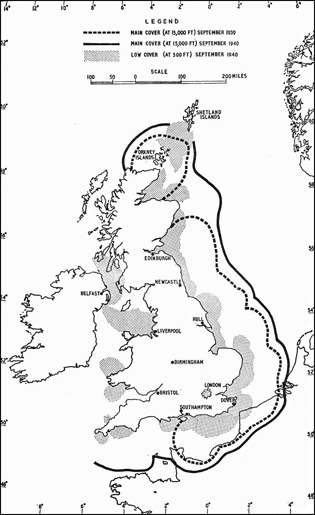
Because the Chain Home radar stations faced out to sea, once airborne intruders had crossed the British coast they could no longer be tracked by radar; and accordingly the interception direction centres relied on visual and aural sightings of the Observer Corps for continually updated information on the location and heading of enemy aircraft formations. While this arrangement worked acceptably during the daylight raids of the Battle of Britain, subsequent bombing attacks of The Blitz demonstrated that such techniques were wholly inadequate for identifying and tracking aircraft at night.
Experiments in addressing this problem started with manually directed radars being used as a sort of radio-searchlight, but this proved too difficult to use in practice. Another attempt was made by using a height finding radar turned on its side in order to scan an arc in front of the station. This proved very workable, and was soon extended to covering a full 360 degrees by making minor changes to the support and bearing systems. Making a display system, the "Plan Position Indicator" (PPI), that displayed a 360 degree pattern proved surprisingly easy, and test systems were available by late 1940.
Starting in 1941 the RAF began deploying production models of the GCI radar, first with expedient solutions known as the AMES Type 8, and then permanent stations based on the much larger AMES Type 7. Unlike the earlier system where radar data was forwarded by telephone and plotted on a map, GCI radars combined all of these functions into a single station. The PPI was in the form of a 2D top-down display showing both the targets and the intercepting night fighters. Interceptions could be arranged directly from the display, without any need to forward the information over telephone links or similar. This not only greatly eased the task of arranging the interception, but greatly reduced the required manpower as well.
Hub AI
Ground-controlled interception AI simulator
(@Ground-controlled interception_simulator)
Ground-controlled interception
Ground-controlled interception (GCI) is an air defence tactic whereby one or more radar stations or other observational stations are linked to a command communications centre which guides interceptor aircraft to an airborne target. This tactic was pioneered during World War I by the London Air Defence Area organization, which became the Royal Air Force's Dowding system in World War II, the first national-scale system. The Luftwaffe introduced similar systems during the war, but most other combatants did not suffer the same threat of air attack and did not develop complex systems like these until the Cold War era.
Today the term GCI refers to the style of battle direction, but during WWII it also referred to the radars themselves. Specifically, the term was used to describe a new generation of radars that spun on their vertical axis in order to provide a complete 360 degree view of the sky around the station. Previous systems, notably Chain Home (CH), could only be directed along angles in front of the antennas, and were unable to direct traffic once it passed behind their shore-side locations. GCI radars began to replace CH starting in 1941/42, allowing a single station to control the entire battle from early detection to directing the fighters to intercept.
GCI systems grew in size and sophistication during the post-war era, in response to the overwhelming threat of nuclear attack. The US' SAGE system was perhaps the most complex attempted, using building-filling computers linked to dozens of radars and other sensors to automate the entire task of identifying an enemy aircraft's track and directing interceptor aircraft or surface-to-air missiles against it. In some cases, SAGE sent commands directly to the aircraft's autopilot, bringing the aircraft within attack range entirely under computer control. The RAF counterpart, ROTOR remained a mostly manual system.
Today, GCI is still important for most nations, although Airborne Early Warning and Control, with or without support from GCI, generally offers much greater range due to the much more distant radar horizon.
In the original Dowding system of fighter control, information from the Chain Home coastal radar stations was relayed by phone to a number of operators on the ground floor of the "filter room" at Fighter Command's headquarters at RAF Bentley Priory. Here the information from the radar was combined with reports from the Royal Observer Corps and radio direction finding systems and merged to produce a single set of "tracks", identified by number. These tracks were then telephoned to the Group headquarters that would be responsible for dealing with that target. Group would assign fighter squadrons to the tracks, and phone the information to Section headquarters, who were in direct contact with the fighters. These fighter aircraft could then be "scrambled" to intercept the aircraft.
Because the Chain Home radar stations faced out to sea, once airborne intruders had crossed the British coast they could no longer be tracked by radar; and accordingly the interception direction centres relied on visual and aural sightings of the Observer Corps for continually updated information on the location and heading of enemy aircraft formations. While this arrangement worked acceptably during the daylight raids of the Battle of Britain, subsequent bombing attacks of The Blitz demonstrated that such techniques were wholly inadequate for identifying and tracking aircraft at night.
Experiments in addressing this problem started with manually directed radars being used as a sort of radio-searchlight, but this proved too difficult to use in practice. Another attempt was made by using a height finding radar turned on its side in order to scan an arc in front of the station. This proved very workable, and was soon extended to covering a full 360 degrees by making minor changes to the support and bearing systems. Making a display system, the "Plan Position Indicator" (PPI), that displayed a 360 degree pattern proved surprisingly easy, and test systems were available by late 1940.
Starting in 1941 the RAF began deploying production models of the GCI radar, first with expedient solutions known as the AMES Type 8, and then permanent stations based on the much larger AMES Type 7. Unlike the earlier system where radar data was forwarded by telephone and plotted on a map, GCI radars combined all of these functions into a single station. The PPI was in the form of a 2D top-down display showing both the targets and the intercepting night fighters. Interceptions could be arranged directly from the display, without any need to forward the information over telephone links or similar. This not only greatly eased the task of arranging the interception, but greatly reduced the required manpower as well.
Recent media