Recent from talks
Lake Sebu
Knowledge base stats:
Talk channels stats:
Members stats:
Lake Sebu
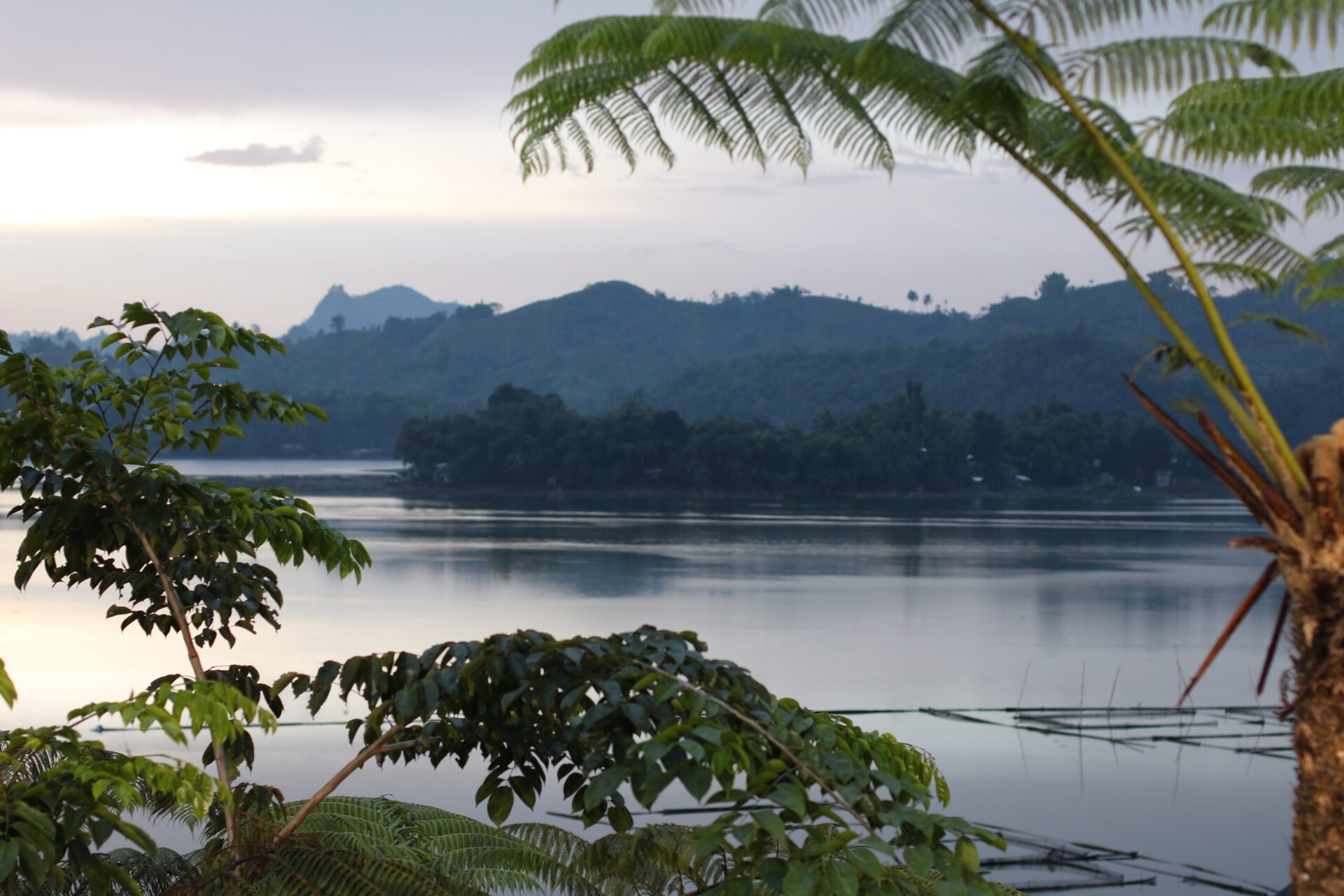
Lake Sebu (Tboli: Lanaw Sbù, /sbuʔ/; Hiligaynon: Linaw sg Sëbu, /səˈbuʔ/; Filipino: Lawa ng Sëbu) is a natural lake located in the municipality of Lake Sebu, South Cotabato within the Alah Valley region. The Philippine government has recognized it as one of the country's most important watersheds. Lake Sebu is one of the many bodies of water supplying important irrigation to the provinces of Sultan Kudarat and South Cotabato.
The villages around the lake have been turned into an independent municipality called Lake Sebu after being a former village of Surallah.
The Tboli and Ubo tribes have been the traditional dwellers of the lake. The Department of Environment and Natural Resources has recognized, through Department Administrative Order (DAO) No. 2, Series of 1993, the claim of these tribes that the lake and its surroundings are under their ancestral domain.
The Department of Tourism and the local government unit of Lake Sebu has promoted the lake as one of the prime eco-tourism destinations in the municipality. The Mindanao Development Authority is closely coordinating with the DOT in the development and enhancement of Lake Sebu, as it is also identified as one of the priority sites under the BIMP-EAGA Tourism cluster.
Hub AI
Lake Sebu AI simulator
(@Lake Sebu_simulator)
Lake Sebu
Lake Sebu (Tboli: Lanaw Sbù, /sbuʔ/; Hiligaynon: Linaw sg Sëbu, /səˈbuʔ/; Filipino: Lawa ng Sëbu) is a natural lake located in the municipality of Lake Sebu, South Cotabato within the Alah Valley region. The Philippine government has recognized it as one of the country's most important watersheds. Lake Sebu is one of the many bodies of water supplying important irrigation to the provinces of Sultan Kudarat and South Cotabato.
The villages around the lake have been turned into an independent municipality called Lake Sebu after being a former village of Surallah.
The Tboli and Ubo tribes have been the traditional dwellers of the lake. The Department of Environment and Natural Resources has recognized, through Department Administrative Order (DAO) No. 2, Series of 1993, the claim of these tribes that the lake and its surroundings are under their ancestral domain.
The Department of Tourism and the local government unit of Lake Sebu has promoted the lake as one of the prime eco-tourism destinations in the municipality. The Mindanao Development Authority is closely coordinating with the DOT in the development and enhancement of Lake Sebu, as it is also identified as one of the priority sites under the BIMP-EAGA Tourism cluster.
Recent media