

Community hub
Recent from talks
Contribute something
Nothing was collected or created yet.
Murrumbeena, Victoria
View on Wikipedia
Murrumbeena (/ˌmʌrəmˈbiːnə/ ⓘ MURR-əm-BEE-nə) is a suburb in Melbourne, Victoria, Australia, 13 km south-east of Melbourne's Central Business District,[3] located within the City of Glen Eira local government area. Murrumbeena recorded a population of 9,996 at the 2021 census.[4]
Key Information


Murrumbeena is a small and highly coveted[5] suburban area with extensive parklands and a rich artistic heritage.
It has multiple commercial zones featuring services and cafes, including Murrumbeena Village, near the train station; Poath Road; North Road; and Murrumbeena Road, near the Beauville Estate and Duncan McKinnon Reserve.
Toponymy
[edit]The name "Murrumbeena" derives from the Aboriginal word "mirambena."[6] It may have meant "land of frogs", "moss growing on decayed wood" or it may be a derivative from the name of an Aboriginal elder. The evidence for any of these etymologies is uncertain.[7] The name was officially adopted when the Murrumbeena railway station opened in 1879.[8]
History
[edit]The Boon Wurrung, the Indigenous Australians of the Kulin Nation, are recognised as the traditional owners of the land now known as Murrumbeena.
A more in-depth look at Murrumbeena’s history and historic photos can be found at Glen Eira Historical Society's Victorian Collections[9] page and at Murrumbeena 3163.[10]
- 14 May 1879 – Murrumbeena Railway station opens[11] and the name Murrumbeena is officially adopted for the settlement
- 21 September 1889 – Railway station signal box contract signed to erect by J. Brown.[12]
- 12 May 1890 – Murrumbeena Post Office opens
- 1891 – A Murrumbeena football team competes against Oakleigh and other clubs.
- 1900 – Film segments of Soldiers of the Cross, the world's first narrative drama film presentation, are shot at Murrumbeena Girls Home.
- 1918 – Murrumbeena Football Club is formed
- 1921 – Merric Boyd opens Australia's first pottery studio at Open Country, 8 Wahroonga Crescent
- 1922 – Electrification of railway & wicket gates[12]
- 12 May 1923 - Murrumbeena Bowls Club is formed and plays at 'The Green', a 4 rink private bowling green owned by A. W. P. Olsen, a local Real Estate Agent at 'Oakdene' 41 Murrumbeena Road
- 1930s – Fredrick Cox commences Jolliff Pottery
- 1939 – Hatton Beck and Lucy Boyd open Altamira Pottery
- 1944 – Arthur Boyd, John Perceval and Peter Herbst establish Arthur Merric Boyd (AMB) Pottery[13] at 500 Neerim Road
- 1972 – Shortening of railway siding at station used to deliver coal and goods.[12]
- 1972 – Schwob's Swiss Bakery[14] expand into manufacturing, moving to premises in Murrumbeena
- 6 December 1977 – Removal of railway siding at station.[12]
- 1989 – Boyd Park established and officially opened by the Mayor of Caulfield, Veronica Martens. Caulfield Environment Group established by local residents to rehabilitate and plant flora in park.
- 1996 – Murrumbeena Secondary College closed
- 2006 – The second Commonwealth Nations Bridge Championship held in Murrumbeena
- 2010 – The Neerim Road level crossing identified by the RACV as one of the worst for traffic congestion in metropolitan Melbourne.[15]
- 2016 – The Victorian government announce plans for grade separation works with an elevated rail project to run through Carnegie, Murrumbeena and Hughesdale, and the relocation of Hughesdale station to within Murrumbeena
- 2018 – New elevated station opens
- 2021 – Murrumbeena Village Precinct receives Heritage Overlay
Murrumbeena Village
[edit]
Heritage protected Murrumbeena Village[16] (1880s) sits on the main street of Neerim Road, the intersection of Murrumbeena Road and the railway station. The oldest building (430 Neerim Road) is a double storey Victorian era building dating from 1889. The village contains modern cafes and dining options (modern Australian, Chinese, fish and chips, Indian, pizza, Thai, Vietnamese); a wine bar; businesses including hairdressers/barbers, florist and curio/op shops; and services including a bank, post office, newsagent and pharmacy. Yoga and dance studios, and a martial arts centre also feature in this area.
Murrumbeena Village is currently undergoing a creative revival following major infrastructure upgrades during 2017–2019. Numerous unique street cafes, evening dining options and a wine bar[17][18][19] have popped up alongside small businesses in creative fields which value the suburb's combined ease of access, walkability and village feel.
A creative market with local wares pops up fortnightly on Sundays (The Alleyway, Neerim Road) opposite the station. 'Local Sundays,' combines live music with barefoot bowls on the last Sunday of the month at the nearby Murrumbeena Bowls Club.
"Frogtopia," twin murals by local artist Anthony Breslin, feature in Attwood Lane between Neerim Road and the station.
Transport
[edit]
Murrumbeena is a well-connected suburb with ease of access to public transport and main road arterials leading to freeways and CityLink.
The main roads delineating Murrumbeena are Dandenong Road, North Road, Murrumbeena Road and Poath Road, while Neerim Road traverses through it.
Murrumbeena railway station is a Zone 1 suburban railway station providing regular services to the city and along the Pakenham and Cranbourne lines. Most peak hour services run partially express, with only five stops between Murrumbeena and Melbourne's CBD. The popular service is well used through to late night. There are direct train connections to Monash University (Caulfield) and bus connections to Monash University (Clayton) and Holmesglen TAFE.
Upon completion of the Metro Tunnel[20] in 2025, express city bound trains from Murrumbeena will be just 3/4 stops from Anzac (St Kilda Road)/Town Hall stations.
Murrumbeena Bus Interchange sits on Murrumbeena Road under the elevated railway station, with Bus Routes 624 and 822 traversing through it.
- Bus Route 623 stops at Dandenong Road service lane, on the northern boundary of Murrumbeena, en route from Chadstone SC to St Kilda.
- Bus Route 624 travels between Kew and Oakleigh via Malvern, Carnegie, Murrumbeena Bus Interchange, Chadstone SC and Holmesglen TAFE, and travels east and west along Neerim Road.
- Bus Route 625 travels between Elsternwick and Chadstone SC via Caulfield, Ormond, Carnegie and Oakleigh, stopping along Kangaroo Road (including Murrumbeena Park) in Murrumbeena.
- Bus Route 626 stops at Dandenong Road service lane, on the northern boundary of Murrumbeena, en route from Chadstone SC to Brighton.
- Bus Route 627 travels between Chadstone SC and Moorabbin Station via Dandenong Road service lane, predominantly stopping along Murrumbeena Road and East Boundary Road.
- Bus Route 630 travels between Elwood and Monash University (Clayton) along North Road via Ormond, Murrumbeena and Huntingdale, stopping on the southern boundary of Murrumbeena.
- Bus Route 822 travels between Chadstone SC and Sandringham via Murrumbeena Bus Interchange and Southland SC, predominantly stopping along Murrumbeena Road.
- Bus Route 900 travels Rowville (Stud Park SC) via Monash University (Clayton), Oakleigh, Chadstone SC to Caulfield/Monash University (Caulfield). It stops on Dandenong Road service lane, on the northern boundary of Murrumbeena, en route to Caulfield.
Architecture and design
[edit]

Murrumbeena Village (c1880s) is heritage protected[16] due to its brick and rendered building facades. This rejuvenating suburb, has seen a significant increase in urban density along the rail corridor and main arterials with single-level dwellings replaced by four to five-storey buildings. Outside of the main streets, Murrumbeena is a mix of predominantly single-family detached homes with small pockets of walk-up flats of up to two stories developed since the 1960s. The predominant style of the buildings in the shopping strip, station and surrounding homes are Federation and Interwar which include many magnificent examples of single story Art Deco designs.
The Victoria Heritage Database lists the following significant buildings in Murrumbeena:
- Murrumbeena Primary School[21] in Hobart Road
- "Alnwick,"[22] 11 Railway Parade, is an early example of Queen Anne style and was built for Sir James Patterson, former Commissioner of Public Works, and Railways and Premier and Chief Secretary at the time
- ”Tralee",[23][24][25] 4 Wahroonga Crescent, was built by painter Arthur Merric Boyd and Emma Minnie Boyd, and is a unique blend of California Bungalow and Victorian styles with ornate features
- "Urangara," 21 Omama Road
- "Croft Head"[26] (built in 1887) at 13 Poath Rd - historically and aesthetically significant
- The Beauville Estate[27] (built 1934–1936), built by Albert Victor Jennings, was the harbinger of planned community developments after WW1 and is listed under the National Trust due to its state heritage significance.
- The stained glass memorial windows[28] of the Uniting Church (formerly St Giles Presbyterian) are listed in the Victorian War Memorial Register.
- Despite its listing in the Heritage Overlay, the original 1922 Murrumbeena Railway Station building[29] (Arts and Crafts features), footbridge and associated gardens were demolished in 2017 to make way for the elevated rail project.
Other listed significant features include:
- Springthorpe Reserve Gates,[30] in Neerim Road, is the last remnant of the Old Melbourne Hospital, founded in 1846-48 and important as the city's first public hospital.
- Andreas Svensson Pipe Organ[31] (circa 1900–1910), in St Peter's Anglican Church at 371 Neerim Road, is the only identifiable example of the leading builder's work and retains its original pipework.
- Murrumbeena Baptist Church (1962), 44 Murrumbeena Road, ‘is aesthetically significant as an unusual example of post-WW2 ecclesiastical architecture incorporating historicist references in a modernist framework.’ Significant features of the stark post-WW2 modernist building, designed by architect Eric Lyon, include the tall hall-like structure with zigzag roof, narrow copper spirelets and a façade of angled bays to the Murrumbeena Road elevation, and rose windows with coloured glazing to the Sydney Street elevation. It was included in the City of Glen Eira Heritage Review 2020.
"Butterfly House,"[32] 38 Kangaroo Road, was designed as a template for modern sustainable design in established suburbs.
Arts and culture
[edit]One of the most significant artistic groups in mid 20th-century Melbourne gathered at "Open Country",[33] the Boyd family property in Murrumbeena. Outer Circle: The Boyds and the Murrumbeena Artists[34][35] (NGV Australia 2014) presented the works created by Merric Boyd, Australia's first studio potter, Arthur Boyd, John Perceval and others at Open Country and the Arthur Merric Boyd (AMB) Pottery[36] on Neerim Road.
In 1954–56, Arthur Boyd was commissioned to create the ceramic Olympic Pylon, known as Totem Pole, here for the Olympic Pool in Melbourne. The heritage-registered sculpture[37] is now erected outside the Melbourne Sports and Entertainment Centre.
Colourful sculptures tower above the Murrumbeena Community Garden beds (planted with a variety of vegetables, sunflowers and Indigenous herbs) and painted furniture at Anthony Breslin's Community Art Project. The surrounding walls feature works of Breslin (including frogs) and other local artists, an extensive mural wall displays hundreds of tiles created by local primary school students, and a sustainable water garden feature sits alongside the shed. It is reached via the driveway of Murrumbeena Uniting Church, 117 Murrumbeena Road.
In 2021, Murrumbeena also became the home to a colourful 40-metre long mural on Railway Parade, The Story of Big Frog, based on Breslin's children's book, BREZANIA.
-
 Anthony Breslin Community Art Project

Education
[edit]

Murrumbeena Primary School is an International Baccalaureate World School and Stephanie Alexander Kitchen Garden Program participant. The school building is on the Victorian Heritage Database due to its architectural significance.[38] Six sculpture totem poles were created here in conjunction with ceramic artist-in-residence Ursula Dutkiewicz[39][40] in 2008. Significant events in the school's history include:
- 1910 – Current site purchased
- 1917 – Current site occupied (opening with five teachers and 250 students)
- 1929 – School swimming pool built
St Patrick's Primary School is a Catholic school located next to the church of the same name.
Murrumbeena High School[41] originally occupied a large parcel of land on the corner of Murrumbeena Road and North Road at 801 North Rd, Murrumbeena 3163, across the road from Duncan McKinnon Reserve. Significant events in its history include:
- 13 August 1974 – The school's art block was burnt down.[42]
- 1990 – Renamed as Murrumbeena Secondary College.[43]
- 1996 – Murrumbeena Secondary College was closed by the Kennett Government,[44] part of a widespread closure of schools that led to a shortage of educational options within a few years.[45] It 'merged' with Prahran High School (also closed) and Caulfield Secondary to form Glen Eira Secondary College. The site was sold to make way for a housing estate.
Parks and recreation
[edit]Forming part of the Outer Circle Railway Linear Park, Boyd Park was named after the artistically talented Boyd family, and links with the Urban Forest at its northern end on Dandenong Road. The leafy park is surrounded by gum trees and has broad, open areas with a small playground and BBQ pavilion. "Open Country", a bronze sculpture by Lenore Boyd representing Merric Boyd's vision of life in early Murrumbeena, is mounted on a boulder nearby the park's Neerim Road entry. The southern end features majestic 250-year-old River Red Gum trees, a bordering post and rail fence, and some of the last remnant indigenous forest in the region, which includes endangered native orchids. Regular wildlife throughout Boyd Park includes brush tail and ringtail possums, 21 recorded native bird species (including owls and tawny frogmouth), geckos and microbats. The endangered Swift Parrot has been monitored foraging amongst the River Red Gums and winter-flowering golden wattle here and near Murrumbeena and Carnegie stations on its annual migration to Tasmania. The eastern koel, with its mournful nighttime cry, was recorded in Murrumbeena in 2022 and 2023.
At the end of the park is a mosaic pavement by artist Donna Leslie, reflecting the ecological harmony, balance and interdependence of the natural elements of our environment in a Koori design. The nearby Caulfield 9th (Murrumbeena) Scout Hall takes advantage of its park/bush environment and is the only group with an animal emblem (the frog) in the state.
The entry to Springthorpe Gardens features the original old gates of the Royal Melbourne Hospital (prior to 1860), which were presented to J. W. Springthorpe, who was a revered physician at the hospital and wrote many medical texts. The park was developed and named after him in 1934.
Murrumbeena Park on Kangaroo Road has an expansive discovery playground with dry riverbed, flying fox, climbing tower, maze, BBQ and picnic facilities. The two established ovals are predominantly used by the Murrumbeena Football Club and Cricket Club. Nearby is an off-leash dog-walking area. Murrumbeena Park Bowls Club is on the park's western boundary.
Duncan McKinnon Reserve, on the corner of Murrumbeena and North Roads, features an athletics facility, netball courts, sporting grounds and playground. The open access, 1.2 km fitness track around the perimeter includes an 'outdoor gym' with balance beam, bench, horizontal bar, jump touch, monkey bars, pull up bar, push up bar and step. Murrumbeena Relay for Life is held at the Duncan McKinnon Athletics Track annually to raise money for the Cancer Council.
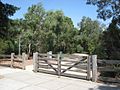
Mallanbool Reserve,[46] off Murrumbeena Road and Leila Road, is a cultural and botanical trail for visitors to learn about the original inhabitants of the area, the Kulin. Its trails connect to Packer Park.
Walking trails
[edit]The historical Boyd Walk commences in Murrumbeena Village opposite Murrumbeena Station and connects eight sites of historical significance. It tells the story of Murrumbeena's artistic heritage and local life of the Boyd family and associated artists who completed significant works in the area.[47]
The Kulin Nation Trail through Mallanbool Reserve is an interpretive cultural and botanical trail telling the stories of the original Indigenous owners of the area.[48]
The 17 km-long Djerring Trail, which runs under the elevated rail pylons, was completed in 2018. The leafy, shared pedestrian/bike path has exercise stations, and links Murrumbeena to Hughesdale (east) and Carnegie (west).[49]
1000 Steps in Murrumbeena - Murrumbeena is reasonably flat apart from the dip between Murrumbeena and Hughesdale Stations. From the ground-level Murrumbeena Station to its platforms, there are 60 steps (4 flights of 15 stairs). A 1000-step challenge will require 16 full sections from bottom to top and a 17th to the end of the 3rd section. (Escalators and lifts don’t count.)
Cycling
[edit]Numerous cycling connections traverse Murrumbeena, including the 17 km-long Djerring Trail, which runs under and alongside the rail corridor from Caulfield to Dandenong.
A shared path through Boyd Park (along the Outer Circle Railway) connects to Gardiners Creek Trail on the other side of Dandenong Road then onto the Yarra Trail and Scotchmans Creek Trail. A bike repair station is alongside the path in Boyd Park.
Rosstown Rail Trail runs east–west along Murrumbeena Crescent.
The shared bike and parking lane along Murrumbeena Road runs north–south connecting to Dandenong Road and extending along East Boundary Road.
-
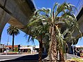
 Palm trees at sunset, Murrumbeena Park
 -
 Murrumbeena Park pavilion
 -
 Outer Circle Railway linear park Murrumbeena
 -
 Murrumbeena Park playground and ovals
 -
 Murrumbeena Park playground
 -
 Looking toward Murrumbeena station from Djerring Trail
 -
 Duncan McKinnon Reserve
 -
 Mallanbool Reserve with galahs
 -
 Entrance to Boyd Park which was named for the potter Merric Boyd


Notable people
[edit]The arts
[edit]Through the Boyds, Murrumbeena played host to other well-known artists including John Perceval, Sidney Nolan, Hatton Beck, and Peter Herbst, Albert Tucker, Joy Hester, Yosl Bergner, Artur and Sylvia Halpern, Jean Langley and many others. Many pottery works produced in Murrumbeena are held in the National Gallery of Victoria's Australian Ceramics collection.[50]
- The potter Merric Boyd (1888–1959) established a studio in Murrumbeena and produced his own distinctive style of Art Nouveau ceramics.
- Doris Boyd (née Gough (1889–1960) was a painter who studied under Bernard Hall and Frederick McCubbin at the National Gallery School, where she met husband Merric Boyd.
- Emma Minnie Boyd (1858–1936) was an experienced and prolific Australian artist and lived at 4 Wahroonga Crescent.
- Arthur Boyd AC OBE (1920–1999) was one of the leading Australian painters of the late 20th Century. In 1995 he was awarded Australian of the Year and in 1999 Boyd's portrait and artwork were featured in the Australian Legends series postage stamps. One of the world's largest tapestries, a greatly enlarged version of Boyd's original painting, hangs in the Great Hall of the Australian Parliament House.
- Guy Boyd (1923–1988) was a figurative sculptor, potter and activist born and raised at Open Country. He authored Justice in Jeopardy in defence of Lindy Chamberlain, and was the subject of a book by Anne Von Burtouch and Patrick Hutchings.
- David Boyd OAM (1924–2011) was a figurative painter, ceramic sculptor and potter, born and raised at "Open Country". He was married to Hermia Boyd and was a member of the Antipodeans group.
- Artist John Perceval AO (1923–2000) married Mary Boyd in 1944 and moved to Open Country, where they raised their four children. Between 1949 and 1955 he concentrated on producing earthenware ceramics and helped to establish the Arthur Merric Boyd Pottery.
- Lady Mary Elizabeth Nolan[51] (née Boyd, also Mary Perceval, 1926–2016) was a photographer and featured in many paintings by Arthur Boyd, sculptures by Guy Boyd and the nativities of (first husband) John Perceval. She created a centre for communal art activities at The Rodd[52] in Wales, along with husband Sidney Nolan.
- Frederick Cox (1861–1965), Murrumbeena artist and potter better known as Jolliff[53][54] Influenced by the Boyd family, he is known for hand-formed pottery and his "wonderfully idiosyncratic body of work", which features in gallery collections.
- Elizabeth Fretwell OBE (1920–2006) was an Australian soprano born and raised in Murrumbeena. She was the prima donna at London's Sadler's Wells Opera (English National Opera) through much of the 1950s and 1960s, sang before Queen Elizabeth II, joined the Australian Opera and performed at Sydney Opera House.
- John Béchervaise OAM MBE (11 May 1910 – 13 July 1998) was an Australian writer, photographer, artist, historian and Antarctic explorer who taught art at Murrumbeena State School.
- Jazz musician/trombonist Frank Traynor (1927–1985) opened the Melbourne Jazz Club, was once dubbed 'Australia's king of jazz,'[55] and was born Murrumbeena.
- Mark Trevorrow, the creator of Bob Downe, the camp safari-suit wearing comic and singer was born and raised in Murrumbeena.
- Musician Nick Cave AO, grew up in the suburb, following his early years in Warracknabeal. Local café Nature Boy, named after one of Cave's songs, is an homage to the former resident.
- TISM played their first show at the Duncan McKinnon Athletics Reserve's track club rooms on 6 December 1983.
- Singer-songwriter Vance Joy[56] (born James Keogh) grew up in Murrumbeena.
- Suzanne Johnston, an operatic mezzo-soprano and ARIA Award winner, was born in Murrumbeena.
- Comedian, radio and TV broadcaster Libbi Gorr grew up in Murrumbeena. Her satirical character Elle McFeast emerged on ABC's Live and Sweaty (alongside Andrew Denton) in 1991.
- Radio and television presenter Ed Phillips lived in Murrumbeena.
- Eve Ash - writer, filmmaker and former director/board member of the AFI and Film Victoria - was raised in Murrumbeena. Her 2019 film Man on the Bus[57] weaves the story of her parents' Holocaust experience and new life in the suburb.
- Brian Wise OAM is a veteran 3RRR broadcaster and founder of Rhythms Magazine, recognised for four decades dedicated to broadcast media, particularly radio.
Sports
[edit]Many Australian Rules footballers played with Melbourne Demons and came from Murrumbeena Football Club and also grew up (or went to school) in the suburb, including Robert Flower from 1973 until 1987, Tom Flower, Ray Carr, Mark Mitchell, Howard Hollow and Ken Jungworth.
- Ellia Green, OAM, is a professional Australian Rugby Union player who represented Australia in Sevens Rugby, won a gold medal at the 2016 Summer Olympics in Rio and is Australia's highest tryscorer in history. He lived in Murrumbeena while attending school.
- Wayne Walsh[58] was recruited from Murrumbeena FC to play for Richmond (Tigers) in 1968, played for South Melbourne (Swans), then returned to the Tigers and played in the 1973/1974 Premiership teams.
- John Richmond was recruited from Murrumbeena FC to play for Richmond in the 1960s.
- Sydney Swans champion footballer Stephen Wright coached Murrumbeena Football Club from 2014 to 2018, making it to grand finals in 2015 and 2017 in the Southern Football Netball League.
- Australian Baseball League player Philip Dale coaches Australian national baseball (including Athens Olympics 2004 silver medal-winning Australian team) and resides in Murrumbeena.
- Paralympic swimming medallist Phillip Tracey was from the suburb.[59]
Business and politics
[edit]- Sir James Patterson KCMG (18 November 1833 – 30 October 1895),[60][61] was an Australian colonial politician and the 17th Premier of Victoria. He lived in Murrumbeena and was still a member of Parliament when he died from influenza.
- Bill Shorten, the Member for Maribyrnong in the Australian Parliament, grew up in Neerim Rd, Murrumbeena and attended Mass at the Good Shepherd Convent, on the current site of Chadstone Shopping Centre. He was the Leader of the Australian Labor Party and Leader of the Opposition in the Australian House of Representatives.
- Entrepreneur, owner of Australia's National Basketball League (NBL) and co-founder of internet provider Dodo, Larry Kestelman[62] attended Murrumbeena High School.
- Gangster “Squizzy" Taylor (Joseph Theodore Leslie Taylor; 1888–1927) holed up in Emily Street for a year.
Sport
[edit]The suburb has an Australian Rules football team competing in the Southern Football League with a history that can be traced back to the formation of the Murrumbeena Junior Football Club in 1918. They have junior and senior sides,[63] including women's teams. Murrumbeena won back-to-back SFNL Women's Division 1 Premierships in 2017, 2018 and 2019.
Murrumbeena Bowls Club and Murrumbeena Park Bowls Club field teams in the Bowls Victoria Pennant competition.
Sporting clubs:
- Murrumbeena Football Club – Founded in 1918.
- Murrumbeena Cricket Club – Founded in 1910.
- Murrumbeena Bowls Club (Blackwood St) - Founded in 1923 initially at 'Oakdene' 41 Murrumbeena Rd and moved to current site in 1925.
- Murrumbeena Park Bowls Club (Gerald St)
- Glenhuntly Athletics Club, Duncan McKinnon Reserve
- Caulfield Little Athletics, Duncan McKinnon Reserve
- Murrumbeena Netball Club (MNC)
- Caulfield and District Netball Association, Duncan McKinnon Reserve
- Murrumbeena Tennis Club
- Caulfield Recreational Tennis Club, opposite Duncan McKinnon Reserve
See also
[edit]- City of Caulfield – Murrumbeena was previously within this former local government area.
References
[edit]- ^ Australian Bureau of Statistics (28 June 2022). "Murrumbeena (suburb and locality)". Australian Census 2021 QuickStats. Retrieved 28 June 2022.
- ^ Australian Bureau of Statistics (28 June 2022). "Murrumbeena (suburb and locality)". Australian Census 2021 QuickStats. Retrieved 28 June 2022.
- ^ "Murrumbeena Postcode".
- ^ Australian Bureau of Statistics (28 June 2022). "Murrumbeena (Suburbs and Localities)". 2021 Census QuickStats. Retrieved 16 July 2022.
- ^ "Murrumbeena: This suburb's biggest problem is 'people move here and don't want to leave'". www.domain.com.au. Retrieved 31 January 2023.
- ^ mirambena
- ^ What does Murrumbeena Mean?, Murrumbeena Community, retrieved 25 July 2010
- ^ Brown-May, Andrew & Swain, Shurlee: The Encycploedia of Melbourne, page 496. Cambridge University Press, 2005.
- ^ Victorian Collections
- ^ Murrumbeena 3163
- ^ "VICSIG". vicsig.net. Retrieved 10 September 2017.
- ^ a b c d "VHD". vhd.heritage.vic.gov.au. Retrieved 10 September 2017.
- ^ "THE POTTERY, 1948 | Deutscher and Hackett". www.deutscherandhackett.com.
- ^ "History". Schwobs.
- ^ Lucas, Clay (21 September 2010). "Level crossings choking city traffic flow: RACV". The Age. Melbourne.
- ^ a b "Heritage protection for Murrumbeena Village".
- ^ "Murrumbeena Wine Bar Is The Chic Suburban Escape For Vino, Tapas And Live Tunes". www.theurbanlist.com. Retrieved 31 January 2023.
- ^ "Murrumbeena Wine Bar". Broadsheet. Retrieved 31 January 2023.
- ^ Solomon, Jade. "First look: Murrumbeena welcomes its first-ever bar". Time Out Melbourne. Retrieved 31 January 2023.
- ^ Metro Tunnel
- ^ "VHD". vhd.heritagecouncil.vic.gov.au.
- ^ "VHD". vhd.heritagecouncil.vic.gov.au.
- ^ "VHD". vhd.heritagecouncil.vic.gov.au.
- ^ "Outer Circle: The Boyds and the Murrumbeena Artists" (PDF). www.ngv.vic.gov.au. Retrieved 18 January 2021.
- ^ "Site 4 — Wahroongaa Crescent - Glen Eira City Council". Archived from the original on 29 January 2019. Retrieved 28 January 2019.
- ^ "Archived copy". Archived from the original on 29 January 2019. Retrieved 28 January 2019.
{{cite web}}: CS1 maint: archived copy as title (link) - ^ "VHD". vhd.heritagecouncil.vic.gov.au. Retrieved 19 January 2019.
- ^ stained glass memorial windows
- ^ "VHD". vhd.heritagecouncil.vic.gov.au.
- ^ "VHD". vhd.heritagecouncil.vic.gov.au.
- ^ "VHD". vhd.heritagecouncil.vic.gov.au.
- ^ "Amazing meld of art, science". Domain.
- ^ "Entrance to open country, the Boyd family home, Murrumbeena [picture]". Trove.
- ^ "Outer Circle: The Boyds and the Murrumbeena Artists | NGV". www.ngv.vic.gov.au.
- ^ Stephens, Andrew (28 November 2014). "Boyd family's Murrumbeena gatherings a fount of inspiration for Australian artists". The Sydney Morning Herald.
- ^ "Trove". trove.nla.gov.au.
- ^ "VHD".
- ^ "VHD". vhd.heritagecouncil.vic.gov.au. Retrieved 29 January 2019.
- ^ "Trove". trove.nla.gov.au.
- ^ "Art Projects Archive 3 | Ursula Dutkiewicz". ursuladutkiewicz.com.
- ^ Murrumbeena High School
- ^ "Art Block". Murrumbeena High School Reunion. Archived from the original on 13 May 2010. Retrieved 24 September 2018.
- ^ "Murrumbeena Secondary College No. 8110 (previously known as Murrumbeena High School 1958-1990) Department of Education School Records". National Library of Australia - Trove. 1958. Retrieved 29 January 2019.
- ^ "Lost Schools of the 1990s". Learning from the Past. Retrieved 29 January 2019.
- ^ Topsfield, Jewel (19 November 2010). "All set for high school but closures leave no place to go". The Age. Retrieved 19 February 2018.
- ^ "Mallanbool Reserve". www.gleneira.vic.gov.au. Retrieved 18 January 2019.
- ^ "Boyd walking tour". www.gleneira.vic.gov.au. Glen Eira City Council.
- ^ "Mallanbool Reserve – Carnegie – Short walks – Native and indigenous plants – Kulin Nation Trail" (PDF). www.gleneira.vic.gov.au. Glen Eira City Council. Retrieved 30 January 2019.
- ^ "Preview the Caulfield-Dandenong Rail Trail". Bicycle Network. 11 October 2018. Retrieved 30 January 2019.
- ^ "Collection Areas | NGV". www.ngv.vic.gov.au.
- ^ "Vale Mary Nolan". Bundanon Trust. Retrieved 24 January 2019.
- ^ Rodd
- ^ "Works | NGV | View Work". www.ngv.vic.gov.au.
- ^ "Works | NGV | View Work". www.ngv.vic.gov.au.
- ^ Watson, Al. "Traynor, Thomas Francis (Frank) (1927–1985)". Cultural Advice. National Centre of Biography, Australian National University – via Australian Dictionary of Biography.
- ^ "Vance Joy: From Cafe Slots to Stadium Shows, Coachella, and Beyond". Broadsheet.
- ^ Man on the Bus
- ^ "Walsh the Coming Home Hero". www.richmondfc.com.au.
- ^ "SA husband and wife both get gold at Paralympics". The Canberra Times. 23 October 1988. Retrieved 1 January 2015.
- ^ Mennell, Philip (1892). . The Dictionary of Australasian Biography. London: Hutchinson & Co. pp. 366–367 – via Wikisource.
- ^ "Dictionary of Australian Biography P-Q". gutenberg.net.au.
- ^ Marshall, Konrad (31 August 2017). "Larry Kestelman: The Melbourne millionaire putting the bounce back into basketball". The Sydney Morning Herald.
- ^ Full Point Footy, Southern Football League, archived from the original on 10 May 2008, retrieved 21 October 2008
Further reading
[edit]- Boyd, David (2012), An Open Home: Recollections of my early life. ISBN 9781742704500
- Bungey, Darleen (2008), Arthur Boyd: A life. ISBN 9781741756135
- Niall, Brenda (2007), 'The Boyds' ISBN 9780522853841
- Phillipp, Franz (1967). Arthur Boyd. ISBN 9221055566
- Smith, Colin G. (2013). Merric Boyd and Murrumbeena: The Life of an Artist in a Time and a Place. ISBN 978-0-646-59558-0
External links
[edit]Murrumbeena, Victoria
View on GrokipediaGeography and Environment
Location and Boundaries
Murrumbeena is a suburb located approximately 13 kilometres south-east of Melbourne's central business district, within the City of Glen Eira local government area.[7][8] The suburb's postcode is 3163.[9] The boundaries of Murrumbeena are generally defined by major arterial roads and streets: Dandenong Road forms the northern boundary, Poath Road the eastern, North Road the southern, and Murrumbeena Road along with Winston Way, Boake Street, and Leila Road the western perimeter.[10][1] These delineations align with official locality mappings maintained by Victorian authorities.[11] Neighbouring suburbs include Carnegie to the north-west, Malvern East to the west, Hughesdale to the south-east, and Bentleigh East to the south.[9] The suburb's compact layout facilitates connectivity via the Pakenham and Cranbourne railway lines, with Murrumbeena railway station serving as a key transport node within its boundaries.[7]Topography and Land Use
Murrumbeena exhibits relatively flat topography characteristic of the broader Port Phillip Plains, with elevations ranging from 41 to 59 metres above sea level and an average of approximately 50 metres.[9][12] The terrain lacks significant hills or ridges, facilitating straightforward urban development and drainage, though the suburb lies within the catchment of the Murrumbeena Drain, which influences local hydrology and flood mapping.[13] The suburb covers about 2.5 square kilometres and is predominantly residential in land use, with zoning under the Glen Eira Planning Scheme emphasising low- to medium-density housing such as detached dwellings and townhouses.[14] A linear commercial strip along Murrumbeena Road accommodates retail, cafes, and professional services, with recent amendments allowing mixed-use developments up to eight storeys in select areas to integrate housing with ground-floor commercial space.[15][16] Open space comprises roughly 9.6% of the total area, featuring parks and reserves that support recreation and biodiversity; notable examples include Murrumbeena Park (5.61 hectares), which hosts sports ovals, playgrounds, and a pavilion, alongside smaller reserves like Duncan McKinnon Reserve and Boyd Park.[17][18] These green areas mitigate urban density effects and align with the City of Glen Eira's strategy for sustainable residential expansion while preserving neighbourhood character.[19]Demographics
Population Trends and Statistics
At the 2021 Australian census, Murrumbeena recorded a population of 9,996 residents, comprising 49.1% males and 50.9% females, with a median age of 37 years.[2] This marked a modest increase from the 9,926 residents enumerated in the 2016 census.[20] Historical census data indicate consistent population growth through the early 21st century, driven by Melbourne's metropolitan expansion, though the pace has slowed recently. The suburb's population rose from 7,607 in 2001 to 8,232 in 2006, 8,592 in 2011, and peaked at 9,926 in 2016 before stabilizing near 10,000 by 2021.[1] This trajectory reflects a compound annual growth rate of approximately 1.4% from 2001 to 2016, decelerating to 0.1% annually between 2016 and 2021, amid broader trends of constrained supply in established inner-suburban areas.[21]| Census Year | Population |
|---|---|
| 2001 | 7,607 |
| 2006 | 8,232 |
| 2011 | 8,592 |
| 2016 | 9,926 |
| 2021 | 9,996 |
Socioeconomic Characteristics
According to the 2021 Australian Census, the median weekly household income in Murrumbeena stood at $2,057, exceeding the Victorian state median of $1,759.[2] Median personal weekly income was $1,035, while median family income reached $2,767. Approximately 31.3% of households earned $3,000 or more per week, placing a significant portion in the highest income quartile relative to the City of Glen Eira.[22] Educational attainment is notably high, with 48.2% of residents aged 15 and over holding a bachelor degree or higher qualification, compared to 29.2% across Victoria.[2] Labour force participation among those aged 15 and over was 71.0%, surpassing the state rate of 62.4%, with an unemployment rate of 4.0%. Of the employed, 59.4% worked full-time and 30.6% part-time. Occupations reflect a professional skew, with 35.8% in professional roles and 16.1% as managers, alongside concentrations in industries such as hospitals (5.1%) and computer system design (4.1%).[2] Housing tenure data indicates a balanced mix: 29.5% of occupied private dwellings were owned outright, 36.4% rented, and the remainder under mortgage. Median weekly rent was $386, and median monthly mortgage repayments $2,167, supporting stable homeownership amid suburban affordability pressures. Family structures emphasize couples, with 46.5% having dependent children and 39.9% childless, contributing to a median household size of 2.4 persons.[2]History
Indigenous Presence and Early Settlement
The land now comprising Murrumbeena formed part of the traditional territory of the Boonwurrung (also spelled Bunurong or Bun wurrung) people, an Aboriginal group of the Kulin Nation whose lands extended south of the Yarra River along coastal and inland areas of present-day southern Melbourne. Local authorities, including the City of Glen Eira Council, recognise both the Boonwurrung and the neighbouring Wurundjeri Woi Wurrung peoples as Traditional Owners and Custodians of the region, reflecting overlapping clan boundaries disrupted by European colonisation.[23] [24] The Boonwurrung sustained themselves through hunting, fishing, and gathering native plants and animals in the area's wetlands, grasslands, and forests, with regional archaeological evidence indicating continuous Aboriginal occupation in the Port Phillip area for at least 30,000–40,000 years prior to European arrival.[25] European exploration and settlement in the vicinity began following the establishment of the Port Phillip District in 1835, with pastoralists claiming large runs for sheep grazing and agriculture by the early 1840s.[26] In the specific area of Murrumbeena, which lay on the southeastern fringe of early Melbourne, land use initially involved farming and market gardens on subdivided estates, remaining sparsely populated amid broader rural expansion driven by wool production and proximity to the city.[1] Physical remnants of this phase include isolated late Victorian villas from the 1850s–1880s, such as those in the Murrumbeena Village Precinct, though most early structures have been lost to later suburbanisation.[26] The opening of the Murrumbeena railway station on 14 May 1879 along the Caulfield–Oakleigh line represented a pivotal development, officially adopting the name Murrumbeena for the nascent settlement and improving connectivity to Melbourne, which spurred initial residential and commercial growth in the late 19th century.[1] Prior to this, the locality featured limited infrastructure, with population densities low and dominated by agricultural holdings rather than urban form.[27] By the 1880s–1890s, subdivision pressures during Melbourne's land boom began transforming the area, though full suburbanisation awaited 20th-century transport and population surges.[26]Suburban Development and Post-War Expansion
Suburban development in Murrumbeena commenced in the late 19th century with initial subdivisions of former market gardens and dairy farms, including portions along Omama Road and Tuckett Street in 1898, though settlement remained sparse until the early 20th century.[1] By 1908, significant unfilled land tracts persisted, but density increased by 1910 with the establishment of community facilities such as a Church of Christ and basic shops including a fruiterer and butcher.[1] The suburb's residential character solidified post-World War I, as many houses were constructed during the inter-war period, supported by the 1877 opening of the Murrumbeena railway station that facilitated access from Melbourne's central business district.[1] Commercial growth paralleled this, with a boom from 1915 to 1925 along Neerim and Murrumbeena Roads, featuring inter-war shops like Wardrop’s Buildings (1920-1921) and Moran & Cato store (1919), culminating in nearly 60 businesses by 1928.[28] Post-World War II expansion built on this foundation amid Melbourne's broader suburban boom driven by immigration and housing demand, though Murrumbeena's growth was more infill-oriented than greenfield due to its established footprint.[1] Modernist additions appeared in the 1950s, such as updated shopfronts (e.g., Nos 457-463 Neerim Road) and two-storey red brick extensions to earlier structures, reflecting adaptive reuse rather than wholesale redevelopment.[28] The 1930s Beauville estate by developer Albert Jennings exemplified pre-war planning, but post-war influxes included Continental European and Greek migrant families, contributing to community institutions like the 1931-opened Catholic primary school, which expanded to serve growing numbers.[1] By the 1960s, infrastructure like petrol stations emerged (e.g., No 51 Murrumbeena Road), signaling motorized suburban lifestyles, while later 1970s developments introduced home units and flats on subdivided large allotments, marking a shift toward higher-density housing.[28][1] This period aligned with Caulfield City's trebling of Continental European migrants by 1947, from 0.6% in 1933 to 1.6%, fueling localized population pressures.[26]Etymology
Origin and Linguistic Roots
The name Murrumbeena derives from the Aboriginal word mirambeena (or variant spellings such as Mirambena), originating in the language of the Boonwurrung/Bunurong people, traditional custodians of the Port Phillip region including this area.[1] [29] The suburb adopted the name from its western boundary road, Mirambena Road, which appears on early maps and likely predates European subdivision in the mid-19th century.[1] Etymological interpretations remain speculative due to limited surviving linguistic records from Victorian Aboriginal languages, disrupted by colonization. Proposed meanings for mirambeena include "belonging to you," "welcome," "land of frogs," or "moss growing on decayed wood," reflecting environmental features like wetlands in the pre-settlement landscape.[1] [29] These draw from historical analyses of Kulin Nation languages but lack definitive attestation, as oral traditions were not systematically documented before significant population decline post-1835 European arrival.[1] Alternative theories link the name to colonial contexts, such as a possible corruption of "me rum beena" ("place of the mounted police"), referencing an Aboriginal tracker in the Native Police Corps active in Victoria from 1837 to 1853; however, this remains unverified and less supported by primary linguistic evidence.[1] The ambiguity underscores broader challenges in tracing Aboriginal toponyms, where phonetic adaptations by English speakers often obscure original semantics.[29]Cultural and Artistic Heritage
The Boyd Family Influence
William Merric Boyd, known as Merric Boyd, established Australia's first studio pottery at the family property "Open Country" in Murrumbeena in 1913, on land purchased by his parents at 8 Wahroongaa Crescent.[30][31] The site served as both a home and workshop, fostering an environment for artistic experimentation in ceramics, which Boyd pioneered through hand-built earthenware pieces featuring Australian motifs and natural forms.[32][33] Merric Boyd, married to Doris Gough in 1915, collaborated with her on pottery production, rebuilding after a 1926 fire that destroyed their initial kiln and studio.[34] Their home became a gathering place for artists, including family members like son Arthur Boyd, born in Murrumbeena in 1920, and associates such as John Perceval, contributing to a vibrant local ceramics scene during the interwar and post-war periods.[35][36] In 1944, Arthur Boyd, John Perceval, and Peter Herbst founded the Arthur Merric Boyd (AMB) Pottery in Murrumbeena, utilizing a local shop space to produce decorated stoneware and porcelain, expanding the family's influence on Australian studio ceramics.[31][37] This collaborative venture attracted potters like Neil Douglas, producing works with Australian wildlife and landscape themes that reflected the Boyd emphasis on national identity in art.[38] The Boyd presence elevated Murrumbeena's status as an artistic hub, with "Open Country" hosting gatherings that inspired figures in painting, sculpture, and pottery, influencing broader Australian cultural heritage through innovative techniques and communal creativity.[3][39] A local park was later named Boyd Park in honor of Merric Boyd's contributions to pottery.[3]Broader Artistic Community
The broader artistic community in Murrumbeena encompasses grassroots initiatives and collaborative projects involving local residents and artists, often centered around community venues like the Murrumbeena Uniting Church's Meeting Place. This space hosts regular art exhibitions, such as the 'Through the Lens' photographic exhibition from 9-19 October 2025, featuring works from local photographers including members of the Southern Suburbs Photographic Society, and a community art exhibition from 11-21 April 2025.[40][41] These events foster participation through workshops and artist talks, promoting creative expression among residents.[42] Prominent community art projects include those led by Melbourne-based artist Anthony Breslin, whose works integrate public murals and garden installations. The Story of Big Frog mural, created in 2020-2021 in collaboration with the Murrumbeena community and supported by a Glen Eira City Council grant, depicts Indigenous storytelling elements and local flora, enhancing public spaces.[43] Breslin's Anthony Breslin Community Art Project at the Murrumbeena Uniting Church features ceramic tiles, paintings, and vegetable garden beds adorned with community-contributed artworks, initiated around 2015 and involving local artists.[44][45] Additionally, the Rotary Club of Caulfield's R100 Murrumbeena Art Wall project, completed in recent years, transformed a 50-meter wall at the corner of Murrumbeena Road and Railway Parade into a mural inspired by Breslin's children's book Brezania, incorporating over 75 panels with original paintings and motivational messages.[46][47] These efforts extend to other local endeavors, such as creative arts therapy programs and knitting circles at the Meeting Place, which blend artistic practice with community building.[48][49] Nearby groups like the Hughesdale Art Group, supported by the Community Bank Murrumbeena, host annual exhibitions that draw participants from the suburb, marking milestones like their 60th exhibition in 2025.[50] Such activities highlight Murrumbeena's role in nurturing amateur and semi-professional artists through accessible, volunteer-driven platforms rather than formal institutions.Local Governance and Urban Planning
Administrative Structure
Murrumbeena is situated entirely within the City of Glen Eira local government area (LGA), a municipal entity in Victoria, Australia, encompassing south-eastern suburbs of Melbourne approximately 10 kilometres from the central business district.[51] [52] The City of Glen Eira spans 38 square kilometres and serves a population of 148,908 as recorded in the 2021 Census.[52] The LGA is governed by the Glen Eira City Council, a unicameral body consisting of nine councillors, each elected to represent a single-member ward for four-year terms, with the structure implemented following a 2023 electoral representation review by the Victorian Government.[53] [54] This subdivided model replaced prior multi-member arrangements to enhance localized representation, with boundaries redrawn to align more closely with community interests and demographic distributions.[55] The council's responsibilities include local planning, infrastructure maintenance, waste services, community health initiatives, and regulatory enforcement under the Local Government Act 2020 (Vic).[56] [52] The suburb of Murrumbeena falls predominantly within the Murrumbeena Ward, one of the nine wards, represented since the October 2024 elections by Councillor Luca Ragni, who was elected Deputy Mayor in November 2024.[57] [54] The ward boundaries, as defined by the Victorian Electoral Commission, incorporate key residential and commercial areas of the suburb, facilitating targeted advocacy on issues such as urban development and park maintenance.[58] The mayor, selected annually from among the councillors by a vote of the council, oversees ceremonial duties and chairs meetings but holds no additional executive powers beyond those of other members.[59] Council decisions are informed by statutory frameworks, including community engagement processes for planning schemes and budgets, with oversight from the Victorian Local Government Inspectorate to ensure compliance and transparency.[60] Murrumbeena's integration into this structure supports suburb-specific initiatives, such as heritage protections in the Murrumbeena Village Precinct, approved via council-led amendments to the Glen Eira Planning Scheme.[61]Development Policies and Controversies
In recent years, development policies in Murrumbeena have been shaped by the Glen Eira City Council's local planning scheme, which emphasizes preserving neighbourhood character, heritage overlays, and low-to-medium density residential zoning, while allowing incremental growth near activity centres like the railway station and commercial strips. However, the Victorian state government's housing initiatives have increasingly intervened, prioritizing higher-density apartments near public transport to address a statewide shortage of over 800,000 dwellings by 2036, often overriding council decisions through ministerial call-ins.[62][63] A prominent controversy arose in 2025 over an eight-storey apartment development proposed for Neerim Road, comprising 110 units adjacent to heritage-listed interwar shops in Murrumbeena Village. Glen Eira City Council rejected the application in March 2025, citing risks of overshadowing the heritage precinct, inadequate setbacks, and incompatibility with the area's established scale, which features predominantly two- to three-storey buildings.[63][64] Despite community submissions highlighting traffic congestion and loss of amenity— with over 100 objections lodged—the Victorian Planning Minister approved the project on May 26, 2025, under call-in powers, arguing it aligned with state housing targets and proximity to the Murrumbeena station, 200 metres away.[65][64] This decision drew criticism from Mayor Simone Zmood, who stated it failed to adequately mitigate local impacts, exacerbating tensions between state-driven density increases and council-led preservation efforts.[64] Broader draft plans released in September 2025 for activity centres in Murrumbeena, Carnegie, and Hughesdale propose up to six-storey developments along commercial strips, prompting further resident concerns over heritage erosion and infrastructure strain, though the state maintains no changes to existing overlays.[66][67] Local advocacy groups have argued that such overrides undermine democratic planning processes, while proponents view them as necessary to counter restrictive local policies amid Melbourne's population growth exceeding 100,000 annually.[68][69]Housing and Economy
Residential Market Dynamics
The residential property market in Murrumbeena is dominated by detached houses on established blocks, with apartments comprising a smaller segment due to the suburb's low-density character and zoning constraints. As of September 2025, the median house sale price stood at $1,610,000, reflecting a 2.9% decline over the preceding 12 months amid broader Melbourne affordability pressures from sustained high interest rates.[70]| Property Type | Median Price (2025) | 12-Month Growth | Recent Sales Volume |
|---|---|---|---|
| Houses | $1,610,000 | -2.9% | 64 |
| Units | $670,000 | +3.1% | Not specified |
Commercial Activity
Commercial activity in Murrumbeena centers on the Murrumbeena Village Precinct along Neerim Road, which functions as the suburb's primary retail and service hub. This precinct hosts a variety of small-scale businesses, including supermarkets like IGA, cafes, and specialty retail outlets that primarily serve the local residential population.[28][75] The commercial strip originated in the late 19th century, with initial shops constructed between 1889 and 1900, followed by rapid expansion in the interwar period driven by residential growth and railway improvements. By 1928, nearly 60 businesses operated there, encompassing grocers, butchers, drapers, chemists, banks, and hairdressers. The precinct retains significant heritage value as a cohesive pre-war streetscape with original shopfronts and architectural detailing, continuing to support everyday commercial needs without large-scale industrial or office presence.[28][76]Transport and Infrastructure
Public Transport Networks
Murrumbeena railway station serves as the suburb's main public transport interchange, situated on the Cranbourne and Pakenham lines within Melbourne's metropolitan rail network.[77] Metro Trains Melbourne operates all passenger services, with trains providing direct access to Flinders Street Station in approximately 20 minutes during typical conditions.[6] Peak-hour frequencies reach every 15 minutes, supporting commuter travel to the city centre and outer southeast suburbs like Cranbourne and Pakenham.[77] The station features platforms for both directions, myki card readers, and connecting bus facilities, though occasional rail replacement buses may substitute train services during maintenance.[77] Bus services, contracted through Public Transport Victoria (PTV), enhance connectivity beyond rail. Route 822 links Chadstone Shopping Centre to Sandringham Station via Murrumbeena, offering access to regional shopping and beach areas.[78] Additional routes such as 627 from Moorabbin to Chadstone and 624 from Kew to Oakleigh intersect at or near the station, facilitating transfers to other parts of Melbourne's southeast.[77] These services operate daily with varying frequencies, integrated via the myki ticketing system for seamless travel across PTV's multimodal network. No tram lines directly serve Murrumbeena, limiting options to rail and bus for public transport users.[77]Road and Connectivity
Murrumbeena is connected to Melbourne's central business district, approximately 13 kilometres north, primarily via arterial roads such as Dandenong Road and North Road, which link to broader highway networks including the Monash Freeway and CityLink tollway.[18] The suburb's internal road network features key arterials like Neerim Road and Murrumbeena Road, classified as State arterial roads under Road Zone Category 1 management by the Department of Transport and Planning.[79] These routes form part of Metropolitan Route 22, extending connectivity eastward to Princes Highway and Oakleigh, and westward toward Caulfield and Booran Road.[80] A major enhancement to road flow occurred with the removal of the Murrumbeena Road level crossing in June 2018, as part of the Caulfield to Dandenong Level Crossing Removal Project.[81] The railway line was elevated over the road, eliminating boom gate delays that previously interrupted vehicular traffic during train passages, thereby reducing congestion and accident risks at this busy arterial intersection.[81] This intervention, one of nine crossings addressed in the project, also integrated improved pedestrian access and a new station, supporting smoother overall network efficiency without altering the road's alignment.[81] Glen Eira City Council maintains non-arterial local roads totaling around 498 kilometres citywide, while arterial segments like Murrumbeena Road fall under state responsibility, with council handling adjacent pathways.[82] Ongoing strategies aim to mitigate delays on these corridors through signal prioritization and corridor upgrades, though peak-hour volumes continue to challenge flow at junctions such as Neerim Road and Murrumbeena Road.[83] Driving times to the CBD typically range from 20 to 30 minutes under normal conditions, varying with traffic on connecting arterials.[84]Education and Community Facilities
Schools and Educational Institutions
Murrumbeena is served primarily by two coeducational primary schools: the government-operated Murrumbeena Primary School and the Catholic St Patrick's Primary School. No secondary schools currently operate within the suburb's boundaries, with local students typically attending nearby public or independent colleges such as McKinnon Secondary College or Glen Eira College. A government secondary school, Murrumbeena Secondary College (No. 8110), previously existed at 801 North Road from its opening on 4 February 1958 until closure on 31 December 1996.[85][86][87] Murrumbeena Primary School (No. 3449), located at Hobart Road, opened on 19 January 1903 and enrols students from Preparatory to Year 6. The school follows the Victorian Curriculum and is authorised as an International Baccalaureate World School for the Primary Years Programme since 26 November 2012, emphasising inquiry-based learning and international-mindedness.[88][89][90] St Patrick's Primary School, situated in the suburb, provides Catholic education from Preparatory to Year 6 under Principal Mrs Joanne Soulsby, integrating faith formation with academic instruction aligned to the Australian Curriculum. The school, part of the Melbourne Archdiocese Catholic Schools system (E No. E1127), maintains a focus on developing responsible leaders through community-oriented programs.[91][92] Early childhood education options include community kindergartens, such as Glen Education St Patrick's Kindergarten, co-located with St Patrick's Primary School to facilitate seamless transitions to formal schooling.[93]Healthcare and Services
One Space Health operates as a modern medical centre in central Murrumbeena, providing consulting suites for general practitioners and allied health professionals, with extended hours from Monday to Saturday.[94] General practice services are supplemented by nearby facilities such as Carnegie Medical Centre, located approximately 1.3 km away, offering bulk-billing options for eligible patients.[95] Murrumbeena Pharmacy, situated at 227A Murrumbeena Road, dispenses prescriptions, conducts vaccinations, and provides medication reviews and health advice.[96] Aged care services include Brimlea Aged Care, a 90-bed residential facility in Murrumbeena accredited for permanent and respite care, featuring 24-hour nursing support, secure environments, and air-conditioned accommodations.[97] St Michael's Aged Care Facility at 1 Omama Road offers residential care with additional mental health referral services.[98] Emmaus Lodge provides a smaller retirement village option with 10 studio units in a secure, garden setting for independent living.[99] Maternal and child health services are available through the Murrumbeena Maternal and Child Health Centre at 107 Murrumbeena Road, operated by Glen Eira City Council, focusing on postnatal support, developmental checks, and breastfeeding advice via a 24-hour helpline.[100] For acute care, residents rely on proximate public hospitals including Caulfield Hospital and Jessie McPherson Private Hospital in adjacent areas, as well as Moorabbin Hospital, which serves as a key regional facility for emergency and specialized treatments under Monash Health.[101][102]Recreation and Leisure
Parks and Open Spaces
Murrumbeena hosts multiple parks and reserves under the management of the City of Glen Eira, offering spaces for organized sports, informal recreation, playground activities, and cultural interpretation. These areas emphasize community use, with facilities ranging from athletic fields to nature trails, supported by local government maintenance and upgrades.[5][103] Murrumbeena Park, established in 1912, spans extensive open grasslands suitable for sports and picnics, featuring two ovals, a nature-based playground with climbing structures and a dry creek bed, three shelters equipped with barbecues, and a recently developed community hub pavilion overlooking the grounds.[5][104] The park includes walking tracks, shaded seating, and amenities like toilets and parking, upgraded in 2022 with additions such as a multipurpose court and scooting loop.[105] Duncan Mackinnon Reserve serves as an elite athletic precinct at the corner of North and Murrumbeena Roads, equipped with an International Association of Athletics Federations-compliant track resurfaced in 2018, 10 netball courts, an outdoor fitness station, and a pavilion with community rooms offering views of the fields.[103][106][107] Boyd Park, located near Murrumbeena Primary School along the former Outer Circle Railway corridor, provides a linear green space with playground equipment under shade sails, hundreds of meters of paved walking and cycling paths, mature trees supporting bird habitats, and connections to broader urban forest networks.[108] Mallanbool Reserve functions as a cultural and botanical interpretive site focused on the Kulin Nation's traditional practices, featuring a 400-meter self-guided trail with native plantings, ephemeral wetlands attracting wildlife, soundposts for audio narration on Indigenous harvesting and hunting, and leash-required paths for leashed dogs.[109][110] Linear open spaces like the Outer Circle Linear Park remnants and sections of the Djerring Trail along the railway lines supplement these reserves, providing shared walking and cycling paths through the suburb for passive recreation and connectivity.[111]
Sports and Active Pursuits
Duncan Mackinnon Reserve serves as a primary hub for athletics and netball in Murrumbeena, featuring a 400-meter synthetic athletics track upgraded to meet World Athletics standards, including facilities for long jump, high jump, discus, shot put, javelin, hammer throw, pole vault, and a water jump.[103][112] The reserve also includes 10 netball courts, an oval suitable for soccer and other field sports, outdoor fitness stations, and walking paths, supporting both competitive training and casual active pursuits.[103][113] It hosts the Caulfield Little Athletics Centre, which provides skill development and competition for children aged 5-15 during the summer season from October to March.[113] Murrumbeena Park offers two ovals primarily used for Australian rules football and cricket, with lighting upgrades completed in late 2024—150 lux LED fixtures around Oval 1 and 50 lux around Oval 2—to enable evening games and training sessions.[5][114] The grounds support local clubs, including the Murrumbeena Football Club, which utilizes the facilities for matches and practice.[115] Other organized sports include tennis at the Murrumbeena Tennis Club, which maintains three en-tout-cas courts for social play, competitions, and coaching programs open to all skill levels.[116] Lawn bowls enthusiasts participate at the Murrumbeena Bowling Club, which received new green-side shelters in February 2025 to provide weather protection during games.[117] These facilities, managed under the Glen Eira City Council, contribute to a community-oriented sports environment accommodating over 230 teams across various codes in the broader municipality.[118]Notable Residents
Artists and Cultural Figures
William Merric Boyd (1888–1959), Australia's pioneering studio potter, resided in Murrumbeena from 1913 until his death, establishing the nation's first such pottery at his property "Open Country" on Wahroongaa Crescent.[31] There, he produced ceramic works influenced by his artistic family background and the semi-rural environment, mentoring a generation of potters despite personal challenges like epilepsy.[119] Merric's son, Arthur Merric Boyd (1920–1999), a prominent painter and member of Australia's Boyd artistic dynasty, was born in Murrumbeena on 24 July 1920.[120] The family home served as a creative hub, attracting visits from artists such as Sidney Nolan and John Perceval, fostering collaborations amid the suburb's early 20th-century development.[31][39] Other Boyd family members with ties to Murrumbeena include potter and sculptor David Boyd (1924–2011) and sculptor Guy Boyd (1923–1988), who contributed to the area's cultural legacy through their multifaceted practices in ceramics, painting, and public art.[121] The Boyd presence elevated Murrumbeena's role in Australian art history, with Merric's workshop influencing post-war ceramic traditions.[119]Other Prominent Individuals
Robert Flower (1955–2014), a revered figure in Australian rules football, developed his skills through Murrumbeena Districts juniors before debuting for Melbourne Football Club in the Victorian Football League (VFL) in 1973, amassing 272 games, three club best and fairest awards, and a place in Melbourne's team of the century.[122] Ken Jungwirth (born 1946), originating from Murrumbeena High School and the local football club, scored the decisive goal in Murrumbeena's 1963 premiership victory and progressed to VFL level, playing 15 games for Melbourne (1966) and 13 for Carlton (1969–1970) as a utility player.[123] Jack Collins (1904–1968), born locally, featured in 54 VFL matches for Melbourne between 1924 and 1934, primarily as a defender, contributing to the club's competitive era post-World War I.[124] Harry Bruce (1895–1977), another Murrumbeena native, served in World War I with the Australian Light Horse before playing 27 games for Melbourne (1919–1923) and later enlisting for World War II duty.[125]References
- https://commons.wikimedia.org/wiki/File:Anthony_Breslin_Community_Art_Project.jpg