

Community hub
Recent from talks
Contribute something
Nothing was collected or created yet.
Warren, Pennsylvania
View on Wikipedia
Warren is a city in and the county seat of Warren County, Pennsylvania, United States, located along the Allegheny River.[4] The population was 9,404 at the 2020 census.[5] It is home to the headquarters of the Allegheny National Forest and the Cornplanter State Forest. It is also the headquarters for the Chief Cornplanter Council, the oldest continuously chartered Boy Scouts of America Council, and the catalog company Blair. Warren is the principal city of the Warren micropolitan area.
Key Information


History
[edit]
Warren was initially inhabited by Native Americans of the Seneca nation. French explorers had longstanding claims to the area which they acted to secure in an unambiguous fashion with a military-Amerindian expedition in 1749 that buried a succession of plaques claiming the territory as France's in response to the formation of the colonial Ohio Company—and the first of these was buried in Warren[6] but ultimately control was transferred to the British after the French and Indian War.
After the Revolutionary War, General William Irvine and Andrew Ellicott were sent to the area to lay out a town in 1795. It was named after Major General Joseph Warren.[7]
The first permanent structure in Warren, a storehouse built by the Holland Land Company, was completed in 1796. Daniel McQuay of Ireland was the first permanent inhabitant of European descent.
Lumber was the main industry from 1810–1840, as the abundance of wood and access to water made it profitable to float lumber down the Allegheny River to Pittsburgh.
David Beaty discovered oil in Warren in 1875 while drilling for natural gas in his wife's flower garden. Oil came to dominate the city's economy. Many of the town's large Victorian homes were built with revenue generated by the local oil and timber industries.[8]
Pittsburgh-Des Moines, which was formerly located in Warren, manufactured the Gateway Arch in St. Louis.[9][10] Pittsburgh-Des Moines (PDM) also made railroad car tanks, storage tanks and other plate work. Several miniature replicas are located within the county, including one at the new visitors center on Routes US 6 and US 62[10] next to the Pennsylvania State Police barracks.
Warren has struggled through hard economic times and a steady decline in population, which peaked at nearly 15,000 in 1940. The city is attempting to bounce back with the Impact Warren project, a riverfront development project in downtown Warren. The completed project will include new townhouses and senior citizen housing, retail and commercial development, a parking garage, convention center and bus depot.[citation needed]
Major employers include Walmart, the United Refining Company (gas supplier for Kwik Fill and Red Apple Food Mart gas stations), Allegheny National Forest, Northwest Bank, Whirley-Drinkworks, Superior Tire and Rubber Corp, Pennsylvania General Energy, Betts Industries, Inc, Blair Corporation, Sheetz, and Interlectric.
The Warren Historic District, A.J. Hazeltine House, John P. Jefferson House, Struthers Library Building, Warren Armory, Warren County Courthouse, Wetmore House, Guy Irvine House. and Woman's Club of Warren are listed on the National Register of Historic Places.[11]
Geography
[edit]Warren is located at the confluence of the Allegheny River and the Conewango Creek. Conewango Creek flows between New York state and Warren. Allegheny Reservoir and Kinzua Dam are nearby.
According to the U.S. Census Bureau, Warren has a total area of 3.1 square miles (8.0 km2), 2.9 square miles (7.5 km2) of which is land and 0.2 square miles (0.52 km2) (6.11%) of which is water.
The Allegheny River from the Kinzua Dam to the City of Warren has been designated a "Recreational Waterway" by the United States Congress.
Climate
[edit]| Climate data for Warren, Pennsylvania (1991–2020 normals, extremes 1896–present) | |||||||||||||
|---|---|---|---|---|---|---|---|---|---|---|---|---|---|
| Month | Jan | Feb | Mar | Apr | May | Jun | Jul | Aug | Sep | Oct | Nov | Dec | Year |
| Record high °F (°C) | 74 (23) |
74 (23) |
83 (28) |
92 (33) |
95 (35) |
98 (37) |
102 (39) |
100 (38) |
100 (38) |
90 (32) |
84 (29) |
74 (23) |
102 (39) |
| Mean daily maximum °F (°C) | 32.6 (0.3) |
35.2 (1.8) |
44.3 (6.8) |
58.3 (14.6) |
69.8 (21.0) |
77.4 (25.2) |
81.3 (27.4) |
80.4 (26.9) |
74.0 (23.3) |
60.8 (16.0) |
47.9 (8.8) |
37.2 (2.9) |
58.3 (14.6) |
| Daily mean °F (°C) | 25.2 (−3.8) |
26.5 (−3.1) |
34.2 (1.2) |
46.4 (8.0) |
57.5 (14.2) |
66.0 (18.9) |
70.0 (21.1) |
69.0 (20.6) |
62.7 (17.1) |
50.9 (10.5) |
39.9 (4.4) |
30.7 (−0.7) |
48.2 (9.0) |
| Mean daily minimum °F (°C) | 17.8 (−7.9) |
17.7 (−7.9) |
24.2 (−4.3) |
34.4 (1.3) |
45.2 (7.3) |
54.5 (12.5) |
58.7 (14.8) |
57.7 (14.3) |
51.5 (10.8) |
40.9 (4.9) |
32.0 (0.0) |
24.3 (−4.3) |
38.2 (3.4) |
| Record low °F (°C) | −26 (−32) |
−34 (−37) |
−24 (−31) |
0 (−18) |
20 (−7) |
29 (−2) |
36 (2) |
35 (2) |
26 (−3) |
14 (−10) |
1 (−17) |
−22 (−30) |
−34 (−37) |
| Average precipitation inches (mm) | 3.64 (92) |
2.77 (70) |
3.26 (83) |
4.13 (105) |
4.29 (109) |
4.66 (118) |
4.76 (121) |
4.07 (103) |
3.95 (100) |
4.02 (102) |
3.62 (92) |
3.81 (97) |
46.98 (1,193) |
| Average snowfall inches (cm) | 18.2 (46) |
14.9 (38) |
10.0 (25) |
2.4 (6.1) |
0.0 (0.0) |
0.0 (0.0) |
0.0 (0.0) |
0.0 (0.0) |
0.0 (0.0) |
0.1 (0.25) |
7.5 (19) |
18.5 (47) |
71.6 (182) |
| Average precipitation days (≥ 0.01 in) | 19.1 | 14.5 | 14.6 | 15.1 | 14.1 | 13.7 | 13.0 | 11.5 | 11.5 | 15.0 | 15.3 | 17.7 | 175.1 |
| Average snowy days (≥ 0.1 in) | 11.0 | 8.6 | 5.5 | 1.4 | 0.0 | 0.0 | 0.0 | 0.0 | 0.0 | 0.2 | 3.5 | 8.1 | 38.3 |
| Source: NOAA[12][13] | |||||||||||||
Demographics
[edit]| Census | Pop. | Note | %± |
|---|---|---|---|
| 1840 | 737 | — | |
| 1850 | 1,013 | 37.4% | |
| 1860 | 1,738 | 71.6% | |
| 1870 | 2,014 | 15.9% | |
| 1880 | 2,810 | 39.5% | |
| 1890 | 4,332 | 54.2% | |
| 1900 | 8,043 | 85.7% | |
| 1910 | 11,080 | 37.8% | |
| 1920 | 14,272 | 28.8% | |
| 1930 | 14,863 | 4.1% | |
| 1940 | 14,891 | 0.2% | |
| 1950 | 14,849 | −0.3% | |
| 1960 | 14,505 | −2.3% | |
| 1970 | 12,998 | −10.4% | |
| 1980 | 12,146 | −6.6% | |
| 1990 | 11,122 | −8.4% | |
| 2000 | 10,259 | −7.8% | |
| 2010 | 9,710 | −5.4% | |
| 2020 | 9,404 | −3.2% | |
| 2023 (est.) | 9,125 | [14] | −3.0% |
| Sources:[15][16][17] | |||
As of 2000 census,[17] there were 10,259 people, 4,565 households, and 2,606 families residing in the city. The population density was 3,508.3 inhabitants per square mile (1,354.6/km2). There were 5,046 housing units at an average density of 1,725.6 per square mile (666.3/km2). The racial makeup of the city was 98.53% White, 0.20% African American, 0.20% Native American, 0.36% Asian, 0.02% Pacific Islander, 0.13% from other races, and 0.56% from two or more races. Hispanic or Latino of any race were 0.39% of the population.
There were 4,566 households, out of which 27.2% had children under the age of 18 living with them, 43.0% were married couples living together, 10.8% had a female householder with no husband present, and 42.9% were non-families. 37.6% of all households were made up of individuals, and 16.4% had someone living alone who was 65 years of age or older. The average household size was 2.17 and the average family size was 2.87.
In the city, the population was spread out, with 23.1% under the age of 18, 7.0% from 18 to 24, 28.4% from 25 to 44, 23.4% from 45 to 64, and 18.1% who were 65 years of age or older. The median age was 39 years. For every 100 females, there were 88.5 males. For every 100 females age 18 and over, there were 83.9 males.
The median income for a household in the city was $32,384, and the median income for a family was $41,986. Males had a median income of $32,049 versus $22,969 for females. The per capita income for the city was $18,272. About 8.0% of families and 10.7% of the population were below the poverty line, including 11.5% of those under age 18 and 6.0% of those age 65 or over.
Sports
[edit]Warren hosted minor league baseball in three different leagues. The 1895 "Warren" team first played minor league baseball as members of the Iron and Oil League.[18] Between 1908 and 1916, Warren hosted the Warren Blues (1908), Warren Bingoes (1914–1915) and Warren Warriors (1916) teams, who all played as members of the Class D level Interstate League.[19][20]
From 1926 to 1939 Warren was home to a professional basketball team. Led by player/coach/manager/owner Gerry Archibald the team changed names frequently to reflect its current sponsor. In 1937, as the Warren Penns, they became a charter member of the National Basketball League (United States). In the middle of the 1938-39 season Archibald moved the team to Cleveland.[21]
In 1940 and 1941, the Warren Redskins and Warren Buckeyes played in the Class D level Pennsylvania State Association.[19][20] The team was a minor league affiliate of the Cleveland Indians in 1940.[22] The Warren teams played home minor league games at Russell Park.[23]
Education
[edit]For public K-12 education, the Warren County School District provides four elementary schools (Eisenhower, Sheffield Area, Warren Area, and Youngsville), one middle school (Beaty-Warren), three middle-high schools (Eisenhower, Sheffield Area, and Youngsville), and one high school (Warren Area).
Northern Pennsylvania Regional College (or NPRC) is an open-admissions college established in 2017 and, as of May 28, 2019, is authorized by the Pennsylvania Department of Education to grant degrees and certificates in the Commonwealth of Pennsylvania.[24]
The Warren County Career Center is an area vocational-technical school serving only the students in the Warren County School District. The Career Center provides training in multiple vocational fields to students in grades 10 through 12.
Notable people
[edit]- Earl Hanley Beshlin, former U.S. Congressman
- Joe Brown, former professional baseball player, Baltimore Orioles and Chicago Whitestockings
- William F. Clinger, former U.S. Congressman
- Gudrun Ensslin, founder member of Red Army Faction, a militant urban group in Germany
- Alice Isabel Hazeltine, librarian, editor, and writer
- Art Johnson, baseball player
- Ed O'Neil, NFL player and All American
- Tom Tellmann, former professional baseball player, Milwaukee Brewers, Oakland Athletics, and San Diego Padres
See also
[edit]References
[edit]- ^ "Council Members - Warren, PA".
- ^ "2019 U.S. Gazetteer Files". United States Census Bureau. Retrieved July 28, 2020.
- ^ "U.S. Census Bureau QuickFacts". United States Census Bureau. May 24, 2024. Retrieved May 30, 2024.
- ^ "Find a County". National Association of Counties. Retrieved June 7, 2011.
- ^ "U.S. Census Bureau QuickFacts: Warren city, Pennsylvania".
- ^ Commissioners: Thomas Lynch Montgomery, Henry Melchior Muhlenberg Richards, John M. Buckalew, George Dallas Albert, Sheldon Reynolds, Jay Gilfillan Weiser, report compiled by George Dallas Albert (1916). The frontier forts of western Pennsylvania. W.S. Ray, state printer. Report By the Commission to Locate the Site of the Frontier Forts of Pennsylvania. p. 4 (Introduction). Retrieved November 29, 2010.
Thereupon to counteract the designs of the English, the Governor-General of Canada, the Marquis de la Galissoniere, sent Celoron in 1749 down the Allegheny and Ohio riversm to take possession of the country in the name of the King of France. His command consisted of 215 French and Canadian soldiers and 55 Indians of various tribes. ... omitted ... Provided with a number of leaden plates, the left... omitted ... by means of Chatauqua creek, a portage, Chautauqua Lake and Conewango creek, they came on the 29th, to the Allegheny river, near the point now occupied by the town of Warren, in Warren County, Pa. The first of the leaden plates was buried at this point. (Q.E.D.)
{{cite book}}: CS1 maint: multiple names: authors list (link) - ^ "Profile for Warren, Pennsylvania". ePodunk. Archived from the original on May 14, 2019. Retrieved May 15, 2010.
- ^ Waples, David A. (2012). The Natural Gas Industry in Appalachia: A History from the First Discovery to the Tapping of the Marcellus Shale. pp. 20–21. ISBN 9780786470006.
- ^ "Pennsylvania boilermakers want you to know that they helped build the Arch, too". St. Louis Public Radio. October 23, 2015. Retrieved April 11, 2021.
- ^ a b "New 'Baby Arch' in Pennsylvania honors boilermakers who built Gateway Arch". St. Louis Public Radio. July 4, 2017. Retrieved April 11, 2021.
- ^ "National Register Information System". National Register of Historic Places. National Park Service. July 9, 2010.
- ^ "NowData – NOAA Online Weather Data". National Oceanic and Atmospheric Administration. Retrieved August 7, 2021.
- ^ "Station: Warren, PA". U.S. Climate Normals 2020: U.S. Monthly Climate Normals (1991-2020). National Oceanic and Atmospheric Administration. Retrieved August 7, 2021.
- ^ "U.S. Census Bureau QuickFacts". United States Census Bureau. May 24, 2024. Retrieved May 30, 2024.
- ^ "Number of Inhabitants: Pennsylvania" (PDF). 18th Census of the United States. U.S. Census Bureau. Retrieved November 22, 2013.
- ^ "Pennsylvania: Population and Housing Unit Counts" (PDF). U.S. Census Bureau. Retrieved November 22, 2013.
- ^ a b "U.S. Census website". United States Census Bureau. Retrieved January 31, 2008.
- ^ "1895 Warren Statistics". Baseball-Reference.com.
- ^ a b "Warren, Pennsylvania Encyclopedia". Baseball-Reference.com.
- ^ a b Johnson, Lloyd; Wolff, Miles, eds. (2007). The Encyclopedia of Minor League Baseball (Third ed.). Baseball America. ISBN 978-1932391176.
- ^ "NBA History > NBL History > Warren Penns, Cleveland Whitehorses". NBA Hoops Online.
- ^ "1940 Warren Redskins Statistics". Baseball-Reference.com.
- ^ "Russell Park in Warren, PA minor league baseball history and teams on StatsCrew.com". www.statscrew.com.
- ^ "Our Story". Northern Pennsylvania Regional College. Retrieved January 4, 2023.
External links
[edit]Municipalities and communities of Warren County, Pennsylvania, United States | ||
|---|---|---|
| City | 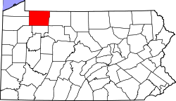 | |
| Boroughs | ||
| Townships | ||
| CDPs | ||
| Unincorporated communities | ||
| Ghost towns | ||
| Footnotes | ‡This populated place also has portions in an adjacent county or counties | |
| National | |
|---|---|
| Geographic | |
| Other | |
Warren, Pennsylvania
View on GrokipediaHistory
Founding and Early Settlement
The region encompassing present-day Warren, Pennsylvania, was originally inhabited by the Seneca people, a prominent tribe within the Iroquois Confederacy, who controlled much of northwestern Pennsylvania during the 16th and 17th centuries.[8] The Seneca maintained villages along the Allegheny River and its tributaries, utilizing the area's rich forests and waterways for hunting, fishing, and agriculture.[9] European contact began in the early 18th century, with French explorers asserting claims to the Ohio Valley, including the lands around Warren. In 1749, Pierre-Joseph Céloron de Blainville led an expedition down the Allegheny River, burying lead plates inscribed with French royal declarations of sovereignty at strategic points, one near the mouth of Conewango Creek to formally claim the territory and deter British encroachment.[8][10] The French and Indian War (1754–1763) shifted control of the region, culminating in the 1763 Treaty of Paris, which ceded French possessions east of the Mississippi River to Great Britain, placing the Warren area under British authority.[8] Post-war, the land remained largely undeveloped, with Native American presence continuing amid tensions during the American Revolutionary War, where some Seneca leaders like Cornplanter allied variably with British and American forces.[11] American settlement accelerated after independence, facilitated by land speculation companies. In 1795, the Pennsylvania State Legislature authorized the layout of a town at the confluence of the Allegheny and Conewango Rivers to promote frontier security and settlement; it was named Warren in honor of Dr. Joseph Warren, the Massachusetts patriot and major general who died at the Battle of Bunker Hill in 1775.[12] Surveyed by General William Irvine and Andrew Ellicott, the site was selected for its strategic river access.[13] The first permanent European structure in Warren was a log storehouse erected in 1796 by the Holland Land Company, a Dutch investment firm that had acquired vast tracts in western Pennsylvania and New York for resale to settlers; this building served as a supply depot and marked the initial foothold of organized settlement.[8][13] Warren County was established in 1800 from parts of Lycoming and Allegheny Counties, with the nascent town designated as the county seat, though permanent residents were scarce until around 1806, when pioneering families like those of James Morrison and Galen Murdock arrived.[13] By 1810, the county's population had grown to 827 from 233 a decade earlier, reflecting modest influxes drawn by affordable land and river transport, while basic infrastructure emerged, including Daniel Jackson's sawmill (circa 1800) for processing timber and a rudimentary schoolhouse opened in 1805–1806 under teacher George W. Fenton.[13] This early development laid the groundwork for Warren's evolution, with the lumber trade beginning to take shape in the ensuing years.[13]Industrial Growth and Modern Era
The lumber industry dominated Warren's economy from 1810 to 1840, capitalizing on the region's vast white pine and hemlock forests and the Allegheny River's navigability for transporting logs to Pittsburgh markets.[14] Local mills processed timber into rafts that were floated downstream, fostering self-sustaining logging camps equipped with stables, blacksmith shops, and worker housing, which supported seasonal employment where laborers often farmed during summers to sustain families.[14] This boom spurred regional settlement and infrastructure, including early roads and bridges, while companies like Wheeler and Dusenbury, established in 1837 near Tidioute, amassed over 40,000 acres of timberland, laying groundwork for Warren's emergence as a key northwestern Pennsylvania hub.[14] The discovery of oil in 1875 marked a pivotal shift, when David Beaty struck crude while drilling for natural gas in Glade Township, yielding an initial 100 barrels per day and igniting the Warren-Glade field.[15] This find, part of broader western Pennsylvania developments following the 1859 Drake well, triggered rapid exploration across townships like Pleasant, Russell, and Youngsville, with production reaching 700 barrels daily by 1877 and enabling infrastructure like the Conewango Pipe Line to connect to railroads.[16] Revenues from timber and oil fueled a Victorian-era construction surge in the late 19th century, evident in ornate mansions, theaters, churches, and public buildings that reflected newfound prosperity and architectural grandeur.[17] Warren's population peaked at nearly 15,000 in 1940, bolstered by manufacturing diversification, including the Pittsburgh-Des Moines Steel Company's fabrication of stainless steel sections for the Gateway Arch in St. Louis, produced at its Warren plant from 1962 to 1965 by local boilermakers.[18][19] Post-World War II, the city faced economic contraction as resource extraction waned and manufacturing jobs shifted due to national deindustrialization trends, leading to steady population loss from 14,900 in the 1940s.[18] Early revitalization in the mid-20th century included urban renewal initiatives to preserve historic districts and adapt industrial sites, setting the stage for later projects like the riverfront-focused Impact Warren.[20]Geography and Environment
Physical Features
Warren, Pennsylvania, is situated at the confluence of the Allegheny River and Conewango Creek in Warren County, in the northwestern part of the state. This strategic location along the rivers has shaped the city's geography, with the Allegheny River flowing southward through the region and Conewango Creek joining it from the north, creating a broad valley that defines the urban layout. The city's geographic coordinates are 41°50′39″N 79°8′33″W.[21] According to the 2020 United States Census Bureau Gazetteer files, Warren covers a total area of 3.09 square miles (8.00 km²), of which 2.91 square miles (7.54 km²) is land and 0.18 square miles (0.46 km²) is water, primarily consisting of riverine features. The city's topography features gently rolling hills typical of the Appalachian Plateau, with an average elevation of 1,210 feet (369 m) above sea level. Warren lies adjacent to the Allegheny National Forest, a vast expanse of over 513,000 acres managed by the U.S. Forest Service, whose supervisor's office is located within the city limits, offering immediate proximity to forested uplands and recreational trails.[22][23] The Allegheny River plays a central role in the local geography and is federally designated as a Recreational river for an 86.6-mile segment under the National Wild and Scenic Rivers System, highlighting its outstanding natural, scenic, and recreational values from Kinzua Dam downstream. Approximately 6 miles east of Warren, the Kinzua Dam, constructed by the U.S. Army Corps of Engineers, impounds the Allegheny River to form the Allegheny Reservoir, a 24-mile-long body of water spanning 12,080 acres that borders the Allegheny National Forest and enhances the region's hydrological landscape.[24][25]Climate
Warren, Pennsylvania, experiences a humid continental climate classified as Dfb under the Köppen-Geiger system, characterized by cold, snowy winters, warm summers, and no dry season.[26] Based on the 1991–2020 climate normals from the National Weather Service, the city has an annual average high temperature of 58.3°F (14.6°C) and an average low of 38.2°F (3.4°C), reflecting significant seasonal variation with mild summers and harsh winters.[27] Precipitation is distributed relatively evenly throughout the year, averaging 46.98 inches annually, while snowfall totals 71.6 inches per year, making winters particularly snowy.[27] The monthly climate patterns underscore this variability, with July being the warmest month (average high 81.1°F/27.3°C, low 58.9°F/14.9°C) and January the coldest (average high 33.1°F/0.6°C, low 17.6°F/-8.0°C). Precipitation peaks in the summer months, with June and July each receiving about 3.8 inches on average, while snowfall is concentrated from November through March, led by January's typical 19.2 inches. The table below summarizes the 1991–2020 monthly averages for high and low temperatures, precipitation, and snowfall.| Month | Avg. High (°F/°C) | Avg. Low (°F/°C) | Precipitation (in.) | Snowfall (in.) |
|---|---|---|---|---|
| January | 33.1 / 0.6 | 17.6 / -8.0 | 3.25 | 19.2 |
| February | 36.5 / 2.5 | 17.6 / -8.0 | 2.68 | 16.5 |
| March | 45.5 / 7.5 | 24.8 / -4.0 | 3.11 | 12.0 |
| April | 58.6 / 14.8 | 34.7 / 1.5 | 3.35 | 2.4 |
| May | 69.8 / 21.0 | 45.5 / 7.5 | 3.54 | 0.1 |
| June | 77.0 / 25.0 | 54.5 / 12.5 | 3.78 | 0.0 |
| July | 81.1 / 27.3 | 58.9 / 14.9 | 3.82 | 0.0 |
| August | 79.2 / 26.2 | 57.2 / 14.0 | 3.66 | 0.0 |
| September | 72.0 / 22.2 | 50.0 / 10.0 | 4.02 | 0.0 |
| October | 60.1 / 15.6 | 39.2 / 4.0 | 3.78 | 0.8 |
| November | 48.9 / 9.4 | 30.9 / -0.6 | 3.54 | 9.6 |
| December | 37.9 / 3.3 | 22.8 / -5.1 | 3.45 | 11.0 |
| Annual | 58.3 / 14.6 | 38.2 / 3.4 | 46.98 | 71.6 |
Government and Administration
Local Government Structure
Warren is a third-class city in Pennsylvania and serves as the county seat of Warren County, hosting key county offices such as the courthouse and administrative facilities.[30] The city operates under a council-manager form of government, as defined by its optional Home Rule Charter adopted in accordance with Pennsylvania's third-class city code.[5] In this structure, the city manager handles day-to-day administration, while the elected council sets policy and oversees operations.[31] The legislative body is the Warren City Council, comprising the mayor—who serves as council president—and six council members, all elected at-large on a nonpartisan basis for staggered four-year terms.[5] Council meetings occur on the third Monday of each month at 7:00 p.m. in the Municipal Building. As of November 2025, David G. Wortman holds the position of mayor, having been re-elected in the November 4 municipal election after securing the Republican primary nomination in May against minimal opposition.[32][33] In the general election, Wortman defeated independent challenger Philip "Phil" Gilbert Jr., a sitting council member and Warren County Tax Claim Bureau director, with 1,307 votes to Gilbert's 819.[34] The council's current composition includes Vice President Danielle Flasher, Maurice J. "Maury" Cashman, Philip Gilbert Jr., and Savannah Casey, who was appointed in October 2025 to fill a vacancy until the term's end.[35][36] As the county seat, Warren's city government maintains close ties with Warren County administration, coordinating on shared services like emergency management and planning. The city participates in the Warren County Intergovernmental Co-Op (COG), a voluntary council of governments established under Pennsylvania's Intergovernmental Cooperation Law to promote regional collaboration on economic development, infrastructure, and public safety initiatives among municipalities and the county.[37] This intergovernmental framework enables joint grant applications and resource sharing, enhancing efficiency in addressing cross-jurisdictional challenges. State-level policies, such as those from the Pennsylvania Department of Community and Economic Development, occasionally influence local governance through funding mandates and regulatory compliance.Public Services and Infrastructure
The City of Warren's Police Department, located at 318 West Third Avenue, provides law enforcement and public safety services to residents and visitors, with non-emergency contact available at (814) 723-2700.[1] The Fire and EMS Department delivers comprehensive fire protection, emergency medical response, hazardous materials handling, and community preparedness programs, staffed by trained firefighters and EMTs; emergency calls are routed through 911, while non-emergency inquiries can be directed to (814) 723-8110 or (814) 723-2950.[38][39] Water and sewer services in Warren are managed by the North Warren Municipal Authority, which supplies potable water and operates wastewater treatment for the area, with customer support at (814) 723-7544 or 44 Hospital Drive.[40] The City's Department of Public Works oversees the wastewater treatment plant and system maintenance, alongside street and property upkeep, ensuring reliable utility infrastructure.[41] Waste management includes curbside recycling collection for households, provided under City Ordinance No. 1514 with supplied containers for materials like paper, plastics, and metals, while residential trash pickup is handled through a partnership with Waste Management (WM).[42][43] Additional community waste services encompass yard waste recycling and leaf collection programs.[44] Transportation infrastructure in Warren centers on major roadways, including U.S. Route 62, which runs north-south through the city as a key commercial corridor, and Pennsylvania Route 59, providing east-west connectivity across Warren County.[45][46] The Allegheny River supports primarily recreational uses such as kayaking, canoeing, and boating launches, with limited commercial navigation due to the upstream Kinzua Dam; facilities like river access ramps facilitate small craft activities.[47] Public transit is operated by the Transit Authority of Warren County (TAWC), offering fixed-route bus services to local destinations including Sheffield and Youngsville since 1980, with schedules available online.[48] Recent infrastructure projects include a scaled-down $3 million parking garage on Clark Street, approved in April 2025 to enhance downtown accessibility without extensive surface lot disruptions.[49] Revitalization efforts also incorporate convention facilities through community centers like the Allegheny Community Center, which hosts events and supports economic development alongside parking improvements.[50] Healthcare facilities in Warren feature Warren General Hospital at 2 West Crescent Park, offering emergency department services with 9 beds, walk-in care for non-life-threatening conditions, and inpatient care, supported by a 24/7 emergency line.[51][52] Ambulance services are provided by EmergyCare, delivering both emergency and non-emergency transport from its Warren base at 12 South State Street.[53] Specialized care includes Warren State Hospital at 33 Main Drive, focusing on psychiatric services.[54] These emergency services integrate with municipal fire-EMS for coordinated HazMat and medical responses via the 911 system.[55] Public services, including reliable utilities and transportation access, bolster tourism by enabling safe exploration of river-based recreation and local events.[56]Economy
Historical Industries
The lumber industry dominated Warren's economy from 1810 to 1840, capitalizing on the region's vast white pine forests and the Allegheny River's navigability for export. Logging techniques involved felling trees near riverbanks and tributaries, where logs were skidded overland using oxen or horses to collection points along streams during winter for easier transport. These logs were then rolled into the water and bound into massive rafts—typically 250 to 300 feet long and 60 to 70 feet wide—during spring high-water periods, allowing fleets of up to 30 rafts to float downstream to Pittsburgh and beyond, often reaching markets as far as New Orleans. The first sawmill in Warren County, a water-powered overshot wheel operation, was established in 1800, producing pine timbers for these early rafts; by 1820, at least 21 additional sawmills operated along Tionesta Creek alone, processing timber into boards and beams that fueled regional construction booms.[57] Following the decline of lumber resources, the oil industry emerged as a transformative force after 1875, with the Beaty well in Glade Township initially yielding 100 barrels per day and marking the start of systematic extraction in Warren County. Drilling methods relied on conventional cable-tool rigs, which used a heavy bit suspended on a cable to pulverize rock formations, often reaching depths of several hundred feet in the region's Devonian sandstone reservoirs; this labor-intensive process was scaled up during booms, as seen in the Cherry Grove field discovered in 1882, where the "646" well produced 2,000 barrels daily and Murphy's No. 2 well peaked at 3,600 barrels per day. Major fields like Cherry Grove and the East Side flats (developed in 1905) generated substantial revenue, with oil prices reaching $1.47 per barrel in 1905, though volatile markets saw crashes to under $0.90 by late 1882; these windfalls funded local infrastructure and contributed to Warren's architectural legacy, including grand Victorian homes and public buildings built from oil fortunes that persist today.[15][16] By the mid-20th century, manufacturing had become a cornerstone of Warren's economy, exemplified by steel fabrication at the Pittsburgh-Des Moines Steel (PDM) plant, which employed hundreds in producing structural components for national projects. From 1962 to 1965, approximately 280 workers at the Warren facility cut, welded, and assembled 80 percent of the stainless steel sections for the Gateway Arch in St. Louis, using type 304 steel with a #3 finish, fabricated in modular pieces for on-site bolting; this effort highlighted the plant's role in heavy industry since its early 20th-century establishment. The broader transition from resource extraction to manufacturing occurred by 1940, as lumber and oil yields diminished, shifting focus to sectors like metal fabrication, machinery, and paper production, which diversified the local workforce and stabilized employment amid national industrial growth.[19][58][59] This evolution from extractive industries to manufacturing laid the groundwork for later economic diversification, though resource booms' decline prompted ongoing adaptations into the postwar era.Current Economy and Developments
Warren, Pennsylvania's economy in 2025 relies on a mix of manufacturing, retail, financial services, and public sector employment, with key employers including United Refining Company, which operates a major oil refinery and ranks among the county's top employers.[60] Northwest Bank, a regional financial institution headquartered in the city, also stands out as a significant employer in the service sector.[60] Blair Corporation, a long-established apparel retailer based in Warren, contributes substantially to local jobs in distribution and e-commerce operations.[61] Whirley-Drinkworks, known for manufacturing drinkware and packaging, employs hundreds in production roles and is listed among the area's leading firms.[60] Walmart's Supercenter serves as a major retail anchor, providing employment in sales, logistics, and customer service for the community.[62] Additionally, the Allegheny National Forest supported around 151 full-time positions in forest management, recreation, and conservation across Warren County offices as of early 2025, though federal layoffs later that year reduced staffing levels.[63] Tourism plays a pivotal role in the local economy, as Warren is situated within the Pennsylvania Wilds region, where visitor spending reached a record $2.1 billion in 2024, generating a total economic impact of $3.29 billion across 13 counties.[64] In Warren County specifically, tourism expenditures grew 13.36% to $216.3 million in 2024 from $190.8 million the prior year, outpacing regional averages in categories like food, recreation, and retail.[65] This growth contributed to Pennsylvania's statewide visitor economy, which produced nearly $84 billion in economic impact and supported over 500,000 jobs in 2024.[66] Revitalization efforts are advancing through initiatives like the Impact Warren riverfront development, which focuses on enhancing the Allegheny River corridor with a new access ramp for small craft and kayaks, a floating dock, extended walking paths, additional parking, and upgrades to Breezepoint Landing, including restrooms and amenities.[47] Engineering for the project is nearly complete as of early 2025, with permits anticipated by mid-year and construction bids potentially issuing in 2026 pending funding from sources like the Appalachian Regional Commission.[47][67] Public input gathered through surveys and meetings in January and March 2025 has shaped additions like trail extensions and riverfront parks.[47] Complementing this, Warren Worx, a collaborative initiative launched in 2024 by the Warren County Chamber of Business and Industry, aims to combat population decline through branding campaigns emphasizing culture, economy, and nature, while fostering partnerships for small business support and community development.[68][69] In 2025, Warren faces economic challenges including ongoing population decline projected at 11% by 2050 and state budget delays that have stalled local projects and funding, contributing to a slow regional downturn.[69][70] Workforce retention issues, such as low wages and burnout, add pressure on employers in a shrinking market.[71] However, tourism demonstrates resilience, with Warren County's gains exceeding state trends and mitigating broader declines through sustained visitor interest in outdoor recreation.[65] The legacy of oil and lumber industries influences current land use, preserving vast forested areas that now drive tourism and conservation jobs.[72]Demographics
Population Trends
The population of Warren, Pennsylvania, stood at 9,404 residents according to the 2020 United States Census.[73] By the 2023 estimate from the U.S. Census Bureau's Population Estimates Program, this figure had declined to 9,209, reflecting an ongoing trend of gradual depopulation.[74] With a land area of approximately 2.91 square miles, the city's population density in 2020 was about 3,230 people per square mile.[73] Historically, Warren's population reached its peak of 14,891 in 1940, driven by the prosperity of local industries such as lumber and manufacturing during the early 20th century. Following World War II, the city experienced a steady decline, with numbers dropping to 10,486 by 2010, attributed primarily to shifts in industrial employment and broader economic changes in the region. This postwar trend has been linked briefly to the economic challenges faced by former manufacturing hubs in rural Pennsylvania. Projections for 2025 indicate a continued slight decrease to around 9,058 residents, influenced by regional migration patterns and an aging population base.[73] Within the city limits, Warren maintains a predominantly urban composition, with nearly all residents living in developed areas featuring residential neighborhoods, commercial districts, and limited green spaces, though small pockets of semi-rural land exist along the outskirts adjacent to the Allegheny River.Socioeconomic Characteristics
Warren, Pennsylvania, exhibits a socioeconomic profile characterized by a largely homogeneous racial and ethnic makeup, modest income levels, and solid but not exceptional educational attainment. The 2020 United States Census reported the city's racial composition as 95.37% White, 1.5% Black or African American, 1.2% two or more races, 0.8% Asian, 0.5% Native American, and Hispanic or Latino (of any race) 0.4%.[75] More recent estimates from the U.S. Census Bureau (2020-2024 American Community Survey) show the following racial and ethnic distribution:| Racial/Ethnic Group | Percentage |
|---|---|
| White alone | 95.0% |
| Black alone | 1.6% |
| American Indian and Alaska Native alone | 0.0% |
| Asian alone | 0.4% |
| Native Hawaiian and Other Pacific Islander alone | 0.2% |
| Two or More Races | 2.7% |
| Hispanic or Latino | 1.0% |