
Community hub
Recent from talks
Contribute something
Nothing was collected or created yet.
Zografou
View on WikipediaZografou (Greek: Ζωγράφου, romanized: Zōgráfou) is a suburban town of approximately 70,000 inhabitants in the eastern part of the Athens agglomeration, Greece. It was named after the Greek politician Ioannis Zografos. To the east of Zografou lies mount Hymettus. The area, being close to the centre of Athens, developed similar urban sprawl characteristics, with high-rise buildings of even 10 stories tall being the norm. The municipality is also home to the National and Kapodistrian University of Athens and the National Technical University of Athens campuses and a significant percentage of the local population are students, faculty, and employees of both institutions. Zografou includes the smaller areas of Ilissia and Goudi.
Key Information


Geography
[edit]Zografou is a landlocked suburb of Athens, located about 4 km east of Athens city centre. The municipality has an area of 8.517 km2.[3] Towards the east the municipality extends to the forested Hymettus mountain. The built-up area of Zografou is continuous with that of municipality of Athens. A large campus of the National and Kapodistrian University of Athens is situated in Ano Ilisia, the easternmost quarter of Zografou. Ano Ilisia derived its name from the river Ilisos, which starts at St Eleousa, now in the University campus.[4][5] Another quarter of Zografou is Goudi, in the northwestern part of the municipality. The main church of Zografou is consecrated to Agios Therapontas (Greek: Άγιος Θεράποντας). With Zografou having been built on the hills of Hymettus, a common sight around the suburb are some very steep uphill streets.
Climate
[edit]Zografou has a hot-summer Mediterranean climate (Csa in the Köppen climate classification). It has hot dry summers and relatively mild winters.
| Climate data for Zografou 219 m a.s.l. (1993-2025) | |||||||||||||
|---|---|---|---|---|---|---|---|---|---|---|---|---|---|
| Month | Jan | Feb | Mar | Apr | May | Jun | Jul | Aug | Sep | Oct | Nov | Dec | Year |
| Record high °C (°F) | 22.6 (72.7) |
22.0 (71.6) |
30.3 (86.5) |
29.9 (85.8) |
38.4 (101.1) |
42.6 (108.7) |
42.5 (108.5) |
43.4 (110.1) |
38.3 (100.9) |
32.9 (91.2) |
27.1 (80.8) |
23.6 (74.5) |
43.4 (110.1) |
| Mean daily maximum °C (°F) | 12.4 (54.3) |
13.0 (55.4) |
15.5 (59.9) |
19.4 (66.9) |
25.0 (77.0) |
29.9 (85.8) |
32.6 (90.7) |
32.2 (90.0) |
27.8 (82.0) |
22.6 (72.7) |
18.0 (64.4) |
13.9 (57.0) |
21.9 (71.3) |
| Daily mean °C (°F) | 9.4 (48.9) |
9.7 (49.5) |
11.7 (53.1) |
15.1 (59.2) |
20.3 (68.5) |
25.1 (77.2) |
28.0 (82.4) |
27.8 (82.0) |
23.5 (74.3) |
18.9 (66.0) |
14.7 (58.5) |
11.0 (51.8) |
17.9 (64.3) |
| Mean daily minimum °C (°F) | 6.3 (43.3) |
6.3 (43.3) |
7.9 (46.2) |
10.8 (51.4) |
15.5 (59.9) |
20.3 (68.5) |
23.4 (74.1) |
23.3 (73.9) |
19.2 (66.6) |
15.1 (59.2) |
11.4 (52.5) |
8.1 (46.6) |
14.0 (57.1) |
| Record low °C (°F) | −4.3 (24.3) |
−7.1 (19.2) |
−2.3 (27.9) |
2.4 (36.3) |
8.7 (47.7) |
11.4 (52.5) |
16.8 (62.2) |
17.0 (62.6) |
11.9 (53.4) |
6.2 (43.2) |
−0.3 (31.5) |
−1.9 (28.6) |
−7.1 (19.2) |
| Average rainfall mm (inches) | 70.2 (2.76) |
47.1 (1.85) |
49.1 (1.93) |
24.8 (0.98) |
25.3 (1.00) |
16.0 (0.63) |
12.2 (0.48) |
8.5 (0.33) |
25.3 (1.00) |
43.7 (1.72) |
80.0 (3.15) |
85.8 (3.38) |
488 (19.21) |
| Source: National Technical University of Athens (Oct 1993- May 2025). [6] | |||||||||||||
Transport
[edit]Zografou is served by bus lines 140 (Polygono - Glyfada), 220 (Ano Ilisia - Akadimia), 221 (Panepistimioupoli - Akadimia), 230 (Akropoli - Zografou), 235 (Zografou - Akadimia), 250 (Panepistimioupoli - Evangelismos station), 608 (Galatsi - Akadimia - Nekr. Zografou), 622 (Goudi - Ano Galatsi) and 815 (Goudi - Tavros).[7] The A62 Hymettus Ring Road (formerly the A64 until 2024) passes through the municipality.
At summer of 2029, Zografou will have 3 metro stations at Ilissia, Zografou (Gardenia Place) and Goudi.
History
[edit]After the departure of the Ottomans from the area in the 1830s, the area came into the ownership of Ioannis Koniaris, mayor of Athens from 1851 to 1854, and Leonidas Vournazos.
In 1902, Eleni Vournazos, widow of Leonidas, sold 1,250 stremmata (1 stremma equal to 1000 square meters ) of the Kouponia/Goudi area to Ioannis Zografos (died 1927), a Member of Parliament for the Nationalist Party and university professor. Dividing it into plots, he sold them for installments of 112 drachma per month. The first houses were erected in 1919. Within ten years, 100 had been built. At this time, the foundations of the Church of St. Therapon were erected.
In 1929, the area, now known as Zografou, was split from the municipality of Athens and became an independent community. It was elevated to a municipality in 1947,[8] its first president being Sotirios Zografos, the son of Ioannis. In 1935, the area of Kouponia (now Ano Ilisia) was incorporated into the community.
Scientific Centers, Museums and others
[edit]- Dimitri Kitsikis Public Foundation"
- Gounaropoulos Museum, dedicated to the works of painter Giorgios Gounaropoulos. It was founded in 1979.
- Marika Kotopouli Museum, a museum of modern art, founded in 1990 and housed in the 1926 villa of actress Marika Kotopouli
Sports
[edit]Zografou hosts the local sport teams Asteras Zografou, a football club founded in 1965 and EFAO Zografou B.C. (formerly Filathlitikos B.C.), a basketball club founded in 1986. In addition, the sport club Ilisiakos, founded in 1927, is based in Ilisia a district that is shared between Municipalities of Athens and Zografou.
| Sport clubs based in Zografou | |||
|---|---|---|---|
| Club | Founded | Sports | Achievements |
| Asteras Zografou | 1965 | Football | Earlier presence in Beta Ethniki |
| EFAO Zografou | 1986 | Basketball | Earlier presence in Greek A2 League basketball |
Historical population
[edit]| Year | Pop. | ±% |
|---|---|---|
| 1981 | 84,548 | — |
| 1991 | 80,490 | −4.8% |
| 2001 | 76,115 | −5.4% |
| 2011 | 71,026 | −6.7% |
| 2021 | 69,874 | −1.6% |
Notable people
[edit]- Dimitri Kitsikis (1935–2021) Royal Society of Canada
- Marika Kotopouli (1887–1954) actress
- Nikos Kourkoulos (1934–2007) actor
- Luciano de Souza (1972-) football player
Gallery
[edit]-
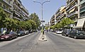 Papagou Avenue in Zografou
 -
 Church of St. Thomas
 -
 Church of St. Therapon
 -
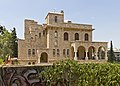 Villa Zografou


See also
[edit]References
[edit]- ^ Municipality of Zografos, Municipal elections – October 2023 Archived 2024-05-08 at the Wayback Machine, Ministry of Interior
- ^ "Αποτελέσματα Απογραφής Πληθυσμού - Κατοικιών 2021, Μόνιμος Πληθυσμός κατά οικισμό" [Results of the 2021 Population - Housing Census, Permanent population by settlement] (in Greek). Hellenic Statistical Authority. 29 March 2024.
- ^ "Population & housing census 2001 (incl. area and average elevation)" (PDF) (in Greek). National Statistical Service of Greece. Archived from the original (PDF) on 21 September 2015.
- ^ "Νεότερη ιστορία - ο Δήμος μας", zografou.gr, accessed 31 August 2008.
- ^ "Aπό την εκδήλωση στο Ζωγράφου για την βίλα Archived November 8, 2008, at the Wayback Machine", indymedia.gr, accessed 31 August 2008.
- ^ "NTUA Zografou". Retrieved 6 June 2025.
- ^ "Passing Lines for Munisipality ZOGRAFOY". oasa.gr. Archived from the original on March 4, 2016. Retrieved 6 October 2017.
- ^ "Δ. Ζωγράφου". EETAA local government changes. Retrieved 29 June 2020.
External links
[edit]- City of Zografou official website (in Greek)
Places adjacent to Zografou | ||||||||||||||||
|---|---|---|---|---|---|---|---|---|---|---|---|---|---|---|---|---|
| ||||||||||||||||
Administrative divisions of the Attica Region | ||
|---|---|---|
| Regional unit of Central Athens |  | |
| Regional unit of North Athens | ||
| Regional unit of West Athens | ||
| Regional unit of South Athens | ||
| Regional unit of Piraeus | ||
| Regional unit of East Attica | ||
| Regional unit of West Attica | ||
| Regional unit of Islands | ||
| ||
| Authority control databases: National |
|---|
Zografou
View on GrokipediaGeography
Location and Topography
Zografou is a landlocked suburb located approximately 4 km east of central Athens, integrated into the eastern sector of the Athens metropolitan agglomeration. The municipality encompasses an area of 8.5 km², characterized by its urban continuity with adjacent districts.[10][11] The municipality shares borders with Athens to the west, Papagou-Cholargos to the north, Paiania to the east, and Kaisariani and Vyronas to the south. It maintains close proximity to the southwestern slopes of Mount Hymettus, which forms part of its eastern boundary and rises prominently from the surrounding terrain, while the area lies within the broader Ilisos River valley.[8][12] Topographically, Zografou features an average elevation of 130 m above sea level, with the landscape gradually ascending eastward toward the higher elevations of Mount Hymettus, reaching up to 1,000 m or more. The terrain includes varied elevations from around 110 m in the central urban zones to steeper, forested hills near the mountain, contributing to a mix of flat valley floors and rising slopes. The urban layout is dominated by high-rise residential and institutional buildings, reflecting intensive development in a compact setting, and incorporates neighborhoods such as Ano Ilissia. University campuses serve as prominent landmarks influencing the spatial organization and built environment.[10][13][14] As of the 2021 census, Zografou has a population density of 8,201 inhabitants per km².[15]Climate
Zografou features a hot-summer Mediterranean climate (Köppen classification Csa), marked by prolonged hot and dry summers followed by mild and wet winters. This regime is typical of the broader Athens region, where seasonal contrasts drive environmental patterns, with minimal temperature fluctuations year-round but pronounced differences in precipitation distribution. Average high temperatures during the summer months of June through August range from 32°C to 35°C, while winter lows from December to February typically fall between 5°C and 8°C. Annual precipitation averages approximately 400 mm, with the majority occurring between October and March, often in short, intense events that contribute to seasonal flooding risks in urban areas. Data from the National Technical University of Athens (NTUA) meteorological station in Zografou, operational since the early 1990s, records these patterns over the 1993–2025 period, including extreme highs up to 42°C during heatwaves and lows reaching -2°C in rare cold snaps.[16] The Mediterranean climate supports a mix of evergreen shrubs and coniferous trees on the slopes of nearby Hymettus, such as Aleppo pines and maquis vegetation, which thrive in the dry summers and rely on winter rains for regeneration. However, Zografou's high urban density exacerbates the urban heat island effect, elevating local temperatures by 2–5°C above surrounding rural areas during summer nights compared to the Athens basin average. The topographical influence of Hymettus also moderates local winds, providing occasional cooling breezes that mitigate peak heat in the municipality.[17][18][19]Demographics
Population Trends
The population of Zografou has exhibited a consistent decline since the early 1980s, reflecting broader demographic shifts in the Athens metropolitan area. According to census data from the Hellenic Statistical Authority (ELSTAT), the resident population peaked at 84,548 in 1981, driven by a post-World War II influx of rural migrants seeking urban opportunities in the expanding suburbs. Subsequent decades saw steady decreases, with the figure dropping to 80,492 by 1991 (a -4.8% change), 76,115 in 2001 (-5.4%), 71,026 in 2011 (-6.7%), and 69,872 in 2021 (-1.6%). Projections indicate further reduction, with an estimated population of approximately 64,468 by 2025, underscoring ongoing challenges in retaining permanent residents.[20]| Year | Population | Change (%) |
|---|---|---|
| 1981 | 84,548 | - |
| 1991 | 80,492 | -4.8 |
| 2001 | 76,115 | -5.4 |
| 2011 | 71,026 | -6.7 |
| 2021 | 69,872 | -1.6 |