
Community hub
Recent from talks
Contribute something
Nothing was collected or created yet.
Chicksands
View on Wikipedia
Chicksands is a village in the civil parish of Campton and Chicksands in the Central Bedfordshire district of Bedfordshire, England. It gives its name to MOD Chicksands, a military base which was developed from the 1930s on the Chicksands Priory estate. The village is on the River Flit and lies immediately west of the town of Shefford. At the 2021 census the Chicksands built up area as defined by the Office for National Statistics (which excludes part of the MOD Chicksands base) had a population of 731. The wider parish of Campton and Chicksands, which also includes the village of Campton, had a population of 1,895.
Key Information


History
[edit]Chicksands appears in the Domesday Book of 1086, where it is listed under the variations Chichesana and Chichesane. William de Cairon was then the tenant of the Bishop of Lincoln, along with three freemen and Walter, holding from Azelina, wife of Ralph Tailbois, as part of her dowry. The place-name itself derives from Old English, meaning “Cicca’s sands,” with Cicca being a personal name and sands referring to the sandy soil of the district.[2][3][4]
One of the most significant landmarks in the area is Chicksands Priory, founded around 1150. The priory was established for the Gilbertine Order, the only monastic order of English origin. Following the Dissolution of the Monasteries in the 16th century, the priory passed into private hands and was later adapted as a country residence. English Heritage notes that the priory’s architecture retains important 12th-century features alongside later Tudor and Jacobean additions, making it one of the best surviving Gilbertine houses in the country.[5] Today, the priory is located within the grounds of the Joint Intelligence Training Group, but it remains accessible to the public by appointment, typically on the first and third Sundays between April and October.
Chicksands entered a new chapter in its history during the Second World War, becoming the site of RAF Chicksands, an important Royal Air Force station. From 1939, the base was used for signals intelligence operations, with Y-Service units intercepting enemy communications. According to the National Archives, RAF Chicksands played a key role in the wartime codebreaking network that supplied intelligence to Bletchley Park.[6][7][8]
After the war, the site was transferred to the United States Air Force (USAF) under post-war defence agreements. From 1950 until 1995, Chicksands was a key American base in Europe. In 1963, the USAF installed one of its first FLR-9 Wullenweber antenna arrays, a massive circular structure known informally as the “Elephant Cage.” Standing nearly 1,500 feet in diameter, the antenna was designed for high-frequency direction-finding during the Cold War. RAF and Forces sources describe it as a technological marvel of its time, although it was dismantled shortly before the USAF’s withdrawal in 1995.[9]
Modern use
[edit]Following the departure of American forces, Chicksands was repurposed for British military use. It is now home to the Joint Intelligence Training Group (JITG) and serves as the headquarters of the British Army’s Intelligence Corps (UK Ministry of Defence, 2021). The site continues to play an important role in preparing personnel for intelligence, cyber, and signals operations in modern defence contexts.[citation needed]
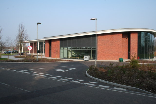
Mid Bedfordshire District Council moved to a new office building on part of the former RAF Chicksands sportsfield, adjacent to the A507, having previously been based in offices at Ampthill and Biggleswade. The new office, named Priory House, was officially opened by the Queen on 17 November 2006 accompanied by the Duke of Edinburgh.[10] The offices are now home to Central Bedfordshire Council.[11]
Governance
[edit]There are two tiers of local government covering Chicksands, at parish and unitary authority level: Campton and Chicksands Parish Council and Central Bedfordshire Council. The parish council generally meets at Campton Village Hall.[12] Central Bedfordshire Council has its headquarters at Priory House on Monks Walk in Chicksands.[13]
Administrative history
[edit]Chicksands was historically an extra-parochial area, outside any parish. Such areas were made civil parishes in 1858.[14] In 1985 the civil parish of Chicksands was merged with the neighbouring parish of Campton to become a new parish called Campton and Chicksands.[15][16] At the 1981 census (the last before the abolition of the parish), Chicksands had a population of 994.[17]
Education
[edit]This section needs expansion. You can help by adding missing information. (January 2025) |
It is in the school catchment area for Robert Bloomfield Academy.[18] It is also in the catchment area for Samuel Whitbread Academy, which has an upper school and sixth form.[19]
References
[edit]- ^ "Population estimates - small area (2021 based) by single year of age - England and Wales". NOMIS. Office for National Statistics. Retrieved 19 April 2025. To get data for individual built-up areas, query the 'Population Estimates / Projections' dataset, then the 'Small area (2021 based) by single year of age - England and Wales' and then choose '2022 built-up areas' for the geography.
- ^ Bedfordshire Archives, Bedford Borough Council (13 August 2025). "Bedfordshire Archives". bedsarchives.bedford.gov.uk. Retrieved 25 August 2025.
- ^ "Hosted By Bedford Borough Council: The Parish of Chicksands in General". Bedfordshire County Council. 7 October 2015. Retrieved 7 January 2024.
- ^ "Chicksands in 1086". Bedfordshire Borough Council. Archived from the original on 20 April 2016. Retrieved 20 May 2016.
- ^ "English Heritage". English Heritage. Retrieved 25 August 2025.
- ^ Archives, The National. "The National Archives". The National Archives. Retrieved 25 August 2025.
- ^ Beatty, Gavin (2010). "Bedfordshire - Defence Intelligence and Security Centre". Sanctuary. No. 39. Ministry of Defence (United Kingdom). p. 67. ISSN 0959-4132.
- ^ "Chicksands Wood". Visit Shefford. Archived from the original on 6 May 2016. Retrieved 20 May 2016.
- ^ "Forces News". www.forcesnews.com. 22 August 2025. Retrieved 25 August 2025.
- ^ "Her Majesty the Queen in Bedfordshire". Bedford Today. 17 November 2006. Archived from the original on 5 August 2016. Retrieved 20 May 2016.
- ^ "Customer Services Centre". Central Bedfordshire Council. Archived from the original on 28 May 2016. Retrieved 20 May 2016.
- ^ "Agendas". Campton and Chicksands Parish Council. Retrieved 4 October 2025.
- ^ "Priory House". Central Bedfordshire Council. Retrieved 4 October 2025.
- ^ Youngs, Frederic (1979). Guide to the Local Administrative Units of England: Volume I, Southern England. London: Royal Historical Society. p. 5. ISBN 0901050679.
- ^ "The Mid Bedfordshire (Parishes) Order 1984" (PDF). Local Government Boundary Commission for England. The National Archives. Retrieved 4 October 2025.
- ^ "Campton & Chicksands Parish Plan" (PDF). Campton & Chicksands.org. 2010. p. 3. Retrieved 20 May 2016.
- ^ "Bedfordshire population figures 1801 – 2011" (PDF). Bedfordshire Archives and Records Service Archives. Retrieved 4 October 2025.
- ^ "Admission Arrangements September 2025" (PDF). Bedfordshire Schools Trust. p. 14/35. Retrieved 3 January 2025. - Map is on p. 34/35.
- ^ "Admission Arrangements September 2025" (PDF). Bedfordshire Schools Trust. p. 15/35. Retrieved 3 January 2025. - Map is on p. 35/35.
External links
[edit]![]() Media related to Chicksands at Wikimedia Commons
Media related to Chicksands at Wikimedia Commons
- Campton & Chicksands
- Chicksands Offices – Mid Beds District Council
- Chicksands History
- Friends of Chicksands Prioy Website
| National | |
|---|---|
| Other | |
Chicksands
View on GrokipediaGeography
Location and Boundaries
Chicksands is a village situated in the Central Bedfordshire district of Bedfordshire, England, within the civil parish of Campton and Chicksands. Its geographical coordinates are approximately 52.03673°N latitude and 0.35959°W longitude, corresponding to an Ordnance Survey grid reference of TL126388.[6] The village lies along the River Flit to its east, bordering the town of Shefford, approximately 1 mile away.[6] The Campton and Chicksands civil parish encompasses an area of about 960 hectares and includes both Chicksands and the adjacent village of Campton.[7] Chicksands is positioned roughly 37 miles (60 km) north of London and 5 miles (8 km) west of Biggleswade, placing it in a rural setting amid the Bedfordshire countryside.[6] The parish boundaries are defined by road networks to the north and south, with the River Flit running through its middle, integrating the village into the broader Central Bedfordshire landscape.[8] Access to Chicksands is primarily via the A507 road, which runs adjacent to the parish and connects it to nearby towns such as Shefford and Bedford.[9] The nearest railway station is Arlesey, located about 4 miles to the north, providing links to London and other regional destinations.[10] Within the village boundaries lies the MOD Chicksands military facility, a significant site for defense operations.Physical Features
Chicksands exhibits a varied topography characterized by a gentle southward slope across its landscape. Elevations range from approximately 150 feet (46 meters) at Priory House in the southern part of the parish to 270 feet (82 meters) near the former site of the Elephant Cage antenna array in the north, with intermediate points such as the Chicksands Avenue checkpoint at around 180 feet (55 meters).[2] This undulating terrain is drained primarily by the River Flit, which meanders through the southern areas, forming lakes and contributing to the local hydrology.[11] Geologically, the region is dominated by the Woburn Sands Formation, a sandstone layer formed during the Early Cretaceous period between 99 and 121 million years ago, which gives the area its characteristic sandy soils.[2] Underlying these sands in western sections, such as around Temple Grove, lies the Gault Formation, a clayey mudstone deposited 99 to 112 million years ago, influencing soil composition and drainage patterns.[2] The parish's name originates from Old English, likely meaning "Cicca's sands," where "Cicca" is a personal name and "sands" refers to the prevalent sandy terrain, as documented in historical records dating back to 1086.[2] The built environment integrates natural and constructed elements, with extensive woodland areas enhancing the site's character. Chicksands Wood, a key feature, is partially managed by Forestry England and encompasses ancient woodland habitats that support notable biodiversity, including species typical of semi-natural broadleaved woods.[12][8] The historic priory estate blends seamlessly with modern military structures within the Ministry of Defence (MOD) site, which covers approximately 200 hectares of parkland and operational grounds.[13] These woodlands and green spaces, including areas designated as County Wildlife Sites, preserve ecological value amid the site's dual historic and contemporary uses.[14]History
Early Settlement and Medieval Period
The name Chicksands derives from Old English, meaning "Cicca's sands," where *Cicca is a personal name and "sands" refers to the area's sandy soil on the Greensand ridge, indicating possible Anglo-Saxon origins for the settlement prior to the Norman Conquest.[2] In the Domesday Book of 1086, Chicksands was recorded as Chichesana or Chichesane in the hundred of Clifton, Bedfordshire, comprising a small agricultural settlement with no recorded church or large population but noted for holdings by three freemen. The land totaled about 4.5 hides, divided as follows: 0.5 hide held by William of Cairon from the Bishop of Lincoln (valued at 12 pence in 1086); 3 hides held by three freemen as a dowry under Azelina, wife of Ralph Tallboys (valued at 20 shillings); and 1 hide held by Walter the monk from Azelina as a marriage portion (valued at 20 shillings, including one water mill worth 10 shillings). Pre-Conquest holders included Alwin Devil, four freemen, and Sweetman, with overall values reflecting post-1066 declines due to Norman-era disruptions.[15][16] Medieval Chicksands grew slowly as an agricultural enclave centered on freemen's arable and pastoral holdings, its development shaped by the influence of the adjacent priory, which contributed to its extra-parochial status exempt from standard ecclesiastical parish oversight. By 1801, the population had reached 42, underscoring its modest scale amid sandy, clay-mixed soils suited to mixed farming.[2][17] Significant administrative changes occurred in the mid-19th century when Chicksands was formally established as a civil parish in 1858 under the Extra-Parochial Places Act, though it lacked an Anglican church and thus maintained ecclesiastical extra-parochial standing into the modern era.[2]Chicksands Priory
Chicksands Priory was established around 1150 as a house of the Gilbertine Order, the only monastic order of English origin, by Payn de Beauchamp, Baron of Bedford, and his wife Rohese, Countess of Essex and widow of Geoffrey de Mandeville, Earl of Essex.[3] Dedicated to St. Mary, it functioned as a double monastery, accommodating both canons and nuns in separate quarters divided by a central church, with an initial community of up to 100 members including lay brothers and sisters.[18] The priory's foundation charter was witnessed by figures such as Archdeacon Nicholas of Bedford (1145–1181) and Simon, the first abbot of Warden Abbey, underscoring its integration into the regional ecclesiastical network. As a monastic community, Chicksands Priory played a key role in spiritual and economic life until its surrender on 22 October 1538 during the Dissolution of the Monasteries under Henry VIII, when 8 canons and 18 nuns were present.[3][19] Its annual income was valued at approximately £186 13s. 4d., supporting modest operations that included managing extensive lands, rectories, and tithes across Bedfordshire and neighboring counties, though it faced financial strains from debts and poor harvests in the 13th and 14th centuries. Following the dissolution, the site was granted by the Crown to Richard Snowe and his wife Elizabeth in 1540, passing through their family before being sold to Peter Osborn in the late 16th century; it remained a private estate under the Osborn (later Osborne) family for over 300 years until 1936.[20][19] The surviving architectural features of the priory include a 13th-century south doorway and elements of the canons' cloister south of the original church, with the present Priory House incorporating medieval remnants such as a 14th-century undercroft and chapel fragments from the 12th century, featuring Norman arches.[3][19] Post-dissolution adaptations transformed the site into a manor house, with significant 18th-century remodeling by architect Isaac Ware and Gothic Revival alterations by James Wyatt around 1813, while preserving core monastic structures within the Grade I listed building.[19] Today, integrated into the MOD Chicksands military site, public access to the priory ruins and house is available only by prior appointment through official channels.[19]MOD Chicksands
World War II Era
In 1936, the Crown Commissioners purchased the Chicksands Priory estate from the Osborn family on 15 April, leading to its development as a military site initially requisitioned by the Royal Navy before being transferred to the Royal Air Force (RAF), which established RAF Chicksands as a key signals intelligence facility.[21] The base underwent significant modifications between 1936 and 1938 by contractors Francis Newton Limited to support its operational needs, including the construction of early listening posts and radio equipment for interception activities.[21] During World War II, RAF Chicksands operated as a Y Station within the broader British signals intelligence network, focusing on intercepting German radio communications and relaying raw signals to codebreakers at Bletchley Park for decryption.[21][22] Its primary operations centered on radio direction finding and continuous monitoring of Axis air force transmissions, contributing essential traffic to the Allied Ultra intelligence effort that informed strategic decisions across multiple theaters.[23] The station's staff included members of the Women's Auxiliary Air Force (WAAF), such as intercept operators who played a vital role in logging and processing the intercepted messages under secretive conditions.[24] Infrastructure at the site featured purpose-built listening posts equipped with aerials and receivers to capture distant signals, while the historic Chicksands Priory was repurposed as the mission operations center and officer billeting quarters, integrating the medieval structure into wartime military functions.[21][25] This setup enabled efficient signals collection without disrupting the estate's layout, though the base endured two bombing raids in 1940 with minimal damage and no casualties.[21]Cold War and Post-War Period
In 1950, the Chicksands site was subleased to the United States Air Force (USAF), which established the 6940th Radio Squadron there to conduct signals intelligence (SIGINT) operations primarily targeting Soviet threats during the early Cold War period.[4][26] The squadron focused on intercepting and analyzing communications to monitor potential adversaries, building on the site's prior role in radio interception while expanding its capabilities under joint RAF-USAF oversight.[4] This arrangement allowed the USAF to maintain a strategic listening post in the UK, contributing to broader NATO intelligence efforts against Eastern Bloc activities.[27] A major infrastructure development occurred in 1962 with the construction of the AN/FLR-9 circularly disposed antenna array, known as the "Elephant Cage," which spanned approximately 1,000 feet in diameter and served as a high-frequency direction-finding system.[28] This massive array, part of the Iron Horse network, was designed to detect and locate Warsaw Pact radio signals over long distances, enhancing SIGINT collection on Soviet military communications.[27][29] The antenna operated until its dismantlement in 1996, reflecting the evolving technological needs of Cold War surveillance.[21] One notable incident during the USAF tenure was the crash of a Fairchild Republic A-10 Thunderbolt II on July 7, 1979, during an air demonstration at the base, which resulted in the death of the pilot, Colonel Thomas B. Thompson, the assistant deputy commander for operations of the 81st Tactical Fighter Wing.[30] The aircraft, serial number 77-0253, impacted approximately 1.5 miles from the airfield after a low-altitude maneuver went wrong, underscoring the risks of demonstration flights at active installations.[30] The USAF began winding down operations in 1995, formally withdrawing by 1997 and returning full control of the site to the Royal Air Force (RAF).[31] In 1997, the British Army's Intelligence Corps relocated its headquarters from Templer Barracks in Ashford, Kent, to Chicksands, integrating the site's facilities for corps administration and training.[32] In 2001, the Time Team archaeological program conducted an excavation at the priory, uncovering part of the Infirmary cloister and providing insights into the site's pre-military history.[33]Current Operations and Future Plans
Since 1997, MOD Chicksands has served as a tri-service facility hosting the Defence Intelligence and Security Centre (DISC), which functions as the headquarters for both the Defence College of Intelligence and the British Army Intelligence Corps.[34] The site supports intelligence operations across the Armed Forces by providing specialized training in areas such as operational intelligence, counter-intelligence, signals intelligence, human intelligence, cyber intelligence, and imagery analysis.[35] This includes courses for personnel from the Army, Royal Navy, and Royal Air Force, emphasizing skills in information gathering, analysis, and decision-making support for military operations.[36] Training at Chicksands encompasses a range of programs tailored to different services and roles, such as the 18-week RAF Intelligence Course for intelligence officers and the 17-week Joint Maritime Intelligence Course for Royal Navy personnel.[37][38] The facility also delivers electronic warfare training for the Royal Corps of Signals and hosts HMS Ferret, a Royal Naval Reserve unit focused on intelligence-related operational capabilities.[39] These programs build on foundational soldier training, incorporating practical elements like shooting, fitness, and analysis under austere conditions, often leading to rapid promotions and advanced qualifications.[35] Key facilities include the Military Intelligence Museum, which is currently housed on-site and documents the history of military intelligence from the Boer War to modern operations, though it is scheduled to relocate to London in the coming years.[40] In 2004, the former U.S. Elementary School site was sold to Mid-Bedfordshire District Council to consolidate local government offices.[13] Looking ahead, MOD Chicksands is slated for closure and disposal starting in 2030 as part of the Ministry of Defence's estate rationalization efforts, with current units relocating to new purpose-built facilities under a major investment in defence intelligence infrastructure.[1] The announcement was made in December 2023 by Minister James Cartlidge during a House of Commons debate.[1] While specific redevelopment plans remain undecided, the site—spanning historic elements like Chicksands Priory—could potentially support housing or community uses, similar to prior partial conversions.[1]Governance and Administration
Local Government Structure
Chicksands, as part of the civil parish of Campton and Chicksands, is governed at the parish level by the Campton and Chicksands Parish Council, the lowest tier of local authority in England responsible for addressing community-specific issues such as welfare, planning consultations, and local amenities.[41] This elected body, consisting of voluntary councillors, organizes community events and maintains an official Facebook page to disseminate news and updates to residents.[42] At the district level, Chicksands falls under the unitary authority of Central Bedfordshire Council, whose headquarters, Priory House, is located in Chicksands at Monks Walk.[43] Constructed in 2006 adjacent to the historic site of Chicksands Priory, Priory House was officially opened by Queen Elizabeth II on 13 November 2006.[44] The council offices at Priory House provide administrative services to over 300,000 residents across Central Bedfordshire, including policy implementation, housing, and environmental management. The parish council also engages with informal community networks, such as the Chicksands Chatters closed Facebook group, to facilitate resident discussions and support.[45] Additionally, the Chicksands Community website serves as a key resource for local information, including on-site facilities and events, complementing the formal governance structures.[45]Administrative Changes
Chicksands originated as an extra-parochial place, exempt from typical parish organization due to its historical ties to Chicksands Priory, which managed ecclesiastical and administrative affairs independently of surrounding parishes.[2] This status persisted until 1858, when legislation converted extra-parochial areas into civil parishes to standardize local governance across England and Wales.[2] In 1985, the civil parish of Chicksands, which had a recorded population of 994 in the 1981 census, merged with the neighboring parish of Campton to form the combined parish of Campton and Chicksands, effective 1 April.[2] This merger reflected efforts to streamline administrative boundaries in rural Bedfordshire amid post-war population shifts and land use changes.[46] Further boundary adjustments occurred in 1993, refining the parish limits to better align with local development patterns.[2] The parish's administrative framework evolved further in 2009 with the creation of the Central Bedfordshire unitary authority, which absorbed the former Mid Bedfordshire district encompassing Campton and Chicksands, consolidating services previously divided between county and district levels.[47] The presence of the military site, including former RAF housing now privately occupied and the ongoing Defence Intelligence and Security Centre, has shaped the parish's status by integrating civilian and secure zones within its boundaries.[9]Demographics
Population Trends
In the early 19th century, Chicksands maintained a small rural population, recording just 42 residents in 1801 and remaining under 100 through the mid-1800s, reflective of its status as a modest agricultural settlement.[17] By 1931, the figure had only slightly increased to 51, indicating limited growth amid broader economic challenges in rural Bedfordshire.[17] A dramatic shift occurred post-World War II with the establishment and expansion of military operations at the site, then known as RAF Chicksands. The population surged to 687 by 1951, driven by the influx of personnel following the arrival of the United States Air Force in 1950, which utilized the base for signals intelligence and radio operations.[17][21] This growth continued variably, peaking at 1,250 in 1971 amid Cold War activities, before stabilizing at 994 in 1981 as operations evolved.[17] The following table summarizes key historical population figures for Chicksands, drawn from UK census records:| Year | Population |
|---|---|
| 1801 | 42 |
| 1931 | 51 |
| 1951 | 687 |
| 1971 | 1,250 |
| 1981 | 994 |