

Community hub
Recent from talks
Contribute something
Nothing was collected or created yet.
Elafonisi
View on WikipediaElafonisi (Greek: Ελαφονήσι [elafoˈnisi], "Deer Island") is an island located close to the southwestern corner of the Mediterranean island of Crete, of which it is administratively a part, in the municipality of Kissamos of the regional unit of Chania. When the weather is fine it is possible to walk to the island through the shallow water. The island is a protected nature reserve. It is known for its pink sand beaches, created by tidal and wave-induced deposits of pigmented microorganisms living in a symbiotic relationship with native seaweed.
Key Information


Greek War of Independence
[edit]At the highest point on the island there is a plaque that commemorates a tragic event. On Easter Sunday of 18 April 1824 several hundred Greeks, mostly women and children, were killed on Elafonisi by Ottoman soldiers. To avoid advancing Turkish Ottoman troops, forty armed men had taken refuge on the island with women, children and old folk where they were waiting for a ship to take them to the Ionian Islands. The Ottoman soldiers had decided to camp on the beach opposite the island. One of their horses walked along the shallow water to the island and the people hiding on the island were discovered. According to several sources there were between 640 and 850 people in total, most of whom were killed and the remaining survivors were sold into slavery in Egypt.[1][2][3]
Shipwreck of the Imperatrix
[edit]A large wooden cross commemorates a shipwreck from 22 February 1907. It was an Österreichischer Lloyd passenger steamer, called the Imperatrix. Due to strong northwest winds 38 people died in a lifeboat that tried to reach the shore. They were all buried on the island. The Imperatrix still lies on the seabed in front of the island's cliffs and was the reason that a lighthouse was built on an island hilltop.[4]
The lighthouse was destroyed during the Second World War by the occupying German troops.[5]
Gallery
[edit]-
 Elafonisi beach
 -
 Elafonisi island in the distance from the coast of Crete.
 -
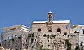 Chrysoskalitissa monastery.


See also
[edit]References
[edit]- ^ Website of local Kissamos, Mythymna and Inachorio Archived 2011-07-21 at the Wayback Machine (Greek)
- ^ Article in Ta Nea newspaper of 17 August 2007 Archived 7 January 2013 at archive.today (Greek)
- ^ Alan Hall: Walking in Western Crete: 45 walks in Kissamos and Selinos, S.200 (English)
- ^ Imperatrix – The Wreck (English)
- ^ Kissamoslive (clubs.pathfinder.gr) Archived 2011-07-01 at the Wayback Machine (Greek)
External links
[edit]- Municipality description Archived 2015-04-12 at the Wayback Machine
Elafonisi
View on GrokipediaGeography and Geology
Location and Topography
Elafonisi is a small islet positioned off the southwestern coast of Crete, within the Chania regional unit of Greece, at coordinates approximately 35°16′N 23°32′E.[9] It lies roughly 150 meters from the mainland shoreline near the village of Elafonisos, accessible via a narrow channel influenced by tidal variations.[10] The site is situated about 8 kilometers southwest of Pachia Ammos beach in the Falassarna area, emphasizing its remote positioning in the Mediterranean Sea.[11] The topography of Elafonisi features a compact landmass estimated at 0.1 square kilometers, characterized by low-lying sand dunes along its perimeter and a predominantly rocky interior.[12] Elevations remain minimal, with the highest points reaching up to 39 meters above sea level in the western rocky sections, while the eastern portions consist of flat, sandy expanses.[12] This low-relief profile contributes to the islet's vulnerability to erosion and tidal influences. Elafonisi connects intermittently to the Cretan mainland through a shallow lagoon approximately 100-200 meters wide, where water depths range from 0.5 to 1 meter during low tide, permitting wading across under favorable conditions.[13][14] Geologically, the islet's structure arises from regional tectonic uplift along the Hellenic Arc and subsequent marine erosion, with a foundational limestone composition typical of Cretan coastal formations that fosters water clarity through sediment filtration.[15][16]