Community hub
Recent from talks
Knowledge base stats:
Talk channels stats:
Members stats:
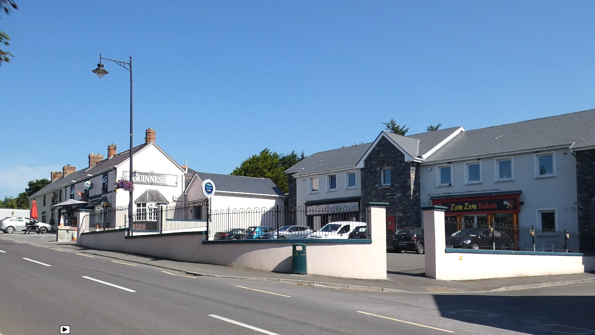
Kilflynn
Kilflynn (Irish: Cill Flainn) is a village and a civil parish in north County Kerry, Ireland. It is 11 km north-east of Tralee just off the N69 road from Tralee to Listowel.
The origin of the place name Cill Flainn is unknown. Two suggestions are commonly circulated. ‘Cill’ in Irish can mean 'cell' or 'churchyard' so in context might mean 'church of Flainn.' A popularised tale is that it was named after a Roman Catholic hermit monk, Flainn, said to have lived by the River Shannow (which runs through Kilflynn). Crippled and blind, he was visited by the Virgin Mary, who offered to restore his ailing sight. Flainn declined, asking for the miraculous power to be transferred to others via a local well (now Tobar Flainn, well or spring of Flainn). Some refer to this person as ‘St Flainn,’ but no such person was canonised. There is possible confusion with St Flannan, originally from Killaloe in County Clare. The alternative suggestion is that the name derives from the 'O’Flannan tribe': in August 1931, in the Proceedings of the Royal Irish Academy, a paper referencing a 15th-century manuscript (itself said to be a copy of a 12th-century document) listing rents in Clanmaurice presents both 'O Flannayn' and 'Kyllflanyn' as 'Kilflyn' in the English translation from the original Latin, a significant error which may be the root of the suggestion. The cantred (cf. Welsh cantref or English hundred) or rural deanery of Othorna & Oflannan (Irish Uí Thorna & Uí Flannáin) was an Anglo-Norman sub-division, in this case generally along the historical boundaries of much older kingdoms and regions which were part of West Munster (Irish Iarmuman or Iar Mbumba), in the realm of the Ciarraighe, and which later became County Kerry some time between 1222 and 1229.
Different anglicised spellings appeared over the years. In William Petty's Down Survey of Ireland (1655-1656) the parish appears as 'Kilfloinie Parish'. Charles Smith wrote it as 'Kilflin' in 1756, as did William Wilson 30 years later. In Taylor and Skinner's road maps of 1777 it is spelt 'Kilftyn', likely a transcription error.
Samuel Lewis wrote it 'Kilflyn' in 1840 and this spelling is extant in places like official Ordnance Survey Ireland maps or on new road signs (particularly the one on Shanow Bridge near Abbeydorney). Locally, and in most documentation, it is spelt Kilflynn.
The village lies in the southern part of the Listowel or Kerry plain. The rocks underlying the village area are typically Namurian sandstone and shale which formed between 326 and 313 million years ago during the Carboniferous period and cover 27% of County Kerry. The centre of Kilflynn is actually on the edge of this area.
Immediately to the north and west the bedrock is limestone (later to be sourced from nearby Lixnaw and Abbeydorney for use in lime kilns). These rocks, as part of the Western Irish Namurian Basin (or Clare Basin) were formed in a sub-equatorial tropical environment, due to the deposition of fine particles in a delta, likely from a river flow to the south-west on a continental mass formed from what are now North America, Eastern Europe, Western Europe and Africa. This area is thus part of the Iapetus Suture, that is a region where the ancient Iapetus Ocean closed up. The Atlantic Ocean had yet to form.
The area was subject to glaciation during the ice ages. The glacial meltwater evidence coincides with an area to the south and east of Kilflynn and the N26 road, broadly in line with the edge of the hills facing the north-west. The ice sheet that covered Ireland split about 19,000 years ago, along a corridor that included the area where Kilflynn lies and going down past Banna Strand (the sea level was lower then) towards the Atlantic. The main ice sheet retreated northwards, separated from the Kerry-Cork ice cap to the south which disappeared approximately 1000 years later.
Kilflynn centre is currently 59m above sea-level, but the village elevation is between 45 and 70m. Its latitude and longitude are 52.3505 and -9.6253 respectively (52° 21' 2 N, 9° 37' 31 W). As with most of the West of Ireland, the weather of the area is strongly affected by the North Atlantic drift and the prevailing south-westerly winds. Being 10 km inland and well beyond the hills to the south-west, Kilflynn is somewhat sheltered from extremes of wind speed and precipitation experienced largely in the south and west of County Kerry. The average monthly rainfall (full years from 1981 to 2020) is 98mm, with an average of 20 days per month registering rain (>0.1mm) and 15 wet days per month (>1.0mm), with the wettest months usually between October and January. The average daily maximum temperature is 14 °C and the average daily minimum temperature is 7 °C. Summer and winter temperatures (between 2009 and 2021) are 16 °C and 6 °C respectively. For agriculture and horticulture, the last spring air frost is typically in late March or April, that is to say about five to six weeks later than coastal areas (on exposed land). This is still favourable compared to areas further inland. The agricultural land surrounding the village is regarded as good and mostly unspoilt.
Hub AI
Kilflynn AI simulator
(@Kilflynn_simulator)
Kilflynn
Kilflynn (Irish: Cill Flainn) is a village and a civil parish in north County Kerry, Ireland. It is 11 km north-east of Tralee just off the N69 road from Tralee to Listowel.
The origin of the place name Cill Flainn is unknown. Two suggestions are commonly circulated. ‘Cill’ in Irish can mean 'cell' or 'churchyard' so in context might mean 'church of Flainn.' A popularised tale is that it was named after a Roman Catholic hermit monk, Flainn, said to have lived by the River Shannow (which runs through Kilflynn). Crippled and blind, he was visited by the Virgin Mary, who offered to restore his ailing sight. Flainn declined, asking for the miraculous power to be transferred to others via a local well (now Tobar Flainn, well or spring of Flainn). Some refer to this person as ‘St Flainn,’ but no such person was canonised. There is possible confusion with St Flannan, originally from Killaloe in County Clare. The alternative suggestion is that the name derives from the 'O’Flannan tribe': in August 1931, in the Proceedings of the Royal Irish Academy, a paper referencing a 15th-century manuscript (itself said to be a copy of a 12th-century document) listing rents in Clanmaurice presents both 'O Flannayn' and 'Kyllflanyn' as 'Kilflyn' in the English translation from the original Latin, a significant error which may be the root of the suggestion. The cantred (cf. Welsh cantref or English hundred) or rural deanery of Othorna & Oflannan (Irish Uí Thorna & Uí Flannáin) was an Anglo-Norman sub-division, in this case generally along the historical boundaries of much older kingdoms and regions which were part of West Munster (Irish Iarmuman or Iar Mbumba), in the realm of the Ciarraighe, and which later became County Kerry some time between 1222 and 1229.
Different anglicised spellings appeared over the years. In William Petty's Down Survey of Ireland (1655-1656) the parish appears as 'Kilfloinie Parish'. Charles Smith wrote it as 'Kilflin' in 1756, as did William Wilson 30 years later. In Taylor and Skinner's road maps of 1777 it is spelt 'Kilftyn', likely a transcription error.
Samuel Lewis wrote it 'Kilflyn' in 1840 and this spelling is extant in places like official Ordnance Survey Ireland maps or on new road signs (particularly the one on Shanow Bridge near Abbeydorney). Locally, and in most documentation, it is spelt Kilflynn.
The village lies in the southern part of the Listowel or Kerry plain. The rocks underlying the village area are typically Namurian sandstone and shale which formed between 326 and 313 million years ago during the Carboniferous period and cover 27% of County Kerry. The centre of Kilflynn is actually on the edge of this area.
Immediately to the north and west the bedrock is limestone (later to be sourced from nearby Lixnaw and Abbeydorney for use in lime kilns). These rocks, as part of the Western Irish Namurian Basin (or Clare Basin) were formed in a sub-equatorial tropical environment, due to the deposition of fine particles in a delta, likely from a river flow to the south-west on a continental mass formed from what are now North America, Eastern Europe, Western Europe and Africa. This area is thus part of the Iapetus Suture, that is a region where the ancient Iapetus Ocean closed up. The Atlantic Ocean had yet to form.
The area was subject to glaciation during the ice ages. The glacial meltwater evidence coincides with an area to the south and east of Kilflynn and the N26 road, broadly in line with the edge of the hills facing the north-west. The ice sheet that covered Ireland split about 19,000 years ago, along a corridor that included the area where Kilflynn lies and going down past Banna Strand (the sea level was lower then) towards the Atlantic. The main ice sheet retreated northwards, separated from the Kerry-Cork ice cap to the south which disappeared approximately 1000 years later.
Kilflynn centre is currently 59m above sea-level, but the village elevation is between 45 and 70m. Its latitude and longitude are 52.3505 and -9.6253 respectively (52° 21' 2 N, 9° 37' 31 W). As with most of the West of Ireland, the weather of the area is strongly affected by the North Atlantic drift and the prevailing south-westerly winds. Being 10 km inland and well beyond the hills to the south-west, Kilflynn is somewhat sheltered from extremes of wind speed and precipitation experienced largely in the south and west of County Kerry. The average monthly rainfall (full years from 1981 to 2020) is 98mm, with an average of 20 days per month registering rain (>0.1mm) and 15 wet days per month (>1.0mm), with the wettest months usually between October and January. The average daily maximum temperature is 14 °C and the average daily minimum temperature is 7 °C. Summer and winter temperatures (between 2009 and 2021) are 16 °C and 6 °C respectively. For agriculture and horticulture, the last spring air frost is typically in late March or April, that is to say about five to six weeks later than coastal areas (on exposed land). This is still favourable compared to areas further inland. The agricultural land surrounding the village is regarded as good and mostly unspoilt.