
Community hub
Recent from talks
Contribute something
Nothing was collected or created yet.
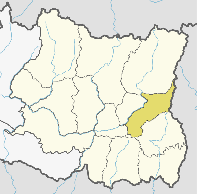
Panchthar District
View on WikipediaPanthar District (Nepali: पान्थर जिल्लाⓘ) is one of 14 districts of Koshi Province in the eastern hilly region of Nepal. It is a Hill district of eastern Nepal. The district covers 1,241 km2 (479 sq mi) of area. The 2011 census counted 191,817 population. Phidim is the district headquarters.
Key Information

History
[edit]Panthar was a part of Old Dhankuta District during Rana era and until 1962. Dhankuta district had two subdivisions Chhathum and Tehrathum. Panchthar was a thum (county) under the Terhathum subvision. It became a separate district in 1962 when the old 32 traditional districts divided into 75 district.
Geography and climate
[edit]| Climate Zone[2] | Elevation Range | % of Area |
|---|---|---|
| Upper Tropical | 300 to 1,000 meters 1,000 to 3,300 ft. |
18.3% |
| Subtropical | 1,000 to 2,000 meters 3,300 to 6,600 ft. |
52.6% |
| Temperate | 2,000 to 3,000 meters 6,400 to 9,800 ft. |
23.9% |
| Subalpine | 3,000 to 4,000 meters 9,800 to 13,100 ft. |
4.7% |
| Alpine | 4,000 to 5,000 meters 13,100 to 16,400 ft. |
0.4% |
Demographics
[edit]| Year | Pop. | ±% p.a. |
|---|---|---|
| 1981 | 153,746 | — |
| 1991 | 175,206 | +1.32% |
| 2001 | 202,056 | +1.44% |
| 2011 | 191,817 | −0.52% |
| 2021 | 172,400 | −1.06% |
| Sources:[3] | ||
At the 2021 Nepal census, Panchthar District had 42,495 households and a population of 172,400. 8.11% of the population was under 5 years of age. Panchthar had a literacy rate of 82.48% and a sex ratio of 1012 females per 1,000 males. 12,336 (7.16%) lived in urban areas.[4]
Ethnicity/caste: Janjatis make up the majority in the district at 73%. Limbu people make up over 43% of the population. Rai peoples such as the Bantawa, Chamling and Sunuwar are 15% of the population. Chhetri are 9%, Bahun 8% and Khas Dalit groups are 6% of the population.[5]
Religion: 55.71% were Kirati, 29.21% were Hindu, 12.26% Buddhist, 2.72% Christian and 0.10% others.[6]
As their first language, 42.27% of the population spoke Limbu, 29.28% Nepali, 6.96% Bantawa, 6.82% Tamang, 3.41% Magar Dhut, 2.86% Rai, 1.87% Chamling, 1.16% Gurung and 1.00% Sunuwar as their first language.[7] In 2011, 33.9% of the population spoke Nepali as their first language.[8]
Municipality and Rural Municipalities of Panchthar
[edit]- Phidim Municipality Nepali: फिदिम नगरपालिका (Phidim Municipality, Ranitar, Lumphabung, Yangnam(1-5), Nangin, Lungrupa)
- Hilihang Rural Municipality Nepali: हिलिहाङ गाउँपालिका (Ambarpur, Panchami, Subhang, Bharapa)
- Kummayak Rural Municipality Nepali: कुम्मायाक गाउँपालिका (Yasok, Rani Gaun, Mangjabung, Syabarumba)
- Miklajung Rural Municipality Nepali: मिक्लाजुंग गाउँपालिका (Aarubote, Sarangdanda, Rabi, Kurumba, Limba, Durdimba)
- Phalelung Rural Municipality (Nepali: फालेलुंग गाउँपालिका (Ektin, Memeng, Prangbung, Yangnam(6,9) Sidin)
- Phalgunanda Rural Municipality (Nepali: फाल्गुनन्द गाउँपालिका (Nawamidanda, Imbung, Pauwa Sartap, Chilingdin, Aangsarang, Phaktep)
- Tumbewa Rural Municipality Nepali: तुम्वेवा गाउँपालिका (Aangna, Olane, Hangum, Mauwa)
- Yangawarak Rural Municipality Nepali: याङवरक गाउँपालिका (Chyangthapu, Phalaicha, Oyam, Tharpu, Nagi)
VDC's in small brackets means they are combined to form main Rural Municipality
Previous Village Development Committees (VDCs) and Municipalities
[edit]
- Aangna
- Aangsarang
- Ambarpur
- Bharapa
- Chilingdin
- Chyangthapu
- Durdimba
- Ektin
- Embung
- Phalaicha
- Hangum
- Kurumba
- Limba
- Lungrupa
- Mangjabung
- Mauwa
- Memeng
- Nagi
- Nangin
- Nawamidanda
- Olane
- Oyam
- Panchami
- Prangbung
- Pauwa Sartap
- Phaktep
- Phidim Municipality
- Prangbung
- Rabi
- Rani Gaun
- Ranitar
- Sarangdanda
- Sidin
- Subhang
- Syabarumba
- Tharpu
- Yangnam
- Yasok
- lumphabung
- sarangdada
- phaktep
People from Panchthar District
[edit]- Basanta Kumar Nemwang, Politician and former minister.
- Bairagi Kainla, Poet and Former Chancellor of Nepal Academy.
- Bhishmaraj Angdembe, Politician.
- Damber Singh Sambahamphe, Politician.
- Ganesh Prasad Rijal, Politician.
- David Shankar, Singer.
- Rambahadur Limbu, Military officer.
- Upendra Subba, Poet, lyricist, Writer, Director.
- Rajendra Prasad Lingden, Politician and former Deputy Prime Minister of Nepal.
- Indra Bahadur Angbo, Politician.
- Khagendra Sangraula, Writer and columnist.
- Krishna Dharabasi, Writer and novelist.
- Manita Shrestha Pradhan, Nepalese judoka.
- Anjila Tumbapo Subba, Footballer.
- Dipak Prakash Baskota, Politician and businessman.
See also
[edit]References
[edit]- ^ Household and population by districts, Central Bureau of Statistics (CBS) Nepal Archived 2013-07-31 at the Wayback Machine
- ^ The Map of Potential Vegetation of Nepal - a forestry/agroecological/biodiversity classification system (PDF), Forest & Landscape Development and Environment Series 2-2005 and CFC-TIS Document Series No.110., 2005, ISBN 87-7903-210-9, retrieved Nov 22, 2013
- ^ "Nepal: Provinces and Districts". www.citypopulation.de.
- ^ "Provincial/District/Local reports: Koshi Province". Census Nepal 2021. Central Bureau of Statistics.
- ^ a b "Table 1: Caste/Ethnicity and sex". Census Nepal 2021. Central Bureau of Statistics. Retrieved 2024-03-16.
- ^ a b "Table 5: Religion and sex". Census Nepal 2021. Central Bureau of Statistics. Retrieved 2024-03-16.
- ^ a b "Table 5: Mother tongue and sex". Census Nepal 2021. Central Bureau of Statistics.
- ^ "Social characteristics tables" (PDF). Central Bureau of Statistics. Archived from the original (PDF) on 2024-09-23. Retrieved 2024-11-29.
External links
[edit]- "Districts of Nepal". Statoids.
Places adjacent to Panchthar District | ||||||||||||||||
|---|---|---|---|---|---|---|---|---|---|---|---|---|---|---|---|---|
| ||||||||||||||||
27°12′N 87°50′E / 27.20°N 87.83°E
Headquarters: Phidim Municipality | ||
| Rural municipalities |  | |
| Municipalities | ||
| International | |
|---|---|
| National | |
| Other | |
Panchthar District
View on GrokipediaPanchthar District is a hilly administrative district in eastern Nepal's Koshi Province, encompassing an area of 1,241 square kilometers with a population of 172,400 as recorded in the 2021 national census.[1][2] The district headquarters is located in Phidim, and its terrain features rugged hills and subtropical to temperate climates conducive to agriculture. Bordered by Ilam District to the west, Taplejung to the north, Sankhuwasabha to the east, and India's West Bengal state to the south along the Mechi River, Panchthar exhibits diverse ethnic composition including Limbu, Rai, and other indigenous groups alongside hill castes.[3] The economy of Panchthar relies predominantly on agriculture, with staple crops such as rice, maize, and millet supplemented by cash crops including ginger, tea, and notably large cardamom, for which the district serves as a primary production hub in Nepal—the world's leading exporter of this spice.[4][5] Organic large cardamom cultivation, often on sloped terrains, yields high profitability and supports export-oriented enterprises, though challenges like disease outbreaks and market fluctuations persist. Remittances from labor migration also bolster household incomes, influencing local economic activities.[4][6] Panchthar's cultural landscape reflects its multi-ethnic populace, with traditions tied to indigenous Kirati practices among Limbu and Rai communities, alongside Hindu and Buddhist influences. The district's natural features, including rivers and forested hills, contribute to its ecological significance, though deforestation and soil erosion from intensive farming pose ongoing environmental pressures. Despite a negative population growth rate of -1.02% between censuses, indicating out-migration, Panchthar maintains agricultural resilience and potential for agro-based development.[1][3]