

Community hub
Recent from talks
Contribute something
Nothing was collected or created yet.
St. Charles County, Missouri
View on Wikipedia
St. Charles County is located in the central eastern part of the U.S. state of Missouri. As of the 2020 census, the population was 405,262,[1] making it Missouri's third-most populous county. Its county seat is St. Charles.[2] The county was organized October 1, 1812, and named for Saint Charles Borromeo, an Italian cardinal.
Key Information


St. Charles County is part of the St. Louis, MO-IL Metropolitan Statistical Area and contains many of the city's northwestern suburbs. The wealthiest county in Missouri,[3] St. Charles County is one of the nation's fastest-growing counties.
St. Charles County includes a part of the Augusta AVA, an area of vineyards and wineries designated by the federal government in 1980 as the first American Viticultural Area.[4] The county's rural outer edge along the south-facing bluffs above the Missouri River, is also part of the broader Missouri Rhineland.
History
[edit]The County of St. Charles was originally called the District of St. Charles and had no definite limits until 1816 to 1818 when neighboring counties were formed.[5] The borders of St. Charles are the same today as they were in 1818.[6]
Geography
[edit]
According to the U.S. Census Bureau, the county has a total area of 593 square miles (1,540 km2), of which 560 square miles (1,500 km2) is land and 32 square miles (83 km2) (5.4%) is water.[8]
The highest elevation is 901 feet (275 m) northwest of Augusta near Femme Osage Creek headwaters.[9]
Adjacent counties
[edit]- Lincoln County (northwest)
- Calhoun County, Illinois (north)
- Jersey County, Illinois (northeast)
- Madison County, Illinois (east)
- St. Louis County (southeast)
- Franklin County (south)
- Warren County (west)
Major highways
[edit] I-64 – Major freeway in the western portion of the county. Originally U.S. Route 40, the highway was upgraded to Interstate standards in the late 2000s. The highway was re-signed as Interstate 64 from the Daniel Boone Bridge to Interstate 70 in Wentzville in 2009.
 I-70 – The major east–west thoroughfare in the county. It is mostly a six-lane freeway in the county, but there are sections in St. Charles and St. Peters where the Interstate widens to 11 lanes of traffic.
 Interstate 70 Business
 US-40
US-40 US-61
US-61 US-67
US-67 Rte-79
 Rte-94
 Rte-364 – A freeway in the southern and central portions of the county that begins at Interstate 270 in western St. Louis County and ends at Interstate 64 in Lake St. Louis.
 Rte-370 – A six-lane freeway that connects Interstate 70 in St. Charles County and Interstate 270 in St. Louis County.
National protected area
[edit]Climate
[edit]
| ||||||||||||||||||||||||||||||||||||||||||||||||||||||||||||||||||||||||||||||||||||||||||||||||||||||||||||||||||||||||||||
Demographics
[edit]| Census | Pop. | Note | %± |
|---|---|---|---|
| 1810 | 3,505 | — | |
| 1820 | 3,970 | 13.3% | |
| 1830 | 4,320 | 8.8% | |
| 1840 | 7,911 | 83.1% | |
| 1850 | 11,454 | 44.8% | |
| 1860 | 16,523 | 44.3% | |
| 1870 | 21,304 | 28.9% | |
| 1880 | 23,065 | 8.3% | |
| 1890 | 22,977 | −0.4% | |
| 1900 | 24,474 | 6.5% | |
| 1910 | 24,695 | 0.9% | |
| 1920 | 22,828 | −7.6% | |
| 1930 | 24,354 | 6.7% | |
| 1940 | 25,562 | 5.0% | |
| 1950 | 29,834 | 16.7% | |
| 1960 | 52,970 | 77.5% | |
| 1970 | 92,954 | 75.5% | |
| 1980 | 144,107 | 55.0% | |
| 1990 | 212,907 | 47.7% | |
| 2000 | 283,883 | 33.3% | |
| 2010 | 360,485 | 27.0% | |
| 2020 | 405,262 | 12.4% | |
| 2024 (est.) | 423,726 | 4.6% | |
| U.S. Decennial Census[11] 1790–1960[12] 1900–1990[13] 1990–2000[14] 2010–2020[15] | |||
2020 census
[edit]| Race / Ethnicity (NH = Non-Hispanic) | Pop 1980[16] | Pop 1990[17] | Pop 2000[18] | Pop 2010[19] | Pop 2020[20] | % 1980 | % 1990 | % 2000 | % 2010 | % 2020 |
|---|---|---|---|---|---|---|---|---|---|---|
| White alone (NH) | 140,241 | 203,705 | 266,158 | 321,078 | 335,879 | 97.32% | 95.68% | 93.76% | 89.07% | 82.88% |
| Black or African American alone (NH) | 1,911 | 4,917 | 7,573 | 14,827 | 20,672 | 1.33% | 2.31% | 2.67% | 4.11% | 5.10% |
| Native American or Alaska Native alone (NH) | 274 | 509 | 596 | 692 | 623 | 0.19% | 0.24% | 0.21% | 0.19% | 0.15% |
| Asian alone (NH) | 510 | 1,394 | 2,397 | 7,789 | 11,068 | 0.35% | 0.65% | 0.84% | 2.16% | 2.73% |
| Native Hawaiian or Pacific Islander alone (NH) | x [21] | x [22] | 61 | 153 | 199 | x | x | 0.02% | 0.04% | 0.05% |
| Other race alone (NH) | 222 | 74 | 224 | 427 | 1,377 | 0.15% | 0.03% | 0.08% | 0.12% | 0.34% |
| Mixed race or Multiracial (NH) | x [23] | x [24] | 2,698 | 5,536 | 19,433 | x | x | 0.95% | 1.54% | 4.80% |
| Hispanic or Latino (any race) | 949 | 2,308 | 4,176 | 9,983 | 16,011 | 0.66% | 1.08% | 1.47% | 2.77% | 3.95% |
| Total | 144,107 | 212,907 | 283,883 | 360,485 | 405,262 | 100.00% | 100.00% | 100.00% | 100.00% | 100.00% |
As of 2020, there were 405,262 people and 150,668 households residing in the county. The population density was 643 inhabitants per square mile (248/km2). There were 161,144 housing units. The racial makeup of the county was 83.8% White, 5.2% African American, 0.1% Native American, 2.8% Asian, 0.1% Pacific Islander, and 6.5% from two or more races. Hispanic or Latino made up 4.0% of the population.[25]
There were 101,663 households, out of which 40.50% had children under the age of 18 living with them, 63.20% were married couples living together, 9.20% have a woman whose husband does not live with her, and 24.20% were non-families. 19.40% of all households were made up of individuals, and 5.90% had someone living alone who was 65 years of age or older. The average household size was 2.76 and the average family size was 3.18.
In the county, the population was spread out in age, with 29.00% under the age of 18, 8.20% from 18 to 24, 32.60% from 25 to 44, 21.60% from 45 to 64, and 8.80% who were 65 years of age or older. The median age was 34 years. For every 100 females there were 97.10 males. For every 100 females age 18 and over, there were 94.10 males.
The median income for a household in the county was $71,458, and the median income for a family was $64,415. Males had a median income of $44,528 versus $29,405 for females. The per capita income for the county was $23,592. 4.00% of the population and 2.80% of families were below the poverty line. Out of the total people living in poverty, 4.90% are under the age of 18 and 5.10% are 65 or older.
St. Charles County has had one of the fastest-growing populations in the state for many decades, with 55% growth in the 1970s, 48% in the 1980s, 33% in the 1990s, and another 27% in the 2000s. The county sits at a cross-section of industry, as well as extensive retail and some agriculture. With the Missouri River on the south and east and the Mississippi River on the north, the county is bisected east to west by Interstate 70. After St. Charles Airport closed in 2010, the county has one remaining small airport, St. Charles County Smartt Airport. Two ferries cross the Mississippi River from St. Charles County.
Education
[edit]Public schools
[edit]School districts include:[26]
High schools (all grades 9–12):
- Fort Zumwalt District
- Fort Zumwalt East High School – St. Peters
- Fort Zumwalt North High School – O'Fallon
- Fort Zumwalt South High School – St. Peters
- Fort Zumwalt West High School – O'Fallon
- Francis Howell District
- Francis Howell Central High School – Cottleville
- Francis Howell North High School – St. Peters
- Francis Howell High School – Weldon Spring Heights
- Orchard Farm District
- Orchard Farm High School – St. Charles
- St. Charles District
- St. Charles High School – St. Charles
- St. Charles West High School – St. Charles
- Wentzville District
- Liberty High School – Lake St. Louis
- Emil E. Holt High School – Wentzville
- Timberland High School – Wentzville
Private schools
[edit]- Academy of the Sacred Heart – St. Charles – (PK-08) – Roman Catholic
- All Saints School – St. Peters – (K-08) – Roman Catholic
- Assumption Catholic Grade School – O'Fallon – (K-08) – Roman Catholic
- Christian High School– O'Fallon and St. Peters– (PK-12) – Non-denominational Christian
- Duchesne High School– St. Charles– (09-12)– Roman Catholic
- First Baptist Christian Academy – O'Fallon – (PK-07) – Non-denominational Christian
- Foristell Baptist Academy – Foristell – (K-09) – Baptist
- Hope Montessori Academy – Lake St. Louis – (PK-K) – Nonsectarian
- Immaculate Conception Catholic School – Dardenne Prairie – (K-08) – Roman Catholic
- Immanuel Lutheran School – St. Charles – (PK-08) – Lutheran
- Immanuel Lutheran School – Wentzville – (PK-08) – Lutheran
- Liberty Classical School – O'Fallon – (07-12) – Non-denominational Christian
- Lutheran High School of St. Charles County – St. Peters – (09-12) – Lutheran
- Messiah Lutheran School – Weldon Spring – (PK-08) – Lutheran
- Mid Rivers Seventh-day Adventist School – St. Peters – (03-08) – Seventh-day Adventist
- St. Charles Borromeo – St. Charles – (K-08) – Roman Catholic
- St. Cletus School – St. Charles – (K-08) – Roman Catholic
- St. Dominic High School – O'Fallon – (09-12) – Roman Catholic
- St. Elizabeth St. Robert Regional School – St. Charles – (PK-08) – Roman Catholic
- St. Joseph School – Cottleville – (K-08) – Roman Catholic
- St. Joseph School – Wentzville – (PK-08) – Roman Catholic
- St. Patrick Elementary School – Wentzville – (K-08) – Roman Catholic
- St. Paul Elementary School – St. Paul – (PK-08) – Roman Catholic
- St. Peter Catholic School – St. Charles – (PK-08) – Roman Catholic
- St. Theodore School – Wentzville – (K-08) – Roman Catholic
- Sts. Joachim & Ann School – St. Charles – (PK-08) – Roman Catholic
- Trinity Lutheran School – St. Charles – (01-08) – Lutheran
- Willott Road Christian Academy – St. Peters – (NS-09) – Baptist
- Zion Lutheran School – St. Charles – (PK-08) – Lutheran
Alternative schools
[edit]- Boonslick State School – St. Peters – Special Education
- Fort Zumwalt Hope High School – O'Fallon – Other/Alternative School – (09-12)
- Francis Howell Union High School – St. Charles – Other/Alternative School – (09-12)
- Heritage Landing – St. Peters – Other/Alternative School – (06-12)
- The Lead School – O'Fallon – Other/Alternative School – (K-12)
- Lewis & Clark Career Center – St. Charles – Vocational/Technical School – (09-12)
- Quest Day Treatment Center – St. Charles – Other/Alternative School – (06-12)
- Success Campus – St. Charles – Other/Alternative School – (09-12)
Higher education
[edit]- Lindenwood University – St. Charles
- St. Charles Community College – Cottleville
Public libraries
[edit]- St. Charles City-County Library District[27]
Government
[edit]St. Charles County is governed by a county executive and a county council. The county council consists of seven members, each elected from various districts in the county. The county executive is elected by the entire county. The current executive is Steve Ehlmann. He was preceded by Joe Ortwerth, who was preceded by Gene Schwendemann, the first county executive of St. Charles County under the new form of government. The executive under the old form of county government was termed a "judge." The county had 258,525 registered voters as of March 2016.[28]
St. Charles County Ambulance District (SCCAD) is the largest such district in Missouri, serving all of St. Charles County and its population of nearly 370,000.
Law enforcement
[edit]The St. Charles County Sheriff's Department (SCCSD) is responsible for court services and security, prisoner transport, civil process, and bailiffs. Until the end of 2014, SCCSD was the primary law enforcement agency serving unincorporated areas of St. Charles County. On January 1, 2015, the St. Charles County Police Department was established and assumed that responsibility.[29] It should not be confused with the St. Charles City Police Department. The St. Charles County Regional SWAT Team is made up of officers from each county law enforcement agency.
The SCCPD Aviation Unit is part of a multi-jurisdictional unit known as the Metro Air Support Unit, with the Metropolitan Police Department, City of St. Louis; St. Louis County Police Department; and St. Charles County Police Department.[30] As of 2024, the fleet included five helicopters,[31] and twelve pilots or pilots in training.[citation needed]
In May 2022, Ryan Keuhner, who was then an SCCSD deputy, shot and killed his neighbor's 3-year-old rescue dog with a pellet gun. The shooting was reportedly unprovoked and Keuhner was off duty at the time. Video of the dog's owner confronting Keuhner was uploaded online, and later gained national coverage. Keuhner resigned in June 2022 and was charged with a class A misdemeanor for animal abuse.[32][33]
Library resolution
[edit]In 2023, the county council issued a resolution aimed at library policies and staff online activities. The resolution followed protests and comments at council meetings from residents who complained about a staff member wearing gender non-conforming clothes. Within the resolution, the council asked the library CEO to remove an article they shared on their personal LinkedIn profile related to conservative campaigns targeting public libraries and freedom of speech.[34]
Politics
[edit]Local
[edit]The Republican Party predominantly controls politics at the local level in St. Charles County. Republicans hold all the elected positions in the county.[35][36][37]
| Position | Incumbent | Party |
|---|---|---|
| Assessor | Travis Welge[38] | Republican |
| Collector | Michelle McBride | Republican |
| Council Member – District 1 | Matt Swanson | Republican |
| Council Member – District 2 | Joseph Brazil | Republican |
| Council Member – District 3 | Michael Elam | Republican |
| Council Member – District 4 | David Hammond | Republican |
| Council Member – District 5 | Terry Hollander | Republican |
| Council Member – District 6 | Nancy Schneider | Republican |
| Council Member – District 7 | Tim Baker | Republican |
| County Executive | Steve Ehlmann | Republican |
| Director of Elections | Kurt Bahr | Republican |
| Prosecuting Attorney | Joe McCulloch | Republican[39][40] |
| Recorder | Mary Dempsey | Republican |
| Sheriff | Scott Lewis | Republican |
State
[edit]| Year | Republican | Democratic | Third Parties |
|---|---|---|---|
| 2024 | 59.51% 132,563 | 38.44% 85,628 | 2.05% 4,561 |
| 2020 | 58.12% 128,230 | 39.84% 87,888 | 2.04% 4,496 |
| 2016 | 54.52% 103,946 | 42.58% 85,704 | 2.90% 5,836 |
| 2012 | 48.58% 89,144 | 48.97% 89,860 | 2.45% 4,486 |
| 2008 | 44.51% 82,440 | 53.84% 99,705 | 1.65% 3,058 |
| 2004 | 55.90% 91,323 | 42.96% 70,184 | 1.14% 1,865 |
| 2000 | 58.24% 74,357 | 39.49% 50,415 | 2.27% 2,907 |
| 1996 | 49.48% 47,886 | 48.01% 46,462 | 2.50% 2,424 |
St. Charles County is divided among eleven legislative districts in the Missouri State House of Representatives, all of which are held by Republicans.
- District 63 – Tricia Byrnes (R-Wentzville, since 2023). Consists of most of Wentzville.
- District 64 – Deanna Self (R-St. Paul, since 2025). Consists of Flint Hill, Josephville, St. Paul, and parts of Foristell, O'Fallon, and Wentzville.
- District 65 – Wendy Hausman (R-St. Peters, since 2023). Consists of West Alton, Portage Des Sioux, and parts of Cottleville, St. Charles, and St. Peters.
- District 69 – Scott Miller (R-St. Charles, since 2025). Consists of parts of St. Peters and Weldon Spring.
- District 102 – Richard West (R-Wentzville, since 2021). Consists of Augusta, Defiance, New Melle, Weldon Springs Heights, and parts of Cottleville, O'Fallon, St. Peters, and Weldon Spring.
- District 103 – Dave Hinman (R-O'Fallon, since 2023). Consists of part of O'Fallon.
- District 104 – Terri Violet (R-St. Peters, since 2025). Consists of part of St. Charles and St. Peters.
- District 105 – Colin Wellenkamp (R-St. Charles, since 2025). Consists of part of St. Charles.
- District 106 – Travis Wilson (R-St. Charles, since 2023). Consists of part of St. Charles.
- District 107 – Mark Matthiesen (R-O'Fallon, since 2023). Consists of parts of Dardenne Prairie and O'Fallon.
- District 108 – Mike Costlow (R-Dardenne Prairie, since 2025). Consists of Lake St. Louis and parts of Dardenne Prairie and O'Fallon.
St. Charles County is divided into three districts in the Missouri State Senate, each of which are represented by Republicans.
- District 2 – Nick Schroer (R-Defiance, since 2023). Consists of the communities of Augusta, Cottleville, Dardenne Prairie, Defiance, Josephville, Lake St. Louis, New Melle, O'Fallon, St. Paul, Weldon Spring, and Weldon Spring Heights.
- District 10 - Travis Fitzwater (R-New Bloomfield, since 2023). Consists of the communities of Flint Hill, Foristell, and Wentzville.
- District 23 – Adam Schnelting (R-St. Charles, since 2025). Consists of Portage Des Sioux, St. Charles, St. Peters, and West Alton.
Federal
[edit]Missouri is represented in the U.S. Senate by Josh Hawley and Eric Schmitt, whose most recent election results from the county are included here.
| Party | Candidate | Votes | % | |
|---|---|---|---|---|
| Republican | Eric Schmitt | 83,559 | 55.35% | |
| Democratic | Trudy Busch Valentine | 64,552 | 42.76% | |
| Libertarian | Jonathan Dine | 2,158 | 1.43% | |
| Constitution | Paul Venable | 709 | 0.47% | |
| Total votes | 150,978 | 100.00% | ||
| Party | Candidate | Votes | % | |
|---|---|---|---|---|
| Republican | Josh Hawley | 93,172 | 52.90% | |
| Democratic | Claire McCaskill | 77,973 | 44.30% | |
| Independent | Craig O'Dear | 2,393 | 1.40% | |
| Libertarian | Japheth Campbell | 1,836 | 1.0% | |
| Green | Jo Crain | 731 | 0.4% | |
| Total votes | 176,105 | 100% | ||
| Party | Candidate | Votes | % | ±% | |
|---|---|---|---|---|---|
| Republican | Roy Blunt | 103,946 | 51.78% | +6.87 | |
| Democratic | Jason Kander | 88,238 | 43.95% | −5.18 | |
| Libertarian | Jonathan Dine | 5,238 | 2.61% | −3.35 | |
| Green | Johnathan McFarland | 1,970 | 0.98% | +0.98 | |
| Constitution | Fred Ryman | 1,355 | 0.67% | +0.67 | |
| Party | Candidate | Votes | % | |
|---|---|---|---|---|
| Democratic | Claire McCaskill | 89,993 | 49.10% | |
| Republican | Todd Akin | 82,278 | 44.90% | |
| Libertarian | Jonathan Dine | 10,924 | 6.0% | |
| Party | Candidate | Votes | % | |
|---|---|---|---|---|
| Republican | Roy Blunt | 73,695 | 59.09% | |
| Democratic | Robin Carnahan | 43,955 | 35.24% | |
| Libertarian | Jonathan Dine | 10,924 | 6.0% | |
Part of St. Charles County is included in Missouri's 2nd Congressional District and is currently represented by Ann Wagner in the U.S. House of Representatives.
| Party | Candidate | Votes | % | ±% | |
|---|---|---|---|---|---|
| Republican | Ann Wagner | 45,941 | 57.38% | ||
| Democratic | Jill Schupp | 31,239 | 39.02% | ||
| Libertarian | Martin Schulte | 2,821 | 3.52% | ||
| Party | Candidate | Votes | % | ±% | |
|---|---|---|---|---|---|
| Republican | Ann Wagner | 37,875 | 57.5% | ||
| Democratic | Cort VanOstran | 26,782 | 40.6% | ||
| Libertarian | Tony Kirk | 956 | 1.5% | ||
| Green | David Arnold | 304 | 0.5% | ||
| Independent | Ken Newhouse (write-in) | 0 | 0.0% | ||
| Total votes | 65,917 | 100.0% | |||
| Republican hold | |||||
Most of St. Charles County is included in Missouri's 3rd Congressional District and is currently represented by Bob Onder (R-Lake St. Louis) in the U.S. House of Representatives.
| Party | Candidate | Votes | % | ±% | |
|---|---|---|---|---|---|
| Republican | Blaine Luetkemeyer | 84,071 | 61.74% | ||
| Democratic | Megan Rezabek | 49,315 | 36.22% | ||
| Libertarian | Leonard J Steinman II | 2,631 | 1.93% | ||
| Party | Candidate | Votes | % | ±% | |
|---|---|---|---|---|---|
| Republican | Blaine Luetkemeyer | 61,751 | 57.77% | ||
| Democratic | Katy Geppert | 43,070 | 40.30% | ||
| Libertarian | Donald V. Stolle | 2,062 | 1.93% | ||
| Total votes | 106,883 | 100.0% | |||
| Republican hold | |||||
| Year | Republican | Democratic | Third party(ies) | |||
|---|---|---|---|---|---|---|
| No. | % | No. | % | No. | % | |
| 1888 | 2,668 | 52.65% | 2,381 | 46.99% | 18 | 0.36% |
| 1892 | 2,522 | 50.00% | 2,485 | 49.27% | 37 | 0.73% |
| 1896 | 3,173 | 56.15% | 2,448 | 43.32% | 30 | 0.53% |
| 1900 | 3,324 | 58.10% | 2,343 | 40.95% | 54 | 0.94% |
| 1904 | 3,203 | 62.91% | 1,788 | 35.12% | 100 | 1.96% |
| 1908 | 3,480 | 62.84% | 1,979 | 35.73% | 79 | 1.43% |
| 1912 | 2,350 | 49.00% | 1,792 | 37.36% | 654 | 13.64% |
| 1916 | 3,518 | 64.16% | 1,914 | 34.91% | 51 | 0.93% |
| 1920 | 6,645 | 72.13% | 2,472 | 26.83% | 96 | 1.04% |
| 1924 | 4,668 | 59.11% | 2,364 | 29.94% | 865 | 10.95% |
| 1928 | 5,404 | 51.43% | 5,081 | 48.36% | 22 | 0.21% |
| 1932 | 3,664 | 34.12% | 6,911 | 64.37% | 162 | 1.51% |
| 1936 | 5,156 | 42.72% | 5,903 | 48.91% | 1,009 | 8.36% |
| 1940 | 7,792 | 59.14% | 5,334 | 40.48% | 50 | 0.38% |
| 1944 | 7,050 | 58.92% | 4,880 | 40.78% | 36 | 0.30% |
| 1948 | 5,976 | 49.54% | 6,049 | 50.14% | 39 | 0.32% |
| 1952 | 8,451 | 56.48% | 6,493 | 43.39% | 20 | 0.13% |
| 1956 | 9,462 | 55.40% | 7,618 | 44.60% | 0 | 0.00% |
| 1960 | 10,888 | 47.80% | 11,890 | 52.20% | 0 | 0.00% |
| 1964 | 9,020 | 38.30% | 14,530 | 61.70% | 0 | 0.00% |
| 1968 | 13,533 | 45.63% | 10,374 | 34.98% | 5,752 | 19.39% |
| 1972 | 25,677 | 69.94% | 11,034 | 30.06% | 0 | 0.00% |
| 1976 | 26,105 | 53.60% | 22,063 | 45.30% | 536 | 1.10% |
| 1980 | 36,050 | 60.32% | 20,668 | 34.58% | 3,050 | 5.10% |
| 1984 | 47,784 | 73.06% | 17,617 | 26.94% | 0 | 0.00% |
| 1988 | 50,005 | 62.90% | 29,286 | 36.84% | 209 | 0.26% |
| 1992 | 38,673 | 36.29% | 37,263 | 34.97% | 30,627 | 28.74% |
| 1996 | 47,705 | 46.66% | 41,369 | 40.46% | 13,172 | 12.88% |
| 2000 | 72,114 | 56.04% | 53,806 | 41.81% | 2,766 | 2.15% |
| 2004 | 95,826 | 58.61% | 66,855 | 40.89% | 807 | 0.49% |
| 2008 | 102,550 | 54.27% | 84,183 | 44.55% | 2,224 | 1.18% |
| 2012 | 110,784 | 59.44% | 71,838 | 38.55% | 3,744 | 2.01% |
| 2016 | 121,650 | 59.87% | 68,626 | 33.78% | 12,908 | 6.35% |
| 2020 | 128,389 | 57.69% | 89,530 | 40.23% | 4,647 | 2.09% |
| 2024 | 130,588 | 57.42% | 92,226 | 40.56% | 4,594 | 2.02% |
Federal politics
[edit]St. Charles County has long been a Republican stronghold despite being an urban county, likely due to being the wealthiest county in Missouri.
Despite this, it did vote for Medicaid expansion in 2020, legal recreational marijuana in 2022, and legal abortion in 2024. It was also one of the few counties in Missouri to shift towards the Democrats from 2020 to 2024.
2016 Missouri presidential primary results
[edit]Republican
Donald Trump won the most votes in St. Charles County, with 41.50 percent. U.S. Senator Ted Cruz (R-Texas) came in second with 38.87 percent, Governor John Kasich (R-Ohio) placed third with 10.70 percent, and U.S. Senator Marco Rubio (R-Florida) was fourth with 7.10 percent.
Democratic
U.S. Senator Bernie Sanders (I-Vermont) won the primary with 54.32 percent to former Secretary of State Hillary Clinton's 44.80 percent.
2012 Missouri presidential primary results
[edit]Republican
Former U.S. Senator Rick Santorum (R-Pennsylvania) won the most votes in St. Charles County, with 56.29 percent. Former Governor Mitt Romney (R-Massachusetts) came in second with 25.43 percent, and former U.S. Representative Ron Paul (R-Texas) was third with 12.69 percent.
Democratic
With incumbent President Barack Obama facing no serious opposition, few St. Charles County voters voted in the Democratic primary; Obama won 87.83 percent.
2008 Missouri presidential primary results
[edit]Republican
Former Governor Mitt Romney (R-Massachusetts) won the most votes in St. Charles County, with 37.72 percent. U.S. Senator John McCain (R-Arizona) came in second with 34.95 percent, former Governor Mike Huckabee (R-Arkansas) placed third with 21.83 percent, and U.S. Representative Ron Paul (R-Texas) was fourth with 3.83 percent.
Democratic
Former U.S. Senator Hillary Clinton (D-New York) received a total of 23,611 votes, more than any candidate from either party in St. Charles County during the 2008 presidential primary.
Communities
[edit]Cities
[edit]Villages
[edit]Census-designated place
[edit]Other unincorporated places
[edit]Islands
[edit]Subregions
[edit]Westplex
[edit]Westplex is an area within St. Charles County in east-central Missouri to the west of St. Louis County.[46]
The Westplex is part of St. Charles County that used to be called "The Golden Triangle". The "triangle" was formed by I-70 to the north, Missouri Route 94 to the southeast, and I-64 to the southwest. Since almost all of the growth in St. Charles County was within this triangle it was dubbed the "Golden" area of St. Charles County, hence, Golden Triangle. Today the Westplex is made up of St. Charles, St. Peters, Weldon Spring, Cottleville, Dardenne Prairie, O'Fallon, Lake St. Louis, and Wentzville.
See also
[edit]References
[edit]- ^ "2020 U.S. Census". United States Census Bureau.
- ^ "Find a County". National Association of Counties. Retrieved June 7, 2011.
- ^ "County-Level Unemployment and Median Household Income for Missouri". www.ers.usda.gov. USDA Economic Research Service. Retrieved March 30, 2009.
- ^ Pingelton, Tim (December 8, 2005). "The Soul of Augusta". Appellation American. Archived from the original on July 24, 2008.
- ^ Bryan, William S. (1993). St. Charles Co., Missouri: biographical sketches from pioneer families of Missouri by Bryan and Rose. Baltimore, Maryland: Genealogical Publishing Company. p. 1.
- ^ "MO: Individual County Chronology". Newberry. Archived from the original on October 22, 2020. Retrieved October 8, 2020.
- ^ "Decurrent False Aster". Field Guide. Missouri Dept. of Conservation. Retrieved September 2, 2015.
- ^ "2010 Census Gazetteer Files". United States Census Bureau. August 22, 2012. Archived from the original on October 21, 2013. Retrieved November 20, 2014.
- ^ USGS 1/3 Arc Second NED
- ^ "NASA Earth Observations Data Set Index". NASA. Archived from the original on May 11, 2020. Retrieved January 30, 2016.
- ^ "U.S. Decennial Census". United States Census Bureau. Retrieved November 20, 2014.
- ^ "Historical Census Browser". University of Virginia Library. Retrieved November 20, 2014.
- ^ "Population of Counties by Decennial Census: 1900 to 1990". United States Census Bureau. Retrieved November 20, 2014.
- ^ "Census 2000 PHC-T-4. Ranking Tables for Counties: 1990 and 2000" (PDF). United States Census Bureau. Retrieved November 20, 2014.
- ^ "2020 Population and Housing State Data". U.S. Census Bureau. Retrieved August 28, 2021.
- ^ "1980 Census of Population - General Social and Economic Characteristics - Missouri- Table 16 - Persons by Spanish Origin, Race, and Sex: 1980" (PDF). United States Census Bureau. p. 20-25.
- ^ "1990 Census of Population - General Population Characteristics - Missouri: Table 5 - Race and Hispanic Origin" (PDF). United States Census Bureau. p. 13-63.
- ^ "P004: Hispanic or Latino, and Not Hispanic or Latino by Race – 2000: DEC Summary File 1 – St. Charles County, Missouri". United States Census Bureau.
- ^ "P2: Hispanic or Latino, and Not Hispanic or Latino by Race – 2010: DEC Redistricting Data (PL 94-171) – St. Charles County, Missouri". United States Census Bureau.
- ^ "P2: Hispanic or Latino, and Not Hispanic or Latino by Race – 2020: DEC Redistricting Data (PL 94-171) – St. Charles County, Missouri". United States Census Bureau.
- ^ included in the Asian category in the 1980 Census
- ^ included in the Asian category in the 1990 Census
- ^ not an option in the 1980 Census
- ^ not an option in the 1990 Census
- ^ "St. Charles County, Missouri". United States Census Bureau. Retrieved January 9, 2022.
- ^ Geography Division (January 12, 2021). 2020 Census - School District Reference Map: St. Charles County, MO (PDF) (Map). U.S. Census Bureau. Retrieved July 22, 2022. - Text list
- ^ Breeding, Marshall. "Saint Charles City – County Public Library". Libraries.org. Retrieved May 8, 2017.
- ^ "Presidential Preference Primary, March 15, 2016, St. Charles County Missouri". St. Charles County Election Authority. March 22, 2016. Retrieved March 30, 2016.
- ^ Schlinkmann, Mark (December 30, 2014). "New St. Charles County police department begins operations Thursday". STLtoday.com. Retrieved June 28, 2017.
- ^ "Metro Air Support Unit of St. Louis, Missouri". Metro Air Support Unit. Retrieved January 10, 2025.
- ^ "Celebrating two decades of Metro Air Support, and taking advantage of community engagement opportunities" (PDF). Commissioner's Correspondence. St. Louis Metropolitan Police Department. August 2024. Retrieved January 10, 2025.
- ^ Byers, Christine (June 27, 2022). "St. Charles County Sheriff's Deputy charged after pellet gun death of neighbor's dog". KSDK. Retrieved April 30, 2023.
- ^ Harris, Taylor Tiamoyo (July 3, 2022). "Ex-St. Charles County sheriff's deputy faces misdemeanor charge in dog's death". St. Louis Post-Dispatch. Retrieved May 1, 2023.
- ^ Hanshaw, Annelise (August 15, 2023). "Community uproar leads St. Charles County to admonish library to be 'non-political'". Missouri Independent. Retrieved August 16, 2023.
- ^ "November 2018 General Election".
- ^ "November 3, 2020 General Election".
- ^ "County Council". St. Charles County, Missouri. Retrieved March 9, 2022.
- ^ "Assessor". St. Charles County, Missouri. Retrieved May 15, 2024.
- ^ Korando, Russell (November 23, 2012). "St. Charles County judge nominated for prosecutor". St. Charles County Suburban Journal. Retrieved December 3, 2013.
Ehlmann was required to appoint someone from the same political party as Banas, a Republican, to serve until the office comes up for election in November 2014.
- ^ "Prosecuting Attorney". St. Charles County. Retrieved August 18, 2024.
- ^ "Official Final Election Results". St. Charles County Election Authority. Retrieved August 19, 2023.
- ^ a b c "County Results". Election Night Reporting. Missouri Secretary of State. Retrieved March 4, 2019.
- ^ "2012 Missouri Senate Results". POLITICO.
- ^ "St. Charles County 2010 Election Results".
- ^ Leip, David. "Dave Leip's Atlas of U.S. Presidential Elections". uselectionatlas.org. Retrieved March 26, 2018.
- ^ "About Westplex". westplex.com. Retrieved October 20, 2017.
External links
[edit]- St. Charles County Government Website
- St. Charles City-County Library District
- St. Charles County Ambulance District
- Greater St. Charles County Chamber of Commerce
- St. Charles County Jail Information
- Digitized 1930 Plat Book of St. Charles County Archived August 16, 2011, at the Wayback Machine from University of Missouri Division of Special Collections, Archives, and Rare Books
Municipalities and communities of St. Charles County, Missouri, United States | ||
|---|---|---|
| Cities | 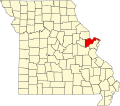 | |
| Villages | ||
| Townships | ||
| CDP | ||
| Other communities | ||
| Ghost towns | ||
| Footnotes | ‡This populated place also has portions in an adjacent county or counties | |
Places adjacent to St. Charles County, Missouri | ||||||||||||||||
|---|---|---|---|---|---|---|---|---|---|---|---|---|---|---|---|---|
| ||||||||||||||||
| Topics |  | |
|---|---|---|
| Central city | ||
| Largest cities (over 50,000 in 2020) | ||
| Medium-sized cities (over 20,000 in 2020) | ||
| Largest towns and villages (over 10,000 in 2020) |
| |
| Missouri counties | ||
| Illinois counties | ||
| Subregions | ||
| International | |
|---|---|
| National | |
| Geographic | |
| Other | |
St. Charles County, Missouri
View on GrokipediaHistory
Early settlement and founding
The earliest European settlement in the area now known as St. Charles County occurred in 1769, when French-Canadian fur trader Louis Blanchette established a trading post called Les Petites Côtes ("The Little Hills") on the north bank of the Missouri River near its confluence with the Mississippi.[9] This outpost, the first permanent white settlement north of the Missouri River and west of the Mississippi, capitalized on the region's abundant wildlife and strategic river access for fur trade under Spanish colonial rule, which had taken control of Upper Louisiana after the 1763 Treaty of Paris ceded the territory from France.[10][11] Blanchette, known as "The Hunter," arrived via the Mississippi and selected the elevated bluffs to avoid seasonal flooding, marking a pragmatic adaptation to the local topography that influenced subsequent development.[12] French-speaking colonists from Canada and Illinois settlements followed, drawn by fur-trapping prospects and arable bottomlands suitable for small-scale agriculture, with the community incorporating elements of French colonial architecture and governance.[13] By the 1790s, the village—renamed San Carlos del Misuri under Spanish administration—supported a modest population of traders, hunters, and farmers, including early structures like log cabins and a wooden church; however, growth remained limited due to isolation and conflicts with indigenous Osage and Missouri tribes over hunting grounds.[9] The 1803 Louisiana Purchase transferred the territory to the United States, spurring American exploration, including the Lewis and Clark Expedition's departure from the area in 1804, which highlighted St. Charles as a key jumping-off point for westward expansion.[11] St. Charles County was officially organized on October 1, 1812, as one of the five original counties of the Missouri Territory, encompassing lands north of the Missouri River and bounded by the Mississippi to the east.[14] Named for Saint Charles Borromeo, patron of the principal settlement, the county's formation responded to rising Anglo-American immigration post-Purchase, with St. Charles designated as the territorial capital until 1821 and Missouri's state capital briefly thereafter.[2] This administrative establishment formalized governance over approximately 1,000 square miles, integrating French Creole influences with incoming Yankee settlers and facilitating land claims under federal surveys.[12]19th-century development
St. Charles County was organized on November 1, 1812, from territory previously part of the St. Louis District, amid Missouri's transition toward statehood. Early 19th-century growth centered on the Missouri River's role in commerce, evolving from fur trading outposts established in the late 18th century to broader agricultural and transport activities. The county's namesake city, St. Charles, founded in 1769 by French-Canadian trader Louis Blanchette as a fur trading post, served as the initial hub for trappers and settlers exploiting river access for pelts and provisions.[11] [10] Missouri's statehood in 1821 elevated St. Charles to temporary capital status, with the first legislative assembly convening there on June 4, 1821, in a brick structure that functioned as the seat of government until 1826, when the capital relocated to Jefferson City. This five-year period accelerated administrative development, including legislative sessions and gubernatorial operations under Alexander McNair, drawing officials and boosting local services despite the provisional nature of the arrangement. The capital role enhanced St. Charles' prominence as a gateway for westward migration and trade, with riverfront facilities supporting packet boats and early steamboat arrivals post-1817.[15] [16] Economic expansion in the mid-19th century shifted toward agriculture, with farms producing staples like hemp, tobacco, and corn for export via the Missouri River, supplemented by burgeoning steamboat traffic that connected the county to St. Louis and upstream markets. German immigrants arriving from the 1830s onward introduced viticulture, cultivating vineyards that formed an early wine industry amid the region's fertile loess soils and river proximity, while fostering commercial districts with mills and warehouses. By the late 1820s, the county's white population had expanded to roughly 4,320 residents, reflecting immigration and land clearance for settlement.[9] [13] [10]20th-century industrialization and suburbanization
The American Car and Foundry Company (ACF), formed in 1899 through the merger including the St. Charles Car Company, became a cornerstone of early 20th-century industrialization in St. Charles County, focusing on steel railroad car production along the Missouri River. By 1906, the facility employed 1,800 workers with an annual payroll exceeding $1 million, contributing significantly to local economic stability amid national railroad expansion. During World War I, ACF supported the War Industries Board with defense contracts, and in World War II, it shifted to manufacturing 1,800 light tanks and aircraft components from 1941 to 1944, peaking employment and reducing regional unemployment. The plant's closure in 1959, driven by declining passenger rail demand, marked the end of this era, though its weekly payroll had reached $250,000 by 1954.[17] Throughout the first half of the century, the county's economy remained tied to manufacturing and agriculture, with population growth modest: approximately 24,700 in 1900, dipping slightly to 22,800 by 1920 due to rural depopulation trends, then stabilizing around 25,600 by 1940 and 29,800 by 1950 per U.S. Census data. Industrial output, including rail-related foundries dating to the 1850s but active into the 20th century, provided limited diversification, as broader mechanization reduced farm labor needs without substantial new factories emerging beyond ACF.[18] Post-World War II suburbanization accelerated dramatically, fueled by federal highway construction and proximity to St. Louis, transforming the county from rural outpost to commuter bedroom community. The completion of Interstate 70 in the 1950s and 1960s enhanced accessibility, enabling daily commutes and spurring residential development; population surged to 52,970 by 1960, more than doubling the 1950 figure. This growth reflected broader regional patterns, including migration from urban St. Louis amid city decline and "white flight," with St. Charles County attracting families seeking affordable housing and space. By 1970, residents numbered 92,954, underscoring the shift to service-oriented suburbs over heavy industry.[18][19]Post-2000 growth and recent events
St. Charles County's population grew from 281,124 in 2000 to 360,485 by the 2010 census, marking a 28.3% increase that outpaced both Missouri's 7% statewide growth and the national average of 9.7% over the same period.[20] This expansion continued post-2010, with the county adding residents at an average annual rate of 1.98%, reaching 416,659 by 2023—a cumulative 48.2% rise since 2000 driven by inbound migration to its suburban communities.[21] Much of this growth concentrated in western cities like Wentzville, which saw the largest absolute population gains in the 2010–2020 decade due to new housing developments and manufacturing job opportunities, while O'Fallon followed closely with significant household increases.[22] Factors contributing to this trend included lower housing costs relative to St. Louis City, family-oriented amenities, and access to interstate highways facilitating commutes to metropolitan employment hubs. Economically, the county maintained momentum as Missouri's third-largest economy, accounting for 6% of the state's GDP through strengths in manufacturing, logistics, and advanced services.[23] Post-2000 developments included sustained job creation, with over 5,300 positions added in a single 12-month span during the early 2000s recovery, and cumulative public investments surpassing $1 billion in transportation infrastructure to support freight and commuter traffic.[24][25] By the 2020s, low unemployment—declining from a COVID-19 peak—and business-friendly policies fueled record-breaking commercial projects, as the county approved major developments exceeding 20,000 square feet for the third straight year in 2023, emphasizing industrial parks and retail expansions.[26][27] Key events since 2010 include the closure of St. Charles Airport that year, redirecting aviation-related economic activity to regional alternatives and underscoring a pivot toward ground-based logistics growth. The 2020 pandemic disrupted this trajectory temporarily, with unemployment spiking amid national lockdowns, but recovery accelerated through diversified sectors resilient to remote work shifts and federal aid.[27] More recently, in 2024, the Missouri Supreme Court ruled against counties imposing sales taxes on recreational marijuana, nullifying a local revenue stream approved by voters, while infrastructure milestones like Phase 1 completion of a regional law enforcement facility highlighted ongoing public safety investments amid population pressures.[28][29]Physical Environment
Geography and topography
St. Charles County occupies 561 square miles in east-central Missouri, forming the northwestern portion of the St. Louis metropolitan area.[25] The county is bounded by the Missouri River to the north, which separates it from counties such as Pike and Lincoln, while its eastern edge adjoins St. Louis County along the Mississippi River drainage influences. Approximately 70 percent of the county's drainage flows toward the Mississippi River, with the remaining 30 percent directed to the Missouri River.[30] The topography consists of gently rolling uplands and riverine lowlands, with elevations ranging from about 400 feet near the Missouri River floodplain to around 700 feet in the interior hills.[31] The Missouri River floodplain extends up to five miles wide in places, featuring flat, alluvial deposits, while adjacent areas rise into loess-covered bluffs and dissected terrain shaped by glacial till and fluvial erosion.[32] These bluffs, particularly along the south-facing slopes above the river, contribute to a landscape of moderate relief, including riverbanks, forested ridges, and open plains suitable for agriculture and development.[25] Geomorphic features reflect the interplay of river incision and sediment deposition, with the county situated between the Missouri and Mississippi River valleys, where drainage divides form subtle ridges and valleys.[33] The absence of dramatic elevation changes results in a restless but navigable terrain, facilitating both historical settlement and modern infrastructure.[34]Climate patterns
St. Charles County experiences a humid continental climate (Köppen Dfa), characterized by hot, humid summers and cold, snowy winters, with significant seasonal temperature variations driven by its mid-latitude continental position and proximity to the Missouri River.[35] Average annual temperatures range from lows around 21°F in winter to highs near 89°F in summer, with an overall yearly mean of approximately 56.5°F.[36] [37] Summers, from June to August, feature average high temperatures in the upper 80s°F, often exceeding 90°F on multiple days, accompanied by high humidity levels that elevate heat indices above 100°F; extreme heat events reaching 100°F or higher occur on about five days annually.[35] Winters, spanning December to February, bring average highs around 40°F and lows dipping to the mid-20s°F, with occasional Arctic outbreaks pushing temperatures below 0°F; snowfall averages 14 inches per year, primarily in January and February.[38] Spring and fall serve as transitional seasons, with March-May seeing rising temperatures and increasing thunderstorm activity, while September-November offer milder conditions with average highs in the 60s-70s°F.[36] Precipitation totals about 42 inches annually, distributed relatively evenly but peaking in spring and early summer due to frontal systems and convective storms; May records the highest monthly average at 4.0 inches of rain.[36] [38] The county lies within a region prone to severe weather, including thunderstorms and occasional tornadoes, influenced by the convergence of warm Gulf moisture and cold continental air masses, though prolonged droughts or floods can occur variably year-to-year.[35]Transportation infrastructure
St. Charles County is traversed by several major interstate highways that facilitate regional and national connectivity, including Interstate 70, which runs east-west through the county and serves as a primary trucking corridor linking Kansas City and St. Louis.[39] Interstate 64 begins at its interchange with I-70 near Wentzville and proceeds eastward concurrently with U.S. Route 40, providing access to the St. Louis metropolitan area.[40] Additional key routes include Interstate 370, U.S. Route 61, U.S. Route 67, Missouri Route 79, Missouri Route 94 (which parallels the Missouri River), Missouri Route 364 (the Page Avenue Extension), and Missouri Route 370.[34] The county has invested significantly in roadway improvements, allocating approximately $750 million in sales tax revenues to fund about $1.3 billion in transportation projects over recent decades, including expansions and rehabilitations.[41] Ongoing initiatives by the Missouri Department of Transportation include adding a third lane to I-70, realigning I-70 between Wentzville Parkway and I-64 for improved capacity and safety, rehabilitating the I-64 bridge over the Missouri River starting in April 2025, and enhancing Missouri Route 79 and Route 94.[42][43][44] Bridges spanning the Missouri River connect the county to adjacent areas, notably the Blanchette Memorial Bridge carrying I-70 and the Daniel Boone Bridge on U.S. Route 40/61, which supports I-64 traffic.[45] Public transportation is provided by the St. Charles County Transit Authority, which operates Ride STC services including on-demand rides within the City of St. Charles and commuter routes linking to St. Louis, such as the #34 line, primarily during peak hours from 6:30 a.m. to 8:00 a.m. and 3:30 p.m. to 6:00 p.m. on weekdays.[46][47] No direct MetroLink light rail service extends into the county, following voter rejection of funding measures in the 1990s and 2000s.[48] The St. Charles County Regional Airport (Smartt Field, FAA: KSET), located in Portage des Sioux, serves general aviation with runways suitable for small aircraft and is situated less than 15 minutes from central attractions.[49] Commercial air travel relies on nearby Lambert-St. Louis International Airport, approximately 9 miles from St. Charles and offering extensive domestic and international flights.[50] Freight movement benefits from the county's proximity to the Missouri River and rail lines, though specific port facilities are limited.[51]Protected areas and natural features
St. Charles County occupies a portion of the Missouri River floodplain and adjacent uplands in eastern Missouri, characterized by gently rolling topography that rises gradually from the river's eastern boundary. The landscape includes broad alluvial floodplains up to five miles wide, covered in part by loess deposits, transitioning to dissected uplands with bluffs and valleys formed by glacial outwash and river incision.[32][31] These features support diverse habitats, including bottomland forests, marshes, and prairie remnants, influenced by periodic Missouri River flooding and seasonal precipitation patterns.[52] Key protected areas include several conservation areas managed by the Missouri Department of Conservation (MDC), emphasizing wildlife habitat preservation, hunting, fishing, and recreation. The August A. Busch Memorial Conservation Area, spanning over 7,000 acres, was acquired by the MDC in 1947 and features extensive trails, lakes stocked for fishing, and restored grasslands for upland game birds.[53] Howell Island Conservation Area covers 2,547 acres of riverine forest and is accessible only by boat, providing habitat for waterfowl and opportunities for primitive hunting and hiking.[54] Marais Temps Clair Conservation Area, a 918-acre oxbow marsh remnant of the Missouri River, serves as critical wetland habitat for migratory birds and amphibians, with limited public access focused on observation.[52] Additional sites include Weldon Spring Conservation Area, which offers over 8,000 acres with multi-use trails for hiking and mountain biking amid oak-hickory woodlands and restored prairies.[55] Cuivre Island Conservation Area, straddling St. Charles and Lincoln counties, protects island ecosystems along the Mississippi River confluence, accessible via Highway 79.[56] County-managed parks such as Klondike Park and Broemmelsiek Park complement these by preserving local woodlands and wetlands, with the latter featuring a 1.8-mile trail system around lakes supporting bass and catfish fisheries.[57] In 2023, St. Charles County acquired land for Spring Bend Park, a forthcoming 300-acre conservation site emphasizing native prairie restoration and river access, set to open in 2024.[58] These areas collectively safeguard biodiversity amid suburban expansion, with MDC properties prioritizing ecological restoration over intensive development.[59]Demographics
Population growth trends
St. Charles County has undergone substantial population expansion since 1970, driven primarily by its position as a suburban extension of the St. Louis metropolitan area, offering residential development opportunities amid urban decline in St. Louis City. The county's population increased from 92,954 in 1970 to 405,262 by the 2020 census, representing a cumulative growth of approximately 336% over five decades. This trajectory reflects broader patterns of suburban migration in the Midwest, fueled by factors such as affordable housing, employment in adjacent industries, and preferences for lower-density living environments.[60][61] Decennial census data illustrate accelerating then decelerating growth rates:| Decade | Population | Percent Change |
|---|---|---|
| 1970 | 92,954 | - |
| 1980 | 144,107 | 55% |
| 1990 | 212,907 | 48% |
| 2000 | 283,883 | 33% |
| 2010 | 361,808 | 27% |
| 2020 | 405,262 | 12% |
2020 census data
The 2020 United States decennial census enumerated a total population of 405,262 in St. Charles County, reflecting a 12.4% increase from the 360,485 residents recorded in 2010.[65] This growth positioned the county as the third-most populous in Missouri, driven largely by suburban expansion near the St. Louis metropolitan area. Racial and ethnic composition data from the census indicated a predominantly White population, with 335,879 individuals (82.9%) identifying as White alone.[66] Black or African American alone comprised 20,066 residents (5.0%), Asian alone 10,452 (2.6%), American Indian and Alaska Native alone 845 (0.2%), Native Hawaiian and Other Pacific Islander alone 74 (0.0%), and two or more races 21,373 (5.3%).[66] Persons of Hispanic or Latino origin numbered 16,011 (4.0%), with the non-Hispanic White alone population at 82.9% of the total.[66]| Race/Ethnicity | Number | Percentage |
|---|---|---|
| White alone | 335,879 | 82.9% |
| Black or African American alone | 20,066 | 5.0% |
| Asian alone | 10,452 | 2.6% |
| Two or more races | 21,373 | 5.3% |
| Hispanic or Latino (any race) | 16,011 | 4.0% |
| Other categories (American Indian, Native Hawaiian, etc.) | <1,000 each | <0.2% each |
Racial, ethnic, and socioeconomic composition
As of the 2022 American Community Survey estimates, St. Charles County's population of approximately 410,000 is predominantly White non-Hispanic, accounting for 83.9% of residents.[67] Black or African American non-Hispanic individuals comprise 4.94%, Asian non-Hispanic 2.7%, and Hispanic or Latino residents of any race make up about 4.0%, with the remainder including smaller shares of two or more races (around 3.5%), American Indian/Alaska Native, Native Hawaiian/Pacific Islander, and other groups.[67] [62] This composition reflects limited ethnic diversity relative to more urbanized areas in the St. Louis metropolitan region, with non-White populations concentrated in suburban pockets near employment hubs.[67] The following table summarizes the racial and ethnic breakdown based on 2022 estimates:| Group | Percentage of Population |
|---|---|
| White (Non-Hispanic) | 83.9% |
| Black or African American (Non-Hispanic) | 4.94% |
| Asian (Non-Hispanic) | 2.7% |
| Hispanic or Latino (any race) | 4.0% |
| Two or more races (Non-Hispanic) | 3.5% |
| Other races (Non-Hispanic) | 1.0% |
Economy
Major industries and employment sectors
The economy of St. Charles County employs 220,616 people as of 2023, reflecting a 1.27% increase from 2022.[67] The county's unemployment rate stood at 2.4% in 2023, among the lowest in the St. Louis metropolitan area.[23] Major employment sectors include health care and social assistance, which leads with 28,385 workers, followed closely by manufacturing at 27,808 employees and retail trade at 24,722.[67] These sectors underscore the county's role in the broader St. Louis metro economy, where it accounted for 44% of job growth from 2012 to 2022.[69]| Industry | Employment (2023) |
|---|---|
| Health Care & Social Assistance | 28,385 |
| Manufacturing | 27,808 |
| Retail Trade | 24,722 |
Income levels and economic indicators
The median household income in St. Charles County was $98,765 in 2023, surpassing the Missouri state median of $68,545 and the national median of approximately $75,000.[71] [72] Per capita personal income reached $64,563 in the same year, reflecting higher average earnings driven by proximity to manufacturing and professional services in the St. Louis metropolitan area.[27] [73] The poverty rate stood at 4.1% in 2023, notably lower than the state rate of around 12% and the national figure of 11.5%, attributable to robust local employment in high-wage sectors.[27] [74] Unemployment averaged below 3% through much of 2023, with monthly rates dipping to 2.3% in December before rising modestly to 3.4% by early 2024 amid national labor market fluctuations.[75] [27] County gross domestic product totaled $24.91 billion in 2023, with per capita GDP exceeding $60,000, supported by steady employment growth of 1.4% annually over the prior five years.[73] [27] These indicators position St. Charles County as one of Missouri's more prosperous regions, though vulnerabilities persist from reliance on cyclical industries like manufacturing.[27]| Economic Indicator | Value (2023) | Comparison to Missouri State |
|---|---|---|
| Median Household Income | $98,765 | +44% |
| Per Capita Income | $64,563 | +17% |
| Poverty Rate | 4.1% | -66% relative |
| Unemployment Rate (avg.) | ~2.5% | -40% relative |
Factors driving growth and development
St. Charles County has recorded the fastest population growth among Missouri counties, expanding from 360,485 residents in 2010 to an estimated 423,726 in 2024, a 15% increase primarily fueled by net domestic migration rather than natural population change.[76][77] This influx, with 95% of new residents aged 60 and older between 2020 and 2024, stems in part from policies like the senior property tax freeze, which incentivizes retirement migration to affordable ranch-style housing amid westward suburban expansion from the St. Louis urban core.[76] The county accounts for approximately 40% of annual new single-family housing permits in the St. Louis region, enabling developers to convert flat agricultural land into residential subdivisions that attract families and retirees seeking lower costs and space compared to denser eastern counties.[25] Economic development is propelled by strategic transportation infrastructure, including over $1 billion in public improvements since 1985 funded by voter-approved sales taxes, which have enhanced access via Interstates 70 and 64, Missouri Route 364, and proximity to the Mississippi River for logistics and manufacturing hubs.[25] These assets support a low unemployment rate of 2.1% in 2022—below the state average of 2.5%—and have driven job growth in sectors like high-tech data centers along the I-64 corridor and cold storage facilities, with 7.2 million square feet of major commercial developments completed in 2023 alone.[27][76] State and local incentives, including tax credits for expanding firms, have attracted over $50 million in projects in 2024, such as expansions by General Mills and new facilities from American Foods Group, bolstering a business-friendly environment with a skilled workforce influx tied to regional commuting patterns.[78][79] This combination of accessibility and policy support has positioned the county as a logistics and high-tech growth leader in the St. Louis metro area.[51]Government and Administration
County government structure
St. Charles County operates under a charter form of government that establishes a strong executive system with separation of powers between the executive and legislative branches.[80] The charter provides home rule authority, allowing the county to enact ordinances and manage local affairs independently of state statutory constraints applicable to non-charter counties.[80] This structure replaced the prior commission form, with the first county executive elected in 2006.[81] The executive branch is headed by an elected County Executive, who serves as the chief administrator, enforces county ordinances, prepares the annual budget for council approval, and appoints department directors subject to council confirmation.[82] The position is filled by popular election for a four-year term, with no term limits specified in the charter.[81] As of 2025, Steve Ehlmann holds the office, having been reelected to his fifth term.[82] The legislative authority resides in a seven-member County Council, elected from single-member districts to staggered four-year terms, ensuring continuity with partial elections every two years.[83] The council enacts legislation, approves budgets and taxes, confirms executive appointments, and provides oversight of county operations.[83] Council meetings are held publicly, with agendas and proceedings accessible via the county website.[84] In addition to the executive and council, several row offices are filled by independently elected officials, including the sheriff (responsible for law enforcement), prosecuting attorney (handling criminal prosecutions), assessor (property valuation), collector of revenue (tax collection), recorder of deeds (land records), and election authority (managing elections).[83] These officials operate autonomously, with budgets and staff managed through their offices, reflecting Missouri's tradition of decentralized county administration to prevent consolidation of power.[83] The county courts, including circuit and associate divisions, handle judicial matters separately under state oversight.[84]Law enforcement agencies
The St. Charles County Sheriff's Department, led by elected Sheriff Scott A. Lewis, handles court services and security, prisoner transportation, civil process serving, and bailiff duties for county courts, municipal courts, juvenile courts, and government buildings.[85][86] Under Missouri law for first-class counties, the sheriff exercises all traditional powers not delegated to the separate county police department, including oversight of the county jail and related corrections functions.[87] The St. Charles County Police Department (SCCPD), the largest law enforcement agency in the county under appointed Chief Kurt Frisz, employs more than 175 sworn officers and 40 civilian staff to deliver full-service policing.[88] It patrols unincorporated areas, contracts to provide services for nine municipalities, and maintains coverage of 18 county parks spanning over 4,000 acres, while responding to 911 calls, conducting investigations, and offering community education programs.[88] The SCCPD also deploys 23 full-time school resource officers across schools in unincorporated zones.[89] New hires start at approximately $66,060 annually with take-home vehicles.[90] Several incorporated cities maintain independent municipal police departments, including the St. Charles City Police Department with 125 sworn officers and 43 civilians serving over 70,000 residents across 24 square miles; the O'Fallon Police Department; the St. Peters Police Department; and smaller forces in Lake Saint Louis, Cottleville, and Foristell.[91][92] These agencies focus on city-specific patrol, traffic enforcement, and investigations within their jurisdictions.[93] Inter-agency cooperation includes the St. Charles County Regional SWAT Team, comprising personnel from the SCCPD, municipal departments, and other local forces for high-risk operations.[94] The county's law enforcement structure reflects Missouri's model separating sheriff-led judicial and corrections roles from appointed police handling general patrol and response duties.[95]Public library system and governance controversies
The St. Charles City-County Library District serves residents of St. Charles County through eleven branches, including locations such as the headquarters in St. Peters, Boone's Trail Branch in Cottleville, and specialized services like a bookmobile.[96][97] The district is governed by a nine-member board of trustees, whose members are appointed by local municipalities and the county executive, with terms typically lasting three years; the board oversees policy, budget, and operations, including a CEO responsible for day-to-day administration. Funding primarily derives from property taxes, which have increased 41% since 2008, though operating expenses have risen faster due to inflation, staffing costs, and maintenance.[98] Governance controversies intensified in 2023 amid debates over library content and staff conduct. Residents challenged books with explicit sexual content, such as "Bang Like a Porn Star: Sex Tips from the Pros" by Winston Gieseke, which was accessible in young adult sections and featured in a bullying-themed display; critics argued it promoted pornography to minors, prompting formal reconsideration requests under district policy.[99][100] In June 2023, a packed board meeting addressed employee attire, with hundreds attending to protest perceived promotion of LGBTQ+ ideologies through staff clothing choices like rainbow apparel, leading to policy discussions on professional dress codes.[101] The St. Charles County Council responded in August 2023 with a resolution urging the library to remain non-political and restricting employee social media activity on partisan issues, citing instances of staff posts perceived as activist.[102][103] Financial and leadership strains escalated in 2024, culminating in CEO Jason Kuhl's resignation on October 18, 2024, after serving since 2015; Kuhl cited a "huge toll" from ongoing culture war disputes, including book challenges and public scrutiny, while supporters attributed his departure to board pressures over operational decisions.[104] Earlier that year, in May 2024, the administration proposed closing three branches (Deer Run, McClay, and Kisker Road) and the bookmobile to address a projected $1.5 million deficit from rising costs outpacing revenue; public backlash, including packed meetings and petitions, led the board to unanimously table the plan indefinitely in June 2024, opting for listening sessions and budget reviews instead.[105][106] By mid-2025, the board formalized a revised content reconsideration policy requiring a supermajority vote (six of nine members) for removals, aiming to balance challenges—eight in 2024, with one book ultimately removed—against free access claims; appointees to the board gained heightened scrutiny for potential influence on such decisions.[107][108] These events reflect broader tensions in Missouri libraries under state rules effective September 2023, which mandate parental consent for minors' checkouts of materials deemed obscene, fueling local debates over censorship versus community standards. Local news coverage, often from outlets like the St. Louis Post-Dispatch, has emphasized defender perspectives on intellectual freedom, though resident testimonies highlight empirical concerns over age-inappropriate materials accessible without barriers.[104]Politics
Local political dynamics
St. Charles County maintains a Republican-dominated local government structure, with County Executive Steve Ehlmann, a Republican serving since 2015, overseeing executive functions including administration and intergovernmental relations.[82][109] The seven-member County Council, elected from single-member districts, consists entirely of Republicans as of 2025: District 1 (Matt Swanson, Vice Chair), District 2 (Joe Brazil), District 3 (Mike Elam, Chair), District 4 (Dave Hammond), District 5 (Terry Hollander), District 6 (Patti York), and District 7 (Tim Baker).[110][109] This partisan uniformity reflects the county's conservative orientation, where Republican candidates have secured all council seats in recent elections, emphasizing fiscal conservatism, infrastructure development, and limited government intervention.[109] Voter participation underscores the engaged electorate, with the county achieving a milestone of over 300,000 registered voters by October 2024 and setting a record for total votes cast in the November 2024 general election, despite a slight dip in turnout percentage compared to urban neighbors.[111][112] Electoral trends favor Republicans, as evidenced by 57.7% support for the Republican presidential candidate in 2020, exceeding the statewide margin and contributing to Missouri's shift toward solid Republican territory in subsequent cycles.[113] Local ballot measures often pass with bipartisan support on issues like public safety funding, though partisan divides emerge in state-influenced areas such as redistricting and school governance.[114] Key dynamics include debates over economic development, such as regulating data centers amid rapid suburban growth, where Executive Ehlmann has advocated for balanced regional approaches to avoid overregulation while addressing infrastructure strains.[115] Occasional intraparty tensions, like primary challenges and candidate eligibility disputes, highlight competitive Republican primaries, but Democratic influence remains marginal, with the local party maintaining organizational presence without recent electoral breakthroughs.[116][117] This structure sustains policy continuity on low taxes and pro-business initiatives, aligning with the county's demographic of affluent suburban families.[118]State and federal representation
St. Charles County residents are represented in the United States Senate by Josh Hawley, a Republican serving since January 3, 2019, and Eric Schmitt, a Republican serving since January 3, 2023.[119] In the United States House of Representatives, following the approval of new congressional maps by the Missouri General Assembly in September 2025, the county lies entirely within Missouri's 3rd congressional district, represented by Bob Onder, a Republican elected in November 2024.[120] Prior to this redistricting, which consolidated the county into a single district to enhance Republican representation amid partisan map-drawing efforts, portions of St. Charles County were included in the 2nd congressional district, held by Ann Wagner (Republican).[121][122] At the state level, St. Charles County is covered by multiple districts in the Missouri Senate and House of Representatives, reflecting its population of over 400,000 as of the 2020 census. In the Senate, key representation includes District 23, held by Adam Schnelting (Republican, elected 2024), and portions of District 2, represented by Nick Schroer (Republican).[123][124] Schnelting, a former Army combat engineer, focuses on issues like public safety and economic development in the district encompassing much of western St. Charles County.[123] The Missouri House districts overlapping the county—such as 69, 102, 103, 104, and 106—are all represented by Republicans as of the 2025 legislative session. Notable members include Scott Miller (District 69, elected 2024), who advocates for minimum wage reforms and local infrastructure; Richard West (District 102); Dave Hinman (District 103); and Travis Wilson (District 106), who has opposed certain urban development projects in St. Charles.[125][126][127] This uniform Republican control aligns with the county's voting patterns, where GOP candidates have dominated state legislative races since the 2010 redistricting cycle.[128]Electoral trends and voting patterns
St. Charles County has exhibited a consistent Republican lean in presidential elections since at least 2016, with the Republican candidate receiving between 57% and 60% of the vote in each cycle.[129][130][131] In the 2016 election, Donald Trump secured 121,650 votes (59.87%), compared to Hillary Clinton's 68,626 votes (33.78%), on a total of 203,184 ballots cast.[129] This pattern held in 2020, where Trump received 128,389 votes (57.69%) against Joe Biden's 89,530 votes (40.23%), with 222,566 total votes.[130] The 2024 contest saw Trump again prevailing with 130,588 votes (57.42%) to Kamala Harris's 92,226 votes (40.56%), amid approximately 227,294 total votes.[131]| Year | Republican Candidate | Votes (%) | Democratic Candidate | Votes (%) | Total Ballots |
|---|---|---|---|---|---|
| 2016 | Donald Trump | 121,650 (59.87%) | Hillary Clinton | 68,626 (33.78%) | 203,184 |
| 2020 | Donald Trump | 128,389 (57.69%) | Joe Biden | 89,530 (40.23%) | 222,566 |
| 2024 | Donald Trump | 130,588 (57.42%) | Kamala Harris | 92,226 (40.56%) | ~227,294 |
Education
Public K-12 school districts
St. Charles County is served by five public K-12 school districts, which collectively enroll approximately 59,626 students in 93 schools during the 2025-26 school year.[135] These districts operate independently, with boundaries generally aligned to municipalities and unincorporated areas, and receive funding primarily through local property taxes and state aid under Missouri's foundation formula. Academic performance varies, with state test proficiency rates ranging from 40-60% across districts, influenced by factors such as student demographics, where economically disadvantaged enrollment averages 10-19% and minority enrollment 20-30%.[136] The Francis Howell R-III School District, headquartered in St. Charles, is the county's top-rated district per independent rankings, serving 17,124 students across 23 schools with a student-teacher ratio of 15:1.[137] It spans portions of O'Fallon, St. Charles, and Lake St. Louis, emphasizing STEM programs and career preparation; 60% of students met or exceeded proficiency in math and reading on state assessments in recent data.[138] The Fort Zumwalt R-II School District, based in O'Fallon, enrolls about 17,500 students in 30 schools, covering much of northern St. Peters, O'Fallon, and parts of St. Charles.[139] Its four high schools have ranked among Missouri's top 30 by U.S. News & World Report for six consecutive years through 2025, based on college readiness metrics including AP participation rates exceeding 40%.[139] Wentzville R-IV School District, located in Wentzville, serves 17,997 students in 22 schools, primarily in the rapidly growing western county areas including Foristell and Lake St. Louis.[140] With a student-teacher ratio of 14:1, it reports 49% proficiency in core subjects, supported by expansions to accommodate population growth from 12,000 students a decade prior.[141] The St. Charles R-VI School District (City of St. Charles) educates 4,700 students in 12 schools within city limits, featuring the Lewis and Clark Career Center shared with partner districts for vocational training in fields like health sciences and manufacturing.[142] It maintains a student-teacher ratio of around 14:1, with intermediate and middle schools structured to support transition to high school.[143] Orchard Farm R-V School District, formed in 1959 and serving rural and suburban areas near St. Charles, has 2,376 students in five schools.[144] It focuses on community-integrated education, with 18.9% economically disadvantaged students and proficiency rates aligned to county averages.[145]| District | Enrollment (2023-24) | Number of Schools | Student-Teacher Ratio |
|---|---|---|---|
| Francis Howell R-III | 17,124 | 23 | 15:1 |
| Fort Zumwalt R-II | ~17,500 | 30 | 15:1 |
| Wentzville R-IV | 17,997 | 22 | 14:1 |
| St. Charles R-VI | 4,700 | 12 | 14:1 |
| Orchard Farm R-V | 2,376 | 5 | 14:1 |
Private and alternative education options
St. Charles County hosts a variety of private schools, predominantly Catholic and Protestant institutions emphasizing religious formation alongside academics. These schools serve students from preschool through high school, with enrollment drawn from local families seeking faith-based alternatives to public education. According to data from the National Center for Education Statistics, the county had over 20 private schools operating as of recent surveys, including parochial options affiliated with the Archdiocese of St. Louis.[146] Prominent Catholic high schools include Duchesne High School in St. Charles, a coeducational college-preparatory institution for grades 9-12 with approximately 500 students, focusing on STEM, arts, and spiritual development.[147] St. Dominic High School in O'Fallon similarly offers a rigorous curriculum for grades 9-12, emphasizing Catholic values and extracurriculars like athletics and service programs, serving around 600 students.[148] Elementary and middle schools abound, such as St. Charles Borromeo School, which provides education from pre-K to 8th grade with a curriculum integrating faith, academics, and community service for about 300 students.[149] Assumption School in O'Fallon, another Catholic option, enrolls roughly 250 students in grades K-8, prioritizing moral education and core subjects.[150] Protestant and non-denominational private schools include Lutheran schools, another prominent religious school system with six different Preschool-8th grade schools across the County.[151] Lutheran High School in St. Peters offers Lutheran education at the secondary school level.[152] First Baptist Christian Academy offers K-12 education with a Baptist focus, emphasizing biblical integration and college preparation for a smaller enrollment of under 100.[150] Montessori and independent options like OakHaven Montessori School provide child-centered learning for ages 3-6, while Andrews Academy operates elementary campuses with innovative, project-based approaches in Lake St. Louis and nearby areas.[153] [154] Alternative education options include homeschooling, supported by local Christian and secular co-ops. The St. Charles Christian Home Educators (SCCHE) offers classes, field trips, and curriculum resources for member families, adhering to Missouri's 1,000-hour annual requirement with 600 hours in core subjects.[155] SHINE St. Charles provides inclusive co-op activities open to all homeschoolers, fostering social and academic enrichment.[156] Secular groups, such as the St. Charles County Secular/Inclusive Homeschoolers, organize park days and events for non-religious families.[157] Specialized alternatives like The Lead School in St. Charles deliver tailored programs for students needing non-traditional settings, focusing on individualized learning paths.[158] For students with disabilities, the ECH School offers K-12 placements with small classes of no more than 10, emphasizing therapeutic and academic support.[159] The county library system further aids homeschoolers with resources like e-books and group events.[160]Higher education institutions
Lindenwood University, a private institution founded in 1832, is located in St. Charles and offers over 100 undergraduate and graduate programs emphasizing liberal arts, business, education, and professional fields within a values-centered framework rooted in Judeo-Christian principles.[161] The university's main campus spans 285 acres in a residential area, serving approximately 4,663 undergraduate students as of fall 2024, with a student-faculty ratio of 14:1.[162] It provides both on-campus and online options, focusing on academic innovation and accreditation by bodies such as the Higher Learning Commission.[161] St. Charles Community College (SCC), a public two-year institution established to serve St. Charles County residents, operates its primary campus at 4601 Mid Rivers Mall Drive in Cottleville, with an enrollment of about 6,014 students.[163] SCC delivers associate degrees and certificates in arts, business, sciences, career-technical fields, and workforce training, alongside partnerships for advanced programs like Central Methodist University's RN-to-BSN nursing track hosted on its campus.[164][165] As a comprehensive community college, it emphasizes accessible education in a suburban setting, supporting transfer pathways to four-year universities and local economic development.[166]Communities
Incorporated cities and villages
St. Charles County encompasses 13 incorporated cities and one village, which collectively house the majority of the county's residents and function as key administrative and economic hubs. These municipalities range from large suburban cities like O'Fallon, which experienced rapid growth due to proximity to St. Louis and industrial development, to smaller historic or rural communities such as Portage des Sioux. Population figures reflect ongoing expansion driven by migration from urban areas and economic opportunities in manufacturing and logistics.[167][168] The following table enumerates the incorporated cities and the village, sorted alphabetically, with population estimates derived from recent U.S. Census Bureau data and projections:| Municipality | Type | Population Estimate (2023) |
|---|---|---|
| Augusta | City | 250 |
| Cottleville | City | 6,274 |
| Dardenne Prairie | City | 14,489 |
| Flint Hill | City | 500 |
| Josephville | Village | 561 |
| Lake St. Louis | City | 19,910 |
| New Melle | City | 534 |
| O'Fallon | City | 93,000 |
| Portage Des Sioux | City | 150 |
| St. Charles | City | 71,802 |
| St. Paul | City | 3,996 |
| St. Peters | City | 60,549 |
| Weldon Spring | City | 5,217 |
| Wentzville | City | 49,187 |