
Community hub
Recent from talks
Contribute something
Nothing was collected or created yet.
Downtown Connector
View on Wikipedia
  Downtown Connector | ||||
|---|---|---|---|---|
| James Wendell George Parkway | ||||
 | ||||
| Route information | ||||
| Maintained by GDOT | ||||
| Length | 7.4 mi[1] (11.9 km) | |||
| Existed | 1952[2]–present | |||
| Component highways | ||||
| NHS | Entire route | |||
| Major junctions | ||||
| South end | ||||
| North end | ||||
| Location | ||||
| Country | United States | |||
| State | Georgia | |||
| County | Fulton | |||
| Highway system | ||||
| ||||
| ||||
In Downtown Atlanta, the Downtown Connector or 75/85 (pronounced "seventy-five eighty-five") is the concurrent section of Interstate 75 and Interstate 85 through the core of the city. Beginning at the I-85/Langford Parkway interchange, the Downtown Connector runs generally due north, meeting the west–east I-20 in the middle. Just north of this is the Grady Curve around Grady Memorial Hospital. Continuing north, the terminus of the Downtown Connector is the Brookwood Interchange or Brookwood Split in the Brookwood area of the city. The overall length of the Downtown Connector is approximately 7.5 miles (12 km).[1] Since the 2000s, it has been officially named James Wendell George Parkway for most of its length, although it is still designated the Connector in the mainstream. It also has unsigned designations State Route 401 (I-75) and State Route 403 (I-85) along its length, due to I-75 and I-85 having 400-series reference numbers.
Route description
[edit]
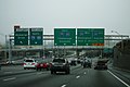
The Downtown Connector carries more than 437,000 vehicles per day at its busiest point — just south of 10th Street in Midtown, while the least traveled portion carries 243,000 vehicles per day — just south of Fulton Street, near the interchange with Interstate 20.[3] The area around the connector and associated interchanges are considered one of the ten-most congested stretches of interstate in the U.S.[4] Due to this fact, many motorists often compare Atlanta to Los Angeles, which is also known for its notoriously-congested freeway system.
The highway is fully instrumented with Intelligent transportation system (ITS) devices. There are more than 25 closed-circuit television cameras between the Langford Parkway interchange (south end) and the Brookwood Interchange (north end). Additionally, the Downtown Connector has three large overhead electronic message signs, and four smaller HOV-dedicated message signs on the median barrier wall. Traffic flow data is gathered through a video detection system, using pole-mounted black-and-white cameras spaced every 1⁄3 mile (0.54 km) on both sides of the roadway. All video and data is fed into the GDOT's Transportation Management Center (TMC), via fiber-optic cable located under the shoulders of the roadway. Virtually all entrance ramps are metered, with the exception of the freeway-to-freeway connection ramps from I-20. As with every other freeway inside the Perimeter, the Downtown Connector is lined with streetlights mounted in the center median, with high-mast lighting at major interchanges.
Atlanta's skyline, both Downtown and Midtown, can be seen from the highway, especially at the northern and southern ends.
History
[edit]Planning and initial construction
[edit]On December 14, 1944, the Georgia State Highway Department, the predecessor agency to the Georgia Department of Transportation (GDOT), collaborated with the city of Atlanta, Fulton County, and the Bureau of Public Roads (BPR), the predecessor to the Federal Highway Administration (FHWA) to work on a plan to improve traffic and connectivity within the Atlanta area. Chicago-based H.W. Lochner & Company, a transportation engineering firm which had been formed earlier that year, was hired to provide a comprehensive transportation plan for the region, using data conducted by the BPR and the state highway department from 1936 to 1945, and future growth projections. The report, which was released on January 10, 1946, recommended a total of six radiating expressways be constructed in the city, with the intent of being integrated into what later became the Interstate Highway System, which at the time was expected to eventually be authorized by Congress. The report recommended that four of these expressways converge into a single north-south route through downtown, which was referred to at the time as both the "Downtown Connector" and the "Downtown Connector Expressway".[5]
Work of the first section of the Downtown Connector, located between Williams Street and the Brookwood Interchange, as well as the approximately 1⁄3 mi (0.54 km) stretch of what is now I-85 north to Peachtree Street, began in September 1948, and was dedicated and opened to traffic on September 25, 1951.[6] The 0.6 mi (0.97 km) stretch from Piedmont Avenue to Williams Street opened on May 5, 1959.[7] Work on a southern stretch of the Connector, a 1.4-mile (2.3 km) section between University Avenue and Richardson Street, began in March 1955, and was dedicated and opened on July 25, 1957.[8] Construction on the final stretch, the 2.3-mile (3.7 km) stretch between Richardson Street and Piedmont Avenue, including the interchange with I-20, began on February 26, 1962,[9] and was opened to traffic on September 18, 1964.[10][11] A ribbon-cutting ceremony for the Downtown Connector, attended by Governor Carl Sanders, FHWA administrator Rex Marion Whitton, and Atlanta mayor Ivan Allen Jr. was held inside the Georgia State Capitol on October 15, 1964.[12]
Initial construction of the highway displaced parts of Techwood Drive and Williams Street in Midtown Atlanta. It also destroyed street grids east and south of downtown, dividing Sweet Auburn in two and the interchange with I-20 leveling the northern part of the Washington-Rawson district. The proposed I-485 was originally planned by the Georgia Department of Transportation to carry some south–north traffic through the eastern side of the city, but most of this was canceled in the 1970s by the then-governor of Georgia, Jimmy Carter. Parts of that road are now I-675 and SR 400.[13]
Reconstruction
[edit]The highway was heavily reconstructed during the 1980s as part of GDOT's Freeing the Freeways program to widen Atlanta-area freeways, with most of the Connector's width being doubled from three to six or seven lanes in each direction.[14] The project included work to increase lanes from six to eight on I-20, I-75, I-85, and I-285 ("The Perimeter"), as well as ten lanes on the downtown connector, involving 126 total miles and was phased over 13 years between 1976 and 1988. The improvement campaign also included elimination of sharp curves and grades, left-hand exits, excessive interchanges, and short acceleration/deceleration lanes.
So as to offer a bypass around construction through the center of the city, the perimeter road (I-285) was completed first. The radiating expressways were then upgraded, and the last phase was reconstruction of the depressed sections through downtown Atlanta. By June 1983, some $252 million in discretionary funds had been used to complete most of the highways save for some major interchanges and the downtown section. The eight miles of the downtown section, which includes the 4.4-mile long downtown connector, was the most complicated section of the entire reconstruction. Work was started on it in 1984, and it included redesigning the massive interchange between I-20 and I-75/85 at Memorial Drive where much of the mileage was on structure. The downtown connector was to be widened to ten lanes, and this required quite a bit of right of way acquisition. Many bridges, including the 55 over the connector portion alone, had to be designed and built.[15] In addition to the general-purpose lanes, provisions for high-occupancy vehicle (HOV) lanes and dedicated on-ramps at Williams Street, Piedmont Avenue, and Memorial Drive were built, and were subsequently converted to HOV usage in 1996.
Later history
[edit]Between 2000 and 2004, the six-lane wide 17th Street Bridge was constructed over the Brookwood Interchange, connecting Midtown Atlanta with the then-new Atlantic Station development. In 2008, reconstruction of the 14th Street Bridge took place in order to accommodate increased traffic flow and pedestrian amenities. This work also included the construction of two new off-ramps: a southbound ramp to 10th Street, and a northbound ramp to 17th Street. This work was completed on May 28, 2010.
In early January 2010, a section of the highway between 14th and 17th streets developed an unusual problem dubbed "phantom ice" during a prolonged cold wave that kept temperatures below freezing for several days in the Atlanta region. GDOT engineers believe that heavy rain in previous months raised the water table and caused it to seep upward through joints between lanes, where it subsequently froze. Commuter traffic was stopped briefly on at least two days in order to treat it with deicing materials and inspect the freeway to determine the cause.[16]
In January 2016, GDOT started a study of the Downtown Connector. Citing high levels of congestion that occur outside of peak periods, the purpose of the study is to gather data and explore options for reducing congestion.[17] Data collection took place all year in 2016, and the data is being analyzed and options evaluated throughout 2017 and 2018. The study is expected to be completed in 2019.[18] The study has already released their data on their website, including nine "Hot Spots", or dangerous and congested points that could most benefit from design improvements,[19] and a detailed analysis of traffic in the whole metro area and how it relates to traffic on the Downtown Connector.[20]
The Stitch
[edit]
The Stitch is a proposed engineering project that would see portions of the Downtown Connector capped and covered with public greenspaces. In August 2016, Central Atlanta Progress (CAP) announced plans to cover the Downtown Connector, converting it to a subterranean roadway and building a series of greenspaces on top of the road to cover an area of approximately 14 acres (5.7 ha), similar to Klyde Warren Park in Dallas. The proposal was first put forward by CAP as a way to reclaim land area taken by the Downtown Connector.[21]
Similar discussions had been held at CAP as early as 2003 and have included similar proposals for the area near the Georgia State Capitol.[22]
This project was drafted by Jacobs Engineering Group and is called "The Stitch", as one of the intents of the project would be to "stitch" together roads that had been divided with the creation of the Downtown Connector.[23] The study, prepared for CAP by Jacobs Engineering Group at a cost of $100,000, called for a 14-acre (5.7 ha) stretch of reclaimed land covering a 0.75-mile-long (1.21 km) stretch of the Downtown Connector from Spring Street to Piedmont Avenue in downtown.[22][24] The study, which compared the project to the Klyde Warren Park in Dallas, said the project would cost approximately $300 million and stimulate approximately $1.1 billion in land development and increased property value.[25] Unlike Klyde Warren Park, The Stitch would involve the creation of multiple parks.[21] The reclaimed land would also allow for the reconnection of Atlanta's street grid, which was interrupted by the construction of the Connector.[26]
Between 2017 and 2018, CAP conducted a year-long viability study on the project that involved Jacobs and John Portman and Associates.[24][27] In March 2019, the Urban Land Institute (ULI) published a feasibility study on the project, while that same month the estimated cost for the project was stated at $452 million.[28][29] Advisors from the ULI estimated that the project could take four years of planning and pre-development and six years of construction.[29]
As of 2019, the project was still in the pre-construction phase, with an estimated timeline and budget of ten years and $452 million, respectively.[30]
In 2021, the Midtown Connector Project (MCP) Foundation released a proposal to build a park over 10 blocks of the Midtown portion of the Downtown Connector from North Avenue to 10th Street.[31][32] The proposal connects that area of the city to the main campus of the Georgia Institute of Technology, which is located on the other side of the Interstate.[33][34][35]
Gallery
[edit]-
 Southern end of the Downtown Connector where I-75 and I-85 diverge
 -
 North end of the Downtown Connector where I-75 and I-85 converge in Midtown
 -
 Downtown Connector view of the downtown skyline
 -
 Downtown Connector facing south from Fifth Street bridge; nighttime view
 -
 Aerial view of the Downtown Connector facing north from downtown
 -
 Aerial view of the Downtown Connector facing south from downtown
 -
 Atlanta Downtown Connector at night
 -
 Downtown Connector at Williams Street looking south
 -
 Downtown Connector at Williams Street looking south during the 2005 ice storm
 -
 Downtown Connector looking north at University Avenue
 -
 Downtown Connector at its interchange with Interstate 20


.jpg)
Exit list
[edit]Exit numbers follow the mileposts along I-75. The entire route is in Atlanta, Fulton County.
| mi | km | Old exit | New exit | Destinations | Notes | ||
|---|---|---|---|---|---|---|---|
| 0.0 | 0.0 | 87 | 242 | Southern end of I-75/I-85 concurrency; southbound exit and northbound entrance; freeway continues with HOV lanes to and from I-75 to the south (no HOV ramps to or from I-85 to the south). | |||
| 0.6 | 0.97 | 88 | 243 | ||||
| 1.7 | 2.7 | 89 | 244 | University Avenue / Pryor Street | |||
| 2.5 | 4.0 | 90 | 245 | Abernathy Boulevard / Capitol Avenue – Georgia State Stadium (formerly Turner Field) | Northbound exit and southbound entrance | ||
| 2.7 | 4.3 | 91 | 246 | Fulton Street / Central Avenue – Downtown | Southbound has no exit to Central Avenue; entrance is from Pulliam Street. | ||
| 3.2 | 5.1 | 92 | 247 | ||||
| 3.1 | 5.0 | — | — | Memorial Drive | HOV ramps for northbound exit and southbound entrance | ||
| 3.9 | 6.3 | 93 | 248A | Martin Luther King Jr. Drive – State Capitol | Southbound exit and northbound entrance | ||
| 4.4 | 7.1 | 94 | 248B | Edgewood Avenue / Auburn Avenue / J.W. Dobbs Avenue | Northbound exit and southbound entrance | ||
| 4.6 | 7.4 | 96 | 248C | Western terminus of SR 10 and Freedom Parkway | |||
| 5.0 | 8.0 | 95 | 248D | J.W. Dobbs Avenue / Edgewood Avenue | Southbound exit and northbound entrance | ||
| 4.6 | 7.4 | 95A | — | Piedmont Avenue | HOV ramps for northbound exit and southbound entrance | ||
| 5.5 | 8.9 | 97 | 249A | Courtland Street – Georgia State University | Southbound exit only | ||
| 5.7 | 9.2 | 98 | 249B | Pine Street / Peachtree Street – Civic Center | Northbound exit only | ||
| 5.8 | 9.3 | 99 | 249C | Williams Street – Georgia World Congress Center, Philips Arena, Mercedes-Benz Stadium | No northbound exit | ||
| 6.0 | 9.7 | 99 | — | Williams Street | HOV ramps for southbound exit and northbound entrance | ||
| 5.9 | 9.5 | 100 | 249D | Spring Street / West Peachtree Street | Northbound exit and southbound entrance | ||
| 6.2 | 10.0 | 100 | 249D | Southbound exit and northbound entrance | |||
| 6.9 | 11.1 | 101 | 250 | 10th Street / 14th Street – Georgia Tech | Northbound exit and southbound entrance | ||
| 6.7 | 10.8 | 102 | 250 | 16th Street / 14th Street / 10th Street | Southbound exit from and northbound entrance to I-75 only; I-85 has a southbound exit to 17th-14th-10th streets (exit 84) but no northbound entrance. | ||
| 7.0 | 11.3 | — | 251A | 17th Street – Midtown | Northbound exit only | ||
| 7.4 | 11.9 | 103 | 251B | Left exits in both directions; northern end of I-75/I-85 concurrency; main HOV lanes on Downtown Connector continue to and from I-85 to the north; freeway continues as I-75 beyond I-85 north with direct HOV ramps provided to and from I-75 to the north. | |||
1.000 mi = 1.609 km; 1.000 km = 0.621 mi
| |||||||
References
[edit]- ^ a b "Route of Downtown Connector (I-75/85)" (Map). Google Maps. Retrieved July 30, 2016.
- ^ State Highway Department of Georgia (1952). System of State Roads (PDF) (Map). Scale not given. Atlanta: State Highway Department of Georgia. OCLC 5673161. Retrieved July 15, 2016. (Corrected to January 1, 1952.)
- ^ "Downtown Connector Study Fact Sheet" (PDF). Downtown Connector Study. Georgia Department of Transportation. Archived from the original (PDF) on June 25, 2018. Retrieved June 25, 2018.
- ^ "Worst City Choke Points". Forbes. February 6, 2006.
- ^ H.W. Lochner & Company; De Leuw, Cather & Company (January 1946). Highway and Transportation Plan for Atlanta, Georgia (Report). H.W. Lochner & Company. Retrieved September 5, 2022 – via Georgia Tech Library.
- ^ Joiner, Alex (September 26, 1951). "3,000 Persons See Opening Of $6 Million Expressway". The Atlanta Constitution. pp. 1, 7. Retrieved September 5, 2022 – via Newspapers.com.
- ^ "Expressway Link Opens Wednesday". The Atlanta Constitution. May 1, 1959. p. 29. Retrieved September 5, 2022 – via Newspapers.com.
- ^ "Griffin Opens New Leg Of Atlanta's Expressway". The Atlanta Constitution. July 26, 1957. p. 15. Retrieved September 5, 2022 – via Newspapers.com.
- ^ "Double Shift Possible on Road Link". The Atlanta Constitution. February 28, 1962. p. 5. Retrieved September 5, 2022 – via Newspapers.com.
- ^ Gaines, Marion (September 19, 1964). "Cars Breeze Along On New Connector". The Atlanta Constitution. pp. 1, 9. Retrieved September 5, 2022.
- ^ "Connector to Open For Traffic Friday". The Atlanta Constitution. September 16, 1964. pp. 1, 10. Retrieved September 5, 2022 – via Newspapers.com.
- ^ "Connector Ribbon Cut-Inside Capitol". The Atlanta Constitution. October 16, 1964. p. 25. Retrieved September 5, 2022 – via Newspapers.com.
- ^ Lichtenstein Consulting Engineers (March 2007). Historic Context of the Interstate Highway System in Georgia (PDF) (Report). Georgia Department of Transportation. Retrieved August 19, 2022.
- ^ "Clearing Those Clogged Arteries: ATLANTA". Time. September 12, 1988 – via content.time.com.
- ^ "History" (PDF). www.dot.ga.gov.
- ^ [1][permanent dead link]
- ^ "Downtown Connector Study". GDOT. Georgia Department of Transportation. Archived from the original on June 25, 2018. Retrieved June 25, 2018.
- ^ "Downtown Connector Study Fact Sheet" (PDF). GDOT. Georgia Department of Transportation. Archived from the original (PDF) on June 25, 2018. Retrieved June 25, 2018.
- ^ "Downtown Connector Impacts Hot Spot Map" (PDF). GDOT. Georgia Department of Transportation. Retrieved June 25, 2018.
- ^ "EXISTING VOLUME DEVELOPMENT AND ORIGIN-DESTINATION DATA" (PDF). GDOT. Georgia Department of Transportation. Retrieved June 25, 2018.
- ^ a b Henry, Scott (August 16, 2016). "The Stitch: An ambitious proposal to build parks and housing above The Connector". Atlanta Magazine. Retrieved September 2, 2022.
- ^ a b Trubey, J. Scott (August 18, 2016). "'Deck park' proposed over Downtown Connector". The Atlanta Journal-Constitution. Retrieved May 22, 2020.
- ^ Trubey, J. Scott (August 17, 2016). "Could capping the Downtown Connector rejuvenate Downtown Atlanta?". The Atlanta Journal-Constitution. Cox Enterprises. Retrieved May 22, 2020.
- ^ a b Green, Josh (February 27, 2018). "Where downtown Atlanta's highway-capping Stitch would go, in photos". Curbed Atlanta. Archived from the original on February 28, 2018. Retrieved May 22, 2020.
- ^ Trubey, J. Scott (August 17, 2016). "Could capping the Downtown Connector rejuvenate Downtown Atlanta?". The Atlanta Journal-Constitution. Retrieved May 22, 2020.
- ^ Trubey, J. Scott (March 29, 2018). "Studies underway for downtown Atlanta deck park over the Connector". The Atlanta Journal-Constitution. Retrieved May 22, 2020.
- ^ Kahn, Michael (October 31, 2017). "Downtown's massive 'The Stitch' project rolls forward with year-long feasibility study". Curbed Atlanta. Archived from the original on October 31, 2017. Retrieved May 22, 2020.
- ^ Slepin, Cali (March 14, 2019). ""The Stitch," Atlanta, Georgia – Advisory Service Panel". Urban Land Institute. Retrieved May 22, 2020.
- ^ a b Keenan, Sean Richard (March 1, 2019). "Advisory panel says highway-capping 'Stitch' project could cost $452M". Curbed Atlanta. Archived from the original on March 2, 2019. Retrieved May 22, 2020.
- ^ Keenan, Sean Richard (March 1, 2019). "Advisory panel says highway-capping 'Stitch' project could cost $452M". Curbed Atlanta. Vox Media. Archived from the original on March 2, 2019. Retrieved May 22, 2020.
- ^ Kelley, Collin (February 23, 2021). "Midtown Connector would cap 10 blocks of interstate with park, reconnect streets". Reporter Newspapers & Atlanta Intown. Retrieved September 2, 2022.
- ^ "A Better Connector". A Better Connector. Retrieved September 2, 2022.
- ^ Torpy, Bill (February 26, 2021). "Opinion: In stitches over crazy, competing Downtown Connector plans". The Atlanta Journal-Constitution. Retrieved March 2, 2021.
- ^ "A Better Connector". A Better Connector. Retrieved September 2, 2022.
- ^ Kelley, Collin (February 23, 2021). "Midtown Connector would cap 10 blocks of interstate with park, reconnect streets". Reporter Newspapers & Atlanta Intown. Retrieved September 2, 2022.
External links
[edit]- Near real-time traffic image of I-75/85 near Tenth St
- Near real-time traffic image of I-75/85 near North Ave/Georgia Tech
- Near real-time traffic image of I-75/85 near Grady Hosp
- Near real-time traffic image of I-75/85 south of University Ave [dead link]
- Jack Etheridge Photographs, 1961-1962 of the downtown connector from the Atlanta History Center
- Atlanta Downtown, The Stich
- Jacobs Engineering Group Stitch Vision Study
Downtown Connector
View on GrokipediaRoute Description
Alignment and Features
The Downtown Connector follows a north-south alignment through the core of Atlanta's central business district, where Interstates 75 and 85 merge into a single corridor south of downtown and diverge in Midtown. This concurrency spans approximately 7.4 miles, commencing near the Perkerson neighborhood in southwest Atlanta and terminating at the northern split around 10th Street.[4] The route's alignment is predominantly linear with minimal curvature, facilitating high-speed travel amid urban density, though it includes transitional ramps and weaves at major interchanges such as with Interstate 20. Constructed largely in a depressed trench via cut-and-cover methods, the freeway sits below surrounding street levels for much of its length, with retaining walls and overpasses spanning the gap to reconnect severed neighborhoods.[5][6] Key features include a capacity of up to 14 lanes—comprising 12 general-purpose lanes and 2 high-occupancy vehicle (HOV) lanes added in the mid-1990s—which support peak commuter volumes exceeding 300,000 vehicles daily. HOV lanes provide dedicated access via specific ramps, such as at Williams Street, to encourage carpooling and reduce congestion.[5][7] The structure incorporates multi-level stack interchanges and bridges over cross streets, engineered for durability amid heavy freight and passenger traffic but prone to flooding from clogged drainage systems during intense rainfall.[6][8]Major Interchanges and Traffic Flow
The Downtown Connector's major interchanges primarily serve urban access and regional connectivity, with the central I-20 interchange at Exits 243A-B standing out as the most significant due to its role linking east-west traffic across metro Atlanta. This stack interchange, originally constructed as a turbine design in the 1960s and modified during 1980s reconstructions, handles substantial cross-flow from I-20 west to I-75/I-85 north and vice versa, contributing to bottlenecks during peak periods.[5] [9] At the southern terminus near the Georgia State Capitol, the Connector diverges into separate paths for I-75 (continuing west toward I-285) and I-85 (eastbound), with Exit 242 to Capitol Avenue providing primary access to southside neighborhoods and Georgia State University. Further north, urban exits such as 245 to US 29/US 78 (Memorial Drive), 247 to Peachtree Street NE—a vital artery for downtown commerce—and 248D to Courtland Street for MARTA rail connections facilitate high-volume local ingress and egress. The northern end converges I-75 and I-85 at the Grady Curve south of Exit 250, funneling traffic toward midtown and beyond.[9] [10] Traffic flows north-south along the approximately 7.5-mile corridor, integrating long-haul volumes from I-75's northwest-southeast alignment (connecting Chattanooga and Macon) with I-85's northeast-southwest path (linking Greenville and Montgomery), while serving as a primary conduit for suburban commuters to downtown employment centers. For southbound through-traffic on I-75, the direct path via the Downtown Connector is shorter in distance than the I-285 bypass and often smoother due to the bypass's heavy truck volumes, as commercial trucks are prohibited on the Connector.[11] HOV lanes enforce minimum occupancy during peak hours to encourage ridesharing.[12] [7] Despite expansions to 12-14 lanes, the segment experiences severe and increasing congestion, particularly at the I-20 interchange and Grady Curve, where peak-hour delays routinely reduce speeds below free-flow conditions. In 2024, the roadway recorded 3,353 collisions, reflecting intense usage and safety challenges amid volumes that rank it among the nation's busiest urban freeways. Ongoing initiatives like the Stitch project aim to cap sections for multimodal improvements without alleviating underlying throughput constraints.[13] [14] [15]Design and Engineering
Construction Standards and Capacity
The Downtown Connector adheres to Interstate Highway System standards established by the Federal-Aid Highway Act of 1956, which mandated full control of access, grade-separated interchanges, 12-foot minimum lane widths, and concrete or asphalt pavements capable of supporting heavy truck traffic at design speeds typically ranging from 50 to 70 mph in urban areas, though actual posted speeds are lower due to congestion and geometry.[16] In its depressed urban trench configuration, the roadway incorporates retaining walls, drainage systems, and noise barriers added during later reconstructions to address site-specific challenges like soil stability and vibration from adjacent high-rises.[1] The Connector's capacity varies by segment but generally comprises 12 to 14 lanes through the core downtown area, including two reversible high-occupancy vehicle (HOV) lanes separated by concrete barriers, enabling a theoretical peak-hour throughput of up to 24,000 vehicles in each direction under free-flow conditions before breakdown occurs.[3] Actual traffic volumes far exceed design expectations, with an annual average daily traffic (AADT) of 419,516 vehicles recorded on I-75 near Atlanta in 2014, ranking among the nation's highest and contributing to frequent level-of-service F conditions during peaks.[2] Expansions in the 1970s and 1980s doubled lane counts in key sections from initial three-lane configurations to six or more per direction, yet persistent overload—driven by radial commuter patterns—has necessitated ongoing managed lane operations and ramp metering to preserve throughput.[10]Structural Challenges and Maintenance
The Downtown Connector's infrastructure, comprising reinforced concrete bridges and elevated sections originally built from the late 1940s to mid-1960s and reconstructed in the 1980s, endures significant wear from average annual daily traffic (AADT) volumes surpassing 400,000 vehicles, particularly near the 10th Street area in Midtown Atlanta. This heavy load, including substantial truck traffic, contributes to accelerated pavement deterioration, joint failures, and surface cracking, requiring systematic interventions to prevent broader structural fatigue.[2] The Georgia Department of Transportation (GDOT) maintains the corridor through routine bridge inspections, resurfacing, and component repairs, with projects often scheduled during off-peak hours to mitigate disruptions in this urban artery. A notable example is the 2016 Fulton County resurfacing initiative, which involved milling and inlaying approximately 6 miles of northbound and southbound lanes from south of University Avenue to the Brookwood Interchange at a cost of $13.8 million, addressing worn travel lanes and shoulders while incorporating ramp closures from midnight to 5 a.m.[17] Ongoing efforts include 2025 resurfacing work with multi-lane closures on southbound sections from 17th Street to University Avenue, alongside lighting upgrades and tunnel repairs that necessitate weekend and overnight restrictions.[18][19] Structural maintenance is complicated by the highway's design—featuring cantilevered elements and deep cuts through dense downtown terrain—which limits access for heavy equipment and amplifies vibration-induced stress under peak loads. GDOT risk assessments identify potential bridge deterioration as an internal vulnerability, exacerbated by external factors such as flooding or severe weather, though no major collapses have occurred on the connector itself. These factors drive a cycle of reactive and preventive measures, with GDOT prioritizing preservation to extend service life amid budget constraints and the corridor's role in regional mobility.[17]History
Planning and Initial Construction (1940s–1960s)
The planning for what would become the Downtown Connector originated in the 1940s amid Atlanta's rapid postwar growth and increasing vehicular congestion in the central business district. Early proposals sought to link northern and southern suburbs while providing a bypass around the heavily trafficked Five Points area, forming a north-south arterial expressway through the urban core.[3] A pivotal document was the 1946 Highway and Transportation Plan for Atlanta, Georgia, prepared by H.W. Lochner & Co. in association with DeLeuw, Cather & Co. for the Georgia Department of Transportation. This Lochner Plan envisioned a radial expressway system radiating from downtown, including routes that later designated as Interstates 75 and 85, with a concurrent downtown segment to facilitate high-volume traffic flow; it projected needs to 1970 and incorporated multi-modal elements like a downtown bus terminal. Atlanta voters approved a $20 million bond issue that year to fund initial expressway development, predating federal interstate legislation and positioning the city to leverage subsequent national funding.[20] Construction accelerated following the Federal-Aid Highway Act of 1956, which provided 90% federal financing for the Interstate System and incorporated Atlanta's pre-existing plans. The Downtown Connector, comprising the merged I-75 and I-85 alignment, involved elevated viaducts and interchanges through downtown, with segments built to six-lane standards initially. Key portions opened progressively: a stretch from Piedmont Avenue to Williams Street in 1959, followed by full connectivity by 1964, when the connector linked midtown convergence to southern divergence near I-20.[1][20] The project, costing millions in early segments (e.g., $6 million for initial 1952 expressway precursors integrated into the system), cleared land for concrete structures rising above the street grid, marking a shift to freeway dominance in urban mobility.[3]Reconstruction and Expansion (1970s–1980s)
In the late 1970s, the Downtown Connector faced increasing congestion due to Atlanta's rapid postwar growth, prompting the Georgia Department of Transportation (GDOT) to initiate planning for major reconstruction under the enabling provisions of the Federal Aid Highway Act of 1976, which expanded interstate funding eligibility to include urban reconstructions.[21] This set the stage for widening the original six-lane configuration, which had been completed in the mid-1960s, to accommodate surging traffic volumes exceeding design capacities.[1] The core of the expansion occurred in the 1980s through GDOT's "Freeing the Freeways" program, a $1.5 billion initiative launched to reconstruct and widen 122 miles of Atlanta's maturing urban interstates from typically six or fewer lanes to eight to twelve lanes, addressing bottlenecks and safety issues like inadequate merge areas and substandard bridges.[22] For the Downtown Connector specifically, this involved reconstructing the depressed corridor through downtown, adding lanes in both directions, replacing numerous overpasses—including those at key interchanges—and acquiring additional right-of-way, which required demolishing adjacent structures and further altering the urban fabric.[23] Construction phases included visible widening work near the Fifth Street Bridge by 1980 and ongoing elevated and subterranean modifications visible in 1984 aerial perspectives, prioritizing capacity over aesthetic integration.[24] By the mid-1980s, the project had expanded the Connector to twelve through-lanes, with later adjustments reaching fourteen in high-volume segments, though empirical data post-completion indicated persistent peak-hour delays due to induced demand from regional sprawl rather than resolved throughput limitations.[5] These enhancements, while empirically boosting average daily traffic handling from under 100,000 vehicles in the 1970s to over 300,000 by decade's end, amplified the highway's physical barrier effect on adjacent neighborhoods without incorporating multimodal mitigations.[1]Post-Reconstruction Developments and Incidents (1990s–2010s)
Following the major reconstruction efforts of the 1970s and 1980s, the Georgia Department of Transportation (GDOT) completed additional widening of the Downtown Connector in the early 1990s, expanding it to 14 through-lanes overall to address surging traffic demands amid Atlanta's population growth and suburban expansion.[3] This phase built on prior expansions from six lanes, incorporating high-occupancy vehicle (HOV) lanes and auxiliary ramps, though empirical data from subsequent traffic studies indicated persistent bottlenecks due to induced demand and limited parallel arterial capacity. In preparation for the 1996 Centennial Olympic Games, GDOT and regional authorities implemented traffic management enhancements, including a centralized system for real-time monitoring and incident response in downtown Atlanta, which integrated with the Connector's operations to mitigate event-related disruptions such as southbound exit closures.[25] [26] Post-Games evaluations showed these measures temporarily reduced average delay times during peak events but failed to resolve chronic congestion, with average daily traffic exceeding 300,000 vehicles by the early 2000s, prompting ongoing operational tweaks like variable signage and lane striping.[27] Structural maintenance challenges emerged in the 2010s, exemplified by falling concrete debris from an overpass on August 14, 2011, which halted northbound traffic near the I-75/I-85 convergence point, causing multi-mile backups and underscoring aging infrastructure vulnerabilities despite prior retrofits.[28] The March 30, 2017, collapse of an I-85 bridge segment due to an intentional fire—though located just north of the Connector's northern terminus—diverted tens of thousands of vehicles daily onto the Downtown Connector, amplifying peak-hour delays by up to 50% and exposing systemic overload risks in the intertwined interstate network.[29] Shortly after, on April 17, 2017, a tractor-trailer collision on the Connector resulted in a hazardous chemical spill, necessitating full closures and hazmat response, further straining emergency protocols and highlighting high crash rates in this corridor, where GDOT data logged thousands of incidents annually from geometric constraints and volumes exceeding design capacity.[30]The Stitch Project (2010s–Present)
The Stitch Project is a proposed civic infrastructure initiative to cap approximately three-quarters of a mile of the Downtown Connector (I-75/I-85) between Ted Turner Drive and Courtland Street, creating about 17 acres of elevated public park space to reconnect historically divided neighborhoods in north Downtown Atlanta.[31] The project addresses the urban fragmentation caused by the highway's construction in the 1950s and 1960s, which displaced communities including Buttermilk Bottom, a predominantly Black neighborhood targeted for the route due to its existing infrastructure vulnerabilities.[32] Feasibility studies began around 2015, evolving from earlier discussions on highway lids as part of broader urban revitalization efforts in Atlanta.[31] Implementation is divided into phases, with Phase 1 focusing on constructing a 450-foot bridge structure over the Connector to link the east and west sides of north Downtown, incorporating programmed green space, plazas, and pathways for pedestrian and cyclist connectivity.[15] Subsequent phases would expand the cap with features like performance venues, community gardens, and integrated development to spur housing and commercial growth.[33] The project is led by the City of Atlanta in partnership with the Georgia Department of Transportation and Atlanta Downtown Improvement District, aiming to enhance access to jobs, affordable housing, and transit while mitigating the Connector's role as a barrier to urban cohesion.[31] As of October 2025, the Atlanta City Council has approved initial funding and design advancements, with construction targeted to begin on Phase 1 despite setbacks.[34][35] Estimated total costs stand at $713 million, subject to refinement through ongoing engineering, with funding sourced from federal grants, state allocations, and local bonds; notable recent inflows include $50 million in 2025 despite a $151 million federal rescission earlier that year.[36][37] Proponents project economic returns including $9 billion in overall benefits, up to $61 million in annual property tax revenue from catalyzed developments totaling 18 million square feet, alongside 4,500 jobs and capacity for 25,000 housing units—figures derived from urban planning models emphasizing adjacency to existing transit and employment hubs.[38] These projections assume effective integration with surrounding revitalization, such as in the Gulch and Old Fourth Ward areas, though realization depends on private investment and sustained public funding amid fiscal uncertainties.[39] Completion timelines extend into the late 2020s or early 2030s, contingent on environmental reviews and procurement.[40]Transportation and Economic Impacts
Benefits to Mobility and Commerce
The Downtown Connector, as the concurrent alignment of Interstates 75 and 85 through central Atlanta, serves as a critical high-capacity corridor that links northern and southern Georgia while providing direct access to the city's downtown core. This infrastructure enables the movement of hundreds of thousands of vehicles daily, with average daily traffic volumes recorded at approximately 326,000 trips near key segments, predominantly supporting commutes to employment hubs and regional travel.[41] By elevating traffic above surface streets, it minimizes interference with local circulation, allowing for faster through-put compared to pre-interstate reliance on arterial roads, thereby enhancing overall urban mobility for both passengers and freight. In terms of commerce, the Connector integrates Atlanta into the national interstate network, facilitating efficient goods transport to and from the metropolitan area's logistics facilities, including Hartsfield-Jackson Atlanta International Airport—the world's busiest by passenger volume—and extensive warehousing districts.[16] It handles significant freight loads, with northbound segments registering over 77,000 average daily vehicles including thousands of trucks, underscoring its role in sustaining supply chains for Georgia's export-oriented industries and distribution centers.[42] This connectivity has historically bolstered Atlanta's emergence as a southeastern economic node, where interstates like I-75 and I-85 enable rapid market access, reducing logistics costs and supporting business expansion in manufacturing, retail, and services.[43]Congestion Patterns and Mitigation Efforts
The Downtown Connector experiences severe congestion primarily due to its high traffic volumes and complex merging geometry, where I-75 and I-85 combine into a single corridor through downtown Atlanta. Annual average daily traffic (AADT) exceeds 419,000 vehicles on segments of I-75 near the connector, with peaks approaching 437,000 vehicles per day just south of 10th Street in Midtown, making it one of the most heavily traveled urban highways in the United States.[2][44] Congestion intensifies during morning and evening rush hours, exacerbated by a 60% local ingress-egress rate along the route and frequent bottlenecks at the I-20 interchange to the south and the I-75/I-85 split to the north, where truck volumes contribute significantly to delays—ranking the I-75/I-85 interchange among the top national freight bottlenecks with over 43,000 daily vehicles in peak periods.[45] Empirical analyses indicate worsening trends at this urban corridor, driven by population growth and insufficient capacity relative to demand, resulting in annual congestion costs for the broader Atlanta region exceeding $3 billion.[13][46] Mitigation efforts have centered on capacity enhancements, operational improvements, and demand management since the corridor's major reconstructions. In the 1980s and 1990s, the Georgia Department of Transportation (GDOT) expanded the connector from six through-lanes to 14 (12 general-purpose plus two reversible high-occupancy vehicle [HOV] lanes in the median), aiming to accommodate surging volumes but yielding only temporary relief as demand outpaced additions.[47] Current strategies include extensive ramp metering on nearly all entrance ramps to regulate inflows and prevent gridlock, coupled with HOV bypasses and dedicated entrance/exit ramps (e.g., at Williams Street) to incentivize carpooling and reduce single-occupancy vehicle usage.[48][7] GDOT has also implemented operational tweaks, such as enhanced pavement markings and lane restriping for better flow, alongside incident management via full instrumentation for real-time monitoring.[49] Longer-term proposals emphasize managed lanes and pricing mechanisms over further widening, given induced demand effects from past expansions. Advocates for variably priced toll lanes argue they could dynamically allocate capacity, funding maintenance while smoothing peaks, as modeled in regional studies showing potential for reduced delays without new construction.[50] GDOT has explored comprehensive studies, including tunnel options under downtown to straighten alignments like the Grady Curve, though implementation remains stalled amid debates over costs and efficacy; such causal interventions target geometric flaws contributing to 40% through-traffic inefficiencies rather than blanket capacity increases.[51] Despite these, congestion persists, underscoring limits of supply-side fixes in high-demand corridors without concurrent land-use or transit integration.[3]Social and Urban Impacts
Neighborhood Division and Displacement
The construction of the Downtown Connector in the 1950s and 1960s physically bisected several central Atlanta neighborhoods, severing pedestrian and community connections while facilitating vehicular access to downtown. Interstate 75 and 85 were routed through areas with lower land values and limited political influence, resulting in the demolition of residential blocks and commercial strips that fragmented social networks and local economies. This division exacerbated existing racial segregation patterns, as the highways created barriers that hindered cross-neighborhood interactions and access to jobs and services.[52][5] Predominantly Black neighborhoods bore the brunt of the impacts, with an estimated 24,000 residents displaced across Atlanta due to the Connector's development alongside contemporaneous urban renewal projects between 1955 and 1965. Specific communities like Sweet Auburn, a historic Black business district, were split by the elevated roadways, isolating institutions such as Big Bethel AME Church and reducing foot traffic to Auburn Avenue's commercial core. In Buttermilk Bottom (also known as Black Bottom), a dense working-class enclave, highway alignments combined with clearance for the Atlanta Civic Center razed over 50 blocks of housing by 1967, displacing thousands of African American families with minimal relocation support or compensation.[53][54][55] Further south, Mechanicsville and Summerhill experienced similar fragmentation, where the Connector's southern approaches cut off direct paths to downtown amenities, contributing to economic decline and population loss in these areas. Approximately 89% of the 14,000 individuals displaced citywide by freeway construction and related renewals were people of color, reflecting patterns where eminent domain proceedings favored infrastructure over community continuity. These displacements often involved substandard housing stock in undervalued zones, with affected residents relocated to public housing or suburbs, perpetuating cycles of poverty rather than enabling equitable urban integration.[56][57][58] Long-term effects included persistent barriers to mobility for non-drivers, as the multi-lane elevated structure discouraged safe crossings and fostered auto-dependency, widening socioeconomic divides. Neighborhoods east of the Connector, such as those in Old Fourth Ward, reported heightened isolation from western commercial hubs, with studies attributing increased commute times and reduced property values to the infrastructure's layout. Efforts to mitigate these divisions, including later proposals for caps or burials, acknowledge the original project's role in entrenching spatial inequities without adequate forethought for pedestrian reconnection.[59][60]Urban Development and Connectivity Effects
The Downtown Connector, completed in phases during the early 1960s, integrated Interstates 75 and 85 into a concurrent urban corridor spanning approximately 3.7 miles through central Atlanta, creating a high-capacity artery that streamlined north-south freight and commuter flows between northern Georgia suburbs, the city's core, and southern destinations including Hartsfield-Jackson Atlanta International Airport. This merger optimized limited urban right-of-way by sharing infrastructure for two major routes, reducing construction footprint while accommodating peak daily traffic volumes exceeding 300,000 vehicles as of the late 20th century.[5] By providing direct elevated access bypassing surface streets, the Connector initially cut travel times for intercity hauls and suburban workers, lowering logistics costs and supporting Atlanta's emergence as a regional logistics and distribution hub during the postwar economic expansion.[16] Enhanced connectivity facilitated the clustering of commercial and office development in adjacent districts, such as Peachtree Center and the Central Business District, where proximity to highway on-ramps enabled rapid influxes of employees and customers from expanding suburbs.[61] The system's role as one of only five U.S. cities intersected by four radial interstates (I-20, I-75, I-85, and I-285) amplified Atlanta's centrality in the national network, drawing corporate relocations and spurring high-rise construction; downtown office inventory grew from under 10 million square feet in 1960 to over 30 million by 1980, correlating with highway-enabled accessibility.[61] Empirical data from the era link interstate investments to accelerated metropolitan expansion, with Atlanta's urbanized area doubling in size between 1960 and 1980, as improved mobility reduced barriers to peripheral residential and industrial siting.[16] Over decades, the Connector's capacity underpinned sustained economic output, with downtown generating approximately $580 million in annual tax revenue by the 2020s, attributable in part to its function as a gateway for tourism, conventions, and professional services reliant on reliable vehicular throughput.[62] However, induced demand eventually elevated congestion, with average speeds dropping below 40 mph during peaks by the 1990s, prompting auxiliary investments like HOV lanes in 1994 to preserve connectivity benefits amid population growth from 1 million in the metro area in 1960 to over 6 million today.[5][61] These dynamics illustrate causal links between infrastructure-enabled access and agglomeration economies, though maintenance of original gains required ongoing adaptations to volume surges driven by regional industrialization.[16]Controversies and Debates
Racial and Equity Criticisms of Original Construction
The construction of the Downtown Connector, comprising the concurrent segments of Interstate 75 and Interstate 85 through central Atlanta, began in the late 1950s and continued through the early 1960s, with segments opening progressively between 1959 and 1964.[3] This routing deliberately traversed predominantly African American neighborhoods, including the historic Sweet Auburn district—known as the "richest Negro street in the world" for its concentration of Black-owned businesses, churches, and residences—because land acquisition was cheaper there and political resistance from white communities was minimal.[60][63] The elevated highway structure physically bisected Auburn Avenue, severing connections within the Black business corridor and isolating residents from downtown resources, a pattern replicated in other urban interstate projects nationwide during the Federal-Aid Highway Act of 1956 era.[64][52] Critics, including urban historians, have argued that the Connector's path exemplified systemic racial bias in infrastructure planning, as state and federal engineers prioritized routes through Black areas to minimize costs and disruption to white suburbs, displacing an estimated thousands of African American families, over 1,000 homes, and numerous businesses and institutions in neighborhoods like Sweet Auburn and adjacent areas.[65][66] This displacement contributed to economic decline in affected communities, with Sweet Auburn's vitality waning post-construction as traffic barriers reduced foot traffic and accessibility, exacerbating wealth gaps already shaped by Jim Crow-era segregation.[67] While some planning documents cited urban renewal goals like slum clearance, empirical outcomes showed disproportionate harm to Black residents, who comprised the majority in razed zones but received inadequate relocation support or compensation compared to standards in whiter areas.[68][57] Equity-focused analyses highlight how the Connector perpetuated racial divides by design, with the highway's barriers limiting Black access to jobs and services downtown while channeling suburban white commuters through the city core, a dynamic rooted in cheaper land values in segregated Black districts rather than neutral engineering criteria.[3] Post-construction studies, such as those by Georgia Tech historian Ronald Bayor, document how such decisions reinforced Atlanta's racial geography, with Black neighborhoods bearing the brunt of eminent domain without equivalent infrastructure benefits.[64] Modern critiques, informed by declassified planning records, contend this was not incidental but aligned with broader mid-century practices where highways served as tools for containing Black populations amid white flight, though some defenders attribute routings to pre-existing density and federal funding pressures rather than overt animus.[69][52] These debates underscore ongoing equity concerns, as the Connector's legacy includes persistent socioeconomic disparities in severed communities, with Black median incomes in adjacent areas lagging behind city averages by over 30% as of recent census data.[56]Debates Over The Stitch: Costs, Efficacy, and Alternatives
The Stitch project has faced scrutiny over its escalating costs, with initial 2019 estimates of approximately $450 million ballooning to a current total of $713 million as of 2025, driven by refined engineering and phased implementation across 14 acres.[70][36] Proponents, including the Central Atlanta Progress (CAP), argue that funding from local sources such as a Stitch Special Assessment District—imposing about $200 in annual property tax increases per $100,000 of assessed value—along with city bonds and private contributions, justifies the investment for long-term urban revitalization.[37] Critics, however, highlight vulnerabilities exposed by the U.S. Department of Transportation's withdrawal of $151 million in federal Reconnecting Communities grants in August 2025, questioning the fiscal sustainability amid reliance on property owners and potential overruns, as similar highway-cap projects elsewhere have exceeded budgets by 20-50% due to unforeseen structural demands.[37][33] Efficacy debates center on whether the cap will meaningfully mitigate the Downtown Connector's divisive legacy without addressing core congestion drivers. Advocates cite projected benefits like enhanced walkability, noise reduction, flood resilience, and a property value premium from proximate green space, drawing on urban studies showing parks can boost nearby real estate by 5-15%.[38][71] Yet, skeptics contend the project preserves the underlying eight-lane highway, unlikely to alleviate chronic traffic bottlenecks—where daily volumes exceed 300,000 vehicles—since it neither expands capacity nor integrates robust alternatives to car dependency, potentially leading to prolonged construction disruptions like lane closures without proportional mobility gains.[72] Empirical parallels, such as Boston's Big Dig, reveal that lids over entrenched infrastructure often fail to deliver promised socioeconomic reconnection if not paired with transit expansions, raising doubts about The Stitch's isolated impact on equity in historically severed Black neighborhoods.[5] Alternatives proposed include partial highway removal or depression rather than capping, which could reclaim more surface land at lower cost—potentially under $500 million for targeted sections—while directly eliminating the barrier, as demonstrated in cities like San Francisco's Octavia Boulevard redesign that improved connectivity and reduced vehicle miles traveled by 20%.[5] Smaller-scale interventions, such as expanded complete streets, bus rapid transit along parallel corridors, or decentralized parks without structural lids, have been suggested to foster urban cohesion more affordably, avoiding the engineering complexities of supporting 200,000 daily interstate loads.[71] Local discussions, including paused Midtown Connector cap plans, underscore preferences for phased, lower-risk enhancements over mega-projects, prioritizing empirical traffic data and resident input on gentrification risks from induced development.[53] Residents have voiced concerns that such alternatives could better balance reconnection with fiscal prudence, potentially averting property tax hikes that exacerbate living costs in adjacent areas.[73]Exits and Interchanges
Northbound Exits
Northbound travelers on the Downtown Connector, the concurrent segment of I-75 and I-85 through central Atlanta, access downtown destinations via a series of closely spaced exits beginning south of the I-20 interchange.[4]| Exit | Destinations |
|---|---|
| 244 | University Avenue (SR 54), serving South Atlanta residential and commercial areas.[4] |
| 245 | Ormond Street to Capitol Avenue and Abernathy Boulevard, connecting to the Georgia State Capitol, Grant Park, and the former Turner Field site redeveloped as Georgia State University facilities.[4][74] |
| 246 | Fulton Street and Central Avenue, providing entry to Georgia State University campus and surrounding urban districts.[75] |
Southbound Exits
Exit 250 serves 10th Street, 14th Street, and 16th Street, offering primary access to Georgia Institute of Technology and Midtown Atlanta's commercial district. This exit connects to local streets via a partial cloverleaf interchange, facilitating entry to residential areas west of the highway and eastward toward Atlantic Station development. The complex at Exit 249 provides multiple ramps: 249D to Williams Street southbound, linking to North Avenue and Georgia Tech's campus core; 249C to Peachtree Street for the Civic Center and MARTA station; 249B to Pine Street north for additional Midtown access; and 249A to Courtland Street south, serving Georgia State University Stadium vicinity.[76] These subexits, part of a tight urban interchange, accommodate high-volume traffic to downtown institutions and events, with Williams Street ramp handling significant Georgia Tech-bound flow. Further south, Exit 248 features subramps: 248D to Capitol Avenue for eastside neighborhoods; 248C to Andrew Young International Boulevard and Freedom Parkway (SR 10), with the latter directing toward the I-85 divergence; 248B to Edgewood Avenue and Auburn Avenue, accessing historic districts including Martin Luther King Jr. National Historical Park; and 248A to Martin Luther King Jr. Drive south toward the State Capitol and former Turner Field site.[77] This final set precedes the highway's split, where southbound lanes separate into I-75 west to I-20 and I-85 southeast, with Exit 248C partially exclusive to I-85 continuity.| Exit | Destinations |
|---|---|
| 250 | 10th St; 14th St; 16th St |
| 249D | Williams St (to North Ave, Georgia Tech) |
| 249C | Peachtree St (Civic Center) |
| 249B | Pine St |
| 249A | Courtland St |
| 248D | Capitol Ave |
| 248C | Andrew Young Intl. Blvd; Freedom Pkwy (SR 10) |
| 248B | Edgewood Ave; Auburn Ave |
| 248A | MLK Jr. Dr (to State Capitol) |
References
- https://commons.wikimedia.org/wiki/File:I-75-I-85_NB_at_Fulton_Street-Central_Avenue.jpeg