

Community hub
Recent from talks
Contribute something
Nothing was collected or created yet.
Mudgee
View on Wikipedia
Mudgee (/mʌdʒi/) is a town in the Central West of New South Wales, Australia. It is in the broad fertile Cudgegong River valley 261 km (162 mi) north-west of Sydney and is the largest town in the Mid-Western Regional Council local government area as well as being the council seat. At the 2021 Census, its population was 11,457.[1] The district lies across the edge of the geological structure known as the Sydney Basin.[2]
Key Information


History
[edit]Wiradjuri people
[edit]The Mudgee and Dabee clans of the Wiradjuri people lived at and around the site of what is now the town of Mudgee on the Cudgegong River. Some cultural and tool-making sites of these Aboriginal people remain, including the Hands on the Rocks, The Drip and Babyfoot Cave sites.[3][4]
Significance of local names
[edit]Many place-names in the region are derived from the original Wiradjuri language, including Mudgee itself, which was named by the Wiradjuri clan who lived there. There are various translations as to what Mudgee means including "resting place", "contented", "nest in the hills" as well as "friend or mate" which the latter coincides with the Wiradjuri word "mudyi".[5][6][7] The correct pronunciation has also been recorded as either Moudgee, Moothi or Mougee.[8][9][10] Nearby places include Lue (Loowee, 'a chain of waterholes'); Gulgong ('a gully'); Wollar ('a rock water hole'); Menah ('flat country'); Eurunderee ('a local tree'); Guntawang ('a peaceful place'), Cooyal ('dry country'); Wilbertree ('a long switch'); Gooree ('native chasing live animal'); Burrendong ('darker than usual'). The Aboriginal name of the Rylstone area was Combamolang.
Early British colonisation (1821 to 1850)
[edit].jpg)
James Blackman, leading a small expedition in the latter half of 1821, was the first British colonist to enter the Mudgee district.[11] Not long after, Lieutenant William Lawson who was then commandant of Bathurst, made several further expeditions to Mudgee. Both Blackman and Lawson found the site to be an Aboriginal settlement or bimmel inhabited by around 100 people who called the area Mudgee or Mujjee.[3][12]
In February 1822, George and Henry Cox, sons of William Cox, followed the trails set up by Blackman and Lawson with 500 head of livestock, and established a grazing property at Menah, 3 km (1.9 mi) north of the current town. The Coxes were soon in conflict with the Mudgee clan who drove away their workers and livestock. George Cox gathered some men at Bathurst and returned to Menah where a two hour fight later ensued, resulting in six Mudgee people being killed and one of Cox's employees being speared to death.[3]
The violence in the region worsened in June 1824, when Theophilus Chamberlain, who was the Coxes' superintendent of their Mudgee property holdings, led a number of punitive expeditions against the local Aboriginal people. A skirmish at Guntawang to the north of Mudgee resulted in some settlers being killed, with around 70 or more Aboriginal people dying in follow up raids. Martial law was declared by Governor Thomas Brisbane in August 1824, leading to further killings of the Wiradjuri people in the Mudgee area. Descendants and workers of the Coxes later described this period as one where "an immense number of natives, men, women and children were slaughtered" and "the bodies of the blacks were piled together and burnt...like old tar barrels". The violence forced the Coxes to abandon Guntawang, and relieving Chamberlain of his duties, they shifted their enterprise to nearby Dabee.[13][14][15][3]
The Cox family remained prominent landholders around Mudgee for many decades, owning the Dabee, Menah and Burrundulla properties. William Lawson and his descendants also continued to be leading pastoralists in the region, holding estates such as Putta Bucca and Havilah.[16]
The site of the Mudgee township was surveyed in 1837 and the first land sales occurred in August 1838. It has been incorrectly claimed that Robert Hoddle designed the village. Although Hoddle was the first surveyor in the region, marking out the boundaries of Putta Bucca and Bombira, by the time the village was gazetted, he had already left the district to become leader of the Port Phillip Survey.[17] John Blackman built a slab hut, the first dwelling in Mudgee and its general store.[18]
By 1841 there were 36 dwellings, three hotels, a hospital, a post office, two stores and an Anglican church. St John's Church of England was consecrated on 6 May 1841.[19] The police station moved from Menah in the mid-1840s and an Anglican school was established in that decade.
1850 to present
[edit]


In 1851 the population of Mudgee was 200. This skyrocketed with the discovery of gold by Edward Hargraves in nearby Hargraves, leading to a gold rush. While no gold was found in Mudgee itself, the town is central to the goldfields of Gulgong, Hill End and Windeyer, and grew rapidly as a result.
Mudgee was declared as a municipality in 1860 making it the second oldest municipality west of the Great Dividing Range with a population of 1500 in 1861. A public school was built in the 1850s together with the present Anglican, Catholic Methodist and Presbyterian churches. A new police station, courthouse, Mechanics' Institute and a town hall were built in the 1860s. There were four coach factories operating in Mudgee to cater for the demand of the nearby goldfields. The National Trust of Australia has a number of these buildings registered including the Mudgee Museum (formerly the Colonial Inn),[20] the Catholic presbytery, the court house, the police station and the Anglican Church. On 1 June 1861 the Electric Telegraph system arrived and was opened for messages to be transmitted and received at the Telegraph office.[21]
One gold miner attracted to the Mudgee district was Niels Peter Larsen, who married Louisa Albury in Mudgee in 1866. They were the parents of leading Australian poet Henry Lawson, born in Grenfell in 1867, and changed their names to Peter and Louisa Lawson. By the birth of their third child, they moved to a selection at Pipeclay (now Eurunderee) 8 km (5 mi) north of Mudgee. The site is now a rest stop with a plaque.
Louisa Lawson's vigorous lobbying led to the establishment of the slab-and-bark Eurunderee Public School in 1876 with Henry Lawson first attending aged nine. He would later write about the school in his poem, The Old Bark School. Lawson later attended St. Matthews Central School, Mudgee before progressively worsening deafness led to him leaving school at 14. He lived in the region until age 15 and many of his stories were written about the district.
Tiny diamonds were sometimes found and discarded by gold panners when "washing off", but sometime before June 1869 a larger specimen was found on the banks of the Cudgegong River about 40 km (25 mi) from Mudgee and appraised by the jeweller George Crisp, of Queen Street, Melbourne, at 22.2 carat.[22] Dubbed the "Mudgee diamond", it was the largest found to that date in Australia,[23] however commercial quantities were not found[24] and companies founded to exploit the discoveries were wound up a few years later.[25]
As the gold petered out in the latter half of the 19th century, Mudgee was sustained by both its wool industry and a nascent wine industry founded by a German immigrant, Adam Roth, in the 1850s. The opening of the railway extension from Rylstone to Mudgee occurred on 10 September 1884.[26][27]
The railway boosted the town's agriculture. The extension between Rylstone and Mudgee closed on 2 March 1992.[27] This same section re-opened eight years later, on 2 September 2000[27] and closed again in 2007. The Wallaby Track Drive Tour visits various sites associated with Lawson including the old Eurundee Public School, the Henry Lawson memorial, the Budgee Budgee Inn, Sapling Gully, Golden Gully and the Albury Pub which was owned by Lawson's grandfather.
In 1890 a local newspaper was founded with the title the Mudgee Guardian and North-Western Representative.[28] Its title changed in 1963 to the Mudgee Guardian and Gulgong Advertiser and is currently published twice a week.
Mudgee's Glen Willow Regional Sports Stadium hosted the 2012 City vs Country Origin rugby league match with an attendance of 8,621, and the 2017 match with an attendance of 8,322.[29] The St. George Dragons regularly host home matches there.[30]
Additionally, in the A-League, the Western Sydney based Western Sydney Wanderers have chosen to take their Community Round match to Mudgee's Glen Willow Regional Sports Stadium, as part of their new Regional Strategy,[31]
In 2014, the local council found itself involved in a statewide corruption investigation when officers of the Independent Commission Against Corruption (New South Wales) raided the local council's offices.[32][33]
Economy
[edit]Mudgee has developed as a wine producing region, it has manufacturing and repair industries. It is also heavily dependent on several major mines in the surrounding area[34] and fly-in fly-out (FIFO) miners who live in the town but work elsewhere.
Other rural produce includes cattle, sheep, wheat, alfalfa, olives, fruit, tomatoes, sweetcorn, honey, alpacas and dairy products. These, however, do not play as large a role as mining.
The Ulan coal mines are in the district and it also produces marble, pottery clays, shale and dolomite. These mines have further potential to expand in the region, however they attract environmental protests.[35]
Local real estate, petrol and living costs skyrocketed since 2010 when the mining boom began to peak.[36] This has rolled onto the local population, who have since had increased difficulty in living in the town.[37][38]
Media
[edit]Radio
[edit]Radio stations that broadcast to Mudgee are ABC Central West, 2BS, 2BXS, and Real FM, a community based station which broadcast from the town.[39]
Television
[edit]Mudgee receives the following free-to-air television stations:
- Seven, 7two, 7mate, 7flix, 7Bravo – Seven Network owned and operated channels.
- 10, 10 Drama, 10 Comedy, Nickelodeon, Sky News Regional – Network 10 owned and operated channels.
- WIN Television, 9Go!, 9Gem, 9Life – Nine Network affiliated channels.
- Special Broadcasting Service, SBS, SBS Viceland, SBS Food, SBS WorldWatch, SBS World Movies, NITV
- ABC Television, ABC, ABC Family, ABC Kids, ABC Entertains, ABC News.
Newspapers
[edit]The Mudgee Guardian is local newspaper which is available on print and online.
Demographics
[edit]According to the 2021 Census:
- Mudgee had a population of 11,457, consisting of 5,538 males (48.8%) and 5,868 females (51.2%) and the median age was 36.[1]
- 864 (7.5%) stated that they were Aboriginal/Torres Strait Islander, 9,996 (87.2%) stated they were non-Indigenous.
- 9,586 (86%) stated they were born in Australia. The other top responses were England (2.1%), New Zealand (0.9%), Philippines (0.5%), India (0.4%) and Nepal (0.4%).
- 56.5% are Christian, with Catholic (24%) and Anglican (18.9%) being the two largest denominations. People with no religion accounted for 37.8%.
- English is the primary language used at home with 89.7% stating that they only used it. Languages other than English accounted for 6.4% with the top languages being, Nepali (0.4%), Punjabi (0.4%), Tagalog (0.3%), Spanish (0.3%) and Mandarin (0.3%).
- The weekly median household income was $1,678.
Climate
[edit]Mudgee has a humid subtropical climate (Cfa), with semi-arid (Bsk) characteristics. Summers are hot with many severe thunderstorms. Winters are relatively cold, with frosty mornings and mostly sunny days, interspersed with periods of rain and, rarely, snow; Mudgee's heaviest snowfall on record was 1 ft 10 in (56 cm) on 5 July 1900.[40] Rainfall is moderate and falls fairly evenly all year round, with a slight peak in summer. Extreme temperatures have ranged from −8.3 °C (17.1 °F) up to 43.9 °C (111.0 °F). The highest monthly rainfall ever recorded was 303.2 mm (11.94 in) in March 1926. Mudgee gets 113 clear days, annually.[41]
| Climate data for Mudgee (George Street, 1907–1995, rainfall 1870–2022); 454 m AMSL; 32.60° S, 149.60° E | |||||||||||||
|---|---|---|---|---|---|---|---|---|---|---|---|---|---|
| Month | Jan | Feb | Mar | Apr | May | Jun | Jul | Aug | Sep | Oct | Nov | Dec | Year |
| Record high °C (°F) | 42.5 (108.5) |
43.9 (111.0) |
37.2 (99.0) |
34.5 (94.1) |
26.1 (79.0) |
22.8 (73.0) |
22.2 (72.0) |
26.8 (80.2) |
32.2 (90.0) |
38.2 (100.8) |
40.2 (104.4) |
40.6 (105.1) |
43.9 (111.0) |
| Mean daily maximum °C (°F) | 31.0 (87.8) |
30.2 (86.4) |
27.8 (82.0) |
23.3 (73.9) |
18.8 (65.8) |
15.2 (59.4) |
14.4 (57.9) |
16.0 (60.8) |
19.6 (67.3) |
23.4 (74.1) |
26.9 (80.4) |
29.8 (85.6) |
23.0 (73.4) |
| Mean daily minimum °C (°F) | 15.5 (59.9) |
15.4 (59.7) |
13.0 (55.4) |
8.5 (47.3) |
5.0 (41.0) |
2.6 (36.7) |
1.3 (34.3) |
2.3 (36.1) |
4.4 (39.9) |
7.6 (45.7) |
10.8 (51.4) |
13.7 (56.7) |
8.3 (46.9) |
| Record low °C (°F) | 3.4 (38.1) |
4.0 (39.2) |
2.0 (35.6) |
−2.7 (27.1) |
−5.6 (21.9) |
−7.5 (18.5) |
−8.3 (17.1) |
−5.7 (21.7) |
−3.2 (26.2) |
−2.3 (27.9) |
0.5 (32.9) |
2.0 (35.6) |
−8.3 (17.1) |
| Average rainfall mm (inches) | 67.7 (2.67) |
63.9 (2.52) |
51.1 (2.01) |
44.2 (1.74) |
49.4 (1.94) |
54.5 (2.15) |
52.9 (2.08) |
53.1 (2.09) |
52.0 (2.05) |
60.0 (2.36) |
62.1 (2.44) |
65.3 (2.57) |
676.2 (26.62) |
| Average rainy days (≥ 0.2mm) | 6.1 | 5.9 | 5.3 | 4.7 | 6.3 | 8.0 | 8.3 | 7.8 | 7.2 | 7.4 | 6.8 | 6.5 | 80.3 |
| Average afternoon relative humidity (%) | 40 | 47 | 46 | 50 | 56 | 58 | 57 | 52 | 47 | 45 | 41 | 40 | 48 |
| Source: Bureau of Meteorology[41] | |||||||||||||
Heritage buildings
[edit]Mudgee has a number of heritage-listed sites, including:
- 5–7 Church Street: Regent Theatre[42]
- 13 Church Street: St Mary's Roman Catholic Church[43]
- 64 Market Street: Mudgee Town Hall[44]
- 80 Market Street: Mudgee Post Office[45]
- 111 Lester's Lane: Binnawee Homestead[46]
- Wallerawang-Gwabegar railway: Mudgee railway station[47]
Churches
[edit]Schools and colleges
[edit]- Cudgegong Valley Public School[56]
- Mudgee High School
- Mudgee Public School[57]
- St Matthews Catholic School[58]
- Mudgee College[59] (TAFE)
Gallery
[edit]-
 Commercial building in town
 -
 Lawson Park Hotel
 -
 Presbyterian Church at night
 -
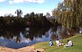 Cudgegong River where it passes close to the town


| Year | Pop. | ±% |
|---|---|---|
| 1921 | 3,170 | — |
| 1933 | 3,993 | +26.0% |
| 1947 | 4,178 | +4.6% |
| 1954 | 5,294 | +26.7% |
| 1961 | 5,312 | +0.3% |
| 1966 | 5,372 | +1.1% |
| 1971 | 5,598 | +4.2% |
| 1976 | 5,724 | +2.3% |
| 1981 | 6,015 | +5.1% |
| 1986 | 6,576 | +9.3% |
| 1991 | 7,447 | +13.2% |
| 1996 | 8,195 | +10.0% |
| 2001 | 8,603 | +5.0% |
| 2006 | 8,249 | −4.1% |
| 2011 | 9,830 | +19.2% |
| 2016 | 10,966 | +11.6% |
| 2021 | 11,563 | +5.4% |
| Source: Australian Bureau of Statistics data.[60][61] | ||
Notable people
[edit]- Natarsha Belling – national newsreader for Channel 10
- Felicity Brown – milliner
- Kathleen Mary Burrow – physiotherapist, businesswoman and Catholic lay leader
- Ivan Dougherty – Australian army officer, who attended Mudgee High School in his youth
- Jamie Fitzgerald – former professional rugby league footballer who played 71 First Grade NRL games
- John Floreani – Lead singer of rock band Trophy Eyes and solo singer-songwriter
- Kevin Golsby – actor, radio and television host
- Darrell Hair – international cricket umpire
- Lisa Keightley – cricketer, first woman to score a century at Lord's in England
- Henry Lawson – one of Australia's most recognised poets and short story writers. Lived in Mudgee for 16 years during childhood after his birth in Grenfell.
- Louisa Lawson – mother of Henry Lawson and prolific activist
- David Lowe – Winemaker and owner Lowe Wines, President NSW Wine Industry Association, Vice President Australian Winemakers Federation
- The Massey family of organists — born in the town and returned frequently
- Scott McGregor – Australian actor, TV presenter and railway historian
- Ted Noffs – Methodist minister and founder of the Wayside Chapel in Kings Cross 1964
- James Stanton – Olympic water polo player for Australia.
- Ken Sutcliffe – television personality, sports reader for Channel Nine
- Dennis Talbot – professional boxer who represented Australia in the 1972 Olympics in Munich
- Gil Wahlquist – pioneer organic winemaker and owner of Botobolar Vineyard
- YNG Martyr – rapper and singer/songwriter, also runs a music marketing company
- Groups
- Brothers3 – X-Factor contestants, 2014
See also
[edit]References
[edit]- ^ a b c Australian Bureau of Statistics (28 June 2022). "Mudgee". 2021 Census QuickStats. Retrieved 1 November 2023.
- ^ Sydney Basin (Map). New South Wales Department of Primary Industries.
- ^ a b c d Gapps, Stephen (2021). Gudyarra, The First Wiradyuri War of Resistance. Sydney: NewSouth.
- ^ Trethowan, Melanie (30 October 2019). "Exploring My Backyard & Aboriginal Art – Hands on Rock, Mudgee". Retrieved 15 January 2022.
- ^ "Aboriginal Place Names". Mudgee Guardian and North-Western Representative. 15 December 1938. p. 14. Retrieved 14 October 2022.
- ^ Grant, Stan (2010). A new Wiradjuri dictionary, compiled by Stan Grant and John Rudder. Canberra: Restoration House. ISBN 9780869421505.
- ^ "Word Up: Nathan Sentance". ABC Radio National. 6 February 2021. Retrieved 14 October 2022.
- ^ "Mudgee". Geographical Names Register (GNR) of NSW. Geographical Names Board of New South Wales. Retrieved 30 July 2013.
- ^ "PLACE NAMES". The Australian Women's Weekly. National Library of Australia. 13 May 1964. p. 61. Retrieved 22 February 2011.
- ^ "Mudgee's Earliest History". Mudgee Guardian and North-western Representative. New South Wales, Australia. 27 March 1933. p. 7. Retrieved 15 January 2022 – via National Library of Australia.
- ^ Greaves, Bernard. "Blackman, James (1792–1868)". Australian Dictionary of Biography. National Centre of Biography, Australian National University. ISBN 978-0-522-84459-7. ISSN 1833-7538. OCLC 70677943. Retrieved 9 December 2013.
- ^ H. Selkirk (1920), "The Discovery of Mudgee", Journal and Proceedings, 6, Sydney: Royal Australian Historical Society, ISSN 1325-9261, nla.obj-593173379, retrieved 16 January 2022 – via Trove
- ^ "A Reminiscence". The Bligh Watchman And Coonabarabran Gazette. Vol. 24. New South Wales, Australia. 29 August 1900. p. 2. Retrieved 16 January 2022 – via National Library of Australia.
- ^ "Mudgee in the Early Days". Mudgee Guardian and North-western Representative. Vol. XIV, no. 1499. New South Wales, Australia. 12 September 1907. p. 5. Retrieved 16 January 2022 – via National Library of Australia.
- ^ "Transcript: Declaration of Martial Law". nma.gov.au. Retrieved 26 September 2016.
- ^ "The late Mr. N. S. Lawson". Mudgee Guardian and North-western Representative. Vol. XLIV, no. 2026. New South Wales, Australia. 12 December 1912. p. 18. Retrieved 16 January 2022 – via National Library of Australia.
- ^ "Mudgee Guardian". 15 April 2014. Retrieved 11 June 2017.
- ^ Yap, Brian. "John Blackman". Freepages. Ancestry.com. Retrieved 9 December 2013.
- ^ "ST. JOHN'S, MUDGEE". Mudgee Guardian and North-western Representative. New South Wales, Australia. 4 June 1936. p. 10. Retrieved 31 October 2017 – via National Library of Australia.
- ^ "Colonial Inn Museum". Mudgee Historical Society Inc. Retrieved 15 November 2011.
- ^ Annette Piper (1 June 1861). "Western Post June 1861". Western Post. Retrieved 14 March 2011.
- ^ "Intercolonial". The Darling Downs Gazette and General Advertiser. Vol. XII, no. 868. Queensland, Australia. 7 July 1869. p. 4. Retrieved 19 June 2022 – via National Library of Australia.
- ^ "Victoria". The Mercury (Hobart). Vol. XIV, no. 2649. Tasmania, Australia. 29 June 1869. p. 3. Retrieved 19 June 2022 – via National Library of Australia.
- ^ "The Bingera Diamond Field". The Sydney Mail and New South Wales Advertiser. Vol. XVI, no. 694. New South Wales, Australia. 18 October 1873. p. 496. Retrieved 19 June 2022 – via National Library of Australia.
- ^ "Melbourne". Empire. No. 6026. New South Wales, Australia. 7 April 1871. p. 2. Retrieved 19 June 2022 – via National Library of Australia.
- ^ "Extension of the Railway to Mudgee". The Sydney Morning Herald. National Library of Australia. 9 September 1884. p. 5. Retrieved 15 November 2011.
- ^ a b c Bozier, Rolfe. "Gwabegar Line". NSWrail.net. Retrieved 15 November 2011.
- ^ Mudgee Guardian and North-Western Representative, trove.nla.gov.au. Retrieved 23 November 2019.
- ^ Chammas, Michael (23 April 2012). "Classy Carney closes on Origin spot with sizzling show". Brisbane Times. Retrieved 29 April 2012.
- ^ "Dragons announce Mudgee fixtures for 2019". 19 October 2018.
- ^ "Wanderers to take Community match to Mudgee as part of new Regional Strategy". 11 July 2018.
- ^ Sa, 7pm TV News (15 May 2014). "ICAC searches Mid-Western Regional Council offices in Mudgee". ABC News. Retrieved 13 November 2015.
{{cite news}}: CS1 maint: numeric names: authors list (link) - ^ "Mid-Western Council abandons extraordinary meeting over ICAC inquiry". MudgeeGuardian.com. 21 May 2014. Retrieved 13 November 2015.
- ^ "Mudgee". Visit NSW. Retrieved 18 May 2013.
- ^ "People's rally protests Mudgee conference | Beyond Zero Emissions". bze.org.au. Retrieved 13 November 2015.
- ^ "Petrol prices down but Mudgee still among most expensive towns to fill up". Mudgee Guardian. 5 January 2015. Retrieved 14 November 2015.
- ^ "If everyone thinks it's a bubble, it probably isn't". ABC News. 17 September 2014. Retrieved 14 November 2015.
- ^ "Australia has to face up to the facts on coal". The Australian.
- ^ "Real FM". Retrieved 28 May 2025.
- ^ "5 July 1900 Snowstorm" (PDF).
- ^ a b "MUDGEE (GEORGE STREET)". Climate statistics for Australian locations. Bureau of Meteorology. April 2013. Retrieved 27 April 2013.
- ^ ""Regent Theatre" | NSW Environment, Energy and Science". www.environment.nsw.gov.au. Retrieved 21 March 2020.
- ^ "St. Mary's Roman Catholic Church, Presbytery, Convent & Hall". New South Wales State Heritage Register. Department of Planning & Environment. H00685. Retrieved 18 May 2018.
 Text is licensed by State of New South Wales (Department of Planning and Environment) under CC BY 4.0 licence.
- ^ "Mudgee Town Hall". New South Wales State Heritage Register. Department of Planning & Environment. H00464. Retrieved 18 May 2018. Text is licensed by State of New South Wales (Department of Planning and Environment) under CC BY 4.0 licence.
- ^ "Mudgee Post Office & Quarters". New South Wales State Heritage Register. Department of Planning & Environment. H01314. Retrieved 18 May 2018. Text is licensed by State of New South Wales (Department of Planning and Environment) under CC BY 4.0 licence.
- ^ "Binnawee Homestead and Outbuildings". New South Wales State Heritage Register. Department of Planning & Environment. H01780. Retrieved 18 May 2018. Text is licensed by State of New South Wales (Department of Planning and Environment) under CC BY 4.0 licence.
- ^ "Mudgee Railway Station, yard and locomotive yard". New South Wales State Heritage Register. Department of Planning & Environment. H01204. Retrieved 18 May 2018. Text is licensed by State of New South Wales (Department of Planning and Environment) under CC BY 4.0 licence.
- ^ "St John's Anglican Church Mudgee P.1". Mudgeehistory.com.au. 9 July 2012. Retrieved 25 December 2012.
- ^ "Mudgee Catholic Church :: Home". Mudgee.catholic.org.au. Retrieved 25 December 2012.
- ^ "Mudgee, St Paul's Presbyterian Church – Find a Presbyterian Church". Findapresbyterianchurch.com. Retrieved 25 December 2012.
- ^ "Uniting Church Mudgee and Rylstone".
- ^ "Contact Us". Frontline.org.au. Retrieved 25 December 2012.
- ^ "Google Maps". Google Maps. Retrieved 7 May 2013.
- ^ Jones, Andrew (16 October 2012). "Mudgee Corps ť". My.salvos.org.au. Archived from the original on 27 November 2012. Retrieved 25 December 2012.
- ^ "Mudgee Seventh-day Adventist Church – Home". Mudgee.adventist.org.au. Retrieved 25 December 2012.
- ^ Cudgegong Valley Public School in All Our Best. "Home". Cudgegongv-p.schools.nsw.edu.au. Retrieved 25 December 2012.
- ^ "Mudgee Public School". Mudgeepublic.com.au. Retrieved 25 December 2012.
- ^ "St Matthews Central School Mudgee NSW Australia". Stmattsmudgee.nsw.edu.au. 30 March 2012. Archived from the original on 24 April 2013. Retrieved 25 December 2012.
- ^ "Mudgee College : TAFE Western". Wit.tafensw.edu.au. Retrieved 25 December 2012.
- ^ "Statistics by Catalogue Number". Australian Bureau of Statistics. Retrieved 15 May 2024.
- ^ "Search Census data". Australian Bureau of Statistics. Retrieved 15 May 2024.
Further reading
[edit]- John Broadley, Historic Houses of Mudgee , Mudgee: J. Broadley, 2011.
- Memories of Mudgee: A Photographic Glimpse of Bygone Days, Mudgee, N.S.W.: Mudgee Historical Society, Mudgee, 2018.
- Mudgee: A Nest in the Hills, Mudgee, N.S.W.: Mudgee Historical Society, Mudgee, 1981. Foreword by Gil Wahlquist.
External links
[edit]- "Mudgee Chamber of Commerce".
- "Mudgee District Local History".
- "Mudgee". visitnsw.com.
- "Mudgee from the air (video)". YouTube.
| International | |
|---|---|
| National | |
| Geographic | |
| Other | |
Mudgee
View on GrokipediaMudgee's heritage includes well-preserved 19th-century architecture, such as its post office and railway station, reflecting its historical role as a transport and administrative hub connected by rail since 1884.[4] The community maintains a strong agricultural ethos, with ongoing innovations in sustainable farming practices amid challenges like land tax reinterpretations affecting primary producers.[10] These elements underscore Mudgee's evolution from frontier settlement to a vibrant inland centre balancing tradition and modern rural enterprise.[11]
History
Indigenous Habitation by Wiradjuri People
The Wiradjuri nation, encompassing central New South Wales including the Mudgee district, maintained traditional custodianship over lands along major river systems such as the Macquarie (Wambool), Lachlan (Calare), and Murrumbidgee, with clans adapting to diverse environments through seasonal mobility and resource use.[12] In the Mudgee region, the Mowgee clan predominated, extending influence over an approximately 50-kilometer radius centered on the town site, while the Dabee clan also inhabited adjacent areas along the Cudgegong River.[13][14] Clan totems structured social and spiritual roles, with the wedge-tailed eagle (Mullian) associated with Mowgee women and the crow (Waggan) with men, guiding kinship, ceremonies, and land stewardship practices.[13][15] Settlement patterns centered on the Cudgegong River, which provided essential water, fish, eels, and edible plants, facilitating semi-permanent camps and serving as a navigation route for trade and gatherings with neighboring groups.[13][15] The region's hilly terrain, reflected in the Wiradjuri-derived name Mudgee (meaning "nest in the hills"), supported hunting of kangaroos, possums, and birds, alongside gathering of bush tucker like yams and native fruits, with fire-stick farming likely used to manage vegetation for improved yields and mobility.[16][13] Cultural and archaeological traces of habitation persist in sacred sites, including rock shelters with hand stencils and paintings at locations such as Hands on the Rocks (featuring over 100 stencils), The Drip, and Babyfoot Cave, where evidence of stone tool manufacture—such as flakes and cores—indicates sustained occupation and ritual activity.[13][15][17] Other markers include Reynold's Creek as a documented resting site for women and children during travel, and relic scatters along Lower Piambong Road, attesting to patterned landscape use for camping, tool production, and ceremonies prior to European contact in the early 19th century.[15] These features, preserved amid the area's sandstone outcrops and river valleys, underscore the Wiradjuri's deep ecological knowledge and territorial continuity.[13]European Settlement and Early Colonization (1820s–1850)
In late 1821, James Blackman led a small expedition from the Bathurst district northward, becoming the first European to cross the Cudgegong River and explore the Mudgee area, identifying fertile grazing lands suitable for pastoral expansion.[4][18] Blackman's route traced from Wallerawang through present-day areas like Cullen Bullen, marking initial European penetration into Wiradjuri territory beyond the Blue Mountains.[18] Permanent settlement followed in early 1823, when George and Henry Cox, sons of road-builder William Cox, established a camp at Munna (later Menah) along the Cudgegong River and secured extensive land grants on its southern banks for sheep grazing.[19] Concurrently, Lieutenant William Lawson claimed approximately 6,000 acres opposite the Cox holdings, while other early pastoralists including Robert Lowe at Wilbetree, Richard Rouse at Guntawang, Henry Bayly at Beaudesert, and Charles Roberts with William Hayes at Havilah occupied runs in the surrounding valleys during the mid-1820s.[4][19] These squatting claims, often formalized later as grants of 640 to 2,560 acres at five shillings per acre, prioritized riverine frontages for water access and stock management, reflecting the era's emphasis on wool production amid growing colonial demand.[19] Additional grants, such as Henry Steel's 2,000 acres in 1825 (registered 1835), further consolidated European control over the district's pastoral potential.[19] By 1833, the initial hub at Menah featured a police station and lock-up to enforce colonial authority and manage convict labor on the runs.[4] The village of Mudgee was officially gazetted in 1838, spurring modest growth; by 1841, it included 36 dwellings, three hotels, a hospital, post office, two stores, and the district's first Anglican church, supporting a small population of free settlers, emancipists, and assigned convicts focused on agriculture and herding.[4] In the mid-1840s, the police presence shifted from Menah to Mudgee proper, underscoring the town's emergence as an administrative center amid ongoing land disputes and frontier tensions.[4] Prior to the 1851 gold discoveries, the economy remained agrarian, with wool as the primary export, though yields were constrained by drought and indigenous resistance to encroachment.[4]Gold Rush and Economic Expansion (1850s–1900)
The discovery of gold in payable quantities near Mudgee, particularly at Hargraves in 1851 following Edward Hargraves' reports, initiated a regional rush that transformed the town into a vital supply and administrative hub for surrounding diggings, despite no significant alluvial deposits within Mudgee itself.[4][20] This influx of prospectors spurred immediate economic activity, with Mudgee's population rising from approximately 200 in 1851 to 1,500 by the 1861 census, driven by demand for goods, lodging, and services catering to miners.[4][16] Local commerce expanded rapidly, including the establishment of four coach factories in the 1860s to facilitate transport to remote claims, alongside nascent industries such as flour mills, foundries, and cordial factories that processed and supplied the growing transient workforce.[4][21] Mudgee's strategic location amplified its prosperity during the broader New South Wales gold era (1851–1880), as it served as the primary entrepôt for fields like Eurunderee, where a major find occurred in 1863.[4] The town's municipal incorporation in 1860, as the second-oldest municipality west of the Great Dividing Range, formalized governance amid this boom, enabling infrastructure investments to handle increased traffic and trade.[4] Economic diversification began early, with the planting of vineyards by German immigrant Adam Roth in 1858 laying foundations for viticulture, complementing wool production from established merino studs that predated the rush but benefited from expanded markets.[4] The period's zenith came in the early 1870s with prolific discoveries at Gulgong (16 miles northwest) and Hill End, which drew up to 20,000 diggers to Gulgong alone by 1872 and yielded approximately 15,000 kilograms of gold from that field between 1870 and 1880.[22][23] Mudgee capitalized as the logistical nexus, experiencing heightened through-traffic, commercial booms in retail and hospitality, and permanent settlement as some miners transitioned to farming or trades.[4][20] The arrival of the railway in 1884 further entrenched this expansion by improving export of agricultural staples like wool, mitigating the goldfields' decline by the late 19th century when yields dwindled due to exhaustion of shallow alluvial deposits.[4] By 1900, these factors had solidified Mudgee's shift toward a mixed agrarian economy, with gold's legacy evident in enduring population and built infrastructure rather than ongoing extraction.[4]Twentieth Century to Present Developments
Following the decline of the gold rush in the late 19th century, Mudgee's economy in the early 20th century shifted toward agriculture, with wool production becoming a primary sustenance alongside limited winemaking activities that had originated in the 1850s but diminished due to droughts.[24] The extension of the railway line to Mudgee in 1884, reaching the town on September 11 of that year, enhanced connectivity and supported agricultural exports, though passenger services persisted only until the late 20th century, ceasing around the 1980s, after which freight operations continued for regional mining and farming needs.[25][26] The mid-20th century saw modest industrial diversification, including manufacturing and repair sectors, but agriculture remained dominant until the post-World War II period when the wine industry began a revival. Large-scale vineyard plantings resumed from 1974, building on the region's viticultural heritage, with Mudgee pioneering Australia's first Chardonnay wines released in 1972 from cuttings planted earlier in the area.[6][27] This resurgence positioned Mudgee as a key producer of robust red wines, particularly Cabernet Sauvignon and Shiraz, contributing to economic growth alongside nearby coal mining operations like the Ulan mine, which bolstered regional employment.[28] In the late 20th and early 21st centuries, tourism emerged as a major driver, leveraging the wine region, historic architecture, and outdoor attractions, leading to Mudgee being named Australia's Top Tourism Town in 2021 and 2022 and inducted into the national tourism awards Hall of Fame.[29] Population estimates indicate steady growth, reaching 11,457 by the 2021 census, supported by lifestyle migration and economic diversification into hospitality and real estate.[3] The Mid-Western Regional Council continues to promote sustainable development, balancing agriculture, viticulture, mining, and tourism amid challenges like drought resilience.[30]Physical Geography
Location and Topography
Mudgee is situated in the Central West region of New South Wales, Australia, within the Mid-Western Regional local government area, approximately 261 km northwest of Sydney along the Great Dividing Range's western slopes.[31] The town occupies coordinates of roughly 32.60°S latitude and 149.60°E longitude.[32] The topography centers on the broad, fertile Cudgegong River valley, where the river flows eastward through the area, supporting alluvial plains and providing drainage.[33] Most of the town lies on relatively high ground south of the river's banks, mitigating flood risks in the northern lowlands.[34] Elevations range from about 450 m at lower points to over 500 m across the urban extent, with an average around 535 m.[32][35] Surrounding terrain includes gently undulating hills and basalt-enriched sediments deposited by the river, forming productive soils amid rolling countryside.[33] These features transition into broader dissected landscapes influenced by the nearby Great Divide, with valleys penetrating from east and west, creating diverse micro-terrains suitable for pastoral and horticultural uses.[36]Climate Characteristics
Mudgee features a humid subtropical climate classified as Köppen Cfa, marked by hot summers, cool winters without severe cold, and moderate year-round precipitation without a pronounced dry season. The region's climate supports agriculture and viticulture, with sufficient rainfall and temperature variability influencing seasonal activities. Data from the Mudgee Airport AWS station, operational since 1990, indicate an annual mean maximum temperature of 22.8 °C and mean minimum of 8.3 °C, reflecting a temperate inland environment at approximately 450 meters elevation.[37] Summer months (December to February) bring the warmest conditions, with mean maximum temperatures ranging from 29.0 °C in December to 30.9 °C in January, and mean minima between 13.8 °C and 16.1 °C; daytime highs occasionally exceed 40 °C during heatwaves. Winters (June to August) are cooler, featuring mean maxima of 14.6 °C to 16.3 °C and minima often near or below freezing at 1.3 °C to 2.4 °C, with frost occurrences averaging over 30 days per year in the coldest months. Transitional seasons show gradual shifts, with spring (September to November) maxima climbing to 19.8–26.4 °C and autumn (March to May) declining to 18.6–27.0 °C.[37] Precipitation totals approximately 666 mm annually, distributed relatively evenly but with a slight elevation in summer and early spring; November and December record the highest monthly averages at 76.7 mm and 76.0 mm, respectively, while autumn months like April and May see the lowest at 38–40 mm. The mean number of rain days (≥1 mm) is about 62 per year, contributing to reliable soil moisture for local farming, though droughts can occur as in 2002–2009 when annual rainfall dipped below 400 mm in some years.[37] Extreme weather includes a record high of 43.9 °C on 11 February 2017 and a record low of -7.7 °C on 17 July 2002, underscoring vulnerability to both heatwaves and occasional frosts that can impact crops. Long-term trends show minor warming, with recent decades exhibiting slightly higher minimum temperatures compared to earlier 20th-century records from Mudgee (George Street) station (1870–2025 rainfall data averaging 679 mm annually).[37][32]| Month | Mean Max Temp (°C) | Mean Min Temp (°C) | Mean Rainfall (mm) |
|---|---|---|---|
| Jan | 30.9 | 16.1 | 67.3 |
| Feb | 29.5 | 15.6 | 64.5 |
| Mar | 27.0 | 13.0 | 67.2 |
| Apr | 22.9 | 7.9 | 39.9 |
| May | 18.6 | 4.0 | 38.0 |
| Jun | 15.0 | 2.4 | 44.3 |
| Jul | 14.6 | 1.3 | 46.9 |
| Aug | 16.3 | 1.6 | 37.8 |
| Sep | 19.8 | 4.3 | 53.3 |
| Oct | 23.2 | 7.8 | 55.1 |
| Nov | 26.4 | 11.3 | 76.7 |
| Dec | 29.0 | 13.8 | 76.0 |
| Annual | 22.8 | 8.3 | 665.5 |
Demographics and Population
Historical Population Trends
In the mid-19th century, prior to the gold rush, Mudgee's population was small, estimated at around 292 residents in 1851, reflecting its status as a nascent pastoral settlement.[38] The discovery of gold in nearby areas, including by Edward Hargraves in 1851, triggered rapid influxes of prospectors, boosting the population to approximately 803 by the late 1850s.[38] This surge aligned with broader New South Wales gold rush dynamics, where regional towns experienced temporary booms driven by alluvial mining. Subsequent decennial censuses captured continued expansion amid transitioning from mining to agriculture, though growth moderated after the initial rush:| Year | Population |
|---|---|
| 1871 | 1,786 |
| 1881 | 2,492 |
| 1891 | 2,410 |
| 1901 | 2,789 |
Current Demographic Profile
As of the 2021 Australian Census, Mudgee had a population of 11,457, with an estimated resident population of approximately 12,833 as of June 2024.[3][41] The sex distribution showed 48.8% male (5,583 people) and 51.2% female (5,868 people).[3] The median age was 36 years, lower than the New South Wales median of 39.[3] The age structure reflected a relatively youthful profile, with 42.4% of residents aged under 20 or 20-39 years, compared to 37.3% in New South Wales overall.[3] Children aged 0-14 comprised 21.2%, while those aged 15-64 made up 62.3%, and 16.5% were 65 and over.[3] This distribution indicates a higher proportion of working-age and younger residents than the state average.[3] Cultural diversity was limited, with 86.0% of residents born in Australia, followed by 2.1% from England and 0.9% from New Zealand.[3] The most common ancestries were Australian (43.8%) and English (43.5%), with Irish at 12.6%; multiple ancestries were reported by many respondents.[3] Aboriginal and Torres Strait Islander people constituted 7.5% of the population (864 individuals), exceeding the New South Wales rate of 3.4%.[3] English was spoken at home by 89.7% of residents, higher than the state figure of 67.6%, with small proportions speaking Nepali (0.4%) or Punjabi (0.4%).[3] Religious affiliation included no religion (37.8%), Catholicism (24.0%), and Anglicanism (18.9%).[3] Socioeconomic indicators included a median weekly household income of $1,678, median family income of $2,120, and median personal income of $775 for those aged 15 and over.[3] Educational attainment emphasized vocational qualifications, with 19.7% holding Certificate III or equivalent and 15.1% possessing a bachelor degree or higher.[3] Labour force participation stood at 62.0%, with unemployment at 3.6% and 58.6% employed full-time.[3]Local Government and Administration
Municipal Governance
The municipal governance of Mudgee falls under the Mid-Western Regional Council, a local government authority in the Central West region of New South Wales, Australia, established on 26 May 2004 through the amalgamation of the former Mudgee Shire Council and portions of the Rylstone and Merriwa shires.[43][44] The council administers an area exceeding 8,700 square kilometres, encompassing Mudgee as its primary administrative centre and major population hub, along with towns such as Gulgong, Rylstone, and Kandos.[45] Its headquarters are located at 86 Market Street, Mudgee.[46] The council consists of nine councillors elected by popular vote every four years, with the mayor selected from among them to serve a four-year term.[47] As of August 2025, the mayor was Des Kennedy.[48] Operational leadership is provided by a general manager, who oversees day-to-day administration and is supported by four directors managing operations, development, corporate services, and community services.[47] The council employs approximately 400 staff to deliver services including infrastructure maintenance, planning, waste management, and community facilities across the region.[49] Governance adheres to the New South Wales Local Government Act 1993, emphasizing community engagement through public consultations, strategic plans like the 2025 Towards 2040 Community Plan, and mechanisms such as youth councils for input on local policies.[47][50] Mudgee-specific administration focuses on urban growth pressures, including housing development and urban release strategies to accommodate population increases primarily in the town.[42] The council's decisions are made at ordinary meetings, with transparency maintained via public agendas and reports.[51]Regional Politics and Policies
The Mid-Western Regional Council (MWRC), which administers Mudgee and surrounding areas, operates as a non-partisan local government body with nine councillors elected at-large via optional preferential voting.[52] In the September 2024 local elections, preferences were distributed across 16,678 votes, resulting in the election of nine new councillors on October 2, 2024, reflecting community priorities on infrastructure, economic diversification, and environmental management.[53] A subsequent by-election in late 2024, costing up to $250,000, was held to replace a resigned councillor rather than using a cheaper countback mechanism, highlighting fiscal debates within council administration.[54] Key regional policies emphasize balancing mining-driven growth with agricultural and viticultural sustainability, as outlined in the Mid-Western Regional Economic Development Strategy (2018–2022 and 2023 update).[30][55] The strategy promotes job creation in mining support services alongside protections for farming and processing industries, acknowledging mining's role in population expansion—such as through coal operations at Ulan Mine, extended by NSW regulators in May 2025 despite activist challenges over environmental impacts.[56] Urban release policies for Mudgee and Gulgong address housing pressures from mining booms, with strategies adopted to manage residential expansion without undermining prime agricultural land.[42] Political tensions center on mining approvals versus agricultural preservation, particularly with the proposed Bowdens Silver Project, an open-cut mine potentially generating lead contamination risks to vineyards and farmland via westerly winds carrying dust.[57] Economic analyses project annual losses up to $334 million in turnover for Mudgee's wine, agriculture, and tourism sectors from such contamination, prompting community calls for lead mining exclusion zones near schools and productive lands.[9][58] MWRC policies, including parks usage reviews and legislative compliance frameworks, aim to mitigate these conflicts by enforcing environmental rehabilitation standards, though critics argue state-level mining regulations under NSW's framework prioritize extraction over long-term soil and water integrity.[59][60] Recent adoptions, such as the Mudgee Regional Airport Master Plan in October 2025, signal council focus on infrastructure to support diversified growth amid these debates.[61]Economy
Agricultural and Viticultural Sector
The agricultural sector in the Mudgee region of New South Wales produces a diverse array of goods, including super fine wool from sheep, honey, livestock such as cattle and sheep, thoroughbred horses, olives, cherries, and grapes, contributing to the local economy alongside mining and tourism.[29] [62] These activities leverage the region's fertile soils and temperate climate, supporting farm businesses that integrate grazing, horticulture, and viticulture. Viticulture forms a pivotal component of Mudgee's agricultural economy, with commercial grape growing commencing in 1858 when German settler Adam Roth established the area's first vineyard, planting varieties including Shiraz, Muscat Hamburg, Frontignac, and White Hermitage.[24] By the 1970s, Italian oenologist Carlo Carino expanded varietal diversity by introducing Nebbiolo, Sangiovese, and Barbera, alongside ongoing cultivation of traditional types.[63] The region now supports over 30 grape varieties, with Shiraz comprising 28% of plantings, Chardonnay 19%, and Cabernet Sauvignon 15%, yielding robust reds and fresh whites suited to the local terroir of sandstone-derived soils and moderate elevations.[64] [65] Emerging plantings of Mediterranean varieties like Tempranillo, Garnacha, Fiano, and Nebbiolo reflect adaptations to the continental climate, enhancing resilience and product differentiation.[66] Wine production underpins regional value-adding, with over 40 cellar doors and estates driving agritourism and exports, though specific tonnage figures for Mudgee remain integrated into broader New South Wales outputs, where red grape prices averaged $431 per tonne in recent crush data.[6] [67] Agricultural enterprises, including viticulture, employ local labor and sustain supply chains, though they face challenges from variable rainfall and competition with mining land use in the Mid-Western Local Government Area.[30]Mining Operations
Mining in the Mudgee region began with gold discoveries in surrounding areas in July 1851, attracting prospectors and contributing to the town's early development, though significant alluvial and reef gold deposits were primarily located outside the immediate Mudgee township, such as at Hargraves and Hill End.[68][20] By 1856, the local population had nearly tripled to 803 due to these rushes, with mining activities including both surface and underground extraction using basic tools like picks and cradles.[69] Gold mining declined by the late 19th century as reefs were exhausted, shifting focus to other minerals. Coal mining emerged in the early 20th century, with the Ulan deposit first exploited underground in the 1920s by local operators using manual methods and pit ponies, producing small volumes for regional use until intermittent closures.[70][71] Modern large-scale operations dominate today, centered on thermal coal extraction for domestic power generation and export, with three principal active mines within 50 km of Mudgee.| Mine | Operator | Type | Distance from Mudgee | Annual Production (Recent) |
|---|---|---|---|---|
| Wilpinjong | Peabody Energy | Open-cut thermal coal | 50 km northeast | 12.6 million tonnes (2024)[72] |
| Moolarben | Yancoal | Open-cut and underground thermal coal | 40 km east | Operating continuously; specific 2024 figures undisclosed publicly[73][74] |
| Ulan | Glencore | Underground thermal coal (with prior open-cut) | Adjacent west | Expansion approved for additional 18.8 million tonnes, extending to 2035[75][76] |
Tourism and Hospitality
Mudgee serves as a prominent destination for wine and food tourism in New South Wales, drawing visitors to its over 100 wineries and vineyards that produce notable red wines suited to the region's temperate climate.[64] The area attracts more than 650,000 visitors annually, primarily for experiences centered on cellar doors, gourmet dining, and local produce markets, contributing an estimated $60.1 million in tourism output, or 0.9% of the regional economy.[81] [82] Key attractions include natural sites like The Drip Gorge and Dunns Swamp for hiking and scenic views, alongside cultural events such as wine festivals that highlight the area's agricultural heritage.[83] Mudgee was named Australia's Top Tourism Town in 2021 and 2022 by Destination NSW, recognized for its community-driven hospitality and integration of wine tasting with outdoor activities.[29] [84] The hospitality sector supports this influx through a mix of boutique hotels, motels, and farm stays, with establishments like Parklands Resort offering on-site dining amid 30 acres of gardens as a base for wine region exploration.[85] Restaurants emphasize seasonal, locally sourced ingredients, such as those at the Oriental Hotel Mudgee, which provides diverse indoor and outdoor dining options featuring regional cuisine.[86] Pubs and hotels, including historic venues like Perry Street Hotel, cater to casual visitors with meals and beverages, fostering a welcoming rural atmosphere that aligns with the town's emphasis on authentic country experiences.[87] Economic analyses indicate tourism's role in sustaining employment in accommodation and food services, though growth remains tied to seasonal events like Mudgee Wine & Food Month.[88] Overall, the sector prioritizes quality over volume, with accommodations often bundling stays with winery tours to enhance visitor retention.[89]Other Industries and Employment
Health care and social assistance is a major employer in the Mid-Western Regional area encompassing Mudgee, supporting approximately 1,200 jobs or 14.8% of total regional employment as of recent estimates.[90] This sector includes Mudgee Hospital, a key facility providing acute care, emergency services, and community health programs, which draws professionals from nursing, allied health, and administration.[8] Growth in this area has been driven by an aging regional population and increased demand for aged care services, with employment rising by around 364 jobs in health between 2016 and 2021 according to census-linked data.[29] Retail trade accounts for about 900 jobs or 11.1% of employment, serving the local population of over 12,000 in Mudgee and surrounding areas through supermarkets, specialty stores, and commercial hubs along Market and Church Streets.[90] [3] While stable in job numbers at around 1,060 as of 2022, the sector supports daily consumer needs and benefits from proximity to agricultural and mining workforces, though it faces competition from online retail.[29] Construction employs roughly 800 workers or 9.9% of the workforce, fueled by residential development, infrastructure projects, and support for mining expansions.[90] This includes 1,031 jobs region-wide, reflecting ongoing housing demand amid population growth of 1.2% annually in recent years.[90] Manufacturing contributes 700 jobs or 8.6%, focusing on food processing, machinery, and small-scale production tied to local resources, though it remains smaller than resource-based sectors.[90] Education and training also employ 700 individuals or 8.6%, encompassing public schools, Mudgee High School, and TAFE campuses offering vocational training in trades and health.[90] Public administration and safety add 600 jobs or 7.4%, primarily through Mid-Western Regional Council operations in planning, environmental services, and emergency response.[90] These sectors collectively provide stable, non-cyclical employment, diversifying the economy beyond primary industries.[8]Controversies and Debates
Mining Versus Agriculture Conflicts
In the Mudgee region, conflicts between mining and agriculture primarily revolve around land acquisition, groundwater depletion, and contamination risks from dust, tailings, and heavy metals, pitting short-term mineral extraction gains against long-term farming viability in a viticulture- and livestock-dependent area. The proposed Bowdens Silver Project, an open-cut operation targeting 29.5 million tonnes of ore over 17 years near Lue, has intensified disputes since its environmental impact statement in 2021, with farmers citing lead dispersal threats to soil, water, and produce that could render agricultural land unusable. A July 2025 economic analysis projected high-impact scenarios from the mine leading to $334 million annual losses in agricultural turnover, $2.6 billion cumulatively across farming, wine, and tourism sectors through reputational harm and market rejection of potentially contaminated goods.[9][91] Project assessments by Silver Mines Ltd. claim mitigation via tailings storage above the water table and monitoring would limit agricultural effects, though critics, including the Mudgee Region Action Group, highlight acid mine drainage risks over 77 hectares and proximity to primary schools and orchards.[92][93] Opposition escalated in August 2025 with demands for a lead exclusion zone, backed by a report warning of irreversible contamination to the Cudgegong River catchment, vital for irrigation, and health risks like lead poisoning in livestock and humans, potentially devastating Mudgee's $500 million-plus wine industry. New South Wales parliamentarians raised land-use conflict alarms in September 2025, presenting farmer letters urging rejection to safeguard prime soils classified as Class 2 and 3 under state mapping. While the project promises 400 construction jobs and $100 million annual royalties, local stakeholders argue these benefits are outweighed by agriculture's generational stability and export value, with some modeling showing net regional GDP contraction under pollution scenarios.[94][95][96] Coal mining expansions at Glencore's Ulan Mine, 25 kilometers from Mudgee, have similarly strained relations, with the May 2025 approval for Modification 8 adding 18.8 million tonnes of extraction and extending operations to 2035 amid claims of unassessed hydrological drawdown affecting 634 hectares of farmland via aquifer depletion up to 10 meters in some bores. The Mudgee District Environment Group filed a September 2025 Court of Appeal challenge, alleging insufficient evaluation of subsidence-induced surface water changes and cumulative impacts on smallholder irrigation from prior dewatering, which has historically reduced farm viability in the Gulgong sub-region. Ulan's 11.3 million tonnes of saleable coal in 2023 generated $1.5 billion in economic output and 588 jobs, yet affected farmers report yield drops from dust deposition and vibration, exacerbating a pattern where mining royalties—$50 million annually to Mid-Western Regional Council—fund infrastructure but fail to offset lost productivity on alienated land.[76][97][98] Historical precedents underscore these frictions: the Bylong Valley Protection Group successfully blocked Korean Coal Holdings' 2018 proposal for a 10 million tonne-per-year open-cut mine on 2,280 hectares of fertile alluvial flats, with the NSW Land and Environment Court upholding rejections in 2020 and 2021 due to irreversible loss of high-capability grazing land and visual blight on adjacent properties. Such cases reflect broader causal tensions in Mudgee's economy, where mining accounts for 83% of regional output but competes for finite water allocations under the Murray-Darling Basin Plan, prompting calls for zoning reforms to prioritize agriculture's lower environmental footprint and resilience to global commodity shifts.[99][62]Environmental Impact Assessments and Legal Challenges
In September 2025, the Mudgee District Environment Group filed an appeal in the New South Wales Land and Environment Court challenging the state government's approval of Glencore's Ulan Coal Mine expansion, which extends operations until 2035 and involves open-cut and underground mining near Mudgee. The group alleges procedural flaws by the Independent Planning Commission, including failure to adequately assess local climate impacts from the project's scope 3 emissions—estimated at over 1 billion tonnes of CO2 equivalent over its life—and rushed decision-making amid unresolved alternative site options.[97][56][100] This action draws on a July 2025 NSW Court of Appeal precedent from the Mount Pleasant mine case, where MACH Energy's 22-year extension was overturned for insufficient evaluation of downstream emissions' contributions to local climate risks, such as extreme weather affecting agriculture and water resources in coal-dependent regions. Critics of the Ulan approval, including environmental advocates, argue it similarly underweights downstream gas emissions despite the mine's projected 10 million tonnes annual coal output, though proponents maintain assessments complied with the Environmental Planning and Assessment Act 1979 by focusing on direct impacts like groundwater drawdown and dust.[56] The Bowdens Silver Project, a major silver-lead-zinc development 30 km northwest of Mudgee approved in 2021 for 25 million tonnes annual ore processing, faced multiple legal hurdles over its environmental impact statement (EIS). A March 2024 Land and Environment Court dismissal of an initial challenge upheld the consent, citing sufficient mitigation for biodiversity and water impacts, but a subsequent November 2024 Court of Appeal ruling quashed it due to EIS deficiencies in addressing cumulative air quality and heritage effects. This led to NSW legislative amendments in late 2024 to clarify assessment requirements and avert broader project delays, amid claims the original EIS overstated offsets and minimized particulate emissions risks to nearby farming.[101][102] Proposed lead mining near Mudgee schools has sparked scrutiny of EIS reliability, with a September 2025 independent report commissioned by local health groups identifying errors in government-endorsed assessments, including underestimated lead dispersion into soil and water affecting agriculture and child health within 5 km radii. Community petitions seek exclusion zones, arguing assessments neglected bioaccumulation data from analogous sites, though regulators defend the processes as meeting EP&A Act standards with modeled dispersion limits below national thresholds.[103][104] These disputes highlight procedural debates under NSW's planning framework, where EISs must quantify impacts like aquifer interference—Ulan's projected 10-15 meter drawdown—and emissions, but judicial reviews often hinge on scope interpretation, with environmental litigants succeeding in about 30% of recent coal and mineral cases by emphasizing causal links to regional hydrology and climate vulnerability over proponent-submitted models.[105]Infrastructure and Services
Transportation Networks
Mudgee is connected to regional and interstate networks primarily via road infrastructure, with the Castlereagh Highway (B55) serving as the principal arterial route. This highway links Mudgee southward to Lithgow (approximately 140 km away via Ilford) and the Great Western Highway, facilitating access to Sydney, while extending northward through Gulgong to connect with the Newell Highway near Dubbo.[106] The Mid-Western Regional Council maintains about 2,460 km of roads in the area, including 205 km of state roads under contract to Transport for NSW, such as segments of the Castlereagh Highway, Sofala Road, and Goolma Road.[107] In June 2024, an 80 km/h speed zone was extended along the Castlereagh Highway approaching Mudgee from the south to enhance safety amid increasing traffic volumes.[108] Public bus and coach services operate through Transport for NSW networks, with the Mudgee Town Coach Stop providing connections to nearby towns and regional centers like Dubbo and Sydney.[109] Long-distance coaches, including those from operators like Greyhound Australia, supplement local routes, offering scheduled services that replaced earlier rail options.[110]Rail infrastructure centers on the heritage-listed Mudgee railway station, located on the former Gwabegar railway line branch, but passenger services ceased in November 1985, with the line to Mudgee now disused.[111] The section from Rylstone southward remains operational for freight, but the Mudgee spur sees no regular traffic, prompting community surveys in 2023 that showed strong support (over 80% in some polls) for restoring passenger rail to Sydney via Lithgow.[112] No active freight services directly serve Mudgee station as of 2025, with goods historically transported by road or via Gulgong.[113] Mudgee Regional Airport (DGE), owned and operated by the Mid-Western Regional Council, supports general aviation and limited commercial flights, primarily to Sydney Kingsford Smith Airport. Regional Express (Rex) and QantasLink provide daily direct passenger flights to Sydney, with Rex also operating services to Parkes; the airport handles around 20,000 passengers annually but lacks international or extensive domestic routes.[114][115] Facilities include a sealed runway (1,440 m long) suitable for small jets, with ongoing council investments for business aviation opportunities.[114]
Media Outlets
The primary print media outlet serving Mudgee is the Mudgee Guardian and Gulgong Advertiser, a newspaper established in 1890 that provides local news, sports, weather, and classifieds for Mudgee and surrounding towns including Gulgong, Rylstone, Kandos, and Dunedoo.[116] [117] Published by Australian Community Media, it operates both in print and digital formats, with daily updates on its website covering community events, business, and regional issues.[118] Radio broadcasting in Mudgee includes commercial station 2MG, which began transmissions on July 2, 1938, initially on AM before transitioning to FM frequencies of 97.1 MHz and 101.5 MHz on March 18, 2024.[119] [120] Owned by the Super Radio Network, 2MG features a format of classic hits, news, talk, and sports programming tailored to the local audience from studios on Putta Bucca Road.[121] Additional local commercial radio includes Real FM on 93.1 MHz, affiliated with 2MG, and Red Dirt Radio on 87.6 MHz, a community-focused station emphasizing country music.[122] [123] Public broadcasting reaches Mudgee via ABC Central West, which transmits on 99.5 MHz FM and delivers regional news, programs, and emergency information across the Central Tablelands, including content relevant to Mudgee residents.[124] [125] Television services consist of standard free-to-air digital signals from national networks such as the Seven Network, Network 10, and ABC, receivable in the area without dedicated local production facilities. No independent local television station operates in Mudgee as of 2025.Culture and Heritage
Historic Buildings and Sites
Mudgee contains a designated heritage conservation area that preserves the town's 19th-century architectural character, including numerous buildings from the mid-1800s onward, reflecting its development during the regional gold rushes and early pastoral settlement.[126] The Mid-Western Regional Council recognizes over 450 individually listed heritage items across its jurisdiction, with Mudgee's conservation area contributing to this inventory by protecting streetscapes and structures integral to the town's historical identity.[127] St Mary of the Presentation Catholic Church, located on Church Street, stands as one of Mudgee's oldest surviving religious structures. The first Catholic Mass in the area was celebrated in 1839, followed by construction of an initial stone church in 1857, elements of which remain incorporated into the current building. The present church was officially opened on 11 November 1876, designed by architect Edward Gell with a sandstone facade and pointed arches; a spire was added in 1911.[128] [129] Its ornate interior features stencilling and stained glass windows from Lyon, Cottier and Company, underscoring its role in early community religious life.[128] The Mudgee Post Office, situated on Short Street, exemplifies early colonial public architecture as one of the state's first major rural post offices, originally constructed around 1862.[130] It was added to the New South Wales State Heritage Register in 1999 for its civic significance and design quality, and later to the Commonwealth Heritage List in 2011.[131] [132] Mudgee Railway Station, on Inglis Street, represents late Victorian railway engineering, designed by Chief Engineer John Whitton and built between 1883 and 1884 as a first-class station to serve the town's growing agricultural and mining economy.[133] Heritage-listed for its architectural merit, the station features intricate detailing and now houses the Art and Crafts Railway Gallery, though passenger services ceased decades ago.[134] [26] Other notable sites include the Mudgee Museum, which preserves artifacts from the town's pioneer era, and various Mechanics Institutes and commercial buildings dating to the 1850s gold rush period, many lining wide streets within the conservation area.[135] [136] Heritage walking tours highlight these structures, emphasizing Mudgee's evolution from a 1830s settlement to a regional hub.[137]Religious Institutions
Religious institutions in Mudgee reflect the town's colonial origins, with Christianity dominating since European settlement in the 1830s. The first recorded religious service was a Catholic Mass celebrated in February 1839 by Father Michael O'Reilly, shortly after land allotments were sold in the area.[128] By 1843, a rudimentary slab Catholic church with a bark roof had been constructed near the site of the current presbytery.[138] Anglican, Methodist, and Presbyterian congregations emerged in the 1850s amid the gold rush era, establishing permanent structures that contributed to the town's early civic development.[16] St Mary's Roman Catholic Church, officially St Mary of the Presentation, stands as a heritage-listed landmark completed and opened on December 3, 1876, replacing earlier makeshift facilities and serving as the focal point for the Catholic community in the Diocese of Bathurst.[139] [140] The Anglican St John the Baptist Church, also from the mid-19th century, was advocated for by local influential figures who convened meetings to fund its construction, underscoring the role of religious bodies in fostering community stability during rapid population growth.[141] Presbyterianism is represented by St Paul's Church, which continues weekly services and emphasizes discipleship in the region.[142] Protestant denominations proliferated post-federation, including the Mudgee Uniting Church, formed from Methodist and other traditions, located at 89 Mortimer Street.[143] [144] Baptist, Salvation Army, and Pentecostal groups such as Frontline Church (Assemblies of God affiliate) and One Life Church offer contemporary worship, with services held Sundays at locations like Adams Street for the former.[145] [146] [147] Smaller or non-traditional Christian outfits, including Latter-day Saints and Christian Outreach Centre, maintain a presence, though detailed historical records are sparse compared to mainline churches.[143] Overall, these institutions support community welfare and faith practices amid Mudgee's rural demographic, with no significant non-Christian religious centers documented in primary sources.Education
Primary and Secondary Schools
Mudgee is served by a mix of government and Catholic systemic schools for primary and secondary education, primarily under the New South Wales Department of Education and the Diocese of Bathurst.[148] Government schools include co-educational public institutions focused on comprehensive curricula from kindergarten to year 12, while the Catholic school offers integrated K-12 education across separate primary and secondary campuses.[149] Primary Schools Mudgee Public School, located on Perry Street, is a government co-educational primary school for kindergarten to year 6, established in 1855 as the 52nd public school in New South Wales.[150] [151] It emphasizes core subjects including literacy, numeracy, and student wellbeing, with a state overall academic score of 76 in recent assessments.[152] Cudgegong Valley Public School, situated at 765 Henry Lawson Drive, caters to kindergarten to year 6 students in a comprehensive co-educational setting, prioritizing foundational skills and community engagement.[153] It recorded a state overall score of around 70 in comparable evaluations.[152] St Matthew's Catholic Primary School, part of the broader St Matthew's Central School on Lewis Street, provides faith-based education for younger students, integrating religious instruction with standard NSW curriculum.[149] It achieved a state overall score of 86, the highest among Mudgee primaries in recent data.[152] Secondary Schools Mudgee High School, a government comprehensive co-educational institution for years 7 to 12 on Barigan Street, was founded in 1916 and enrolls approximately 1,000 students.[154] [155] It offers a broad curriculum including vocational pathways and extracurriculars, with about 13% of students identifying as Indigenous in 2018 data.[156] St Matthew's Catholic Secondary School, also on Lewis Street, extends the Catholic system's K-12 model for years 7 to 12, fostering interactions between primary and secondary students through shared events.[157] Enrollment figures align with the combined central school structure, emphasizing holistic development alongside academics.[158]| School Name | Sector | Year Levels | Establishment Year | Notes |
|---|---|---|---|---|
| Mudgee Public School | Government | K-6 | 1855 | Central urban location; focus on core NSW syllabus.[150] |
| Cudgegong Valley Public School | Government | K-6 | Not specified in records | Rural-edge setting; co-ed comprehensive.[153] |
| St Matthew's Catholic Primary | Catholic | K-6 | Part of central school | Faith-integrated; high academic rating.[149] |
| Mudgee High School | Government | 7-12 | 1916 | ~1,000 students; diverse pathways.[154] |
| St Matthew's Catholic Secondary | Catholic | 7-12 | Part of central school | Linked campuses; wellbeing emphasis.[157] |