

Community hub
Recent from talks
Contribute something
Nothing was collected or created yet.
Samundri
View on WikipediaSamundri (Urdu, Punjabi: سمندری) is a city and headquarters of Samundri Tehsil located in Faisalabad District of Punjab province, Pakistan.[1][2][3]
Key Information


It is the 55th most populous city of Pakistan, according to the 2017 census.[4]
History
[edit]Etymology
[edit]Samundri was on a major trade route during the reign of Sher Shah Suri. The present site of Samundri city was founded in 1887 as Chak No. 533 G.B. Later it was renamed as Seh Mundri because of three Hindu mandirs or temples in the area. The word Seh (سه) means Three in Persian and Mandir is a Sanskrit word for temple.
Modern
[edit]In 1887, there were three Hindu shrines in this area but now what remains, houses the Government Primary School No 4. Migration between India and Pakistan was continuous before the independence. By the 1930s Western Punjab was predominantly Muslim and supported the Muslim League and Pakistan Movement. After the independence in August 1947, the minority Hindus and Sikhs migrated to India while the Muslim refugees from Eastern Punjab in India settled in Western Punjab and across Pakistan.[5] Today Samundri is known for its contributions to Pakistan's Kabaddi team providing dozens of big names especially from Chak 176 G.B and 478 G.B. It has many Gujjar, Rajput and Jat farmers who tend to be physically strong and larger in constitution than elsewhere in the region.[6][2]
- Qaees Daud Khan (born 1994), The most famous[why?] Pakistani farmer in Samundri[according to whom?]
Geography
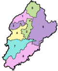
[edit]Samundri is located at 31°03'45"N 72°57'15"E (31.063, 72.954), at an altitude of 168 metres (429 ft), and is 45 km from Faisalabad, 66 km from Jhang, 30 km from Gojra, 46 km from Sahiwal and just 15 km from Tandlianwala. The upcoming Karachi-Lahore Motorway will pass through the neighborhood of Tandlianwala[2] known as Samundari Interchange Km 1016 on Samundari-Tandlianwala Road. Then it will be easily accessible from Lahore and Multan. The Post Code of Samundari is 37300.
Demographics
[edit]Population
[edit]| Year | Pop. | ±% p.a. |
|---|---|---|
| 1951 | 6,637 | — |
| 1961 | 9,515 | +3.67% |
| 1972 | 13,642 | +3.33% |
| 1981 | 30,849 | +9.49% |
| 1998 | 54,908 | +3.45% |
| 2017 | 156,991 | +5.68% |
| 2023 | 186,371 | +2.90% |
| Sources:[7] | ||
According to 2023 census, Samundri had a population of 186,371.
Economy
[edit]Samundri is home to a major grain, whole corn & sugar market. Sugarcane and wheat are the major crops of the area, while corn is the most-traded good locally. Rice is also grown here but, due to water shortages, fewer farmers opt to grow it. Vegetables are grown on many hectares, fulfilling 50% of the demand.
The Anarkali Bazaar is the main commercial market of the city, and the Jinnah Market is the oldest. Other markets in the city include Jamat Ali Bazaar, Katchery Bazaar, Mandi Bazaar, Nehar Bazaar, Qasim Bazaar, Kashmiri Bazaar, Sunny Plaza and Chaki Bazaar.
Samundri is also known for its custom truck painting business.
Major Banks in Samundari:
Notable residents
[edit]- Ramish Amin (1999 - Till Date) Supporter of Democracy & rule of law in Pakistan
- Rao Kashif Raheem Khan (born 1970), Pakistani politician
References
[edit]- ^ "Towns & Unions in the City District of Faisalabad (including Samundri)". Government of Punjab website. 1 February 2011. Archived from the original on 26 March 2012. Retrieved 14 April 2021.
- ^ a b c Muhammad Hassan Miraj (20 May 2013). "The Alexander of Samundri". Dawn. Retrieved 14 April 2021.
- ^ Two former MPAs from Samundri join PML-Q. The News International. Published 18 February 2020. Retrieved 14 April 2021.
- ^ "PAKISTAN: Provinces and Major Cities". PAKISTAN: Provinces and Major Cities (scroll down to read under title 'Towns & Municipalities' including Samundri). citypopulation.de website. Retrieved 14 April 2021.
- ^ Dube, I. &. S. (2009). From Ancient to Modern: Religion, Power, and Community in India (Hardcover). Oxford University Press.
- ^ Samthar State - Imperial Gazetteer of India, v. 22, p. 26. Digital South Asia Library. Retrieved 14 April 2021.
- ^ "Population by administrative units 1951-1998" (PDF). Pakistan Bureau of Statistics.[permanent dead link]
Samundri
View on GrokipediaHistory
Etymology
The name Samundri derives primarily from Seh-Mandri (or Seh-Mandari), a Persian-Hindi compound where seh signifies "three" and mandri (or mandir) denotes a temple, referencing three ancient Hindu temples in the locality.[6][7] This etymology is corroborated across local historical accounts, with two of the temples now lost and the third site repurposed as a government primary school by the early 20th century.[6][7] An alternative local tradition links the name to the region's watery landscape during the 16th-century reign of Sher Shah Suri, when large ponds and a baoli (stepwell) created an aquatic setting reminiscent of the sea (samundar in Urdu/Persian), attracting trade caravans along ancient routes.[6] The modern city originated in 1887 as Chak No. 533 G.B. under British colonial canal colonization in Punjab, adopting or adapting the pre-existing areal designation.[7][6]Early Settlement and Colonial Period
The modern town of Samundri originated in the late 19th century as part of the British colonial canal colonization efforts in Punjab, with the site designated as Chak No. 533 G.B. around 1887. This numbering system reflected the British practice of allotting irrigated land parcels (chaks) under the Chenab Canal system to promote agriculture in arid regions. Prior to formalized British settlement, the area likely hosted sparse rural communities, though no extensive pre-colonial urban center is documented at the precise location.[7] The name "Samundri" derives from local linguistic roots, possibly "Seh Mandri," where "Seh" means "three" in Persian and "Mandri" refers to Hindu temples, alluding to three such structures in the vicinity that may have marked an earlier informal settlement or worship site. British administrators formalized the village's development amid the expansion of the Lower Chenab Canal network, which transformed barren lands into fertile tracts by the 1890s, attracting settlers primarily from Punjab's rural Muslim and Hindu agrarian classes. This irrigation-driven growth positioned Samundri as an emerging rural hub rather than a pre-existing trade nexus, contrasting with older Punjab towns.[7] Under British rule, Samundri functioned as the headquarters of a tehsil within Jhang District until 1904, overseeing local revenue collection and canal water distribution. In that year, it was transferred to the newly created Lyallpur District (renamed Faisalabad in 1979), comprising tehsils including Lyallpur, Samundri, and Toba Tek Singh, to streamline administration of the canal colonies. Colonial infrastructure development included the construction of a hospital, police station, post office, and basic roads in the late 19th century, facilitating governance and trade in wheat, cotton, and sugarcane. These investments underscored the British emphasis on agricultural productivity, with Samundri benefiting from proximity to the main canal lines, though it remained secondary to Lyallpur city.[4][8]Post-Independence Developments
Following the partition of British India on August 14, 1947, Samundri, like much of Punjab, experienced significant demographic upheaval as the local Hindu and Sikh populations migrated to India, replaced by Muslim refugees fleeing eastern Punjab and other regions. This resettlement reshaped the town's social and economic fabric, with incoming families often taking over abandoned properties and integrating into the agrarian economy. The broader Faisalabad district, encompassing Samundri tehsil, saw its population surge due to this influx; for context, Lyallpur (now Faisalabad city) grew from 69,930 residents in 1941 to 179,000 by 1951, a 152.2% increase primarily attributed to refugee settlement.[4][4] In the decades after independence, Samundri consolidated its role as an agricultural hub within Pakistan's canal-irrigated Punjab heartland, focusing on cash crops such as sugarcane, wheat, and cotton, alongside vegetable production. The town's economy centered on grain, corn, and sugar markets, supporting local farmers through established trading networks that expanded with national agricultural policies emphasizing irrigation maintenance and input subsidies. By the 1960s, alignment with Pakistan's Green Revolution—introducing high-yield seed varieties, fertilizers, and tube wells—boosted productivity in tehsil areas like Samundri, though the town itself remained predominantly rural and less industrialized than Faisalabad city. Population growth continued steadily, driven by high birth rates and migration for farming opportunities, with the tehsil's administrative status reinforcing its function as a sub-district center for governance and commerce.[9]Geography
Location and Topography
Samundri serves as a tehsil headquarters in Faisalabad District, Punjab Province, Pakistan, situated approximately 45 kilometers southeast of Faisalabad city.[10] The town lies within the coordinates of roughly 31.06° N latitude and 72.95° E longitude.[11] It is positioned in the central part of Punjab, between longitudes 73° and 74° E and latitudes 30° and 31.5° N, as defined for the broader Faisalabad District.[12] The topography of Samundri consists of flat alluvial plains characteristic of the Punjab region, with minimal elevation variations.[13] The average elevation is approximately 174 meters (571 feet) above sea level, reflecting the uniform terrain of the Indo-Gangetic plain.[13] This level landscape, formed by sediment deposits from the Indus River system, lacks significant hills, valleys, or other relief features, facilitating extensive irrigation and agriculture.[12] The surrounding area benefits from canal networks, though natural drainage follows the gentle slope toward the Chenab River to the north.[10]
Climate and Environmental Features
Samundri exhibits a semi-arid climate with extreme heat during summers and relatively mild winters, influenced by its location in Punjab's alluvial plains. Summer temperatures, peaking in May and June, frequently exceed 40°C, with average highs in June reaching 45.69°C. Winters from December to February feature cooler conditions, with daytime highs typically between 20°C and 25°C and nighttime lows dropping to around 5°C.[14] [1] Precipitation is modest and concentrated in the monsoon period from July to September, supporting seasonal agriculture but contributing to occasional flooding in low-lying areas. Annual rainfall averages align with regional patterns in Faisalabad district, where irrigation compensates for aridity.[1] The topography consists of flat, fertile alluvial plains formed by the Indus River system, part of the Rechna Doab between the Ravi and Chenab rivers, at an elevation of approximately 168 meters. These plains are extensively irrigated by the Gugera Branch Canal and Burala Branch Canal, enabling cultivation of crops like wheat, cotton, and sugarcane, though over-reliance on canal water strains resources during dry spells.[15] Environmental concerns include significant water pollution from the Samundri Drain, which aggregates industrial effluents, domestic sewage, and agricultural runoff from Faisalabad and surrounding areas before discharging into the Ravi River. Groundwater near the drain shows elevated contamination levels, with over 90% of samples in proximal areas exceeding safe limits for parameters like total dissolved solids and heavy metals, impacting rural drinking water quality and human health. Air pollution, driven by textile industries and vehicular traffic in the district, exacerbates respiratory issues, though specific monitoring in Samundri tehsil remains limited.[16] [17] [18]Demographics
Population Growth and Density
The population of Samundri city has experienced rapid urbanization-driven growth, increasing from 54,908 residents in the 1998 census to 156,938 in the 2017 census, an average annual growth rate of approximately 5.5% over the 19-year period.[19] This expansion reflects broader trends in Punjab's rural-to-urban migration and agricultural prosperity in Faisalabad District. By the 2023 census, the city's population reached 186,371, with a moderated annual growth rate of 2.9% from 2017 to 2023, indicating a slowdown possibly due to maturing urban infrastructure and out-migration to larger centers like Faisalabad.[19] Samundri Tehsil, encompassing the city and surrounding rural areas, recorded a population of 508,637 in 1998, rising to 643,114 in 2017 and 729,672 in 2023 across an area of 754 km².[5] The tehsil's population density stood at 967.7 persons per km² in 2023, up from lower figures in prior censuses, driven by consistent annual growth averaging around 1.8% from 1998 to 2017 and 2.1% from 2017 to 2023.[5] These rates align with Punjab's provincial average but are tempered by the tehsil's agrarian base, where population pressures on arable land contribute to densities higher than the national rural mean.[20]| Census Year | Samundri City Population | Tehsil Population | Tehsil Density (per km²) |
|---|---|---|---|
| 1998 | 54,908 | 508,637 | ~675 |
| 2017 | 156,938 | 643,114 | ~853 |
| 2023 | 186,371 | 729,672 | 967.7 |