.jpg/250px-20140720_122639_Schloss_Burgsteinfurt,_Steinfurt_(DSC04864_crop).jpg "Steinfurt")
.jpg/2000px-20140720_122639_Schloss_Burgsteinfurt,_Steinfurt_(DSC04864_crop).jpg)
Community hub
Recent from talks
Contribute something
Nothing was collected or created yet.
Steinfurt
View on WikipediaThis article has multiple issues. Please help improve it or discuss these issues on the talk page. (Learn how and when to remove these messages)
|
Steinfurt (German: [ˈʃtaɪnfʊʁt] ⓘ; Westphalian: Stemmert) is a city in North Rhine-Westphalia, Germany. It is the capital of the district of Steinfurt. From c. 1100–1806, it was the capital of the County of Steinfurt.
Key Information
.jpg)


Geography
[edit]Steinfurt is situated north-west of Münster, North Rhine-Westphalia. Its name, roughly meaning “stony ford”, came into being in 1975 when the two hitherto independent towns Borghorst and Burgsteinfurt amalgamated. Borghorst became a prosperous city due to its flourishing textile industry, whereas Burgsteinfurt has always rather been characterized by culture and administration. Tourists of the 19th century passing Burgsteinfurt praised the city as the "Paradise of Westphalia" and "Royal Diamond" (Königsdiamant) because of its 75 monumental buildings and moated castle.
Neighbouring municipalities
[edit]Steinfurt borders Ochtrup, Wettringen, Neuenkirchen, Emsdetten, Nordwalde, Altenberge, Laer, Horstmar and Metelen.
City division
[edit]Steinfurt consists of Borghorst and Burgsteinfurt, each with three attached farming communities:
- Burgsteinfurt
- Hollich
- Sellen
- Veltrup
- Borghorst
- Dumte
- Wilmsberg
- Ostendorf
History
[edit]

Burgsteinfurt is among the most remarkable places in Münsterland. Predominantly influenced by Protestants, it is home to one of the oldest academies of continuing education in Westphalia. It harbours buildings of all ages and one of the most beautifully moated castles in the entire region. These landmarks distinguish "Stemmert" – as it is often called by its inhabitants – from the neighbouring countryside. Additionally a delightful landscape can be found in Burgsteinfurt, especially the Bagno, a forested amusement park which dates back to the 18th century with one of the oldest free-standing European concert halls.
The origins of Burgsteinfurt are unknown. It is assumed different circumstances led to its foundation, in particular farming, the river Aa and the Order of Saint John.
The Koch Family is an important and substantial part of the community.


The farming communities Hollich, Sellen and Veltrup are significantly older than Burgsteinfurt. The centre of Burgsteinfurt developed around the main farm of "Veltrup," which already existed in 890 as "villa veliun." Probably "villa veliun" was the main homestead of a small settlement, which was located on the territory of today's inner castle ward. Back then there was a market square at the current castle's entrance, which later developed into the "Old Town" of today.
Another settlement not dated back precisely yet was found in the course of archeological excavations in the area of the contemporary "Steintorfeldmark." All three farming communities had their own sanctuaries in pre-Christian time. After the era of Christianization they built a church in honour of Irish missionaries, which was the predecessor of today's Great Protestant Church. The farming communities celebrate their own feasts and customs with their own special atmosphere up to now although they were incorporated into the city in 1939.
Steinfurt's name originates from an old stone passage (or "ford") across the river "Aa." This passage was probably located at today's crossways of "Wasserstraße" and "Europaring." Being a part of a military formation connecting east and west, it offered one of only few possibilities to cross the river with coaches. The authority controlling the "ford" was powerful, authorised to charge tolls, and fords were also places of commerce. In a document from 1129 there is the first reference to two noblemen "de Steinvorde" (of Steinfurt). They probably had a moated castle built in the place of the main farm of Veltrup near the "ford" in order to control it.
The first rival was the Ascheberg clan living in a castle near today's road to Emsdetten, the old road of army and commerce to Münster and other eastern Germanic areas. There was a permanent war between the House of Ascheberg and the House of Steinfurt. In 1164 the Ascheberg clan is said to have destroyed the castle of the Steinfurt clan while the latter were on a trip to Cologne. After their return to Steinfurt they satisfied their desire for revenge and destroyed the castle of Ascheberg.
The noblemen of Steinfurt put forward a liberal settlement policy offering tradesmen, craftsmen and other citizens favourably situated houses near the "ford." In return they had to provide currency, wax or poultry and the old farming community "Villa Veliun" turned into a market square. In a document from 1338 the settlement is named "unse Stat to Stenvorde" (our city of Stenvorde). From 1816 up to the administrational reform in 1975 the city was called "Burgsteinfurt" and now there is just the city of "Steinfurt" uniting the two parts – Burgsteinfurt and Borghorst.
The Knights of St. John of Jerusalem was a religious and military order of striking importance for Steinfurt, which came to Burgsteinfurt sometime in the 13th century. The knights were given several manors around Steinfurt. Next to the major church the "Knights" founded their settlement called "Kommende" in 1244 of which most of the old buildings have survived until today.
From the 12th century on there was another settlement developed in the neighbourhood of the "Kommende," which is now the district of Burgsteinfurt called "Friedhof" (free area).
The wealth of the Order of St. John grew continuously. The noblemen gave them authority to supervise the major church, including the prerogative to appoint clergymen and to manage its funds. Additionally they accepted donations of several rich farms as well as possessions in the surrounding area. The settlement of the Knights of St. John of Jerusalem in Steinfurt, which was the first settlement of the order in Westphalia, became the biggest one in the region. In Münster they also founded a branch settlement. The Knights of St. John and the "Friedhof" (cemetery)-district formed an important unity. The "Friedhof" (free zone)-district was an independent area outside Steinfurt with its own civil rights. The name "Friedhof" doesn't refer to a cemetery, but reminds the reader of a pre-Christian sanctuary, which was located in the place of today's "Great Church." A person reaching this holy place was free; even criminals could not be punished here. In 1347 Steinfurt was granted town privileges. A hundred years later the County of Steinfurt was integrated into the community of counties immediate to the Empire, so that Steinfurt was only subordinate to the Emperor of Germany. Nevertheless, the ambitions of Münster kept growing. The self-government of Steinfurt had always annoyed the bishop of Münster.
But Steinfurt prepared itself. The citizens built walls, ramparts, ditches and so on at their own expense. A complete wall around the city was put up. This fortification consisted of the city wall, the inner moat, the rampart, the outer moat and a forward wall. The course of this fortification can be traced in today's cityscape. It develops around the old city centre from the "Schüttenwall" via the "Wilhelmsplatz," the "Kalkwall," the "Stampenwall" and the "Neuen Wall." The small lanes "Türkei," "Löffelstraße," "An der Stadtmauer," "Drepsenhoek" and "Viefhoek" run parallel to the old city wall.
Additionally four city gates were built: "Kirchpforte," "Rottpforte," "Steinpforte," and "Wasserpforte." There was only a small gate for pedestrians southward to the castle in the "Burgstraße." The road to Borghorst was built in the 19th century, when the ancient fortification had almost vanished. The "Friedhof"-district had its own fortification – secluded by its own city gate "Blocktor." The old guarding plans of Steinfurt showed the names of citizens who had to "tho wake und to yse," i.e., to guard the fortification and keep them clean and to de-ice them. In winter, when the moat was frozen, they had to break up the ice to guarantee the security of the city. Therefore, the citizenship was divided into three boroughs – the so-called "Eise" (Kirchsträßner Eis, Steinsträßner Eis, Wassersträßner Eis).
Simultaneously the city became more prosperous. In 1421 Eberwin I von Götterswick, who ruled Bentheim and Steinfurt since Steinfurt's dynasty was extinct, donated the town hall with market stalls of butchers and with a set of scales to the city. All citizens became more and more self-confident. As the Great Church was located outside the fortified city, they built a new Small Church from 1471–1475, on the foundation walls of the poorhouse of the Holy Spirit; until 1807 the annual election of the council took place there on 7 January. Later the Counts of Steinfurt conferred the right to build, and the right to put taxes on routes and beer to the city authorities. In 1561 the citizens proudly built their new town hall, resembling the town hall in Münster, on the foundation walls of the old market hall. This town hall was located at the crossroads of the three main streets from Münster (Wasserstraße), from Coesfeld (Kirchstraße) and from Schüttorf (Steinstraße).
During the aftermath of the Reformation Count Arnold II converted for his wife's sake to Lutheranism. This caused tensions with the order of the Knights of St John of Jerusalem, which resulted in the assault on the Great Church on 25 January 1564 (Steinfurt Reformation Day). While the count was asleep, the Great Church was taken. From this time on, only Lutheran church services were held in the Great Church and even today the date is known as the "Robber-Feast." The noble family converted collectively to the Calvinistic Church and stayed alert. From 1591 to 1593 Count Arnold founded a special type of university known as "Hohe Schule," which was a Protestant institution opposing the Catholic Münster.
Unlike universities recognised by the German Emperor or the Pope the "Hohe Schule" mustn't award doctorates. Still this oldest of all Westphalian universities attracted students and scientists from all over Europe; the city became wealthy and famous throughout Germany and the neighbouring countries. Especially Protestant Dutch students appreciated the Hohe Schule. Professor Conrad Vorstius taught there from 1596 until 1605 before he was chosen to become successor of Jacobus Arminius at the Leiden University. Some professors built renaissance-style houses, two of which can still be viewed at the old market square. The Count of Steinfurt even provided cover to Calvinists and Mennonites, who usually came from wealthy families and, therefore, brought many economic resources and also education to Steinfurt. Thus Steinfurt became and remained a Calvinistic-Mennonite island in the centre of Catholic Münsterland for a long time.
But all the prosperity vanished in the Thirty Years' War. The Black Death as well as mercenaries from all over Europe looting the city frightened off many citizens who emigrated in particular to the Netherlands. At the end of the war a great deal of houses was destroyed. Only a minority of citizens still lived in town. Yet even in the post-war period Burgsteinfurt remained lively. In 1660, Prince-Bishop Bernhard von Galen of Münster occupied the town and even ignored judicial orders by the Reichskammergericht, the highest court of the Holy Roman Empire at that time. He even enforced the right of Catholics to perform the mass in the Great Church. The occupation stopped in 1716 because an agreement was reached. Shortly after that a Catholic baroque church was built in Burgsteinfurt. Furthermore, the county of Steinfurt proved to be liberal towards Jews. In 1662 the Count of Steinfurt licensed one of them to live and work in Steinfurt in accordance with his religion. Even though the citizens originally objected to the settlement of Jews, the Jewish community grew successively.
A more peaceful period of time began. Moats and walls were flattened and the resulting new land was given to the citizens for cultivation. Count Charles Paul Ernest planned increasing the economic power of the city. Inspired by several journeys to foreign countries he decided to build an amusement park east of the castle – the "Bagno" (Italian: il bagno = bath, spa) – based on French blueprints.
His heir Louis William Geldricus Ernest of Bentheim and Steinfurt expanded the originally little lake and reconstructed the garden in English style. In the time to follow many exotic buildings were put up, among these a so-called Chinese palace, an Arion ship, a Gothic house and the artificial ruin of a castle. Today there are only the concert hall, the island with the ruin and the New Guardhouse ("Neue Wache") left, but the "Bagno" has become established as an attraction for tourists.
At the same time the conflict between Count and city came to a climax. Following a legal dispute the Count of Steinfurt deposed the city council, arrested the mayor and deployed 150 French soldiers. He banned the town guards and, consequently, the town guard festivals called "Schützenfest." Later peace was restored through a settlement and a new council was elected. In 1806 the French allocated Steinfurt to the grand duchy "Berg." Steinfurt was now the head of the "arrondissement" and therefore its administrational centre. Thus, a decision had been made which is still valid today. Steinfurt is still the seat of the local government, the local district court and the financial authorities. The French also closed the "Kommende."
The decision of the French to choose Burgsteinfurt as an administrational centre was simultaneously the start of the industrial era. Due to poor harvests and subsequent common impoverishment many citizens left for the United States. Especially in Ohio and Missouri old "Stemmerter" (= citizens of Steinfurt) left their traces at that time. Meanwhile, Steinfurt was linked to the existing road networks. Old city gates were torn down to establish new housing estates beyond the old city boundaries. In 1851 the first house was built outside the ancient urban area. Railroad connections were established from Steinfurt to Münster, Enschede, Rheine, Oberhausen and Borken. Textile industry, tobacco factories and the brewery "Rolinck" gained recognition. The predominantly Protestant population grew significantly. An almost forgotten fact is that a first line of telegraphs existed between Burgsteinfurt and Borghorst. Christoph Ludwig von Hoffmann, MD, scientist and personal physician of the Count, installed the optical telegraph.
At the end of World War II, the town was in the British Zone of Occupation. The townsfolk were noted in the British press for their silent but palpable resentment of the British occupation. On 29 May 1945 the people of the town were ordered to watch an Allied documentary film detailing Nazi mass murder.[3]
Historical monuments
[edit]

The Old Town Hall built in 1561 indicates by its Renaissance gable the self-confidence of the economically successful citizens of Burgsteinfurt. The swinging contours of the gable lead to seven peaked pyramids and the crest of the city. The turret of the town hall is supported by one big beam, called "Kaiserstiel" (i.e., emperor's beam). The Gothic hall below on the first floor contained the city guard and the prison for a very long time. On the second floor there is the big assembly hall of the city council and the chamber with the fireplace.
At the beginning of the Hahnen street is the "Huck-Beifang-Haus." Eberhard Huck, the Count's financial administrator, had built this house as an annex to his wife's home in "Bütkamp 3." The proud owner noted on the bay in Latin: "Sunt hae structae aedes Eberhardie sumptibus Hucki. Ex his as superas sperat abire domos," which would be in English something like: "This house was built at the expense of Eberhard Huck. From here he hopes he will come into heaven one day." The bay is marked with the crest of the Huck family (Huck = hook) and Beifang family and the year 1607. The building, which in the meantime harboured the public library, serves now occasionally as an art gallery and a function hall for public lectures.
From here a narrow medieval lane, the "Kalkarstiege," leads to "Bütkamp." There are several classic buildings all at once: first the Haus Bütkamp 3 on the left side and the house called Ackerbürgerhaus, a building inhabited by a citizen who was a farmer as well as a citizen of the town and who had his land outside the city walls. On the right side is a very graceful half-timbered house with two storeys located. It dates from the beginning of the 17th century and is called Kornschreiberhaus ("Bütkamp 14"). The second floor and the third floor extend into the street. Thus the house offered more space. Michael Oeglein from Southern Germany's Swabia was the architect and initial owner of this house. He was in charge of collecting the duties and taxes the farmers owed to the Count. They delivered food grain ("Korn") and he had to keep records. Since "keeping records" is in colloquial German "(auf-)schreiben", his house was eventually known as "Kornschreiberhaus."
The tall building housing the "Stadtbücherei" (municipal public library) is known as "Weinhaus" (wine-house). It is the oldest building at the market square. Built around 1450 by the Count, it served as accommodation for his guests and later on for selling wine. Moreover, it demonstrated how the Count held sway over the town and its market square which symbolized the wealth and power of the citizens. Due to certain defects concerning the building's construction the roof had to be restored in 1490 already. The wall close to "Kirchstrasse" had to be rebuilt after the Thirty Years' War. And the stucco façade, a mix of Baroque elements and Art Nouveau dates back to 1912. Nowadays the house lodges a fireplace which was relocated from house "Markt 16." It shows Adam and Eve while Eve passes on the apple to Adam.
Close to the Wine-House there are two houses in Renaissance style. The house "Markt 18" was owned by the judge and law professor at the "Hohe Schule," Johannes Goddaeus, who had the house built on the foundations of a wine-shop. The house "Markt 16" was constructed by the Count's administrator Dr. Caspar Kestering and his wife Adelheid Huberts immediately after the Thirty Years' War in 1648. Their initials are eligible in the crest of the two lions in front of the door. In the past there was a tavern, the cellar of which still exists. During the Thirty Years' War the house was destroyed, but Kestering had a new house put up on the foundation of the old one in the style of the Dutch Renaissance.
Opposite to this house there is the House Pieter van der Swaagh, which was built in 1784 by judge Friedrich Houth in classicistic style. The flowerpots on the house with the artificial agaves probably derive from the Bagno.
The tour leads on to "Burgstrasse." The Count's the former "Kunsthaus" (House of Arts) deserves attention because more than a hundred years ago it was a unique museum of artwork, stuffed crocodiles and odd scientific instruments. At the end of "Burgstrasse" there is the "Schlossmühle" (castle mill) on the left and the castle itself on the right. There was a mill on this site already in the Middle Ages, today there is a café and a restaurant.
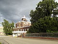
The Castle is one of Burgsteinfurt's most important buildings. Registered sightseeing tours are offered, but only a limited area is open for tourists because the castle is still inhabited by the noble family. A fortified castle was erected on a hill already dug up in the 10th century, but was destroyed in 1164 in a conflict with Ascheberg's nobility. The new facility contained an outer wall, the "Buddenturm," a tall tower for defence demolished in the 18th century, and the tower used for living with the Great hall. A rare construction are the two chapels built on top of each other and used as two-storeyed chapel. The auxiliary building ("Vorburg") of today in front of the main residence or "Hauptburg" comprises flats, garages, stables and farm buildings. In the middle there is a little Baroque "house" for a well, built by stonemason Johann Schrader.
From the castle and the market the former university building "Hohe Schule" can be seen. In order to oppose the activities of the Jesuits in Münster and "Münsterland," Count Arnold IV (1554–1606) founded a Calvinistic university, once the oldest university in Westphalia. Starting in 1591 the "Hohe Schule" offered courses in law, theology, medicine/physics, philosophy, history and rhetoric. Doctors’ degrees, however, were not awarded in Burgsteinfurt. The "Hohe Schule" was built in the Renaissance style and is crowned by two weather vanes that are marked with the crest of Count Arnold IV and his wife. Around the big tower runs a gallery, where people could make astronomical computations. At the beginning of the 19th century the "Hohe Schule" was closed. It was used then by French troops under Napoleonic rule, later on as the seat of a law court and as a prison.
From the "Hohe Schule" an alley branches off, the so-called Kautenstege, actually Kortenstege or "short way." At the beginning the old Geisthaus (House of the Holy Spirit) can be seen, the only surviving poorhouse of the city from the 15th century. In "Kautenstege" a memorial stone reminds the visitor of the Synagogue that once stood here and the Jewish citizens who were deported. The Synagogue was destroyed in November 1938. At the end of "Kautenstege" there is the Steinstrasse ("cobblestone street," in former times the only paved street in Burgsteinfurt); on the right side there is the old town hall, the starting point of the tour.
Education
[edit]
In Steinfurt there are a variety of schools and colleges, including two secondary schools, one of which is the "Gymnasium Arnoldinum," a descendant of the "Hohe Schule."
The engineering faculties of the University of Applied Sciences Münster (Fachhochschule Münster) are based in Steinfurt.
Transport
[edit]Train
[edit]Steinfurt-Burgsteinfurt station is located on the Münster–Enschede railway and has an hourly train service to Münster in one direction and to Enschede in the other direction.[4]
Buses
[edit]Bus lines connect Steinfurt to Rheine, Emsdetten and Coesfeld
Bicycle
[edit]Bicycle paths lead to Metelen, Rheine, Horstmar and Münster.
Twin towns – sister cities
[edit] Liedekerke, Belgium
 Neubukow, Germany
 Rijssen-Holten, Netherlands
Notable people
[edit]- Alexander Hegius (c. 1439–1498), humanist, priest and member of the Brothers of Common Life
- Johann Friedrich Böckelmann (1632–1681), jurist and professor
- Louis William Geldricus Ernest, Prince of Bentheim and Steinfurt (1756–1817), nobleman
- Ludwig Wilhelm, Prince of Bentheim and Steinfurt (1812–1890), nobleman, Royal Hanoverian and Prussian Lieutenant General
- Alexis, Prince of Bentheim and Steinfurt (1845–1919), nobleman and statesman
- Levin Ludwig Schücking (1878–1964), anglist and Shakespeare researcher
- Heinz Baumkötter (1912–2001), SS leader and concentration camp doctor
- Paul Gauselmann (born 1934), founder and chairman of the company's group of companies of the same name
- Jutta Richter (born 1955), author of children's and youth literature
- Bertram Engel (born 1957), drummer
- Mikael Forssell (born 1981), Finnish footballer
- Peter Elkmann (born 1981), racing driver
- Lena Wermelt (born 1990), footballer
- Jannine Weigel (born 2000), German-Thai singer, actress and model
Gallery
[edit]-
 Old Town Borghorst
 -
 St. Johanneskirche SELK
 -
 Speicherhaus in Wilmsberg
 -
 Urban Park Borghorst
 -
 BWS shopping Centre
 -
 Borghorst Synagogue Memorial
 -
 Castle moat
 -
 Bagno Concert Hall
 -
 Historical Old Town of Burgsteinfurt
 -
 Rolinck brewery
 -
 Steinfurt's bicycle station
 -
 Cinema Steinfurt
 -
 School of Economics
 -
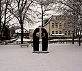
 The Sunken Town
 -
 Cycle race Steinfurt 2014


See also
[edit]- Steinfurter Bagno, a public park near Burgsteinfurt
References
[edit]- ^ Wahlergebnisse in NRW Kommunalwahlen 2020, Land Nordrhein-Westfalen, accessed 30 June 2021.
- ^ "Alle politisch selbständigen Gemeinden mit ausgewählten Merkmalen am 31.12.2023" (in German). Federal Statistical Office of Germany. 28 October 2024. Retrieved 16 November 2024.
- ^ "Steven Spielberg Film and Video Archive- Forced confrontation, cinema". Resources.ushmm.org. 1945-05-30. Retrieved 2014-04-14.
- ^ "Steinfurt-Burgsteinfurt station". NRW Rail Archive (in German). André Joost. Retrieved 18 January 2014.
- ^ "Städtepartnerschaften". steinfurt.de (in German). Steinfurt. Retrieved 2021-04-01.
External links
[edit]- Official website
 (in German)
 - Corpus juris of the Principality of Münster / Steinfurt, Anholt, Gemen (in German)
Towns and municipalities in Steinfurt (district) | ||
|---|---|---|
 | ||
| International | |
|---|---|
| National | |
| Geographic | |
| Other | |
Steinfurt
View on GrokipediaSteinfurt is a municipality and the administrative seat of the Steinfurt district in North Rhine-Westphalia, Germany.[1] Formed on January 1, 1975, by the merger of the independent towns of Burgsteinfurt and Borghorst, it encompasses two distinct urban centers with preserved historical cores.[2] The town has a population of 36,547 residents and spans an area of 111.67 square kilometers, yielding a density of approximately 327 inhabitants per square kilometer.[3][4] Located in the Münsterland region near the Dutch border, Steinfurt is defined by its medieval origins, including references to early settlements around 890 AD, and features prominent landmarks such as Burgsteinfurt Castle, a Renaissance-era residence, alongside old town avenues, mills, and remnants of knightly order structures.[5][6] Its economy blends agriculture with mid-sized industries, supported by proximity to larger cities like Münster.[7]
Geography
Location and administrative divisions
Steinfurt lies at geographical coordinates 52°09′N 7°21′E, with an average elevation of approximately 60 meters above sea level.[8][9] The town is situated in the northwestern portion of North Rhine-Westphalia, roughly 33 kilometers northwest of Münster and proximate to the Dutch border, within the Münsterland region.[10][7] As the administrative seat of the Steinfurt district (Kreis Steinfurt), Steinfurt serves as the central hub for the surrounding rural area in the Regierungsbezirk Münster.[6] The district encompasses diverse municipalities, with Steinfurt functioning as its primary urban center.[7] Internally, the town comprises two main districts: Burgsteinfurt and Borghorst, each preserving distinct historical cores that reflect their origins as separate municipalities prior to amalgamation.[6] Burgsteinfurt features the prominent castle complex, while Borghorst maintains its traditional old town layout, contributing to the town's dual-character structure.[6]Topography and climate
Steinfurt occupies the Westphalian lowlands, featuring predominantly flat to gently undulating terrain with average elevations of approximately 60 meters above sea level and limited relief variations reaching up to 70 meters over short distances.[11] [12] This landscape, shaped by glacial and fluvial processes, supports extensive drainage via rivers such as the Steinfurter Aa, which bisects the municipality and defines local hydrological features before merging with the Vechte downstream.[9] The region exhibits a temperate oceanic climate (Köppen Cfb), with annual average temperatures near 10°C, winter daily means around 2°C (January highs of 4°C and lows of 0°C), and summer peaks averaging 18°C (July highs of 22°C and lows of 13°C).[12] [13] Precipitation totals roughly 800–860 mm yearly, fairly uniform across seasons but with elevated winter maxima up to 53 mm monthly, fostering consistent moisture levels that mitigate drought but heighten flood susceptibility in low-elevation riverine zones during intense events. The mild conditions, combined with moderate humidity (rarely muggy) and prevailing westerly winds averaging 10–13 mph, influence soil moisture and evapotranspiration, directly affecting lowland ecological dynamics and water table stability.[12]Demographics and population trends
As of 31 December 2021, Steinfurt had a population of 35,392 residents, distributed across its main districts of Borghorst (19,657) and Burgsteinfurt (15,735), with a near-even gender split of 17,674 males and 17,718 females.[14] Estimates for 2024 place the figure at approximately 34,860, reflecting a modest annual growth rate of 0.99% between 2022 and 2024 based on official statistical extrapolations.[15] The 2022 census indicated that 84.2% of residents were born in Germany, with 3.9% born in other EU countries and 11.9% from non-EU origins, underscoring a predominantly native composition with limited foreign-born presence compared to urban centers in North Rhine-Westphalia.[15] Population dynamics in recent years show a natural decline offset by net positive migration. In 2021, there were 373 live births and 399 deaths, yielding a negative natural increase of 26 individuals, consistent with low fertility rates (around 1.4 children per woman in the broader district) and an aging demographic typical of rural German municipalities.[14] Inflows totaled 2,002 arrivals, outpacing outflows of 1,755 departures, for a net migration gain of 247, primarily internal domestic moves including 1,516 intra-city relocations; this pattern aligns with regional trends where migration sustains stability amid sub-replacement births and higher mortality among older cohorts.[14] The modern town emerged on 1 January 1975 from the merger of Borghorst and Burgsteinfurt, consolidating populations that had grown steadily from 19th-century bases through industrialization and post-World War II resettlement of ethnic German expellees from Eastern Europe, which boosted Westphalian towns like Steinfurt by 10-20% in the late 1940s and 1950s amid national reconstruction.[16] Since the merger, the population has expanded by roughly 15-20% to its current level, driven more by commuter inflows and family retention than explosive growth, with projections for the district indicating continued modest increases through 2030 via balanced migration rather than natural surplus. Religious composition reflects the region's historical Protestant-Catholic equilibrium, with Burgsteinfurt's Reformed heritage contrasting Münsterland's Catholic majority, though precise town-level figures remain dominated by these two confessions absent significant non-Christian minorities.[17]History
Early settlement and medieval origins
The earliest documented evidence of settlement in the Steinfurt area dates to circa 890 AD, when the "villa Seliun"—corresponding to the modern Bauerschaft Sellen—was recorded as a possession of Werden Abbey in the Ruhr region.[18] This reference indicates an agricultural estate amid the post-Carolingian reorganization of Saxon territories in Westphalia, where Frankish monastic institutions consolidated landholdings following the subjugation of local tribes under Charlemagne's campaigns in the late 8th century.[19] By the early 12th century, Steinfurt emerged as a fortified site, with the first explicit mention in 1129 of two noblemen identified as "de Steinvorde," likely denoting lords associated with a stone ford or crossing on the local river.[20] These figures, operating within the feudal framework of the Holy Roman Empire's Lower Rhenish-Westphalian territories, probably initiated construction of a moated castle to assert control over the flat, unprotected landscape, serving as a bulwark against regional rivalries and facilitating oversight of agrarian production.[20] The castle's ring-shaped design, adapted to watery environs without natural elevations, underscores pragmatic engineering responses to environmental constraints and the need for defensible manors in a landscape dotted with competing lordships.[21] The nascent settlement's economy centered on subsistence agriculture from surrounding farmsteads like Sellen, supplemented by rudimentary trade along prehistoric and early medieval routes traversing Westphalia's river valleys.[19] This base reflected broader causal patterns in medieval Europe, where fortified nuclei drew peasant labor and resources, enabling lords to extract rents and military service amid the fragmentation of Carolingian authority into localized power centers by the 11th century. No significant archaeological excavations have unearthed pre-12th-century urban structures at Steinfurt, suggesting organic growth from rural hamlets rather than imposed Roman or earlier continuity.[22]Rise and governance of the County of Steinfurt
The lordship of Steinfurt emerged in the 12th century around the fortified Burgsteinfurt, a water castle constructed near a ford on the Steinfurter Aa river north of Münster, serving as the core of a territory built on land ownership, bailiwick duties, and judicial authority held by the noble lords of Steinfurt.[23][19] The castle faced early destruction in 1164 by the lords of Ascheberg but was subsequently rebuilt, underscoring its strategic role in regional defenses and control over local trade routes.[19] By the 13th century, the settlement of Burgsteinfurt received urban privileges, formalized in 1347, which granted market rights and fostered economic ties through linen production and guilds established around 1500.[19] Dynastic consolidation advanced in 1421 when Everwin von Götterswick, linked to the County of Bentheim, married the heiress of Steinfurt, integrating the lordship into the Bentheim lineage and initiating a period of territorial linkage that persisted through personal unions from 1530 onward under the von Bentheim-Steinfurt counts.[23] To counter expansionist claims by the Bishopric of Münster, the counts in 1486 pledged the territory to Emperor Frederick III, receiving it back as an imperial fief; this culminated in 1495 when Maximilian I elevated Steinfurt to an immediate imperial county, granting Reichsunmittelbarkeit primarily over Burgsteinfurt town and its parish.[23][24] Conflicts with Münster persisted, involving legal disputes from the 14th century and culminating in the 1716 treaty, which affirmed the county's limited sovereignty while restricting its immediacy.[23][19] Governance emphasized feudal structures, with counts exercising high justice, advocacy over ecclesiastical properties like the Johanniterkommende established around 1190, and oversight of manorial obligations from vassals and freeholders.[19] By 1536, Burgsteinfurt achieved partial self-administration through elected councilors, balancing princely authority with burgher input on local ordinances and taxation, though ultimate feudal duties tied the county to imperial obligations.[19] Under rulers like Karl Paul Ernst von Bentheim-Steinfurt in the 18th century, administrative efforts included infrastructural enhancements, such as the Bagno park (1765–1775), reflecting a shift toward enlightened absolutism while maintaining traditional legal codes rooted in Westphalian customs.[19] The von Bentheim-Steinfurt line's rule until 1806 preserved the county's autonomy amid regional power struggles, prioritizing defensive fortifications and judicial consolidation over extensive expansion.[23]Integration into Prussia and modern developments
In 1806, during the Napoleonic reorganization of German territories, the County of Steinfurt was mediatized and annexed to the Grand Duchy of Berg on August 25, under the Confederation of the Rhine.[25] This marked the end of its sovereignty as an immediate imperial estate, with local governance subordinated to French-influenced Berg administration, including Steinfurt serving briefly as an arrondissement center.[25] Following the defeat of Napoleon, the Congress of Vienna in 1815 incorporated the territory into the Kingdom of Prussia as part of the new Province of Westphalia, where it remained under Prussian rule until 1918.[25] During the 19th century, Steinfurt experienced modest economic shifts within Prussian Westphalia, transitioning from feudal agrarian structures to proto-industrial activities, notably linen production that employed a significant portion of the rural workforce into the early 1800s.[26] Industrialization was limited compared to the nearby Ruhr region, with the local economy retaining a strong agricultural base supplemented by small-scale textile and consumer goods manufacturing, reflecting broader patterns in north-western Germany's rural proto-industry rather than heavy mechanization.[26] The population grew steadily, supported by Prussian administrative stability, though without major infrastructural upheavals until the late 1800s rail expansions connecting Steinfurt to Münster and beyond. The 20th century brought disruptions from the World Wars. During World War I, Steinfurt contributed manpower and resources to the German war effort as part of Westphalia, facing food shortages and economic strain typical of rural Prussian districts. World War II saw minimal direct bombing damage due to its non-industrial profile, but the region endured Allied advances; by war's end in 1945, Steinfurt fell into the British occupation zone, where locals were compelled to view documentary evidence of Nazi atrocities, fostering noted resentment toward occupation authorities.[27] Post-1945 reconstruction integrated Steinfurt into the newly formed state of North Rhine-Westphalia in 1946, under British military government, enabling participation in West Germany's Wirtschaftswunder through agricultural modernization and light industry growth. The 1975 territorial reform expanded the town by merging adjacent municipalities like Borghorst and Wilmsberg, elevating its status as administrative seat of the Steinfurt district with a population exceeding 34,000 by 1980.[28] Into the 21st century, Steinfurt has maintained stability as a district capital, emphasizing sustainable agriculture, commuter links to urban centers like Münster, and preservation of historical sites amid demographic steadiness around 35,000 residents as of 2020, without significant industrial or migratory upheavals.[29]Government and administration
Local governance structure
Steinfurt functions as a municipal corporation under the Gemeindeordnung for North Rhine-Westphalia, which establishes a dual structure of executive and legislative organs for self-governance. The hauptamtlicher Bürgermeister, elected directly by residents for a five-year term, serves as the chief executive, chairing the city council and directing the administration. The Stadtrat, comprising 40 members also elected for five years, holds legislative authority, including enacting statutes, approving the annual budget, and overseeing executive actions through committees.[30] The administration adopts a Vorstandsmodell organized into three primary pillars—general administration, technical services, and financial management—overseen by the Verwaltungsvorstand, which includes the mayor, a first deputy, a technical deputy, and the treasurer. This setup coordinates 68 specialized departments (Fachdienste) handling operational tasks, such as central services, green space maintenance, and road upkeep. Responsibilities encompass zoning and building permits under state building codes, delivery of essential services like waste management and public utilities, and coordination across the town's districts (Stadtteile), including Burgsteinfurt and Borghorst, each subdivided into three Bauerschaften for localized input.[31][32][33] Fiscal operations maintain autonomy within Germany's federal framework, with the municipality levying taxes such as property and trade taxes, supplemented by Länder grants and fees, to fund a budget exceeding €100 million annually as of recent audits. The council approves the budget, while the mayor executes it, subject to financial supervision by the Bezirksregierung Münster to ensure compliance with balanced budgeting principles. District-level coordination ensures equitable service distribution, with administrative units addressing infrastructure needs tailored to urban cores and rural peripheries.[34][35]Political composition and elections
In the municipal elections held on September 14, 2025, the Christian Democratic Union (CDU) achieved the strongest result in Steinfurt's city council (Stadtrat), maintaining its position as the leading party in this conservative-leaning rural district of North Rhine-Westphalia. The Alternative for Germany (AfD) secured entry into the council for the first time, reflecting localized expressions of voter dissatisfaction with mainstream parties on issues such as infrastructure maintenance and fiscal priorities, amid a national pattern of AfD advances in similar regions. Voter turnout for the council election stood at approximately 58 percent, higher than in some prior cycles and indicative of sustained local engagement post-reunification shifts toward greater political pluralism in western Germany.[36][37] The mayoral election in the same cycle proceeded to a runoff on September 28, 2025, between Michael Schell, backed by the CDU and Social Democratic Party (SPD), and Christian Franke, supported by the Greens (Grüne), Freie Wähler Steinfurt (FWS), and other local alliances. Franke won with 56.7 percent of the valid votes in the runoff, where turnout dropped to 43 percent, succeeding the previous administration amid debates over municipal funding for transport links and urban renewal projects. This outcome marked a departure from CDU-influenced leadership continuity, though the party's council dominance suggests ongoing conservative influence in budgetary and planning decisions.[38][39] Historical election trends in Steinfurt show stable CDU majorities since the 1990s, with voter preferences emphasizing practical governance over ideological extremes, though recent cycles have seen modest gains for protest-oriented lists tied to tangible concerns like regional connectivity and agricultural support. Pre-2025 data from 2020 indicated CDU at around 36 percent, Greens at 19 percent, and SPD at 18 percent, with the 2025 results preserving this hierarchical structure despite AfD's breakthrough.[40][37]Economy
Agricultural and industrial base
The agricultural sector in Steinfurt, embedded in the livestock-intensive Münsterland region, emphasizes animal husbandry over crop monocultures, with feed crops like silage maize and grains supporting dairy, pork, and poultry production. Kreis Steinfurt hosts over 3,100 holdings across approximately 120,000 hectares of utilized agricultural land, reflecting a dense farm structure that has sustained rural employment despite structural consolidation. Livestock inventories include 862,412 pigs, 212,409 cattle, and 94,519 poultry, underscoring the district's role in regional meat and dairy output, though numbers have fluctuated with market pressures and regulatory shifts toward sustainability.[41][41] Agriculture employs roughly 1,718 workers, or 1% of the district's total social insurance-obligated workforce as of June 2023, highlighting its foundational yet modest contribution amid broader economic diversification.[42] Complementing agriculture, industry—particularly manufacturing—anchors Steinfurt's economic base through mid-sized clusters in metalworking, plastics, vehicle components, and agro-food processing, leveraging proximity to the A1 motorway and Dutch border for logistics integration. Manufacturing sustains 40,636 jobs (24% of total employment) as of mid-2023, with over 1,200 firms across 197 subsectors generating €11.89 billion in annual turnover and employing more than 45,000 workers in key operations like trailer production (e.g., Schmitz Cargobull) and ready-meal manufacturing (e.g., Apetito).[42][42] Logistics amplifies industrial viability, with over 400 specialized firms handling warehousing and road freight (94% of goods movement), capitalizing on cross-border trade corridors to mitigate rural-industrial imbalances.[42] This sectoral interplay fosters resilience, though growth trails national averages due to input cost volatility and export dependencies.[42]Recent developments in energy and infrastructure
In response to the intermittency of renewable energy sources under Germany's Energiewende policy, Kreis Steinfurt developed the Steinfurter Flexkraftwerke concept in 2015–2016, integrating Power-to-Gas technology to convert surplus electricity from wind, solar, and biomass into hydrogen via electrolysis for storage and later use in power generation, heating, and transport.[43] The initiative targets 2 GW of renewable capacity by 2050 to achieve regional energy self-sufficiency and climate neutrality, with demonstration phases planned from 2017–2021 and full scaling by 2030, addressing grid stability by repurposing approximately 173 MW of existing wind capacity and injecting hydrogen or biomethane into gas networks.[44] Early production figures indicated 1,358 GWh of renewable electricity generated in 2015 against a 2,793 GWh demand, underscoring the need for flexible storage to balance supply fluctuations.[44] Building on this, the district has advanced hydrogen-focused projects since 2020, positioning Steinfurt as a hydrogen region by leveraging up to 50 local renewable installations for green hydrogen production to power fuel cells in mobility and industry, with applications including a local logistics firm's hydrogen fueling station.[45] These efforts align with the district's Masterplan 100% Klimaschutz, aiming for 100% renewable energy by 2050 through wind, solar, and biomass, though hydrogen production costs—estimated at 3.3–7.1 €/kg in initial analyses—highlight economic hurdles amid Energiewende's broader challenges of high infrastructure expenses and persistent fossil fuel imports for backup.[44][46] Infrastructure upgrades supporting these energy shifts include sector-coupling investments, such as linking existing gas grids to electrolyzers, funded partly through regional and federal programs like HyTrustPlus (2014–2016), which emphasized private capital and crowdfunding over subsidies to mitigate profit-driven distortions in energy markets.[43] While EU funds have bolstered North Rhine-Westphalia's renewable integration via the Connecting Europe Facility, specific allocations to Steinfurt prioritize practical grid enhancements over expansive new builds, reflecting critiques of Energiewende's escalating system costs—reaching billions annually nationwide—potentially prioritizing sector profits through EEG levies over reliable, low-emission outcomes.[47][48]Culture and heritage
Historical monuments and architecture
The moated castle of Burgsteinfurt, first documented in 1129, represents the oldest water castle complex in Westphalia and served as the seat of the Counts of Steinfurt.[49] Constructed as a ring-shaped structure on an artificial island in the Steinfurter Aa river, it features an upper castle, lower castle, and adjacent castle mill, surrounded by protective moats.[49] The castle endured destruction in 1164 by the lords of Ascheberg but was rebuilt under the patronage of Archbishop Reinald von Dassel of Cologne for the lords Ludolf and Rudolf von Stenvorde.[49] A distinctive double chapel, with upper and lower levels connected by an opening, functioned until the 14th century, reflecting early medieval defensive and religious integration.[49] Architectural evolution includes later reconstructions, such as after damages in the Thirty Years' War, with major rebuilding between 1706 and 1715 incorporating Baroque elements alongside its medieval core.[21] Nearby Renaissance structures complement the castle, including the Countess Walburg House from 1559, noted for its two-story bay window with ornate early Renaissance decoration.[50] The Old Town Hall, erected in 1561, exemplifies Renaissance gable design symbolizing the prosperity of Burgsteinfurt's burghers, though it sustained severe damage during World War II and subsequent restoration.[51] The Große Kirche (Great Church) in Burgsteinfurt, with origins in the mid-12th century, preserves Romanesque elements in its northern transept and underwent Gothic expansions, originally dedicated to Saint Willibrord.[52] This Protestant church anchors the historic old town, which retains timber-framed houses and medieval layout remnants.[53] Post-World War II efforts focused on repairing war damages to these structures, including the castle complex, to preserve their historical integrity amid the town's occupation in the British zone.[51] Remaining elements of the medieval town walls and gates, such as defensive features tied to the Knights of St. John settlement from 1244, underscore Steinfurt's fortified past.[49]Cultural institutions and events
The Stadtmuseum Burgsteinfurt, established from a municipal collection in 1911 and expanded through private donations and endowments, houses exhibits on local history, crafts, and daily life in the region, serving as a key repository for Westphalian cultural artifacts.[54] Kunsthaus Kloster Gravenhorst, located in a historic Cistercian monastery within Steinfurt's municipality, functions as a center for contemporary art with rotating exhibitions, artist residencies, and interdisciplinary projects including light, sound, and garden installations that integrate modern expressions with the site's medieval architecture.[55] Annual events emphasize traditional markets and festivals rooted in agrarian and communal customs, such as the Brunnenfest in Borghorst district, held since at least the early 20th century to inaugurate the seasonal market cycle with local music, food stalls, and artisan displays.[56][57] The Schweinmarkt and Erntedankmarkt feature regional produce, livestock, and harvest-themed activities, continuing Westphalian practices of communal trade and thanksgiving amid contemporary economic shifts.[58] Other recurring gatherings include the Wein- und Braufest, showcasing local beverages and brewing heritage, and kunSTvoll, an art market promoting handmade crafts, which collectively sustain cultural continuity by blending historical rituals with accessible public participation.[57][58] These institutions and events prioritize preservation of indigenous customs over external influences, fostering community identity in a modernizing context.[56]Education
Primary and secondary schools
Steinfurt's primary education consists of six Grundschulen serving pupils from ages 6 to 10, including the Bismarckschule, Grundschule Dumte, Heinrich-Neuy-Schule, Marienschule, and Regenbogenschule, with an additional Schulverbund for coordinated offerings across sites.[59] These schools emphasize foundational skills in literacy, numeracy, and social development, with class sizes averaging around 23 pupils statewide, though local data reflect demographic stability in enrollment amid North Rhine-Westphalia's gradual population shifts.[60] Secondary education follows Germany's stratified model, with one Gymnasium—the Städtisches Gymnasium Borghorst—providing academic preparation for the Abitur university entrance qualification to 624 pupils in the 2024/25 school year; it operates as a gebundenes Ganztagsgymnasium with integrated all-day programs.[61] [62] Two Realschulen cater to intermediate qualifications oriented toward vocational training or further technical education: the Realschule am Buchenberg, enrolling 646 students in 2024/25 with bilingual and music tracks, and the Städtische Realschule Burgsteinfurt, emphasizing music (including brass classes) and economics, which graduated 56 pupils in June 2025.[63] [64] Hauptschulen, focused on basic vocational skills, are confined to Burgsteinfurt and diminishing in number due to statewide reforms favoring Gesamtschulen for integrated secondary tracks.[65] Pupil transitions from primary to secondary levels mirror district patterns, with approximately 4,111 students advancing to Sekundarstufe I forms in the Kreis Steinfurt for 2022/23, indicating rigorous selection based on primary assessments without widespread evidence of grade inflation. Enrollment remains steady, supporting vocational orientations in non-academic tracks, though specific state exam pass rates for Steinfurt schools are not publicly disaggregated beyond compliance with NRW standards.[66]Higher education and vocational training
The Steinfurt campus of Münster University of Applied Sciences (FH Münster) serves as the primary local institution for higher education, specializing in engineering disciplines such as chemical engineering, mechanical engineering, electrical engineering, and environmental engineering. Established as part of FH Münster, which enrolls approximately 15,000 students across its sites, the Steinfurt location emphasizes practical, industry-oriented programs including bachelor's degrees in biomedical engineering and master's programs in related fields.[67][68] In October 2025, groundbreaking occurred for new laboratory and institute buildings at the Technologie-Campus Steinfurt, enhancing research and teaching infrastructure for these departments with modern workshops and facilities spanning 6,500 square meters.[69] Residents also access the nearby University of Münster (Westfälische Wilhelms-Universität Münster), a full research university located about 30 kilometers away, offering broader academic programs in humanities, sciences, and medicine, though Steinfurt's focus remains on applied sciences. FH Münster's programs integrate theoretical coursework with practical projects, aligning with regional industries in manufacturing and technology.[70] Vocational training in Steinfurt follows Germany's dual education system, combining on-the-job apprenticeships in companies with classroom instruction at local Berufsschulen. The Technische Schulen Steinfurt provide Berufsschule programs for trades including mechanics, electrical installation, and industrial engineering, preparing apprentices for certifications after 2-3.5 years of training.[71] Similarly, the Hermann-Emanuel-Berufskolleg offers vocational schooling for sectors like agriculture and logistics, with sites in Steinfurt supporting dual Ausbildungen that emphasize hands-on skills relevant to the Münsterland region's economy.[72] The Kreishandwerkerschaft Steinfurt-Warendorf coordinates craft apprenticeships, focusing on skilled trades such as metalworking and construction, with high completion rates typical of North Rhine-Westphalia's system, where over 50% of starters finish their training, leading to direct employment in local firms.[73] These programs link closely to regional employers in agriculture, mechanics, and energy sectors, facilitating seamless transitions to the workforce.[74]Transport and connectivity
Rail and road networks
Steinfurt-Burgsteinfurt station serves as the main rail hub for Steinfurt, located on the Münster–Enschede railway line, a 64 km single-track, non-electrified route extending from Münster in Germany to Enschede in the Netherlands. Regional trains designated as RB64, operated by Deutsche Bahn Regio, run hourly in both directions, providing direct connections with stops at intermediate stations including Gronau and Ochtrup.[75][76] Travel times average 44 minutes to Enschede and under 30 minutes to Münster Hauptbahnhof, facilitating cross-border commuter and regional travel.[77] The town's road connectivity relies on proximity to the Bundesautobahn 1 (A1), Germany's principal north-south motorway spanning 749 km from Schleswig-Holstein to Saarland, with access via interchanges near Dülmen approximately 15 km east. Bundesstraße 54 (B54), a federal highway oriented north-south, links Steinfurt directly to Münster (25 km south) and the Dutch border at Gronau (15 km north), handling significant regional traffic volumes.[78] The Münster–Enschede line also supports limited freight operations, historically including connections to nearby routes like Ahaus, aiding goods movement in the Münsterland region despite its primary focus on passengers.Public buses and cycling infrastructure
Public bus services in Steinfurt fall under the coordination of the Kreis Steinfurt, which serves as the public transport authority and develops the local transport plan, with operations managed by regional providers including Veelker GmbH for select routes. [79] Local and regional lines, such as R75 from Reckenfeld and R80 from Rheine, converge at Steinfurt-Burgsteinfurt station, enabling transfers to rail services on the Münster–Enschede line.[80] [81] These routes typically run hourly during peak hours, with reduced frequency off-peak, and adhere to integrated timetables for seamless bus-rail connections at the main station.[82] The 2022 Integrated Mobility Concept for Steinfurt notes that public transport handles a limited share of intra-city travel, primarily serving commuting to the central station and surrounding districts like Borghorst. Cycling infrastructure in Steinfurt connects to the broader Münsterland network, featuring dedicated paths along routes like the RadBahn Münsterland, which spans from Coesfeld to Rheine and passes through the town for recreational and commuter use.[83] Local features include cycle streets, such as repurposed farm roads granting cyclists priority over motor vehicles to enhance safety on shared access paths.[84] The Kreis Steinfurt's cycling concept emphasizes linkages between bike routes and public transport hubs, including secure parking at the Bahnhof to support multimodal trips. In the district, urban areas account for 86% of traffic accidents (2,258 of 2,632 total in recent data), prompting infrastructure upgrades like the Velorouten system for faster, safer daily cycling corridors such as the Triangel and RadBahn alignments. [85]International relations
Twin towns and partnerships
Steinfurt maintains twin town partnerships with Rijssen-Holten in the Netherlands, established in 1974, and Liedekerke in Belgium, formalized in June 1975 following initial contacts in 1973.[86][87] These agreements emphasize cultural and economic cooperation, including youth group exchanges and club activities, with municipal grants available to support cross-border initiatives.[86] The city also holds a domestic partnership with Neubukow in Mecklenburg-Vorpommern, Germany, initiated on 24 October 1990 to aid post-reunification recovery through cultural exchanges and mutual support.[88][86] Joint activities under these ties focus on practical exchanges rather than broader geopolitical aims, reflecting post-World War II efforts toward regional reconciliation formalized by European municipal councils.[86]Notable individuals
Historical figures
Arnold II (c. 1497–1553), Count of Bentheim-Steinfurt from 1498, assumed control over the County of Bentheim in 1530 following the extinction of its ruling line, thereby uniting Bentheim and Steinfurt under a single administration.[89] He designated Burgsteinfurt as a key residence, fortifying the castle complex as the administrative center for the expanded territories. In 1544, Arnold II initiated the Reformation in both counties, establishing Lutheranism as the dominant faith and aligning the region with Protestant reforms during a period of religious upheaval.[90] This governance contributed to the consolidation of power and ecclesiastical stability in northwestern Westphalia.[91]
Arnold III (1554–1606), grandson of Arnold II and Count from 1562, further expanded the house's influence through his 1577 marriage to Magdalena of Limburg, acquiring jure uxoris rights to that county alongside Bentheim, Tecklenburg, and Steinfurt. His rule oversaw the Protestant consolidation post-Reformation, maintaining the county's autonomy amid the lead-up to the Thirty Years' War.[92]