

Community hub
Recent from talks
Contribute something
Nothing was collected or created yet.
Bad Vilbel
View on WikipediaBad Vilbel (German pronunciation: [baːt ˈfɪlbl̩] ⓘ) is a spa town in Hesse (Hessen), Germany, famous for its many mineral water springs. Bad Vilbel is the largest town in the Wetteraukreis district and part of the Frankfurt Rhein-Main urban area with its city center being located 8 km northeast of downtown Frankfurt am Main at the banks of the river Nidda.
Key Information


History
[edit]Bad Vilbel was founded in 774 (first written document) but much older artefacts were found in the area. In 1848 during railway works, a Roman villa was unearthed with a Thermae and a Mosaic. A replica of this mosaic is presented in a modern exhibition in the spa gardens.
20th Century
[edit]| Year | Pop. | ±% |
|---|---|---|
| 1998 | 28,509 | — |
| 2000 | 29,716 | +4.2% |
| 2002 | 30,290 | +1.9% |
| 2004 | 30,905 | +2.0% |
| 2006 | 31,348 | +1.4% |
| 2008 | 31,456 | +0.3% |
| 2010 | 31,822 | +1.2% |
| 2014 | 32,584 | +2.4% |
| 2016 | 33,458 | +2.7% |
| 2017 | 33,745 | +0.9% |
| As of 31 December of each year Source: HSL | ||
The town Vilbel got the label "Bad" (spa) in 1948 for its numerous mineral springs. The health spa operations stopped in the 1960s but the mineral water industry connected more springs of the Wetterau by pipelines to the bottling plant of Hassia in Bad Vilbel. The hessian government reform formed 1971/72 Bad Vilbel (with Heilsberg), Dortelweil, Gronau and Massenheim to the new city Bad Vilbel. Since 1997 great areas have been developed for living and business, like the residential area of Dortelweil-West or the commercial park Quellenpark between Bad Vilbel, Massenheim and Dortelweil.
-
 fountain near the old town-hall
 -
 old town-hall
 -
 Cultural center, old mill
 -
 Friedrich-Karl-Sprudel
 -
 Hassia mineral spring
 -
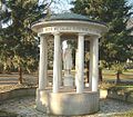
 exhibition of Roman mosaic
 -
 shopping & business center in Dortelweil


Mayor
[edit]The Current Mayor is Sebastian Wysocki (born 1985) of the Christian Democratic Union of Germany (CDU). He was elected in March 2022.
| Name | Party | Time |
|---|---|---|
| Thomas Stöhr | CDU | 2004-2022 |
| Günther Biwer | CDU | 1980-2004 |
| Erich Glück | SPD | 1968-1980 |
| Georgh Muth | SPD | 1955-1968 |
| Kurt Moosdorf | SPD | 1946-1955 |
| Karl Bruder jun. | SPD | 1945-1946 |
| Joseph Seitz | NSDAP | 1933-1945 |
| Kurt Moosdorf | SPD | 1928-1933 |
| Bernhard Rechthien | SPD | 1919-1928 |
Transport
[edit]Bad Vilbel has four railway stations (Bad Vilbel, Bad Vilbel Süd and Dortelweil on the Main–Weser Railway and Gronau on the Vilbel–Glauburg-Stockheim railway) served by Frankfurt's local transport network (S-Bahn line S 6 and RE Line 34). It has access to the A661 autobahn and the highway B3.
Furthermore, Bad Vilbel has several local bus lines called Vilbus connecting the city center to the neighborhoods. Additional connections to Frankfurt am Main with the local Frankfurt bus line 30 and with Offenbach am Main with the fast bus line X97.
Hessentag 2025 in Bad Vilbel
[edit]The 62nd Hessentag, the largest and oldest state festival in Germany, was held in Bad Vilbel from 13 to 22 June 2025, under the motto "Wir bringen Hessen auf die Bühne" ("We bring Hesse onto the stage"). Originally planned for 2020 but cancelled due to the COVID‑19 pandemic, Bad Vilbel hosted the event for the first time in 2025.[3]
Over the ten days, the festival featured more than 1,500 free events and a total of 13,000 program points across cultural, educational, musical and sporting offerings.[4][5] Visitors enjoyed concerts by artists such as Nina Chuba, Mando Diao and Ski Aggu in the Stadtwerke‑Arena and other venues.[6]
The festival's "Treffpunkt Hessen" forum served as the central showpiece, where the Hessian parliament, political parties, associations and government agencies presented themselves. Highlights included an exhibition on climate, nature and regional products ("Der Natur auf der Spur").[7] On 14 June the "Day of Volunteer Emergency Responders" included formal recognition by the Minister‑President Boris Rhein.[8]
Bad Vilbel attracted roughly one million visitors across the ten days, according to official figures.[9]
Twin towns – sister cities
[edit]Bad Vilbel is twinned with:[10]
 Brotterode-Trusetal, Germany (1990)
 Eldoret, Kenya (1982)
 Glossop, England, United Kingdom (1987)
 Moulins, France (1990)
See also
[edit]- Bad Vilbel station
- English electronic music duo Autechre released a song entitled Second Bad Vilbel on their EP Anvil Vapre. The title derives from the town's twinning with Glossop, an area the group would have passed en route to Sheffield, from their homes in Rochdale.
- Asteroid (340980) Bad Vilbel discovered 2007 by Uwe Süßenberger .
Notable people
[edit]Born in Bad Vilbel
[edit]
- Wilhelm von Finck (1848–1924), banker and co-founder of the Alliance Insurance
- Friedel Lutz (1939-2023), former national soccer player
- Kathrin Anders (born 1982), German politician (The Greens), Members of the Landtag of Hesse since 2019
Linked to Bad Vilbel
[edit]- Klaus Havenstein (1922–1998), actor and television presenter, from 1990 to 1992 director of the Castle Festival Bad Vilbel
- Jürgen Sparwasser (born 1948), is a retired German football player and later briefly a football manager living in Bad Vilbel. He gained fame as East Germany football player at the 1974 FIFA World Cup finals, where he scored the winning goal in a politically prestigious match against West Germany
References
[edit]- ^ "Ergebnisse der letzten Direktwahl aller hessischen Landkreise und Gemeinden" (XLS) (in German). Hessisches Statistisches Landesamt. 5 September 2022.
- ^ "Alle politisch selbständigen Gemeinden mit ausgewählten Merkmalen am 31.12.2023" (in German). Federal Statistical Office of Germany. 28 October 2024. Retrieved 16 November 2024.
- ^ "Hessentag in Bad Vilbel: Start, Dauer und Programm-Highlights". HessenToday (in German). 2025-04-30. Retrieved 2025-08-05.
- ^ "Hessentagsprogramm für Bad Vilbel vorgestellt". hessen.de (in German). 2025-04-30. Retrieved 2025-08-05.
- ^ ""Ein grandioser Hessentag"". Stadt Bad Vilbel (in German). Retrieved 2025-08-05.
- ^ "Programm für den Hessentag in Bad Vilbel steht – über 13.000 Programmpunkte". www.fnp.de (in German). 2025-05-02. Retrieved 2025-08-05.
- ^ "Jetzt geht's los: Der Hessentag 2025 startet in Bad Vilbel!". Osthessen|News (in German). 2025-06-13. Retrieved 2025-08-05.
- ^ "Danke, Bad Vilbel! Und auf ein Wiedersehen 2026 in Fulda!". hessen.de (in German). Retrieved 2025-08-05.
- ^ "Hessentag 2025 | Hessischer Landtag". hessischer-landtag.de (in German). 2025-06-16. Retrieved 2025-08-05.
- ^ "Städtepartnerschaften". bad-vilbel.de (in German). Bad Vilbel. Archived from the original on 2021-04-10. Retrieved 2021-02-04.
This article needs additional citations for verification. (December 2014) |
External links
[edit]- Official site (in German)
Towns and municipalities in Wetteraukreis district | ||
|---|---|---|
 | ||
| International | |
|---|---|
| National | |
| Geographic | |
| Other | |
Bad Vilbel
View on GrokipediaGeography
Location and setting
Bad Vilbel is situated in the Wetteraukreis district of the German state of Hesse, approximately 8 km northeast of Frankfurt am Main, and forms part of the broader Frankfurt Rhein-Main metropolitan region. The town occupies geographic coordinates of 50°10′41″N 8°44′10″E.[13][14] The municipality encompasses a total area of 25.68 km² and is positioned along the Nidda River, which flows through its territory and shapes much of the local hydrology. Elevations within Bad Vilbel range from 109 m above sea level at the river's lowest points to around 200 m in higher areas, contributing to a varied topography that includes gentle slopes and lowlands. The surrounding landscape features the Nidda floodplain, which provides fertile alluvial soils, as well as expansive fruit-growing fields characteristic of the Wetterau region, known for traditional orchards (Streuobstwiesen) producing apples, pears, cherries, and other fruits. Additionally, the town includes the Stadtwald (town forest), offering wooded areas for recreation, and the Kurpark (spa park), a landscaped green space centered around the town's historic mineral springs.[13][9][15][16] Bad Vilbel experiences a temperate oceanic climate (Köppen classification Cfb), typical across much of Hesse, with mild winters and cool summers moderated by its proximity to the Rhine-Main area. The average annual temperature is approximately 10°C, while annual precipitation averages between 600 and 700 mm, distributed relatively evenly throughout the year with slightly higher amounts in summer months. This climatic pattern supports the region's agricultural activities, including the fruit cultivation in surrounding fields.[17][18]Administrative divisions
Bad Vilbel is administratively divided into five districts: the core town (Kernstadt) of Bad Vilbel and the surrounding areas of Heilsberg, Dortelweil, Gronau, and Massenheim. These divisions form the basis of the municipality's spatial organization, with each district maintaining distinct local identities while integrated into the overall urban structure.[19] The current configuration resulted from historical incorporations that expanded the town's boundaries. Heilsberg was incorporated as a district in 1948, Gronau followed in 1971, and Dortelweil and Massenheim were merged in 1972 as part of Hesse's territorial reforms aimed at municipal consolidation. These events unified previously independent communities under Bad Vilbel's administration, enhancing its regional coherence without altering the districts' semi-autonomous character in community matters.[19] Situated in the Wetteraukreis district of the state of Hesse, Bad Vilbel's administrative divisions shape local governance by delineating responsibilities for services such as infrastructure maintenance and urban planning across the districts. This structure ensures balanced representation in the municipal council, where district-specific needs inform policy decisions. The 1970s incorporations notably boosted the town's population, contributing to its growth as a mid-sized urban center.[19]History
Early and medieval periods
The area of Bad Vilbel shows evidence of Roman settlement from the 1st to 3rd centuries AD, part of the broader Roman occupation of the Wetterau region along the Nidda River. Archaeological findings include a villa rustica with associated thermae, uncovered in 1848 during construction of the Main-Weser Railway near the modern Südbahnhof. The site featured a well-preserved bath complex dating to around 180 AD, including a notable Oceanus mosaic floor measuring approximately 7 by 4.75 meters, depicting the sea god Oceanus surrounded by marine creatures and mythical beings; this is the largest and most significant Roman mosaic discovered in Hesse and is now housed in the Hessisches Landesmuseum Darmstadt. These remains indicate an agricultural estate with luxurious amenities, reflecting the economic prosperity of Roman rural villas in the region.[20][21][22] The first documented reference to the settlement dates to 774 AD, when it appears as "Felwila" (meaning "place by the old wall with willows") in a donation charter by the noblewoman Liutswind to Lorsch Abbey, located in the Niddagau administrative district. This early medieval record, preserved in the abbey's codex, marks Vilbel as a Frankish-era estate amid Christianization efforts in the region, with further mentions as "villa" in 780. By the 8th century, the area had transitioned from Roman abandonment around 260 AD to Frankish agricultural communities, with scattered farms consolidating into a village structure.[23][21][20] During the high and late medieval periods, Bad Vilbel developed as a feudal village under shifting lordships, benefiting from its strategic position along the Nidda River trade routes connecting Frankfurt and the Wetterau. In 1128, Walter von Vilbel is recorded as a royal ministerialis, highlighting local noble families' roles in regional administration. Following the extinction of the Münzenberg counts in 1255, the territory was partitioned, with five-sixths falling to the Lords of Falkenstein and one-sixth to Hanau, later evolving into shared control between Hanau and the Electorate of Mainz by the 14th century, with the Nidda serving as a jurisdictional boundary. A key event was the introduction of a bridge toll in 1342 to fund Nidda crossings, underscoring Vilbel's growing importance in overland commerce, particularly after Frankfurt's 1240 trade fair privileges stimulated regional exchange; agricultural produce and early mineral water resources contributed to this economic role. The village's medieval growth included the construction of a water castle around 1120 by local knights, symbolizing feudal defense and control.[20][21][23]Modern period
In the 19th century, Bad Vilbel experienced significant industrial growth centered on its mineral springs, with the establishment of bottling operations that capitalized on the water's therapeutic properties. The opening of the Frankfurt-Vilbel-Friedberg railway in 1850 facilitated this expansion, enabling efficient distribution and contributing to a population increase to approximately 2,800 residents. A pivotal development occurred in 1864 with the founding of Hassia Sprudel by Johann Philipp Wilhelm Hinkel, marking the onset of a thriving mineral water industry that became a cornerstone of the local economy. By the late 19th century, spa infrastructure emerged, exemplified by the construction of the Kurhaus "Vilbeler Höhe" in 1897 by Carl Brod, which promoted the town as a health destination. Official recognition as a spa town followed in 1925, with state-approved healing springs, and culminated in 1936 when Vilbel was designated a health resort and spa ("Fremdenverkehrsgemeinde und Heilbad").[24][24][24] The early 20th century brought challenges from the World Wars, which disrupted growth but caused relatively contained damage compared to larger urban centers. During World War I (1914–1918), the town served as a quartering site for troops and hosted a lazaretto for the wounded, straining local resources. World War II inflicted more direct harm, particularly through an air raid on March 2, 1944, which destroyed 12% of the core town's buildings and killed around 50 civilians, contributing to overall wartime losses of 62 civilian deaths, 437 fallen or missing soldiers, and 128 partially or fully destroyed structures. Despite these impacts, the mineral springs infrastructure remained largely intact, preserving the basis for postwar revival.[24][25][21] Postwar recovery accelerated in the late 1940s, with the Hessian state granting the "Bad" prefix in 1948 to affirm its spa status, coinciding with 29 active mineral water businesses that underscored economic resilience. Territorial expansions during the 1971–1972 regional reforms incorporated the neighboring districts of Gronau, Dortelweil, and Massenheim, boosting the population to 17,866 by 1970 and integrating new agricultural and residential areas. The 1950s through 1980s saw robust economic rebound, driven by the mineral water sector's expansion—reaching a production peak of about 500 million bottles annually by 1975—alongside mergers like the 1982 formation of Hassia & Luisen Mineralquellen, which solidified Bad Vilbel's role in regional industry.[24][24][24] In recent decades, Bad Vilbel has undergone suburbanization as a northern commuter hub of the Frankfurt Rhein-Main metropolitan area, located just 8 kilometers from Frankfurt's city center, attracting residential development in areas like Dortelweil-West and Quellenpark to accommodate growing populations and businesses. This proximity has enhanced its appeal for high-tech and service sectors while maintaining its spa heritage. The town hosted the 62nd Hessentag state festival from June 13 to 22, 2025, drawing approximately 950,000 visitors and highlighting its cultural vibrancy.[20]Demographics
Population statistics
As of December 31, 2023, Bad Vilbel had a population of 35,619 inhabitants.[26] By December 31, 2024, this figure had increased to 35,961.[26] As of June 30, 2025, the population was 35,947.[27] With a municipal area of 25.7 km², the population density stands at 1,401 inhabitants per km² as of the end of 2024 and 1,399 inhabitants per km² as of June 30, 2025.[26][27] The population of Bad Vilbel has shown consistent growth over the past century and a half, expanding from approximately 5,000 residents around 1900 to a post-merger surge in the 1970s, followed by steady increases driven by its appeal as a suburban location. This development reflects broader regional patterns, including commuting ties to nearby Frankfurt.[2] Key census data illustrate this trajectory:| Year | Population |
|---|---|
| 1871 | 3,052 |
| 1939 | 6,257 |
| 1950 | 8,600 |
| 2023 | 35,619 |