")
Community hub
Recent from talks
Contribute something
Nothing was collected or created yet.
Spring (hydrology)
View on Wikipedia


A spring is a natural exit point at which groundwater emerges from an aquifer and flows across the ground surface as surface water. It is a component of the hydrosphere, as well as a part of the water cycle. Springs have long been important for humans as a source of fresh water, especially in arid regions which have relatively little annual rainfall.
Springs are driven out onto the surface by various natural forces, such as gravity and hydrostatic pressure. A spring produced by the emergence of geothermally heated groundwater is known as a hot spring. The yield of spring water varies widely from a volumetric flow rate of nearly zero to more than 14,000 litres per second (490 cu ft/s) for the biggest springs.[1]
Formation
[edit]
Springs are formed when groundwater flows onto the surface. This typically happens when the water table reaches above the surface level, or if the terrain depresses sharply. Springs may also be formed as a result of karst topography, aquifers or volcanic activity. Springs have also been observed on the ocean floor, spewing warmer, low-salinity water directly into the ocean.[2]
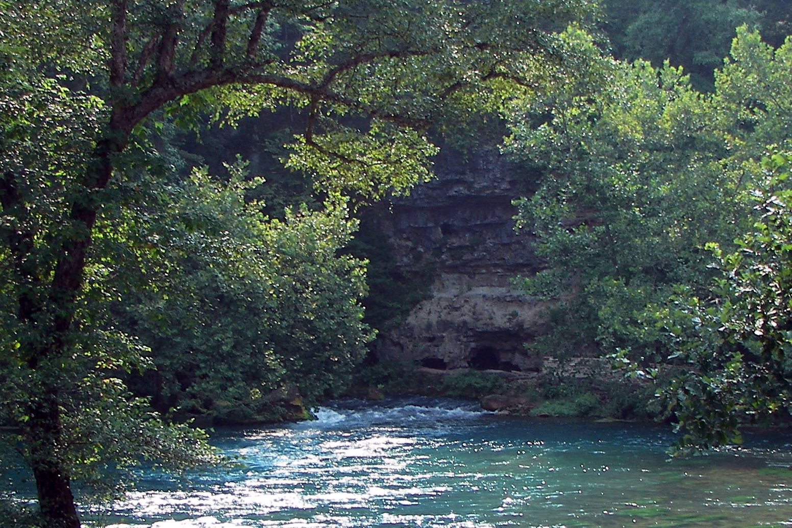
Springs formed as a result of karst topography create karst springs, in which ground water travels through a network of cracks and fissures—openings ranging from intergranular spaces to large caves, later emerging in a spring.
The forcing of the spring to the surface can be the result of a confined aquifer in which the recharge area of the spring water table rests at a higher elevation than that of the outlet. Spring water forced to the surface by elevated sources are artesian wells. This is possible even if the outlet is in the form of a 300-foot-deep (91 m) cave. In this case the cave is used like a hose by the higher elevated recharge area of groundwater to exit through the lower elevation opening.
Non-artesian springs may simply flow from a higher elevation through the earth to a lower elevation and exit in the form of a spring, using the ground like a drainage pipe. Still other springs are the result of pressure from an underground source in the earth, in the form of volcanic or magma activity. The result can be water at elevated temperature and pressure, i.e. hot springs and geysers.

The action of the groundwater continually dissolves permeable bedrock such as limestone and dolomite, creating vast cave systems.[3]
Types
[edit]
- Depression springs occur along a depression, such as the bottom of alluvial valleys, basins, or valleys made of highly permeable materials.[4]
- Contact springs, which occur along the side of a hill or mountain, are created when the groundwater is underlaid by an impermeable layer of rock or soil known as an aquiclude or aquifuge[4]
- Fracture, or joint occur when groundwater running along an impermeable layer of rock meets a crack (fracture) or joint in the rock.[4]
- Tubular springs occur when groundwater flows from circular fissures such as those found in caverns (solution tubular springs) or lava tubular springs found in lava tube caves.[5][6]
- Artesian springs typically occur at the lowest point in a given area. An artesian spring is created when the pressure for the groundwater becomes greater than the pressure from the atmosphere. In this case the water is pushed straight up out of the ground.[7]
- Wonky holes are freshwater submarine exit points for coral and sediment-covered, sediment-filled old river channels.[8]
- Karst springs occur as outflows of groundwater that are part of a karst hydrological system.[9]
- Thermal springs are heated by geothermal activity; they have a water temperature significantly higher than the mean air temperature of the surrounding area.[10] Geysers are a type of hot spring where steam is created underground by trapped superheated groundwater resulting in recurring eruptions of hot water and steam.[6]
- Carbonated springs, such as Soda Springs Geyser, are springs that emit naturally occurring carbonated water, due to dissolved carbon dioxide in the water content. They are sometimes called boiling springs or bubbling springs.[11]
- "Gushette springs pour from cliff faces"[12]
- Helocrene springs are diffuse that sustain marshlands with groundwater.[12]
Flow
[edit]Spring discharge, or resurgence, is determined by the spring's recharge basin. Factors that affect the recharge include the size of the area in which groundwater is captured, the amount of precipitation, the size of capture points, and the size of the spring outlet. Water may leak into the underground system from many sources including permeable earth, sinkholes, and losing streams. In some cases entire creeks seemingly disappear as the water sinks into the ground via the stream bed. Grand Gulf State Park in Missouri is an example of an entire creek vanishing into the groundwater system. The water emerges 9 miles (14 km) away, forming some of the discharge of Mammoth Spring in Arkansas. Human activity may also affect a spring's discharge—withdrawal of groundwater reduces the water pressure in an aquifer, decreasing the volume of flow.[13]
Classification
[edit]
Springs fall into three general classifications: perennial (springs that flow constantly during the year); intermittent (temporary springs that are active after rainfall, or during certain seasonal changes); and periodic (as in geysers that vent and erupt at regular or irregular intervals).[5]
Springs are often classified by the volume of the water they discharge. The largest springs are called "first-magnitude", defined as springs that discharge water at a rate of at least 2800 liters or 100 cubic feet (2.8 m3) of water per second. Some locations contain many first-magnitude springs, such as Florida where there are at least 27 known to be that size; the Missouri and Arkansas Ozarks, which contain 10[14][13] known of first-magnitude; and 11[15] more in the Thousand Springs area along the Snake River in Idaho. The scale for spring flow is as follows:
| Magnitude | Flow (ft3/s, gal/min, pint/min) | Flow (L/s) |
|---|---|---|
| 1st magnitude | > 100 ft3/s | 2800 L/s |
| 2nd magnitude | 10 to 100 ft3/s | 280 to 2800 L/s |
| 3rd magnitude | 1 to 10 ft3/s | 28 to 280 L/s |
| 4th magnitude | 100 US gal/min to 1 ft3/s (448 US gal/min) | 6.3 to 28 L/s |
| 5th magnitude | 10 to 100 gal/min | 0.63 to 6.3 L/s |
| 6th magnitude | 1 to 10 gal/min | 63 to 630 mL/s |
| 7th magnitude | 1 pint to 1 gal/min | 8 to 63 mL/s |
| 8th magnitude | Less than 1 pint/min | 8 mL/s |
| 0 magnitude | no flow (sites of past/historic flow) |
Water content
[edit]
Minerals become dissolved in the water as it moves through the underground rocks. This mineral content is measured as total dissolved solids (TDS). This may give the water flavor and even carbon dioxide bubbles, depending on the nature of the geology through which it passes. This is why spring water is often bottled and sold as mineral water, although the term is often the subject of deceptive advertising. Mineral water contains no less than 250 parts per million (ppm) of tds. Springs that contain significant amounts of minerals are sometimes called 'mineral springs'. (Springs without such mineral content, meanwhile, are sometimes distinguished as 'sweet springs'.) Springs that contain large amounts of dissolved sodium salts, mostly sodium carbonate, are called 'soda springs'. Many resorts have developed around mineral springs and are known as spa towns. Mineral springs are alleged to have healing properties. Soaking in them is said to result in the absorption of the minerals from the water. Some springs contain arsenic levels that exceed the 10 ppb World Health Organization (WHO) standard for drinking water.[16] Where such springs feed rivers they can also raise the arsenic levels in the rivers above WHO limits.[16]
Water from springs is usually clear. However, some springs may be colored by the minerals that are dissolved in the water. For instance, water heavy with iron or tannins will have an orange color.[3]
In parts of the United States a stream carrying the outflow of a spring to a nearby primary stream may be called a spring branch, spring creek, or run. Groundwater tends to maintain a relatively long-term average temperature of its aquifer; so flow from a spring may be cooler than other sources on a summer day, but remain unfrozen in the winter. The cool water of a spring and its branch may harbor species such as certain trout that are otherwise ill-suited to a warmer local climate.
Types of mineral springs
[edit]
- Sulfur springs contain a high level of dissolved sulfur or hydrogen sulfide in the water. Historically they have been used to alleviate the symptoms of arthritis and other inflammatory diseases.[17][18]
- Borax springs[19]
- Gypsum springs[5]
- Saline springs[20]
- Iron springs (chalybeate spring)[5]
- Radium springs (or radioactive springs) have a detectable level of radiation produced by the natural radioactive decay process[21][6]
Uses
[edit]
Springs have been used for a variety of human needs - including drinking water, domestic water supply, irrigation, mills, navigation, and electricity generation. Modern uses include recreational activities such as fishing, swimming, and floating; therapy; water for livestock; fish hatcheries; and supply for bottled mineral water or bottled spring water. Springs have taken on a kind of mythic quality in that some people falsely believe that springs are always healthy sources of drinking water. They may or may not be. One must take a comprehensive water quality test to know how to use a spring appropriately, whether for a mineral bath or drinking water. Springs that are managed as spas will already have such a test.
Drinking water
[edit]Springs are often used as sources for bottled water.[22] When purchasing bottled water labeled as spring water one can often find the water test for that spring on the website of the company selling it.
Irrigation
[edit]Springs have been used as sources of water for gravity-fed irrigation of crops.[23] Indigenous people of the American Southwest built spring-fed acequias that directed water to fields through canals. The Spanish missionaries later used this method.[24][25]
Sacred springs
[edit]
A sacred spring, or holy well, is a small body of water emerging from underground and revered in some religious context: Christian and/or pagan and/or other.[26][27] The lore and mythology of ancient Greece was replete with sacred and storied springs—notably, the Corycian, Pierian and Castalian springs. In medieval Europe, pagan sacred sites frequently became Christianized as holy wells. The term "holy well" is commonly employed to refer to any water source of limited size (i.e., not a lake or river, but including pools and natural springs and seeps), which has some significance in local folklore. This can take the form of a particular name, an associated legend, the attribution of healing qualities to the water through the numinous presence of its guardian spirit or of a Christian saint, or a ceremony or ritual centered on the well site. Christian legends often recount how the action of a saint caused a spring's water to flow - a familiar theme, especially in the hagiography of Celtic saints.[citation needed]
Thermal springs
[edit]
The geothermally heated groundwater that flows from thermal springs is greater than human body temperature, usually in the range of 45–50 °C (113–122 °F), but they can be hotter.[6] Those springs with water cooler than body temperature but warmer than air temperature are sometimes referred to as warm springs.[28]
Bathing and balneotherapy
[edit]Hot springs or geothermal springs have been used for balneotherapy, bathing, and relaxation for thousands of years. Because of the folklore surrounding hot springs and their claimed medical value, some have become tourist destinations and locations of physical rehabilitation centers.[29][30]

Geothermal energy
[edit]Hot springs have been used as a heat source for thousands of years. In the 20th century, they became a renewable resource of geothermal energy for heating homes and buildings.[29] The city of Beppu, Japan contains 2,217 hot spring well heads that provide the city with hot water.[31] Hot springs have also been used as a source of sustainable energy for greenhouse cultivation and the growing of crops and flowers.[32]
Terminology
[edit]Cultural representations
[edit]Springs have been represented in culture through art, mythology, and folklore throughout history. The Fountain of Youth is a mythical spring which was said to restore youth to anyone who drank from it.[34] It has been claimed that the fountain is located in St. Augustine, Florida, and was discovered by Juan Ponce de León in 1513. However, it has not demonstrated the power to restore youth, and most historians dispute the veracity of Ponce de León's discovery.[35][36]
Pythia, also known as the Oracle at Delphi was the high priestess of the Temple of Apollo. She delivered prophesies in a frenzied state of divine possession that were "induced by vapours rising from a chasm in the rock". It is believed that the vapors were emitted from the Kerna spring at Delphi.[37][38]
The Greek myth of Narcissus describes a young man who fell in love with his reflection in the still pool of a spring. Narcissus gazed into "an unmuddied spring, silvery from its glittering waters, which neither shepherds nor she-goats grazing on the mountain nor any other cattle had touched, which neither bird nor beast nor branch fallen from a tree had disturbed." (Ovid)[39]
The early 20th century American photographer, James Reuel Smith created a comprehensive series of photographs documenting the historical springs of New York City before they were capped by the city after the advent of the municipal water system.[40] Smith later photographed springs in Europe leading to his book, Springs and Wells in Greek and Roman Literature, Their Legends and Locations (1922).[41]
The 19th century Japanese artists Utagawa Hiroshige and Utagawa Toyokuni III created a series of wood-block prints, Two Artists Tour the Seven Hot Springs (Sōhitsu shichitō meguri) in 1854.[42]
The Chinese city Jinan is known as "a City of Springs" (Chinese: 泉城), because of its 72 spring attractions and numerous micro spring holes spread over the city centre.[43][44]
-
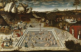
 John William Waterhouse Echo And Narcissus, 1903
 -
 Lucas Cranach, Der Jungbrunnen (Fountain of Youth), 1546
 -
 Sokokura, from the series Two Artists Tour the Seven Hot Springs (Sōhitsu shichitō meguri) by Utagawa Toyokuni III and Utagawa Hiroshige, 1854
 -
 Oracle of Delphi, red-figure kylix, Kodros Painter, depicting Pythia with a cup presumably holding water from a spring, 440–430 BC
 -
 A Woman Drinks at the Carmen Spring, on West 175th Street and Amsterdam Avenue, New York City, by James Reuel Smith, c. 1897–1902
 -
 Belqais Spring Garden, Charam, Iran, is a Persian garden where all the water sources are springs located within it.

.jpg)


Handscroll,_ink_and_colors_on_paper,_28.4_x_93.2_cm_National_Palace_Museum,_Taipei.jpg)
See also
[edit]References
[edit]- ^ "Te Waikoropupū Springs". New Zealand Department of Conservation. Retrieved 6 February 2022.
- ^ "Springs and the Water Cycle". www.usgs.gov. Retrieved 14 November 2021.
- ^ a b "Springs - The Water Cycle, from USGS Water-Science School". ga.water.usgs.gov. Archived from the original on 9 May 2009.
- ^ a b c "Well Design and Spring Development". National Engineering Handbook. January 2010. Archived from the original on 21 October 2020.
- ^ a b c d Bryan, Kirk (November 1919). "Classification of Springs". The Journal of Geology. 27 (7): 522–561. Bibcode:1919JG.....27..522B. doi:10.1086/622677. JSTOR 30058415. S2CID 129936821. Retrieved 14 November 2021.
- ^ a b c d Poehls, D.J.; Smith, Gregory J. (2011). Encyclopedic Dictionary of Hydrogeology. Elsevier Science. ISBN 9780080925271. Retrieved 15 November 2021.
- ^ Westbrook, Cherie J. (2017). "Heads Above Water: The Inside Story of the Edwards Aquifer Recovery Implementation Program by Robert L. Gulley". Great Plains Research. 27 (2): 143. doi:10.1353/gpr.2017.0022. ISSN 2334-2463. S2CID 133972692.
- ^ Horstman, Mark (18 May 2006). "Wonky Holes". Catalyst transcript. Australian Broadcasting Corporation. Archived from the original on 19 April 2019. Retrieved 17 April 2019.
- ^ Whittow, John (1984). Dictionary of Physical Geography. London: Penguin. p. 291. ISBN 0-14-051094-X.
- ^ "Spring | water". Britannica. Archived from the original on 25 July 2020.
- ^ Cinta Pinzaru, Simona; Ardeleanu, Mircea; Brezestean, Ioana; Nekvapil, Fran; Venter, Monica M. (2019). "Biogeochemical specificity of adjacent natural carbonated spring waters from Swiss Alps promptly revealed by SERS and Raman technology". Analytical Methods; Royal Society of Chemistry. 11 (6). Retrieved 15 November 2021.
- ^ a b c "Springs of New Jersey" (PDF).
- ^ a b "USGS Surface-Water Data for Missouri". waterdata.usgs.gov. Archived from the original on 4 March 2018. Retrieved 3 July 2011.
- ^ Vineyard and Fender, 1982. p. 12
- ^ "Thousand Springs Research Project". 9 May 2006. Archived from the original on 12 December 2012 – via University of Idaho.
- ^ a b Li, Chaoliu; Kang, Shichang; Chen, Pengfei; Zhang, Qianggong; Mi, Jue; Gao, Shaopeng; Sillanpää, Mika (2014). "Geothermal spring causes arsenic contamination in river waters of the southern Tibetan Plateau, China". Environmental Earth Sciences. 71 (9): 4143–4148. Bibcode:2014EES....71.4143L. doi:10.1007/s12665-013-2804-2. S2CID 128479153.
- ^ Pearl, Richard Howard; Ringrose, Charles D.; Zacharakis, Ted G. (1982). "Geothermal Resource Assessment of Hot Sulphur Springs, Colorado". Colorado Geological Survey. Retrieved 14 November 2021.
- ^ Gemici, Burcu; Wallace, John L. "Encyclopedia of Inland Waters". Retrieved 15 November 2021.
- ^ Zakrajsek, John R. (2006). Identifying Systematic Behaviors in Borax Lake Geothermal Springs, Southeast Oregon. University of Idaho. Retrieved 14 November 2021.
- ^ Bischoff, Matt C. (2018). Touring California and Nevada hot springs. Guilford, Connecticut: Falcon Guides. ISBN 9781493029112. Retrieved 14 November 2021.
- ^ Leonard, Robert B.; Janzer, Victor J. (July–August 1978). "Natural radioactivity in geothermal waters, Alhambra Hot Springs and nearby areas, Jefferson County, Montana" (PDF). Journal of Research of the U.S. Geological Survey. 6 (4). Retrieved 14 November 2021.
- ^ Royte, Elizabeth (2011). Bottlemania: Big Business, Local Springs, and the Battle Over America's Drinking Water. Bloomsbury Publishing. ISBN 978-1596913721. Retrieved 14 November 2021.
- ^ Clement, Christopher Ohm; Moseley, Michael E. (1991). "The Spring-Fed Irrigation System of Carrizal, Peru: A Case Study of the Hypothesis of Agrarian Collapse". Journal of Field Archaeology. 18 (4): 425–443. doi:10.1179/009346991791549059.
- ^ "Acequias and River Systems". Retrieved 15 November 2021.
- ^ Romero, Simon (13 July 2021). "Drought Hits the Southwest, and New Mexico's Canals Run Dry". The New York Times. Retrieved 15 November 2021.
- ^ Ray, Celeste (2011). "The Sacred and the Body Politic at Ireland's Holy Wells". International Social Science Journal. 62 (205/206): 271–85. doi:10.1111/issj.12000.
- ^ Byrne, Garreth (2002). "Holy Wells in Britain and Ireland". Contemporary Review. 280 (1636): 295 – via EBSCOhost.
- ^ Pentecost, Allan; Jones, B.; Renault, R.W. (2003). "What is a hot spring?". Canadian Journal of Earth Sciences. 40 (11): 1443–1446. Bibcode:2003CaJES..40.1443P. doi:10.1139/e03-083. Retrieved 15 November 2021.
- ^ a b van Tubergen, A (1 March 2002). "A brief history of spa therapy". Annals of the Rheumatic Diseases. 61 (3): 273–275. doi:10.1136/ard.61.3.273. PMC 1754027. PMID 11830439.
- ^ "A History of Geothermal Energy in America". U.S. Department of Energy Efficiency and Renewable Energy. Retrieved 30 October 2020.
- ^ Holtz, Michael (9 March 2018). "Japan builds a head of steam for an alternative to nuclear". Christian Science Monitor. Retrieved 17 November 2021.
- ^ "Case Studies in Hot Spring Use for Sustainable Energy" (PDF). Oita Prefectural Government. Retrieved 17 November 2021.
- ^ a b c d "Springs characteristics".
- ^ Sowers, Lloyd (25 October 2021). "Water from St. Pete's famed Fountain of Youth contained high levels of lithium". FOX 13 News. Retrieved 11 November 2021.
- ^ Connolly, Patrick (5 November 2020). "St. Augustine Fountain of Youth may be Florida's oldest attraction". orlandosentinel.com. Retrieved 11 November 2021.
- ^ Shaer, Matthew (June 2013). "Ponce De Leon Never Searched for the Fountain of Youth". Smithsonian Magazine. Retrieved 11 November 2021.
- ^ Broad, William J. (19 March 2002). "For Delphic Oracle, Fumes and Visions". The New York Times. Retrieved 13 November 2021.
- ^ Hale, John R.; de Boer, Jelle Zeilinga; Chanton, Jeffrey P.; Spiller, Henry A. (August 2003). "Questioning the Delphic Oracle". Scientific American. 289 (2): 66–73. Bibcode:2003SciAm.289b..66H. doi:10.1038/scientificamerican0803-66. JSTOR 26060404. PMID 12884540. Retrieved 13 November 2021.
- ^ Nelson, Max (April–May 2000). "Narcissus: Myth and Magic". The Classical Journal. 95 (4): 363–389. JSTOR 3298150. Retrieved 13 November 2021.
- ^ "James Reuel Smith springs and wells photograph collection 1893–1902 – Brooklyn collection". New York Historical Society digital collection. Retrieved 13 November 2021.
- ^ Smith, James Reuel (1922). Springs and Wells in Greek and Roman Literature. New York and London: G.P. Putnam's Sons. Retrieved 13 November 2021.
- ^ "Sokokura, from the series Two Artists Tour the Seven Hot Springs (Sōhitsu shichitō meguri)". Fine Arts Museum of San Francisco. Retrieved 13 November 2021.
- ^ "Overview - Jinan, a City of Springs". english.jinan.gov.cn. Retrieved 20 July 2022.
- ^ "Jinan: a City of Springs". The World of Chinese. Retrieved 20 July 2022.
Further reading
[edit]- LaMoreaux, Philip E.; Tanner, Judy T, eds. (2001), Springs and bottled water of the world: Ancient history, source, occurrence, quality and use, Berlin, Heidelberg, New York: Springer-Verlag, ISBN 3-540-61841-4
- Springs of Missouri, Vineyard and Feder, Missouri Department of Natural Resources, Division of Geology and Land Survey in cooperation with U.S. Geological Survey and Missouri Department of Conservation, 1982
- Cohen, Stan (Revised 1981 edition), Springs of the Virginias: A Pictorial History, Charleston, West Virginia: Quarrier Press.
External links
[edit]| International | |
|---|---|
| National | |
| Other | |
Spring (hydrology)
View on GrokipediaFormation and Geology
Geological Processes
A spring is defined as a natural point where groundwater emerges onto the Earth's surface, typically due to the intersection of an aquifer with the land surface or the release of pressurized water through geological conduits.[1] This emergence occurs when geologic structures allow stored groundwater to flow under the influence of gravity or hydrostatic pressure, often at points of topographic low or structural weakness.[1] Central to spring formation are aquifers—permeable subsurface layers of rock or sediment that store and transmit groundwater—and aquitards, which are low-permeability layers that confine or redirect flow.[9] Hydrostatic pressure gradients develop when water recharges an aquifer, creating a head that exceeds the elevation of the surface outlet; this pressure forces water upward through fractures or dissolution channels until it discharges.[10] In unconfined aquifers, springs form simply where the water table meets a sloping land surface, allowing gravity-driven seepage.[11] Cross-sectional views of such systems typically illustrate a layered subsurface: an upper unsaturated zone overlying a saturated aquifer bounded below by an aquitard, with the water table curving downward from recharge areas to discharge points like valley walls, where erosion exposes the aquifer.[12] One primary geological process is karst dissolution, prevalent in soluble carbonate rocks like limestone and dolomite, where slightly acidic rainwater percolates through soil, dissolving minerals along joints and bedding planes to enlarge conduits over millennia.[9] This creates high-permeability networks that concentrate groundwater flow and lead to vigorous spring discharge at cave mouths or sinkhole margins.[13] The Mammoth Cave system in Kentucky exemplifies this, formed within Mississippian-age limestones through progressive dissolution by vadose and phreatic waters, resulting in extensive passages and associated springs that emerge along the Green River.[13] Faulting and fracturing represent another key mechanism, where tectonic activity displaces rock layers, juxtaposing permeable aquifers against impermeable barriers and creating preferential flow paths for groundwater.[10] Fault zones act as hydraulic conduits or barriers, channeling water under pressure to the surface, particularly in regions of active or ancient tectonics like the Basin and Range Province.[14] For instance, in the Great Basin, springs discharge along fault scarps where fractured carbonates intersect the valley floor, facilitating rapid ascent from deep aquifers.[14] Seepage from perched water tables also contributes to spring formation, occurring when a low-permeability layer, such as clay or silt, impedes downward infiltration above the main aquifer, creating a localized saturated zone.[11] If this perched table intersects a hillside or valley slope, groundwater seeps out as diffuse springs, often in areas with heterogeneous geology like glacial till overlays.[15] In cross-section, this appears as a shallow, lens-shaped saturated pocket perched atop an aquitard, draining laterally where topography breaches it.[11]Types by Origin
Springs are classified by their geological origins, which determine how groundwater emerges at the surface through specific structural and hydrological mechanisms. This categorization highlights variations in aquifer confinement, permeability, and tectonic influences that control discharge pathways. Gravity springs emerge under unconfined conditions where the water table intersects the land surface, allowing groundwater to flow downhill from elevated recharge areas without significant pressure.[16] These springs, also known as descending or depression springs, form when percolated water encounters an impermeable layer and moves laterally until it reaches a topographic low point, such as a valley or hillside.[17] They are common in areas with gently sloping terrain and porous overburden, where hydrostatic pressure drives the flow. Artesian springs arise from confined aquifers under positive pressure from overlying impermeable layers, causing water to rise and flow naturally at the surface without pumping, similar to flowing artesian wells.[18] This pressurized discharge occurs where recharge from higher elevations builds hydraulic head in the aquifer, often along fault lines or basin margins that breach the confining strata.[19] A prominent example is the Edwards Aquifer in Texas, where artesian conditions produce major outflows like San Marcos Springs, comprising over 200 individual vents that discharge from the karstic limestone aquifer along the Balcones Fault Zone.[20] Fracture and fault springs develop along cracks, joints, or tectonic faults in otherwise low-permeability rocks, where permeable fracture zones or fault planes serve as conduits for groundwater movement and emergence.[10] Faults can act as barriers or pathways that focus flow, particularly in mountainous or tectonically active regions, by offsetting aquifers and creating preferential discharge sites.[21] These springs are prevalent in hard rock terrains, such as granites or schists, where fracturing enhances secondary porosity. Karst springs originate from soluble rock formations like limestone, where dissolution creates extensive underground networks of caves and conduits that channel high volumes of groundwater to the surface.[22] The geological process involves chemical weathering that enlarges fractures into karst features, leading to concentrated outflows at basin edges or swallow holes. An illustrative case is the Aach Spring in Germany, the resurgence point of the Danube River's karst system, where water travels underground for about 11.7 km before emerging as the country's largest spring.[23] Seep springs involve diffuse, low-velocity discharge through unconsolidated sediments or soil layers, where shallow groundwater percolates slowly over a broad area without a distinct orifice.[24] These form in fine-grained materials like alluvium or colluvium overlying semi-permeable strata, resulting in saturated zones rather than channeled flow. In the Edwards Plateau of Texas, seeps are widespread along the margins of the Edwards-Trinity Aquifer, emerging from fractured limestones in low-relief areas and contrasting with the more focused artesian discharges of the main Edwards Aquifer.[25]Hydrological Properties
Flow and Discharge
The discharge of a spring refers to the volume of water emerging from the spring per unit time, typically measured in cubic meters per second (m³/s) or liters per second (L/s), representing the rate at which groundwater exits the aquifer through the spring outlet. This outflow is a direct manifestation of the aquifer's hydraulic properties and serves as a key indicator of the spring's hydrological health and resource potential. Discharge varies widely among springs, from small seeps yielding less than 1 L/s to large karst systems exceeding 10 m³/s, influencing their utility for water supply and ecosystem support. Several factors govern the flow and discharge of springs, primarily driven by aquifer recharge rates, which depend on precipitation infiltration and surface water contributions to the groundwater system. Seasonal variations in precipitation can lead to fluctuations, with higher discharge during wet periods due to increased recharge and lower during dry seasons from reduced input. Evaporation from the spring pool and surrounding area reduces effective outflow, particularly in arid regions, while barometric pressure changes can induce minor pressure head variations in the aquifer, affecting discharge on short timescales. Additionally, the geological structure of the aquifer, such as fracture networks, can influence flow paths and thus modulate discharge responses to these factors. Measuring spring discharge employs several established techniques to quantify flow accurately. Weir methods involve constructing a low barrier across the spring channel to divert flow over a notched plate, where discharge is calculated from the water height using empirical formulas like the Francis equation for rectangular weirs. Tracer dilution techniques inject a known concentration of dye or salt upstream and measure its dilution at the outlet to estimate flow volume, ideal for irregular or submerged outlets. Stage-discharge rating curves are developed by correlating water level (stage) measurements with simultaneous discharge data over time, allowing continuous estimation from gauged levels via sensors. These methods ensure reliable data for monitoring and modeling, with selection based on site accessibility and flow characteristics. Spring discharge exhibits significant variability, distinguishing between baseflow— the steady, sustained output from aquifer storage during normal conditions—and peak flows that surge during storms due to rapid recharge and pressure transmission through the aquifer. This variability is often modeled using Darcy's Law, which describes groundwater flow as proportional to the hydraulic gradient:where is discharge, is hydraulic conductivity, is the cross-sectional area of flow, and is the hydraulic gradient. In karst springs like Comal Spring in Texas, discharge can fluctuate dramatically, from near 0 m³/s during extreme droughts to over 100 m³/s during heavy rainfall events, with a historical average of about 8 m³/s, reflecting rapid conduit flow and vulnerability to drought or contamination.[26] Such variability underscores the need for adaptive management in karst systems, where historical records show long-term declines linked to regional groundwater overuse.