

Community hub
Recent from talks
Contribute something
Nothing was collected or created yet.
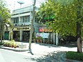
Dusit district
View on WikipediaThis article needs additional citations for verification. (September 2018) |
Dusit (Thai: ดุสิต, pronounced [dù(ʔ).sìt]) is one of the 50 districts (khet) of Bangkok, Thailand.
Key Information


The district is the administrative centre of the kingdom, as both the National Assembly and Dusit Palace are in the district, as are several ministries. It is connected to Rattanakosin Island by Ratchadamnoen Avenue (literally, 'royal way for travelling').
Neighbouring districts are, clockwise from north, Bang Sue, Phaya Thai, Ratchathewi, Pathum Wan, Pom Prap Sattru Phai, Phra Nakhon, and across the Chao Phraya River, Bang Phlat.
History
[edit]
The district was established by King Chulalongkorn, who wanted to escape the confines of Rattanakosin Island.[2] The king began with the construction of a new palace compound called the Dusit Palace in 1890s, slowly adding many new residences and mansions into its grounds. This included the Vimanmek Mansion which was constructed in 1900 completely out of teak, and was used as a royal palace for a short time, but was abandoned in 1908. Reconstructed in 1992, it was a major tourist attraction until its closure in 2018. The Amphorn Sathan Residential Hall was completed in 1906, and became the main residential palace of the king. The pathway connecting the Grand Palace to Dusit Palace eventually became Ratchadamnoen Avenue.
The construction of both Dusit Palace and Ratchadamnoen Avenue allowed and encouraged the expansion of Bangkok outside its city walls and the traditional confines of the Rattanakosin area. The palace expanded Bangkok northwards, while the avenue accommodated further growth. The avenue extended from the palace, starting in front of the Ananta Samakhom Throne Hall and the Royal Plaza southwards along the Makawan Rangsant and Phanfah Lielas Bridges then westward across the Phanbipob Liela Bridge, then south again long the Sanam Luang to the Grand Palace.
The Chitralada Royal Villa was built by King Vajiravudh (Rama VI), and was a residence of King Bhumibol Adulyadej. The large park around the palace was used by the king for agricultural research.
In September 2025, there was a road collapse in the Dusit district with a major sinkhole on Samsen Road between the Samsen Police Station and Vajira Hospital.
Buildings
[edit]Important buildings in the district include Ananta Samakhom Throne Hall, which was another former residence of King Chulalongkorn, and was later used as the first parliament building. It was built 1907–1915 by the Italian architects, Annibale Rigotti and Mario Tamagno. Next to the throne hall is the Amphorn Sathan Residential Hall, the official residence of the current monarch King Vajiralongkorn.
Next to the building is Suan Amporn Park, and across the street Dusit Zoo, the first zoo in Thailand (moved to Pathum Thani since the end of September 2018). The vast space in front of Ananta Samakom Throne Hall is the Royal Plaza. At the middle of the plaza is the equestrian statue of King Chulalongkorn. Various events are held in Suan Amporn Park and Royal Plaza. Yearly events include commencements of many universities in Bangkok, and the Red Cross Fair which takes place for nine days from the end of March to the first week of April.
Important government buildings such as the Government House and Phitsanulok Mansion are also in Dusit. Wasukri Pier is the pier to board and store royal barges, which sail in Thailand's Royal Barge Procession. Near the pier is the National Library of Thailand. Additionally, it is also home to several military camps: 1st Cavalry Regiment, King's Guard; 4th Cavalry Division, King's Guard; 1st Field Artillery Battalion, King's Guard; Air Defense Artillery Division; Department of Army Transportation; Army Ordnance Department; Army Ordnance Learning Center; Command And General Staff College; and some parts of Royal Thai Air Force (RTAF) such as the Directorate of Aeronautical Engineering. For this reason, Dusit has long been known politically as the "Military Zone".[3]
Since 1932 the National Assembly has been situated somewhere within the district. From 1932 to 1974 the legislature met at the Ananta Samakhom Throne Hall. From 1974 the legislature moved to a purposefully built Parliament House (next to the Dusit Palace complex) and met there until 2018. Then it was moved again to a new building named the Sappaya-Sapasathan in the Kiakkai neighbourhood in the north of the district.
Several other palaces have been converted into facilities for other purposes. Chan Kasem Palace was initially built for the crown prince by King Rama V, but was never used by King Rama VI and later became the office of the Ministry of Education. Suan Sunandha Palace was built for the queen, consorts, princes and princesses, but is now home to Suan Sunandha Rajabhat University.
The most famous Buddhist temple of the district is Wat Benchamabophit, built by Prince Naris as the royal temple of King Chulalongkorn.

Transport
[edit]Train
[edit]The Bang Sue MRT Station of the MRT is a short distance outside Dusit District at its extreme northeast corner, in Bang Sue District.
The Yommarat Railway Halt of the SRT is on the border of Dusit and Ratchathewi Districts.
The Sam Sen Railway Station of the SRT is on the border of Dusit and Phaya Thai Districts.
Water taxis
[edit]Dusit District Chao Phraya Express Boat piers are Thewet Pier, Payap Pier, Irrigation Dept. Pier, Kheaw Khai Ka Pier, and Kiak Kai Pier.
Administration
[edit]The district is divided into five sub-districts (khwaeng):
| 1. | Dusit | ดุสิต | |
| 2. | Wachiraphayaban | วชิรพยาบาล | |
| 3. | Suan Chitlada | สวนจิตรลดา | |
| 4. | Si Yaek Maha Nak | สี่แยกมหานาค | |
| 5. | Thanon Nakhon Chai Si | ถนนนครไชยศรี |
Gallery
[edit]-
 Equestrian statue of King Chulalongkorn and Royal Plaza in front of Ananta Samakhom Throne Hall
 -
 Uthong Nai Road beside Ananta Samakhom Throne Hall
 -
 Sam Sen Railway Station view toward Hua Lamphong (right is Dusit, left is Phaya Thai)
 -
 Chamai Maruchet Bridge, crossing Khlong Prem Prachakon in front of Government House
 -
 Wat Benchamabophit or Marble Temple
 -
 Sanam Sua Pa, beside Royal Plaza, Bureau of the Royal Household office
 -
 Veterinary hospital on Rama V Road opposite Chitralada Royal Villa
 -
 Ministry of Education
 -
 Vajira Hospital, public hospital
 -
 Sappaya-Sapasathan the new national legislative building
 -
 Wat Kaew Fah Chulamanee the temple by the Chao Phraya River
 -
 Chao Phraya Express Boat passes through Kheaw Khai Ka Pier, a pier between Irrigation Dept. and Kiak Kai Piers

.jpg)
.jpg)


.jpg)


_%E0%B8%A7%E0%B8%B1%E0%B8%94%E0%B9%81%E0%B8%81%E0%B9%89%E0%B8%A7%E0%B8%9F%E0%B9%89%E0%B8%B2%E0%B8%88%E0%B8%B8%E0%B8%AC%E0%B8%B2%E0%B8%A1%E0%B8%93%E0%B8%B5_%E0%B9%80%E0%B8%82%E0%B8%95%E0%B8%94%E0%B8%B8%E0%B8%AA%E0%B8%B4%E0%B8%95_%E0%B8%81%E0%B8%A3%E0%B8%B8%E0%B8%87%E0%B9%80%E0%B8%97%E0%B8%9E%E0%B8%A1%E0%B8%AB%E0%B8%B2%E0%B8%99%E0%B8%84%E0%B8%A3_Wat_Kaew_Fa_Chula_Manee,Bangkok_(6).jpg)

References
[edit]- ^ "Population and House Report for Year 2017". Department of Provincial Administration, Ministry of Internal Affairs. Retrieved 2018-04-01. (Search page)
- ^ Holland, Michael. "The Dusit District". Bangkok For Visitors. Retrieved 2025-09-28.
- ^ "19 กันยา 2549: 11 ปี "ทหารแตงโม" "ตำรวจมะเขือเทศ" ยังไม่หมดไทย". BBC Thai (in Thai). 2017-09-22.
External links
[edit]- Dusit District(Thai)
.svg)
Dusit district
View on GrokipediaGeography and Environment
Location and Boundaries
Dusit district occupies a central position in Bangkok, Thailand, within the Bangkok Metropolitan Administration, which comprises 50 districts. Positioned in the northern-central zone of the city, it centers around coordinates approximately 13.78°N, 100.52°E. The district functions as Thailand's primary administrative hub, encompassing royal palaces, the National Assembly, and government offices.[4] The western boundary of Dusit is delineated by the Chao Phraya River, separating it from Thonburi-side districts including Bangkok Noi. This riverine edge features piers such as Kheaw Khai Ka, facilitating express boat access. Landward boundaries extend northward along routes like Samsen Road, adjoining Bang Sue district, and eastward and southward to interface with Phaya Thai, Ratchathewi, Pathum Wan, Pom Prap Sattru Phai, and Phra Nakhon districts in a clockwise progression from the north. These limits follow administrative delineations visible on district maps, incorporating canals like Khlong Prem Prachakon in the southern reaches.[5][6] Key infrastructural features reinforce these boundaries, including bridges such as Chamai Maruchet over Khlong Prem Prachakon near the Government House, and railway halts like Yommarat on the eastern edge shared with Ratchathewi. The district's compact footprint emphasizes its role in linking Bangkok's historic core with modern expansions, without extending into peripheral suburbs.[5]Topography and Climate
Dusit district occupies a flat, low-lying portion of Bangkok's alluvial floodplain along the Chao Phraya River, with terrain characterized by minimal elevation variations averaging around 2 meters above sea level across much of the area, though localized measurements indicate up to 6 meters in certain subdistricts.[7][8] The underlying geology consists of soft marine clay, known as Bangkok clay, with an average thickness of 15 meters, overlying deeper sediments; this compressible substrate contributes to ongoing land subsidence rates of 1-2 cm per year in central Bangkok, exacerbating flood vulnerability in Dusit despite urban drainage infrastructure. The district's surface is almost entirely artificial, dominated by paved roads, buildings, and canals that historically served as drainage and transport routes, with no significant hills or natural relief features.[9] The climate of Dusit mirrors that of greater Bangkok, classified as tropical monsoon (Köppen Aw), featuring consistently high humidity (typically 70-80%) and temperatures year-round, with an annual average of approximately 28°C.[10] Three distinct seasons prevail: a hot season from March to May, when daily highs often exceed 34°C and heat indices surpass 40°C due to humidity; a rainy season from June to October, delivering about 80% of the annual 1,668 mm precipitation, with September recording the peak at 244 mm and up to 20 days of measurable rain; and a cooler, drier season from November to February, with lows around 23°C and minimal rainfall (e.g., 10 mm in December). These patterns stem from the southwest monsoon, leading to frequent flooding in low-elevation areas like Dusit, where canal systems and river proximity amplify risks during peak events, as observed in historical floods like those of 2011.[10]Demographics
Population Trends
The population of Dusit district was recorded at 102,656 residents in the 2020 Thai Population and Housing Census conducted by the National Statistical Office.[13] This census figure captures de facto residents present in the district at the time of enumeration, encompassing 50,639 males and 52,017 females.[14] In contrast, the registered population—based on household registration records (tabien baan)—was higher at 175,658, highlighting discrepancies common in urban Thailand where many individuals maintain rural registrations despite residing in Bangkok. Population trends in Dusit reflect broader patterns in Bangkok's inner districts, characterized by stagnation or modest fluctuations rather than rapid growth. The district's limited residential land availability, dominated by royal palaces, government offices, and institutional uses, constrains expansion and contributes to low density relative to more commercial areas, at approximately 9,600 persons per square kilometer based on census data. Historical census comparisons indicate stability, with figures remaining in the 90,000–100,000 range in prior decades, influenced by out-migration to suburbs, aging demographics, and conversion of housing to non-residential purposes amid rising property values.[15]| Year | Census Population | Source |
|---|---|---|
| 2020 | 102,656 | National Statistical Office[13] |
Socioeconomic Characteristics
Dusit district exhibits a socioeconomic profile dominated by public administration and government-related occupations, reflecting its role as Bangkok's key administrative center housing numerous ministries, the National Assembly, and royal institutions. A 2025 survey of 1,000 residents in the Dusit prototype area for integrated healthcare services revealed that 28.5% were employed in government or state enterprises, the second-largest occupational group after private sector employees at 37.3%, underscoring the district's reliance on stable civil service jobs.[17] This concentration of public sector employment correlates with middle- to upper-middle-class characteristics, as civil servants in Thailand typically require higher education and receive consistent salaries above the national average, though district-specific income data remains scarce in public records. The area's low residential density—stemming from extensive institutional land use—further limits poverty exposure, aligning with central Bangkok's urban poverty rate of approximately 1.37% in recent assessments, lower than national figures.[18] Overall, Dusit's socioeconomic stability supports limited inequality compared to Bangkok's outer districts, with residents benefiting from proximity to elite amenities and secure livelihoods in policy and administration.[19]History
Origins and Early Development
The Dusit area originated as low-lying, sparsely populated land north of Bangkok's traditional Rattanakosin Island core, characterized by canals and agricultural use prior to the late 19th century.[20] Its transformation into a significant district began under King Chulalongkorn (Rama V), who, seeking relief from the summer heat of the Grand Palace, initiated plans for a new royal residence after his 1897 European tour.[21] This vision drew inspiration from Western palace gardens, aiming to create a serene "celestial garden" complex blending Thai traditions with European influences.[21] Construction of the Dusit Palace complex commenced around 1897, with key structures like Vimanmek Mansion—the world's largest golden teakwood building—completed by 1901 as the king's primary residence until 1925.[22] The project spanned over 64,000 square meters initially, expanding Bangkok's urban footprint inland and necessitating infrastructure such as drainage and access roads.[23] To integrate Dusit with the old city, Ratchadamnoen Avenue was developed as a grand processional route, facilitating vehicular travel and symbolizing Siam's modernization efforts.[2] Early development emphasized royal utility over public settlement, with the area serving primarily as an exclusive enclave for palaces, throne halls, and private gardens during Rama V's reign (1868–1910).[24] This royal focus laid the groundwork for Dusit's later administrative prominence, though population growth remained limited until subsequent reigns.[25]Royal and Administrative Expansion
King Chulalongkorn (Rama V) began the royal expansion of the Dusit area in the late 19th century, envisioning a spacious European-inspired residence to escape the summer heat and overcrowding of the Grand Palace in Rattanakosin.[26] Construction of the Dusit Palace complex, originally known as Wang Suan Dusit, commenced between 1897 and 1901 over a large expanse north of the old city, involving land reclamation from swamps and the creation of gardens, canals, bridges, and roads.[26] [27] The palace grounds were formally inaugurated in 1898, marking the shift of royal activities northward.[27] Central to this expansion was Vimanmek Mansion, the world's largest golden teakwood structure, erected in 1900 and completed on March 27, 1901, serving as Rama V's primary residence until 1906.[26] [21] The Abhisek Dusit Throne Hall followed in 1904, functioning as a venue for receiving foreign dignitaries and hosting banquets.[22] Ananta Samakhom Throne Hall, designed by Italian architects Annibale Rigotti and Mario Tamagno, began construction in 1907 under Rama V and was finished in 1915 under King Vajiravudh (Rama VI), symbolizing the blend of Thai and Renaissance styles in royal architecture.[28] Administrative expansion paralleled royal development, as Rama V planned to relocate government offices along the newly constructed Ratchadamnoen Avenue to connect the Grand Palace with Dusit and reduce congestion in the old capital.[26] Ananta Samakhom initially served as the National Assembly's meeting place post-1932 constitutional changes.[26] In 1923, Rama VI commissioned Rigotti to design what became Government House on the site of the former Ban Norasingh residence, though full construction and official use as the Prime Minister's office occurred later, with acquisition by the state in 1941 and designation in 1963, consolidating executive functions in Dusit.[28] [29] This infrastructure laid the foundation for Dusit's role as Bangkok's administrative hub by the mid-20th century.Post-War Modernization and Recent Transformations
Following World War II, Dusit district underwent modernization primarily through enhancements to its royal and administrative infrastructure, aligning with Thailand's broader national development under King Bhumibol Adulyadej (Rama IX), who ascended the throne in 1946. Chitralada Royal Villa, originally constructed in 1913, was renovated and established as the king's permanent residence by 1957, after which it served as the center for various royal initiatives, including educational and agricultural projects such as the Chitralada School for royal and staff children.[30] This period saw the district's role as a governmental hub solidify, with expansions of ministries like the Ministry of Education and public institutions such as Vajira Hospital, reflecting centralized administrative growth amid Bangkok's rapid urbanization.[31] Throughout the late 20th century, Dusit maintained its historical and green character despite surrounding urban pressures, with infrastructure improvements including road networks like Rama V Road and bridges over khlongs, supporting connectivity to central Bangkok. Limited commercial development preserved the area's royal prestige, though government facilities modernized to accommodate post-war economic shifts, including influences from U.S. military presence during the Vietnam War era that boosted regional infrastructure indirectly.[32] In recent years, transformations have focused on contemporary administrative upgrades, exemplified by the Sappaya-Sapasathan parliament complex in Dusit, where construction commenced on June 8, 2013, on a 300,000 m² site along the Chao Phraya River, replacing the outdated facility in Pathum Wan district. Costing approximately 12 billion baht, the lotus-inspired structure, designed for efficiency and symbolism of purity in governance, was partially operational by 2019 and fully transitioned by 2023, marking a shift to modern legislative functionality amid delays from technical and political factors.[33] [34] Recent challenges, such as a major sinkhole in September 2025 near Vajira Hospital attributed to MRT construction subsidence, highlight tensions between infrastructure advancement and geological stability in the district.[35]Administration and Government
District Governance
Dusit District is administered as one of the 50 districts (khet) of the Bangkok Metropolitan Administration (BMA), Thailand's capital city government established under the Bangkok Metropolitan Administration Act of 1985. The district office, located at 317 Sukhothai Road in Dusit subdistrict, serves as the primary executive body responsible for implementing BMA policies at the local level, including civil registration, urban planning, revenue collection, public health services, and maintenance of infrastructure such as roads and parks. The district director (ผู้อำนวยการสำนักงานเขต), appointed by the Governor of Bangkok, leads the office and reports to the BMA's central administration. As of October 2025, the position is held by Mrs. Waranya Lilaburanapong (นางวรัญญา ลีลาบูรณพงศ์), who succeeded Mr. Thianchai Wongsuwan following his transfer to Bang Khae District on September 30, 2025.[36] The director oversees a structure comprising sections for administration, registry, engineering, finance, health, and environment, with staffing levels determined by BMA guidelines to handle the district's 10.66 square kilometers and its population of approximately 75,000 residents. Local governance in Dusit emphasizes coordination with national institutions due to the district's role as Bangkok's administrative hub, hosting entities like the Government House and National Assembly, though these fall under central authority rather than district jurisdiction. The BMA Governor, Chadchart Sittipunt, elected in May 2022 for a four-year term, holds ultimate oversight, with district operations funded through BMA budgets allocated based on population, area, and service demands. Unlike provincial amphoe, Dusit lacks an elected council; decision-making integrates with the BMA Metropolitan Council, which comprises 50 elected members representing districts proportionally.Key Public Institutions
Dusit district functions as a primary administrative hub for Thailand, hosting critical national government institutions including the executive and legislative branches. The Government House, situated at 1 Nakhon Pathom Road, serves as the official residence and workplace for the Prime Minister and cabinet, encompassing offices for deputy prime ministers and key secretariats.[37] Completed in 2008, the complex features modern facilities integrated with traditional Thai architecture, symbolizing the continuity of governance.[38] The Sappaya-Sapasathan, Thailand's current National Assembly building, occupies a 424,000 square meter site along the Chao Phraya River in the Kiakkai area of Dusit, operational since 2019 as the world's largest parliament structure by floor area.[34] It accommodates both houses of parliament, committee rooms, and administrative offices, replacing the older facility to enhance legislative efficiency.[39] Several ministries maintain headquarters in Dusit, underscoring its role in policy formulation. The Ministry of Education, located at 319 Wang Chankasem Palace on Ratchadamnoen Nok Road, oversees national education policy, curriculum standards, and higher education institutions, managing a budget exceeding 500 billion baht annually as of recent fiscal years.[40] Public healthcare in Dusit is anchored by Vajira Hospital, a tertiary care and teaching facility founded in 1912 on Samsen Road, affiliated with Navamindradhira University for medical training and serving as a key provider of specialized services to the local population.[41] With over 1,000 beds and advanced departments in cardiology, neurology, and emergency care, it handled approximately 1,500 outpatients on its first full reopening day post-repairs in September 2025.[41]Landmarks and Architecture
Royal Palaces and Residences
The Dusit Palace complex in Dusit district encompasses multiple royal residences and halls, primarily developed under King Chulalongkorn (Rama V) from the late 19th to early 20th centuries, spanning over 64,000 square meters with 13 structures amid gardens and lawns.[42] This European-inspired layout, divided by canals, served as a key royal retreat and administrative hub.[42] Chitralada Royal Villa, constructed in 1913 by King Vajiravudh (Rama VI), occupies 4 square kilometers within the complex and functioned as the primary Bangkok residence for King Bhumibol Adulyadej (Rama IX) and Queen Sirikit from the mid-20th century until Rama IX's death in 2016.[43][44] The villa features traditional Thai architecture with a surrounding moat and supported royal agricultural and scientific initiatives during Rama IX's tenure.[45] Vimanmek Mansion, erected in 1900 on Ko Si Chang island and relocated to Dusit, stands as the world's largest golden teakwood building, blending Victorian and Thai styles across three stories and 81 rooms.[46][47] Originally a personal residence for Rama V, it hosted royal family members until 1925 and later opened as a museum showcasing period artifacts, though it was dismantled in 2019 for foundation repairs.[48][49] Ananta Samakhom Throne Hall, commissioned in 1908 by Rama V and completed in 1915, features Italian Renaissance architecture with white marble domes and serves as a former reception venue within Dusit Palace, now functioning as a museum for royal exhibitions.[50][51] The two-story structure, designed by Italian architects, hosted state ceremonies and parliamentary sessions until 1932.[52] Amphorn Sathan Residential Hall, built in 1906, remains the primary residence for King Maha Vajiralongkorn (Rama X) as the central structure in the Dusit Palace ensemble.[42]Government and Historical Buildings
The Dusit district serves as a hub for key Thai government institutions and preserves architectural landmarks from the modernization era under King Chulalongkorn (Rama V). Structures here blend European influences with Thai royal traditions, originating from the late 19th and early 20th centuries when the area developed as an extension of the Dusit Palace complex.[28][50] The Government House, located at 1 Phitsanulok Road, functions as the primary office for the Prime Minister and cabinet ministers, hosting conferences and state functions. Completed in 1930, its Venetian Gothic design features a golden dome topped by a statue of Phra Phrom (Brahma), drawing inspiration from Venice's Ca' d'Oro Palazzo. The building symbolizes executive authority and has been central to Thailand's administrative operations since its establishment.[53][28] Sappaya-Sapasathan, the current National Assembly building, opened in 2019 on the east bank of the Chao Phraya River in the Kiakkai area of Dusit. Spanning 424,000 square meters, it is the world's largest parliament complex, designed to evoke Mount Meru with modern facilities for legislative proceedings. Constructed to replace the former parliament near Dusit Zoo, it represents a significant investment in contemporary governance infrastructure amid debates over its cost exceeding initial estimates.[34][54] Among historical edifices, the Ananta Samakhom Throne Hall stands as a neoclassical marble structure built between 1906 and 1915 during the reigns of Kings Rama V and VI. Originally a royal reception hall within Dusit Palace, it now hosts exhibitions and events, noted for its Italian Renaissance-style facade and interior frescoes depicting Thai history. The hall served as a provisional headquarters for the People's Party during the 1932 Siamese Revolution, marking a pivotal shift toward constitutional governance.[50][55][56] The Vimanmek Mansion, constructed in 1900 from golden teakwood, was once the world's largest wooden residence and a symbol of Rama V's architectural innovations blending Victorian and Thai elements. Located in the Dusit Palace grounds, it functioned as a royal villa until relocation efforts and subsequent closure to the public in recent years, preserving artifacts from the era.[47][46]Contemporary Developments
The Sappaya-Sapasathan, Thailand's current parliament building, was completed in 2019 and represents a significant contemporary architectural development in Dusit district's Kiakkai neighborhood along the Chao Phraya River's east bank.[34] This structure, which replaced the former parliament house, spans 424,000 square meters of floor space, making it the world's largest parliament building by area, with capacity for over 5,000 occupants and parking for 2,000 vehicles.[57] Designed by National Artist Theeraphon Niyom and a team incorporating elements of Buddhist and Hindu cosmology, the building's architecture blends modern construction with traditional Thai motifs, including a central Thai pagoda as its focal feature and assembly halls named Suriyan (Sun) and Chantra (Moon).[58][34] The design draws on the Thai concept of the 'Three Worlds'—Earth, Heaven, and Hell—symbolizing spiritual hierarchy through its spatial organization and aesthetic elements.[59] In May 2025, renovations to the complex drew public scrutiny over costs and maintenance, highlighting ongoing debates about fiscal management in public infrastructure projects.[60] Despite such concerns, the Sappaya-Sapasathan stands as a landmark fusing functionality with cultural symbolism, enhancing Dusit's profile as a hub for governmental architecture.Transportation
Rail and Mass Transit
The Dusit district lacks operational stations for Bangkok's elevated BTS Skytrain or underground MRT subway systems, limiting direct mass rapid transit access for residents and visitors.[61] The nearest BTS stations, such as Victory Monument or Phaya Thai, lie in adjacent districts like Ratchathewi and Phaya Thai, requiring supplementary bus or taxi connections.[62] Rail services in Dusit primarily involve the State Railway of Thailand's main northern line, which traverses the district along routes connecting central Bangkok to northern provinces. Chitralada railway station, located on Sawankhalok Road in the Suan Chitlada subdistrict, exclusively serves royal transport to and from Chitralada Royal Palace and remains closed to public use.[63] The adjacent Sam Sen station, situated on the border with Phaya Thai district approximately 4.8 kilometers north of central Bangkok Station, provides public access to intercity and commuter trains, including services on the SRT Light Red and Dark Red lines, with up to 86 daily trains handling passenger and freight traffic.[64][65] Ongoing MRT infrastructure underlies parts of Dusit, including tunnels associated with the Purple Line, which have prompted investigations into subsidence risks following a major road collapse on Samsen Road near Vajira Hospital in September 2025. The Mass Rapid Transit Authority (MRTA) assumed responsibility for the incident, linked to construction activities, and confirmed tunnel stability while halting related works and committing to broader inspections.[66][67] No new stations are currently operational in Dusit as of October 2025, though master plans envision expanded rail connectivity to alleviate reliance on road transport in this administrative hub.[68]Waterways and Roads
Dusit district borders the Chao Phraya River to the west, providing primary waterway access via express boat services that connect the area to central Bangkok and northern suburbs. Key piers include Kiak Kai Pier (N14) and Irrigation Department Pier (N15), where orange-flag boats operate daily from approximately 6:00 a.m. to 7:00 p.m., with fares starting at 15 baht for short trips and increasing by distance.[69] These services accommodate commuters and tourists, offering an alternative to road traffic amid the district's dense urban layout. Internal khlongs, such as Khlong Prem Prachakon near the Government House, support limited local navigation but lack regular public boat routes, primarily serving drainage and crossed by bridges like Chamai Maruchet Bridge.[70] Roads dominate land transportation in Dusit, with Samsen Road serving as a major north-south artery linking the district to Bang Sue and beyond, though it suffered a 50-meter-deep sinkhole collapse on September 23, 2025, adjacent to Vajira Hospital, prompting closure, utility disruptions, and rerouting via parallel streets like Krung Thon Buri Road.[71] [72] Other principal routes include Rama V Road, facilitating access to royal palaces and Chitralada Villa, and Uthong Nai Road bordering Ananta Samakhom Throne Hall, both accommodating buses, taxis, and motorcycles amid high governmental traffic volumes. Ratchawithi Road connects eastward to Victory Monument station, integrating with broader mass transit networks for regional mobility.[73] The district's road infrastructure supports administrative functions but faces congestion, exacerbated by events like school reopenings and construction-related incidents.[72]Economy and Development
Economic Activities
The economy of Dusit district relies predominantly on public administration, tourism-related services, and small-scale community enterprises rather than heavy industry or large-scale manufacturing. Government institutions, including ministries and royal households, employ a substantial portion of the local workforce in administrative, clerical, and support roles, reflecting the district's role as an administrative hub within Bangkok. Healthcare services, exemplified by public facilities like Vajira Hospital, contribute to employment and economic output through medical care and related support industries. Tourism supports ancillary businesses such as guided tours, souvenirs, and hospitality near landmarks like Wat Benchamabophit and Chitralada Palace, drawing visitors who sustain local vendors and transport operators along the Chao Phraya River and nearby piers. Retail activities occur in modest shopping areas like Center One Shopping Plaza and community markets, where small traders offer everyday goods and local specialties.[74] Grassroots economic initiatives focus on value-added community products, with urban leaders leveraging local intellectual capital to develop sustainable enterprises amid challenges like economic disparities and urban competition. Riverside communities, such as Sam Sen, have adapted traditional livelihoods to modern commerce, though high competition in Bangkok has shifted many toward service-oriented self-employment. District programs promote local food stalls and crafts through events, aiming to boost income for residents via markets and pop-up fairs.[75][76]Major Projects and Investments
The Sappaya-Sapasathan parliamentary complex stands as the most significant public infrastructure project in Dusit District during the 2010s and 2020s. Situated along the east bank of the Chao Phraya River in the Kiakkai subdistrict, construction began in the early 2010s and faced delays, with completion in July 2019 after approximately eight years of work.[77] [78] The facility, designed by Arsomsilp Architects, provides over 424,000 square meters of floor space, making it the world's largest parliament building by area, capable of accommodating more than 5,000 personnel.[34] The total cost escalated to 22.987 billion baht, far exceeding initial estimates due to scope expansions and delays.[77] It replaced the aging parliament near Dusit Zoo, centralizing legislative functions and enhancing administrative efficiency in the district's government hub.[39] In 2025, the complex underwent scrutiny for proposed renovations budgeted at nearly 1.2 billion baht for fiscal year 2026, aimed at addressing maintenance issues identified shortly after opening.[79] [60] These works reflect ongoing public investment to sustain the facility's operational integrity amid criticisms of construction quality. Private sector investments in Dusit remain limited, constrained by the district's predominance of royal estates, government properties, and historical sites, which prioritize preservation over commercial development.Culture and Society
Educational Facilities
Dusit district accommodates a mix of public and private educational institutions, ranging from royal-affiliated schools to public universities emphasizing vocational and professional training. Notable secondary schools include Chitralada School, situated within the grounds of Chitralada Palace along Rajavithi Road, which provides education to children of royal household staff and select others under the patronage of the Thai monarchy.[80] Vajiravudh College, an all-boys boarding school at 197 Rajvithi Road established in 1910, focuses on rigorous academic preparation modeled after British public schools, serving students from grades equivalent to 7 through 12.[81] Primary and early education options feature St. Andrews International School Dusit, a co-educational British curriculum institution for ages 2 to 11, located adjacent to Chitralada Palace and emphasizing inclusive learning environments since its founding in 2010.[82] Vocational training is available through Chitralada Vocational School, affiliated with the Chitralada Technology Institute and operated under the Bureau of the Royal Household at Sanam Sueapa, offering practical skills programs in fields like technology and agriculture.[83] Higher education is anchored by two public universities: Suan Sunandha Rajabhat University at 1 U-Thong Nok Road, which traces its origins to a royal garden school named by King Rama V and now delivers undergraduate and graduate degrees in disciplines including education, sciences, and management.[84] Suan Dusit University, based at 295 Nakhon Ratchasima Road, specializes in applied programs such as food science, hospitality, nursing, and early childhood education, with its Faculty of Education evolving from the Phra Nakhon School of Education founded in 1938 for teacher training.[85] These institutions contribute to Dusit's role in professional development, often integrating practical training with proximity to government and royal sites.Parks, Recreation, and Community Life
Suan Amporn Park, situated adjacent to the Ananta Samakhom Throne Hall in Dusit Palace grounds, functions primarily as a ceremonial green space rather than a typical urban park, hosting public events such as university commencements and national fairs.[86] The park's location near key government and royal buildings limits everyday recreational use, with access often tied to scheduled gatherings.[87] Sanam Suea Pa, an expansive open field neighboring the Royal Plaza, serves dual purposes as a training ground for the Wild Tiger Corps and a site for community-oriented festivals, including seasonal celebrations that draw local residents.[88] This area accommodates informal recreation like morning exercises and aerobics, common in Bangkok's public open spaces, though structured activities are infrequent outside official events.[89] Community life in Dusit centers on these historic venues, where residents engage in traditional practices such as alms-giving to monks and participation in royal commemorations, reflecting the district's administrative and ceremonial character over vibrant daily leisure pursuits.[90] Local markets and university grounds, including those at Suan Dusit University, provide supplementary social hubs, fostering modest community interactions amid the area's government-dominated landscape.[6]References
- https://en.wikivoyage.org/wiki/Bangkok/Dusit
- https://en.climate-data.org/asia/[thailand](/page/Thailand)/bangkok/bangkok-6313/
- https://weather-and-climate.com/average-monthly-[precipitation](/page/Precipitation)-Rainfall%2CBangkok%2CThailand