Hubbry Logo
Turia (river)Turia (river)Main
Open search
Turia (river)
Community hub
Turia (river)
logo
8 pages, 0 posts
0 subscribers
Be the first to start a discussion here.
Turia (river)
Turia (river)
from Wikipedia

Turia
Guadalaviar
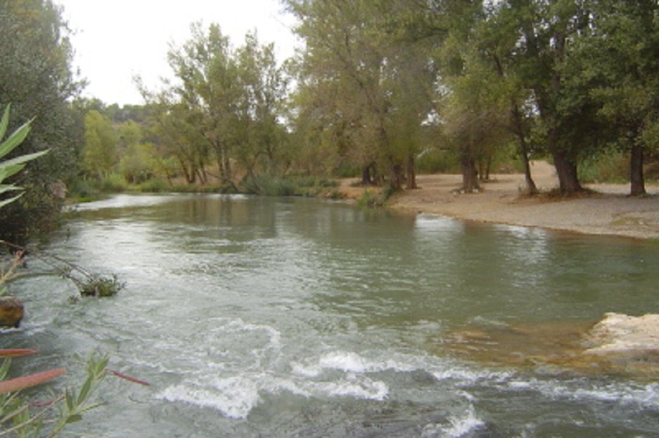
View of Turia River near Benaguasil
Map
EtymologyProto-Celtic *dubr-, 'river'
Native name
Location
CountrySpain Spain
RegionAragon
Castilla–La Mancha
Valencian Community
DistrictProvince of Teruel
Province of Cuenca
Province of Valencia
Physical characteristics
Source 
 • locationMontes Universales, Aragon, Spain
 • elevation1,680 m (5,510 ft)
Mouth 
 • location
Mediterranean Sea in Valencia, Province of Valencia, Valencian Community, Spain
 • elevation
0 m (0 ft)
Length280 km (170 mi)
Basin size6,393.6 km2 (2,468.6 sq mi)
Source of the Turia River, known as Guadalaviar, in the Montes Universales
A view of the river as it passes through the Albarracín Mountains

The Turia (Spanish: [ˈtuɾja] ) or Túria (Valencian: [ˈtuɾi.a])[a] is a river in Spain, which has its source in the Montes Universales in the mountain ranges of the northwesternmost end of the Sistema Ibérico, Teruel province. From its source to roughly the city of Teruel, it is called Guadalaviar (Spanish: [ɡwaðalaˈβjaɾ], Valencian: [ɡwaðalaviˈaɾ]).[b] It runs through the provinces of Teruel, Cuenca and Valencia, and discharges into the Mediterranean Sea near the city of Valencia. The river formerly ran through the center of the city but was diverted south of the city to prevent flooding.

Name

[edit]

The Latin name Tūria (also recorded as Tyrius) has been connected with the Celtic root *dubr-, 'river'; the river would thus share a root with the Douro. The name Guadalaviar is instead borrowed from Arabic الوادي الأبيض al-wādī l-abyaḍ, 'the white river'.[1][2]

Diversion project

[edit]

The river is notorious for its floods. The flood which occurred on 14 October 1957, known as the Great Flood of Valencia, flooded large parts of the city of Valencia, and caused a great deal of damage to both life and property. To prevent this from happening in the future, a diversion project was devised (Pla Sud in Valencian; Plan Sur in Spanish), completed in 1969, and the river was divided in two at the western city limits near Quart de Poblet. During floods, most of the water is diverted southwards along a new course that skirts the city, until it meets the Mediterranean.[3] The old course of the river has been turned into a central green-space for the city, a cultural attraction known as the Garden of the Turia.

Not unlike the Los Angeles River, the man-made diversion channel south of the city is often found dry, since water primarily flows during periods of flooding. Under ordinary flow rates the water is directed through irrigation channels to help cultivate the fertile plain of Valencia. Throughout history the water of the River Turia has been used to irrigate the region. In modern times, a complex network of irrigation has been created, with the main axis centred on the diversion project.[4] Beyond irrigation, these channels also take runoff and surplus water from the Turia to the wetlands and marshes around Valencia.

Attractions along the old course

[edit]
Map of Turia Garden

The old riverbed is now a verdant sunken park that allows cyclists and pedestrians to traverse much of the city without the use of roads. The park, called the 'Garden of the Turia' (Jardí del Túria/Jardín del Turia) boasts numerous ponds, paths, fountains, flowers, football pitches, cafés, artworks, climbing walls, an athletics track, a zen garden and more. The many bridges overhead carry traffic across the park.

External image
image icon Parc Gulliver at flickr. Playground laid out as a giant Gulliver with visitors as Lilliputians.

Towards the park's eastern end of the river course is the Valencian Music Palace (el Palau de la Música Valenciana). Also towards the eastern end is the Gulliver Park (Parc Gulliver/Parque Gulliver) (39°27′46″N 0°21′33″W / 39.46278°N 0.35917°W / 39.46278; -0.35917), a children's adventure playground featuring a huge fibreglass model of Lemuel Gulliver tied to the ground with ropes. The model is constructed such that the ropes are climbable. In addition, Gulliver's clothes form slides and ladders on which to play.

Marking the park's eastern extreme is Valencia's neo-futuristic architectural and cultural complex, the City of Arts and Sciences, featuring the opera house Palau de les Arts Reina Sofia, an cinemax/panetarium L'Hemisfèric, the science museum Museu de les Ciències Príncipe Felipe, and an oceanographic park L'Oceanogràfic.

Two Metrovalencia stations lie beneath the riverbed, with entrances on either bank: Túria and Alameda.

See also

[edit]

Notes

[edit]

References

[edit]
[edit]
Revisions and contributorsEdit on WikipediaRead on Wikipedia
from Grokipedia
The Turia River (Spanish: Río Turia), also known as the Guadalaviar in its upper reaches, is a significant in eastern that originates at La Muela de San Juan in the Montes Universales mountain range, within the municipality of Guadalaviar in the , , at an elevation of approximately 1,680 meters. It flows southeast for about 280 kilometers through the provinces of Teruel, Cuenca, and , draining a basin of roughly 6,350 square kilometers before discharging into the at the in the . The Turia has played a central role in the region's , , and urban development, with its waters supporting systems and contributing to the fertile plains around since Roman times. However, the river is most renowned for the devastating of 14 October 1957, known as the Gran Inundación, which caused widespread destruction in , resulting in at least 81 deaths and extensive damage due to extreme rainfall exceeding 600 mm in some areas. In response, Spanish authorities implemented the Plan Sur in the , diverting the river's course southward to a new channel bypassing the city center, thereby mitigating risks while preserving the old riverbed for . This diversion transformed the former 9-kilometer riverbed into the Jardín del Turia (Turia Gardens), one of Europe's largest urban parks, inaugurated in 1986 after public protests in the rejected plans for a , advocating instead for a green corridor under the slogan "El cauce del Turia es nuestro y lo queremos verde." The park stretches from the Cabecera del Turia to the , encompassing diverse landscapes such as pine groves, citrus orchards, ponds, sports facilities, and playgrounds like Gulliver Park, while integrating 18 historic bridges and modern architectural landmarks. Today, the Turia remains vital for water supply via interconnections like the Júcar-Turia Canal, though it faces ongoing challenges from climate variability, pollution, and recent extreme events such as the 2024 DANA floods.

Geography

Course

The Turia River originates in the Montes Universales mountain range within the Iberian System, specifically at the springs (manantiales) located on the Muela de San Juan, in the municipality of Guadalaviar, province, , , at an elevation of approximately 1,680 meters above . In its upper reaches, the river is known as the Guadalaviar or Río Blanco, emerging from karstic formations characteristic of the rugged, high-altitude terrain of the Sierra de and surrounding highlands. The river follows a predominantly west-to-east course for a total length of 280 kilometers, traversing three autonomous communities: , Castilla-La Mancha, and the . It begins in the mountainous , passing through narrow valleys and deep gorges near towns such as and , where the landscape features steep slopes and forested plateaus. As it progresses southward into the in Castilla-La Mancha, the terrain transitions to broader valleys amid semi-arid plateaus, with the river cutting through outcrops and receiving tributaries that enhance its flow. Entering the , the Turia shifts southeastward, flowing through the Rincón de Ademuz enclave and then along the fertile coastal plains of Valencia province, where it supports extensive agricultural areas like the historic Huerta de Valencia. Major urban centers along its path include in the upper basin and , the river's namesake city, in the lower reaches. In the lower reaches, the river follows a diverted artificial channel south of the city center, supporting irrigated orchards in the surrounding areas before reaching its mouth. The Turia discharges into the south of , between the neighborhoods of Nazaret and El Grao, at approximately 39°25′26″N 0°19′56″W, forming a deltaic outlet influenced by coastal .

Basin and Hydrology

The of the Turia River covers an area of 6,393.6 square kilometers, encompassing diverse terrain from the mountainous Iberian System in its upper reaches to the coastal plains near . The basin is divided into sub-basins, with the upstream Guadalaviar section originating in the Montes Universales and flowing southeastward until its confluence with the Alfambra River near , where it assumes the name Turia. Other notable tributaries include the Magro River, which joins in the mid-basin, and several ravines (barrancos) such as the Barranco del Barco and Barranco de la Rivera in the lower sections, contributing to the overall hydrological network. The of the Turia is characterized by a typical Mediterranean , with an annual discharge of approximately 10.43 cubic meters per second at the basin's outlet prior to modern regulations. Flow rates exhibit significant seasonal variations, featuring low volumes during the dry summer months (July-August, with minimal of around 8-10 mm) and higher discharges in autumn due to intense convective storms. Approximately 50% of historical floods have occurred in autumn (October-November), when peak reaches 50-70 mm, leading to rapid runoff from the basin's steep slopes. The Turia plays a vital role in and for in the region, supporting extensive cultivation of fruits, , and other crops through natural flows and associated canal systems. Annual runoff contributes about 173 hm³ to regional , though the basin's irregular —marked by prolonged droughts interspersed with flash floods—has historically made it prone to extreme events influenced by the .

Etymology

Origin of the Name

The name of the Turia River derives from the Latin form Tūria, first attested during the Roman period as the Romans encountered and documented the of the . This classical designation appears in ancient geographical texts, reflecting the river's significance in the landscape of . For instance, refers to it as the flumen Turium in his (Book III), describing its position relative to coastal settlements like Valentia and Saguntum. Similarly, includes the Turia among the rivers of eastern in his (Book II, Chapter 6), listing it alongside the Iberus and Sucro as a key waterway in the region's coordinate system. The pre-Roman inhabitants, including Celtic and Iberian tribes in the river's basin, used the name Tirio (or a variant), which the Romans Latinized to Tūria. Linguistically, Tūria belongs to the "Old European" layer of river names identified in Indo-European linguistics, suggesting an ancient substrate influence from pre-Roman groups in the interior of Hispania, where the Turia originates. Scholarly analyses of European hydronymy, building on Hans Krahe's foundational work, trace such formations to migratory Indo-European patterns predating the Roman era. The term's phonetic evolution likely involved local adaptations, emphasizing the river's flowing nature. It has been proposed to share roots with other peninsular rivers like the (Latin Durius), possibly from a hydronymic element meaning "river" or "water." The adoption of Tūria by Roman authorities occurred amid the conquest of Hispania, beginning with the Second Punic War in 218 BCE, when Roman forces under Scipio integrated indigenous toponyms into their administrative and cartographic systems. Pre-Roman inhabitants, including Celtic and Iberian tribes in the river's basin, probably used variants of this name rooted in their languages, which the Romans Latinized without significant alteration to maintain geographical continuity. This process exemplifies how Roman expansion preserved select local hydronyms while imposing Latin orthography, ensuring Tūria's endurance in classical literature. Upstream, the river was alternatively known as Guadalaviar, reflecting later influences, but the core Tūria form persisted in reference to its lower course.

Historical and Alternative Names

The upper section of the river, from its source in the Montes Universales to approximately the city of , is historically known as the Guadalaviar, a name derived from the "wādī al-abyad," meaning "white river," reflecting the sediment-laden waters during the Islamic period in the . This designation persisted through the medieval era in the Aragonese territories, where local usage maintained the Arabic-influenced term even after the Christian . In medieval and Renaissance texts, particularly in Valencian and Catalan contexts, the river was referred to as Túria, an adaptation of its classical Latin root that emphasized its role in the fertile huerta of Valencia. This form appears in historical documents from the Kingdom of Valencia, highlighting the linguistic influences of the Crown of . The classical Latin name, recorded as Tūria or possibly Tirius, underscores an ancient Indo-European origin linked to riverine terms. Today, the official name in Spanish is Río Turia, adopted nationwide, while bilingual signage in the Valencian Community accommodates both Turia and Túria to reflect the co-official status of Valencian (a variant of Catalan). Regionally, the distinction endures: Guadalaviar predominates in Aragon for the upstream reaches, whereas Turia or Túria is standard in Valencia for the lower course.

History

Pre-Modern Period

The Turia River played a pivotal role in the Roman foundation and development of Valentia Edetanorum in 138 BC, where the city was established on an island formed by the river's meanders, providing natural defenses and access to fertile marshlands suitable for . The river facilitated for early Roman settlers, supporting cultivation and enabling trade along the and Via Herculea routes connecting to Mediterranean ports like Carthago Nova and . A port near the modern Serranos Bridge handled goods traffic during the Imperial era, contributing to the city's growth from a population of about 500 in the Republican period to around 2,000 by the Imperial era. During the Muslim rule in from the 8th to 13th centuries, the Turia River became central to an advanced irrigation network of acequias, or mother canals, that distributed water across the Horta de Valencia plain, transforming arid lands into productive agricultural zones yielding crops like and supporting silk production. These systems, drawing from the river's flow, were managed by officials such as the ṣāḥib al-sāqiya, who oversaw equitable allocation and resolved disputes, fostering a communal structure that sustained economic prosperity. The acequias' gravity-fed design, rooted in Islamic , remained largely intact after the Christian conquest, underscoring their enduring impact on the region's fertility. The Turia River influenced the Reconquista's dynamics in Valencia, serving as a strategic barrier during the 1238 conquest by King James I of , who positioned his forces on its northern bank for defensive advantage against Muslim defenders on the southern side. Post-conquest, the river's location bolstered Valencia's emergence as the capital of the Kingdom of Valencia within of , with bridges like the medieval Al-Qantara facilitating urban expansion and trade, solidifying the city's status as a key Mediterranean hub. The river's role in delineating settlement patterns helped integrate the conquered territory, promoting agricultural continuity and economic revival under Christian rule. Historical records document frequent Turia River floods from the 14th to 18th centuries, with 8 events in the escalating to 54 in the 18th, often causing widespread inundation in . Major incidents, such as those in 1577, 1581, and 1590 during the , damaged infrastructure and saltworks, leading to fruit shortages and reduced revenues that strained local economies. In the , floods like the 1617 series and the 1632 event disrupted and sectors, while 18th-century overflows in 1776 and 1783–1784 prompted crop abandonment considerations and economic losses in the Albufera lagoon area, highlighting the river's dual role as a vital resource and recurring hazard.

19th and Early 20th Century Developments

During the , the significantly transformed Valencia's relationship with the Turia River, as burgeoning textile, ceramics, and food processing industries drew workers to the city and spurred settlement along the riverbanks. Factories and worker housing proliferated in areas like Ruzafa and near the Trinidad and Serranos bridges, where the river provided convenient access to water for industrial processes and initial urban amenities. This industrialization increased the population from approximately 110,000 at the start of the 19th century to around 145,000 by mid-century, reaching over 200,000 by 1900, fostering dense ribbon developments that extended the city's footprint into previously rural floodplains adjacent to the Turia. In the early , Valencia's urban expansion accelerated with formal planning initiatives, such as the 1887 and 1912 expansion plans, which doubled the city's area through grid-patterned extensions and annexations of suburbs like Marxalenes. To accommodate this growth, several modern bridges were constructed over the Turia, including the Aragón Bridge in 1933 and the Campanar Bridge in 1937, utilizing and to support increased vehicular and traffic, as well as emerging ring roads for industrial connectivity. These infrastructures not only facilitated the integration of peripheral settlements but also symbolized Valencia's modernization, enabling efficient transport links between the expanding industrial zones and the historic core. Initial flood mitigation efforts emerged in response to the heightened vulnerability from urban encroachment, with legal frameworks like the 1866 Water Law mandating dikes and canals to curb overflows into built-up areas. The 1907 Public Works Act further authorized state-funded hydraulic projects, including reinforced levees along the Turia's lower course and minor diversion channels, while the 1926 Water Law established the Júcar-Turia Hydrographic to coordinate basin-wide management and reduce flood risks through improved monitoring and minor dams upstream. Despite these measures, such as the partial diking systems implemented in and , they proved inadequate against the river's episodic high flows, as evidenced by recurrent inundations that highlighted the limitations of piecemeal in an industrializing landscape. The Turia remained socio-economically vital for until the mid-20th century, serving as the primary source of water through an extensive network of acequias that supported the fertile huerta orchards, which supplied , , and grains essential to the region's export-driven economy. This agricultural reliance, bolstered by 19th-century expansions in canal infrastructure drawing from the river, underpinned industrial growth by providing and raw materials for processing industries. Additionally, the river's bridges enhanced overland transport networks, linking Valencia's ports and railways to inland production sites, though the Turia itself was not navigable for commercial vessels due to its shallow, silting course.

1957 Valencia Flood

Causes and Sequence of Events

The 1957 Valencia flood was primarily triggered by an extreme meteorological event known as a gota fría (cold drop), a phenomenon where a mass of cold air from the north interacts with warm Mediterranean waters, leading to intense, prolonged rainfall over short periods. This event occurred in mid-October 1957, with heavy rains beginning around 12 October and the main downpours on 14 October, particularly affecting the eastern . In the Turia River basin, rainfall totals exceeded 500 mm in some upstream areas within 24 hours, far surpassing typical seasonal norms and overwhelming the river's capacity. The Turia River's hydrology naturally predisposed it to flooding due to its steep in the upper basin, which funnels water rapidly toward the flatter coastal plains, combined with a narrow channel in the region that restricted flow during high volumes. Human activities exacerbated these vulnerabilities: widespread in the mountainous headwaters during the early reduced soil absorption and increased runoff, while early along the riverbanks in limited natural overflow areas and altered dynamics, leading to shallower channels over time. These factors transformed what might have been a manageable swell into a catastrophic surge. The sequence of events centered on 14 October, with scattered showers from 12 October saturating soils across the Júcar and Turia basins. The gota fría brought torrential rain, and the flooding consisted of two waves: the first reaching around 1:00 a.m. on 14 October, and the second more destructive wave at approximately 1:30 p.m. that afternoon. Upstream reservoirs, such as those on tributaries, began spilling over, but the of the Turia swelled dramatically, with tributaries contributing additional unchecked flows from deforested slopes. The crisis peaked with the second wave, when the floodwaters reached city center, surging to depths of 4–5 meters in streets and up to 7 meters at some bridges, as the river breached its confines. Contributing to the disaster's severity was the inadequacy of and measures at the time. The existing levees along the Turia in , constructed in the early for lesser floods, were overtopped and eroded under the unprecedented volume, with several sections failing entirely due to under-design for such extreme events. Moreover, the absence of a coordinated warning system—relying instead on rudimentary telegraphic alerts from upstream gauges—delayed evacuations and response, allowing the flood to catch the population largely unaware as waters inundated the city.

Immediate Impacts and Response

The 1957 Valencia flood resulted in an official death toll of 81 people, primarily in the city and surrounding areas, though contemporary estimates and local accounts suggest the actual number may have reached up to 300 due to underreporting by the Franco regime. The deluge caused widespread destruction, submerging three-quarters of Valencia's streets under up to three meters of water and mud, leaving more than 7,300 people homeless, and severely damaging key infrastructure including bridges, roads, and the city's electrical and water systems. Economic losses were staggering, estimated at over 10,000 million pesetas, with significant impacts on Valencia's agriculture—where groves and networks were ravaged—and its burgeoning industrial sector, including factories and warehouses that were inundated and rendered inoperable. Unions reported that 5,580 businesses alone suffered damages exceeding 1,100 million pesetas, exacerbating the region's postwar recovery challenges. In the immediate aftermath, the Franco regime mobilized emergency aid, with General personally visiting on 24 October 1957 to oversee operations and pledge support, though delivery was criticized for delays. The military played a central role, deploying thousands of troops for efforts, , and a massive cleanup operation known as the "Battle of the Mud," which removed over a million cubic meters of debris in weeks using trucks, bulldozers, and manual labor. Initial debates on river management emerged, fueled by the mayor's public criticism of inadequate preparedness and aid, highlighting tensions between local authorities and the over long-term prevention. The displaced thousands, prompting temporary shelters in schools and , while contaminated floodwaters and accumulated led to crises, including a coincidental outbreak that worsened respiratory illnesses amid unsanitary conditions.

Diversion Project

Planning and Engineering

Following the devastating , which caused over 80 deaths and extensive damage to the city, Spanish engineers proposed the Plan Sur as a comprehensive solution to mitigate future flood risks by diverting the Turia River away from urban areas. The initiative, conceptualized in the late 1950s, was spearheaded by engineers Claudio Gómez Perretta and architect Fernando García Ordoñez, who advocated for rerouting the river southward to bypass entirely. This southern diversion plan emerged as the preferred alternative among several options, including reinforcing the existing channel or northern rerouting, due to its feasibility in protecting the city's core while leveraging the flat terrain south of . The engineering design centered on a 12-kilometer artificial channel constructed south of the city, engineered to convey peak flows of up to 5,000 cubic meters per second, far exceeding the 1957 's intensity. Key features included reinforced spillways to manage overflow during extreme events and upstream for attenuating peaks, ensuring controlled release into the new channel. The also incorporated integration with existing basin infrastructure, such as the Loriguilla on the Turia, to regulate inflows and enhance overall storage capacity. These elements were refined by Vicente Fullana, who overhauled the initial 1958 proposal into a more viable 1965 version, addressing geotechnical challenges like the unstable marjal soils through deep pilings and reinforcements. Under the Franco regime, the Plan Sur faced significant political obstacles, including skepticism from the Ministry of Public Works regarding budget allocations and structural integrity, which led to disputes over elements like bridge counts (18 required versus the ministry's proposed 2-3) and stormwater systems. To resolve funding issues, a special water tax of 1 peseta per cubic meter was imposed on users to cover additional infrastructure. Local opposition arose primarily from southern huerta farmers, who feared land expropriations—totaling around 300 hectares and 800 homes—would disrupt agriculture, though concerns over potential for were also voiced amid the diversion's reconfiguration of natural flows. Despite these hurdles, the plan received legislative approval via Ley 81/1961 on December 23, solidifying state commitment to the project as a national priority for .

Construction and Operational Details

The construction of the Nuevo Cauce del Turia, the diversion channel under the Plan Sur, commenced in 1966 after initial planning and approval phases. Major earthworks and structural reinforcements progressed through 1969, when key sections were completed and tested during minor floods, enabling provisional use. Full construction wrapped up by 1972, with the system achieving operational status in 1973 following final integrations and official inauguration. The engineered channel measures approximately 12 kilometers in length, with a maximum width of 200 meters and a depth accommodating up to 7.5 meters in cross-section. It boasts a hydraulic capacity of 5,000 cubic meters per second, sufficient to manage extreme events with a 500-year , and terminates at the near Pinedo, about 3 kilometers south of the original mouth. These specifications ensure robust flood containment while minimizing urban encroachment. In operation, the diversion structure automatically routes high-volume flows exceeding safe thresholds into the new channel to prevent overflows into Valencia's , while lower seasonal discharges follow the original riverbed during dry periods. This dual-path mechanism balances flood protection with ecological and agricultural needs in the basin. Ongoing maintenance and enhancements are managed by the Confederación Hidrográfica del Júcar (CHJ), which coordinates periodic , structural inspections, and vegetation control to sustain hydraulic efficiency. In the , the CHJ has implemented upgrades, including capacity assessments and connectivity improvements, to bolster resilience against intensified rainfall patterns linked to , as evidenced by post-2024 DANA evaluations.

Garden of the Turia

Transformation Process

Following the devastating flood of October 1957, which left the Turia riverbed filled with thick mud and debris across , initial cleanup efforts were launched immediately, involving civil and military brigades to remove the wreckage at an estimated cost of 350 million pesetas (approximately 2.1 million euros in adjusted terms). These operations cleared the path for the river's diversion under the Plan Sur, completed between 1965 and 1972, transforming the former into a dry urban corridor. In the 1970s, amid growing urban pressures, municipal proposals emerged to repurpose the riverbed by filling it in, constructing buildings atop it, or converting it into a major highway system to ease . These plans faced strong public opposition, including widespread protests in 1972–1973 where citizens chanted slogans like "The bed of the Turia is ours and we want it green," ultimately leading to the city's acquisition of the 1.36 million square meters of riverbed in 1976 for green space development. Urban planning for the site advanced in the and , with commissioned in 1981 by the Valencia City Council to develop a master plan that envisioned the riverbed as a divided into 18 sequential sections, or tramos, emphasizing geometric gardens and integrated . presented the design in 1982, covering about 1 million square meters, and gained international visibility through an exhibition at Rome's in 1983, attended by the city's mayor, which accelerated execution starting that summer. The transformation proceeded in phases across the tramos, beginning with early plantings such as 1,000 eucalyptus trees in 1977 and expanding to diverse native and ornamental species by the mid-1980s to establish a lush green corridor. Concurrently, networks of pedestrian paths were laid out, and new bridges—such as the 166-meter-long replacement for the Pasarela de la Exposición, opened to traffic in 1967—were integrated with existing historic structures to connect the sections seamlessly, with major completions by 1986. The site received its legal designation as the Jardín del Turia in 1979, spanning approximately 136 hectares over 8.5 kilometers through the city center, with plans to expand to 160.5 hectares in the future.

Features and Attractions

The Garden of the Turia features a diverse array of recreational zones designed to cater to various activities and age groups. Sports areas include dedicated facilities such as football pitches, rugby fields, baseball diamonds, an athletics track, a skating rink, and multi-sports courts, allowing visitors to engage in a wide range of athletic pursuits. Playgrounds are prominent, with the standout Gulliver Park offering a 70-meter-long sculpture of the fictional character Gulliver, standing about 9 meters high, complete with climbing structures, slides, and imaginative play elements inspired by the novel Gulliver's Travels. Cycling and jogging paths stretch along the park's 8.5-kilometer length, featuring flat, well-maintained trails suitable for bicycles, segways, and pedestrians, with rental services available for bikes and tandems to enhance accessibility. Cultural and architectural landmarks enrich the park's appeal, integrating it seamlessly with Valencia's urban fabric. The garden lies in close proximity to major attractions like the , a futuristic complex of museums, an aquarium, and an opera house, and the Bioparc, a modern zoo emphasizing immersive African wildlife exhibits. Notable bridges span the former riverbed, including the vibrant Puente de las Flores with its colorful floral decorations and the striking l’Assut d’Or bridge designed by , one of 18 bridges that connect the park to the city's historic center and modern districts. Biodiversity adds a natural dimension to the recreational experience, with features like serene ponds that support aquatic life, expansive palm groves interspersed with orange trees, woods, and aromatic plantings creating shaded, scenic environments. The park hosts over 100 species, including common residents such as Eurasian hoopoes, Sardinian warblers, and European serins, as well as introduced parakeets like and rose-ringed varieties, making it a notable urban site. The Garden of the Turia draws millions of visitors annually—over three million in recent years—serving as a vital green space for locals and tourists alike. It hosts various events, including an annual jazz festival with free opening performances and seasonal fairs such as the Andalusian Fair featuring and , as well as amusement and medieval markets that transform sections of the park into lively cultural hubs.

Ecology and Environmental Management

Pre-Diversion Ecosystem

Before the intensification of human interventions in the 20th century, the Turia River in Valencia, Spain, sustained a diverse riparian ecosystem characterized by extensive wetlands and floodplain habitats along its lower course. These areas featured dynamic water flows that fostered lush vegetation and supported a variety of aquatic and terrestrial species, contributing to the ecological balance of the region. The river's natural regime, with periodic flooding, enriched the soil and maintained habitat connectivity, though early agricultural expansions began to encroach on these zones as early as the 18th and 19th centuries through irrigation systems and milling activities. The riparian forests along the lower Turia were dominated by native tree species such as (), (Populus nigra), (Salix alba), and grey willow (Salix atrocinerea), interspersed with tamarisk shrubs (Tamarix canariensis) and dense stands of (Arundo donax). These plant communities formed a geosérie fluvial valenciana, providing shade, , and structure for wildlife, while Mediterranean shrubs like (Pistacia lentiscus) added to the diversity. Wetlands adjacent to the river channel served as critical nurseries for aquatic life and buffer zones against , maintaining a relatively intact despite gradual disruptions from conversion. This pre-diversion ecosystem was vital for regional , hosting emblematic species such as the (Lutra lutra), (Alcedo atthis), and native fish including the Valencian barbel (Luciobarbus guiraonis). The and riparian zones also facilitated migratory bird routes, with waterfowl like (Anas platyrhynchos) and (Gallinula chloropus), as well as raptors, using the area as a stopover linked to broader Valencian systems such as the Albufera , which received Turia inflows via channels. Although had begun to fragment habitats by the late , the overall ecological integrity persisted, underscoring the river's role in supporting interconnected hotspots.

Post-Diversion Changes and Conservation

Following the diversion of the Turia River in 1972, the original riverbed in experienced a significant loss of natural hydrological dynamics, as the channel no longer received regular flows, resulting in drier conditions and reduced that altered riparian habitats. This shift, however, facilitated the conversion of the 8-kilometer urban stretch into a , enhancing urban greenery and through managed landscaping that now supports over 15,000 trees and diverse shrub layers. Restoration efforts in the focused on rehabilitating degraded sections of the old bed and upstream areas, including the reintroduction of native riparian species such as and Salix spp. to restore ecological connectivity and stabilize banks, while removing invasive exotics like . recycling has been integral to these initiatives, with treated from Valencia's purification plants used for in the Turia Gardens, conserving potable and sustaining amid Mediterranean ; annual usage exceeds 1 million cubic meters for this purpose. Conservation initiatives have included EU-funded projects under the and Europe programs, such as the NaTURTURia initiative (ongoing as of November 2025, scheduled for completion by December 31, 2025), which targets hydromorphological recovery and wetland revival near the river's mouth by improving connectivity to the Albufera Natural Park through bioengineering and enhancement. These efforts also incorporate ongoing monitoring of agricultural pollutants, particularly pesticides from Valencia's intensive citrus and , with studies revealing seasonal peaks in residues like fungicides in downstream waters, prompting to mitigate risks. Current challenges stem from , which has intensified episodic high flows—exemplified by the 2024 DANA event, where extreme rainfall overwhelmed upstream areas in the Turia basin but the diversion channel mitigated flooding in city, protecting urban ecosystems while highlighting vulnerabilities in upstream habitats—while base flows decline due to prolonged droughts, straining the diversion system's design limits. In response, adaptations include proposals for additional retention , such as floodable parks along the Turia and new green corridors to channel excess water, alongside upgrades to existing reservoirs like the Benagéber Dam to better regulate variable flows under EU NextGenerationEU funding. Post-2024 recovery efforts have focused on repairing affected riparian zones and enhancing resilience in the Turia basin.

References

Add your contribution
Related Hubs
User Avatar
No comments yet.