
Community hub
Recent from talks
Contribute something
Nothing was collected or created yet.
Woodside, California
View on Wikipedia
Woodside is an incorporated town in San Mateo County, California, United States, on the San Francisco Peninsula. It has a council–manager system of government.
Key Information


The population of the town was 5,309 at the 2020 census.[4] The town's population has a median household income above $250,000 and median home price above $5 million. The town is known for its quaint and small town feel despite being close to Silicon Valley, and is home to many venture capital and investment firms.
History
[edit]The Woodside area was originally home to the Ohlone tribe.[7] In 1769, led by Gaspar de Portolá, Spanish explorers searching for San Francisco Bay camped at a site near Woodside. In 1840, the land that was to be the future Woodside became part of a Mexican land grant, Rancho Cañada de Raymundo, which in 1841 was granted to an Englishman, John Coppinger.
Woodside is said to be the oldest English-speaking settlement in the southern part of the San Francisco Peninsula. The first English-speaking settlers arrived in the early 19th century to log the rich stands of redwoods. Charles Brown constructed the first sawmill in Woodside on his Mountain Home Ranch around 1847. Brown's adobe house still stands today.[8] By mid-century, the Woodside area had a dozen mills producing building materials for a booming San Francisco.
In 1849, during the California Gold Rush, 20-year-old Mathias Alfred Parkhurst purchased 127 acres (0.5 km2) of timberland and named it "Woodside". By the late 19th century, Woodside was home to country estates. The Sequoia Redwood trees in Woodside are currently 3rd generation growth; the first generation of which were used to build San Francisco's original homes[citation needed]. After the 1906 San Francisco earthquake, the loggers returned to Woodside to cut the second growth of redwood so it could be used for the rebuilding of San Francisco[citation needed].
In 1909, the Family, a private club in San Francisco, set up camp facilities and rustic buildings in Woodside at the Family Farm, a rural retreat used by club members for recreation. Gatherings at the Family Farm include an annual Farm Play, written and performed by members. In 1912, the Family pooled funds to build Our Lady of the Wayside Church in Portola Valley, designed by 19-year-old Timothy L. Pflueger, his first commission.[9] The historic building was repaired at a cost of $600,000 after the 1989 Loma Prieta earthquake.[10]
Woodside was incorporated in 1956 and it retains a rural residential character even though it is only a short commute to Silicon Valley and Stanford University.
In early 2022, the town initially declared itself a mountain lion habitat to circumvent state affordable housing requirements and then subsequently retracted that position.[11] It backed down after California Attorney General Rob Bonta denied this claim writing, "[t]here is no valid basis to claim that the entire town of Woodside is a habitat for mountain lions."[12][13]

On November 15, 2023, a meeting was held at the Filoli estate between President Biden and General Secretary of the Chinese Communist Party Xi Jinping amid the 2023 Asia-Pacific Economic Cooperation summit taking place in San Francisco. After meeting with Chinese leader Xi Jinping that day, Biden announced the two made progress on a common understanding to crack down on chemicals trafficked from China that are used to make fentanyl, improve military communications in the Indo-Pacific, and address risks associated with artificial intelligence.[14]
Geography
[edit]Woodside is located on the San Francisco Peninsula in San Mateo County. The town is on the eastern slopes of the Santa Cruz Mountains and its south-western boundary reaches California State Route 35 which runs along the ridge of those mountains. Redwood City to the north with Atherton and Menlo Park to the east lie between Woodside and the San Francisco Bay. To the south is Portola Valley.
Much of Woodside is wooded, with redwoods and Douglas fir dominating in the western hills and more oaks and eucalyptus in the lower areas. West Union Creek joins Bear Creek in Woodside. Woodside has a variety of habitat types including California oak woodland and riparian zones. There is considerable biodiversity present, Woodside being within the California Floristic Province. Notable species present include the rare and endangered species Acanthomintha duttonii, the San Mateo Thornmint. The San Andreas Fault runs through portions of Woodside.

Climate
[edit]As is true of most of the California coastal areas, weather in Woodside is usually mild during most of the year. Summers are dry and can be hot; winter temperatures rarely dip much below freezing. Average January temperatures are a maximum of 60 °F (16 °C) and a minimum of 36 °F (2 °C). Average July temperatures are a maximum of 88 °F (31 °C) and a minimum of 51 °F (11 °C). Snowfall is extremely rare except in the nearby Santa Cruz Mountains, where several inches falls every several years. Annual precipitation averages 30.9 in (780 mm) and falls on an average of 61 days annually.
The record maximum temperature was 114 °F (46 °C) on July 22, 2006, and the record minimum temperature was 17 °F (−8 °C) on February 6, 1989. Temperatures reach 90 °F (32 °C) or higher on an average of 48.4 days annually. Temperatures drop to freezing on an average of 10.0 days annually. The maximum rainfall in one year was 59.86 in (1,520 mm) in 1983. The maximum rainfall in one month was 20.50 in (521 mm) in December 2002 and the maximum in 24 hours was 4.64 in (118 mm) on December 1, 2002. On February 5, 1976, 3.0 in (7.6 cm) of snow fell at the fire station.
Hills and mountains between Woodside and the Pacific coast make fog much less prevalent than in nearby San Francisco. As well, during the summer, Woodside's climate is hotter than that of San Francisco.
| Climate data for Woodside, California | |||||||||||||
|---|---|---|---|---|---|---|---|---|---|---|---|---|---|
| Month | Jan | Feb | Mar | Apr | May | Jun | Jul | Aug | Sep | Oct | Nov | Dec | Year |
| Record high °F (°C) | 75 (24) |
84 (29) |
88 (31) |
99 (37) |
104 (40) |
108 (42) |
111 (44) |
114 (46) |
108 (42) |
106 (41) |
90 (32) |
76 (24) |
114 (46) |
| Mean maximum °F (°C) | 70 (21) |
76 (24) |
79 (26) |
88 (31) |
95 (35) |
100 (38) |
102 (39) |
102 (39) |
99 (37) |
94 (34) |
79 (26) |
69 (21) |
102 (39) |
| Mean daily maximum °F (°C) | 61.2 (16.2) |
64.3 (17.9) |
68.5 (20.3) |
73.0 (22.8) |
78.7 (25.9) |
84.1 (28.9) |
88.1 (31.2) |
88.4 (31.3) |
86.1 (30.1) |
79.8 (26.6) |
67.6 (19.8) |
60.9 (16.1) |
75.1 (23.9) |
| Daily mean °F (°C) | 49.0 (9.4) |
51.7 (10.9) |
54.8 (12.7) |
57.8 (14.3) |
62.3 (16.8) |
66.5 (19.2) |
69.9 (21.1) |
69.8 (21.0) |
68.0 (20.0) |
62.7 (17.1) |
54.0 (12.2) |
48.9 (9.4) |
59.6 (15.3) |
| Mean daily minimum °F (°C) | 36.8 (2.7) |
39.1 (3.9) |
41.2 (5.1) |
42.6 (5.9) |
46.1 (7.8) |
48.9 (9.4) |
51.8 (11.0) |
51.3 (10.7) |
49.9 (9.9) |
49.8 (9.9) |
40.5 (4.7) |
37.0 (2.8) |
44.6 (7.0) |
| Mean minimum °F (°C) | 28 (−2) |
29 (−2) |
32 (0) |
34 (1) |
39 (4) |
42 (6) |
43 (6) |
44 (7) |
42 (6) |
36 (2) |
30 (−1) |
27 (−3) |
26 (−3) |
| Record low °F (°C) | 19 (−7) |
17 (−8) |
28 (−2) |
30 (−1) |
29 (−2) |
36 (2) |
35 (2) |
28 (−2) |
38 (3) |
25 (−4) |
23 (−5) |
20 (−7) |
17 (−8) |
| Average precipitation inches (mm) | 5.56 (141) |
5.49 (139) |
4.26 (108) |
1.89 (48) |
0.65 (17) |
0.14 (3.6) |
0.01 (0.25) |
0.04 (1.0) |
0.19 (4.8) |
1.25 (32) |
3.57 (91) |
5.42 (138) |
28.47 (723.65) |
| Average snowfall inches (cm) | 0.0 (0.0) |
0.1 (0.25) |
0.0 (0.0) |
0.5 (1.3) |
0.0 (0.0) |
0.0 (0.0) |
0.0 (0.0) |
0.0 (0.0) |
0.0 (0.0) |
0.0 (0.0) |
0.0 (0.0) |
0.1 (0.25) |
0.7 (1.8) |
| Source: NOAA[15] | |||||||||||||
Demographics
[edit]| Census | Pop. | Note | %± |
|---|---|---|---|
| 1960 | 3,592 | — | |
| 1970 | 4,734 | 31.8% | |
| 1980 | 5,291 | 11.8% | |
| 1990 | 5,035 | −4.8% | |
| 2000 | 5,352 | 6.3% | |
| 2010 | 5,287 | −1.2% | |
| 2020 | 5,309 | 0.4% | |
| U.S. Decennial Census[16] | |||
2010 Census
[edit]At the 2010 census Woodside had a population of 5,287. The population density was 450.6 inhabitants per square mile (174.0/km2). The racial makeup of Woodside was:
- 4,717 (89.2%) White
- 332 (6.3%) Asian
- 144 (2.7%) from two or more races
- 63 (1.2%) from other races
- 23 (0.4%) African American
- 4 (0.1%) Native American
- 4 (0.1%) Pacific Islander
There were 243 residents of Hispanic or Latino origin, of any race (4.6%).[17]
There were 1,977 households. The average household size was 2.67. There were 1,487 families (75.2% of households); the average family size was 3.01. The median age was 48.8 years. The homeowner vacancy rate was 0.9%; the rental vacancy rate was 3.7%.
2020 Census
[edit]At the 2020 census the town had a population of 5,309. The racial makeup was:
- 83.9% White
- 7.1% two or more races
- 6.7% Asian
- 0.6% African American.[4]
In 2023, the US Census Bureau estimated that the median household income was more than $250,000, and the per capita income was $152,475. About 2.2% of families and 4.2% of the population were below the poverty line.[18]
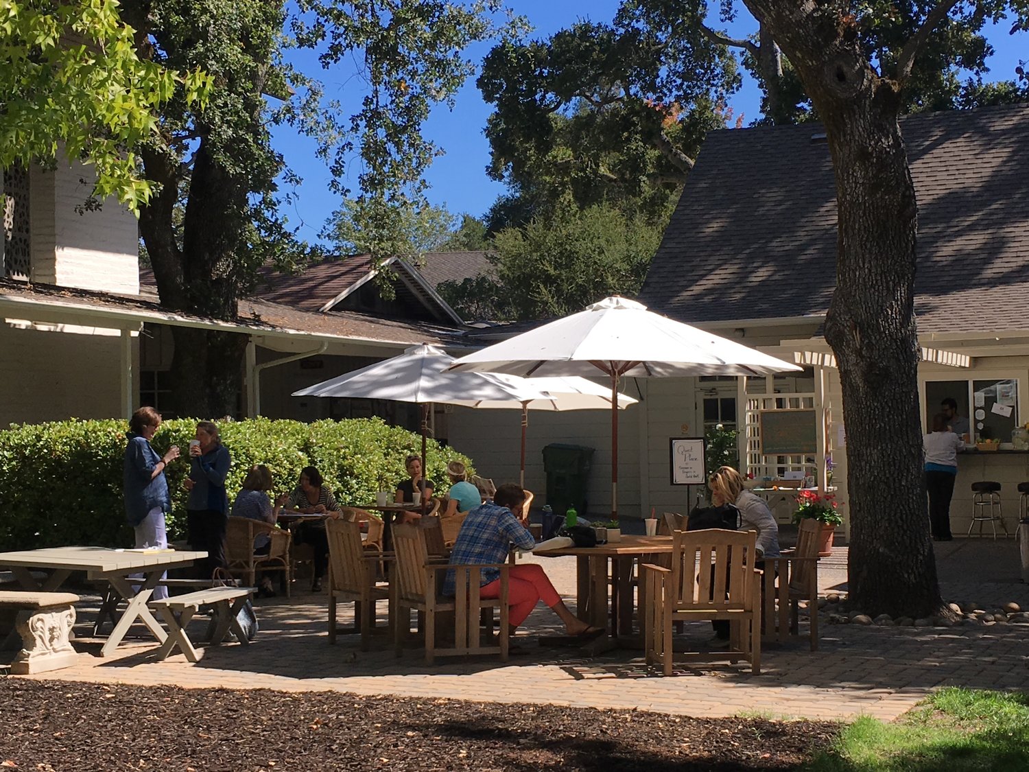
Parks and recreation
[edit]Numerous residents keep horses, and the town government maintains a network of horse trails. Some residents live on farmland used for business. The town is also popular among local cyclists and draws them in large numbers on weekends. The most popular road cycling routes include Old La Honda Road, King's Mountain Road, Cañada Road, Skyline Boulevard and Highway 84. The Tour of California bicycle race includes several roads along and adjacent to CA-84 and Skyline Boulevard.
Woodside is home to a number of open space preserves, including the Purisima Open Space (part of the Midpeninsula Regional Open Space), where both horseback riding and bicycling are allowed. For mountain biking, the famous Skeggs Point is located in Woodside along Skyline Boulevard. It is also home to Huddart County Park, which is accessible by authorized motor vehicles, pedestrians, and horses on Kings Mountain Road.
Wunderlich Park is extremely popular with both hiking and horse enthusiasts. The trails in this park are shared by those on foot and on horse and span almost 1000 acres.
Arts and culture
[edit]Djerassi Resident Artists Program
[edit]Dr. Carl Djerassi founded an artists' colony south of Woodside in memory of his late daughter Pamela.[19] The Djerassi Artists Residency is one of several Bay Area programs that houses artists.
Filoli Historic House & Gardens
[edit]Filoli Gardens is a historic estate in Woodside, featuring a 54,000-square-foot Georgian Revival mansion and 16 acres of formal gardens on a 654-acre property. Built between 1915 and 1917 for mining magnate William Bowers Bourn II, the site is managed by the National Trust for Historic Preservation. Filoli is open to the public and is known for its horticultural collections, seasonal displays, and use as a venue for cultural and educational programs.
Politics
[edit]In the California State Legislature, Woodside is in the 13th senatorial district, represented by Democrat Josh Becker, and in the 23rd Assembly district, represented by Democrat Marc Berman.[20]
Federally, Woodside is in California's 16th congressional district, represented by Democrat Sam Liccardo.[21]
Schools
[edit]The Woodside Elementary School District operates public elementary and middle schools. The Sequoia Union High School District operates Woodside High School.
Funding for public schools in Woodside are supplemented by grants from private foundations set up for that purpose and funded by local residents that enables Woodside to have one of the highest per pupil funding rates for elementary school and middle school students in the Bay Area.[22]
Points of interest
[edit]-

-
 Woodside Public Library
 -
 The Woodside Store, a local park includes a preserved historic hardware store.
 -
 Folger Estate Stable Historic District, within Wunderlich Park.
 -
 Mortimer Fleishhacker House and Estate


The city is served by the Woodside Public Library of the San Mateo County Libraries, a member of the Peninsula Library System.
In popular culture
[edit]The Mortimer Fleishhacker House was filmed as the Martin family house in the Robin Williams movie Bicentennial Man.[23] Dynasty was filmed at the Filoli Estate (not the interior of the mansion, but the exterior), as were the films The Wedding Planner, The Game, Lolita, George of the Jungle, Heaven Can Wait, and Harold and Maude. The musical Rent also has a scene filmed inside the Filoli Estate.
Notable people
[edit]This section needs additional citations for verification. (November 2020) |
Several notable people who live or have lived in Woodside, California, include:


.jpg)

Actors and entertainment
[edit]- Michelle Pfeiffer, actress, and her husband David E. Kelley, television producer
- Shirley Temple Black, child movie star
Artists and designers
[edit]- Frances Baldwin, artist and painter[24]
- Margaret Keane, artist who produced popular paintings of "big eye" waifs, and Walter Keane, her husband, who falsely claimed he had painted them.[25][26]
Business and entrepreneurs
[edit]- Nolan Bushnell, founder of Atari and Chuck E. Cheese's Pizza-Time Theater
- Scott Cook, co-founder of Intuit, Inc.[27]
- John Doerr, venture capitalist
- Masayoshi Son, founder and CEO of Softbank[28]
- Larry Ellison, CEO of Oracle Corporation, who spent nine years building an architecturally authentic, $200+ million Japanese feudal castle and man-made lake in Woodside;[29]
- Kenneth Fisher, founder of Fisher Investments, Forbes columnist, author, and local historian
- James Folger, coffee magnate
- Kazuo Hirai, CEO of Sony Corporation
- Steve Jobs, co-founder of Apple Inc. owned the Jackling House in Woodside, but had it demolished and was in the process of replacing it with a modern home on the same parcel before his death.
- Mike Markkula, second CEO of Apple Inc.
- Gordon E. Moore, co-founder of Intel and originator of Moore's Law
- Charles R. Schwab, American investor and founder of Charles Schwab Corporation
- Thomas Siebel, founder of Siebel Systems
- Jeffrey Skoll, Canadian internet entrepreneur
- John Thompson, CEO of Symantec
- Nick Woodman, founder and CEO of GoPro
Musicians
[edit]- Joan Baez, folk singer[30]
- Neil Young, rock musician and songwriter, who owns a 1,500 acres (6.1 km2) ranch and recording studio.[31]
Scientists
[edit]- Carl Djerassi, novelist, Stanford professor, and member of team that developed the birth control pill
- Koko, the gorilla who was taught in American Sign Language
Sports
[edit]- Julian Edelman, football player, attended Woodside High School
- Willie McCovey, played nineteen seasons for the San Francisco Giants. McCovey Cove at AT&T Park, and Willie McCovey Field at Woodside Elementary School are named after him.
- Lia Smith, diver, grew up in Woodside
- Zack Test, rugby union player
- Bill Walsh, former San Francisco 49ers head coach and Pro Football Hall of Fame, who died on July 30, 2007.
- Ricky Watters, Former NFL running back
Other
[edit]- Prince Vasili Alexandrovich of Russia, Russian royalty, nephew of Tsar Nicholas II
See also
[edit]References
[edit]- ^ "California Cities by Incorporation Date". California Association of Local Agency Formation Commissions. Archived from the original (Word) on November 3, 2014. Retrieved August 25, 2014.
- ^ "2019 U.S. Gazetteer Files". United States Census Bureau. Archived from the original on January 16, 2020. Retrieved July 1, 2020.
- ^ "Woodside". Geographic Names Information System. United States Geological Survey, United States Department of the Interior. Retrieved December 3, 2014.
- ^ a b c "Woodside (town) QuickFacts". United States Census Bureau. Archived from the original on September 23, 2023. Retrieved December 13, 2021.
- ^ "ZIP Code(tm) Lookup". United States Postal Service. Archived from the original on December 26, 2018. Retrieved December 3, 2014.
- ^ "Population and Housing Unit Estimates". United States Census Bureau. May 24, 2020. Archived from the original on July 1, 2021. Retrieved May 27, 2020.
- ^ "Town History". Town of Woodside. Retrieved January 24, 2025.
- ^ Gemmet, Andrea (July 6, 2005). "Eucalyptus trees fall, Brown Adobe stays put at Woodside's former Schroll estate". The Almanac News. Archived from the original on May 28, 2022. Retrieved August 2, 2017.
- ^ Poletti, Therese (2008). Art Deco San Francisco: The Architecture of Timothy Pflueger. Princeton Architectural Press. ISBN 978-1-56898-756-9.
- ^ "St. Denis Parish. History". Stdenisparish.org. Archived from the original on July 24, 2008. Retrieved March 9, 2022.
- ^ Dillon, Liam (February 4, 2022). "Wealthy town has an answer against building affordable housing: Mountain lions". Los Angeles Times. Retrieved February 6, 2022.
- ^ Maria Cramer and Alan Yuhas (February 7, 2022). "California Town Says Mountain Lions Don't Stop Housing After All". The New York Times. Retrieved June 8, 2022.
- ^ staff, NBC Bay Area; News • •, Bay City (February 7, 2022). "Woodside Reverses Housing Decision After AG Denies Mountain Lion Sanctuary Claim". NBC Bay Area. Archived from the original on February 7, 2022. Retrieved February 7, 2022.
- ^ House, The White (November 16, 2023). "Remarks by President Biden in a Press Conference | Woodside, CA". The White House.
- ^ "NOWData - NOAA Online Weather Data". National Oceanic and Atmospheric Administration. Archived from the original on August 15, 2019. Retrieved June 25, 2022.
- ^ "Census of Population and Housing". Census.gov. Archived from the original on July 1, 2021. Retrieved June 4, 2015.
- ^ "2010 Census Interactive Population Search: CA - Woodside town". U.S. Census Bureau. Archived from the original on July 15, 2014. Retrieved July 12, 2014.
- ^ "Woodside town, California; DP03: Selected Economic Characteristics - 2023 ACS 5-Year Estimates Comparison Profiles". US Census Bureau. Retrieved June 25, 2025.
- ^ "Djerassi artists' retreat hosts rare open house". East Bay Times. July 28, 2007. Retrieved August 2, 2017.
- ^ "Statewide Database". UC Regents. Archived from the original on February 1, 2015. Retrieved November 29, 2014.
- ^ "California's 16th Congressional District - Representatives & District Map". Civic Impulse, LLC. Retrieved March 13, 2013.
- ^ George Packer (May 27, 2013). "Change the World Silicon Valley transfers its slogans—and its money—to the realm of politics". The New Yorker. Archived from the original on July 29, 2015. Retrieved July 30, 2015.
In wealthy districts, the public schools have essentially been privatized; they insulate themselves from shortfalls in state funding with money raised by foundations they have set up for themselves.
- ^ "Forever Green: A conservation easement ensures one of Woodside's grandest estates, Green Gables, will be preserved (March 17, 2004)". www.almanacnews.com. Archived from the original on August 16, 2024. Retrieved August 16, 2024.
- ^ "Frances Baldwin". SFGate. Hearst Communications. August 10, 1999. Archived from the original on November 16, 2018. Retrieved December 25, 2015.
- ^ Nelson, Cletus. Citizen Keane: The Big Lies Behind the Big Eyes. Feral House.
- ^ Hamlin, Jesse (December 14, 2014). "Artist Margaret Keane hasn't lost wide-eyed enthusiasm for work". SFGATE. Retrieved November 5, 2020.
- ^ "Scott Cook". Forbes. Retrieved November 4, 2014.
- ^ "Masayoshi Son". Forbes. Archived from the original on March 9, 2014. Retrieved July 7, 2015.
- ^ Woollard, Deidre (March 27, 2008). "Larry Ellison's $3 Million Tax Rebate". Luxist.com. Archived from the original on March 10, 2012. Retrieved October 1, 2012.
- ^ Vaziri, Aidin (April 2, 2017). "Joan Baez opens up on retirement, Rock Hall induction". SFChronicle=. Archived from the original on October 2, 2020. Retrieved November 5, 2020.
- ^ Wheeler, Brad (January 11, 2019). "Musician Pegi Young, Neil's ex-wife, who died on New Year's Day, co-founded a school for children with special needs". The Globe and Mail. Retrieved November 5, 2020.
External links
[edit]Municipalities and communities of San Mateo County, California, United States | ||
|---|---|---|
| Cities and towns |  | |
| CDPs | ||
| Unincorporated communities | ||
| Ghost towns | ||
| Bodies of water |
|  | |||||||||||
|---|---|---|---|---|---|---|---|---|---|---|---|---|---|
| Counties | |||||||||||||
| Cities and towns |
| ||||||||||||
| CDPs over 10k | |||||||||||||
| Sub-regions | |||||||||||||
| Other | |||||||||||||
| International | |
|---|---|
| National | |
| Geographic | |
| Other | |
Woodside, California
View on GrokipediaHistory
Indigenous and Early Settlement
The territory comprising present-day Woodside, located in the coastal redwood belt of San Mateo County, was occupied by Ohlone (formerly termed Costanoan) bands for millennia prior to European arrival, with evidence of human presence dating back at least 10,000 years through regional archaeological findings such as shell middens, stone tools, and grinding implements.[6] These groups maintained semi-permanent villages and exploited the dense redwood forests for resources, fashioning dome-shaped dwellings from redwood bark slabs leaned against frames and utilizing the wood's straight grain for dugout canoes, bows, and ceremonial items; they also practiced cultural burning to manage understory vegetation and promote acorn production in oak-redwood mosaics.[7][8] Spanish expeditions under Gaspar de Portolá traversed the Peninsula in 1769, but direct colonization via missions like San Francisco de Asís (1776) and Santa Clara de Asís (1777) drew Ohlone laborers from the area, decimating populations through disease and relocation by the early 19th century.[6] Following Mexican independence in 1822, secularization of missions in 1834 enabled large ranchos under the Mexican land grant system; the Woodside vicinity formed part of Rancho Cañada de Raymundo, a 12,545-acre grant awarded to Irish settler John Coppinger in 1833 for cattle ranching, which passed to his widow and later John Greer after Coppinger's death in 1836.[9] The Mexican-American War concluded with the 1848 Treaty of Guadalupe Hidalgo, ceding California to the United States and prompting U.S. land claims commissions to adjudicate grants like Cañada de Raymundo, finalized in patent by 1860s surveys.[10] Early Anglo-American pioneers arrived in the early 1850s, subdividing rancho lands for subsistence agriculture—including wheat, vegetables, and orchards on alluvial flats—and modest logging to harvest redwoods for local mills and San Francisco's post-Gold Rush construction boom, though large-scale timber extraction awaited later decades.[9][11]Logging Era and Transition to Residential Use
The logging era in Woodside commenced in the early 19th century as English-speaking settlers arrived to exploit the dense coast redwood (Sequoia sempervirens) forests covering the peninsula's hills. Initial operations involved rudimentary sawmills, with Charles Brown establishing the first around 1838 to process timber for local and San Francisco Bay Area demand.[9] By the 1850s, amid the California Gold Rush, logging intensified dramatically; R.O. Tripp pioneered extraction along Redwood Creek, hauling felled trees down Woodside Road—then a rugged ox-cart trail—to tidewater ports in what became Redwood City.[12] Temporary mills proliferated, and rudimentary railroads supplemented overland transport, enabling the shipment of lumber southward to support booming construction in San Francisco and beyond.[11] This resource extraction peaked from the 1850s through the 1890s, driven by high demand for durable redwood in housing, wharves, and ships, but led to extensive clearing across the Woodside vicinity, with accessible stands rapidly diminishing as operations pushed upslope.[13] By the late 1890s, viable commercial timber in lower-elevation areas was nearing exhaustion, prompting mill closures and a sharp decline in logging activity around 1900, as the economic viability of further uphill harvesting waned without denser infrastructure.[9] The resulting scarred landscapes, dotted with stumps and secondary growth, underscored the causal depletion: unchecked exploitation had transformed a once-lush forest into marginal farmland or idle tracts, halting the industry's dominance. Post-1900, the exhaustion of timber resources incentivized a pivot toward land preservation for elite recreational use, as denuded properties became attractive to affluent San Franciscans escaping urban density. Starting in the 1880s—overlapping with logging's tail end—wealthy individuals acquired vast holdings for country estates, reforesting select areas for aesthetic and sporting purposes while repurposing cleared land for orchards, pastures, and residences.[9] Structures like the Pioneer Hotel, erected in 1882, marked this transitional hub for visitors and prospective buyers, facilitating the conversion of former mill sites into private ranches and retreats.[13] Early ranchers, including figures who consolidated holdings amid the timber bust, emphasized sustainable grazing over renewed cutting, thereby preserving residual woodlands that might otherwise have faced agricultural subdivision; this elite stewardship, rooted in resource scarcity rather than conservation ideology, laid the groundwork for Woodside's enduring low-density character.[9]Incorporation and Post-War Suburbanization
Woodside residents voted to incorporate the town on October 20, 1956, by a margin of 646 to 574, with formal incorporation occurring on November 16, 1956.[9] This action provided local control over land use and services previously managed by San Mateo County, primarily to avert urbanization pressures and enforce low-density residential zoning that preserved the area's rural estate character.[13][14] Post-World War II population expansion accelerated suburban development, with census figures recording 3,592 residents in 1960, rising to 4,731 by 1970 and 5,291 by 1980.[15][16] This influx comprised affluent professionals commuting to emerging tech hubs in adjacent Silicon Valley, where semiconductor and electronics industries burgeoned from the 1950s onward, drawn by Woodside's proximity to San Francisco while offering spacious lots amid redwood groves.[13] Incorporation facilitated essential infrastructure upgrades, including town-managed road maintenance and water systems, which supported the shift from scattered estates to organized suburban enclaves without compromising density limits.[9] Initial zoning ordinances emphasized one-acre minimum lots for residences, enabling selective subdivision of larger holdings while curbing commercial or high-density intrusions that had threatened under county oversight.[14] These measures aligned with broader Bay Area trends of postwar flight to semi-rural suburbs, bolstered by federal highway investments like Interstate 280, which enhanced accessibility by the 1960s.[17]Preservation Movements and Recent Challenges
In the 1970s, the establishment of the Midpeninsula Regional Open Space District in 1972 enabled systematic acquisition and protection of open spaces across the San Francisco Peninsula, including parcels within and adjacent to Woodside, through voter-approved bonds and public funding that prioritized habitat conservation over development.[18] Resident-driven efforts complemented these initiatives, with organizations like the Peninsula Open Space Trust facilitating private land donations and easements to preserve rural landscapes, emphasizing the maintenance of natural features amid encroaching suburban pressures.[19] By the 1990s, Woodside's General Plan Conservation Element codified policies to retain significant lands in their natural state, explicitly linking undeveloped areas to habitat protection and the town's equestrian-oriented rural identity, funded largely through local parcel taxes and voluntary contributions rather than state mandates.[20] During the 2000s, Woodside intensified resistance to urban sprawl by adopting residential design guidelines in 2000, which imposed strict aesthetic and scale controls to harmonize new builds with the existing low-density environment while navigating county-level development proposals.[21] Legal challenges arose, including lawsuits over infrastructure assessments like parking districts, where the town defended restrictions to curb paved expansion and preserve open vistas, though such litigation strained municipal budgets and underscored tensions with pro-growth advocates.[22] These measures effectively limited infill, sustaining a density of roughly 725 residents per square mile as of recent estimates, far below regional urban averages.[23] Recent challenges have centered on state housing laws clashing with local preservation priorities. In February 2022, Woodside temporarily halted approvals under Senate Bill 9—which permits lot splits for up to two units on single-family parcels—by invoking a clause exempting "sensitive habitat" due to mountain lion presence, but rescinded the moratorium after threats of legal action from housing advocacy groups and state oversight, allowing limited projects to proceed under CEQA scrutiny.[24] The town's 2023-2031 Housing Element, mandating 328 units (including 194 affordable), has sparked debates over rezoning sites like High Road and Raymundo Drive, with CEQA reviews highlighting wildlife corridors and infrastructure limits; as of 2024, the plan remains uncertified by the state, prompting accusations of exclusionary zoning from Sacramento officials despite Woodside's arguments rooted in topographic constraints and flood risks.[25] In May 2025, Caltrans withheld a surplus parcel for affordable housing citing rare wildflower protections, further illustrating federal-state overrides of local control.[26] These conflicts have preserved empirical outcomes like median home values surpassing $5 million and minimal density growth, bolstering property stability but drawing state rebukes for impeding regional supply amid California's broader shortages—critiques often amplified by outlets with incentives to prioritize density narratives over site-specific environmental data.[27][28]Geography and Environment
Location, Topography, and Boundaries
Woodside is situated in western San Mateo County on the San Francisco Peninsula, approximately 25 miles southeast of downtown San Francisco.[29] The town lies within the northern foothills of the Santa Cruz Mountains, bordered to the north by Redwood City and Emerald Hills, to the east by Portola Valley and Atherton, and to the south and west by unincorporated areas of the Santa Cruz Mountains.[30] These boundaries were established upon the town's incorporation on November 16, 1956, encompassing a total area of 11.47 square miles, of which nearly all is land with minimal water coverage.[29][31] The topography features steep hills and ridges with elevations ranging from around 300 feet in the eastern portions to over 2,000 feet in the higher western reaches, dominated by dense second-growth redwood forests interspersed with oak woodlands.[32] Creeks such as Los Trancos Creek drain the area toward the east, carving narrow valleys that amplify flood risks during heavy rainfall while contributing to the region's aesthetic and ecological value through perennial streams and riparian habitats.[33] This rugged terrain imposes significant constraints on development, restricting large-scale construction to flatter valley floors and ridgelines, which has preserved much of the town's 7,200 acres as open space and limited urban sprawl.[34] The elevation gradients and forested slopes enhance Woodside's appeal as a semi-rural enclave amid the urbanizing Bay Area, fostering large-lot estates and equestrian properties that capitalize on the natural seclusion.[35]Climate and Weather Patterns
Woodside features a warm-summer Mediterranean climate (Köppen Csb), marked by mild temperatures year-round, with cool, wet winters and dry summers moderated by coastal influences.[36] Average high temperatures range from 60°F in January to 72°F in August, while lows vary from 37°F in winter months to 57°F in summer, based on historical observations from local stations including Woodside Fire Station 1.[37] Annual precipitation averages around 30 inches, concentrated in the wetter season from October to March, during which over 80% of rainfall occurs, often from Pacific storms.[36] The town's topography, with elevations from 200 to over 2,000 feet, creates microclimates where higher ridges experience cooler conditions and earlier fog dissipation compared to lower valleys nearer the coast.[38] Persistent summer fog from the Pacific Ocean, advected inland by onshore winds, reduces daytime highs by 5-10°F in affected areas and contributes to "fog drip," providing supplemental moisture equivalent to 10-20 inches annually in forested zones.[20] This fog supports moisture-dependent vegetation like coast redwoods, which derive up to 40% of their water from condensation on foliage rather than direct rainfall.[20] Historical weather records show vulnerability to extremes, including multi-year droughts such as the severe 1976-1977 event, which reduced regional precipitation by over 50% below normal, and the 2012-2016 drought, the most intense in modern California history with statewide deficits exceeding 20 inches annually in multiple years.[39] Dry summers, combined with low humidity below 30% and Santa Ana-like winds, elevate wildfire risks, as seen in regional events where fuel aridity from prolonged dry spells—averaging 5-6 months without significant rain—facilitates rapid fire spread.[40] Conversely, intense atmospheric rivers have caused localized flooding, such as during the October 2021 event that delivered over 5 inches in 24 hours to parts of San Mateo County.[41]Natural Features, Wildlife, and Conservation Efforts
Woodside's landscape features dominant mixed oak woodlands and redwood-mixed evergreen forests, alongside grassland and chaparral zones that support diverse native flora.[20] These habitats, characteristic of the northern California coastal foothills, include coast redwoods (Sequoia sempervirens) reaching heights over 300 feet in protected groves and coast live oaks (Quercus agrifolia) forming dense canopies that stabilize soils and moderate microclimates.[42] Empirical surveys indicate these ecosystems host high plant diversity, with over 1,000 native species regionally, though local fragmentation from roads and legacy logging reduces connectivity.[43] Wildlife populations thrive in these areas, with black-tailed deer (Odocoileus hemionus columbianus) commonly foraging in oak understories, providing prey for apex predators like mountain lions (Puma concolor), which maintain ecological balance through herbivore control but pose rare risks to humans via vehicle collisions or attacks—averaging 0.5 incidents annually statewide.[44] Bird species exceed 100 documented types, including acorn woodpeckers (Melanerpes formicivorus) caching seeds in oak bark and California quail (Callipepla californica) nesting in grasslands, supporting pollination and seed dispersal.[45] Larger preserves like Huddart Park encompass 972 acres of redwood forest and riparian zones, buffering against urban encroachment and preserving corridors for bobcats (Lynx rufus), coyotes (Canis latrans), and gray foxes (Urocyon cinereoargenteus).[46] Adjacent public lands total over 2,000 acres when including Wunderlich Park, fostering gene flow amid suburban pressures.[47] Conservation efforts emphasize habitat preservation through town ordinances enacted post-1950s to cap density at one unit per 2-5 acres, minimizing fragmentation that exacerbates edge effects like increased predation on fawns.[20] These measures, rooted in empirical data on biodiversity loss from development, include invasive species control targeting French broom (Genista monspessulana), which outcompetes natives and heightens fire fuels—removal efforts have cleared thousands of acres locally via volunteer programs.[20] [48] Trade-offs arise in human-wildlife dynamics, as seen in 2022 when Woodside initially deemed all parcels mountain lion habitat to exempt SB 9 duplex projects under endangered species clauses, blocking potential infill that could reduce sprawl-driven habitat loss; legal challenges reversed this, allowing limited development while affirming lions' wide-ranging territories (up to 100 square miles) render blanket protections ecologically imprecise.[49] [50] Similarly, in 2025, Caltrans halted a proposed 200-unit affordable housing site on town-owned land near I-280 due to rare wildflowers (e.g., bent-flowered fiddleneck), prioritizing floral endemism over density benefits that might curb exurban conversion—highlighting causal tensions where strict protections preserve niches but constrain low-impact housing, potentially shifting impacts to less-regulated areas.[51] Low-density zoning thus enables resident-led stewardship, reducing per-capita disturbance, yet limits access for monitoring invasive spread or firebreaks.[20]Demographics
Population Trends and Census Data
The 2020 United States Census recorded a population of 5,309 for Woodside, marking a modest increase of 22 residents (0.4%) from the 5,287 counted in the 2010 Census. This slight uptick followed a peak of 5,513 in the 2000 Census, after which growth stagnated amid strict land-use regulations implemented post-incorporation in 1956 to preserve the town's rural character and limit suburban expansion. Recent estimates indicate a reversal, with the population dipping to approximately 5,181 by 2023 and projected to continue declining at an annual rate of about 1.7%, reaching around 4,867 by late 2025, reflecting minimal net migration and aging demographics rather than economic displacement.[52][53] Woodside's population density remains among the lowest in the San Francisco Bay Area at roughly 463 persons per square mile, calculated from its 11.47 square miles of land area and the 2020 Census figure, underscoring its emphasis on spacious estates and open space over dense development. Historical trends show slow, episodic growth from the town's logging-era roots through mid-20th-century residential conversions, with post-1950s zoning ordinances capping subdivision and enforcing minimum lot sizes, which stabilized numbers below 6,000 despite proximity to Silicon Valley's economic pull.[54] Between 2000 and 2020, the average annual growth rate hovered near zero, contrasting sharply with Bay Area-wide urbanization pressures. Demographic aging contributes to this stability, with a median resident age of 46.5 years as of 2023, skewed older by long-term family-held properties and low birth rates; under-18 residents comprised just 17.9% of the 2020 population, while those 65 and over accounted for 25.1%.[52] This structure aligns with Woodside's evolution into an enclave of established households, where conservation policies have prioritized permanence over influxes of younger commuters.[1]Socioeconomic Profile and Wealth Distribution
Woodside exhibits one of the highest median household incomes in California, estimated at over $250,000 in 2023, reflecting the concentration of high-earning professionals in proximity to Silicon Valley's technology sector.[55] [53] The area's poverty rate remains low at approximately 4.2%, significantly below both state and national averages, with educational attainment driving this profile: around 76% of residents aged 25 and older hold at least a bachelor's degree, including substantial shares with advanced degrees.[52] [56] Median home values exceed $3.5 million as of 2024, sustained by limited housing supply amid expansive rural zoning regulations that prioritize large-lot single-family development and environmental preservation over density.[57] [58] These restrictions, including minimum lot sizes and resistance to multifamily projects—often justified by wildlife habitat concerns such as mountain lion presence—constrain new construction, elevating property prices through basic supply-demand dynamics.[59] [60] The resulting exclusivity attracts affluent buyers while funding robust local infrastructure, including well-resourced public schools and parks, though it limits broader access. Income inequality in Woodside, measured by a Gini coefficient of approximately 0.49, surpasses the national average of 0.41, indicating moderate disparities even within this high-wealth enclave.[55] This metric underscores a bimodal distribution, with top earners—often tech executives—contrasting against service-oriented households, yet the overall affluence mitigates absolute deprivation. Critics, including housing advocates, argue such zoning-enforced scarcity perpetuates segregation, but empirical data affirm its role in maintaining elevated asset values that underpin community services without relying on external subsidies.[61][25]Racial, Ethnic, and Cultural Composition
According to the 2020 United States Census, Woodside's population of 5,309 residents exhibited low racial and ethnic diversity compared to San Mateo County overall, where non-White groups constitute over 50% of the population. Non-Hispanic Whites comprised 81.5% of residents, Asians 5.9%, Hispanics or Latinos of any race 6.2%, Blacks or African Americans 0.8%, and other groups including Native Americans, Pacific Islanders, and multiracial individuals the remainder.[62] This composition reflects the town's historical development as an affluent residential enclave of large estates since the early 20th century, attracting primarily European-descended landowners and professionals rather than broader immigrant settlement patterns seen in urban or industrial areas.[16]| Race/Ethnicity | Percentage (2020 Census) |
|---|---|
| White (non-Hispanic) | 81.5% |
| Hispanic or Latino (any race) | 6.2% |
| Asian | 5.9% |
| Two or more races | 3.1% |
| Black or African American | 0.8% |
| Other | <1% each |