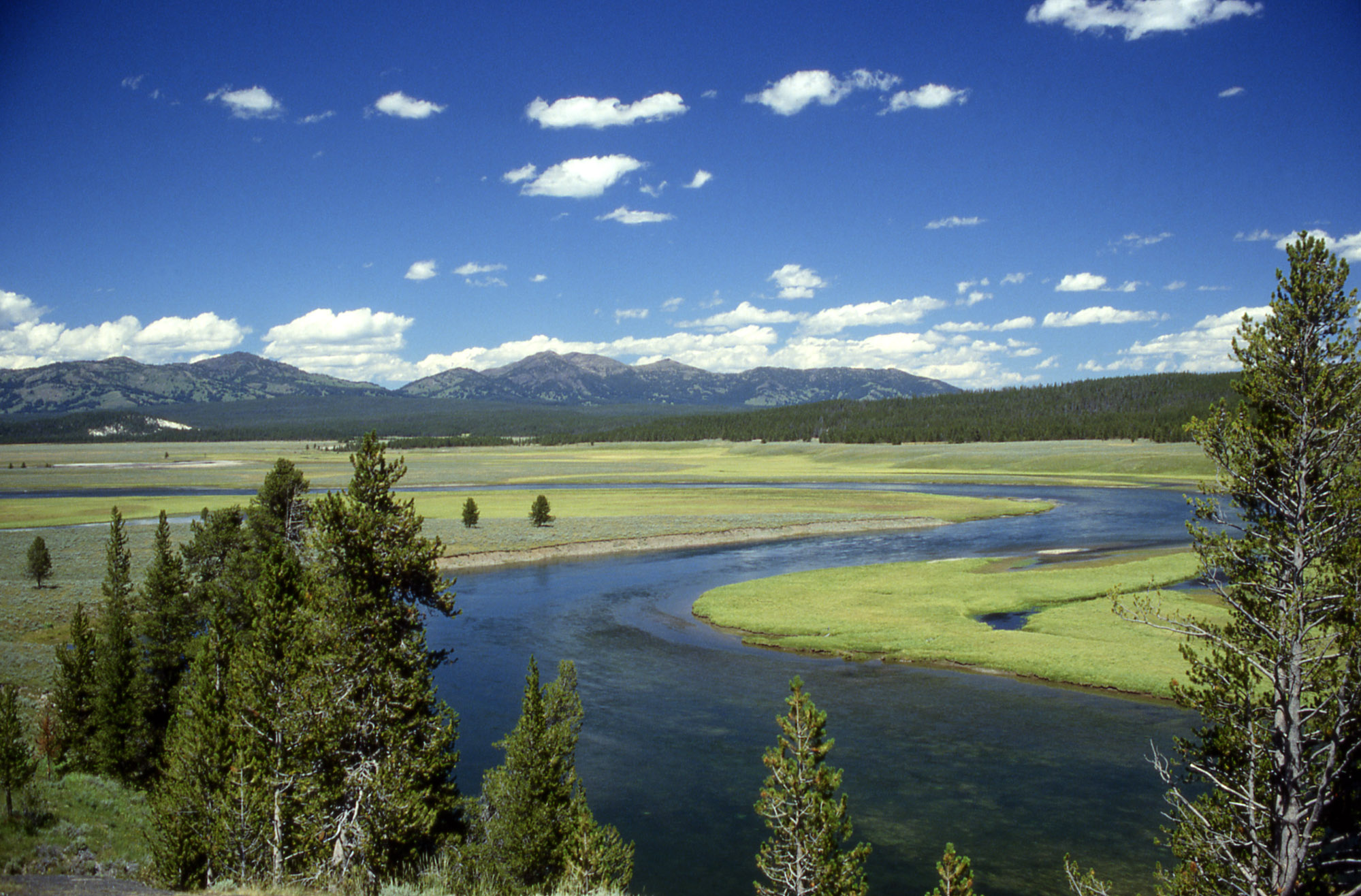

Yellowstone Caldera
View on Wikipedia
The Yellowstone Caldera, also known as the Yellowstone Plateau Volcanic Field, is a Quaternary caldera complex and volcanic plateau spanning parts of Wyoming, Idaho, and Montana. It is driven by the Yellowstone hotspot and is largely within Yellowstone National Park. The field comprises four overlapping calderas, multiple lava domes, resurgent domes, crater lakes, and numerous bimodal lavas and tuffs of basaltic and rhyolitic composition, originally covering about 17,000 km2 (6,600 sq mi).
Key Information


Volcanism began 2.15 million years ago and proceeded through three major volcanic cycles. Each cycle involved a large ignimbrite eruption, continental-scale ash-fall, and caldera collapse, preceded and followed by smaller lava flows and tuffs. The first and also the largest cycle was the Huckleberry Ridge Tuff eruption about 2.08 million years ago, which formed the Island Park Caldera. The most recent supereruption, about 630,000 years ago, produced the Lava Creek Tuff and created the present Yellowstone Caldera. Post-caldera eruptions included basalt flows, rhyolite domes and flows, and minor explosive deposits, with the last magmatic eruption about 70,000 years ago. Large hydrothermal explosions also occurred during the Holocene.
From 2004 to 2009, the region experienced notable uplift attributed to new magma injection. The 2005 disaster film Supervolcano, produced by the BBC and the Discovery Channel, increased public attention on the potential for a future catastrophic eruption. The Yellowstone Volcano Observatory monitors volcanic activity and does not consider an eruption imminent. Imaging of the magma reservoir indicates a substantial volume of partial melt beneath Yellowstone that is not currently eruptible.
Geology
[edit]The Yellowstone Plateau Volcanic Field lies at the eastern end of the Snake River Plain and disrupts the continuity of the Laramide orogenic belt, which formed during the Late Cretaceous.[1] From about 53 to 43 million years ago, this area experienced significant andesitic volcanism exceeding 29,000 km3 (7,000 cu mi) in total volume, forming the Absaroka Volcanic Supergroup. Prominent peaks such as Mount Washburn and Eagle Peak are eroded remnants of these earlier stratovolcanoes.[2] Before the formation of the Yellowstone Plateau, the Teton Range and Madison Range were likely structurally continuous, as were the Red Mountains and Gallatin Range.[3]
Current Yellowstone volcanism is not a continuation of Laramide tectonism or the Absaroka volcanic province.[3] Instead, it is the most recent part of a linear age-progression of rhyolitic complexes along the Snake River Plain, extending at least 16 million years to the McDermitt caldera complex.[4] Large rhyolitic tuff supereruptions occurred at these older eruptive centers.[5][6] One is the 12.1 million-year-old Ibex Hollow Tuff from the Bruneau-Jarbidge volcanic field in southern Idaho, burying herds of Nebraska mammals under volcanic ash.[7] Older volcanics proposed to be part of this hotspot track include the 56 million-year-old Siletzia oceanic plateau and the 70 million-year-old Carmacks Group.[8][9]
The cause of the northeastward progression of volcanism is debated. Some models invoke only upper-mantle processes, such as mantle pushed upward by the leading edge of the subducting Farallon plate,[10] slab rollback,[11] a propagating rift,[12] or mantle convection driven by abrupt changes in thermal layer thickness at the continent–ocean boundary.[13] A proposed lower-mantle origin suggests a fragment of the subducting Farallon slab penetrated the 660 km (410 mi) discontinuity, pushing up the lower mantle and triggering melting of water-rich transition zone beneath the western United States.[14] Alternatively, a long-lived mantle plume rooted at the core–mantle boundary has been proposed. The plume erupted the Columbia River Basalt Group and is now feeding the Yellowstone hotspot.[15] Seismic tomography has revealed a 350 km (220 mi) wide, cylindrical thermal anomaly extending from the deepest mantle to just beneath Yellowstone, supporting the mantle plume origin.[16] In this model, the North American Plate moves southwest at about 2.2 cm (0.87 in) per year over the relatively stationary plume, creating the observed age-progression of eruptive centers.[17]
Since its most recent major eruption approximately 640,000 years ago (the Lava Creek event), Yellowstone has remained geologically active, primarily due to the vast magma chamber beneath the caldera. This chamber is estimated to contain around 4,000 km³ of partially molten material, making it one of the largest of its kind globally. Periodic uplift of the caldera floor—measured at rates of up to 75 mm per year—provides valuable insights into the dynamics of subterranean magma movement and is a key focus of ongoing geological monitoring efforts.[18]
Structure of calderas
[edit]The northern and eastern extent of the first-cycle caldera are unknown due to burial, although it likely reached into the third-cycle caldera, perhaps east of the Central Plateau.[19] The Huckleberry Ridge Tuff in the Red Mountains is interpreted as thick intracaldera fill of the Island Park Caldera,[20] and Big Bend Ridge at the southwestern edge of the volcanic plateau is inferred to be part of its caldera wall.[20] A fault along the Snake River and Glade Creek, bounding the northern end of Teton Range and Huckleberry Ridge, is also thought to be part of the Island Park ring-fault.[21] It is not known whether any of the first-cycle caldera segments was resurgent.[22]
The second-cycle caldera is known as the Henry's Fork Caldera. Thurmon Ridge at the northwestern edge of the volcanic plateau is inferred to be its northern caldera wall.[23] The fault along Big Bend Ridge was reactivated, collapsing again during the second-cycle caldera formation.[20] Although basalt flows bury its southern and eastern boundary, a positive gravity anomaly indicates a circular caldera about 19 km (12 mi) in diameter, with its southern boundary in the middle of the Island Park basin.[23]
Robert L. Christiansen inferred that the Yellowstone Caldera is a compound caldera comprising two partially overlapping ring-fault zones, centered on the resurgent Mallard Lake dome and Sour Creek dome.[24] The southwest boundary is unconstrained due to post-caldera rhyolite burial, but he proposed that the south flank of Purple Mountain and the Washburn Range, along with the west flank of the Absaroka Range, mark the caldera boundary on the north and east sides.[25] Lake Butte, Flat Mountain Arm of Yellowstone Lake, north foothill of Red Mountains and Lewis Falls mark the southeast and south sides of Yellowstone caldera rim.[26] However, the purported Sour Creek ring-fault zone and the location of the eastern caldera boundary have been challenged. More recent field mappings suggest the eastern ring-fault lies west of Sour Creek dome, closely following the Yellowstone River.[27][28]
The most western portion of Yellowstone Lake is the elliptical 6 km × 8 km (3.7 mi × 5.0 mi) West Thumb Basin, which includes one of the lake's deepest areas. It is interpreted as a fourth caldera, formed by a third-cycle post-caldera explosive eruption.[29]

Eruption history
[edit]A total of 6,500 km3 (1,600 cu mi) of rhyolite and 250 km3 (60 cu mi) of basalt were emplaced over three volcanic cycles between about 2.15 million and 0.07 million years ago.[30] Each cycle lasted roughly three-quarters of a million years. The sequence of events in each cycle is similar: a catastrophic rhyolitic ash-flow sheet and caldera collapse, preceded and followed by eruptions of rhyolitic lavas and tuffs and basaltic eruptions near the caldera margin.[31] Ash-flow sheets account for more than half of the total volcanic volume of the Yellowstone Plateau.[32]
First-cycle
[edit]
The first-cycle lasted from about 2.15 million to 1.95 million years ago, spanning approximately 200 ky.[33] The only known pre-collapse rhyolitic unit is the Rhyolite of Snake River Butte, located just north of Ashton and dated at 2.1398±0.0035 million years,[34] roughly 60–70 kyr before the caldera-forming Huckleberry Ridge Tuff.[35] Its vent lies near the eventual first-cycle caldera margin close to the Big Bend Bridge.[19] Additional rhyolite flows may have erupted along the incipient ring-fault,[19] but the pre-collapse rhyolite history likely spans no more than ~70 kyr.[35] Another pre-collapse unit is the 60 to 70 m (200 to 230 ft)-thick Junction Butte Basalt on the northeastern margin of the plateau,[19] dated at 2.16±0.04 million years.[36] The Overhanging Cliff basalt is a flow of this unit.[19]
The first-cycle caldera-forming event was the eruption of the Huckleberry Ridge Tuff at 2.0773±0.0034 million years ago, during transitional magnetic polarity.[37] Its thickness exceeds 1 km (0.62 mi) in the Red Mountains area.[38] The initial Plinian phase deposited up to 2.5 m (8.2 ft) of fallout ash at Mount Everts before transitioning to ash-flow tuff.[39][40] Early Plinian activity was intermittent, sourced from multiple vents, probably lasted a few weeks and evacuated about 50 km3 (12 cu mi) of magma from four magma bodies,[41] triggering caldera collapse at the onset of transition to ash-flow.[42][41] The ash-flow tuff is a composite sheet consisted of three intermittent members, with a total magma volume of about 2,450 km3 (590 cu mi).[39] Member A likely vented from the plateau's central area[39] and tapped nine magma bodies.[41] After a hiatus of a few weeks or more,[42] the most voluminous Member B erupted from north of Big Bend Ridge.[43] After another extended break of years to decades,[42] part of the Member A magmatic system was rejuvenated to feed Member C.[42] The least voluminous Member C might have source area near the Red Mountains, where it is about 430 m (1,410 ft) thick.[44] Some outcrops of Member A and Member C have been misidentified as Member B, complicating volume estimates of individual ash-flow unit.[45] Glen A. Izett estimated that an additional 2,000 km3 (480 cu mi) of ash was dispersed as fallout across North America.[46] Tephra fallout from this event is known as the Huckleberry Ridge ash bed (formerly "Pearlette type B"). Its area covered exceeds 3,400,000 km2 (1,300,000 sq mi).[47]. It is widely distributed and has been identified in the Pacific Ocean at Deep Sea Drilling Project Site 36, about 1,600 km (990 mi) from Island Park Caldera,[48] as well as in the Humboldt and Ventura basins of coastal California,[49] near Afton in Iowa, Benson in Arizona, and Campo Grande Mountain in Texas.[50]
One lava flow near the Sheridan Reservoir[51] and two flows at the north end of Big Bend Ridge[52] are post-collapse rhyolites of the first-cycle volcanism. The Sheridan Reservoir Rhyolite, dated at 2.07±0.19 million years,[51] if vented from the Island Park ring-fracture, required a flow distance of at least 20 km (12 mi).[53] Its volume is estimated to exceed 10 km3 (2.4 cu mi).[54] The other two flows, the Blue Creek flow and the overlying Headquarters flow, have a combined volume of 10–20 km3 (2.4–4.8 cu mi)[55] and erupted respectively at 1.9811±0.0035 million years and 1.9476±0.0037 million years ago.[34]
Second-cycle
[edit]After ~500 kyr of quiescence,[56] a new magmatic system formed north of Big Bend Ridge. It erupted the Bishop Mountain Flow at 1.4578±0.0016 million years and the Tuff of Lyle Spring at 1.4502±0.0027 million years.[57] The Bishop Mountain Flow is a rhyolite with an exposed volume of about 23 km3 (5.5 cu mi) and reaches a thickness of 375 m (1,230 ft) along the inner caldera wall. The Tuff of Lyle Spring is a 1 km3 (0.24 cu mi), composite ash-flow sheet consisting of two cooling units.[58] Both eruptions appear to have originated from an isolated, highly evolved local magma chamber distinct from the second-cycle magma source.[52] Tiffany A. Rivera et al. (2017) suggest these two eruptions should not be assigned to the second cycle but instead represent the separate Lyle Spring magmatic system.[56] The next pre-collapse rhyolite eruption is the Green Canyon Flow in the north of Big Bend Ridge, with a mapped volume of about 5 km3 (1.2 cu mi), dated at 1.2989±0.0009 million years.[57] Its age is indistinguishable from that of the subsequent Mesa Falls Tuff, but the Henry's Fork Caldera fracture truncates the Green Canyon Flow, indicating it predates the second-cycle caldera.[59]
The second-cycle caldera-forming eruption was the Mesa Falls Tuff, dated at 1.3001±0.0006 million years.[60] Its exposed thickness exceeds 150 m (490 ft) on Thurmon Ridge, though it is likely much thicker within the caldera.[52] During the initial Plinian phase, about 5 m (16 ft) of ash and pumice were deposited around the Ashton area, while much of the vitric ash dispersed to more distant regions, as inferred from the high crystal content of the local deposit. This airfall is overlain by a 1 m (3.3 ft) pyroclastic surge layer also enriched in crystals.[61] A single cooling unit of ash-flow tuff followed, covering about 2,700 km2 (1,000 sq mi) with an estimated volume of 280 km3 (67 cu mi).[52] The Mesa Falls ash bed (formerly "Pearlette type S") is the distal ash-fall of this eruption, found in Brainard and Hartington in Nebraska, and in the southern Rocky Mountains of Colorado.[50]
Post-collapse eruptions included the Moonshine Mountain dome[62] and five rhyolite domes collectively known as the Island Park Rhyolite.[23] The Moonshine Mountain dome, with an estimated volume of 2.5 km3 (0.60 cu mi), erupted at 1.3017±0.0019 million years.[57] While its age is indistinguishable from the Mesa Falls Tuff, field evidence indicates it formed after the collapse of the Henry's Fork Caldera.[62] The dome's magma source is likely the same region that supplied the Bishop Mountain Flow.[63] The Island Park Rhyolite comprises five bodies: Silver Lake dome, Osborne Butte dome, Elk Butte dome, Lookout Butte dome, and Warm River Butte dome.[23] These domes collectively have a total volume of 1–2 km3 (0.24–0.48 cu mi).[55] All five erupted within a few centuries, around 1.2905±0.0020 million years, during a single eruptive episode.[64] While Lookout Butte is located on the rim of Big Bend Ridge caldera wall, the vents for the other four domes align along a northwest-trending, structurally controlled linear vent zone about 30 km (19 mi) long and no more than 7 km (4.3 mi) wide.[65]
Third-cycle
[edit]Pre-collapse third-cycle silicic rocks are broadly divided into the Mount Jackson Rhyolite and the Lewis Canyon Rhyolite,[66] which vented along what later became the ring-fracture zone of the third-cycle caldera.[67] The earliest known lava in this cycle is the Wapiti Lake flow of the Mount Jackson group, dated at 1.2187±0.0158 million years,[68] exposed near the Grand Canyon of the Yellowstone and likely vented near Wapiti Lake.[69] Another flow, the Moose Creek Butte flow (1.1462±0.0022 million years), also belongs to the Mount Jackson group.[70] Although younger than the Island Park Rhyolite, its geochemical similarity has led some researchers to propose it as a second-cycle post-collapse eruption.[71] Pumice of an unknown tuff unit at Broad Creek has an age range from 0.948±0.016 million years to 1.11±0.02 million years.[72] Later Mount Jackson eruptions include the Flat Mountain Rhyolite (0.929±0.034 million years)[73] and the Harlequin Lake flow (0.8300±0.0072 million years).[68] The Lewis Canyon Rhyolite group contains lavas dated to 0.8263±0.0184 million years,[68] though Robert L. Christiansen suggests they could be late-stage first-cycle eruptions.[74] A recently discovered ash-flow unit is dated to 0.796 million years.[75] An explosive eruption deposited pumiceous fallout near Harlequin Lake,[66] which is immediately overlain by the Mount Haynes lava (0.7016±0.0014 million years).[68] An ash bed from a Yellowstone eruption was deposited in the Great Salt Lake approximately 0.7 million years ago.[76] The age of the Big Bear Lake flow is uncertain, but it lies beneath the third-cycle caldera-forming Lava Creek Tuff.[66] Additional Mount Jackson flows may be buried within the Yellowstone caldera, inferred from intracaldera topography.[74]
The climatic ash-flow eruption of the third cycle was the Lava Creek Tuff, dated at 0.6260±0.0026 million years,[35] during a glacial–interglacial transition in the Marine Isotope Stage.[77] This composite tuff sheet consists of at least two members, distinguishable by a widely occurring welding intensity decrease between them,[78] and represents a total ash-flow volume of about 1,000 km3 (240 cu mi).[79] Member A likely erupted south of Purple Mountain, where it reaches its greatest thickness of 430 m (1,410 ft) and exhibits maximum welding.[79] The Purple Mountain to Gibbon Canyon segment of caldera wall collapsed after the emplacement of Member A but before it completely cooled.[80] A 20–30 cm (7.9–11.8 in) loose crystal ash unit separates Member A from Member B, indicating a break in the eruption sufficiently long for cooling of thick ash-flows.[81] A 3 m (9.8 ft) thick pumiceous ash-fall deposit underlies Member B and probably marks its initial phase.[81] Member B ash-flows extends radially outward along paleovalleys and more extensive plateau segments. The eruptive center for Member B appears to be situated farther east compared to that of Member A.[82] However, this simplistic eruptive sequence has been challenged.[27] An additional 40 m (130 ft) ash-flow unit (informally named unit 2) has been identified, venting from around Bog Creek. Unit 2 erupted some decades after Member A had cooled[83] and overlies tuff fragments from Member A.[75] Two additional rhyolite ash-flow units (unit 3 and unit 4) have been recognized, erupting from a vent near Stonetop Mountain and are previously undocumented parts of the Lava Creek Tuff.[83] An unknown welded tuff underlying Member B at Flagg Ranch, not attributed to Member A, was emplaced shortly before the initial ashfall of Member B and is considered part of the early Lava Creek eruption.[84] Rather than having the simple structure of just two ignimbrite sheets, the Lava Creek Tuff may consist of multiple ash-flow lobes from distinct magma bodies.[75] The ash fallout from the Lava Creek Tuff eruption is known as the Lava Creek ash bed (formerly "Pearlette type O"),[50] covering an area exceeding 3,000,000–4,000,000 km2 (1,200,000–1,500,000 sq mi).[47] Perkins and Nash (2002) estimated that the volume of this ash bed is greater than 500 km3 (120 cu mi).[85] It has been identified in the Gulf of Mexico,[86] near Regina, Saskatchewan,[87] in Ventura, California,[88] and in Viola Center, Iowa.[50]
Post-collapse rhyolites
[edit]Post-collapse rhyolites likely erupted shortly after the Lava Creek Tuff.[89] The subaerial post-collapse silicic rocks are collectively referred to as the Plateau Rhyolite,[90] which primarily consists of lava flows.[89] Plateau Rhyolite is divided into three intracaldera members—Upper Basin Member, Mallard Lake Member, and Central Plateau Member—and two extracaldera members—Obsidian Creek Member and Roaring Mountain Member.[91] It is likely that rhyolitic pumice and ash were erupted during the opening of vents for each of these lava flows.[89] The earliest intracaldera rhyolite, the East Biscuit Basin Flow of the Upper Basin Member, is dated to 0.635±0.014 million years, followed by felsic lithic clasts of an unknown unit (0.6±0.02 million years) in Yellowstone Lake,[92] and the North Biscuit Basin Flow (0.580±0.040 million years).[93] The earliest extracaldera rhyolite is the Riverside Flow (0.5258±0.0033 million years) of the Roaring Mountain Member,[94] broadly contemporaneous with the Middle Biscuit Basin Flow (0.527±0.028 million years).[93] Two ash-flow tuff units of the Upper Basin Member include the 35 m (115 ft)-thick Tuff of Uncle Tom's Trail[91] and the 230 m (750 ft)-thick Tuff of Sulphur Creek[95], the latter dated at 0.479±0.02 million years.[96] Tuff of Sulphur Creek is at least 13 km3 (3.1 cu mi).[97] These tuffs were deposited on the north flank of the Sour Creek dome.[91] The Canyon lava flows of the Upper Basin Member erupted immediately after the Tuff of Sulphur Creek, as the ash-flow was still hot at the time of emplacement.[98] Both the Tuff of Sulphur Creek and Canyon flows originated from a vent near Fern Lake.[98] The two tuffs and Canyon flows have a combined magma volume of 40–70 km3 (9.6–16.8 cu mi).[55] The Dunraven Road Flow (0.486±0.042 million years) of the Upper Basin Member overlies the Canyon flows[98] and may have had an extracaldera vent.[99] The Cougar Creek lava dome of the Roaring Mountain Member erupted 0.358±0.002 million years north of the caldera.[100] Four additional lava flows of the Obsidian Creek Member—Willow Park dome, Apollinaris Spring dome, Gardner River complex, and Grizzly Lake complex—erupted between 0.326±0.002 million years and 0.263±0.003 million years,[100] in the vicinity of Norris Geyser Basin northward toward Mammoth Hot Springs.[101] The South Biscuit Basin Flow of the Upper Basin Member erupted 0.257±0.009 million years ago.[93] The Scaup Lake Flow of the Upper Basin Member is dated to 0.244±0.009 million years,[93] while the Landmark dome of the Obsidian Creek Member is 0.226±0.006 million years.[100]
Non-explosive eruptions of lava and less-violent explosive eruptions have occurred in and near the Yellowstone caldera since the last supereruption.[102][103] The most recent lava flow occurred about 70,000 years ago, while a violent eruption excavated the West Thumb of Lake Yellowstone 174,000 years ago. Smaller steam explosions occur as well. An explosion 13,800 years ago left a 5 km (3.1 mi) diameter crater at Mary Bay on the edge of Yellowstone Lake (located in the center of the caldera).[104] Currently, volcanic activity is exhibited via numerous geothermal vents scattered throughout the region, including the famous Old Faithful Geyser, plus recorded ground-swelling indicating ongoing inflation of the underlying magma chamber.[citation needed]
Hazards
[edit]Earthquakes
[edit]
Volcanic and tectonic actions in the region cause between 1,000 and 2,000 measurable earthquakes annually. Most are relatively minor, measuring magnitude 3 or weaker. Occasionally, numerous earthquakes are detected in a relatively short period of time, an event known as an earthquake swarm. In 1985, more than 3,000 earthquakes were measured over a period of several months. More than 70 smaller swarms were detected between 1983 and 2008. The USGS states these swarms are likely caused by slips on pre-existing faults rather than by movements of magma or hydrothermal fluids.[106][107]
In December 2008, continuing into January 2009, more than 500 earthquakes were detected under the northwest end of Yellowstone Lake over a seven-day span, with the largest registering a magnitude of 3.9.[108][109] Another swarm started in January 2010, after the Haiti earthquake and before the Chile earthquake. With 1,620 small earthquakes between January 17, 2010, and February 1, 2010, this swarm was the second-largest ever recorded in the Yellowstone Caldera. The largest of these shocks was a magnitude 3.8 that occurred on January 21, 2010.[107][110] This swarm subsided to background levels by February 21. On March 30, 2014, at 6:34 AM MST, a magnitude 4.8 earthquake struck Yellowstone, the largest recorded there since February 1980.[111] In February 2018, more than 300 earthquakes occurred, with the largest being a magnitude 2.9.[112]
Volcanoes
[edit]
The Lava Creek eruption of the Yellowstone Caldera, which occurred 640,000 years ago,[113] ejected approximately 1,000 cubic kilometres (240 cu mi) of rock, dust and volcanic ash into the atmosphere. It was Yellowstone's third and most recent caldera-forming eruption.
Geologists closely monitor the elevation of the Yellowstone Plateau, which has been rising as quickly as 150 millimetres (5.9 in) per year, as an indirect measurement of changes in magma chamber pressure.[114][115][116]
The upward movement of the Yellowstone caldera floor between 2004 and 2008—almost 75 millimetres (3.0 in) each year—was more than three times greater than ever observed since such measurements began in 1923.[117] From 2004 to 2008, the land surface within the caldera moved upward as much as 8 inches (20 cm) at the White Lake GPS station.[118][119] In January 2010, the USGS stated that "uplift of the Yellowstone Caldera has slowed significantly"[120] and that uplift continues but at a slower pace.[121] USGS, University of Utah and National Park Service scientists with the Yellowstone Volcano Observatory maintain that they "see no evidence that another such cataclysmic eruption will occur at Yellowstone in the foreseeable future. Recurrence intervals of these events are neither regular nor predictable." This conclusion was reiterated in December 2013 in the aftermath of the publication of a study by University of Utah scientists finding that the "size of the magma body beneath Yellowstone is significantly larger than had been thought". The Yellowstone Volcano Observatory issued a statement on its website stating:
Although fascinating, the new findings do not imply increased geologic hazards at Yellowstone, and certainly do not increase the chances of a "super eruption" in the near future. Contrary to some media reports, Yellowstone is not "overdue" for a super eruption.[122]
Media reports were more hyperbolic in their coverage.[123]
A study published in GSA Today, the monthly news and science magazine of the Geological Society of America, identified three fault zones where future eruptions are most likely to be centered.[124] Two of those areas are associated with lava flows aged 174,000–70,000 years ago, and the third is a focus of present-day seismicity.[124]
In 2017, NASA conducted a study to determine the feasibility of preventing the volcano from erupting. The results suggested that cooling the magma chamber by 35 percent would be enough to forestall such an incident. NASA proposed introducing water at high pressure 10 kilometers underground. The circulating water would release heat at the surface, possibly in a way that could be used as a geothermal power source. If enacted, the plan would cost about $3.46 billion. Brian Wilcox of the Jet Propulsion Laboratory observes that such a project could incidentally trigger an eruption if the top of the chamber is drilled into.[125][126]
According to analysis of earthquake data in 2013, the magma chamber is 80 km (50 mi) long and 20 km (12 mi) wide. It also has 4,000 km3 (960 cu mi) underground volume, of which 6–8% is filled with molten rock. This is about 2.5 times bigger than scientists had previously imagined; however, scientists believe that the proportion of molten rock in the chamber is too low to allow for another supereruption.[127][128][129]
In October 2017, research from Arizona State University indicated prior to Yellowstone's last supereruption, magma surged into the magma chamber in two large influxes. An analysis of crystals from Yellowstone's lava showed that prior to the last supereruption, the magma chamber underwent a rapid increase in temperature and change in composition. The analysis indicated that Yellowstone's magma reservoir can reach eruptive capacity and trigger a super-eruption within just decades, not centuries as volcanologists had originally thought.[130][131]
Hydrothermal explosions
[edit]
Volcanic eruptions and ongoing geothermal activity at Yellowstone are attributed to a large plume of magma located beneath the caldera. This magma contains dissolved gases held under immense pressure. If the pressure is sufficiently reduced—due to geological shifts such as crustal fracturing—these gases can exsolve, forming bubbles and causing the magma to expand. This process can trigger a chain reaction, where further pressure release leads to increased gas expansion. In extreme cases, this may culminate in an explosive eruption if overlying crustal material is forcefully ejected.[citation needed][132]
Studies and analysis may indicate that the greater hazard comes from hydrothermal activity which occurs independently of volcanic activity.[citation needed][133] Over 20 large craters have been produced in the past 14,000 years, resulting in such features as Mary Bay, Turbid Lake, and Indian Pond, which was created in an eruption about 1300 BC.[citation needed]
In a 2003 report, USGS researchers proposed that an earthquake may have displaced more than 77 million cubic feet (2,200,000 m3; 580,000,000 US gal) of water in Yellowstone Lake, creating colossal waves that unsealed a capped geothermal system and led to the hydrothermal explosion that formed Mary Bay.[134][135]
Further research shows that very distant earthquakes reach and have effects upon the activities at Yellowstone, such as the 1992 7.3 magnitude Landers earthquake in California's Mojave Desert that triggered a swarm of quakes from more than 800 miles (1,300 km) away, and the 2002 7.9 magnitude Denali fault earthquake 2,000 miles (3,200 km) away in Alaska that altered the activity of many geysers and hot springs for several months afterward.[136]
In 2016, the USGS announced plans to map the subterranean systems responsible for feeding the area's hydrothermal activity. According to the researchers, these maps could help predict when another eruption occurs.[137]
Cultural significance
[edit]IUGS geological heritage site
[edit]In respect of it being "well-known for its past explosive volcanic eruptions and lava flows as well for its world class hydrothermal system", the International Union of Geological Sciences (IUGS) included "The Yellowstone volcanic and hydrothermal system" in its assemblage of 100 geological heritage sites around the world in a listing published in October 2022. The organization defines an IUGS Geological Heritage Site as "a key place with geological elements and/or processes of international scientific relevance, used as a reference, and/or with a substantial contribution to the development of geological sciences through history".[138]
See also
[edit]

References
[edit]- ^ Christiansen 2001, p. 9.
- ^ USGS 2021.
- ^ a b Christiansen 2001, p. 11.
- ^ Henry et al. 2017, p. 1066.
- ^ Christiansen et al. 2013.
- ^ Perkins et al. 1995, p. 1500.
- ^ Sarna-Wojcicki et al. 2023, p. 22.
- ^ Camp & Wells 2021, p. 4.
- ^ Johnston et al. 1996, p. 997.
- ^ Faccenna et al. 2010, p. 58.
- ^ Long et al. 2012, p. 2.
- ^ Christiansen, Foulger & Evans 2002, p. 1247.
- ^ King 2007, p. 224.
- ^ Zhou 2018, p. 449.
- ^ Richards, Duncan & Courtillot 1989, p. 106.
- ^ Nelson & Grand 2018, p. 280.
- ^ Anders 1994.
- ^ Pathak, Charudatta (April 20, 2025). "yellowstone-volcano-and-its-geological-evolution".
- ^ a b c d e Christiansen 2001, p. 53.
- ^ a b c Christiansen 2001, p. 61.
- ^ Christiansen 2001, p. 62.
- ^ Christiansen 2001, p. 63.
- ^ a b c d Christiansen 2001, p. 66.
- ^ Christiansen 2001, p. 35.
- ^ Christiansen 2001, p. 36.
- ^ National Park Service.
- ^ a b Wilson, Stelten & Lowenstern 2018, p. 52.
- ^ Yellowstone Volcano Observatory 2023, p. 29.
- ^ Christiansen 2001, p. 45.
- ^ Christiansen 2001, p. 69.
- ^ Christiansen 2001, p. 1.
- ^ Christiansen 2001, p. 68.
- ^ Rivera et al. 2017, p. 384.
- ^ a b Rivera et al. 2017, p. 380.
- ^ a b c Wotzlaw et al. 2015, p. 4.
- ^ Christiansen 2001, p. 22.
- ^ Singer et al. 2014, p. 35.
- ^ Wilson 2017, p. 45.
- ^ a b c Christiansen 2001, p. 55.
- ^ Wilson 2009.
- ^ a b c Swallow et al. 2018, p. 32.
- ^ a b c d Swallow et al. 2019, p. 1374.
- ^ Christiansen 2001, p. 57.
- ^ Christiansen 2001, p. 59.
- ^ Phillips, Garwood & Feeney 2014.
- ^ Izett 1981, p. 10201.
- ^ a b Sarna-Wojcicki et al. 2023, p. 24.
- ^ Sarna-Wojcicki et al. 1987, p. 215.
- ^ Sarna-Wojcicki et al. 1987, p. 207.
- ^ a b c d Izett & Wilcox 1982.
- ^ a b Watts, Bindeman & Schmitt 2011, p. 862.
- ^ a b c d Christiansen 2001, p. 64.
- ^ Watts, Bindeman & Schmitt 2011, p. 863.
- ^ Watts, Bindeman & Schmitt 2011, p. 860.
- ^ a b c Balsley & Gregory 1998, p. 130.
- ^ a b Rivera et al. 2018, p. 236.
- ^ a b c Rivera et al. 2018, p. 229.
- ^ Rivera et al. 2018, p. 226.
- ^ Rivera et al. 2018, p. 234.
- ^ Rivera et al. 2016, p. 7.
- ^ Neace 1986, p. 73.
- ^ a b Rivera et al. 2018, p. 235.
- ^ Stelten, Champion & Kuntz 2018, p. 59.
- ^ Stelten, Champion & Kuntz 2018, p. 55.
- ^ Christiansen 2001, p. 67.
- ^ a b c Christiansen 2001, p. 17.
- ^ Christiansen 2001, p. 19.
- ^ a b c d Troch et al. 2017, p. 7.
- ^ Christiansen 2001, p. 24.
- ^ Stelten, Champion & Kuntz 2018, p. 53.
- ^ Troch et al. 2017, p. 14.
- ^ Obradovich 1992, p. 10.
- ^ Christiansen 2001, p. 21.
- ^ a b Christiansen 2001, p. 25.
- ^ a b c Myers et al. 2024.
- ^ Perkins & Nash 2002, p. 374.
- ^ Matthews, Vazquez & Calvert 2015, p. 2524.
- ^ Christiansen 2001, p. 26.
- ^ a b Christiansen 2001, p. 31.
- ^ Christiansen 2001, p. 38.
- ^ a b Christiansen 2001, p. 29.
- ^ Christiansen 2001, p. 34.
- ^ a b U.S. Geological Survey, Volcano Science Center 2024, p. 29.
- ^ Henderson 2023.
- ^ Perkins & Nash 2002, p. 377.
- ^ Sarna-Wojcicki & Davis 1991, p. 112.
- ^ Westgate, Christiansen & Boellstorff 1977, p. 357.
- ^ Sarna-Wojcicki et al. 1987, p. 216.
- ^ a b c Christiansen et al. 2007, p. 7.
- ^ Christiansen 2001, p. 39.
- ^ a b c Christiansen 2001, p. 40.
- ^ Morgan & Shanks 2005, p. 37.
- ^ a b c d Till et al. 2019, p. 3868.
- ^ Nastanski 2005, p. 47.
- ^ Pritchard & Larson 2012, p. 209.
- ^ Christiansen 2001, p. 27.
- ^ Manley & McIntosh 2002, p. 220.
- ^ a b c Christiansen 2001, p. 42.
- ^ Pritchard & Larson 2012, p. 226.
- ^ a b c Christiansen et al. 2007, p. 78.
- ^ Christiansen 2001, p. 48.
- ^ Bindeman, Ilya N.; Fu, Bin; Kita, Noriko T.; Valley, John W. (January 2008). "Origin and Evolution of Silicic Magmatism at Yellowstone Based on Ion Microprobe Analysis of Isotopically Zoned Zircons". Journal of Petrology. 49 (1): 163–193. CiteSeerX 10.1.1.583.1851. doi:10.1093/petrology/egm075.
- ^ "Secrets of supervolcanoes" (PDF). University of Oregon.
- ^ "Introduction to hydrothermal (steam) explosions in Yellowstone". Yellowstone National Park. Yellowstone Net. Archived from the original on January 6, 2009. Retrieved December 31, 2008.
- ^ "Yellowstone National Park Earthquake listings". Retrieved April 20, 2013.
- ^ "Yellowstone Earthquake Swarms". Yellowstone Volcano Observatory. Archived from the original on April 3, 2012. Retrieved January 1, 2009.
- ^ a b "January 2010 Yellowstone Seismicity Summary". Archived from the original on November 8, 2014. Retrieved February 1, 2010.
- ^ "Yellowstone Volcano Observatory". United States Geological Survey. Retrieved April 29, 2020.
- ^ "UUSS Webicorder (Seismogram) at Lake for December 31, 2008". Retrieved January 1, 2009.[dead link]
- ^ Johnson, Kirk (January 31, 2010). "Hundreds of Quakes Are Rattling Yellowstone". The New York Times. Retrieved January 23, 2014.
- ^ Zuckerman, Laura. "Yellowstone National Park rattled by largest earthquake in 34 years". Reuters. Retrieved March 31, 2014.
Gedeon, Jacqueline (March 31, 2014). "4.8 magnitude earthquake hits Yellowstone National Park". KECI. Montana. Retrieved April 4, 2018. - ^ Zachos, Elaina (February 21, 2018). "Earthquake Swarms Are Shaking Yellowstone's Supervolcano. Here's What That Means". National Geographic. Archived from the original on February 22, 2018. Retrieved April 4, 2018.
Bartels, Meghan (February 20, 2018). "Yellowstone Supervolcano Earthquake Swarm Hits 200 Shakes in Less Than Two Weeks". Newsweek. Retrieved April 4, 2018. - ^ "Undine Falls, Lava Creek, Yellowstone National Park". United States Geological Survey. Archived from the original on February 4, 2012. Retrieved January 2, 2009.
- ^ Timmer, John (November 8, 2007). "Yellowstone recharges". arstechnica.com. Retrieved November 8, 2007.
- ^ Smith, Robert B.; Chang, Wu-Lung; Siegel, Lee (November 8, 2007). "Yellowstone rising: Volcano inflating with molten rock at record rate" (Press release). University of Utah Public Relations. Archived from the original on February 28, 2018. Retrieved June 27, 2009 – via EurekAlert! (American Association for the Advancement of Science).
- ^ Chang, W.-L.; Smith, R. B.; Wicks, C.; Farrell, J. M.; Puskas, C. M. (November 9, 2007). "Accelerated Uplift and Magmatic Intrusion of the Yellowstone Caldera, 2004 to 2006". Science. 318 (5852): 952–956. Bibcode:2007Sci...318..952C. doi:10.1126/science.1146842. PMID 17991858. S2CID 22478071.
- ^ "Molten Rock Fills Yellowstone Volcano at Record Rate". newswise.com. Retrieved April 15, 2024.
- ^ "Recent ups and downs of the Yellowstone Caldera". Yellowstone Volcano Observatory. United States Geological Survey. September 28, 2008. Archived from the original on April 13, 2012. Retrieved December 31, 2008.
- ^ Smith, Robert B.; Jordan, Michael; Steinberger, Bernhard; Puskas, Christine M.; Farrell, Jamie; Waite, Gregory P.; Husen, Stephan; Chang, Wu-Lung; O'Connell, Richard (November 20, 2009). "Geodynamics of the Yellowstone hotspot and mantle plume: Seismic and GPS imaging, kinematics and mantle flow" (PDF). Journal of Volcanology and Geothermal Research. 188 (1–3): 26–56. Bibcode:2009JVGR..188...26S. doi:10.1016/j.jvolgeores.2009.08.020.
- ^ Current Alerts for U.S. Volcanoes. volcano.wr.usgs.gov
- ^ GPS Station: WLWY – Data Products – Time Series Plots. unavco.org
- ^ "Monitoring Upgrades Result in New Insight into Yellowstone's Magma System" (Press release). Yellowstone Volcano Observatory (USGS). December 19, 2013. Archived from the original on March 4, 2016. Retrieved January 2, 2014.
- ^ Burnett, Jim (January 1, 2014). "Reactions To Yellowstone Supervolcano Study Ranged From Hysteria To Ho-Hum". National Parks Traveller. Retrieved January 2, 2014.
- ^ a b Lovett, Richard A. (September 20, 2012). "Yellowstone Supervolcano Discovery—Where Will It Erupt?". National Geographic. Archived from the original on June 28, 2021.
- ^ Cox, David (August 17, 2017). "Nasa's ambitious plan to save Earth from a supervolcano". BBC. Retrieved April 29, 2020.
- ^ "No, NASA Isn't Going to Drill to Stop Yellowstone from Erupting". Discover Magazine. Retrieved April 29, 2020.
- ^ Witze, Alexandra (2013). "Large magma reservoir gets bigger". Nature. doi:10.1038/nature.2013.14036. S2CID 130449188.
- ^ "USGS: Volcano Hazards Program – Yellowstone Volcano Observatory Featured Articles Archive". Archived from the original on March 4, 2016. Retrieved April 4, 2014.
- ^ "Discovery of Ancient Super-eruptions Suggests the Yellowstone Hotspot May Be Waning (USGS Release Date: JUNE 29, 2020)". July 9, 2018. Retrieved February 16, 2021.
- ^ Aceves, Ana (October 12, 2017). "Yellowstone Supervolcano May Erupt Sooner Than Anticipated". PBS. Retrieved March 12, 2021.
- ^ Diebel, Matthew (October 16, 2017). "Scientists seek clues to what triggered past Yellowstone 'supervolcano' eruptions". USA Today. Retrieved March 12, 2021.
- ^ "Volcano deformation: what and why". U.S. Geological Survey (USGS). August 2021.
- ^ "The real hazards of yellowstone". June 2019.
- ^ "Frequently asked questions about recent findings at Yellowstone Lake". Yellowstone Volcano Observatory. United States Geological Survey. September 11, 2008. Archived from the original on April 3, 2012. Retrieved December 31, 2008.
- ^ "Tsunami linked to Yellowstone crater". USA Today. January 14, 2008. Retrieved December 31, 2008.
- ^ "Quake in Alaska Changed Yellowstone Geysers". University of Utah. May 27, 2004. Retrieved December 31, 2008.
- ^ "We're About to Find Out What's Rumbling Below The Yellowstone Supervolcano". Science Alert. November 16, 2016. Retrieved May 22, 2017.
- ^ "The First 100 IUGS Geological Heritage Sites" (PDF). IUGS International Commission on Geoheritage. IUGS. Retrieved November 13, 2022.
Sources
[edit]- Manley, C. R.; McIntosh, W. C. (2002). "The Juniper Mountain volcanic center, Owyhee County, southwestern Idaho: Age relations and physical volcanology". In Bonnichsen, Bill; White, C. M.; McCurry, Michael (eds.). Tectonic and Magmatic Evolution of the Snake River Plain Volcanic Province. Bulletin. Vol. 30. Idaho Geological Survey. pp. 205–227.
- Morgan, Lisa A.; Shanks, W. C. Pat III (2005). "Influences of Rhyolitic Lava Flows on Hydrothermal Processes in Yellowstone Lake and on the Yellowstone Plateau". Geothermal Biology and Geochemistry in YNP. Montana State University. Retrieved February 15, 2025.
- Christiansen, Robert L.; Lowenstern, Jacob B.; Smith, Robert B.; Heasler, Henry; Morgan, Lisa A.; Nathenson, Manuel; Mastin, Larry G.; Muffler, L.J. Patrick; Robinson, Joel E. (2007). "Preliminary Assessment of Volcanic and Hydrothermal Hazards in Yellowstone National Park and Vicinity". Open-File Report: 61. Bibcode:2007usgs.rept...61C. doi:10.3133/ofr20071071. ISSN 2331-1258.
- Obradovich, J. D. (1992). "Geochronology of the Late Cenozoic volcanism of Yellowstone National Park and adjoining areas, Wyoming and Idaho". Open-File Report (Report). Open-File Report. U.S. Geological Survey. doi:10.3133/ofr92408. Retrieved February 15, 2025.
- Pritchard, Chad J.; Larson, Peter B. (March 16, 2012). "Genesis of the post-caldera eastern Upper Basin Member rhyolites, Yellowstone, WY: from volcanic stratigraphy, geochemistry, and radiogenic isotope modeling". Contributions to Mineralogy and Petrology. 164 (2): 205–228. Bibcode:2012CoMP..164..205P. doi:10.1007/s00410-012-0733-9. ISSN 0010-7999.
- Till, Christy B.; Vazquez, Jorge A.; Stelten, Mark E.; Shamloo, Hannah I.; Shaffer, Jamie S. (2019). "Coexisting Discrete Bodies of Rhyolite and Punctuated Volcanism Characterize Yellowstone's Post-Lava Creek Tuff Caldera Evolution". Geochemistry, Geophysics, Geosystems. 20 (8): 3861–3881. Bibcode:2019GGG....20.3861T. doi:10.1029/2019gc008321. ISSN 1525-2027.
- Nastanski, Nicole Marie (2005). Petrogenesis of extracaldera rhyolites at Yellowstone volcanic field: Evidence for an evolving silicic magma system north of Yellowstone Caldera (Master's thesis). University of Nevada, Las Vegas. doi:10.25669/mkjk-5nhm.
- Perkins, Michael E.; Nash, Barbara P. (March 1, 2002). "Explosive silicic volcanism of the Yellowstone hotspot: The ash fall tuff record". GSA Bulletin. 114 (3): 367–381. Bibcode:2002GSAB..114..367P. doi:10.1130/0016-7606(2002)114<0367:ESVOTY>2.0.CO;2. ISSN 0016-7606.
- Westgate, J. A.; Christiansen, E. A.; Boellstorff, J. D. (1977). "Wascana Creek Ash (Middle Pleistocene) in southern Saskatchewan: characterization, source, fission track age, palaeomagnetism and stratigraphic significance". Canadian Journal of Earth Sciences. 14 (3): 357–374. Bibcode:1977CaJES..14..357W. doi:10.1139/e77-037. ISSN 0008-4077.
- Sarna-Wojcicki, Andrei M.; Davis, Jonathan O. (January 1, 1991), Morrison, Roger B. (ed.), "Quaternary tephrochronology", Quaternary Nonglacial Geology: Conterminous U.S., vol. K-2, Geological Society of America, p. 0, doi:10.1130/dnag-gna-k2.93, ISBN 978-0-8137-5461-1, retrieved January 30, 2025
- Henderson, Stacy (November 20, 2023). "The Mystery of Flagg Ranch, OR, the case of the unknown ignimbrite". Yellowstone Volcano Observatory. Retrieved January 29, 2025.
- Myers, Madison; Henderson, Stacy; Salazar, Raymond; Wilson, Colin J N; Finch, Hailey; Brown, Thomas (December 11, 2024). A chronostratigraphic reassessment of the Lava Creek Tuff, Yellowstone. American Geophysical Union Fall Meeting. San Francisco, CA.
- U.S. Geological Survey, Volcano Science Center (2024). "Yellowstone Volcano Observatory 2023 annual report". Circular (Report). Circular. Reston, VA: U.S. Geological Survey. p. 49. doi:10.3133/cir1524.
- Matthews, Naomi E.; Vazquez, Jorge A.; Calvert, Andrew T. (2015). "Age of the Lava Creek supereruption and magma chamber assembly at Yellowstone based on 40Ar/39Ar and U-Pb dating of sanidine and zircon crystals". Geochemistry, Geophysics, Geosystems. 16 (8): 2508–2528. doi:10.1002/2015GC005881. ISSN 1525-2027.
- Stelten, Mark E.; Champion, Duane E.; Kuntz, Mel A. (January 15, 2018). "The timing and origin of pre- and post-caldera volcanism associated with the Mesa Falls Tuff, Yellowstone Plateau volcanic field". Journal of Volcanology and Geothermal Research. 350: 47–60. Bibcode:2018JVGR..350...47S. doi:10.1016/j.jvolgeores.2017.12.002. ISSN 0377-0273.
- Troch, Juliana; Ellis, Ben S.; Mark, Darren F.; Bindeman, Ilya N.; Kent, Adam J. R.; Guillong, Marcel; Bachmann, Olivier (January 23, 2017). "Rhyolite Generation prior to a Yellowstone Supereruption: Insights from the Island Park–Mount Jackson Rhyolite Series". Journal of Petrology egw071. doi:10.1093/petrology/egw071. hdl:20.500.11850/197283. ISSN 0022-3530.
- Anders, Mark H. (1994). "Constraints on North American plate velocity from the Yellowstone hotspot deformation field". Nature. 369 (6475): 53–55. Bibcode:1994Natur.369...53A. doi:10.1038/369053a0. ISSN 1476-4687.
- Balsley, Steven D.; Gregory, Robert T. (October 1, 1998). "Low-18O silicic magmas: why are they so rare?". Earth and Planetary Science Letters. 162 (1): 123–136. doi:10.1016/S0012-821X(98)00161-7. ISSN 0012-821X. OSTI 1370.
- Camp, Victor; Wells, Ray (2021). "The Case for a Long-Lived and Robust Yellowstone Hotspot". GSA Today. 31 (1): 4–10. Bibcode:2021GSAT...31a...4C. doi:10.1130/gsatg477a.1. ISSN 1052-5173.
- Christiansen, E. H.; McCurry, M. O.; Champion, D. E.; Bolte, T.; Holtz, F.; Knott, T.; Branney, M. J.; Shervais, J. W. (December 1, 2013). "Rhyolites in the Kimberly Drill Core, Project Hotspot: First Intracaldera Ignimbrite from the Central Snake River Plain, Idaho?". Fall Meeting 2013. 2013. American Geophysical Union: V53E–05. Bibcode:2013AGUFM.V53E..05C.
- Christiansen, Robert L. (2001). "The Quaternary and Pliocene Yellowstone Plateau volcanic field of Wyoming, Idaho, and Montana". USGS Report: 4. Bibcode:2001usgs.rept....4C. doi:10.3133/pp729G. ISSN 2330-7102.
- Christiansen, Robert L.; Foulger, G. R.; Evans, John R. (2002). "Upper-mantle origin of the Yellowstone hotspot". Geological Society of America Bulletin. 114 (10): 1245–1256. Bibcode:2002GSAB..114.1245C. doi:10.1130/0016-7606(2002)114<1245:UMOOTY>2.0.CO;2.
- Faccenna, Claudio; Becker, Thorsten W.; Lallemand, Serge; Lagabrielle, Yves; Funiciello, Francesca; Piromallo, Claudia (October 15, 2010). "Subduction-triggered magmatic pulses: A new class of plumes?". Earth and Planetary Science Letters. 299 (1): 54–68. Bibcode:2010E&PSL.299...54F. doi:10.1016/j.epsl.2010.08.012. ISSN 0012-821X.
- Henry, Christopher D.; Castor, Stephen B.; Starkel, William A.; Ellis, Ben S.; Wolff, John A.; Laravie, Joseph A.; McIntosh, William C.; Heizler, Matthew T. (July 17, 2017). "Geology and evolution of the McDermitt caldera, northern Nevada and southeastern Oregon, western USA". Geosphere. 13 (4): 1066–1112. Bibcode:2017Geosp..13.1066H. doi:10.1130/ges01454.1. hdl:20.500.11850/225749. ISSN 1553-040X.
- Izett, Glen A. (1981). "Volcanic ash beds: Recorders of Upper Cenozoic silicic pyroclastic volcanism in the western United States". Journal of Geophysical Research: Solid Earth. 86 (B11): 10200–10222. Bibcode:1981JGR....8610200I. doi:10.1029/JB086iB11p10200. ISSN 2156-2202.
- Izett, G. A.; Wilcox, R. E. (1982). "Map Showing Localities and Inferred Distributions of the Huckleberry Ridge, Mesa Falls, and Lava Creek Ash Beds of Pliocene and Pleistocene Age in the Western United States and Southern Canada". U.S. Geological Survey. Retrieved January 12, 2025.
- Johnston, Stephen T.; Jane Wynne, P.; Francis, Don; Hart, Craig J. R.; Enkin, Randolph J.; Engebretson, David C. (November 1, 1996). "Yellowstone in Yukon: The Late Cretaceous Carmacks Group". Geology. 24 (11): 997–1000. Bibcode:1996Geo....24..997J. doi:10.1130/0091-7613(1996)024<0997:YIYTLC>2.3.CO;2. ISSN 0091-7613.
- King, Scott D. (March 1, 2007). "Hotspots and edge-driven convection". Geology. 35 (3): 223–226. Bibcode:2007Geo....35..223K. doi:10.1130/G23291A.1. ISSN 0091-7613.
- Long, Maureen D.; Till, Christy B.; Druken, Kelsey A.; Carlson, Richard W.; Wagner, Lara S.; Fouch, Matthew J.; James, David E.; Grove, Timothy L.; Schmerr, Nicholas; Kincaid, Chris (2012). "Mantle dynamics beneath the Pacific Northwest and the generation of voluminous back-arc volcanism". Geochemistry, Geophysics, Geosystems. 13 (8) 2012GC004189. Bibcode:2012GGG....13.AN01L. doi:10.1029/2012gc004189. hdl:1721.1/85588. ISSN 1525-2027.
- National Park Service. "Gibbon Falls". National Park Service. Retrieved January 12, 2025.
- Neace, T. F. (1986). Eruptive style, emplacement, and lateral variations of the Mesa Falls Tuff, Island Park, Idaho, as shown by detailed volcanic stratigraphy and pyroclastic studies (M.S. thesis). Pocatello: Idaho State University.
- Nelson, Peter L.; Grand, Stephen P. (2018). "Lower-mantle plume beneath the Yellowstone hotspot revealed by core waves". Nature Geoscience. 11 (4): 280–284. Bibcode:2018NatGe..11..280N. doi:10.1038/s41561-018-0075-y. ISSN 1752-0908.
- Perkins, Michael E.; Nash, William P.; Brown, Francis H.; Fleck, Robert J. (December 1, 1995). "Fallout tuffs of Trapper Creek, Idaho—A record of Miocene explosive volcanism in the Snake River Plain volcanic province". GSA Bulletin. 107 (12): 1484–1506. Bibcode:1995GSAB..107.1484P. doi:10.1130/0016-7606(1995)107<1484:FTOTCI>2.3.CO;2. ISSN 0016-7606.
- Phillips, William M.; Garwood, Dean L.; Feeney, Dennis M. (2014). "Geologic Map of the Salmon Quadrangle, Lemhi County, Idaho". Idaho Geological Survey. Retrieved January 12, 2025.
- Richards, Mark A.; Duncan, Robert A.; Courtillot, Vincent E. (October 6, 1989). "Flood Basalts and Hot-Spot Tracks: Plume Heads and Tails". Science. 246 (4926): 103–107. Bibcode:1989Sci...246..103R. doi:10.1126/science.246.4926.103. PMID 17837768.
- Rivera, Tiffany A.; Darata, Rachel; Lippert, Peter C.; Jicha, Brian R.; Schmitz, Mark D. (December 1, 2017). "The duration of a Yellowstone super-eruption cycle and implications for the age of the Olduvai subchron". Earth and Planetary Science Letters. 479: 377–386. Bibcode:2017E&PSL.479..377R. doi:10.1016/j.epsl.2017.08.027. ISSN 0012-821X.
- Rivera, Tiffany A.; Furlong, Ryan; Vincent, Jaime; Gardiner, Stephanie; Jicha, Brian R.; Schmitz, Mark D.; Lippert, Peter C. (2018). "Volcanism at 1.45 Ma within the Yellowstone Volcanic Field, United States". Journal of Volcanology and Geothermal Research. 357: 224–238. Bibcode:2018JVGR..357..224R. doi:10.1016/j.jvolgeores.2018.04.030. ISSN 0377-0273.
- Rivera, Tiffany A.; Schmitz, Mark D.; Jicha, Brian R.; Crowley, James L. (October 29, 2016). "Zircon Petrochronology and40Ar/39Ar Sanidine Dates for the Mesa Falls Tuff: Crystal-scale Records of Magmatic Evolution and the Short Lifespan of a Large Yellowstone Magma Chamber". Journal of Petrology egw053. doi:10.1093/petrology/egw053. ISSN 0022-3530.
- Sarna-Wojcicki, A. M.; Morrison, S. D.; Meyer, C. E.; Hillhouse, J. W. (February 1, 1987). "Correlation of upper Cenozoic tephra layers between sediments of the western United States and eastern Pacific Ocean and comparison with biostratigraphic and magnetostratigraphic age data". GSA Bulletin. 98 (2): 207–223. Bibcode:1987GSAB...98..207S. doi:10.1130/0016-7606(1987)98<207:COUCTL>2.0.CO;2. ISSN 0016-7606.
- Sarna-Wojcicki, Andrei M.; Knott, Jefferey R.; Westgate, John A.; Budahn, James R.; Barron, John; Bray, Colin J.; Ludvigson, Greg A.; Meyer, Charles E.; Miller, David M.; Otto, Rick E.; Pearce, Nicholas J.G.; Smith, Charles C.; Walkup, Laura C.; Wan, Elmira; Yount, James (July 20, 2023). "Ibex Hollow Tuff from ca. 12 Ma supereruption, southern Idaho, identified across North America, eastern Pacific Ocean, and Gulf of Mexico". Geosphere. 19 (5): 1476–1507. Bibcode:2023Geosp..19.1476S. doi:10.1130/GES02593.1. ISSN 1553-040X.
- Singer, Brad S.; Jicha, Brian R.; Condon, Daniel J.; Macho, Alexandra S.; Hoffman, Kenneth A.; Dierkhising, Joseph; Brown, Maxwell C.; Feinberg, Joshua M.; Kidane, Tesfaye (November 1, 2014). "Precise ages of the Réunion event and Huckleberry Ridge excursion: Episodic clustering of geomagnetic instabilities and the dynamics of flow within the outer core". Earth and Planetary Science Letters. 405: 25–38. Bibcode:2014E&PSL.405...25S. doi:10.1016/j.epsl.2014.08.011. ISSN 0012-821X.
- Swallow, Elliot J.; Wilson, Colin J. N.; Myers, Madison L.; Wallace, Paul J.; Collins, Katie S.; Smith, Euan G. C. (March 29, 2018). "Evacuation of multiple magma bodies and the onset of caldera collapse in a supereruption, captured in glass and mineral compositions". Contributions to Mineralogy and Petrology. 173 (4): 33. Bibcode:2018CoMP..173...33S. doi:10.1007/s00410-018-1459-0. ISSN 1432-0967.
- Swallow, Elliot J; Wilson, Colin J N; Charlier, Bruce L A; Gamble, John A (June 28, 2019). "The Huckleberry Ridge Tuff, Yellowstone: evacuation of multiple magmatic systems in a complex episodic eruption". Journal of Petrology. 60 (7): 1371–1426. doi:10.1093/petrology/egz034. hdl:10468/8257. ISSN 0022-3530.
- USGS (February 14, 2021). "The Other Volcanic Range in the Yellowstone Region: The Absarokas". USGS. United States Geological Survey. Retrieved January 10, 2025.
- Watts, Kathryn E.; Bindeman, Ilya N.; Schmitt, Axel K. (May 1, 2011). "Large-volume Rhyolite Genesis in Caldera Complexes of the Snake River Plain: Insights from the Kilgore Tuff of the Heise Volcanic Field, Idaho, with Comparison to Yellowstone and Bruneau–Jarbidge Rhyolites". Journal of Petrology. 52 (5): 857–890. doi:10.1093/petrology/egr005. ISSN 0022-3530.
- Wilson, C. J. (December 1, 2009). "Physical Volcanology of the Huckleberry Ridge Tuff". American Geophysical Union. 2009: V23C–2085. Bibcode:2009AGUFM.V23C2085W.
- Wilson, Colin J.N. (February 1, 2017). "Volcanoes: Characteristics, Tipping Points, and those Pesky Unknown Unknowns". Elements. 13 (1): 41–46. Bibcode:2017Eleme..13...41W. doi:10.2113/gselements.13.1.41. ISSN 1811-5209.
- Wilson, Colin J. N.; Stelten, Mark E.; Lowenstern, Jacob B. (May 16, 2018). "Contrasting perspectives on the Lava Creek Tuff eruption, Yellowstone, from new U–Pb and 40Ar/39Ar age determinations". Bulletin of Volcanology. 80 (6): 53. doi:10.1007/s00445-018-1229-x. ISSN 1432-0819.
- Wotzlaw, Jörn-Frederik; Bindeman, Ilya N.; Stern, Richard A.; D'Abzac, Francois-Xavier; Schaltegger, Urs (September 10, 2015). "Rapid heterogeneous assembly of multiple magma reservoirs prior to Yellowstone supereruptions". Scientific Reports. 5 (1) 14026. Bibcode:2015NatSR...514026W. doi:10.1038/srep14026. hdl:20.500.11850/104434. ISSN 2045-2322. PMC 4564848. PMID 26356304.
- Yellowstone Volcano Observatory (2023). Yellowstone Volcano Observatory 2022 Annual Report (Report). Circular. U.S. Geological Survey. Retrieved January 11, 2025.
- Zhou, Ying (2018). "Anomalous mantle transition zone beneath the Yellowstone hotspot track". Nature Geoscience. 11 (6): 449–453. Bibcode:2018NatGe..11..449Z. doi:10.1038/s41561-018-0126-4. ISSN 1752-0908.
Further reading
[edit]- Bennington, N.; Schultz, A.; Bedrosian, P.; Bowles-Martinez, E.; et al. (January 2, 2025). "The progression of basaltic–rhyolitic melt storage at Yellowstone Caldera". Nature. 637 (8044): 97–102. Bibcode:2025Natur.637...97B. doi:10.1038/s41586-024-08286-z. ISSN 0028-0836. PMID 39743608.
- Breining, Greg (2007). Super Volcano: The Ticking Time Bomb beneath Yellowstone National Park. St. Paul, Minnesota: Voyageur Press. ISBN 978-0-7603-2925-2.
A popularized scientific look at the Yellowstone area's geological past and potential future
. - Sutherland, Wayne; Sutherland, Judy (2003). Yellowstone Farewell. Spur Ridge.
A novel looking at an eruption in the Yellowstone Caldera written by a practicing Wyoming geologist. Contains a wealth of technical details on the geology of western Wyoming
. - Vazquez, J. A.; Reid, M. R. (2002). "Time scales of magma storage and differentiation of voluminous rhyolites at Yellowstone caldera". Contributions to Mineralogy and Petrology. 144 (3). Wyoming: 274–285. Bibcode:2002CoMP..144..274V. doi:10.1007/s00410-002-0400-7. S2CID 109927088.
External links
[edit] Media related to Yellowstone Caldera at Wikimedia Commons
- The Snake River Plain and the Yellowstone Hot Spot
- Yellowstone Volcano Observatory
- FAQ relating to the supervolcano Archived April 20, 2012, at the Wayback Machine
- Supervolcano documentary from BBC
- Interactive: When Yellowstone Explodes Archived July 5, 2011, at the Wayback Machine from National Geographic
- Canales, Manuel; Chung, Daisy; Santamarina, Daniela; Paniagua, Ronald; Preppernau, Charles; Canellas, Hernan; Umentum, Andrew; Conant, Eve; Sickley, Theodore A. (May 2016). "Inside Yellowstone's Supervolcano". National Geographic. National Geographic Society. Archived from the original on April 16, 2016.
- Huang, Hsin-Hua; Lin, Fan-Chi; Schmandt, Brandon; Farrell, Jamie; Smith, Robert B.; Tsai, Victor C. (2015). "The Yellowstone magmatic system from the mantle plume to the upper crust". Science. 348 (6236): 773–776. Bibcode:2015Sci...348..773H. doi:10.1126/science.aaa5648. PMID 25908659. (46,000 km3 magma reservoir below chamber)
- Inside Yellowstone's Supervolcano, National Geographic

| National | |
|---|---|
| Geographic | |


Yellowstone Caldera
View on GrokipediaLocation and Overview
Geographical Setting
The Yellowstone Caldera is centered at approximately 44°25′N 110°40′W and spans roughly 45 by 85 km, encompassing parts of northwestern Wyoming, southeastern Montana, and eastern Idaho.[7][4] It lies predominantly within Yellowstone National Park, forming a central topographic depression amid the park's volcanic plateau landscape.[8] The caldera's boundaries are defined by surrounding mountain ranges, including the Absaroka Range along its northern and eastern edges and the Teton Range to the southwest, which contribute to the park's rugged high-elevation terrain.[8] Elevations across the caldera vary from about 2,100 to 2,800 meters, with Yellowstone Lake—a prominent feature covering much of the caldera's interior—positioned at 2,357 meters above sea level.[9][10] The region's climate features a continental pattern with cold winters and high annual snowfall averaging 381 cm, though geothermal heating from the caldera's hydrothermal systems creates localized microclimates that melt snow and moderate temperatures around active features.[11][12]Supervolcanic Significance
The Yellowstone Caldera is classified as a supervolcano due to its capacity for eruptions rated at Volcanic Explosivity Index (VEI) 8, defined by the ejection of more than 1,000 cubic kilometers of material in a single event.[13] This classification stems from its geological record, particularly the Lava Creek Tuff eruption around 640,000 years ago, which released approximately 1,000 km³ of pyroclastic material, forming the current caldera and exemplifying the scale required for supervolcanic status.[4] In comparison to other supervolcanoes, Yellowstone's eruptive volumes align closely with those of Taupo in New Zealand, where the Oruanui eruption about 26,500 years ago achieved VEI 8 status with a bulk tephra volume exceeding 1,000 km³, marking it as the most recent such event globally.[14] The Toba supervolcano in Indonesia produced a larger VEI 8 eruption around 74,000 years ago, ejecting roughly 2,800 km³ of dense rock equivalent material, which dwarfs Yellowstone's individual events but occurred far less frequently in the recent geological record.[15] Yellowstone stands out for its repetitive nature, having hosted two VEI 8 eruptions within the past 2.1 million years—more than the single such events recorded at Toba (74,000 years ago) or Taupo (26,500 years ago) over shorter recent timescales.[4] The caldera's supervolcanic activity arises from the Yellowstone hotspot, a stationary mantle plume that pierces the North American Plate, driving extensive volcanism and tectonic deformation across the continent.[16] As the plate drifts southwestward over the hotspot at about 2–3 cm per year, it generates a linear trail of rhyolitic volcanism known as the Snake River Plain, which has influenced regional faulting, crustal thinning, and uplift in the western United States.[17] This interaction underscores Yellowstone's role in broader North American tectonics, contributing to the Basin and Range Province's extensional regime through repeated magma intrusions and surface deformations. Supervolcanic eruptions at Yellowstone have profoundly impacted North America through widespread ash dispersal, with the Lava Creek event blanketing areas from the Rocky Mountains to the Mississippi River Valley and eastward to the Atlantic coast in layers up to several centimeters thick in distant regions.[18] Ash deposits from this eruption have been identified in over 300 sites across 12 states and into Canada, illustrating the potential for such events to disrupt ecosystems, agriculture, and climate on a continental scale.[19]Geological Structure
Caldera Morphology
The Yellowstone Caldera features a nested structure composed of three overlapping collapse basins formed by successive supereruptions, with the outermost Huckleberry Ridge Caldera (2.08 million years ago) encompassing an area of approximately 75 by 55 kilometers, the intermediate Mesa Falls Caldera (1.3 million years ago) measuring about 16 kilometers in diameter, and the innermost and youngest Lava Creek Caldera (640,000 years ago) spanning roughly 45 by 85 kilometers.[20] This nested morphology reflects progressive evacuation of magma chambers, leading to asymmetric collapse along ring faults that define irregular, elongate depressions partially obscured by later volcanic infilling. Central to the caldera's morphology are two prominent resurgent domes that formed following the Lava Creek collapse: the Sour Creek Dome in the northeastern sector and the Mallard Lake Dome in the southwestern sector. These domes represent post-caldera rebound, where the subsided floor uplifts due to isostatic recovery and renewed magmatic pressure from underlying partially molten reservoirs, resulting in differential elevations of up to several hundred meters above the surrounding caldera floor.[21] The uplift mechanics involve viscoelastic relaxation of the crust combined with influx of magma or hydrothermal fluids, causing episodic doming that has persisted for hundreds of thousands of years, with the Sour Creek Dome exhibiting greater elevation and the Mallard Lake Dome exhibiting a more subdued, graben-like central depression.[22] The caldera's boundaries are delineated by major fault systems, including the Mallard Lake Fault Zone, which transects the southwestern resurgent dome and extends as an extensional graben system influenced by ongoing tectonic stretching across the region. This fault zone plays a critical role in bounding the structural margins of the inner caldera, accommodating differential movements between the uplifted domes and adjacent subsided areas through normal faulting that offsets post-caldera lavas and exposes older units. Similarly, the Sour Creek Fault Zone parallels the northeastern rim, contributing to the caldera's irregular outline by facilitating collapse and later resurgence.[23] Surface expressions of the caldera's morphology are evident in the topography as a broad, low-relief depression averaging 300 to 600 meters deep, with steep marginal scarps up to 500 meters high marking the ring-fracture zones, particularly along the western and northwestern rims where collapse features remain prominent.[4] These collapse scars, along with the subdued domes and fault scarps, are clearly visible in satellite imagery such as Landsat or InSAR data, revealing a patchwork of intracaldera rhyolite flows that have filled much of the basin while highlighting ongoing deformation patterns.[24]Magma Chamber Dynamics
The magma chamber beneath the Yellowstone Caldera consists of a partially molten reservoir primarily located at depths of 5 to 17 kilometers in the upper crust, extending approximately 90 kilometers in length and 40 kilometers in width.[3] Seismic tomography studies utilizing data from 1984 to 2010 have revealed low seismic wave velocities in this region, indicative of a partial melt fraction estimated at 5 to 15 percent, dominated by molten rhyolite within a crystal-rich matrix.[25] More recent analyses from 2013 to 2020, incorporating ambient noise correlations and full waveform inversion, confirm this structure and suggest ongoing accumulation of melt in zones previously associated with rhyolite storage.[26] Yellowstone's magmatic system originates from a hotspot driven by a mantle plume upwelling from depths exceeding 300 kilometers, which supplies basaltic magma to the base of the crust.[27] This deep plume, characterized by low seismic velocities extending from the upper mantle, facilitates periodic injections of hot basalt that interact with the overlying crustal rocks, promoting melting and magma differentiation.[28] These basaltic inputs are essential for sustaining the long-term evolution of the system, as evidenced by geochemical signatures in erupted materials linking deep-sourced components to surface volcanism. Within the chamber, extensive crystal mush zones dominate, comprising over 85 percent crystals embedded in a low-volume interstitial melt, where fractional crystallization processes concentrate silica to produce the characteristic rhyolitic composition.[29] Rejuvenation events, triggered by basalt recharge, remobilize this mush by heating and partial melting, enabling extraction of eruptible rhyolite batches without requiring wholesale melting of the reservoir.[30] This dynamic interplay of crystallization, accumulation, and episodic replenishment maintains the reservoir's longevity over hundreds of thousands of years. Geophysical surveys provide further evidence of the chamber's configuration, revealing two distinct lobes: an upper crustal reservoir at 5 to 17 kilometers depth and a deeper lower crustal body from 20 to 50 kilometers.[3] Gravity anomaly data show negative Bouguer anomalies of up to -6 mGal over these regions, attributable to the low-density partial melt, while magnetotelluric imaging highlights conductive anomalies linked to interconnected melt networks in both lobes.[31] Recent high-resolution magnetotelluric arrays confirm isolated melt pockets within these structures, underscoring their segmented nature.[32]Eruption History
Huckleberry Ridge Eruption
The Huckleberry Ridge Eruption, the first major caldera-forming event in the Yellowstone volcanic field's history, occurred approximately 2.08 million years ago.[33] This supereruption ejected about 2,500 km³ of material, primarily in the form of the Huckleberry Ridge Tuff, classifying it as a Volcanic Explosivity Index (VEI) 8 event due to its volume exceeding 1,000 km³.[13] The eruption marked the initial pulse of the Yellowstone hotspot's influence on the region's volcanism, producing one of the largest known ignimbrite deposits in the geologic record. The eruption unfolded in three distinct phases, corresponding to the tuff's three members (A, B, and C), which together represent a complex sequence of explosive activity lasting weeks to months. It began with an initial Plinian phase of widespread fallout ash, depositing fine particles over vast areas, followed by voluminous pyroclastic flows that generated the bulk of the tuff. Member A (volume ~820 km³) initiated the main explosive phase, succeeded by the larger Member B (~1,340 km³) and the more localized Member C (~290 km³), each associated with progressive caldera subsidence. These flows were highly energetic, traveling tens of kilometers and welding into thick, rheomorphic sheets upon deposition. The eruption triggered significant caldera collapse, forming the expansive Island Park Caldera with initial dimensions of approximately 75 km by 55 km, comprising overlapping segments including Big Bend Ridge, Snake River, and Red Mountains.[4] This structure, now partially buried under later volcanic deposits, represents the foundational collapse feature of the Yellowstone system. The immediate effects included profound landscape alteration, with the tuff filling paleovalleys and creating structural relief across fault zones like the Teton Range. Ash layers from the eruption are traceable across the western United States, extending into southern Canada, with distal deposits thinning from hundreds of meters near the source to centimeters thousands of kilometers away. Thickness maps indicate deposits exceeding 1 m in parts of Idaho, particularly around the caldera margins, where they preserve evidence of the eruption's far-reaching atmospheric impact.Mesa Falls Eruption
The Mesa Falls Eruption, occurring approximately 1.3 million years ago, represents the second major caldera-forming event in the Yellowstone Plateau volcanic field's history. This supereruption expelled an estimated 280 cubic kilometers of material, primarily as the Mesa Falls Tuff, a voluminous ignimbrite deposit that ranks as a Volcanic Explosivity Index (VEI) 7 event.[4][34] The eruption's climax involved pyroclastic flows that traveled tens of kilometers, depositing thick layers of welded tuff across the region, with ash fallout extending far beyond the immediate area.[35] This event partially overlapped the much larger Island Park Caldera formed by the earlier Huckleberry Ridge Eruption, leading to the collapse of a smaller, nested structure known today as the Henrys Fork Caldera, approximately 16 kilometers in diameter.[4][36] The caldera collapse was driven by the evacuation of a shallow rhyolitic magma chamber, resulting in a topographic depression that now lies west of the modern Yellowstone Caldera within present-day Idaho. Following the main explosive phase, volcanic activity transitioned toward effusive styles, with the formation of multiple rhyolite dome complexes, such as those in the Island Park Rhyolite unit, indicating a shift from high-volume plinian eruptions to more localized dome-building processes.[35] The eruption's widespread ash veil contributed to regional and potentially global environmental disruptions, including temporary climate cooling due to the injection of aerosols into the atmosphere, as inferred from stratigraphic and paleoclimatic records. Evidence from distal ash layers preserved in sedimentary sequences and indirect correlations with paleoclimate proxies, such as those in ice core analogs for supereruptions, supports short-term cooling effects lasting years, though less severe than those from the larger Huckleberry Ridge event.[37][18] These impacts highlight the eruption's role in shaping the volcanic field's cyclic evolution, bridging the initial massive outburst with subsequent, more moderate activity.Lava Creek Eruption
The Lava Creek Eruption, occurring approximately 631,000 years ago, represents the most recent cataclysmic event in the Yellowstone Plateau volcanic field's history, ejecting over 1,000 km³ of material primarily as the Lava Creek Tuff. This supereruption unfolded in two main phases, designated as members A and B, with member A comprising about 510 km³ of densely welded rhyolitic ignimbrite rich in hornblende and allanite phenocrysts, erupted at temperatures around 800°C, and member B following with a comparable volume of moderately welded material at about 950°C. The eruption's rapid progression is evidenced by the lack of significant erosion or weathering between the members, indicating a continuous depositional sequence over a geologically brief interval, likely spanning weeks to months.[38] During the eruption, the emptying of the underlying magma chamber triggered caldera collapse, forming the modern Yellowstone Caldera, which measures approximately 45 by 85 km in extent. This subsidence was exceptionally rapid, occurring over the course of days to weeks as the ground surface foundered into the evacuated reservoir, a process inferred from the structural continuity of the tuff deposits and comparisons with other caldera-forming events. The collapse reshaped the regional topography, incorporating elements of the nested older calderas while defining the current topographic basin.[7][39] The eruption produced widespread ash fallout, with member B tephra blanketing much of the western United States and extending up to 2,400 km northward to Saskatchewan and southward to Texas, while member A was more localized to northern Wyoming. These distal ash layers have been correlated across sediment cores and outcrops, providing key stratigraphic markers for Pleistocene deposits throughout North America. Post-eruption, the thick ignimbrite sheets underwent prolonged cooling, leading to devitrification, welding gradients, and the development of prominent columnar joints in the more densely welded portions, particularly in member A, as thermal contraction fractured the rock perpendicular to the cooling surfaces.[38]Post-Lava Creek Rhyolites
Following the explosive Lava Creek Eruption approximately 640,000 years ago, volcanic activity in the Yellowstone Caldera transitioned to a predominantly effusive style, characterized by over 40 rhyolitic eruptions that produced lava domes and flows. These events extruded a total volume of approximately 600 km³ of rhyolite, significantly less than the preceding supereruption but still substantial in scale.[40][41] The eruptions generated thick, viscous flows with glassy obsidian margins and associated pumice deposits from minor explosive phases, reflecting a decrease in explosivity compared to earlier caldera-forming events.[40] Eruption ages have been determined primarily through ⁴⁰Ar/³⁹Ar and K-Ar dating of sanidine and obsidian, revealing episodic activity with age clusters around 161 ka, 110 ka, and 71 ka. Notable examples include the Mallard Lake flow, dated to 151 ± 4 ka, which forms a prominent feature on the resurgent Mallard Lake dome, and the Pitchstone Plateau flow, the youngest and most voluminous at approximately 70 km³, erupted around 70 ± 2 ka.[40][42] These flows exhibit compositional variations, including plagioclase-rich rhyolites with low δ¹⁸O values indicative of hydrothermal alteration prior to eruption.[40] The spatial distribution of these rhyolites was concentrated within the caldera interior, particularly along ring-fracture zones and NNW-trending fault lineaments, contributing to the uplift and formation of resurgent domes such as Sour Creek and Mallard Lake. This intracaldera focus helped rebuild the caldera's floor, with flows filling depressions and promoting doming through accumulated volume and tectonic forces.[40] Activity rates declined progressively, with the last major eruption at ~70 ka, signaling a waning of magmatic supply from the underlying hotspot while maintaining persistent influence on the region's volcanism.[40][4]Current Activity
Seismic Patterns
The Yellowstone Caldera experiences persistent seismic activity, with the Yellowstone Volcano Observatory (YVO) recording approximately 1,500 to 2,500 earthquakes annually since systematic monitoring began in 1985.[43] Most of these events are small, with magnitudes below 3.0, and are imperceptible to humans without instrumentation.[1] A significant portion—often over half—of this seismicity occurs in clusters known as earthquake swarms, which are sequences of events without a clear mainshock-aftershock pattern and are common in volcanic regions like Yellowstone.[44] Earthquake swarms in the caldera typically last from days to months and reflect interactions between the region's active fault systems and subsurface fluids. For instance, the 2017 Maple Creek swarm, one of the most prolific on record, produced over 3,000 earthquakes from June to September beneath the western boundary of Yellowstone National Park, east of Hebgen Lake.[45] These swarms often exhibit spatial and temporal patterns, with hypocenters migrating outward from initial depths of 5–10 km, a process linked to the movement of hydrothermal or magmatic fluids that pressurize and lubricate faults.[46] Such migrations frequently align with the caldera's ring faults, which formed during past eruptions and now channel fluid-driven seismicity.[47] Among the largest historical events, the 1959 M7.3 Hebgen Lake earthquake, located just west of the caldera, exemplifies the region's tectonic extension, with its focal mechanism indicating normal faulting on a west-dipping plane.[48] More recently, moderate events like the M4.4 earthquake in 2017 near Norris Geyser Basin also show normal faulting mechanisms, consistent with the broader pattern of extensional stress in the Yellowstone Plateau.[49] These larger quakes, though infrequent, highlight the interplay between volcanic and tectonic processes, occasionally influencing nearby hydrothermal activity through fluid redistribution.[44] As of February 2026, earthquake activity remained at background levels, with 74 earthquakes located in the Yellowstone region during the month, the largest being a magnitude 2.4 event.[50]Ground Deformation
Ground deformation at the Yellowstone Caldera is monitored using a network of continuous Global Positioning System (GPS) stations, interferometric synthetic aperture radar (InSAR), leveling surveys, and borehole tiltmeters, revealing cyclic patterns of uplift and subsidence driven by subsurface processes.[51] These measurements indicate that the caldera floor has experienced net uplift of approximately 70 cm since 1923, interspersed with periods of subsidence, with deformation concentrated over two resurgent domes: Sour Creek in the northeast and Mallard Lake in the southwest.[22] From 1923 to 1985, the central caldera uplifted at an average rate of 1–2 cm per year, with leveling surveys showing about 72 cm of total rise by 1977, accelerating to 2.2 cm per year in the late 1970s.[52] This was followed by subsidence from 1985 to 1995 at rates of 1.9–2 cm per year, totaling around 19 cm near Le Hardy Rapids, coinciding with a major earthquake swarm that likely triggered fluid withdrawal.[22] Uplift resumed in localized areas after 1995, culminating in a pronounced resurgence from 2004 to 2009, where InSAR and GPS data recorded up to 23 cm of total uplift over the resurgent domes at peak rates exceeding 7 cm per year in the northeast lobe.[22] Since 2015, the caldera has experienced variable deformation, including subsidence and uplift. From 2020 to mid-2025, subsidence predominated at rates averaging about 2 cm per year, modulated by seasonal variations from snowmelt and groundwater recharge. Uplift along the north caldera rim began in July 2025 but paused by mid-January 2026. As of March 2026, subsidence continues in parts of the Yellowstone Caldera, although data from late February are affected by heavy snow and winter weather impacting GPS signals.[50] [53] The Yellowstone Volcano Observatory's monthly update on March 2, 2026, reports that Yellowstone Caldera activity remains at background levels, with Volcano Alert Level NORMAL and Aviation Color Code GREEN. Monitoring shows minor earthquakes and no evidence of large cracks, fissures, or massive ground failures. Claims of a 53-mile or 61-mile crack or any massive fissure in Yellowstone as of March 2026 are unfounded.[50] Modeling studies from 2017 to 2023 attribute uplift episodes primarily to basaltic magma recharge into a mid-crustal sill at 6–16 km depth, injecting 0.01–0.1 km³ per year and pressurizing the overlying rhyolitic magma reservoir, while subsidence is largely explained by hydrothermal fluid dynamics, including depressurization and migration following seismic events.[22] These interpretations integrate geodetic data with seismic and gravity observations, distinguishing magmatic from hydrothermal signals through spatiotemporal patterns, such as the independent behavior of the resurgent lobes during the 2004–2009 event.[54]Hydrothermal Systems
The Yellowstone Caldera is home to an extraordinarily active hydrothermal system, encompassing more than 10,000 thermal features that represent the world's largest concentration of geysers, hot springs, mud pots, and fumaroles.[55] These features arise from the interaction of groundwater with heat from the underlying magmatic system, creating dynamic surface expressions of subsurface energy. Iconic examples include Old Faithful Geyser in the Upper Geyser Basin, which erupts predictably every 60 to 110 minutes—averaging about 90 minutes—propelling water and steam to heights of 30 to 55 meters.[56] The circulation powering this system involves meteoric water, primarily from rainfall and snowmelt, that infiltrates the subsurface to depths of 1 to 3 kilometers, where it is heated to temperatures between 200 and 400°C by the shallow magma chamber before ascending through fractures and porous rock.[55] This heated water emerges at the surface, sustaining the diverse thermal manifestations. The features display distinct zonation influenced by local chemistry and gas content: neutral to alkaline chloride waters in geyser basins form expansive sinter terraces of siliceous deposits, while acidic sulfate waters in areas like Mud Volcano produce mud pots—bubbling clay mixtures generated by microbial oxidation of hydrogen sulfide—and fumaroles, the hottest steam vents with minimal liquid discharge.[57] These environments support vibrant microbial ecosystems dominated by thermophilic extremophiles, such as bacteria that form colorful mats adapted to high temperatures, acidity, and mineral-rich conditions, contributing to both the visual spectacle and biogeochemical processes like mineral precipitation.[56] Recent hydrothermal activity underscores the system's dynamism. On July 23, 2024, a significant explosion at Black Diamond Pool in Biscuit Basin ejected hot water, mud, and rock fragments up to 100 meters, damaging nearby boardwalks but resulting in no injuries.[58] This event was followed by ongoing smaller activity at the site, including a small eruption on May 31, 2025, and a minor hydrothermal eruption during July 2–8, 2025, each forming small craters without causing injuries.[59][60] Biscuit Basin has remained closed to the public since the 2024 explosion due to ongoing hazards and damage assessments, as of November 2025.[61]Hazards and Risks
Supervolcanic Eruption Potential
The Yellowstone Caldera has experienced three major supervolcanic eruptions in the past 2.1 million years, with an average recurrence interval of approximately 730,000 years between them, the most recent being the Lava Creek Eruption about 640,000 years ago.[13] Based on assessments from the Yellowstone Volcano Observatory (YVO) as of 2025, the system shows no signs of impending activity that would suggest an eruption within the next several millennia, as volcanic cycles are irregular and not overdue per historical patterns.[13] Probabilistic models estimate the annual chance of a future VEI 8 supereruption at Yellowstone at about 1 in 730,000, derived from averaging the time intervals between past caldera-forming events.[13] These models incorporate tephra dispersion simulations, such as those using the Ash3d volcanic ash transport tool, which predict widespread ash fallout from an eruption ejecting around 1,000 km³ of material—comparable to the volume of the Lava Creek Eruption—covering millions of square kilometers across the United States and southern Canada, with thicknesses ranging from millimeters on the coasts to meters in the Rocky Mountains.[18] A supereruption would inject massive amounts of ash and sulfur aerosols into the stratosphere, leading to global climatic effects including year-long cooling of several degrees Celsius, potential crop failures, and disruptions to agriculture due to reduced sunlight and ash deposition.[13] Modeling suggests global cooling of 1–5°C depending on the study and sulfur emissions, with the U.S. Geological Survey noting effects larger than but analogous to the 0.7°C global drop following the 1991 Mount Pinatubo eruption.[37] Pre-eruptive precursors to a supervolcanic event would likely include prolonged seismic swarms and rapid ground uplift or subsidence, detectable weeks to years in advance through YVO monitoring networks.[62] As of November 2025, no such precursors are observed, with seismic and deformation patterns remaining within normal background levels.[63]Earthquake and Volcanic Hazards
The Yellowstone Caldera region faces significant seismic hazards primarily from surrounding faults, including the Teton fault to the south, which is capable of producing earthquakes up to magnitude 7.5.[64] These events could cause strong ground shaking across the park and nearby communities, potentially damaging infrastructure such as roads, bridges, and buildings. Probabilistic seismic hazard maps from the U.S. Geological Survey indicate a 2% probability of exceeding peak ground accelerations in 50 years for firm rock sites in the area, highlighting the Teton fault as the highest-risk feature in the Greater Yellowstone region due to its slip rate of approximately 1.3 mm/year.[65][66] Volcanic risks in the caldera include the potential for smaller-scale events, such as basaltic fissure eruptions analogous to regional activity or rhyolite dome extrusions similar to those occurring between 180,000 and 70,000 years ago.[23] These could produce lava flows or minor explosive phases that threaten park infrastructure, including visitor centers, geothermal features, and access routes within tens of kilometers of vents. The last magmatic eruption, a rhyolitic lava flow on the Pitchstone Plateau approximately 70,000 years ago, demonstrates the style of such events, which, if repeated, would primarily affect localized areas rather than the broader region.[1] The Yellowstone Volcano Observatory (YVO) mitigates these hazards through real-time monitoring and a tiered alert system, with levels ranging from NORMAL/GREEN (indicating background activity) to WATCH/YELLOW for elevated unrest; as of November 2025, the status remains at NORMAL/GREEN.[50] Evacuation and response models developed by YVO and partners consider impacts within a 500 km radius for ash dispersal or shaking from moderate events, facilitating coordinated alerts to protect visitors and residents. Earthquake swarms, common in the region with 1,500–2,500 events annually, can disrupt tourism by altering perceptions of safety and temporarily closing areas; as of November 2025, an ongoing earthquake swarm is occurring but remains at background levels per YVO.[67][68][50]Hydrothermal Explosions
Hydrothermal explosions in the Yellowstone Caldera are phreatic events driven by the sudden flashing of superheated groundwater into steam, which violently fragments and ejects overlying rock, sediment, boiling water, and mud from subsurface reservoirs.[69] This process occurs without direct involvement of fresh magma, relying instead on the intense heat from underlying magmatic systems to pressurize shallow aquifers within the caldera's extensive hydrothermal network.[58] An abrupt pressure drop—often triggered by the rupture of a confining seal—initiates rapid steam expansion, propelling debris outward in a high-velocity plume.[70] These explosions vary widely in scale, from minor blasts forming craters less than a meter across to massive events that produce the world's largest known hydrothermal craters. The Mary Bay crater on the northern shore of Yellowstone Lake, formed approximately 13,000 years ago, exemplifies a large-scale explosion, measuring over 2.5 kilometers in diameter and ejecting rock fragments up to 2 kilometers from the site.[71] Smaller events are more frequent, with those creating craters under 1 meter occurring annually or a few times per year, while explosions comparable to the July 23, 2024, incident at Biscuit Basin—which hurled mud, rocks, and water over 120 meters—happen roughly every decade to a few decades.[72] Larger explosions, forming craters exceeding 100 meters wide, occur on average every 700 years, with at least 20 such features documented in the park over the past 14,000 years.[69] The primary dangers stem from the unpredictable nature of these blasts, which can injure or kill visitors through flying debris, scalding steam, or collapses near thermal features. In the Biscuit Basin event, the explosion damaged boardwalks and scattered rocks weighing up to 90 kilograms, prompting immediate area closure.[73] Hazard assessments identify high-risk zones within about 1 kilometer of active geysers, hot springs, and fumaroles, where pressure buildup is most likely; these areas feature warning signs, enforced trail restrictions, and temporary closures to mitigate risks.[74] Monitoring via seismic and infrasound networks helps detect precursors, but explosions can occur with little warning due to localized subsurface changes.[70] Explosion scale is influenced by factors such as reservoir depth, fluid volume, and confinement strength, with pressure accumulation often resulting from mineral precipitation that clogs conduits and traps superheated fluids.[58] In Yellowstone's silica-rich waters, rapid deposition of siliceous scales can seal fractures, allowing steam pressure to build until catastrophic release, as modeled through fluid dynamics simulations of porous media flow and phase changes.[75] These mechanisms highlight the caldera's active hydrothermal systems as a persistent, localized threat distinct from magmatic eruptions.[76]Potential impacts of a future supereruption
While the Yellowstone Volcano Observatory reports no signs of imminent large-scale eruptive activity and the probability of a caldera-forming supereruption is exceedingly low in the next few thousand years, USGS hazard assessments model the consequences of such a rare event. A supereruption would produce extensive ashfall across much of the United States, with regional effects including pyroclastic flows near the caldera and widespread ash deposition farther away, alongside short-term global climate cooling lasting years to decades. In Colorado, hundreds of miles downwind, ash accumulations would vary by region according to dispersal models:- Northern Colorado: approximately 4 to 12 inches (10 to 30 cm) of ash.
- Southern Colorado: about 1 to 4 inches (2.5 to 10 cm) of ash.