Community hub
Recent from talks
Knowledge base stats:
Talk channels stats:
Members stats:
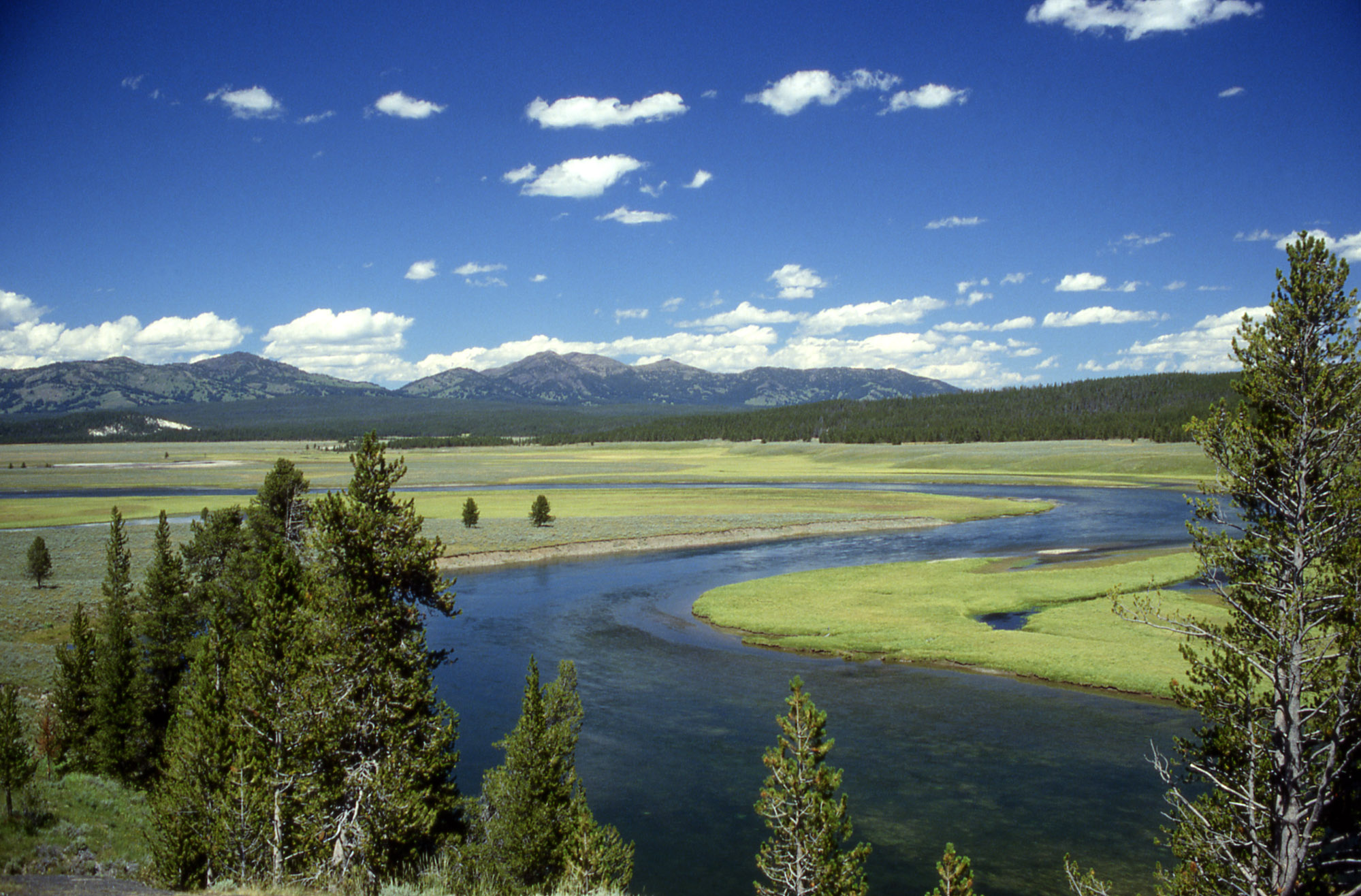
Yellowstone Caldera
The Yellowstone Caldera, also known as the Yellowstone Plateau Volcanic Field, is a Quaternary caldera complex and volcanic plateau spanning parts of Wyoming, Idaho, and Montana. It is driven by the Yellowstone hotspot and is largely within Yellowstone National Park. The field comprises four overlapping calderas, multiple lava domes, resurgent domes, crater lakes, and numerous bimodal lavas and tuffs of basaltic and rhyolitic composition, originally covering about 17,000 km2 (6,600 sq mi).
Volcanism began 2.15 million years ago and proceeded through three major volcanic cycles. Each cycle involved a large ignimbrite eruption, continental-scale ash-fall, and caldera collapse, preceded and followed by smaller lava flows and tuffs. The first and also the largest cycle was the Huckleberry Ridge Tuff eruption about 2.08 million years ago, which formed the Island Park Caldera. The most recent supereruption, about 630,000 years ago, produced the Lava Creek Tuff and created the present Yellowstone Caldera. Post-caldera eruptions included basalt flows, rhyolite domes and flows, and minor explosive deposits, with the last magmatic eruption about 70,000 years ago. Large hydrothermal explosions also occurred during the Holocene.
From 2004 to 2009, the region experienced notable uplift attributed to new magma injection. The 2005 disaster film Supervolcano, produced by the BBC and the Discovery Channel, increased public attention on the potential for a future catastrophic eruption. The Yellowstone Volcano Observatory monitors volcanic activity and does not consider an eruption imminent. Imaging of the magma reservoir indicates a substantial volume of partial melt beneath Yellowstone that is not currently eruptible.
The Yellowstone Plateau Volcanic Field lies at the eastern end of the Snake River Plain and disrupts the continuity of the Laramide orogenic belt, which formed during the Late Cretaceous. From about 53 to 43 million years ago, this area experienced significant andesitic volcanism exceeding 29,000 km3 (7,000 cu mi) in total volume, forming the Absaroka Volcanic Supergroup. Prominent peaks such as Mount Washburn and Eagle Peak are eroded remnants of these earlier stratovolcanoes. Before the formation of the Yellowstone Plateau, the Teton Range and Madison Range were likely structurally continuous, as were the Red Mountains and Gallatin Range.
Current Yellowstone volcanism is not a continuation of Laramide tectonism or the Absaroka volcanic province. Instead, it is the most recent part of a linear age-progression of rhyolitic complexes along the Snake River Plain, extending at least 16 million years to the McDermitt caldera complex. Large rhyolitic tuff supereruptions occurred at these older eruptive centers. One is the 12.1 million-year-old Ibex Hollow Tuff from the Bruneau-Jarbidge volcanic field in southern Idaho, burying herds of Nebraska mammals under volcanic ash. Older volcanics proposed to be part of this hotspot track include the 56 million-year-old Siletzia oceanic plateau and the 70 million-year-old Carmacks Group.
The cause of the northeastward progression of volcanism is debated. Some models invoke only upper-mantle processes, such as mantle pushed upward by the leading edge of the subducting Farallon plate, slab rollback, a propagating rift, or mantle convection driven by abrupt changes in thermal layer thickness at the continent–ocean boundary. A proposed lower-mantle origin suggests a fragment of the subducting Farallon slab penetrated the 660 km (410 mi) discontinuity, pushing up the lower mantle and triggering melting of water-rich transition zone beneath the western United States. Alternatively, a long-lived mantle plume rooted at the core–mantle boundary has been proposed. The plume erupted the Columbia River Basalt Group and is now feeding the Yellowstone hotspot. Seismic tomography has revealed a 350 km (220 mi) wide, cylindrical thermal anomaly extending from the deepest mantle to just beneath Yellowstone, supporting the mantle plume origin. In this model, the North American Plate moves southwest at about 2.2 cm (0.87 in) per year over the relatively stationary plume, creating the observed age-progression of eruptive centers.
Since its most recent major eruption approximately 640,000 years ago (the Lava Creek event), Yellowstone has remained geologically active, primarily due to the vast magma chamber beneath the caldera. This chamber is estimated to contain around 4,000 km³ of partially molten material, making it one of the largest of its kind globally. Periodic uplift of the caldera floor—measured at rates of up to 75 mm per year—provides valuable insights into the dynamics of subterranean magma movement and is a key focus of ongoing geological monitoring efforts.
The northern and eastern extent of the first-cycle caldera are unknown due to burial, although it likely reached into the third-cycle caldera, perhaps east of the Central Plateau. The Huckleberry Ridge Tuff in the Red Mountains is interpreted as thick intracaldera fill of the Island Park Caldera, and Big Bend Ridge at the southwestern edge of the volcanic plateau is inferred to be part of its caldera wall. A fault along the Snake River and Glade Creek, bounding the northern end of Teton Range and Huckleberry Ridge, is also thought to be part of the Island Park ring-fault. It is not known whether any of the first-cycle caldera segments was resurgent.
Hub AI
Yellowstone Caldera AI simulator
(@Yellowstone Caldera_simulator)
Yellowstone Caldera
The Yellowstone Caldera, also known as the Yellowstone Plateau Volcanic Field, is a Quaternary caldera complex and volcanic plateau spanning parts of Wyoming, Idaho, and Montana. It is driven by the Yellowstone hotspot and is largely within Yellowstone National Park. The field comprises four overlapping calderas, multiple lava domes, resurgent domes, crater lakes, and numerous bimodal lavas and tuffs of basaltic and rhyolitic composition, originally covering about 17,000 km2 (6,600 sq mi).
Volcanism began 2.15 million years ago and proceeded through three major volcanic cycles. Each cycle involved a large ignimbrite eruption, continental-scale ash-fall, and caldera collapse, preceded and followed by smaller lava flows and tuffs. The first and also the largest cycle was the Huckleberry Ridge Tuff eruption about 2.08 million years ago, which formed the Island Park Caldera. The most recent supereruption, about 630,000 years ago, produced the Lava Creek Tuff and created the present Yellowstone Caldera. Post-caldera eruptions included basalt flows, rhyolite domes and flows, and minor explosive deposits, with the last magmatic eruption about 70,000 years ago. Large hydrothermal explosions also occurred during the Holocene.
From 2004 to 2009, the region experienced notable uplift attributed to new magma injection. The 2005 disaster film Supervolcano, produced by the BBC and the Discovery Channel, increased public attention on the potential for a future catastrophic eruption. The Yellowstone Volcano Observatory monitors volcanic activity and does not consider an eruption imminent. Imaging of the magma reservoir indicates a substantial volume of partial melt beneath Yellowstone that is not currently eruptible.
The Yellowstone Plateau Volcanic Field lies at the eastern end of the Snake River Plain and disrupts the continuity of the Laramide orogenic belt, which formed during the Late Cretaceous. From about 53 to 43 million years ago, this area experienced significant andesitic volcanism exceeding 29,000 km3 (7,000 cu mi) in total volume, forming the Absaroka Volcanic Supergroup. Prominent peaks such as Mount Washburn and Eagle Peak are eroded remnants of these earlier stratovolcanoes. Before the formation of the Yellowstone Plateau, the Teton Range and Madison Range were likely structurally continuous, as were the Red Mountains and Gallatin Range.
Current Yellowstone volcanism is not a continuation of Laramide tectonism or the Absaroka volcanic province. Instead, it is the most recent part of a linear age-progression of rhyolitic complexes along the Snake River Plain, extending at least 16 million years to the McDermitt caldera complex. Large rhyolitic tuff supereruptions occurred at these older eruptive centers. One is the 12.1 million-year-old Ibex Hollow Tuff from the Bruneau-Jarbidge volcanic field in southern Idaho, burying herds of Nebraska mammals under volcanic ash. Older volcanics proposed to be part of this hotspot track include the 56 million-year-old Siletzia oceanic plateau and the 70 million-year-old Carmacks Group.
The cause of the northeastward progression of volcanism is debated. Some models invoke only upper-mantle processes, such as mantle pushed upward by the leading edge of the subducting Farallon plate, slab rollback, a propagating rift, or mantle convection driven by abrupt changes in thermal layer thickness at the continent–ocean boundary. A proposed lower-mantle origin suggests a fragment of the subducting Farallon slab penetrated the 660 km (410 mi) discontinuity, pushing up the lower mantle and triggering melting of water-rich transition zone beneath the western United States. Alternatively, a long-lived mantle plume rooted at the core–mantle boundary has been proposed. The plume erupted the Columbia River Basalt Group and is now feeding the Yellowstone hotspot. Seismic tomography has revealed a 350 km (220 mi) wide, cylindrical thermal anomaly extending from the deepest mantle to just beneath Yellowstone, supporting the mantle plume origin. In this model, the North American Plate moves southwest at about 2.2 cm (0.87 in) per year over the relatively stationary plume, creating the observed age-progression of eruptive centers.
Since its most recent major eruption approximately 640,000 years ago (the Lava Creek event), Yellowstone has remained geologically active, primarily due to the vast magma chamber beneath the caldera. This chamber is estimated to contain around 4,000 km³ of partially molten material, making it one of the largest of its kind globally. Periodic uplift of the caldera floor—measured at rates of up to 75 mm per year—provides valuable insights into the dynamics of subterranean magma movement and is a key focus of ongoing geological monitoring efforts.
The northern and eastern extent of the first-cycle caldera are unknown due to burial, although it likely reached into the third-cycle caldera, perhaps east of the Central Plateau. The Huckleberry Ridge Tuff in the Red Mountains is interpreted as thick intracaldera fill of the Island Park Caldera, and Big Bend Ridge at the southwestern edge of the volcanic plateau is inferred to be part of its caldera wall. A fault along the Snake River and Glade Creek, bounding the northern end of Teton Range and Huckleberry Ridge, is also thought to be part of the Island Park ring-fault. It is not known whether any of the first-cycle caldera segments was resurgent.