


Community hub
Alief, Houston
View on Wikipedia
Alief (/ˈeɪliːf/ AY-leef) is a working-class suburb[3] in Southwest Harris County, Texas, United States. Most of Alief is within the city limits of Houston, while a portion of the community is in unincorporated Harris County.[4]
Key Information


First settled in 1894 as a rural farm community, Alief experienced rapid population growth in the 1970s and 1980s. The community became one of the most ethnically diverse areas in Houston.[5]
History
[edit]Early settlement (1861–1917)
[edit]In 1861, Reynolds Reynolds claimed 1,250 acres (5.1 km2) of land[6][7] near Brays Bayou. The land was sold to Jacamiah Seaman Daugherty in 1888 and in the following year, he allowed the San Antonio and Aransas Pass Railway to build on his land.[6][7] Daugherty sold his land in 1893 to Francis Meston who planned to engineer a community.[6][7] Daugherty stayed to oversee land sales in Meston's Houston office.[7] In 1894, the community was surveyed[6][7] and recognized by Harris County. Surveyors named the town Dairy, Texas.[6][7] The first two town settlers, Dr. John S. Magee and his wife, Alief Ozelda Magee, moved from Ellis County to Dairy the same year.[6]

Alief Ozelda Magee, acting as the town's first postmistress, applied to open the first post office in 1895.[6][7][8] On August 16, 1895, the post office opened.[9] The postal service referred to the office as "Alief" in her honor to help avoid confusion with mail intended for the similarly named town of Daisy, Texas.[6][7][8] The site of the post office, which was operated from her home, was honored with a Texas State Historical Marker in 1990.[6] The marker (number 10644) is located on the south side of 7th Street between F Street and G Street.[6]
Meston deeded property to Dr. John S. Magee, Newton Gentry, and Hardy Price for use as a cemetery in 1900.[10] Alief Ozelda Magee, who died in 1899, is buried in the cemetery.[8][10] The cemetery is located at what is now the intersection of Bellaire Blvd. and Dairy Ashford.[8][10] The Texas Historical Commission recognized Alief Cemetery with a historical marker (number 10589) in 1984.[10]
The Flood of 1899 and the Galveston Hurricane of 1900 destroyed the Methodist Episcopal Church along with the town's cotton and corn crops, forcing 24 of the 30 families that resided in Alief to relocate.[7] The town reverted to prairie and wolves openly roamed during daytime.[7] Daugherty found a positive side to the flooding; he persuaded the remaining six families that rice was better suited to grow in Alief's flood plains than previous crops and spent his own money to help cultivate the first rice crops.[7] Daugherty succeeded: his rice became an instant cash crop[6] that persuaded many to return to Alief.[7] In 1901, Alief's first immigrant families, a small group of Germans arrived.[7] In 1904, the majority of those who had left in the wake of the 1900 hurricane returned.[7] The rapid growth period created a commercial district along the railroad tracks, convincing the San Antonio & Aransas Pass Railway to construct a depot.[7]
Due to its propensity for flooding, the citizens established the Harris County Flood Control District in Alief in 1909.[6][7] The chairman of the Harris County Drainage District was Daugherty.[11] Trustees S.B. (Shorter) Burleson and Will and Eddie Garmond for the Prairie Grove Missionary Baptist Church purchased land in 1910 which would later become the church's home.[12] The historic African American church's congregation met in the home of S.B. (Shorter) Burleson before the construction of the sanctuary.[12] Credit for the church's name is primarily attributed to Mamie Burleson.[12] In 1911, the Dairy School District was established[7] and a three-story school was built.[13]
The town was officially renamed "Alief, Texas" in 1917[6] and the Dairy School District became the Alief Independent School District[13] (Alief ISD).
Development (1918–1969)
[edit]Automobiles arrived in Alief by 1920.[13] The sanctuary for Prairie Grove Missionary Baptist Church was constructed between 1921 and 1922.[12] The Cane Belt Canal, which "ran from the Brazos River, eight miles north of Richmond, through Alief and south to Alvin," according to the Westchase District, was completed in 1934.[14] Daugherty promoted the canal, which was used for irrigation by rice farmers.[14] The year after the canal was completed, Alief obtained electricity.[13] Education in Alief was segregated.[7] From 1927 to 1937, African American children used Prairie Grove Missionary Baptist Church's sanctuary as a schoolhouse.[12] Previously, African American children attended school in a one-room schoolhouse.[7] Alief ISD's three-story schoolhouse was condemned in 1939,[13] and its students attended classes in a nearby building until a new school annex was added in 1940.[13] Also in 1940, one of their 11 children, Melissa Outley, died at 19. She is the first to be buried at the Prairie Grove cemetery, which was adjacent to Prairie Grove Missionary Baptist Church.[12] Parthenia Outley was married to David Outley, both of whom were born in 1886. Parthenia died in 1967, and David died in 1981.He was the first African American educator in Alief as he created the one room schoolhouse aforementioned.David E. Outley has a school named in his honor in Alief located at 12355 Richmond Ave., Houston, TX 77082.[15][16][12] The church's sanctuary was demolished in the 1940s as attendance fell.[12] Alief Community Church first opened its doors in 1941.[17] Population fluctuated wildly, ranging from a low of 35 in the 1930s to 200 by 1942.[7] Alief acquired telephone service in 1943.[18] E.W.K. "Andy" Andrau opened Andrau Airpark[14] in 1946.[19] In 1964, Alief ISD built its oldest remaining school, Alief Elementary School (later renamed for teacher Cynthia Youens).[13] By the same year, oilman Robert E. "Bob" Smith owned 11,000 acres of land including what is now the Westchase area.[14]
Growth, diversification, and annexation (1970–1989)
[edit]
In 1970, Alief was still primarily pastureland and major thoroughfares, such as the Sam Houston Tollway, were still gravel roads.[13] The 1970s were a prosperous time for Houston,[20] and Alief continued to grow as people came to the area in search of housing.[20] Houston began expanding westward with the development of River Oaks and Memorial, and the trend continued to Alief.[21] Many of the new residents were low-income apartment dwellers.[20] The community's population increased by a factor of four between 1970 and 1985.[13] Between 1980 and 1985, approximately a third of the population growth experienced by Harris County occurred in the southwest quadrant of the county bounded by the Katy and South (288) freeways, with Alief accounting for half of that, or one-sixth of the overall growth of the county during that five-year time frame.[21] The Alief Independent School District struggled to find room for all of the new students.[20]
As the population of Alief increased in the 1980s,[22] the community began to diversify. In 1978, close to 80% of the people in the community were white.[23] Less than 4% of the people in the community were African American.[23] The shift was primarily for socio-economic reasons.[23] Many low-income Spanish-speaking immigrants settled in traditionally low-income areas of Houston inside Loop 610.[23] Many African-Americans who could afford to left traditional African-American neighborhoods to move to Alief and other parts of Southwest Houston during the 1980s.[22][23] White people who could afford to move to newer suburbs further from Houston than Alief began to leave the community.[23] In addition, many people of Asian ancestry settled in Alief, Sharpstown, and Westwood, creating one of the largest Asian-American concentrations in Houston.[22] Southwest Houston's Asian population included mainly immigrants from China, the Philippines, India, Pakistan, Vietnam, Cambodia, and Korea.[22] In addition, Southwest Houston became home to many people from Taiwan, Bangladesh, Japan, Laos, and Indonesia.[24] By the late 1980s, white students accounted for less than half of the students enrolled in Alief ISD.[23]
In addition changes in population and demographic, the community underwent several other important changes. Robert E. "Bob" Smith died in 1973, and his widow sold 760 acres of land to the Westchase Corporation which began developing the Westchase District.[14] Houston began annexing Alief in 1977.[13][25] The City of Houston voted to annex the Alief-Fondren area on November 23, 1977.[26] In 1978, Brown and Root built a large engineering complex at the corner of Bellaire Blvd. and Beltway 8.[27] Houston continued to annex pieces of Alief into the 1980s.[28] West Oaks Mall opened in 1984[29] and was annexed by the City of Houston the same year.[28] The community feared that annexation would lead to neglect by Houston's government and protested further annexations.[28] Despite these efforts, Houston succeeded in annexing most of the area.[30] Agriculture began to fade.[31][32] The last cotton gin in Alief closed in 1976,[32] and the area ceased growing cotton altogether by 1982.[31] Alief was one of the last places where cotton had been grown in Harris County.[31][32] Dairy, cattle, vegetable production, and rice production also declined.[31] Urban development took the place of agriculture.[31] In the spring of 1985, Houston Fire Station #76 was opened to serve the Alief area.[33] The Alief Branch Library (since renamed the David M. Henington-Alief Regional Library) was also opened in 1985.[34][35] As a sign of the community's growing diversity, the Houston Chronicle noted that the library staff spoke, "a variety of languages, including Hindi, Mandarin Chinese and Farsi (referring to Persian)," when the library first opened.[35] West Houston Medical Center was constructed in 1985 as well.[36][37] The Alief General Hospital building was abandoned. The Fame City entertainment complex and water park (which later became Fun Plex and Adventure Bay) held its grand opening in 1986.[38] Fame City featured roller skating, movie theaters, a sound studio, miniature golf, bumper-cars, bowling, alley, games, rides, an arcade, restaurants and shops indoors, and a 10-acre water park outdoors.[38] The Alief Brown and Root building closed in May 1987, but was reopened in November 1988 when the industry saw increased growth.[27] Andrau Airpark was sold to the Camden Trust in 1998, although the airport continued to operate.[14]
Population boom (1990–2010)
[edit]The size and diversity of Alief's population continued to grow. Alief's population increased by 45% from 1990 to 2005.[39] By 1991, Alief ISD was growing at a rate of approximately 1,500 new students per year.[40] Houston City Council District F (which included Alief and Sharpstown) had a population that was approximately 46% white with quickly growing African American, Hispanic, and Asian segments.[41] Previously, District F had a mostly white population.[41] Alief ISD's student population was 24% African American by 1991.[23] By 1993, there were 34% more Asian businesses than there had been in 1982.[42] Canterbury United Methodist Church began offering services in Vietnamese in 1995.[43] By 1996, Alief was one of the most ethnically diverse school districts in the country.[44] The district's students spoke a total of 57 different languages. Christ the King Episcopal Church was offering an "African Thanksgiving Feast" since many of the church members had African heritage.[45] The district's main high schools, Hastings and Elsik, were the two largest high schools in Texas.[44] Alief ISD estimated a total enrollment of 39,000 students in the district, with 8,582 students attending either Hastings or Elsik.[44] Mik Giglio of the Houston Press said in 2000 that in 1997 Alief "was a blend of its affluent, white former self and the predominantly poor, ethnic enclave it has since become."[46] In the first 1991 Mayor of Houston election, most Alief voters voted for Bob Lanier. However, in the community Sylvester Turner, Lanier's opponent, had a large second-most following in terms of votes.[47][48] In 2008, M. J. Khan represented the District F (which includes Alief).[49] By December 3, 1991, increases in crime and changes of demographics in southwestern Houston neighborhoods led to many challengers desiring to fill the city council seat of District F.[50] By 1997, street signs in Alief near Bellaire and Corporate were in both English and Chinese.[51] The Chinese signs had the Chinese phonetic pronunciations of the English names so that English and Chinese speakers could understand each other.[51] In 1997, Hong Kong Development announced plans to build a center called Hong Kong City at the corner of Bellaire and Boone.[52] The developers hoped that building west of Beltway 8 would move the center of the growing Asian business community further west.[52] The Hong Kong City Mall opened in 1999.[53] At the same time that the African American, Hispanic, and Asian populations increased, the white population decreased.[54] Researchers cited social class differences as the reason most white people moved away from Alief.[54] People with greater financial means of all ethnicities moved to further outlying suburbs with greater amenities and better performing schools during the period, while people with lesser financial means moved into the area to take advantage of newer housing and better amenities and schools than those that they left behind.[54] The change was seen disproportionately in the white population since the white population was disproportionately wealthier.[54] Allen G. Breed of the Associated Press wrote: "Alief is an impoverished, multicultural enclave where many of the business and street signs are in both English and one of several Asian languages. The district's 47,000 students speak nearly 70 tongues, and the number of students qualifying for free or reduced lunch over 70%.".[55]
Many developments in education took place in the 1990s in Alief. In 1993, Alief ISD instituted a rule which made passing the statewide standardized test, the Texas Assessment of Academic Skills (TAAS) Exit Exam, a requirement for high school graduation.[56] Many parents protested the measure.[56] In 1995, voters decided to allow Alief ISD to build the Hastings and Elsik Ninth Grade Centers.[57] In 1998, voters approved funds for Alief ISD to use to build a new high school,[58] which would later become Alief "Doc" Taylor. The period was also marked with political scandals. In 1991, a ballot box from the Boone Elementary polling location containing over 700 ballots went missing after the poll closed.[59]
In late 1994, David M. Henington, the director of the Houston Public Library, retired. In an article about his retirement plans he told the reporter he wanted personal computers placed in all of Houston's branch libraries so that all Houstonians could access the internet "information superhighway" during their visits.[60] In 1996, the Henington-Alief Library began offering free internet access to the public.[61] The service was text-only and was limited to 20 minutes when other users were waiting to use the computers.[61] The move by the Houston Public Library was intended to bring internet access to Houstonians who did not have a home computer and therefore did not have home access to the internet.[61]
The City of Houston did limited purpose annexation in Alief after the year 2000.[62]
In 2005, Alief became home to many Hurricane Katrina evacuees.[63] More than 3,000 evacuees enrolled in Alief ISD schools.[63] Alief ISD spent $12 million to accommodate Hurricane Katrina evacuees in 2005.[55] The United States government promised to reimburse the district, but in 2006 Alief had not yet received the money.[55] Many of the students who were displaced by the hurricane were academically behind their Texas peers.[63] In 2006, former United States President George H. W. Bush and Houston Mayor Bill White led a fundraising campaign to help Alief ISD and other districts pay for educating the displaced students.[63] Between 2005 and 2010 more than 30,000 evacuee families lived in section 8 based apartment complexes throughout southwest Houston. Alief had the biggest concentration of Katrina evacuees in the city. Shortly after Katrina refugees moved in, many areas containing apartment complexes began to rapidly decline. Residents stated, "the neighborhood already had problems with Hispanic gangs but nowhere near as bad as it is now with all the killings." With overcrowded apartments, many landlords were forced to stop leasing to evacuees after numerous violations such as noise, vandalism and domestic violence. Some apartments specifically around Woodfair and Bissonnet streets, became a hotbed for crime. The influx of evacuees caused a major uptick in shootings all across the Southwest region. According to HPD, homicide statics for the Southwest area from the previous ten years were mostly done by Latino men who were gang affiliated. Homicides compared to after evacuees arrived was 10 times higher. Houston's homicide rate has shot up 18% since the storm, and police statistics show that one in every five homicides in the city involved a Katrina evacuee as suspect, victim or both. Residents and community leaders began filing complaints to push out evacuees due to the rise in crime stating, "It's time for them to go home," In response, Houston Police Chief Harold L. Hurtt hired 400 additional officers to deal with the city's evacuee-fueled crime wave. HPD added the rise in murders were committed by New Orleans teenagers from rival housing projects, shooting at each other over long-standing beefs that had amongst each other.[64][65]
Cityscape
[edit]The Alief Community Association defines the boundaries of Alief as, "Westheimer on the north, Sam Houston Tollway on the east, Fort Bend County Line on the west and Interstate 69/U.S. Highway 59 on the south,"[66] while the Alief Independent School District boundaries extend as far east as Gessner in some places.[67] The Alief Super Neighborhood Council (ASNC) and the International Management District (IMD) have their own boundaries.[68]
Government
[edit]Municipal
[edit]Alief is partially annexed by the City of Houston, and partially unincorporated. This section pertains only to the annexed portion of Alief. Please see the "County" section for unincorporated Alief.
As of 2011 Houston City Council District F covers the parts of Alief in Houston.[69]
The portion of Alief in Houston is within Super Neighborhood #25 Alief. Its recognized council was established on June 25, 2000.[18] Each super neighborhood represents a group of civic clubs, places of worship, businesses, and other institutions and community interests.[70]
| Represents | Name | First Elected | District Boundaries |
|---|---|---|---|
| District F[71] | Tiffany D. Thomas | 2019 | Map of District F (after 2011 redistricting) |
| At-Large Position 1[71] | Mike Knox | 2015 | All of Houston |
| At-Large Position 2[71] | David W. Robinson | 2013 | All of Houston |
| At-Large Position 3[71] | Michael Kubosh | 2013 | All of Houston |
| At-Large Position 4[71] | Letitia Plummer | 2019 | All of Houston |
| At-Large Position 5[71] | Sallie Alcorn | 2019 | All of Houston |
County
[edit]| Commissioner | Name | Party | First Elected | Current Term Ends | District Boundaries | |
|---|---|---|---|---|---|---|
| Precinct 4[72] | Lesley Briones | Democrat | 2022 | 2026 | Map of Precinct 4 | |
State representation
[edit]| Senators | Name | Party | First Elected | Current Term Ends | District Boundaries | |
|---|---|---|---|---|---|---|
| District 13[73] | Rodney Ellis | Democrat | 1990 | 2014 | Map of District 13 | |
| District 17[74] | Joan Huffman | Republican | 2008 | 2012 | Map of District 17 | |
| Representatives | Name | Party | First Elected | Current Term Ends | District Boundaries | |
| District 133[75] | Jim Murphy | Republican | 2010; Also served 2006-2008 | 2012 | Map of District 133 | |
| District 149[76] | Hubert Vo (unseated Talmadge L. Heflin) | Democrat | 2004 | 2012 | Map of District 149 | |
National representation
[edit]| Senators | Name | Party | First Elected | Current Term Ends | Level | |
|---|---|---|---|---|---|---|
| Senate Class 1 | Ted Cruz[77] | Republican | 2012 | December 2024 | Junior Senator | |
| Senate Class 2 | John Cornyn[77] | Republican | 2002 | December 2026 | Senior Senator | |
| Representatives | Name | Party | First Elected | Current Term Ends | District Boundaries | |
| District 9[78] | Al Green | Democrat | 2004 | January 2023 | Map of District 9[dead link] | |
Demographics
[edit]In 2015 the Houston portion of the Alief Super Neighborhood had 106,657 people, with 7,544 people per square mile. 49% were Hispanic, 22% were non-Hispanic black, 19% were non-Hispanic Asians, 9% were non-Hispanic whites, and 1% were non-Hispanic others. The median income was $46,187.[79]
The annexed portion of Alief[which?] had a population of 108,971 people which was growing at a rate of 1.15% annually in 2009.[80] The City of Houston stated on its website that the "legendary diversity" in Alief "is evident in the large section of Asian residents and businesses along Bellaire Boulevard.[81]" According to the Alief Independent School District in 2011, "Virtually every culture of the modern world is represented in [the district's] 45,000 student enrollment; more than 80 languages and dialects are spoken" among its students.[13]
In 2009, the population of the annexed portion of Alief[which?] was 11.1% white(non-Hispanic), 28.4% black(non-Hispanic), 21.2% Asian, and 37.9% Hispanic.[80] The number of Asians and Hispanics in the annexed portion of Alief[which?] increased between the years 2000 and 2009 while the number of people from all other ethnic groups listed by the City of Houston Planning Department either declined or showed no change.[80] The number of households in the annexed portion of Alief increased from 31,033 in 2000 to 33,654 in 2009.[80] The average size of households in the area increased as well, from 3.15 to 3.22.[80] The median age of residents in the annexed portion of Alief was 29.6 in 2009.[80] The median household income in 2009 was $50,028 annually and the average household income was $54,295 annually for Alief households located in Houston.[80] The unemployment rate increased significantly, from 7.4% in 2000 to 11.5% in the annexed portion[which?] of Alief.[80]
In 2000 the Alief Super Neighborhood had 41,820 residents, with 2,962 people per square mile. 31% were Hispanic, 28% were non-Hispanic black, 21% were non-Hispanic Asian, 17% were non-Hispanic white, and 3% were non-Hispanic other.[79]
Media
[edit]The major citywide newspaper for Houston is the Houston Chronicle, and the Houston Post previously was a major daily newspaper.
Education
[edit]Primary and secondary schools
[edit]
Public schools
[edit]Public school students the vast majority of areas considered to be Alief are served by the Alief Independent School District (Alief ISD).

As of 2011, the Alief Independent School District has 24 elementary schools.[82] Youens Elementary[83] and Chancellor Elementary go all the way to fifth grade,[84] however most students are also zoned to an intermediate school for fifth and sixth grade. The district has six intermediate schools as of 2011.[82] Students attend middle school for the sixth through eighth grades.[85] The district has six middle schools as of 2011.[82] High school students in Alief ISD are assigned by lottery to either Alief Elsik High School, Alief Hastings High School, or Alief Taylor High School during October of their eighth grade year.[86] They can also choose to apply for admission to Alief Kerr High School.[87] Students selected to attend Hastings High School attend the Hastings Ninth Grade Center during their ninth grade year, and students selected to attend Elsik High School attend the Elsik Ninth Grade Center during their ninth grade year.[88] It also operates Alief Early College High School, which opened in 2010 and allows students to take courses for dual credit and graduate with both a high school diploma and the equivalence of an associate degree at the same time.[89] The district also has two alternative schools.[82] The Alief Learning Center has its own campus,[90] while the Crossroads/ Night High School/ LINC/ SOAR (Crossroads) meets in the annex between Hastings and Elsik.[91] The Crossroads program is designed for "at-risk students with discipline problems who are behind in academic credit and are at risk of not graduating from high school,[91]" as well students who are pregnant or parenting, emancipated minors, and students who have failed the TAKS/ TAAS tests.[92]
A portion of the City of Houston-defined Alief Super Neighborhood within Fort Bend County is in the Fort Bend Independent School District.[79] Some residents are zoned to Meadows Elementary School in Meadows Place along with Dulles Middle School and Dulles High School in Sugar Land, while others are zoned to Townewest Elementary School, Sugar Land Middle School, and Kempner High School.[93]
Charter schools
[edit]Alief is served by multiple charter schools, which are not affiliated with Alief ISD nor Fort Bend ISD.
Alief Montessori Community School is a pre-kindergarten through fifth grade school following Montessori philosophy.[94] Students are typically between 3 and 12 years old.[94] The school is located on 6th Street in the historic townsite of Alief.[94] As of July 2011, the school is undergoing an expansion. Groundbreaking on the expansion was held on March 26, 2010.[95] In 2011, Children at Risk, an education advocacy non-profit, ranked the Alief Montessori among the ten best Houston-area elementary schools.[94] The school has been recognized as an "exemplary school" by the Texas Education Agency every academic year since 1999 and was a recipient of the Honor Roll School Award from the Texas Business and Education Coalition.[96] Its 2011 per-pupil spending of $3,587 was one of the lowest in Houston.[97]
Harmony Public Schools offers two campuses in the Alief area, Harmony School of Innovation (grades K-8)[98] and Harmony Science Academy High (grades 9-12).[98]
Knowledge Is Power Program (KIPP) operates charter schools which serve Alief, including KIPP SHINE Preparatory (pre-kindergarten through grade 4),[99] KIPP Academy Middle School (grades 5-8),[100] KIPP Houston High School (grades 9-12),[101] and KIPP Unity (pre-kindergarten through grade 2).
Private schools
[edit]Christ the Lord Lutheran School is located at 4410 S. Kirkwood Rd.[102] The school instructs preschool through the eighth grade[102] as part of the 4th largest private/parochial school system in the United States, Wisconsin Evangelical Lutheran Synod (WELS).[102] The school has been in operation since 1972.[102]
Strake Jesuit College Preparatory and St. Agnes Academy are located in proximity to Alief.[103]
The Darul Arqam Schools Southwest Campus is located in Alief, Houston, with a Sugar Land postal address.[104][105]
Colleges, universities, and higher education
[edit]
The Houston Community College System (HCCS) has served the Alief area since 1982.[106] The HCC Alief Campus, a part of the Southwest College,[107] is located at 2811 Hayes Road in the Westchase area of Houston.[106][108] The HCC Alief Continuing Education Center is located at 13803 Bissonnet Road in an unincorporated area in Harris County.[106] In 1982, HCCS expanded classes to Alief Elsik High School. In 2001, HCCS opened the Alief Center on Bissonnet. In 2007, the new Alief Campus in Westchase opened. In 2008, the former Alief Center became the Continuing Education Center.[106]
Public libraries
[edit]
Alief is served by both the Houston Public Library and the Harris County Public Library.
The David M. Henington-Alief Regional Branch of Houston Public Library is in Alief.[109] The branch is located at 7979 South Kirkwood Street[110] and was originally named the Alief Branch Library when it opened in 1985.[34][35] The library was later named for David M. Henington, who served as the Director of the Houston Public Library for 26 years.[111] It's now a part of Alief Neighborhood Center.[112][113] The area is also served by the Judson W. Robinson-Westchase Neighborhood Library of HPL at 3223 Wilcrest Drive, within the Alief ISD boundaries.[114]
Residents of Alief within Harris County may obtain library cards for the Harris County Public Library (HCPL) system.[115] There are no HCPL branches in the Alief area.[116] Fort Bend County Libraries serves the Fort Bend County areas.
Emergency services
[edit]
Fire service
[edit]Alief residents in Houston receive fire services from the Houston Fire Department. The Houston Fire Department has operated Station 76 Alief Community since 1985.[117] A part of Fire District 83 is also in Alief.[118][119]
For residents of unincorporated Harris County, emergency medical services (EMS) and fire service are provided by a volunteer fire department, the Community Volunteer Fire Department (CVFD). CVFD is a combination career and volunteer fire suppression and EMS provider which operates two stations in the Alief area. CVFD also has a training center in the Alief area, where a bi-yearly cadet program takes place. A new training center is proposed next door to the current Station 1.[120]
Police services
[edit]Alief is served by the Houston Police Department, which has Alief in the Westside Patrol Division, headquartered at 3203 South Dairy Ashford Road,[121][122] in the Alief area.[123] In 2000 the police department's Westwood Storefront in the Westwood Mall was scheduled to open before May 2000; it is the first police storefront to open in Alief. Construction delays foiled plans to open the storefront at the end of 1999 and in March 2000.[124]
Harris County Sheriff's Office serves unincorporated sections of Harris County. The Alief area outside of Houston is within the District IV Patrol Bureau, headquartered at the Clay Road Substation at 16715 Clay Road.[125][126] The Mission Bend Storefront is located at 7043 Highway 6 South.[126]
Alief ISD Police Department serves the Alief Independent School District as its law enforcement agency. Alief ISD Police keep staff, students, facilities and the public safe. Alief ISD Police respond to other agencies in need of assistance in the surrounding Harris County and Houston area.
Medical services
[edit]Hospital
[edit]West Houston Medical Center is located on West Houston Center Blvd. The current location was constructed in 1985.[36][37] West Houston Medical Center is an HCA member hospital.[127] The facility has 410 physicians, 742 total employees,[127] and 195 beds.[128] The center houses an emergency room[127] which had annual visits of 47,156 in the year which was most currently reported as of July 2011.[128] The center also has a cardiovascular services area, a women's center, a cancer center, a gamma knife, and many other services.[127] US News & World Report Health ranked West Houston Medical Center the #18 hospital in Houston as of July 2011.[128]
Government-funded healthcare
[edit]
The El Franco Lee Health Center in Alief, operated by Harris Health System (formerly Harris County Hospital District), opened on May 19, 2009.[129] Prior to the opening, the closest facility was the People's Health Center. The district said in a 2006 Houston Chronicle article that it planned to build a health care facility in Alief.[130] The center has 66,000 square feet (6,100 m2) of space.[131] The previous designated health care center was People's Health Center, now Valbona Health Center. The nearest public hospital is Ben Taub General Hospital in the Texas Medical Center.[132]
Transportation
[edit]Mass transit
[edit]The Metropolitan Transit Authority (METRO) provides local bus services to the area.
METRO Park & Ride locations in Alief include:[133]
- Gessner Park & Ride located at Westpark at Gessner, Houston, TX 77036 (Considered to be located in Alief when Gessner is considered the boundary line for Alief)
- Mission Bend Park & Ride located at 13855 Alief Clodine Rd. (at METRO Blvd.), Houston, TX 77083
- Westchase Park & Ride located at 11050 Harwin Dr., Houston, TX 77072
- Westwood Park & Ride located at 9990 Southwest Fwy. (south of Bissonnet), Houston, TX 77036 (Considered to be located in Alief when Gessner is considered the boundary line for Alief)
Major highways
[edit]


Airports
[edit]Andrau Airpark operated in Alief from 1946 to 1998, when it was closed to make room for the Royal Oaks Country Club and subdivision.[19]
Parks and recreation
[edit]The Alief Community is home to public parks maintained by Harris County, public parks maintained by the City of Houston, and private parks and venues.
Harris County parks
[edit]Harris County operates parks throughout Alief which is in Precinct 3. Harris County parks are maintained by the Precinct's Parks Division.[134]

- Alief-Amity Park, an 11-acre (45,000 m2) park located along Westpark Tollway adjacent to Alief Elsik High School.[135] In 1975, the county acquired what is now the park site from the Cloud family. The park was dedicated in the early 1980s.[136] The park, once upon a time, was the site of the original Alief railroad depot.[citation needed]
- Archbishop Joseph A. Fiorenza Park is located north of Westpark Tollway along Eldridge Road in northwest Alief. This park includes a 0.6-mile (0.97 km) trail.[137] Located on part of a Harris County Flood Control District site acquired in 1988, the park was dedicated in June 1999. It is named after Roman Catholic Archdiocese of Galveston-Houston archbishop Joseph Fiorenza.[138]
- Arthur Storey Park is a 175-acre (0.71 km2) green space along Brays Bayou at the intersection of Bellaire Boulevard and State Highway Beltway 8, immediately west of Chinatown.[139] In August 1995, the Harris County Flood Control District began acquiring land along the bayou, and in October of that year it agreed to allow the establishment of a park. The commissioner's court voted to rename the park in January 1997 after Arthur L. Storey Jr., who worked for the Harris County Flood Control District.[140][141] Storey is credited with "modernizing and streamlining the county's flood control district operations while simultaneously considering [the district's operations'] environmental implications."[141] The park opened and was dedicated on September 26, 1997.[140]

The duck pond at Arthur Storey Park - Mike Driscoll Park is a 46-acre (0.19 km2) park located on West Center Boulevard between Westpark Tollway and Brays Bayou.[142] The park hosts a playground and a 1.13-mile (1.82 km) asphalt walking trail.[142]

City of Houston parks
[edit]The City of Houston operates parks in the annexed portion of Alief. City of Houston parks are maintained by the City of Houston Parks and Recreation Department.[143]

- Alief Community Park is a 37.3-acre (0.151 km2) park located at the southwest corner of Bellaire Boulevard and Kirkwood Road.[144] The park was acquired by the City of Houston in 1993 from the First United Methodist Church of Houston for $3.5 million.[145] The city originally named the park Southwest Park, but changed the name to Alief Community Park in 1997.[145] It is home to Alief Community Center and Alief Pool.[144][145] The park also boasts basketball courts, tennis courts, baseball fields, playgrounds, paved trails, and multi-purpose fields.[144] In 2011, a new hike and bike trail funded by a Texas Department of Transportation grant was constructed.[145] Alief Pool was nearly closed in 2011 due to city budget cuts;[146] however, corporate donors Marathon Oil and ConocoPhillips agreed to sponsor the pool.[147]
- Boone Park is located on Boone Road between Bellaire Boulevard and Beechnut Street.[144] It was created by the City of Houston in 1984, and has since been improved by the city, oil companies, and volunteers.[148][149] The parks amenities include a 1.06-mile (1.71 km) walking trail system, cricket field, playground, picnic pavilion, and multi-purpose fields, as well as a nature preserve recognized by the Texas Forestry Department.[150][144][151]
- Hackberry Park is located 1.5 miles (2.4 km) west of Boone Park on South Dairy Ashford Road between Bellaire Boulevard and Kirkwood Road.[152] The park features a 1-mile (1.6 km) outer-loop trail.[153] In addition, the park has a community center, a sprayground, and a playground.[152] The park is the former home of Hackberry Golf Course and occupies 22.5 acres (0.091 km2).[153] The park was acquired in 2007, at a cost of $5 million, and dedicated in 2009.[154][153]
- Harwin Park is located in northeast Alief along Harwin Road near the intersection with Wilcrest Drive. It contains multi-purpose fields, a trail system, and a playground.[152] The park is a 8.3-acre (0.034 km2) property and was established in 1989.[148]
Religion
[edit]Christianity
[edit]The Roman Catholic Archdiocese of Galveston-Houston operates Notre Dame Church in Alief. It opened in 1969 with 173 families and a 5,000-square-foot (460 m2) church structure with room for 750. From 1970 to 1975 the Continuing Christian Education and parish hall structures were built. By 2008 the church had 2,600 families. It previously used a 13,000-square-foot (1,200 m2) sanctuary. By 2008 it struggled to cope with the demand, so it began building a new sanctuary and day chapel as part of a $5.7 million capital campaign, with 20,280 square feet (1,884 m2) of space. The South Continuing Christian Education structure previously on the site was to be razed. The church's site has 10 acres (4.0 ha) of land.[155]
Ascension Chinese Mission (traditional Chinese: 美華天主堂; simplified Chinese: 美华天主堂; pinyin: Měi Huà Tiānzhǔ Táng; lit. 'US-China Catholic Church') is in the Alief super neighborhood.[156][157] It originated from a Chinese worship service that was established in the 1970s.[158] The parish was created in 1988,[159] initially operating out of a commercial center in the southwest Houston Chinatown area. It relocated to its current site in Spring 1991.[158]
Christ, The Incarnate Word Church (Vietnamese: Giáo Xứ Đức Kito Ngôi Lời Nhập Thể), also in the Alief super neighborhood,[156] opened in 1998.[160] It is one of five Vietnamese Catholic churches in the Houston area.[161] The archdiocese operates another Alief church, St. Justin Martyr.[162]
Wilcrest Baptist Church is in the area.
Other religions
[edit]Shri Krishna Vrundavana has a Sugar Land postal address, but is physically in the Alief super neighborhood in the Houston city limits.[163][164] It occupies the 450-person, 9,000-square-foot (840 m2) former La Festa Hall. It was established in 2011 with about 200 people in its congregation; originally the temple rented its property. In October 2015 the temple organizers bought the current site for $1.3 million. In December 2015 its congregation had numbered over 800.[163]
The Islamic Society of Greater Houston (ISGH) operates Masjid At-Taqwa (Synott Islamic Center), which has a Sugar Land postal address but is in the Alief super neighborhood in Houston.[105][165] By the 2000s Alief had the highest percentage of Muslims in Houston and the Greater Houston area overall.[citation needed]
Community events and festivals
[edit]Lunar New Year Festival
[edit]The Lunar New Year Festival is an annual event[166] which was first held in 1996.[166] The event has featured dancing, cooking, and a beauty contest.[166] The festival claims to be the "largest international celebration in the southwest."[166]
International Parade
[edit]The International Parade was first held in 2008.[167] The parade is held annually near the end of September.[167] The parade strives to include many different ethnic groups and promote the diversity of the community.[167] The route travels down Bellaire Blvd.[167]
See also
[edit]References
[edit]- ^ a b "Super Neighborhood Resource Assessment – Alief" (PDF). City of Houston. August 2014. Retrieved September 20, 2017.
- ^ "US Board on Geographic Names". United States Geological Survey. October 25, 2007. Retrieved January 31, 2008.
- ^ Alief, Texas, gears up for biggest year for multifamily completions on record
- ^ "The Changing Face of Houston - Alief | Art Attack | Houston | Houston Press | The Leading Independent News Source in Houston, Texas".
- ^ Elbein, Saul (July 5, 2012). "Saving the Mint". Texas Observer. Retrieved December 8, 2017.
- ^ a b c d e f g h i j k l m ""Dairy (Alief)". Archived from the original on July 14, 2014. Retrieved June 24, 2011.." Texas Historical Commission. 1990. Retrieved June 24, 2011.
- ^ a b c d e f g h i j k l m n o p q r s t Hazlewood, Claudia. ""Alief, TX".." Texas State Historical Association. Retrieved June 25, 2011.
- ^ a b c d ""Residents roll up their sleeves to preserve history".
{{cite web}}: CS1 maint: deprecated archival service (link)." KTRK-TV. October 22, 2006. Retrieved June 24, 2011. - ^ ""Postmaster Finder Post Offices by ZIP Code". Archived from the original on October 17, 2020. Retrieved September 23, 2011.." (enter "774" - first 3 numbers of Alief, TX zip code) United States Postal Service. Retrieved on September 23, 2011.
- ^ a b c d ""Alief Cemetery". Archived from the original on July 14, 2014. Retrieved June 24, 2011.." Texas Historical Commission. 1984. Retrieved June 24, 2011.
- ^ Kleiner, Diana J. ""DAUGHERTY, JACAMIAH SEAMAN".." Texas State Historical Association. Retrieved June 26, 2011.
- ^ a b c d e f g h ""Prairie Grove Cemetery". Archived from the original on July 14, 2014. Retrieved June 24, 2011.." Texas Historical Commission. 2006. Retrieved June 26, 2011.
- ^ a b c d e f g h i j k Community-School Relations Department (of Alief Independent School District). ""Welcome". Archived from the original on January 27, 2016. Retrieved July 1, 2011.." Alief Independent School District. Created on November 11, 2008, and updated on October 6, 2010. Retrieved July 1, 2011.
- ^ a b c d e f ""THE HISTORY OF WESTCHASE". Archived from the original on October 3, 2011. Retrieved July 1, 2011.". Westchase District. 2010. Retrieved July 1, 2011
- ^ Martin, Betty L. ""Alief cemetery gets historic marker".". Houston Chronicle. March 19, 2008. Retrieved July 1, 2011.
- ^ "History of the School." Outley Elementary School. Alief Independent School District, n.d. Web. 19 Jan 2012. <"Outley Elementary School / Homepage".>.
- ^ Staff. """Something's Happening"/Youths to rally against violence, crime".". Houston Chronicle. October 5, 1991. Retrieved July 6, 2011.
- ^ a b ""Alief History".." Alief Super Neighbourhood Council. Retrieved on July 1, 2011.
- ^ a b Cook, Lynn J. ""Development plans ground Andrau airport"." Houston Business Journal. Sunday December 27, 1998. Retrieved on June 29, 2011.
- ^ a b c d Cobb, Kim. ""Drugs, neglect transform 'single scene' to slums".". Houston Chronicle. July 17, 1988. Retrieved July 3, 2011.
- ^ a b Sallee, Rad. ""County continues westward expansion".". Houston Chronicle. August 3, 1986. Retrieved July 3, 2011.
- ^ a b c d Rodriguez, Lori. ""Census tracks rapid growth of suburbia".." Houston Chronicle. Sunday March 10, 1991. Section A, Page 1.
- ^ a b c d e f g h Markley, Melanie and Stephanie A. Sin. ""Urban and suburban Houston: a tale of two cities/School districts' makeup shifts along with population".". Houston Chronicle. July 8, 1991. Retrieved July 23, 2011.
- ^ Sallee, Rad. ""Asian communities expand in Houston".". Houston Chronicle. October 13, 1985. Retrieved July 3, 2011.
- ^ "Super Neighborhoods Super Neighborhood 25 - Alief". City of Houston. Retrieved June 7, 2020.
1977 -- Houston begins annexing the areas of Alief [...]
- ^ Rendon, Ruth. ""In Clear Lake, they fought and lost/Kingwood annexation revives memories of battle in 1970s".". Houston Chronicle. August 11, 1996. Retrieved July 15, 2011.
- ^ a b Bivins, Ralph. ""Brown & Root site near Alief reopens".". Houston Chronicle. November 22, 1988. Retrieved July 3, 2011.
- ^ a b c Mintz, Bill. ""Suburbs jittery over prospect of land grabs by city".". Houston Chronicle. September 15, 1986. Retrieved July 3, 2011.
- ^ "Fact sheet" (PDF). Archived from the original (PDF) on July 16, 2011. Retrieved July 3, 2011., West Oaks Mall.
- ^ ""My City Houston Map Viewer". Archived from the original on January 26, 2017. Retrieved July 4, 2011. City of Houston. Retrieved July 3, 2011
- ^ a b c d e Antosh, Nelson. ""Agent reflects on change in county agriculture".". Houston Chronicle. July 14, 1985. Retrieved July 3, 2011.
- ^ a b c Antosh, Nelson. ""From fertile to fallow/Wounded by urban sprawl and market flux, the local agricultural tradition is dwindling".". Houston Chronicle. March 31, 1996. Retrieved July 15, 2011.
- ^ Mintz, Bill. ""Updating fire apparatus a priority".". Houston Chronicle. May 11, 1985. Retrieved July 3, 2011.
- ^ a b Mintz, Bill and Burke Watson. ""Mayor Whitmire proposes $1.29 billion city budget".". Houston Chronicle. May 11, 1985. Retrieved July 3, 2011.
- ^ a b c Staff. ""Library's 30th branch to be dedicated today".". Houston Chronicle. August 18, 1985. Retrieved July 3, 2011.
- ^ a b Staff. ""Maternal instincts of a bird again interrupts business".". Houston Chronicle. June 14, 1985. Retrieved July 2, 2011.
- ^ a b ""Our Hospital". Archived from the original on April 26, 2011. Retrieved July 3, 2011.'. West Houston Medical Center. (c)1999-2010. Retrieved July 2, 2011.
- ^ a b Spies, Michael. ""FAME CITY".". Houston Chronicle. June 12, 1986. Retrieved July 3, 2011.
- ^ "Texas, TX Household Income, Population & Demographics | Point2".
- ^ ""Cy-Fair's boom time/Explosive growth puts financial pinch on schools".". Houston Chronicle. September 16, 1991. Retrieved July 6, 2011.
- ^ a b Johnson, Stephanie. ""Crime, drugs main issues in Dist. F race".". Houston Chronicle. November 3, 1991. Retrieved July 6, 2011.
- ^ Yip, Pamela. ""Houston's Asian Entrepreneurs Reshaping Adopted Home".". Houston Chronicle. March 21, 1993. Retrieved July 6, 2011.
- ^ Staff. ""Five Jewish groups to observe Purim with city food drive".". Houston Chronicle. March 2, 1996. Retrieved July 15, 1996.
- ^ a b c Sallee, Rad. ""Roof repairs only the start of area districts' concerns".". Houston Chronicle. August 25, 1996. Retrieved July 15, 2011.
- ^ Holmes, Cecile S. and Robert Vara. ""35 years of faith".". Houston Chronicle. December 14, 1996. Retrieved July 15, 2011.
- ^ Giglio, Mike. "Houston's Working Class Gets Bumped into Homelessness and Poverty by the Crashing Economy." Houston Press. Wednesday March 18, 2009. Giglio, Mike. "3".. Retrieved on October 13, 2011.
- ^ Rodriguez, Lori. ""Saying goodbye, with no regrets".." Houston Chronicle. Saturday November 9, 1991. A31.
- ^ Bernstein, Alan and Jim Simmon. ""Black vote went solidly for Turner/Whitmire failed to produce split".." Houston Chronicle. Thursday November 7, 1991. A21.
- ^ ""City Council".." City of Houston. Retrieved on May 10, 2008.
- ^ Johnson, Stephen. ""Crime, drugs main issues in Dist. F race". Archived from the original on December 16, 2008.." Houston Chronicle. November 3, 1991. Voter's Guide, Page 5.
- ^ a b Hoffman, Ken. ""Street names in Chinese a clever sign of the times".". Houston Chronicle. March 23, 1997. Retrieved July 15, 2011.
- ^ a b Bivins, Ralph. ""Alief-area shopping center planned with an Asian flavor".". Houston Chronicle. March 16, 1997. Retrieved July 15, 2011.
- ^ ""Hong Kong City Mall". Archived from the original on December 11, 2016. Retrieved July 10, 2011." Hong Kong City Mall. (c)2008. Retrieved July 6, 2011.
- ^ a b c d Rodriguez, Lori. ""THE CENSUS / Census study: White flight soars / UH analysis spots segregation trend".". Houston Chronicle. April 15, 2001. Retrieved July 20, 2011.
- ^ a b c Breed, Allen G. ""Evacuee students find ways to fit in, make best of dislocation".." Associated Press. April 9, 2006.
- ^ a b Staff. ""Area briefs".". Houston Chronicle. June 2, 1993. Retrieved July 6, 2011.
- ^ Staff. ""Voters Decide Fate of Schools".". Houston Chronicle. December 2, 1995. Retrieved July 15, 2011.
- ^ Staff. ""Alief voters pass school bonds issue".". Houston Chronicle. September 13, 1998. Retrieved July 15, 2011.
- ^ Staff. ""City set to probe missing ballot box".". Houston Chronicle. December 9, 1991. Retrieved July 6, 2011.
- ^ Dyer, R.A. ""Public Library's chief set to retire/His career in system spans 27 years".". Houston Chronicle. Section A, Page 33, 2 STAR Edition. November 26, 1994. Retrieved July 24, 2011.
- ^ a b c Sallee, Rod. ""Library hops on superhighway/Internet to soon be option at several public libraries".". Houston Chronicle. February 8, 1996. Retrieved July 15, 2011.
- ^ "Annexations in Houston" (PDF). City of Houston. p. 53/62. Retrieved March 10, 2024. - See the southwestern part of the map.
- ^ a b c d Radcliffe, Jennifer. ""More sought for displaced students: Initiative asks $5 million to help schools in HISD, Alief deal with victims of Katrina". April 21, 2006.". Houston Chronicle. April 21, 2006. Retrieved July 21, 2011.
- ^ "Houston Grumbles as Evacuees Stay Put - Los Angeles Times". Los Angeles Times. August 21, 2006.
- ^ Leahy, Jennifer. ""Homicide rate on track to be worst in a decade". October 21, 2006.." Houston Chronicle. October 21, 2006.
- ^ Lee, Marie. ""Alief Community Association". Archived from the original on March 26, 2012.." Alief Community Association, Inc. Retrieved June 28, 2011.
- ^ ""Map of District With All Campus Facilities" (PDF). Archived from the original (PDF) on March 4, 2016. Retrieved June 29, 2011.." Alief Independent School District. Retrieved June 28, 2011.
- ^ "The Alief Community". (map collection) - embedded in "Home". Alief Super Neighborhood Council. Retrieved August 14, 2019. - Note: Autry, Christina (June 13, 2019). "Q&A With Superintendent of Alief ISD and IMD Board Member HD Chambers". International District, Houston. Retrieved August 14, 2019.
The International Management District (IMD) largely overlaps with Alief ISD[...]
- ^ "City of Houston, Council District Maps, District F" (PDF). Archived from the original (PDF) on June 25, 2012. Retrieved November 5, 2011.." City of Houston. Retrieved on November 5, 2011.
- ^ ""Proclamation". Archived from the original on July 28, 2011. Retrieved November 16, 2008.." Super Neighborhood Alliance. Retrieved on November 16, 2008.
- ^ a b c d e f Houston, City of. ""ZIP Codes Reference > 77072". Archived from the original on October 5, 2011. Retrieved July 23, 2011.". City of Houston. nd. Retrieved July 23, 2011.
- ^ Harris County. ""About the Commissioner".". nd. Retrieved January 14, 2025.
- ^ Texas Senate. ""Senator Rodney Ellis: District 13". Archived from the original on August 3, 2011. Retrieved July 23, 2011.". The Texas Senate. nd. Retrieved July 23, 2011
- ^ Texas Senate. ""Senator Joan Huffman: District 17". Archived from the original on March 9, 2014. Retrieved July 23, 2011.". The Texas Senate. nd. Retrieved July 23, 2011
- ^ Texas House of Representatives. ""Texas House Member Rep, Murphy, Jim District 133".". Texas House of Representatives. nd. Retrieved July 23, 2011.
- ^ Texas House of Representatives. ""Texas House Member Rep, Vo, Hubert District 149".". Texas House of Representatives. nd. Retrieved July 23, 2011.
- ^ a b ""Senators of the 116th Congress (Texas)"." United States Senate. nd. Retrieved September 16, 2019.
- ^ ""Biography of Congressman Al Green".". United States House of Representatives. nd. Retrieved July 23, 2011.
- ^ a b c "Super Neighborhood Resource Assessment No. 25 Alief" (PDF). City of Houston. Retrieved August 14, 2019.
- ^ a b c d e f g h Houston, City of. "[Demographic and Income Profile: ALIEF 2000-2009]".[where?] City of Houston, Planning and Development Dept., Public Policy Division. April 20, 2010. Retrieved July 23, 2011.
- ^ ""Super Neighborhood #25 - Alief". Archived from the original on November 17, 2011. Retrieved July 2, 2011.". City of Houston. nd. Retrieved July 1, 2011.
- ^ a b c d Alief Independent School District. ""AISD Campus Listing". Archived from the original on July 29, 2012. Retrieved July 5, 2011. Alief Independent School District. June 9, 2010. Retrieved July 4, 2011.
- ^ Texas Education Agency. ""TEXAS EDUCATION AGENCY 2009 CAMPUS ACCOUNTABILITY DATA TABLES - STANDARD PROCEDURES DISTRICT NAME: ALIEF CAMPUS NAME: YOUENS EL". Archived from the original on January 26, 2016. Retrieved May 14, 2019.". Texas Education Agency. November 2009. Retrieved July 4, 2011.
- ^ Texas Education Agency. ""TEXAS EDUCATION AGENCY 2009 CAMPUS ACCOUNTABILITY DATA TABLES - STANDARD PROCEDURES DISTRICT NAME: ALIEF CAMPUS NAME: CHANCELLOR EL". Archived from the original on January 27, 2016. Retrieved May 14, 2019.". Texas Education Agency. November 2009. Retrieved July 4, 2011.
- ^ Texas Education Agency. ""TEXAS EDUCATION AGENCY 2009 CAMPUS ACCOUNTABILITY DATA TABLES - STANDARD PROCEDURES DISTRICT NAME: ALIEF CAMPUS NAME: Alief Middle". Archived from the original on January 26, 2016. Retrieved May 14, 2019.". Texas Education Agency. November 2009. Retrieved July 4, 2011.
- ^ Hainline, L. Scott. ""ATHLETICS Incoming classes bring surprises". August 4, 2009.". Houston Chronicle. August 4, 2009. Retrieved July 4, 2011.
- ^ ""How is Kerr Different?".". September 11, 2009. Retrieved July 4, 2011.
- ^ Reents, Jennifer Newton. ""Isolating 9th Graders Separate schools ease the academic and social transition for high school-bound students".". The School Administrator. March 2002. Retrieved July 4, 2011.
- ^ Foster, Robin. ""Deadline to apply to Alief Early College High School is April 15". April 2, 2009.." Houston Chronicle. April 2, 2009. Retrieved on July 4, 2011.
- ^ ""Alief Learning Center"." Retrieved July 4, 2011.
- ^ a b Wickliffe, Tremayne ""Home"." nd. Retrieved July 4, 2011.
- ^ ""Alief Night High School". nd. Retrieved July 4, 2011.
- ^ "Fort Bend" (PDF).
- ^ a b c d ""Alief Montessori Community School". Alief Montessori Community School. nd. Retrieved July 4, 2011.
- ^ ""Alief Montessori Groundbreaking". Archived from the original on March 26, 2012. Retrieved July 5, 2011.". March 26, 2011. Retrieved July 4, 2011.
- ^ "Alief Montessori Community School: About". Alief Montessori Community School. Retrieved December 8, 2017.
- ^ Mellon, Ericka. ""Big spending may not spell school success in Houston". Chron. April 18, 2011.." Houston Chronicle. Monday April 18, 2011. Retrieved on December 30, 2011.
- ^ a b ""Harmony Public Schools in Houston". Archived from the original on June 20, 2011. Retrieved July 6, 2011.". Harmony Public SchoolsSchool of Innovation. nd. Retrieved July 5, 2011.
- ^ ""KIPP SHINE Preparatory".". KIPP. nd. Retrieved July 6, 2011.
- ^ ""KIPP Academy Middle School".". KIPP. nd. Retrieved July 6, 2011.
- ^ ""KIPP Houston High School".". KIPP. nd. Retrieved July 6, 2011.
- ^ a b c d ""School". Archived from the original on February 5, 2012. Retrieved July 14, 2011." Christ the Lord Lutheran. (c)2011. Retrieved July 14, 2011
- ^ Asin, Stephanie. ""GOING BY DIFFERENT BOOKS/More private institutions get the call". Archived from the original on June 17, 2012.". Houston Chronicle. August 8, 1993. Section C, Page 1. Retrieved July 21, 2011.
- ^ "Darul Arqam Southwest". Archived from the original on January 21, 2018. Retrieved January 20, 2018. Quote "An AdvancEd accredited Islamic School in Sugar Land and a member of the IEIT School System." and "10415 Synott Rd. Sugar Land, TX 77498" However the school is actually in the Houston city limits. See the City of Houston and Alief super neighborhood maps. From the "City of Houston". Archived from the original on October 31, 1996.: "The U.S. Postal Service establishes ZIP codes and mailing addresses in order to maximize the efficiency of their system, not to recognize jurisdictional boundaries."
- ^ a b "City of Houston and ETJ" (PDF). City of Houston. Archived from the original (PDF) on May 23, 2019. Retrieved June 7, 2020. and "No. 25 Super Neighborhood Resource Assessment (Alief)" (PDF). City of Houston. p. 2. Retrieved June 7, 2020. - Compare these maps to the Shri Krishna Vrundavana address: "10223 Synott Road" to the Masjid At-Taqwa address: "10415 Synott Road, Sugar Land, TX, 77478", and to the Darul Arqam Southwest address, same as that of Masjid At-Taqwa.
- ^ a b c d ""HCC provides opportunity and education for the Alief community" (PDF).[permanent dead link]." Houston Community College System. Retrieved on April 8, 2009.
- ^ ""HCC Southwest College". Archived from the original on October 31, 2013. Retrieved April 8, 2009.." Houston Community College. Retrieved on April 8, 2009.
- ^ ""SECT2-key.gif". Archived from the original on February 27, 2009. Retrieved April 8, 2009.." Westchase. Retrieved on April 8, 2009.
- ^ ""HPL's Named Buildings". Archived from the original on September 29, 2008. Retrieved November 16, 2008.." Houston Public Library. Retrieved on November 16, 2008.
- ^ ""Henington-Alief Regional Library". Archived from the original on October 25, 2008. Retrieved November 16, 2008.." Houston Public Library. Retrieved on November 16, 2008.
- ^ ""Library's Named Buildings". Houston Public Library. September 26, 2014.". Houston Public Library. Retrieved July 4, 2011.
- ^ "HPL News - Visit Us at Houston Public Library". houstonlibrary.org. Retrieved March 8, 2026.
- ^ Weems, LaDonna. "Visit Us: Alief: HPL". houstonlibrary.org. Retrieved March 8, 2026.
- ^ ""Robinson-Westchase Neighborhood Library". Archived from the original on February 10, 2009. Retrieved June 7, 2020.." Houston Public Library. Retrieved on December 4, 2008.
- ^ Admin. ""Library Cards".". Harris County Public Library. June 3, 2008. Retrieved July 4, 2011.
- ^ Admin. ""Locations"." Hsrris County Public Library. June 9, 2009. Retrieved July 4, 2011.
- ^ ""Fire Station 76". Archived from the original on August 7, 2007. Retrieved November 16, 2008.." City of Houston. Retrieved on November 16, 2008.
- ^ ""Fire Stations".." City of Houston. Retrieved on May 7, 2010.
- ^ Rodriguez, Lori. ""Opinions vary over naming the growing Asian community on Houston's southwest side". May 9, 2007. Archived from the original on May 21, 2011. Retrieved April 16, 2020.." (). Alternate version without Chinatown map: ""DIVERSITY DEBATE / Chinatown outgrowing name / Opinions vary over naming the growing Asian community on Houston's southwest side".." Houston Chronicle. Wednesday May 9, 2007. A1.
- ^ ""Territory Map". Archived from the original on January 31, 2009. Retrieved November 16, 2008.." Community Volunteer Fire Department. Retrieved on November 16, 2008.
- ^ ""Westside Patrol Division".. City of Houston. Retrieved on November 16, 2008.
- ^ ""VOLUNTEER INITIATIVES PROGRAM - Citizens Offering Police Support".." City of Houston. Retrieved on November 16, 2008.
- ^ Warren, Mike. ""Area police officer honored for patrol on Richmond strip / Business group salutes HPD sergeant".." Houston Chronicle. Wednesday September 20, 2000. ThisWeek 3. Retrieved on May 27, 2012.
- ^ Mangin, Charles de. ""Alief 's first / New police storefront set to open".." Houston Chronicle. Wednesday March 15, 2000. ThisWeek 1. Retrieved on December 30, 2011.
- ^ "District IV Patrol Map". Archived from the original on July 18, 2011. Retrieved November 16, 2008.. Harris County Sheriff's Office. Retrieved on November 16, 2008.
- ^ a b ""District IV". Archived from the original on March 13, 2009. Retrieved November 16, 2008.." Harris County Sheriff's Office. Retrieved on November 16, 2008.
- ^ a b c d ""West Houston Medical Center". Archived from the original on January 15, 2012. Retrieved July 6, 2011." (in scrolling graphic). HCA Gulf Coast. nd. Retrieved July 6, 2011.
- ^ a b c ""West Houston Medical Center".". US News & World Report Health. (c) 2011. Retrieved July 6, 2011.
- ^ ""El Franco Lee Health Center". Archived from the original on May 2, 2009. Retrieved May 25, 2009.." Harris County Hospital District. Accessed April 26, 2009.
- ^ Kumar, Seshadri. ""County plans Alief health center / Twelve-acre facility would be largest in HCHD".." Houston Chronicle. Thursday October 26, 2006. ThisWeek 5. Retrieved on May 25, 2009.
- ^ ""HCHD Set to Open New El Franco Lee Health Center in Alief". Archived from the original on July 18, 2011. Retrieved March 18, 2010.." Harris County Hospital District. Retrieved on March 18, 2010.
- ^ "Clinic/Emergency/Registration Center Directory By ZIP Code". Harris County Hospital District. November 19, 2001. Archived from the original on November 19, 2001. Retrieved April 8, 2021. - See ZIP code 77099. "See this map for relevant ZIP code" (PDF)..
- ^ ""Schedules & Maps Park & Ride Locations". Archived from the original on May 25, 2015. Retrieved July 2, 2011.". Metropolitan Transit Authority of Harris County, Houston, Texas. Retrieved July 2, 2011.
- ^ ""About Precinct 3 : Precinct Three Facts" (PDF). Archived from the original (PDF) on December 8, 2016. Retrieved May 4, 2016.". Harris County Precinct 3. Retrieved July 1, 2011.
- ^ ""Alief-Amity Park (11 Acres)".." Harris County, Texas. Retrieved on November 16, 2008.
- ^ ""Alief-Amity Park : History".." Harris County, Texas. Retrieved on November 16, 2008.
- ^ ""Archbishop Joseph A. Fiorenza Park".." Harris County, Texas. Retrieved on November 16, 2008.
- ^ ""Archbishop Joseph A. Fiorenza Park : History".." Harris County, Texas. Retrieved on November 16, 2008.
- ^ ""Arthur Storey Park".." Harris County, Texas. Retrieved on November 16, 2008.
- ^ a b ""Arthur Storey Park : History".." Harris County, Texas. Retrieved on November 16, 2008.
- ^ a b Williams, Sarah. ""Alumni honored for distinguished achievements". Archived from the original on September 8, 2011. Retrieved September 21, 2011.." Rice News and Media Relations. May 10, 2007. Retrieved September 21, 2011.
- ^ a b ""Mike Driscoll Park".." Harris County, Texas. Retrieved on June 29, 2011.
- ^ ""Houston Parks and Recreation Department".". City of Houston. (c)2011. Retrieved July 1, 2011
- ^ a b c d e ""Our Parks A-F". Archived from the original on September 3, 2011. Retrieved June 29, 2011.." Houston Parks and Recreation Department. Retrieved June 28, 2011.
- ^ a b c d ""Alief Park". Archived from the original on June 26, 2012. Retrieved June 29, 2011." Houston Parks and Recreation Department. Retrieved June 28, 2011.
- ^ ""Houston budget plan includes city service changes". Archived from the original on October 9, 2012. Retrieved May 14, 2019.." KTRK-TV. Thursday May 19, 2011. Retrieved on May 21, 2011.
- ^ ""ALL Swimming Pools and Community Centers To Open For Summer 2011".." H.P.A.R.D. Latest News. Houston Parks and Recreations Department. Retrieved June 28, 2011.
- ^ a b Walker, Ronald Boyce ""Alief to lobby for community center in area / Mayor White to field inquires at neighborhood council meeting".." Houston Chronicle. February 9, 2006. Retrieved June 29, 2011.
- ^ Martin, Betty L. ""Alief may see improvements to Boone Park / Upgrades to include parking, lights, benches"." Houston Chronicle. June 16, 2005. Retrieved June 29, 2011.
- ^ Walker, Ronald Boyce""Bike, walk project mulled / Transportation agency to decide if Keegans Bayou plan gets the OK".." Houston Chronicle. May 11, 2006. Retrieved June 29, 2011.
- ^ Staff. ""AROUND THE AREA".." Houston Chronicle. March 23, 2006. Retrieved June 29, 2011.
- ^ a b c ""Our Parks G-N". Archived from the original on August 1, 2011. Retrieved June 29, 2011.." Houston Parks and Recreation Department. Retrieved June 28, 2011.
- ^ a b c Martin, Betty L. ""PARK PLACE Former par-3 golf course opens as Alief park, community center".." Houston Chronicle. March 26, 2009. Retrieved July 1, 2011.
- ^ Meeks, Flori. ""ALIEF SUPER NEIGHBORHOOD Chairman resigns to take new job in Oklahoma New chairman to be elected in January 2010"." Houston Chronicle. September 17, 2009. Retrieved July 1, 2011.
- ^ "Notre Dame Church eyes larger complex in Alief". Houston Chronicle. April 29, 2008. Retrieved June 1, 2020.
- ^ a b "No. 25 Alief Super Neighborhood Assessment" (PDF). City of Houston. p. 2. Retrieved June 9, 2020.
- ^ "Home". Ascension Chinese Mission. Retrieved June 9, 2020.
4605 Jetty Ln, Houston, TX 77072
- ^ a b "About Us". Ascension Chinese Mission. Archived from the original on June 9, 2020. Retrieved June 2, 2020.
- ^ Vara, Richard. "Area Asian Catholics to come together in celebration." Houston Chronicle. August 21, 1999. Religion p. 1. NewsBank Record: 3159522. Available from the Houston Chronicle "website's newspaper databases"., accessible with a library card and PIN.
- ^ "Home". Christ, The Incarnate Word Church. Retrieved June 9, 2020.
8503 S. KIRKWOOD HOUSTON TX 77099
- ^ Latson, Jennifer. ""Mass honors those lost in Sherman bus crash". Chron. September 8, 2008.." Houston Chronicle. September 8, 2008. Retrieved on May 5, 2014.
- ^ Vara, Richard (September 7, 2002). "Houston-area churches reflect about Sept. 11". Houston Chronicle. Retrieved June 9, 2020.
[...]St. Justin Martyr Catholic Church in Alief.
- ^ a b Kadifa, Margaret (December 8, 2015). "Hindu temple finds new home in Sugar Land". Houston Chronicle. Fort Bend Sun. Retrieved June 7, 2020.
10223 Synott Road
- This property "has a Sugar Land postal address". but in fact is in the city of Houston. "USPS postal service boundaries do not necessarily correspond to municipal boundaries". Archived from the original on October 31, 1996.. Compare the address to the maps of the Houston city limits. - ^ "City of Houston and ETJ" (PDF). City of Houston. Archived from the original (PDF) on May 23, 2019. Retrieved June 7, 2020. and "No. 25 Super Neighborhood Resource Assessment (Alief)" (PDF). City of Houston. p. 2. Retrieved June 7, 2020. - Compare these maps to the Shri Krishna Vrundavana address: "10223 Synott Road" and to the Masjid At-Taqwa address: "10415 Synott Road, Sugar Land, TX, 77478"
- ^ "Islamic Centers". Islamic Society of Greater Houston. Archived from the original on June 4, 2020. Retrieved June 7, 2020.
Masjid At-Taqwa (Synott Islamic Center) Address: 10415 Synott Road Sugarland [sic] TX, 77478
- At-Taqwa has a Sugar Land postal address but in fact is in the city of Houston. "USPS postal service boundaries do not necessarily correspond to municipal boundaries". Archived from the original on October 31, 1996.. Compare the address to the maps of the Houston city limits. - ^ a b c d ""15th Annual Lunar New Year Festival" (PDF).[permanent dead link]". Produced for event date February 5, 2011. Retrieved July 10, 2011.
- ^ a b c d Baird, Annette. ""ALIEF INTERNATIONAL PARADE: Event promises to be bigger, better".". Houston Chronicle. September 23, 2009. Retrieved July 6, 2011.
Further reading
[edit]
- Alief Super Neighborhood Council (ASNC)
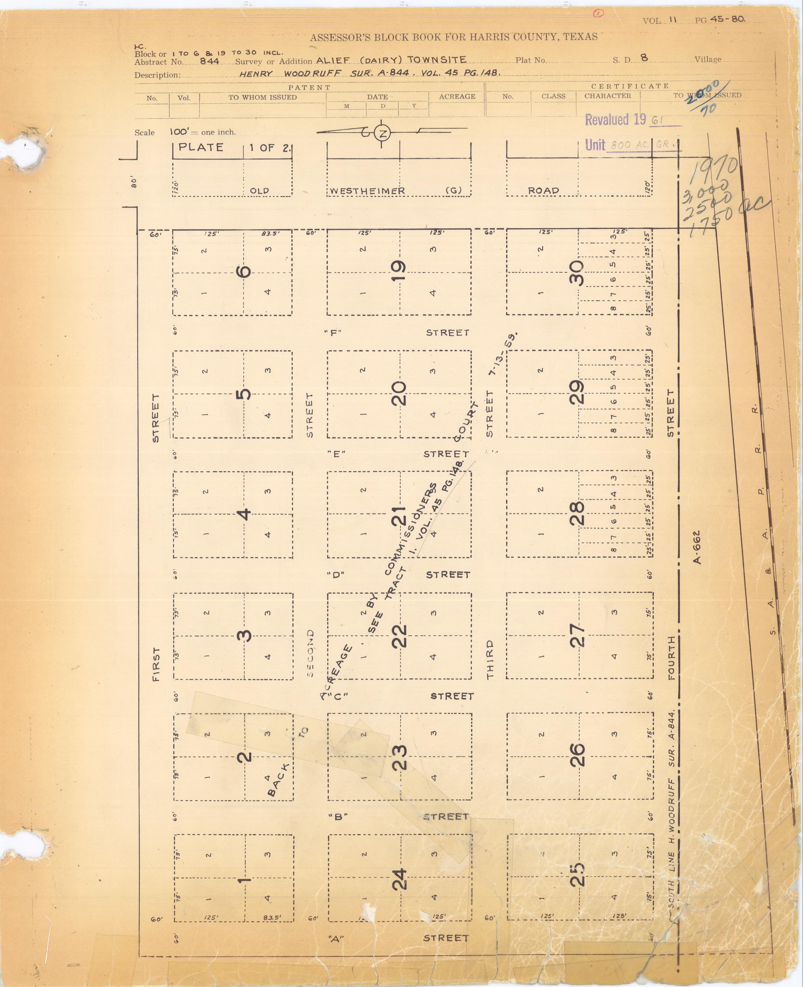
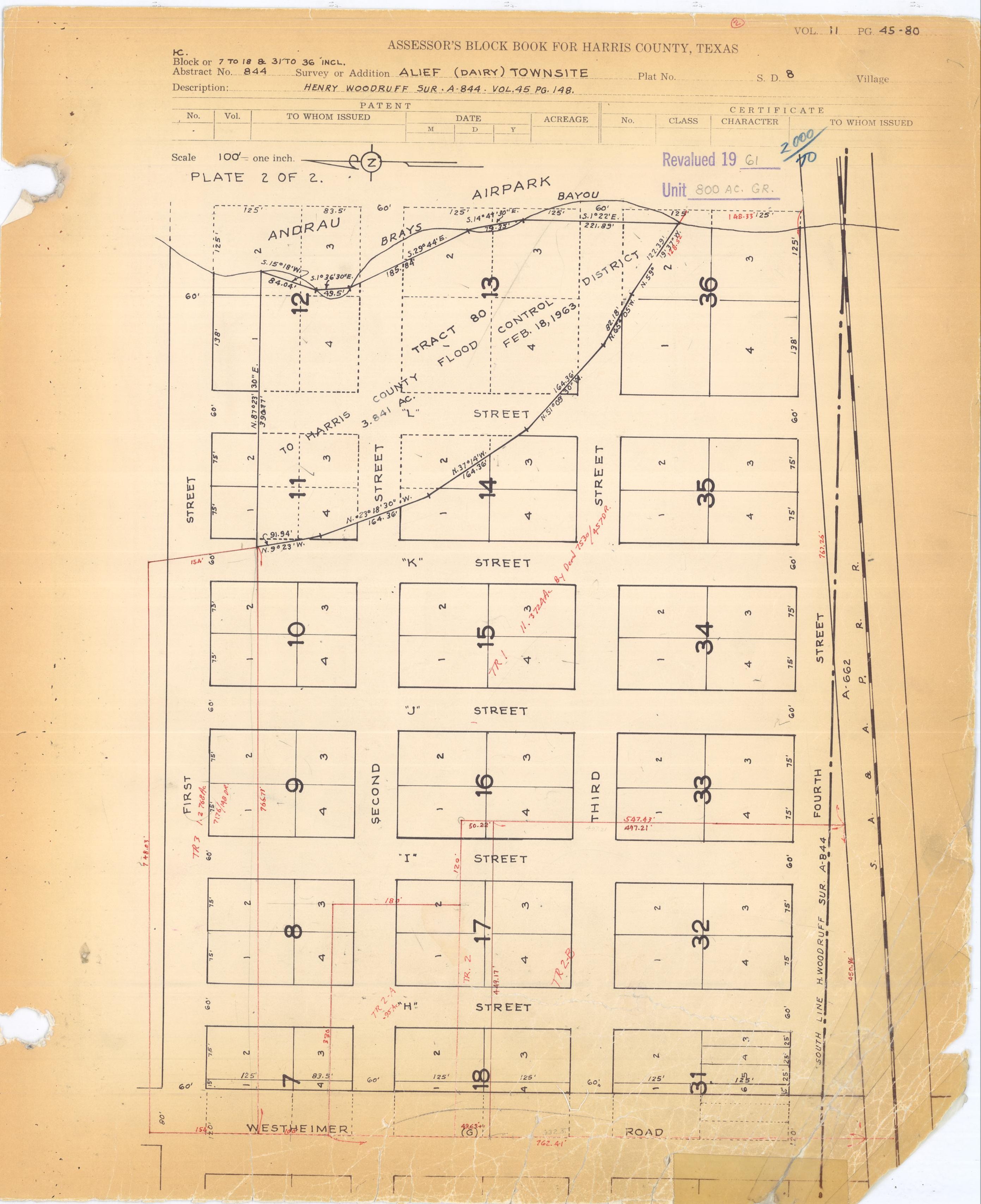
- Harris County Block Books, Dairy (Alief) Townsite. Volume 11, Pages 45–80. Andrau Airpark indicated.


Alief, Houston
View on GrokipediaFollowing annexation by the City of Houston in stages during the 1970s, Alief saw rapid suburban expansion and demographic shifts driven by influxes of Latin American, African American, and Asian immigrants, resulting in a racial and ethnic composition where Hispanics constitute about 45%, African Americans 25%, Asians 21%, and Whites 7% of the population. The neighborhood is defined by its urban-suburban mix, served primarily by the Alief Independent School District, which manages education for a highly diverse student body amid socioeconomic challenges such as median household incomes around $37,000 and elevated poverty rates exceeding 20%.[1][3][4] Notable infrastructure includes proximity to major highways like Beltway 8 and the Westpark Tollway, facilitating connectivity, though the area contends with issues like higher crime rates in certain pockets linked to economic disadvantage and density.[5]
History
Early settlement (1861–1917)
The area now known as Alief was first settled in 1861 when Reynolds Reynolds claimed 1,250 acres (5.1 km²) of flood-prone prairie land near the headwaters of Brays Bayou, approximately 15 miles southwest of Houston.[1] Early economic activities centered on agriculture, including rice, corn, cattle, cotton, and dairy farming, though the region's frequent flooding limited sustained development.[6] In 1888, land promoter Jacamiah Seaman Daugherty purchased the property from Reynolds's heirs and began subdividing it to attract settlers.[1] The following year, Daugherty granted a right-of-way to the San Antonio and Aransas Pass Railway, facilitating access and spurring modest growth.[1] By 1893, Francis I. Meston had acquired the land and platted the townsite with surveyor W. D. Twitchell; county surveyors named the community Dairy in 1894.[1] That same year, Dr. John S. Magee and his wife, Alief Ozelda Magee, relocated from Ellis County, Texas, establishing one of the area's prominent early households.[6] A post office application in 1895 prompted a name change to Alief, honoring the community's first postmistress, Alief Ozelda Magee, to avoid confusion with another locality named Daisy.[1] By 1896, the population reached 25 residents, and a two-room school for white children and a one-room school for black children were constructed.[1] However, disasters hindered progress: a major flood in 1899 and the Galveston hurricane in 1900 devastated farms and reduced the remaining 30 families to just six.[1] Recovery was gradual; Daugherty introduced rice as a cash crop around 1900, followed by the construction of railway depots in 1904 and the first cotton gin in 1905, with cotton production resuming by 1915.[1] The Alief Independent School District was established in 1911, marking a step toward formal community organization, though the area remained a small, rural farming outpost through 1917.[1] In that year, the local Dairy School District was officially redesignated as Alief I.S.D., reflecting the post office's earlier nomenclature shift.[6]Development and pre-annexation era (1918–1976)
Following World War I, Alief persisted as a small agricultural community centered on farming, with cotton production continuing as a staple crop after its resumption in 1915. Rice farming also emerged as a key economic activity, supported by regional irrigation advancements. The area's rural character defined its development, with limited urbanization and reliance on rail transport via the historic Alief depot for shipping produce.[1] In 1934, the extension of the Cane Belt Canal irrigation system to Alief markedly enhanced rice production, establishing it as a primary cash crop and bolstering agricultural viability during the Great Depression. This infrastructure improvement mitigated water scarcity issues inherent to the region's flat prairie soils, enabling more reliable yields. Population levels fluctuated sharply amid economic hardship, dropping from 112 residents in the early 1930s to 35 by the decade's close.[1][7] World War II spurred modest recovery, with the population reaching 200 by 1942 due to wartime labor demands in nearby Houston industries drawing some settlers. Postwar stabilization maintained around 150 residents through the 1950s, as farming remained dominant and non-agricultural businesses stayed minimal. By 1962, the population had increased to 1,400, indicating gradual suburban encroachment from Houston's westward expansion while Alief retained its unincorporated status and agrarian focus.[1] The Alief Independent School District, encompassing 37 square miles, initiated construction of a new school facility in 1964 to accommodate the district's needs, though enrollment fell by over 50% from 1964 to 1968, likely reflecting temporary out-migration or consolidation trends. Throughout this era, Alief avoided significant industrial or residential booms, preserving its identity as an independent farming enclave until Houston's annexation processes commenced in 1977.[1][8]Annexation, diversification, and growth (1977–1989)
Houston initiated the annexation of Alief in 1977, incorporating sizable portions of the community into city limits, with further annexations occurring in 1978 and 1982.[9] This process culminated in the annexation of remaining areas by 1984, integrating Alief more fully into Houston's infrastructure, including the extension of Metro bus routes to serve the suburb.[8] The annexation reflected Houston's expansive growth during the oil boom era, transforming Alief from a semi-rural outpost to a burgeoning suburban extension.[10] During this period, Alief experienced rapid population expansion, quadrupling from approximately 30,000 in 1970 to over 135,000 residents by 1985, accounting for a significant share of Harris County's overall growth.[9] This surge was driven by affordable housing developments attracting working-class families amid Houston's economic prosperity, shifting the landscape from pastureland and rice fields to residential neighborhoods and commercial strips.[11] Ethnic diversification accelerated with a substantial influx of Asian immigrants, particularly Vietnamese refugees following the 1975 fall of Saigon, alongside other groups from South and Southeast Asia, fundamentally altering the community's demographic profile from predominantly Anglo and Black to a multicultural mosaic.[9] This migration, combined with increasing Hispanic settlement, laid the groundwork for Alief's reputation as one of Houston's most diverse areas, though it also introduced challenges in infrastructure and public services straining to keep pace with the boom.[1]Expansion and contemporary shifts (1990–present)
In the 1990s, Alief continued its trajectory of rapid population expansion amid Houston's economic rebound, with urban development supplanting remaining agricultural uses and further annexation incorporating portions into the city limits. The community's population, estimated at around 135,000 in 1985, approached 200,000 by 2002, driven by sustained immigration and affordable housing attracting Hispanic, Black, Indian, and Asian residents as white households increasingly relocated to outer suburbs like Sugar Land and Katy.[9][11] This diversification was evident in Alief ISD, where student enrollment exceeded 43,000 by 2002 across 32 campuses, with demographics shifting to 37% African-American, 37% Hispanic, 16% Asian, and 10% Anglo.[9] The district added approximately 1,500 students annually by 1991, reflecting overcrowding pressures from family growth in the area.[12] Economic activity supported this expansion, with major corporations such as Halliburton and Shell maintaining facilities in Alief, alongside hundreds of small businesses catering to diverse ethnic enclaves, including Asian markets and international dining options.[9] Infrastructure adaptations included the conversion of a disused railroad line into a toll road by 2004, enhancing connectivity via Beltway 8 and nearby highways.[1] However, the post-oil bust environment contributed to socioeconomic strains, including perceptions of neighborhood decline from white flight and rising property value fluctuations, though population metrics indicated net growth through the 2000s.[11] From the 2010s onward, Alief's population stabilized around 106,000 within defined super neighborhood boundaries by 2017, with Alief ISD serving over 291,000 residents by that year amid slower but persistent demographic increases of about 13% from 2010 levels.[13][14] Contemporary shifts have emphasized resilience against environmental vulnerabilities like recurrent flooding and urban heat islands, exacerbated by the area's low-lying terrain and dense development. Community-led initiatives, such as the Alief-Westwood Action Plan, target improvements in housing, safety, education, and economic opportunities to counter disinvestment.[15] A key project, the 37-acre Alief Park and Neighborhood Center—featuring a 70,000-square-foot civic hub, fitness facilities, pool, and integrated city services—addresses these issues while promoting equity in one of Houston's most ethnically varied districts, with construction and programming advancing since 2023.[16][17]Geography and Cityscape
Location and boundaries
Alief is located in the far southwestern sector of Houston, Texas, within Harris County, approximately 12 miles southwest of downtown Houston. The community occupies a position along major transportation corridors, including proximity to the Westpark Tollway to the north and the Sam Houston Tollway (Beltway 8) to the east.[18] The boundaries of Alief, as defined by Super Neighborhood 25 for community planning purposes, extend north to Harwin Drive, south to West Bellfort, east to Beltway 8, and west to the Houston city limits, roughly between Eldridge Parkway and Synott Road.[19] This delineation encompasses a diverse urban area spanning about 14 square miles, though exact limits can vary by context such as school districts or municipal services.[20] The Alief Independent School District, which serves the majority of residents, covers a broader territory extending north to Westheimer Road, east to Gessner Road, and into Fort Bend County to the south and west.[19] Geographic coordinates for central Alief are approximately 29.6827° N, 95.5932° W.[21] Most of the area lies within Houston city limits following annexations starting in 1977, with a small unincorporated portion remaining in Harris County.[22] To the south, it abuts the Fort Bend County line, influencing regional jurisdictional overlaps.[18]Physical features and urban layout
Alief occupies predominantly flat terrain typical of the Houston metropolitan area within the Gulf Coastal Plain, with elevations averaging approximately 89 feet (27 meters) above sea level.[23] This low-lying landscape contributes to subsidence risks and periodic flooding, exacerbated by the region's clay soils and proximity to Houston's extensive bayou system, which aids natural drainage but requires engineered controls.[24] Limited natural features include scattered wetlands and channels feeding into larger waterways like Brays Bayou to the east, though much of the original prairie has been developed. Green spaces mitigate urban density, featuring parks such as Alief Community Park and the adjacent Alief Neighborhood Center, which incorporate resilient landscaping elevated above the 500-year floodplain.[25][26] The urban layout reflects post-World War II suburban expansion, characterized by a rectilinear grid of residential streets lined with single-family homes and multi-family apartments, punctuated by commercial corridors along key arterials. Major thoroughfares include State Highway 6 (running north-south), Farm to Market Road 1093, Beechnut Street, and Harwin Drive, which support local commerce and connectivity.[27] The area spans about 14 square miles, bounded northward by the Westpark Tollway, eastward by the Sam Houston Tollway (Beltway 8), and southward by the Fort Bend County line, creating a roughly rectangular footprint integrated into Houston's extraterritorial jurisdiction.[18] These perimeter highways enable rapid access to downtown Houston, approximately 12 miles northeast, but have isolated internal neighborhoods, leading to ongoing municipal efforts for enhanced pedestrian paths, bike facilities, and transit links to address segmentation and heat island effects through tree planting along county roads.[28][29]Demographics
Population trends and growth
Alief's population remained modest as a rural enclave through the mid-20th century but underwent rapid expansion beginning in the 1970s, nearly quadrupling by 1985 amid the construction of low-cost apartment complexes and early waves of immigration that drew working-class families to the area.[8] This surge continued post-annexation, transforming Alief from a sparsely populated outpost into one of Houston's denser southwestern suburbs, with population density rising sharply as multifamily housing proliferated.[13] Census data for Super Neighborhood 25, encompassing core Alief areas, records a population of 41,820 in 2000, escalating to 106,657 by 2015—a 155% increase accompanied by density climbing from 2,962 to 7,544 persons per square mile.[13] By 2017, the figure reached 119,598, reflecting a 186% rise from 2000 driven by sustained immigration from Latin America, Asia, and Africa, alongside natural population increase and limited new land development constrained by urban boundaries.[30] Recent estimates indicate the population exceeding 120,000 as of 2025, though growth has moderated compared to earlier decades, with some annual fluctuations possibly tied to economic cycles and housing availability.[31] The Alief Independent School District, serving much of the community, mirrors this trajectory, with its resident population growing 10.4% from 257,740 in 2010 to 284,503 in 2015, underscoring ongoing demographic pressures on infrastructure.[4] Overall, Alief's expansion has outpaced Houston's citywide rate in key periods, fueled by its role as an entry point for newcomers seeking affordable urban proximity.[30]Ethnic composition and immigration patterns
Alief's ethnic composition reflects its status as one of Houston's most diverse communities, with no single racial or ethnic group forming a majority. According to 2016–2020 American Community Survey data for Super Neighborhood 25 (Alief), Hispanics or Latinos comprise 47.4% of the population, followed by Black or African Americans at 26.1%, Asians at 18.7%, non-Hispanic Whites at 6.5%, and smaller shares of other groups including American Indians/Alaska Natives (0.1%), Native Hawaiians/Pacific Islanders (0.03%), and those identifying as some other race or two or more races (1.3%).[32]| Racial/Ethnic Group | Percentage |
|---|---|
| Hispanic or Latino | 47.4% |
| Black or African American | 26.1% |
| Asian | 18.7% |
| White (non-Hispanic) | 6.5% |
| Other (including multiracial) | ~1.3% |
Socioeconomic indicators
Alief's median household income stood at $50,216 in 2023, according to 2019–2023 American Community Survey estimates for Super Neighborhood 25, reflecting a modest increase from prior years but remaining below the Houston citywide median of approximately $60,000.[36] [37] This figure aligns with data from the Alief Independent School District area, where median household income was reported at $52,396, underscoring persistent income constraints amid a diverse, immigrant-heavy population.[38] The poverty rate in Alief averages 24.2–24.9%, more than 1.5 times the Texas statewide rate of 14.7% and exceeding the Harris County figure of 15.9%.[39] [20] [38] Approximately 25,900 residents lived below the poverty line in recent estimates, with families and children facing elevated risks due to large household sizes and limited wage growth in service-oriented employment sectors.[40] Educational attainment lags behind regional norms, with roughly 30% of adults aged 25 and older lacking a high school diploma or equivalent, compared to 21% citywide.[22] Only about 20% hold a high school diploma as their highest credential, while postsecondary completion rates—such as associate's or bachelor's degrees—hover below 25%, correlating with barriers like language proficiency among non-native English speakers and underfunded local schooling.[22] [41] Housing affordability poses challenges, with median home values around $210,000 in recent sales data, though older estimates pegged owner-occupied values at $104,300.[42] [4] Renters, comprising a majority, face burdens as 58.5% allocate 30% or more of income to housing, exceeding national and city averages and exacerbating economic strain.[43] Unemployment tracks Houston metro trends at about 5%, with limited localized data indicating similar rates influenced by energy sector volatility and entry-level job reliance.[44]| Indicator | Alief Value | Houston/TX Comparison |
|---|---|---|
| Median Household Income (2023) | $50,216 | Houston: ~$60,000; TX: $79,721[36][45] |
| Poverty Rate | 24.2–24.9% | TX: 14.7%; Harris Co.: 15.9%[39][20] |
| No High School Diploma (Adults 25+) | ~30% | Houston: 21%[22] |
| Renters Spending ≥30% Income on Housing | 58.5% | US: 49.6%; Houston: 50.7%[43] |
Economy
Employment sectors and workforce
The workforce in Alief primarily consists of residents employed in private companies (73.6%), with a notable portion self-employed (12.7%).[40] Blue-collar occupations account for 28.4% of jobs held by Alief residents, reflecting the community's working-class character, while white-collar roles comprise the majority at 71.6%.[40] Construction represents the dominant employment sector, employing 17% of workers in the Alief study area as of 2017, followed by professional services. Other significant sectors include retail trade, transportation and warehousing, and administrative support, driven by the area's proximity to major highways like Beltway 8 and proximity to Houston's logistics hubs. Many residents commute to jobs in central Houston or nearby industrial zones, with common occupations encompassing sales, office administration, production, and service roles aligned with the neighborhood's diverse immigrant population.[22] Median household income in the Alief Independent School District area, indicative of local workforce earnings, stood at $37,353 as of recent estimates, with 24.7% of the population below the poverty level, underscoring challenges in higher-wage sectors.[4] Unemployment rates mirror broader Harris County trends, around 4-5% in recent years, though underreporting may occur among informal or gig economy workers prevalent in immigrant-heavy communities like Alief.[46]Local businesses and commerce
Alief's local commerce thrives on small, family-owned enterprises that mirror the area's ethnic diversity, with a focus on retail, services, and dining tailored to immigrant communities. Strip malls and standalone shops dominate, offering affordable goods and cultural specialties rather than large-chain dominance. Key sectors include ethnic groceries, restaurants, and professional services, supported by the International District Management's efforts to enhance retail viability through household surveys on preferences.[47] Local businesses provide essential economic anchors, employing residents in proximity to home and contributing to Houston's overall small-firm job share of about 12%.[48] Bellaire Boulevard emerges as the primary commercial artery, hosting a concentration of Asian-oriented businesses such as supermarkets, pho restaurants, and import stores that serve the substantial Vietnamese, Chinese, and other East Asian populations.[18] Establishments like the H-E-B at 14498 Bellaire Boulevard provide everyday retail, including bakery and floral services, alongside specialized outlets for international foods.[49] Nearby plazas, including Saigon-Houston Plaza and Hong Kong City Mall, feature vendors selling apparel, electronics, and cuisine from Southeast Asia, fostering a bustling ethnic marketplace.[50] African and South Asian retail, such as Alief African Foods at 9755 South Kirkwood Road stocking imported staples, further diversifies offerings for Nigerian, Ghanaian, and Indian customers.[51] West Oaks Mall, a 1-million-square-foot regional center opened in 1984 at 1000 West Oaks Mall, anchors broader retail with remaining tenants like Macy's, though foot traffic has waned amid broader suburban mall challenges in Houston.[52] [53] Service-oriented commerce, including pharmacies and financial centers like Bank of America branches on Bellaire, complements shopping districts, emphasizing accessibility for working-class residents.[54] Overall, Alief's business landscape prioritizes niche, community-driven trade over high-end or corporate retail, aligning with socioeconomic patterns of moderate-income households.[55]Economic hurdles and opportunities
Alief faces significant economic hurdles, including a poverty rate of 24.2%, substantially higher than the Texas average of 14.7% and the U.S. average of 13.4%.[39] The area's median household income stands at approximately $47,321 to $49,314, with 55% of households earning less than $50,000 annually and 25% living below the federal poverty line, compared to Houston's median of $60,440.[56][40] Over 42% of residents allocate more than 30% of their income to basic expenses, exacerbating financial strain amid high energy costs from extreme heat and frequent flooding, which disrupts local commerce and limits access to disaster insurance and discretionary funding.[56] Additional challenges include overcrowding, with 13.5% of households overcrowded versus the U.S. average of 3.4%, and a high renter cost burden affecting 53% of residents, compared to 48% citywide.[57] Employment is often concentrated in low-wage sectors such as warehousing and logistics, with limited upward mobility due to educational and language barriers in a community where 83% of the population is classified as economically disadvantaged by the Texas Education Agency.[56] Infrastructure deficiencies, including inadequate sidewalks, drainage issues in 40% floodplain areas, and transit gaps, further hinder business operations and workforce access to broader Houston job markets.[48] Opportunities arise from targeted initiatives, such as workforce training at facilities like the Alief Campus Workforce Education & Career Center, which offers programs in electrical, HVAC, plumbing, and automation to address shortages in manufacturing, technology, and healthcare.[58] Small business development is supported through loans (with $56 million disbursed in 2017 and goals for 10% growth by 2025), entrepreneurship workshops, incubators, and activation of underutilized strip malls via pop-up events and the Houston West Chamber of Commerce.[48] The area's five Opportunity Zones, diverse foreign-born population (47%), and population growth of over 17,000 since 2000 position Alief for economic expansion, bolstered by resilience projects like community gardens, tree planting (400+ trees planned), and infrastructure upgrades including 10 miles of sidewalks and new bus shelters by 2025.[48][56]Government and Politics
Municipal and county governance
Alief lacks an independent municipal government, functioning instead as a community primarily within Houston's city limits, where governance is administered by the Houston City Council and associated departments such as Planning and Development and Neighborhoods.[18] The incorporated areas receive municipal services including zoning, waste management, and parks maintenance directly from Houston, with community input facilitated through Super Neighborhood 25, an advisory body established in 1999 to prioritize local needs like infrastructure and safety.[19] This structure promotes resident collaboration with city officials but limits direct control, as decisions rest with Houston's at-large mayor and 11 district council members.[22] Unincorporated sections of Alief, comprising a smaller portion of the community, are governed by Harris County's Commissioners Court, which includes a county judge and four precinct commissioners elected to staggered four-year terms, overseeing budgets exceeding $2.5 billion annually for county-wide services.[59] These areas, lacking city-level ordinances, rely on county provisions for roads, flood control via the Harris County Flood Control District, and law enforcement through precinct constables rather than Houston Police Department patrols.[60] Alief intersects Harris County Precincts 3 and 4, with Precinct 4 handling initiatives like sidewalk expansions totaling 50 miles near local schools as of March 2025 and environmental projects such as the Alief Linear Forest.[61] Precinct 3 maintains certain county parks in the area. This dual jurisdiction can lead to service disparities, with unincorporated residents advocating for annexation to access fuller Houston amenities, though county governance emphasizes fiscal conservatism and infrastructure resilience.[62]Elected representation
Alief residents within Houston city limits are represented in the Houston City Council by District F member Tiffany D. Thomas, elected in 2019 and serving a term through 2023 with re-election in subsequent cycles; the district encompasses the Alief Super Neighborhood #25.[63] [19] At the county level, Alief falls primarily under Harris County Precinct 3, represented by Commissioner Tom S. Ramsey (Republican), elected in 2022 for a four-year term focused on infrastructure and public safety initiatives in the area.[19] For state representation, the community is covered by Texas House District 149, held by Hubert Vo (Democrat) since 2004, with his district explicitly including most of Alief and emphasizing education and economic development.[64] [65] In the Texas Senate, District 13 representative Borris L. Miles (Democrat), elected in 2016 and re-elected in 2022, oversees legislation affecting southwest Houston suburbs like Alief.[19] Federally, Alief lies within Texas's 9th Congressional District, represented by Al Green (Democrat) since 2005, who addresses issues such as housing affordability and flood control relevant to the area's demographics.[66] The state's U.S. senators are John Cornyn (Republican, serving since 2002) and Ted Cruz (Republican, serving since 2013), both elected statewide.Political leanings and key issues
Alief residents predominantly support Democratic candidates in federal, state, and local elections, consistent with broader Harris County trends where Democrats have secured majorities in recent presidential contests, including Joseph Biden's 56% to Donald Trump's 43% margin in 2020.[67] The community lies mainly within Texas's 9th congressional district, represented by Democrat Al Green since 2005, who won reelection in 2024 with 73% of the vote, and Texas House District 149, held by Democrat Hubert Vo, a Vietnamese-American lawmaker serving since 2004.[68] However, demographic shifts among Alief's large Hispanic and Asian immigrant populations have shown modest Republican gains in recent cycles, mirroring national patterns where such neighborhoods tilted rightward in the 2020 presidential election due to economic concerns and cultural conservatism.[69] Key political issues center on public education funding and property taxes, exacerbated by Alief Independent School District's (Alief ISD) enrollment decline of approximately 8,000 students over the past decade, largely to charter schools, leading to budget strains from inflation and rising insurance costs.[70] On November 5, 2024, Alief voters narrowly approved the district's Voter-Approved Tax Ratification Election (VATRE) by 50.73%, authorizing a property tax increase to raise about $15 million annually for operations, reflecting tensions over fiscal sustainability versus tax burdens in a low-income area. Low voter turnout compounds these debates, with Alief's participation historically lagging Harris County's average—around 40% abstention in the 2024 presidential election countywide—prompting youth-led efforts like AliefVotes, founded in 2022, to enhance civic engagement amid diversity-driven barriers such as language and work schedules.[71][72]Education
Primary and secondary education
The Alief Independent School District (Alief ISD) provides public primary and secondary education to the Alief community in southwest Houston, operating 47 schools for grades pre-kindergarten through 12.[73] As of the 2023-2024 school year, enrollment stood at 39,451 students, reflecting a diverse population where 61.8% are Hispanic, 24% African American, 9.7% Asian, and 3.3% White; 87.4% qualify as economically disadvantaged, and 57.6% have limited English proficiency.[74] Alief ISD structures its primary education through 24 elementary schools serving pre-K to fifth grade and 6 intermediate schools for sixth grade, followed by secondary education in 6 middle schools for seventh and eighth grades and 5 comprehensive high schools for ninth through twelfth grades, supplemented by alternative and magnet programs.[75] The district emphasizes bilingual education and English language learner support given the high proportion of non-native English speakers.[74] Academic outcomes lag state averages, with only 40% of elementary students proficient in reading and 30% in math on STAAR assessments, contributing to the district's overall C accountability rating from the Texas Education Agency for 2024-2025 across student achievement, progress, and gap-closing domains.[76][74] Despite challenges, the four-year high school graduation rate reached 87.1% for the Class of 2023, with a 2.6% dropout rate for grades 9-12.[74] Private and charter school options in Alief are limited compared to public enrollment, including Alief Montessori Community School, which offers primary through middle school programs with a focus on Montessori methods for a smaller student body.[77] Charters like Houston Classical, serving pre-K to sixth grade, provide alternatives emphasizing classical curricula but draw from broader Houston areas rather than exclusively Alief.[78]Academic performance and systemic issues
Alief Independent School District (Alief ISD), which serves most of the Alief community, received a C accountability rating from the Texas Education Agency (TEA) for the 2024–2025 school year, reflecting scaled scores in the 60–69 range across domains including student achievement, school progress, and closing performance gaps. This rating is determined primarily by performance on the State of Texas Assessments of Academic Readiness (STAAR), where district-wide results show proficiency rates below state averages, particularly in reading and mathematics for grades 3–8 and end-of-course exams. For instance, in high schools like Elsik High School, mathematics proficiency hovers around 28% and reading at 32%, contributing to the overall district challenges in meeting state standards.[79][80][74] The district's four-year graduation rate stood at 87% for the class of 2023, a decline from prior years and below the state average of approximately 90%, with dropout rates influenced by factors such as student mobility and socioeconomic pressures. While some campuses, like Alief Early College High School, achieve higher rates near 100%, systemic variations persist across the district's 39,451 students, many of whom attend schools rated C or lower. These outcomes align with TEA's emphasis on empirical measures of academic growth, though critics note that raw proficiency metrics may undervalue progress in high-needs environments.[81][82][74] Systemic issues in Alief ISD stem largely from a student demographic where over 80% qualify as economically disadvantaged, with a majority Hispanic enrollment and a substantial proportion—around 30%—classified as emergent bilingual learners requiring English as a Second Language (ESL) support. Poverty correlates strongly with lower academic performance, as evidenced by national and state data linking household income to standardized test outcomes and graduation persistence, independent of instructional quality. The district addresses language barriers through targeted ESL certification for teachers, aiming to reduce the number of non-certified staff in emergent bilingual classrooms, but resource strains from high-needs populations persist, including elevated teacher turnover despite average experience levels of 11.3 years. Funding per pupil, while aligned with state formulas, faces pressures from facilities needs and pre-K expansions for at-risk four-year-olds, underscoring causal links between socioeconomic realities and educational hurdles rather than isolated policy failures.[83][84][74]Post-secondary options
The primary post-secondary institution serving Alief residents is the Houston Community College (HCC) Alief Hayes Campus, located at 2811 Hayes Road in the Westchase District of west Houston.[85] This campus offers associate degrees, certificates, and workforce training in fields such as engineering, arts, film production, and entrepreneurship, including specialized facilities like a sound stage and the West Houston Institute for advanced technical programs.[85] HCC, established in 1971, enrolls over 70,000 students annually across its system, providing affordable open-admission access tailored to local needs in diverse communities like Alief.[86] Alief ISD collaborates with HCC through the Alief Early College High School, hosted at the Alief Hayes Campus, enabling high school students to earn up to 60 transferable college credits toward associate degrees or workforce certifications at no cost, facilitating seamless transition to post-secondary education.[85] Additional HCC offerings include community enrichment programs in culinary arts, automotive technology, and personal finance, available online and onsite to support adult learners in Alief.[87] For four-year degrees, Alief residents typically commute to nearby universities such as the University of Houston, approximately 15 miles northeast, which provides over 300 undergraduate and graduate programs as a tier-one research institution.[88] Other accessible options include North American University in adjacent Stafford, about 3 miles away, focusing on business, engineering, and education degrees for international and local students.[89] These institutions support transfer pathways from HCC, with articulation agreements ensuring credit compatibility for Alief graduates pursuing bachelor's degrees.[90]Public Safety and Crime
Crime statistics and patterns
Alief reports a total crime rate of 92 incidents per 1,000 residents, significantly higher than the Houston citywide rate of 56 per 1,000.[91] [92] An examination of Houston Police Department records from 2019 to 2024 ranks Alief among the city's neighborhoods with the most reported crimes overall, alongside areas like Sharpstown and Greenspoint.[93] Violent crime rates in Alief exceed national benchmarks, with robbery at 646.5 per 100,000 residents, aggravated assault at 558.6 per 100,000, and murder at 15.2 per 100,000.[3]| Crime Type | Alief Rate (per 100,000) | National Average (per 100,000) |
|---|---|---|
| Robbery | 646.5 | 135.5 |
| Aggravated Assault | 558.6 | 282.7 |
| Murder | 15.2 | 6.1 |