Hubbry Logo
AtarotAtarotMain
Open search
Atarot
Community hub
Atarot
logo
8 pages, 0 posts
0 subscribers
Be the first to start a discussion here.
Atarot
Atarot
from Wikipedia

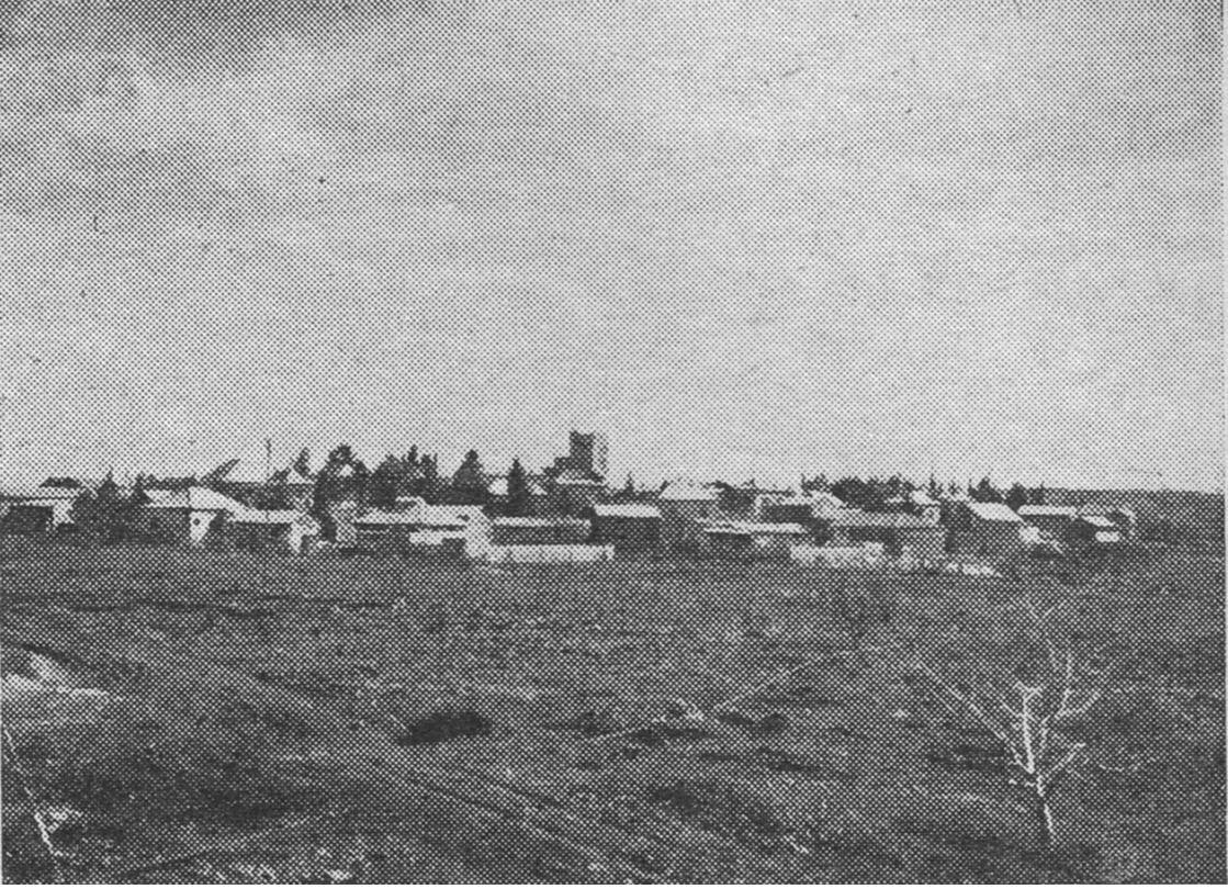
Atarot (Arabic: عطروت Hebrew: עטרות) was a moshav in Mandatory Palestine, north of Jerusalem along the highway to Ramallah. It was named after the biblical Atarot mentioned in Joshua 16:2, which is believed to have been situated nearby. The moshav was captured and destroyed by the Jordanian Arab Legion during the 1948 Arab-Israeli War. Atarot Airport, closed since the Second Intifada. Today, the area hosts the Atarot Industrial Zone, which is Jerusalem's largest industrial zone.[1]

Key Information

History

[edit]

Establishment

[edit]

In 1912, the Palestine Land Development Corporation (PLDC) purchased land in the hills north of Jerusalem from the neighbouring Arab village of Kalandia.[2] In 1914 the tract was settled by Zionist youth of the Second Aliyah who prepared the rocky soil for agriculture. Among the settlers was Levi Eshkol, a future Prime Minister of Israel.[3][4]

After the outbreak of World War I, the project was abandoned until 1922, when a group of workers returned to the area to continue reclamation and planting work.[4] This group leased some of the land to local Arabs and acquired more tracts for settlement. The plan was to ready the land for sale to individuals and groups. When the venture proved unsuccessful, the Jewish National Fund bought 375 dunams of the best land. It was on this land that Atarot was established. The village was named for the biblical town of Ataroth believed to be located nearby.[3]

Atarot construction of water tank 1928

In 1925, Atarot was joined by Neve Yaakov, creating a bloc of Jewish settlement in the area.[4] In 1931, the British Mandatory government expropriated 200 of the 375 dunams to construct a small airfield, in the process demolishing homes and uprooting fruit orchards, and harming the village's growth. The PLDC sold more of the land such that the moshav members were left with only 14 dunam per plot, while 30 dunam was considered to be the minimum necessary for sufficient income. Water shortages also plagued the village, as the locally constructed reservoir could not satisfy the needs, and so it was necessary to purchase water from neighbouring Arab villages as well as from the expensive British-built Jerusalem municipal pipes.[3]

Atarot farmers supplied fruit, produce and dairy products to Jerusalem.[5] Some of the moshav's fields were located at a distance, which created a security problem during the 1929 Palestine riots and 1936–1939 Arab revolt in Palestine when its residents were shot at, robbed, and besieged.[3]

According to a census conducted in 1931 by the British Mandate authorities, Atarot had a population of 250 inhabitants, in 59 inhabited houses.[6]

In the 1940s, the village had a population of 150.[4]

Depopulation in 1948 War

[edit]

Following the Israeli Declaration of Independence and attack of five Arab armies, the village withstood repeated attacks and acted as a bulwark during the Jordanian Arab Legion's 1948 Siege of Jerusalem. The Haganah command for the Jerusalem area finally decided to evacuate the remaining defenders; they left on 17 May 1948. The Jordanian forces looted and burned the village, turning the land into an extension of Kalandia Airport.[7][8][9]

The refugees maintained their desire to remain organised as an agricultural cooperative, and in August of that year they were resettled in the former Templer village of Wilhelma, which they named Bnei Atarot in remembrance of their original home.[8][9]

Israeli author Esther Streit-Wertzel was commissioned in 2005 by the original families to write a chronicle of the village; she ultimately produced a novel on the topic.[10]

1967 war and aftermath

[edit]

Following the 1967 Six-Day War, the airport and site of the former village were captured by Israel along with the rest of the West Bank. The area was annexed into the expanded Jerusalem Municipality, and an industrial park was developed alongside the airport, renamed for the former village.[8][9]

Second Intifada

[edit]

During the Second Intifada, the park and airport suffered from Palestinian attacks due to their proximity to Ramallah, leading to the closure of the airport.[9][11][12][13]

On February 27, 2000, a young Jewish Israeli businessman, Gadi Rejwan, who owned a factory in Atarot, was shot to death by one of his Arab workers.[14]

Industrial zone

[edit]

Before the Intifada, the zone housed over 200 companies including Coca-Cola, Mercedes-Benz, Israel Aircraft Industries, and many Arab-owned and joint enterprises. Some 4,000 people were employed prior to 2000, Arabs from Jerusalem and the West Bank comprising about two-thirds.[11]

With the ebbing of violence, the Atarot Industrial Zone saw renewed activity, and several new companies moved in, aided by the new Highway 45's linking the area to the nearby Route 443 expressway to the Tel Aviv metropolitan area and Highway 50 (Begin Boulevard) to central Jerusalem. As of 2003, the area, which has surpassed Har Hotzvim to become the largest industrial zone in Jerusalem, houses 160 factories in a variety of industries.[15] The area is managed by a non profit organisation, which successfully lobbied the Jerusalem Municipality for the right to handle security, previously carried out by private firms.[15]

Waste transfer station

[edit]

A new waste transfer station in Atarot started receiving waste from Jerusalem in February 2014. According to Israel's Ministry of Environmental Protection, the new waste station will allow the closure of the polluting waste facility located in Abu Dis.[16]

See also

[edit]

References

[edit]
Revisions and contributorsEdit on WikipediaRead on Wikipedia
from Grokipedia
Atarot was a agricultural settlement () established in 1914 by a small group of Zionist laborers north of in , aimed at developing farming in rocky hill terrain; it was re-founded in 1922 by Eastern European immigrants and later joined by German settlers in . The settlement supplied produce and dairy to and served as a strategic outpost during conflicts, but was evacuated by its approximately residents on May 17, 1948, amid the Arab-Israeli War, after which Jordanian forces destroyed the village and its structures. Following Israel's capture of the area in the 1967 , Atarot was incorporated into 's municipal boundaries, where an industrial zone was developed on the site, including remnants of the adjacent Atarot Airport—a British Mandate airfield opened in the that operated for domestic flights until its closure in 2000 due to security threats during the Second Intifada. The site's pre-1948 Jewish ownership and development contrast with narratives framing it as inherently Palestinian territory, as evidenced by historical records of its establishment and operation as a Jewish farming community prior to Jordanian occupation and destruction. Efforts to revive settlement there, including proposed residential expansion, have faced international criticism as violations of occupation law, though such views often overlook the area's documented Jewish continuity from the Mandate era until 1948. Atarot's exemplifies early Zionist agricultural pioneering amid intercommunal tensions, with its agricultural model influencing subsequent hill settlements despite wartime depopulation.

Geography and Location

Site and Boundaries

Atarot occupies approximately one square kilometer in northern , establishing it as the city's largest industrial zone. Its footprint integrates into the broader urban expanse of , bordered by Palestinian neighborhoods including to the south and , while extending northward toward the Qalandiya area. The zone aligns with Israeli Highway 60, designated within as the Talpiot–Atarot Axis, facilitating vehicular access along this north-south corridor. Terrain consists of the undulating Judean hills characteristic of the region, with elevations reaching around 800 meters above , positioning Atarot amid 's elevated northern periphery.

Proximity to Key Sites

The Atarot industrial zone lies adjacent to the Qalandiya checkpoint, the main border crossing linking northern to , situated roughly 10 kilometers north of Jerusalem's city center and 3 kilometers south of Ramallah's southern boundary. This proximity enables straightforward road access to Ramallah's urban and commercial districts via local arteries like Route 60. The zone connects to broader transportation networks through Highway 1, which links eastward to Ben Gurion International Airport, approximately 40 kilometers away, supporting freight movement between central and regional hubs. Historically tied to the defunct Atarot Airport—also known as —the site's disused runway remnants persist in the vicinity, influencing the linear layout of industrial roads and facilities developed post-1967. enhancements have incorporated elements of this legacy aviation infrastructure to align with modern zoning. Proposed rail links, such as the "Brown Line" extension, aim to originate from the Atarot area, connecting it directly to Jerusalem's existing system and potentially to settlements like , as outlined in municipal planning documents. These developments underscore the area's integration into regional transit corridors.

Historical Background

Biblical and Ancient Context

Ataroth, also known as Ataroth-addar, appears in the Hebrew Bible as a boundary marker in the territorial allotment to the tribe of Benjamin. In Joshua 18:13, the description of Benjamin's northern border states that it "goes down to Ataroth-addar, on the hill that lies on the south side of Lower Beth-horon," situating it within the central hill country west of the Jordan River, adjacent to Ephraim's territory described in Joshua 16:5. This places Ataroth-addar amid the rugged terrain north and west of Jerusalem, distinguishing it from other biblical sites bearing similar names, such as the Gadite Ataroth east of the Jordan in Gilead (Numbers 32:3, 34). The name, deriving from Hebrew roots meaning "crowns" or "excrescences," reflects typical topographic descriptors for elevated settlements in the biblical land division narratives. Scholarly identifications of Ataroth-addar remain tentative, with proposed sites including Khirbet Atara (near modern Deir Ibzi' in the Samarian hills) or ed-Dariyeh (south of Lower Beth-horon, approximately 20 kilometers west-northwest of ), based on proximity to described landmarks like Beth-horon. These align with the biblical coordinates but lack definitive epigraphic or stratigraphic confirmation linking them directly to the I-II context of the tribal allotments, circa 1200–1000 BCE. Other candidates, such as Khirbet Raddana, have been suggested but dismissed due to mismatched elevations or distances. Archaeological surveys in the broader Atarot region, including the modern industrial zone north of , reveal limited pre-Hellenistic remains overlaid by later occupations, such as Byzantine and Crusader-era structures at Khirbet er-Ram. Rock-hewn installations, field walls, and minor sherds indicate sporadic settlement continuity from the , but no substantial fortified tell or inscriptions attest to a prominent biblical Ataroth-addar here, likely due to intensive modern development and erosion in the systems. Empirical data thus supports the site's inclusion in Benjamin's allotment via scriptural rather than robust artifactual , underscoring the challenges of correlating textual boundaries with physical loci in disturbed highland terrains.

Mandate Era and 1948 War

Jewish efforts to establish an agricultural settlement at Atarot commenced under the British Mandate after the Jewish National Fund purchased land there in 1912, located north of Jerusalem along the road to Ramallah. Initial settlement occurred in 1914 by Zionist youth groups aiming to reclaim and cultivate the rocky terrain, but the site was abandoned during World War I due to Ottoman conscription and instability. Resettlement resumed in by a group of workers focused on planting and , evolving into a cooperative by the late 1920s. Residents engaged in and auxiliary , producing goods supplied to markets despite challenging soil conditions. By the 1940s, the community numbered approximately 150 inhabitants, sustaining operations amid rising Arab-Jewish tensions in the Mandate period. Positioned as a northern outpost, Atarot functioned strategically to secure Jerusalem's approaches during the 1947-1948 phase, facing intermittent attacks from local Arab forces. Following Israel's on May 14, 1948, the settlement succumbed to advances by the Jordanian ; defenders evacuated just prior to its capture, after which the site was destroyed. Jewish residents were unable to return until Israel's capture of the area in , marking the end of Mandate-era Jewish presence there.

Jordanian Control (1949-1967)

Following the 1948 Arab-Israeli War and the subsequent between and , the Atarot area—including the site of the pre-war Jerusalem Airport—came under Jordanian administration as part of the territory west of the Green Line. formally annexed the , encompassing Atarot, on April 24, 1950, through a parliamentary resolution that unified it with the East Bank under the Hashemite Kingdom, granting residents Jordanian citizenship while receiving recognition only from Britain and . The annexation emphasized political incorporation but involved limited economic prioritization of the region, with Jordanian governance focusing on security and administrative control rather than extensive modernization outside key assets like transport hubs. The airport at Atarot, referred to by Jordanians as Airport, resumed civilian operations shortly after the , serving as a primary entry point for Jerusalem-bound pilgrims, , and officials. By the mid-1960s, it handled around 100,000 passengers annually, operating flights to approximately 15 destinations, including international routes to and , and catering mainly to affluent travelers via Airlines. To facilitate expansions, Jordanian authorities demolished the ruins of the former Jewish village of Atarot and its adjacent , repurposing the cleared land for runway and facility enhancements. However, surrounding lands saw negligible transformation, remaining predominantly agricultural or fallow, with no recorded initiatives for industrial zoning, manufacturing, or significant residential expansion during this period. Jordan's administration, including Atarot, prioritized military preparedness and Arab nationalist alignment over infrastructural innovation, reflecting broader resource allocation toward the East Bank's urban centers like . This stasis in non-aviation development contrasted with the airport's niche viability, which depended on pilgrimage traffic and limited elite connectivity. In the prelude to the 1967 , Jordan deepened ties with and , formalizing a mutual defense agreement with on May 30, 1967, and permitting Iraqi troop deployments in the , which intensified border skirmishes and set the stage for armed confrontation without altering Atarot's civilian character.

Israeli Capture and Initial Development (1967)

During the , Israeli Defense Forces captured the Atarot area from Jordanian control as part of operations securing eastern and its northern periphery on June 5–7, 1967. The advance met limited organized Jordanian resistance in the Atarot vicinity, reflecting the broader disintegration of defenses amid Israel's coordinated ground and air offensives in the Jerusalem theater. Upon securing the site, IDF units discovered virtually no remnants of the pre-1948 Jewish and settlement structures, which Jordan had demolished following its 1948 occupation of the territory. In the war's immediate aftermath, Israeli authorities initiated topographic and surveys of Atarot to assess viability for renewed , prioritizing consolidation and economic reintegration over Jordanian territorial assertions, which Israel deemed illegitimate extensions of the armistice lines. On June 27, 1967, the Israeli cabinet approved expanding Jerusalem's municipal boundaries northward to encompass Atarot, applying Israeli civil law and administration to the area as part of the city's reunification. This administrative incorporation facilitated preliminary deliberations for non-military uses, setting the stage for post-conflict utilization while maintaining military oversight amid ongoing regional tensions.

Development and Infrastructure

Establishment of the Industrial Zone

Following the Israeli capture of in the 1967 and subsequent annexation, initial zoning for industrial development in the Atarot area commenced in the late , leveraging proximity to the former Atarot airfield and available land for . The zone was formally established in 1970 by the Jerusalem Economic Corporation on approximately 270 dunams of land expropriated from the adjacent Palestinian neighborhood of Bayt Hanina, targeting light industries such as , , and assembly operations attracted by low land costs and logistical advantages. This early phase emphasized rapid buildup, including roads and utilities, to integrate the area into Jerusalem's municipal framework and foster manufacturing output amid post-war reconstruction priorities. A growth spurt occurred in the , with the zone expanding to accommodate additional factories and warehouses, driven by incentives like subsidized rents—reported at around 23 shekels per square meter—and tax rates of 74-85 shekels per square meter, making it competitive for small-to-medium enterprises. By the decade's end, Atarot had solidified as Jerusalem's primary industrial hub, incorporating sectors like chemicals, materials, and automotive repair, with over 200 facilities operational by the early . The zone's incorporation into broader planning frameworks, including updates to the municipal master plan, further institutionalized its role, designating it for sustained industrial use and entrenching its contribution to the city's base through designated expansion zones covering more than 150 acres. This planning supported achievements in economic integration, positioning Atarot as a key node for goods production and distribution, with facilities from multinational firms enhancing output in consumer goods and despite regional security challenges.

Economic and Employment Growth

The Atarot industrial zone, operational since the mid-1980s, has matured into a significant and hub in , hosting approximately 160 businesses and factories as of 2020. These include plants producing exportable kosher products, automotive repair facilities, and warehousing operations, contributing to Israel's broader industrial output through diverse production activities. Israeli government policies have facilitated this growth via financial incentives under the Capital Investment Encouragement Law, which provides tax reductions and grants for investments in designated development areas, including parts of classified for such benefits. Additional advantages, such as subsidized land and lower operational costs—industrial rent at around 23 shekels per square meter and municipal taxes of 74-85 shekels per square meter—have attracted enterprises compared to central sites. Employment in the zone reached about 3,600 workers by the late 2010s, reflecting steady post-2000 recovery from disruptions that initially halved occupancy. Operations have since expanded amid regional tensions, with sustained activity underscoring adaptability through security adaptations and ongoing investments. While specific GDP contributions from Atarot remain undocumented in public aggregates, its export-oriented firms bolster Israel's in sectors like processed foods, aligning with national incentives for peripheral industrial development.

Waste Management and Recent Projects

The GreenNet recycling and facility in Atarot, operational since August 2013, serves as the primary sorting and transfer station for mixed from the metropolitan area, handling refuse from approximately one million residents. The plant processes incoming waste through automated and manual sorting to separate recyclables such as metals, plastics, , and , which are compacted into bales for delivery to downstream industries, while non-recyclable residues are transferred for disposal or further treatment. This replaced older dumping practices and supports for its northern sector by reducing transport needs to distant landfills. In August 2025, inaugurated an advanced facility in Atarot dedicated to and , with a daily processing capacity of 2,000 tons. The plant employs sorting and separation technologies to convert debris into reusable raw materials, minimizing use, curbing , and conserving natural aggregates, with a total investment of 40 million Israeli shekels including 5.6 million shekels from the Ministry of . This development addresses the high volume of inert generated in the region and aligns with national goals for . On May 28, 2025, the Israeli government approved plans to construct an advanced recovery facility at Atarot's existing site, enabling or similar processes to generate from residual waste streams. The project seeks to decrease dependence on southern landfills, shorten waste haulage distances, and contribute to Jerusalem's infrastructural resilience, funded in part by the national Cleanliness Maintenance Fund under the Ministry of Environmental Protection's "garbage to gold" initiative. Specific details on annual throughput, output, or emission mitigation technologies remain forthcoming as construction advances.

Security and Conflicts

Second Intifada and Subsequent Violence

During the (September 2000 to early 2005), the Atarot industrial zone north of became a frequent target of Palestinian terrorist attacks, primarily shootings and infiltrations, resulting in multiple Israeli fatalities and disruptions to operations. On January 25, 2001, Akiva Pashkos, 45, was shot dead in a terror attack near the zone. The area experienced repeated incidents of shooting, stone-throwing, and firebombing over subsequent months. Further attacks included a February 22, 2002, on the Atarot-Givat Ze'ev road, killing Valery Ahmir, 59, with claiming responsibility; and on February 27, 2002, Gad Rejwan, 34, was shot by a Palestinian employee inside a in the zone, also claimed by Fatah-affiliated groups. These events, amid broader Intifada violence, prompted temporary evacuations and heightened security protocols in the zone to protect workers, contributing to operational halts in vulnerable facilities. The adjacent Atarot Airport, repurposed for limited civilian use post-1967, faced sniper fire and shootings at its runways, leading to its indefinite closure by the mid-2000s due to persistent threats. Construction of the Israeli security barrier, initiated in and operational in the area by 2003–2004, correlated with a sharp empirical decline in such infiltrations and shootings targeting Atarot, as overall terrorist attacks from the dropped significantly—suicide bombings, a hallmark of the , fell by over 90% nationwide post-barrier phases. This reduction reflected the barrier's role in impeding terrorist access, though critics attribute part of the decline to other factors like targeted operations. Subsequent violence post-2005 was sporadic and lower-intensity, including isolated stabbings and shootings linked to ongoing incitement by groups like and . A notable incident occurred on March 2, 2006, when a man was knifed in the industrial zone, injuring at least one Israeli amid a wave of similar attacks. No large-scale bombings or coordinated assaults recurred at the scale of the , with incidents remaining infrequent and often neutralized by enhanced checkpoints and patrols.

Security Measures and Incidents

The Atarot industrial zone is protected by the Israeli separation barrier, consisting of fencing, concrete walls, and electronic surveillance systems, which encircles the area to restrict access from adjacent Palestinian neighborhoods like and Ar Ram. IDF patrols and checkpoints, including vehicle and pedestrian screening points, maintain continuous presence, with measures intensified after the Second Intifada (2000–2005) through technological upgrades such as cameras and sensors. Private security companies supplement these with on-site guards at factories and warehouses, conducting worker checks and perimeter patrols. Security incidents have persisted, particularly amid escalations following the October 7, 2023, attacks from Gaza. On September 8, 2025, two gunmen infiltrated via a breach in the separation fence near Atarot and carried out a at a bus stop, killing six before being neutralized by security forces. A week later, on September 15, 2025, Israeli Border Police shot and killed another Palestinian attempting to cross the same fence breach near Atarot, preventing potential further infiltration. These events prompted rapid response times, with forces securing the site within minutes and repairing the barrier. Efficacy data from Israeli security assessments link the barrier and checkpoints to reduced infiltration rates; pre-barrier monthly crossings from the numbered in the hundreds during peak violence, dropping to dozens annually post-2006 upgrades due to layered defenses. Deterrence effects are evident in thwarted attempts, though vulnerabilities like fence breaches underscore the need for ongoing maintenance amid regional tensions.

Residential and Expansion Plans

Proposed Housing Developments

In 2021, the Israeli Ministry of Housing advanced a detailed plan (TPS 764936) for the construction of approximately 9,000 housing units on the site of the former Atarot Airport in northern , located adjacent to the Qalandiya area south of . The proposed neighborhood would incorporate residential zones alongside commercial and public service facilities to support community needs, with zoning allocated primarily for Jewish residents (around 8,000 units) and a smaller portion (about 1,000 units) for Arab residents. Israeli authorities have rationalized the project as essential for accommodating natural population expansion within the unified boundaries of , established following the 1967 , emphasizing the area's integration into the city's urban fabric. Proponents highlight historical precedents, noting Atarot's pre-1948 role as a Jewish and agricultural hub under the British Mandate, which underscores continuity of Jewish presence and development rights in the region. The plan's design includes provisions for low-density zoning in select areas to minimize environmental disruption, based on preliminary assessments of the site's and existing .

Status and Challenges

The Atarot residential expansion project, envisioning up to 9,000 housing units on the site of the former airport, faced significant setbacks following a U.S. warning in late 2021 that such developments in would "deeply damage" prospects for a . The Jerusalem District Planning Committee delayed approval on December 6, 2021, citing procedural concerns amid this external pressure, effectively freezing substantive progress. subsequently paused advancement of the plan in November 2021 to avoid escalating diplomatic tensions with the Biden administration. By early 2025, following the inauguration of U.S. President , Israeli authorities revived the Atarot plan alongside other settlement initiatives in the area, with the Planning Committee advancing discussions on February 19, 2025. However, as of October 2025, no major construction has begun, despite these approvals, due to persistent logistical and oppositional hurdles. Primary challenges stem from Palestinian objections, which frame the project as fragmenting territorial continuity between and , thereby complicating Palestinian urban development. International boycotts, including BDS campaigns targeting Atarot's industrial operations—such as factories employing Palestinian labor—have further complicated builder participation by increasing financial and reputational risks for involved firms. These external factors have outweighed domestic drivers like Israel's acute demands for ultra-Orthodox populations, illustrating how geopolitical signaling from key allies can supersede internal policy imperatives in constraining project momentum. The : Jerusalem, Capital of Israel, enacted by the on July 30, 1980, declares ", complete and united" as 's capital and extends the full scope of , , and administration to the areas annexed to the following the 1967 , including northern sectors such as Atarot. This legislation formalized the integration of territories into Israel's domestic legal order, applying municipal governance, planning regulations, and public services uniformly across the expanded city borders, with Atarot falling within the 's administrative . Under this framework, Atarot's industrial zone is subject to Israeli zoning and overseen by the Planning and Building Committee, which approves development plans, building permits, and infrastructure projects in accordance with the Planning and Building Law of 1965. Businesses and facilities in Atarot operate under Israeli tax codes, including municipal property taxes (arnona) levied by the and national income taxes administered by the Tax Authority, with compliance enforced through standard domestic mechanisms. Empirical indicators of sovereign enforcement include substantial Israeli government investments in Atarot's , such as the of an advanced construction facility on August 7, 2025, funded by the state to support industrial operations and reduce environmental impact within the municipal framework. These developments, alongside road and utility expansions, reflect the application of Israeli administrative as integral acts of rather than provisional measures.

International Law Perspectives

The (ICJ), in its July 9, 2004, advisory opinion on the Legal Consequences of the Construction of a Wall in the Occupied Palestinian Territory, concluded that Israel's establishment and maintenance of settlements in occupied Palestinian territory, including , breaches Article 49(6) of the relative to the Protection of Civilian Persons in Time of War, which prohibits an occupying power from transferring parts of its own civilian population into the territory it occupies. The opinion emphasized that such transfers, aimed at altering the demographic composition of the occupied territory, contravene , with Atarot—located in northern on land captured in 1967—falling within this assessment as part of Israel's settlement policy. Although advisory opinions lack binding force and mechanisms, they carry significant interpretive weight in international legal scholarship and state practice. The reinforced this view in Resolution 2334, adopted unanimously on December 23, 2016 (with U.S. abstention), declaring that Israeli settlements in Palestinian territory occupied since 1967, including , "have no legal validity" and represent "a flagrant violation under ," urging immediate cessation of all settlement activities. Subsequent UN reporting, including the Secretary-General's March 2025 update, has tracked ongoing expansions, noting over 700,000 settlers across the and by then, underscoring persistent non-compliance with the resolution's demands. These positions reflect a broader international consensus, as affirmed in repeated UN resolutions demanding withdrawal from occupied territories, though implementation remains stalled due to the non-binding nature of many such instruments and dynamics in the Security Council. Practical applications include the European Court of Justice's November 12, 2019, ruling mandating that products from s in occupied territories, such as those produced in Atarot's industrial zone, must be labeled to indicate their origin (e.g., "" or specific locale like " ()"), enabling consumer distinction and aligning with obligations not to aid or recognize unlawful situations under . This policy, implemented across EU member states since 2015 guidelines, stems from the view that remains occupied territory, with no state recognizing Israel's 1980 ; diplomatic recognitions of by 145 UN member states as of 2024 further illustrate this non-recognition doctrine. Bodies like the ICJ and UN, while authoritative on interpretive norms, face critiques for compositional imbalances favoring certain geopolitical blocs, limiting their perceived neutrality in enforcement.

Disputes and Viewpoints

Palestinian authorities and advocates maintain that the Atarot industrial zone disrupts territorial contiguity between and , effectively fragmenting Palestinian-controlled areas and undermining prospects for a viable contiguous state. This separation is cited as exacerbating economic isolation for , with the zone's expansion viewed as a deliberate barrier to urban cohesion and development. Regarding the , Palestinian perspectives hold that ongoing settlement activities in Atarot contravene the agreements' intent to preserve and defer final-status issues like borders and settlements without prejudice, interpreting expansions as altering the status quo in violation of interim commitments. Israeli officials counter that Atarot serves essential security functions, providing a strategic buffer against threats from nearby Palestinian areas and facilitating intelligence and rapid response capabilities amid persistent terrorism risks, as evidenced by historical attacks originating from adjacent zones. They argue that the Oslo framework neither explicitly prohibits settlement maintenance nor overrides Israel's sovereign claims to Jerusalem-area lands, emphasizing instead mutual economic benefits, such as the zone's role in employing over 2,000 Palestinians daily in higher-wage industrial jobs that foster interdependence rather than isolation. Critics of Palestinian claims highlight Oslo violations by the Palestinian Authority, including incitement and failure to curb violence, as primary obstacles to progress. International legal assessments, such as those from the , deem Atarot and similar settlements unlawful under occupation law, asserting they impede . Israeli legal experts and policymakers rebut these as institutionally biased, pointing to the ICJ's reliance on adversarial UN reports over balanced evidence, selective disregard for security necessities, and composition influenced by anti-Israel voting blocs, which undermines rulings' credibility. On labor issues, reports from groups like document exploitative conditions for Palestinian workers in Atarot, including permit fees and limited protections. However, participation remains empirically voluntary, with workers drawn by wages 2-3 times higher than in alternatives—averaging 4,000-5,000 NIS monthly versus 1,500 NIS locally—reflecting causal economic pressures from Palestinian governance failures rather than coercion alone, as corroborated by labor migration patterns. Such organizations' narratives, while highlighting real abuses, are critiqued for overlooking these pull factors and broader contextual incentives.

Economic and Social Impact

Employment for Palestinians

The Atarot industrial zone serves as a major employer for Palestinian workers from the , with approximately 3,600 individuals commuting daily through checkpoints like Qalandiya to reach job sites in , , and related sectors. These workers, predominantly residents of Palestinian Authority (PA)-administered areas, fill roles that leverage the zone's proximity to while navigating permit requirements and security screenings imposed since the . Employment here contributes to broader labor patterns where, prior to October 2023 restrictions, around 150,000 held permits for work in and settlements, including industrial parks like Atarot. Wages for these workers typically range from 200-250 Israeli shekels per day (about $50-65 USD), exceeding PA employer averages by a factor of two to four times and surpassing the PA's informal minimum wage equivalents, though often falling short of Israel's mandated minimum of approximately 5,880 shekels monthly (around $1,550 USD). PA-affiliated sources, including state media, have acknowledged that such positions offer superior pay and benefits—such as partial health coverage deductions—compared to local opportunities, where unemployment hovers above 25% and economic stagnation limits viable alternatives. This disparity underscores the zone's role in alleviating household poverty, as families with at least one settlement-employed member experience lower poverty rates, per International Labour Organization analyses of labor's poverty-mitigating effects in the region. Critics, including Palestinian labor advocates and groups, argue that reliance on these jobs fosters economic dependency on Israeli operations amid PA governance failures, such as underdeveloped and restricted , potentially undermining long-term self-sufficiency. Conversely, empirical data highlights formed through daily interactions, which some observers note as rare conduits for pragmatic despite political tensions, though such bonds remain limited by wage gaps and permit vulnerabilities. Post-October 2023 permit suspensions have exacerbated , with many former Atarot commuters facing income loss equivalent to 20-30% of PA GDP contributions from cross-border labor.

Business Operations and Criticisms

The Atarot Industrial Zone primarily hosts facilities and operations, including , , and distribution centers operated by Israeli and international firms. Notable companies include Central Bottling Company, the Israeli franchise of , which maintains a regional there; , which produced Pillsbury products via subsidiaries until its 2022 divestment; and local entities such as Oppenheimer , Abadi , and G1 Secure Solutions. These businesses engage in activities like bottling beverages, producing baked goods and snacks, and providing security services, leveraging the zone's proximity to for efficient access. Criticisms of these operations center on allegations of complicity in maintaining Israeli settlements deemed illegal under by bodies like the . In 2020, the UN Council's database listed companies with ties to settlements, including those in Atarot such as , for activities like operating facilities that support settlement infrastructure; the list, mandated by a resolution from the council—often critiqued for its composition favoring states critical of —aimed to inform risk assessments but drew accusations of politicized selectivity. Watch's 2016 report "Occupation, Inc." argued that settlement businesses, including those in Atarot, contribute to violations by normalizing control over occupied territory and displacing Palestinian economic viability, though HRW's methodology has faced scrutiny for overlooking comparable scrutiny of other global occupations. Advocacy groups like BDS International have targeted firms such as and with calls, framing their presence as enabling "apartheid" and urging divestment. Companies have responded by emphasizing voluntary operations under Israeli legal frameworks, compliance with domestic regulations, and rejection of extraterritorial boycotts as infringing on free enterprise; for instance, prior to its exit, maintained that its activities were lawful and not settlement-exclusive. Boycott campaigns have had limited efficacy in halting overall zone activity, as evidenced by the persistence of over 100 firms despite UN listings and BDS pressures—Atarot hosted around 200 businesses as recently as 2017, with many and operations continuing amid global sales growth for brands like , whose Israel-linked revenues rose despite sporadic protests. Empirical analyses of boycotts indicate they rarely achieve revenue collapses or operational shutdowns, often damaging reputations more than bottom lines, a pattern reflected in Atarot where divestments like ' remain exceptions rather than norm.

References

Add your contribution
Related Hubs
User Avatar
No comments yet.