Hubbry Logo
BarrhavenBarrhavenMain
Open search
Barrhaven
Community hub
Barrhaven
logo
8 pages, 0 posts
0 subscribers
Be the first to start a discussion here.
Barrhaven
Barrhaven
from Wikipedia

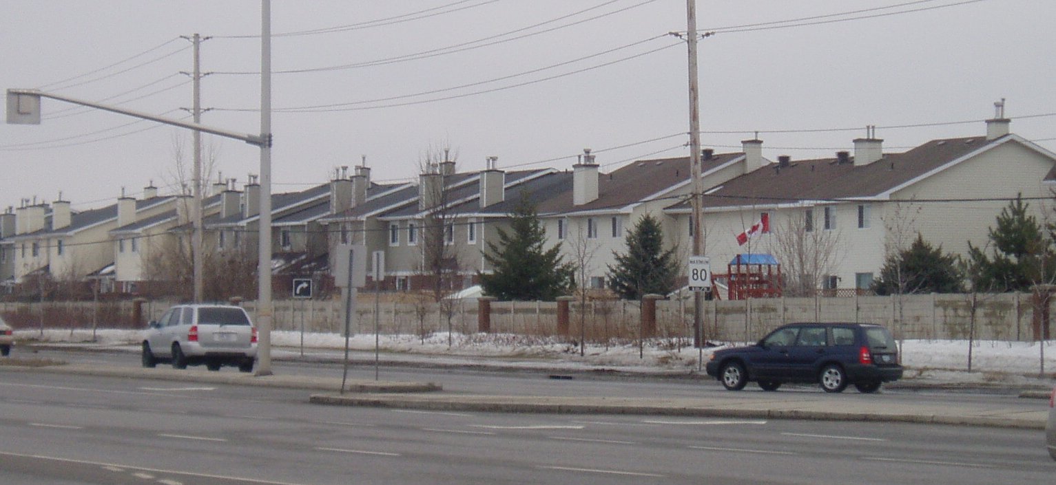
Barrhaven is a suburb of Ottawa, Ontario, Canada. It is located about 17 km (11 mi) southwest of the city's downtown core. Prior to amalgamation with Ottawa in 2001, Barrhaven was part of the City of Nepean. Its population as of the Canada 2021 Census was 103,234.[1]

Key Information

Geography

[edit]

Barrhaven is approximately bounded to the north by the Greenbelt, to the east by the Rideau River, to the west by Highway 416, and to the south by the new Half Moon Bay development along Cambrian Road south of the Jock River. The area is diagonally bisected by CN rail tracks. Barrhaven is surrounded by rural areas and farmland, with the exception of the growing Riverside South area across the Rideau River. Directly south of Barrhaven is Manotick, a commuter town of the city.

Barrhaven is divided into several areas: Barrhaven proper or Old Barrhaven is the westernmost part of the neighbourhood, lying between Cedarview Road and Greenbank Road. New residential development is expanding the west side of Old Barrhaven between Cedarview and Strandherd Drive. Also included in this area is a triangle of land east of Greenbank between Fallowfield Road and the railway tracks known as Knollsbrook or The Triangle. South of this is the area known as Longfields, which stretches south to Strandherd and east to Woodroffe Avenue. Sandwiched between the railway tracks, Jockvale Road, Greenbank and Strandherd is the neighbourhood of Barrhaven on the Green. East of Woodroffe, next to the Rideau River, is the neighbourhood of Davidson Heights. South of Strandherd and east of Greenbank is a new community known as Chapman Mills. As Prince of Wales Drive approaches Longfields Drive, there is a thriving community known as Stonebridge that is located beside the Stonebridge Golf & Country Club.

History

[edit]
Initial subdivision houses along Larkin Drive built ca. late 1960s/early 1970s

The Barrhaven area was long inhabited by First Nations peoples, and the modern Jockvale Road follows an ancient path that was originally a trail through the wilderness [citation needed]. In the 19th century the area became populated by colonial era farmers as the area was divided into a number of rural homesteads.

The old Barrhaven School House located at Jockvale and Strandherd was built in 1906. Today, the school stands as a historic site. In 1911, the Canadian Northern Railway built a rail line from Ottawa to Toronto through the area. Fast passenger service was offered for many years from Fallowfield Station (near the intersection of Strandherd Dr and Cedarview Rd) to Ottawa and beyond[2] After many years of absence, passenger rail service was reintroduced to the area by Via Rail in the fall of 2002 through a new Fallowfield Station located at the intersection of Fallowfield Road and Woodroffe Avenue.

Modern Barrhaven was established in the 1960s, one of a group of new suburbs built outside the Greenbelt from the main city of Ottawa. Building in the area was begun by Mel Barr, for whom the community is named. Barr had originally purchased a 200-acre (0.81 km2) farm with the intent of constructing a horse racing track. However the Rideau Carleton Raceway was built further to the east, and Barr instead decided to develop his land for housing. In 1968-69 Barrhaven Public School was built as the very first public school in Barrhaven.

Barrhaven was incorporated into the City of Nepean in 1978 and subsequently grew rapidly into a community of several tens of thousands of people. Commercial centres were slower to arrive. In 1990 the area was served by a single grocery store, had no movie theatre, and not even a bar. This has changed with the opening in 1991 of the vast Barrhaven Town Centre complex of big box stores and smaller commercial establishments, as well as a few smaller shopping malls. The 1990s also saw the influx of high-tech companies into the area (such as JDS Uniphase and Nortel), and the growth of the Public Service in the National Capital Region. The area got its first high school in 1998 when Mother Teresa High School (Catholic) opened, followed by John McCrae Secondary School (public) in 1999. Barrhaven gained its third high school in 2002 when St. Joseph High School (Catholic) opened. In September 2009, Longfields-Davidson Heights Secondary School (Public) opened. In 2011 École secondaire catholique Pierre-Savard opened.

In 2024, Barrhaven was the site of the city's worst mass killing in its history when six people were killed with a bladed weapon.[3]

Character

[edit]
Davidson Heights section of Barrhaven

Like most North American suburbs built so quickly and so recently, Barrhaven has a very uniform feel. Almost every street consists of town houses with some streets having comparatively large suburban houses. In the older parts of Barrhaven, the streets are curvilinear, never forming a grid as they do in older parts of Ottawa. The area is very suburban and tends to attract families.[fact or opinion?]

Neighbourhoods

[edit]

Barrhaven is divided into many neighbourhoods. The names are generally selected by developers.

  • Barrhaven (also known as Old Barrhaven) west of Greenbank, south of Fallowfield, north of the rail tracks, and east northeast of Jockvale
  • Strandherd Meadows, the infill development extending Old Barrhaven to Strandherd Drive
  • Longfields, east of Greenbank Road, west of Woodroffe Avenue, south of Fallowfield Road and north of Strandherd Drive
  • Davidson Heights, east of Woodroffe Avenue
  • Havenlea, bounded by Crestway Drive, Leikin Drive, Prince of Wales and Cresthaven Drive
  • Chapman Mills, bounded by Prince of Wales Dr to the south/east, Woodroffe Ave to the west, and Stoneway Dr to the north.
  • Rideau Glen, along Prince of Wales Dr, Holborn Avenue, and Rideau Glen Drive, north of Winding Way
  • Winding Way, east of Prince of Wales Drive
  • Stonebridge, located between Jockvale Rd and Prince of Wales
  • Half Moon Bay, new neighbourhood under development along Cambrian Road, west of Greenbank, east of Highway 416, south of the Jock River and north of Barnsdale Road
  • Quinn's Pointe, new community under development along Cambrian Road, west of Greenbank, north of Barnsdale Road[4]
  • Barrhaven Mews, new community under construction between Strandherd Road and the Jock River and west of Jockvale/Greenbank Roads
  • Barrhaven On The Green, located between Jockvale Road, Greenbank Road, Strandherd Road, and the Rail tracks
  • Heart's Desire, located along the Jock River, in between Jockvale Road and Woodroffe Ave.
  • West Pointe Village, located between Cedarview Rd., Fallowfield Rd., Strandherd Rd., and the Rail tracks
  • Pheasant Run, west of Larkin Drive, south of Fallowfield, north of Jockvale and east of Cedarview Road
  • Fraservale, south and west of Jockvale, east of Cedarview and north of rail tracks
  • Knollsbrook, west and north of rail tracks, south of Fallowfield and east of Greenbank.
  • Havencourt, across from South Nepean Park, east of Greenbank between the transitway and Longfields Drive.
  • Havencrest, East of the intersection of Strandherd and Fallowfield and North of Jockvale Road.

Features and amenities

[edit]

Barrhaven contains several public and Catholic schools and numerous parks and playgrounds, mainly built in since 2000. It is also home to the Walter Baker Sports Centre which contains a library and other facilities. The main commercial district, called the Chapman Mills Marketplace, surrounds the intersection of Strandherd Drive and Greenbank Road. It hosts a seven-screen cinema, and numerous stores. The Minto Recreation Complex, a new multi-use community centre at the corner of Cambrian and Greenbank, opened in 2014.[5][6] A major employment district was established in 2015 in the area west of Strandherd Drive adjacent to Highway 416, known as the CitiGate corporate campus.[7]

Transportation

[edit]

Barrhaven is served by two bus rapid transit lines and is very near to the terminus of O-Train Line 2 at Limebank station. Several local buses run in Barrhaven, including routes 70, 73, 80, 99, 110, and 173. Routes 275, 277, and 279 only run during rush hour and (along with Transitway routes 74 and 75) connect to O-Train Line 1 at Tunney's Pasture station.

Intercity Via Rail connections can be made at Fallowfield railway station to Montreal and Toronto.

Route 72 Express Bus to Downtown Ottawa

Until 2006, it had been planned that the north–south light-rail O-Train (today's Line 2) would be extended to the centre of Barrhaven near Riocan Marketplace via Riverside South. The project was cancelled on December 14, 2006, by Ottawa City Council, which decided to focus on building rail-based rapid transit lines in the inner city instead. Rail-based rapid transit to Barrhaven is not expected to be introduced until after 2031, when the three lines in the inner city are expected to be completed.

On January 2, 2007, OC Transpo opened the Strandherd Transitway station and Park & Ride lot in Barrhaven. Directly across from the Chapman Mills Marketplace Wal-Mart & TD Bank, the facility has parking space for about 330 cars. It was built to help with overcrowding at the Fallowfield Station and meet the increased demand for park and ride spaces in the community. Rapid transit route 75 takes approximately 10 minutes to travel between Fallowfield Station and Strandherd Station, and 2 minutes between Strandherd Station and Barrhaven Centre Station. The Province of Ontario funded one-third of the $5 million cost.

In April 2011, the transitway (BRT) network was expanded in Barrhaven. One feature was the extension of Route 94 (now Route 74) to the intersection of Woodroffe and Strandherd. A new stretch of BRT was also constructed between Fallowfield and Strandherd to reduce travel times on Route 95 (Route 75 since 2019).[8] In September 2014, a new BRT route was established on Chapman Mills Drive, using a graveyard median from the canceled south-western LRT route. Route 99 started at Barrhaven Centre and, using new Beatrice Station proceeded to Greenboro Station (the former O-Train Line 2 terminus) at non-peak hours via Riverside South (Vimy Memorial Bridge) and Leitrim Station. At peak hours, the 99 went all the way to Hurdman Station via the Southeast Transitway, connecting to the O-Train Line 1. Since the opening of O-Train Line 2's extension to Riverside South, route 99 has been truncated to end at Limebank station, Line 2's southern terminus, and had its frequency reduced.

Education

[edit]

Public schools

[edit]

Elementary:

  • Adrienne Clarkson Elementary School
  • Barrhaven Public School (first school opened in Barrhaven in 1968)
  • Berrigan Elementary School
  • Chapman Mills Public School
  • Farley Mowat Public School
  • Half Moon Bay Public School (Opened September 2016.)
  • Jockvale Elementary School
  • Mary Honeywell Elementary School
  • École Michaëlle Jean (French)
  • Wazoson Public School (Opened January 2024.)

Intermediate:

Secondary:

Catholic schools

[edit]
St Joseph Catholic High School, Barrhaven

Elementary:

  • L'école élémentaire catholique Jean-Robert Gauthier (French)
  • L'école élémentaire catholique Pierre Elliot Trudeau (French)
  • L'école élémentaire catholique Sainte-Kateri (French)
  • Monsignor Paul Baxter Catholic elementary school
  • St. Elizabeth Ann Seton Catholic elementary school (opened February 1987)
  • St. Cecilia Catholic Elementary School
  • St. Emily Catholic elementary school
  • St. Luke Catholic elementary school
  • St. Patrick Catholic elementary school (opened November 1978)
  • St. Andrew Catholic elementary school
  • St. Benedict Catholic elementary school
  • St. Juan Diego Catholic elementary school

Secondary:

Preschools

[edit]
  • Educara Montessori Child Care

Private schools

[edit]
  • Educara Montessori Child Care
  • Little Scholars Montessori
  • Ottawa Christian School

Photos

[edit]

Notes

[edit]

References

[edit]
[edit]
Revisions and contributorsEdit on WikipediaRead on Wikipedia
from Grokipedia
Barrhaven is a suburban community in the southwest of Ottawa, Ontario, Canada, characterized by its rapid residential growth, family-friendly amenities, and proximity to natural features like the Jock River.
Originally rural farmland used by Indigenous peoples and European settlers in the 19th century, Barrhaven began urban development in the 1950s when developer Melville Barr initiated housing projects following the failure of a proposed racetrack. Prior to Ottawa's 2001 amalgamation, it formed part of the former City of Nepean, with early landmarks like the Jockvale Schoolhouse dating to 1841 serving as community hubs.
The area has experienced significant expansion since the early 2000s, driven by new subdivisions such as Stonebridge and Half Moon Bay, transforming it into a self-contained "city within a city" with a population estimated at 106,610 across Barrhaven East (45,250 residents) and West (61,360 residents) as of year-end 2024. Bounded approximately by Fallowfield Road to the north, Highway 416 to the west, Barnsdale Road to the south, and the Rideau River to the east, it spans about 43 square kilometres and features a high average household income of $140,800 (2020), supporting over 39,000 households as of 2024. Ongoing projects include the planned Stage 2 LRT extension to Barrhaven Town Centre, expected after 2031.
Key amenities include the Minto Recreation Complex and Walter Baker Sports Centre for sports and fitness, the Ruth E. Dickinson Branch of the Ottawa Public Library, and Cineplex Odeon Barrhaven Cinemas for entertainment, alongside shopping at Chapman Mills Marketplace and big-box retailers like Walmart and Costco. Outdoor recreation is abundant, with parks like Clarke Fields and Chapman Mills offering trails, splash pads, and winter rinks, while the Vimy Memorial Bridge—completed in 2014 and awarded the Gustav Lindenthal Medal—provides scenic connectivity over the Rideau River. Community events such as the Barrhaven Santa Claus Parade, Canada Day celebrations, and the annual Jock River canoe race highlight its vibrant, family-oriented culture.

Geography and Environment

Location and Boundaries

Barrhaven is a suburban community situated in the southwestern portion of , , , approximately 17 kilometres southwest of the city's downtown core. Originally part of the independent City of Nepean, it was incorporated into the amalgamated City of Ottawa in 2001. The neighbourhood's boundaries are defined to the north by the Ottawa Greenbelt, to the east by the , to the west by Highway 416, and to the south by the Jock River, covering a total land area of 42.93 km². Barrhaven maintains close proximity to significant infrastructure and landmarks, including the major thoroughfare of Bank Street that bisects the area and provides essential connectivity, as well as the , situated roughly 14 km to the northeast. In the context of municipal governance, as of the 2022 elections, the community falls primarily within Wards 3 (Barrhaven West) and 24 (Barrhaven East), with portions extending into Ward 21 (Rideau-Jock, previously known as Rideau-Goulbourn). Barrhaven integrates into Ottawa's broader urban expansion framework through initiatives like the Barrhaven South Community Design Plan, which outlines development south of the Jock River—east of Highway 416, north of Barnsdale Road, and west of Jockvale and Greenbank Roads—as a strategic extension to support sustainable growth and infrastructure alignment with the city's Official Plan.

Topography and Natural Features

Barrhaven's topography is characterized by a predominantly flat suburban plain, with elevations ranging from 80 to 120 meters above mean , reflecting the influence of post-glacial sediments deposited in the ancient . This low-relief landscape, averaging around 99 meters in elevation, supports extensive urban development while preserving subtle variations tied to the region's glacial history. The area's natural water features include the Jock River forming its southern boundary and the along the eastern edge, both contributing to a network of tributaries, wetlands, and areas. These elements are complemented by constructed management facilities, such as the Clarke Bellinger pond, which treat runoff from urban surfaces to mitigate and in the Jock River watershed. Environmentally, as of 2022, Barrhaven features cover of approximately 16-17 percent (16 percent in Barrhaven East and 17 percent in Barrhaven West), below the city-wide urban average of 20.6 percent, with green spaces like the Chapman Mills Conservation Area providing habitats along the corridor. The region remains vulnerable to flooding due to its proximity to river floodplains, as highlighted by ongoing adjustments to Jock River flood lines to accommodate development while protecting natural features. Sustainable initiatives, including the Barrhaven South Community Design Plan, emphasize preserving woodlots, enhancing stormwater controls, and integrating to address these risks. Barrhaven shares Ottawa's , marked by cold winters with average January temperatures around -10°C and warm summers, but local effects amplify temperatures in built-up areas by absorbing and retaining heat from impervious surfaces.

Demographics

Population and Growth

Barrhaven's reached 103,234 according to the 2021 Census of Population conducted by . This marked significant growth from approximately 88,600 residents in 2016, reflecting a robust expansion driven by suburban appeal. The area's stood at 2,404.7 people per in 2021, underscoring its development as a densely settled suburban community within . As of year-end 2024, Barrhaven's was estimated at 106,610, with Barrhaven East at 45,250 and West at 61,360 , continuing its upward trajectory. The suburb experiences an annual influx of about 3,500 , primarily fueled by family-oriented migration seeking options and ongoing residential developments. This steady growth rate positions Barrhaven as one of 's fastest-expanding areas, supported by its relative affordability compared to central neighbourhoods. Key drivers include planned infrastructure investments and housing supply increases to meet demand from young families and commuters. Housing trends emphasize single-family homes and townhouses, which dominate the suburb's residential landscape and cater to its . Recent development plans for Barrhaven South include approximately 3,600 new housing units across Areas 3 and 4 (corresponding to Phases 3 and 4), located east and west of Greenbank Road, integrating mixed residential types to support sustainable expansion.

Socioeconomic and Cultural Composition

Barrhaven exhibits a diverse socioeconomic and cultural composition, reflecting its status as a growing suburban in . According to the 2021 Census by , the area's ethnic makeup includes approximately 60% of residents of European descent, with visible minorities comprising a significant portion of the remaining population, including 15% of South Asian origin, 10% Chinese, and 5% . This diversity has been bolstered by , contributing to a multicultural environment that continues to evolve. Economically, Barrhaven is characterized by relatively affluent households, with a median income of $125,000 in 2020—higher than the Ottawa city average of $102,000. Homeownership rates are notably high at 75%, underscoring a stable, middle-class residential base oriented toward long-term family living. In terms of age and family structure, the is predominantly family-focused, with approximately 25% of the under 18 years old and 12% over , indicating a youthful demographic with many households centered on children. This structure supports a vibrant local culture, evident in events like multicultural festivals that highlight the area's ethnic diversity. However, newcomers often encounter integration challenges, including shortages and opposition to support facilities, as seen in recent debates over reception centers in the neighborhood.

History

Early Settlement and Indigenous Presence

The area now known as Barrhaven, located within the traditional and unceded territory of the Anishinaabe Algonquin Nation, has been inhabited by Algonquin peoples for at least 8,000 years, as evidenced by archaeological findings across the . These Indigenous communities utilized the landscape seasonally for hunting, fishing, and gathering, particularly along the and its tributary, the Jock River, which provided vital resources such as , fish, and wild plants like lily roots. The rivers served as key travel routes connecting the to the , facilitating trade and mobility through portages and canoe navigation. Archaeological assessments in Barrhaven have identified potential for pre-contact Indigenous sites due to the proximity of watercourses like the Jock River, with artifacts such as projectile points and tools indicating long-term occupation patterns. European exploration and settlement began later, with Nepean Township—encompassing Barrhaven—surveyed and established in 1792 as one of Upper Canada's early administrative divisions, though initial grants to settlers like George Hamilton remained largely undeveloped. The first permanent European settler, Ira Honeywell, arrived in 1810, clearing land for farming near the Jock River, followed by others like Jerard B. Chapman in 1814, marking the start of small-scale agricultural communities dominated by Irish immigrants. The construction of the from 1826 to 1832 significantly enhanced regional access, bypassing the vulnerable and promoting trade in timber and , which indirectly supported farming expansion in Nepean by improving transportation links to markets in (now ) and Kingston. Despite this, the population remained sparse, with only 191 residents across 35 families recorded in Nepean by 1822, reflecting the challenges of swampy terrain and isolation that kept the area agriculturally focused and underdeveloped until the mid-20th century.

Modern Suburban Development

Barrhaven's transformation from to a planned suburban community began in the late 1950s when developer Mel Barr purchased 200 acres of farmland south of Ottawa's Greenbelt in 1959, initially envisioning a track but pivoting to residential development. The area, named after Barr, saw its first housing projects emerge in the early as part of Ottawa's broader suburban expansion beyond the Greenbelt, with Minto Communities becoming a key player by constructing thousands of homes across multiple neighborhoods starting in the . By 1978, Barrhaven was formally incorporated into the newly established City of Nepean, which facilitated coordinated planning and infrastructure investments to support growing residential demand. This period marked the suburb's shift toward a more structured community layout, influenced by regional policies aimed at accommodating population spillover from central Ottawa. The area's integration accelerated with the 2001 municipal amalgamation, merging Nepean into the expanded City of Ottawa and enabling larger-scale under the city's Official Plan, which designated Barrhaven as a priority zone for suburban intensification and sustainable growth. Major housing expansions occurred during the and , driven by demand for affordable family homes near employment centers, resulting in over 21,000 new residences built between 1988 and 2012 as the suburb extended southward and eastward. Infrastructure improvements, such as the extension of Highway 416 in the late —constructed in phases from 1990 onward—enhanced accessibility, connecting Barrhaven directly to and further spurring development. Growth continued into the 2010s, with population increases of around 13.5% from 2016 to 2021, supported by new amenities like the opening of Longfields-Davidson Heights Secondary School in 2009 to serve expanding families. Economically, Barrhaven's location near has attracted and industrial activities, positioning it as a hub for in warehousing and distribution since the early , while proximity to the broader tech ecosystem in western draws commuters seeking living. Recent efforts to redefine its image from a "sleepy " include the 2023 launch of , a master-planned by Minto in the emerging Barrhaven , emphasizing mixed-use urban amenities, green spaces, and transit-oriented design to foster a more vibrant, self-contained destination.

Recent Events and Challenges

On March 6, 2024, a horrific occurred at a on Berrigan Drive in Barrhaven, where Febrio Dezoysa, a 19-year-old , killed six people: Amarakoonmala Jayarathna, her four children (aged 7 months to 10 years), and family acquaintance Dhanushka Wickramasinghe. Dezoysa was arrested shortly after and, on November 6, 2025, pleaded guilty to six counts of first-degree murder, receiving a life sentence with no parole eligibility for 25 years; the judge described the act as "monstrous, even demonic." The incident deeply traumatized the community, prompting vigils, through local organizations, and statements from Mayor emphasizing support for survivors and hopes for closure. Barrhaven has faced recurring environmental challenges, including a minor flooding event in August 2023 when heavy rains of 75-100 mm in six hours caused widespread road submersion and across , including in Barrhaven neighborhoods. Housing affordability has intensified amid rapid growth, with the 2024 City of Housing Needs Assessment highlighting pressures on low-income residents due to rising rents and limited options in expanding suburbs like Barrhaven. In response, the city approved 117 new affordable rental units in Barrhaven in July 2025 as part of a broader strategy to address shortages. Infrastructure improvements aim to support this expansion; the Ontario government's 2024 budget allocated $5 million for and design of a new interchange at Highway 416 and Barnsdale Road to alleviate traffic from booming subdivisions. Ongoing for Barrhaven South Phase 4, a 74-hectare urban expansion east of Greenbank Road, advanced in 2025 with public engagement on neighborhood design to integrate residential, commercial, and green spaces. In the wake of the 2024 incident, community safety efforts have included the Ottawa Police Service's "Residents Matter" initiative, launched in June 2024, which enhances late-night enforcement and visibility in high-growth areas like Barrhaven to address rising concerns over . On a positive note, 2023 reimagining initiatives by the Barrhaven Business Improvement Area sought to diversify the local economy beyond residential focus, launching campaigns for "urban experiences" to attract retail and services as the population surpassed 100,000 residents.

Neighbourhoods and Community Life

Key Neighbourhoods

Barrhaven encompasses several distinct residential neighbourhoods, each characterized by unique housing styles, development timelines, and features that contribute to its suburban appeal. These areas range from the established core to rapidly expanding sections, reflecting the community's growth since the mid-20th century. Old Barrhaven serves as the original core of the , featuring homes primarily built in the 1960s and 1970s, including single-family detached houses and some styles in areas like Cedargrove and Pheasant Run. This neighbourhood offers a mature suburban feel with mature tree-lined streets and established lots, appealing to families seeking established properties. stock here includes ranch-style bungalows and two-story homes, with variations in size from smaller starter homes to larger family residences. Longfields, developed mainly in the early , is a family-oriented area east of Greenbank Road, known for its spacious lots and emphasis on community living. The neighbourhood features a mix of single-detached homes and townhouses, with many properties designed for growing families, including options with finished basements and attached garages. Its population is estimated at around 23,000 residents, supporting a vibrant, child-friendly environment with nearby schools and parks integrated into the layout. Stonebridge stands out as a golf course community bordering the Jock River, with development peaking in the late 1990s and early , centered around the Stonebridge Golf & Country Club. Housing here includes upscale single-family homes, units, and some executive-style properties with views of the fairways, often featuring larger lots and modern amenities like home theaters. The area has an estimated population of approximately 11,000, fostering a premium residential experience with green spaces woven throughout. Chapman Mills, emerging in the mid-2000s, offers a diverse mix along the Jock River's scenic banks, including townhomes, stacked condos, row houses, and single-family homes suitable for various budgets. This emphasizes walkable paths and access, with development focused on mid-rise buildings and family-oriented designs. Its is around 14,000, highlighting its role as a balanced residential hub within Barrhaven. Davidson Heights, a newer development from the late 2000s and 2010s, lies east of Woodroffe Avenue near the , featuring contemporary single-detached homes and townhouses tailored for modern families. The area includes energy-efficient builds and proximity to educational facilities like Longfields-Davidson Heights , established in 2009. Housing variations support multigenerational living, with an emphasis on open-concept interiors and larger backyards. Half Moon Bay, part of the ongoing southern expansion, is rapidly developing with a focus on young families and includes a significant number of townhomes alongside single-detached options. Built primarily in the , it offers serene, master-planned layouts with nature paths and playgrounds, promoting an active . This area exemplifies Barrhaven's shift toward denser, efficient housing forms while maintaining green buffers. These neighbourhoods are interconnected through key local roads such as Strandherd Drive, which links Old Barrhaven to southern areas like Stonebridge and Chapman Mills, facilitating easy access across the community. Emerging developments, including Barrhaven South-West Phase 3, are in the planning stage with public engagement ongoing as of 2025, as part of a larger urban expansion plan, adding to the area's projected growth with sustainable community designs.

Social Character and Culture

Barrhaven embodies a classic suburban , characterized by -oriented living and a design that prioritizes quiet residential streets. Its neighborhoods feature curvilinear street patterns typical of conventional suburban layouts, which promote a sense of seclusion and safety through winding roads and cul-de-sacs, fostering an environment ideal for young families. Prior to 2024, the area enjoyed relatively low rates compared to urban , with stable incident levels and a reputation as a secure hub. Community life revolves around active resident leagues, such as the Barrhaven Men's Slo-Pitch Association and various groups, which organize recreational activities to build social bonds. Annual events like the Barrhaven Parade exemplify this spirit, drawing families for a festive along Strandherd Drive that celebrates traditions and strengthens neighborhood ties. The community's cultural landscape has shifted notably since the post-2010 influx of immigrants, transitioning from a more uniform demographic to one marked by increasing diversity. Barrhaven has seen the highest rise in populations among suburbs, with South Asian residents comprising about 26% of that group by 2017, alongside growing numbers of newcomers from various global regions. This evolution is reflected in local arts and gatherings, such as the Barrhaven , where vendors offer seasonal produce, baked goods, and live music to encourage community interaction and cultural exchange. Multicultural associations, including the Barrhaven Indian Community and the Barrhaven Islamic Centre, support this vibrancy by hosting social events and providing spaces for cultural preservation among residents who collectively speak nearly 140 languages. In 2023, local initiatives like the "I Heart Barrhaven" campaign sought to redefine the area's identity, promoting it as a dynamic hub rather than a mere commuter suburb through enhanced retail, events, and urban-style amenities. The Barrhaven Business Improvement Area plays a key role in this evolution, fostering volunteerism among residents to support business growth and community projects that add vibrancy to commercial corridors. Following the tragic 2024 mass stabbing that claimed six lives, including four children, and the perpetrator's guilty plea on November 6, 2025, the community has focused on healing through public support networks and mental health resources. Initiatives include expanded crisis lines and youth advocacy programs, such as those from Healthy Routes, alongside annual Mental Health Week observances that emphasize compassion and stigma reduction to aid recovery and resilience.

Amenities and Infrastructure

Parks, Recreation, and Community Facilities

Barrhaven features a variety of parks and green spaces that provide residents with opportunities for , nature appreciation, and community gatherings. Major parks include Malvern Park, adjacent to the Walter Baker Sports Centre, which offers sports fields, walking paths, a , and a , serving as a hub for local athletic activities and family outings. The Chapman Mills Wetlands, an urban conservation area along the , encompasses 23 acres of natural shorelines, forests, and a 1.5-kilometer ideal for leisurely walks, , and wildlife observation, while also contributing to flood mitigation through its wetland ecosystem. Complementing these are the Jock River Trail system, which includes over 10 kilometers of multi-use paths such as the 3.7-kilometer Stonebridge Trail, winding through wooded areas and along the river for , , and programs focused on local ecology. Recreation centres in Barrhaven support active lifestyles with modern amenities. The Minto Recreation Complex, opened in 2010, is a key facility featuring two NHL-sized ice rinks for hockey and , a six-lane 25-meter lap pool with diving boards, a leisure pool with a , a full-sized gymnasium for , , and fitness classes, and universal change rooms to ensure accessibility. It hosts a range of programs, including leagues, adult fitness sessions, and family swim times, promoting physical health and social engagement among residents. Nearby, the Walter Baker Sports Centre provides additional indoor options like a fitness centre with cardio and strength equipment, walking tracks, and multi-purpose rooms for community events. Community facilities enhance leisure and learning opportunities. The Ruth E. Dickinson Branch of the Ottawa Public Library, located within the Walter Baker Centre, offers books, digital resources, and programs such as storytimes, workshops, and sessions tied to nearby natural areas. Arenas at the Minto Complex and splash pads scattered throughout the area, including those at Kilbirnie Park, Greenbank Park, and Black Raven Park, provide seasonal cooling and play options for children, with features like dumping buckets, misters, and ground sprayers. Looking ahead, 2025 plans include developments in Barrhaven's southern phases to expand recreational options. The Jock River North District Park is under development (as of mid-2025) with new soccer and ultimate fields, a /pickleball court, , , and extended trail systems for enhanced family programs and flood-resilient . Additionally, the McKenna Casey with separate areas for large and small breeds, connected by a multi-use path to Clarke Fields, is under construction (as of September 2025) and expected to open by late 2025, fostering pet-friendly community activities. A replacement for the Ruth E. Dickinson Library branch is also in design stages (as of September 2025), aiming to provide a larger, modern space in central Barrhaven by the late 2020s. These initiatives underscore Barrhaven's commitment to sustainable recreation and .

Commercial and Retail Services

Barrhaven's commercial landscape is anchored by several prominent shopping centers that serve as hubs for everyday retail and services. Chapman Mills Marketplace, located at the intersection of Strandherd Drive and Greenbank Road, is a large unenclosed retail complex spanning 566,673 square feet with 66 units, featuring major anchors such as , , , SportChek, and Galaxy Cinemas. Nearby, , also at Strandherd Drive and Greenbank Road, covers 188,562 square feet and includes key retailers like Home Depot, , , , and Toys "R" Us, alongside quick-service restaurants such as , , and Subway. In the Stonebridge area, Stonebridge Town Centre offers a mix of essential retail with tenants including , , and Osmow's, catering to local residents' needs. The business ecosystem in Barrhaven supports over 500 local enterprises as of recent directories, encompassing a diverse array of retailers, restaurants, and service providers within the Barrhaven Business Improvement Area (BIA). This includes independent shops, chain outlets, and , with the BIA's membership reaching 620 businesses by , reflecting steady expansion. Healthcare clinics, such as medical aesthetics centers and therapy providers, alongside numerous dining options from fast-casual eateries to ethnic restaurants, contribute to a vibrant local . The sector has seen growth in , driven by low vacancy rates in Ottawa's suburban retail spaces, which dropped to record lows in 2023 amid population increases in areas like Barrhaven. Retail and services play a significant role in Barrhaven's , providing employment opportunities and supporting community needs without specific sector percentages isolated for the area, though broader suburban retail has boomed with in-store demand. New developments, including emerging plazas in southern expansions like those near , have added to this growth, with expectations for further retail in 2025. Essential services are well-represented, with pharmacies like and , banks including BMO and CIBC, and professional offices for financial and services integrated into these centers. markets and seasonal further enhance to fresh and local vendors.

Transportation

Road and Highway Access

Barrhaven's primary highway access is provided by Highway 416, also known as the Veterans Memorial Highway, which forms the community's western boundary and serves as a major north-south corridor. This freeway connects directly to via interchanges to the north, offering residents straightforward routes to and broader regional networks. Key local roadways enhance connectivity within and beyond Barrhaven, including the Vimy Memorial Bridge (originally the Strandherd-Armstrong Bridge), which crosses the and links Strandherd Drive in Barrhaven to Earl Armstrong Road in Riverside South. Federal funding for the bridge's construction was prioritized in 2007, with actual building commencing in 2010 and the structure opening to traffic in 2014 after delays. The bridge supports vehicular, cycling, and pedestrian movement, alleviating pressure on alternative crossings. To accommodate rapid suburban growth, infrastructure improvements include a new interchange at Highway 416 and Barnsdale Road, for which the Ontario government allocated $5 million in March 2024 to advance design and construction, with over $50 million committed overall as of January 2025; a tender for detail design was issued in August 2025, with bids closing November 27, 2025. This project targets gridlock in south Ottawa by improving access for booming residential areas. Additionally, Greenbank Road is undergoing widening from two to four lanes between Highway 416 and its realigned extension, with detailed design set to conclude by the end of 2025 and initial construction beginning in spring 2026 to handle increased traffic volumes. Commuter traffic patterns in Barrhaven predominantly follow Highway 416 northward to for trips to central , but local arterials like Bank Street suffer from chronic congestion, especially during rush hours, due to high volumes of through traffic and development pressures. These issues underscore ongoing efforts to expand capacity and optimize flow in the network.

Public Transit and Connectivity

Public transit in Barrhaven is primarily provided by , 's regional transit authority, with a network of bus routes connecting the community to central and surrounding areas. Key services include Route 75, which operates between Station and Barrhaven Centre via the Transitway, providing frequent access to downtown destinations. Route 70 serves as a vital local connector, linking Barrhaven Centre to Station and integrating with the broader system, while Route 171 historically provided service from to Barrhaven Centre before being replaced by an extended Route 70 as part of the 2025 restructuring. The Strandherd Station, part of the Strandherd-Armstrong Transitway opened in 2007, functions as a major hub with park-and-ride facilities, facilitating efficient transfers for south-end commuters. Rail connectivity includes Fallowfield Station, a key stop for Via Rail's Toronto-Ottawa corridor, offering intercity service with approximately 10 daily trains in each direction as of 2025. Future enhancements feature a planned extension of Line 1 from Baseline Station to , anticipated after 2031, which will introduce service along a 10-kilometer corridor with seven new stations and improved pedestrian and cycling facilities. Barrhaven's transit system links residents to in approximately 50 to 90 minutes via express buses like Route 75, depending on traffic and transfers, and provides access to Ottawa International Airport through connections at South Keys Station on Line 4, typically adding 20 to 30 minutes to the journey. Integration with the city's network is supported by multi-use pathways and bike racks at major stations, including over $20 million invested in pedestrian and as part of recent expansions. In response to southern growth, completed a comprehensive bus route review in 2023, leading to service enhancements under the New Ways to Bus initiative launched in April 2025, which improved frequencies and connectivity for high-demand areas like Barrhaven.

Education

Public Schools

Barrhaven's public schools are managed by the (OCDSB), serving students from junior through grade 12 with a focus on English instruction supplemented by Core French and specialized immersion programs. The district emphasizes inclusive education, including support for students with autism spectrum disorders and other , amid ongoing in the suburb. Among the elementary schools, Barrhaven Public School, the area's first public institution, opened in 1968 and serves approximately 440 students in grades JK-6. It offers full-day bilingual , an English program with Core French, Early French Immersion starting in junior , and Middle French Immersion from grade 4, alongside specialized classes for autism spectrum and primary students. Other elementary options include Chapman Mills Public School (JK-6, opened in the early ) and Jockvale Elementary School (JK-6), both providing Core French and access to immersion pathways. Wazoson Public School, opened in January 2024 in the Half Moon Bay community, serves JK-6 students with English and French programs. Cedarview (grades 7-8) supports the transition to with similar language programs. Mary Sweetland Public School, established in the 1980s, emphasizes French immersion for its JK-6 students. Longfields Station Public School, opened in the 2000s, caters to JK-6 with a focus on community integration and language instruction. At the secondary level, Longfields-Davidson Heights Secondary School operates a dual-campus model for grades 7-12, having opened in 2009 with an initial capacity expansion completed by 2012; it currently enrolls about 2,250 students. The school features specialized programs in comprehensive arts (including music, , , and ), technology, hospitality and tourism, and French Immersion, alongside support for learners and needs. John McCrae Secondary School (grades 9-12) complements this with semestered programming and extracurricular opportunities. Across Barrhaven's public schools, total enrollment reached approximately 10,000 students in 2023, reflecting the suburb's rapid development. To address capacity pressures, the OCDSB added portables in 2024, including upgrades and allocations for growth in facilities like Barrhaven Public School.

Catholic and Private Institutions

Barrhaven's Catholic educational institutions fall under the oversight of the Ottawa Catholic School Board (OCSB), which emphasizes faith-based learning integrated with academic programs. St. Elizabeth Ann Seton Catholic Elementary School, established in 2002, serves junior kindergarten through grade 6 students in the Barrhaven-on-the-Green area, fostering a partnership between , home, and school communities. This school offers a rooted in Catholic values, including and extracurricular activities such as choir and community service initiatives. Similarly, St. Joseph High School, opened in 2002 to accommodate growth in the Barrhaven suburb, provides from grades 7 to 12. The high school incorporates faith-based elements into its programs, alongside sports teams, arts clubs, and leadership opportunities. Combined enrollment across Barrhaven's Catholic schools reached notable growth in 2023, reflecting broader OCSB trends with over 48,000 students system-wide, driven by increases in the area. These institutions prioritize spiritual development through daily , sacramental preparation, and extracurriculars like retreats and groups, distinguishing them from secular options. In response to rising demand, the OCSB opened St. Juan Diego Catholic Elementary School in Barrhaven South in January 2024, serving junior kindergarten to grade 6 with French immersion options and capacity for further expansion. This addition addressed enrollment pressures, accommodating junior kindergarten through grade 5 students initially while integrating faith-centered curricula and community facilities. Private educational options in Barrhaven include specialized preschools that integrate daycare with early learning. Little Explorers Reggio Emilia Preschool, located at 2900 Jockvale Road, offers programs for toddlers (18 months to 3 years) and preschoolers (2.5 to 5 years), emphasizing creative play, self-discipline, and parent involvement in a nurturing environment. While private French immersion schools are limited locally, families may access broader Ottawa options for immersion-focused private education, though Barrhaven's private sector primarily features such early childhood centers with flexible, child-led curricula. These private institutions complement Catholic schools by providing alternative early learning pathways, often with enrollment tied to availability and fees.

References

Add your contribution
Related Hubs
User Avatar
No comments yet.