

Community hub
Recent from talks
Contribute something
Nothing was collected or created yet.
Cardamom Mountains
View on WikipediaThe Cardamom Mountains (Khmer: ជួរភ្នំក្រវាញ, Chuŏr Phnum Krâvanh [cuə pʰnum krɑʋaːɲ]; Thai: ทิวเขาบรรทัด, Thio Khao Banthat [tʰīw kʰǎw bān.tʰát]), or the Krâvanh Mountains, is a mountain range in the southwest part of Cambodia and Eastern Thailand. The majority of the range is within Cambodia.
Key Information


The silhouette of the Cardamom Mountains appears in the provincial seal of Trat Province in Thailand.[2]
Location and description
[edit]The mountain range extends along a southeast-northwest axis from Chanthaburi Province in Thailand, and Koh Kong Province in Cambodia on the Gulf of Thailand, to the Veal Veang District in Pursat Province, and extends to the southeast by the Dâmrei (Elephant) Mountains.[3] The Thai part of the range comprise heavily eroded and dispersed mountain fragments of which the Khao Sa Bap, Khao Soi Dao and Chamao-Wong Mountains, east, north and west of Chanthaburi respectively, are the most prominent.
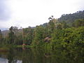
Dense tropical rainforest prevails on the wet westward slopes which annually receive from 3,800 to 5,000 mm (150 to 200 in) of rainfall. By contrast, only 1,000 to 1,500 mm (40 to 60 inches) fall on the wooded eastern slopes in the rain shadow facing the interior Cambodian plain, such as the Kirirom National Park. Most of the mountains are a dense wilderness, with almost no human population or activity, but on the eastern slopes, cardamom and pepper are grown commercially, and several large-scale construction projects have begun since the turn of the century.
Summits
[edit]The highest elevation of the Cardamom Mountains is Phnom Aural in the northeast at 1,813 m (5,948 ft). This is also Cambodia's highest peak.
Other important summits in the Cambodian parts are:
- Phnom Samkos (1,717 m (5,633 ft)
- Phnom Tumpor 1,516 m (4,974 ft)
- Phnom Kmoch 1,220 m (4,003 ft)
In Thailand, the most prominent peaks are:
- Khao Sa Bap 673 m (2,208 ft)
- Khao Soi Dao Tai 1,675 m (5,495 ft)
- Khao Chamao 1,024 m (3,360 ft)
History
[edit]The Cardamom Mountains holds many historic sites and relics from the 15th- to 17th-century specifically. This includes a number of exposed burial sites of a type known as jar burials. The burials are scattered around the mountains, set out on remote, natural rock ledges, and contains 60 cm exotic ceramic jars and rough-hewn log coffins.[4][5][6]
The jar burials are a unique feature of this region, and form a previously unrecorded burial practice in Khmer cultural history. Local legends suggest the bones are the remains of Cambodian royalty. Along with these jar burials archeologists have discovered various material evidence associated with the remains, such as glass beads consisting of various colors and composition. These glass beads, which were a common product in maritime trade between nearby countries, were most likely obtained by Cardamom Mountain communities by trading forest products, such as wood and resin, that they had access to.[7]

.jpg)
Chulasirachumbot Cetiya in Namtok Phlio National Park, Thailand.
A unique rock art cave site known as Kanam depicts ancient elephants, elephant riders, deer and wild cow (or buffalo) in red ochre paint.[8] The site is located in the eastern part of the Cardamoms near Kravanh Township (Pursat Province). The Cardamoms are home to one of the largest protected wild elephant populations in Southeast Asia. The human riders may represent elephant capture and training activities - a major cultural tradition among various ethnic groups in the area until the 1970s. Traditions, experts, and elephant populations were decimated by the Khmer Rouge Regime.
The cave and paintings may have played important roles for rituals and magic used to placate ancestors and spirits; seek protection (elephant capture is very dangerous); bring good fortune; and transmit specialized knowledge (teaching/training).
Some of the paintings may be various species of wild cow or buffalo. It is difficult to distinguish the possible cow from the possible deer representations due to the simple silhouette style. However, cowhides are extremely important for lassoes, ropes, snares and riggings related to elephant capture. Local elephant masters claimed there was more ritual and magic associated with these highly critical items than all others related to elephant capture. Thus, wild cow or buffalo representation might be expected.
The large representation of deer may relate to the massive deerskin trade to Japan in the 15th - 17th centuries. Taiwan's deer populations had been almost annihilated due to insatiable demands for Samurai armor and Japanese accessories made of deerskin. Deerskin sourcing shifted to Cambodia and Thailand. As deer populations decreased, local hunters also may have resorted to more investment in magic and ritual to seek assistance from ancestors and spirits to increase luck. The paintings are thought to date from the late Angkorian period through the post-Angkor period (contemporaneous with the jar burials, perhaps created and used by the same ethnic groups). The site may date to as early as the Funan period (1st - 6th centuries) when the practice of capturing, training, and trading live elephants was first historically noted (a mission was sent to China in 357 AD with trained elephants as part of the tributary gifts to Emperor Mu of Jin). Whether or not elephant capture, training, and use for labor, prestige and warfare existed prior to the Funan period is unknown. It is possible that the practice, technology and knowledge was obtained through South Asian influence in the early first millennium AD.

These paintings help with understanding the ecological history. Local ethnic groups were able to maintain, sustain and promote elephant populations through a somewhat symbiotic relation until the 20th century. Deer and wild cow/buffalo, however, may have been hunted to near extinction by the 15th - 17th centuries. Eld's deer, muntjac, sambar, gaur, kouprey and banteng were probably far more prevalent in the past.
Indigenous people
[edit]Part of the mountains are home to indigenous people, including the Chhong in both Thailand and Cambodia,[9] and the ethnic Por (or Pear) in Pursat Province, Cambodia.[10] They all belong to the group known as Pearic peoples. In Cambodia, indigenous people are collectively referred to as Khmer Loeu.
Khmer Rouge
[edit]This largely inaccessible mountain range formed one of the last strongholds of the Khmer Rouge, after Vietnamese forces toppled their regime in Phnom Penh during the Cambodian–Vietnamese War. The border with Thailand in the west acted as a conduit for foreign support of and, eventually, a sanctuary for fleeing Khmer Rouge fighters and refugees.[11]
Modern development
[edit]The inaccessibility of the hills has also helped to preserve the primeval forest and ecosystems of the area relatively intact. In 2002, however, a transborder highway to Thailand was completed south of the Cardamoms, along the coast. The highway has fragmented habitats for large mammals, such as elephants, big cats and monkeys. The highway has also opened up for agricultural slash-and-burn projects and opportunistic poaching for endangered animals, all degrading the natural value and the forests’ ecosystems.[12]
Tourism is relatively new to the Cardamom Mountains. In 2008, Wildlife Alliance launched a community-based ecotourism program in the village of Chi-Phat, marketed as the "gateway to the Cardamoms".[13] Tourist visitors to Chi-Phat continue to grow and the community is regarded as a model for community-based ecotourism, with approximately 3,000 annual visitors generating more than $US 150,000 for the local community.[14]
International conservation organizations working in the area includes Wildlife Alliance,[15] Conservation International,[16] and Fauna and Flora International.[17] In 2016, the southern slopes of the Cardamom Mountains were designated as a new national park; Southern Cardamom National Park.[12] It appears, however, that rampant illegal poaching is continuing nonetheless.[18]
Ecology
[edit]These relatively isolated mountains are part of the Cardamom Mountains rain forests ecoregion, an important ecoregion of mostly tropical moist broadleaf forest.[19] Being one of the largest and still mostly unexplored forests in Southeast Asia, it is separated from other rainforests in the region by the large Khorat Plateau to the north. For these reasons, the ecoregion is home to several endemic species and is a refuge for species that have been decimated or are endangered elsewhere. The Vietnamese Phú Quốc island off the coast of Cambodia has similar vegetation and is included in the ecoregion.[19]
Most of the ecoregion is covered in evergreen rain forest, but with several different habitats. Above 700 metres, a special thick evergreen forest-type dominates, and on the southern slopes of the Elephant Mountains, dwarf conifer Dacrydium elatum forests grow. On the Kirirom plateau, Tenasserim pine forest is found. The northern part of the Cardamom Mountains is home to the southernmost natural habitats of Betula (species Betula alnoides). Throughout, Hopea pierrei, an endangered canopy tree rare elsewhere, is relatively abundant in the Cardamom Mountains. Other angiosperm tree species are Anisoptera costata, Anisoptera glabra, Dipterocarpus costatus, Hopea odorata, Shorea hypochra, Caryota urens and Oncosperma tigillarium.[20] Other conifers include Pinus kesiya, Dacrycarpus imbricatus, Podocarpus neriifolius, P. pilgeri and Nageia wallichiana.[21][22]
Fauna
[edit]
.jpeg)

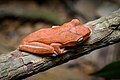
The moist climate and undisturbed nature of the rocky mountainsides appear to have allowed a rich variety of wildlife to thrive, although the Cardamom and Elephant Mountains are poorly researched and the wildlife that is assumed to be here remains to be catalogued. They are thought to be home to over 100 mammals, such as the large Indian civet and banteng cattle, and most importantly the mountains are thought to shelter at least 62 globally threatened animal species and 17 globally threatened trees, many of them endemic to Cambodia.[23] Among the animals are fourteen endangered and threatened mammal species, including the largest population of Asian elephant in Cambodia and possibly the whole of Indochina although this still needs to be proved. Other mammals, many of which are threatened, include Indochinese tiger, clouded leopard (Pardofelis nebulosa), dhole (a wild dog) (Cuon alpinus), gaur (Bos gaurus), banteng (Bos javanicus), the disputed kting voar (Pseudonovibos spiralis), Malayan sun bear, pileated gibbon (Hylobates pileatus), Sumatran serow (Capricornis sumatraensis), Sunda pangolin and the Tenasserim white-bellied rat.[24] There are at least 34 species of amphibians, three of them described as new species to science from here.[25]
The rivers are home to both Irrawaddy and humpback dolphins and are home to some of the last populations on Earth of the very rare Siamese crocodiles and the only nearly extinct northern river terrapin, or royal turtle remaining in Cambodia. While the forests are habitat for more than 450 bird species, half of Cambodia's total of which four, the chestnut-headed partridge, Lewis's silver pheasant (Lophura nycthemera lewisi), the green peafowl (Pavo muticus) and the Siamese partridge (Arborophila diversa) are endemic to these mountains. A reptile and amphibian survey led in June 2007 by Dr Lee Grismer of La Sierra University in Riverside, California, USA, and the conservation organisation Fauna and Flora International uncovered new species, such as a new Cnemaspis gecko, C. neangthyi.[23][26]
-
 Malayan Sun Bear was formerly much more extant in South-East Asia
 -
 Lewis's silver pheasant
 -
 The vulnerable Indo-Pacific humpback dolphin is here
 -
 Lizards. Flower's long-headed lizard (pseudocalotes floweri), a species endemic to this region
 -
 Snakes. Here Vogel's pit viper (trimeresurus vogeli)
 -
 The moist conditions of the rain forests support numerous species of amphibians. (polypedates megacephalus, spot-legged tree frog)


_by_Rushen.jpg)
.jpg)
.jpg)
Protected areas
[edit]With the establishment of the Southern Cardamom National Park in May 2016, nearly all of the Cardamom Mountains are now under some form of high level protection, mostly national park area and wildlife sanctuaries. However, the level of active protection has been criticised.[27]
The human population of the Cardamom Mountain Range, although very small, is extremely poor. Threats to the ecological stability and biological diversity of the region include illegal wildlife poaching, habitat destruction due to illegal logging, construction and infrastructure projects, plantation clearings, mining projects, and forest fires caused by slash-and-burn agriculture. While the Cambodian forests in the Cardamom Mountains are fairly intact,[citation needed] the section in Thailand has been badly affected.

Protections in the Cardamom Mountains comprise the following:
- Cambodia
- Central Cardamom Mountains National Park
- Southern Cardamom National Park
- Botum-Sakor National Park
- Kirirom National Park
- Preah Monivong National Park (aka Bokor National Park)
- Phnom Samkos Wildlife Sanctuary
- Phnom Aural Wildlife Sanctuary
- Tatai Wildlife Sanctuary
- Peam Krasop Wildlife Sanctuary
- Thailand
- Namtok Khlong Kaeo National Park
- Namtok Phlio National Park
- Khao Khitchakut National Park
- Khao Chamao-Khao Wong National Park
- Khao Soi Dao Wildlife Sanctuary
- Klong Kruewai Chalerm Prakiat Wildlife Sanctuary
- Khao Ang Rue Nai Wildlife Sanctuary.
Threats
[edit]
This section needs expansion. You can help by adding to it. (December 2019) |
The flora, fauna and ecosystems of the Cardamom Mountains are threatened by large construction and infrastructure projects, mining, illegal logging, and opportunistic hunting and poaching.[28]
Despite the very high level of protectional status, the actual protection of the conservation areas and implementation of the law has been very poor.[27] The violation of the protection laws has happened on all levels, from opportunistic locals, and local business entrepreneurs, to governmental institutions, foreign companies and international criminal organisations. In the late 2010s, international conservation organisations, and the UN, has collaborated with the Cambodian government to halt a number of planned construction projects and clearings in protected areas. In 2016, the Cambodian government established a collaboration with international conservation organisations to increase on-ground patrolling and actual park ranger services, building several ranger headquarters and hiring armed personnel with arresting rights. This might signify a change in the destructive trends, at least concerning governmental responsibilities.[29]
Tourism
[edit]
The Cardamom Mountains are an emerging tourist destination.[30]
The village of Chi Phat runs a Community-Based Eco-Tourism project with the support of conservation NGO, Wildlife Alliance. Previously a logging and hunting community, villagers now make sustainable income through homestays, multiple day guided treks to natural and cultural sites, mountain bike, boat and bird watching tours.[citation needed]
The Wildlife Release Station in Koh Kong Province is a release site for animals rescued from the illegal wildlife trade in Cambodia by the NGO Wildlife Alliance. Binturong, porcupine, pangolins, civets, macaques and an array of birds are among the many species that have been released on site. The station was opened to tourists in December 2013, offering guests an insight into the workings of a wildlife rehabilitation and release site while staying in jungle chalets and enjoying Cambodian hospitality. Activities offered can include feeding resident wildlife, jungle hiking, radio tracking and setting camera traps to monitor released wildlife.[citation needed]
Wild Animal Rescue (WAR Adventures Cambodia) also organize a wide range of deep jungle activities from the family trekking to the hardcore RAID adventure, jungle orientation and survival training course, even animals and human tracking course, all in the region of Sre Ambel in the South-west of the Cardamom mountains.[citation needed]
-
 Scenic nature
 -
 Campsite in Khao Khitchakut National Park, Thailand
 -
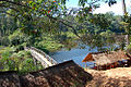 Campsite in Kirirom National Park, Cambodia
 -
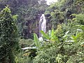
 The waterfalls in the Thai part of the mountains are popular destinations


.jpg)
See also
[edit]- Dâmrei Mountains
- Cardamom Khmer, a variant of the Khmer language spoken in these mountains
- K5 Plan
References
[edit]- ^ "Cambodia Ecological Zonation" (PDF). Archived from the original (PDF) on 2016-03-04. Retrieved 2012-01-28.
- ^ Seals of The Provinces of Thailand
- ^ Cardamom and Elephant Mountains (Cambodia) It does snow in these mountain rangesArchived 2012-03-25 at the Wayback Machine
- ^ Beavan, Nancy; Halcrow, Sian; McFaden, Bruce; Hamilton, Derek; Buckley, Brendan; Tep, Sokha; Shewan, Louise; Ouk, Sokha; Fallon, Stewart (2012). "Radiocarbon Dates from Jar and Coffin Burials of the Cardamom Mountains Reveal a Unique Mortuary Ritual in Cambodia's Late- to Post-Angkor Period (15th–17th Centuries AD)". Radiocarbon. 54 (1): 1–22. Bibcode:2012Radcb..54....1B. doi:10.2458/azu_js_rc.v54i1.15828. hdl:1885/52455. ISSN 1945-5755.
- ^ Beavan, Nancy; Hamilton, Derek; Tep, Sokha; Sayle, Kerry (2015). "Radiocarbon Dates from the Highland Jar and Coffin Burial Site of Phnom Khnang Peung, Cardamom Mountains, Cambodia" (PDF). Radiocarbon. 57 (1): 15–31. Bibcode:2015Radcb..57...15B. doi:10.2458/azu_rc.57.18194. ISSN 1945-5755. S2CID 129583294.
- ^ "ANU - Ceramic Jars". Archived from the original on 2012-03-17. Retrieved 2011-11-14.
- ^ Carter, A. K.; Dussubieux, L.; Beavan, N. (2016). "Glass Beads from 15th–17th Century CE Jar Burial Sites in Cambodia's Cardamom Mountains". Archaeometry. 58 (3): 401–412. doi:10.1111/arcm.12183. ISSN 1475-4754.
- ^ Latinis, D. Kyle; Griffin, P. Bion; Tep, Sokha (May 2016). "The Kanam Rock Painting Site, Cambodia: Current Assessments". NSC Archaeological Report Series. #2: 1–91.
- ^ Beyond material benefits – Connecting conservation and cultural identity in Cambodia
- ^ "The Survival of Cambodia's Ethnic Minorities". www.culturalsurvival.org. Archived from the original on 2019-06-08. Retrieved 2019-12-09.
- ^ Fiona Terry (12 April 2013). Condemned to Repeat?: The Paradox of Humanitarian Action. Cornell University Press. pp. 118–. ISBN 978-0-8014-6863-6.
- ^ a b "Southern Cardamom Forest Registered as a National Park!". Wildlife Alliance. 18 May 2016. Archived from the original on 8 March 2021. Retrieved 14 August 2018.
- ^ Lonely Planet Chi Phat
- ^ Reimer, J. K., & Walter, P. (2013). How do you know it when you see it? Community-based ecotourism in the Cardamom Mountains of southwestern Cambodia. Tourism Management, 34, 122-132.
- ^ "Wildlife Alliance Forest Protection Program". Archived from the original on 2013-11-12. Retrieved 2013-11-25.
- ^ "Conservation International Cambodia Program". Archived from the original on 2009-03-19. Retrieved 2009-03-03.
- ^ Fauna & Flora International Cardamoms Mountain Program
- ^ "Over 100,000 snares found in Cardamom National Park". The Phnom Penh Post. 25 May 2018. Retrieved 14 August 2018.
- ^ a b "Cardamom Mountains rain forests". Terrestrial Ecoregions. World Wildlife Fund.
- ^ "World Wildlife Fund - Cardamom Mountains Moist Forests". Archived from the original on 2015-05-17. Retrieved 2012-02-21.
- ^ "Conifers of Cambodia, Lao PDR and Vietnam". Science/Genetics & Conservation/Conifer Conservation. Royal Botanic Garden Edinburgh. 2010. Archived from the original on 29 November 2007. Retrieved 19 April 2012.
- ^ Forest Vegetation of Cardamom Mountains, Cambodia. A.N. Kuznetsov, S.P. Kuznetsova. BULLETIN OF MOSCOW SOCIETY OF NATURALISTS. BIOLOGICAL SERIES. 2012. Vol. 117, part 5, 2012 September – October, p. 39–50 (in Russian)
- ^ a b BBC News, "New cryptic gecko species is discovered in Cambodia ", 24 March 2010: accessed 24 March 2010.
- ^ CeroPath - Niviventer tenaster Thomas, 1916
- ^ Ohler, A.; S. R. Swan; J. C. Daltry (2002). "A recent survey of the amphibian fauna of the Cardamom Mountains, Southwest Cambodia with descriptions of three new species" (PDF). Raffles Bulletin of Zoology. 50: 465–481.
- ^ Grismer, J. L.; Grismer, L. L.; Chav, T. (2010). "New Species of Cnemaspis Strauch 1887 (Squamata: Gekkonidae) from Southwestern Cambodia". Journal of Herpetology. 44: 28–36. doi:10.1670/08-211.1. S2CID 86089147.
- ^ a b Mech Dara (25 May 2018). "Over 100,000 snares found in Cardamom National Park". The Phnom Penh Post. Retrieved 14 December 2019.
- ^ Timothy J. Killeen (2012). The Cardamom Conundrum - Reconciling Development and Conservation in the Kingdom of Cambodia. NUS Press. ISBN 978-9971-69-614-6.
- ^ Cardamom National Park, Cambodia
- ^ Duncan Forgan (25 June 2018). "How Luxury Camps are Saving the Cardamom Mountains". Remote Lands. Retrieved 13 December 2019.
External links
[edit]- Cardamom Mountains Moist Forests (WWF website)
- Description by Wayne McCallum of a trip through the forests in 2005
- Gerald Flynn; Vutha Srey (27 June 2024). "History repeats as logging linked to Cambodian hydropower dam in Cardamoms". Mongabay.
| International | |
|---|---|
| National | |
| Other | |
Cardamom Mountains
View on GrokipediaGeography
Location and Extent
The Cardamom Mountains, known locally as Krâvanh Mountains, constitute a major range in southwestern Cambodia and southeastern Thailand, extending along a southeast-northwest axis. The range primarily spans Cambodia's Koh Kong, Pursat, and Kampong Speu provinces, with extensions into adjacent areas of Preah Sihanouk and Battambang provinces, while in Thailand it covers parts of Chanthaburi and Trat provinces.[3][8][9] Geographically, the mountains lie between approximately 10°50' N to 12°45' N latitude and 102°30' E to 104° E longitude, forming a discontinuous chain that connects to the Dâmrei (Elephant) Mountains to the southeast. The total extent of the range covers roughly 20,000 square kilometers, though the broader ecoregion including foothills and lowlands extends to about 44,000 square kilometers. To the southwest, the range borders the Gulf of Thailand; to the northwest, the international boundary with Thailand; and to the east and north, it transitions into Cambodia's central plains and lowlands.[10][8][11] This positioning integrates the Cardamom Mountains into the wider Annamite-Chanthaburi geological and physiographic system of mainland Southeast Asia, where it serves as a significant watershed divide. Major rivers such as the Koh Kong and Prek Tach originate within the range, flowing toward the Gulf of Thailand and contributing to regional hydrology. For scale, the Cardamom range's length of about 160 kilometers rivals segments of the adjacent Annamite Range, underscoring its prominence among Indochinese highland formations.[8][12]Topography and Hydrology
The Cardamom Mountains display a rugged topography defined by steep escarpments that ascend abruptly from near sea level along the coastal plains to elevations exceeding 1,500 meters, with the highest point at Phnom Aural reaching 1,813 meters above sea level.[13] This elevation profile encompasses dissected plateaus, incised valleys, and pronounced ridges, resulting from prolonged tectonic deformation within the Indochina block, including Cenozoic exhumation and earlier Mesozoic uplift events that elevated and dissected the ancient landforms.[14] [15] Geologically, the range is dominated by granitic plutons and associated metamorphic rocks formed during the Late Cretaceous, approximately 75 to 98 million years ago, as part of broader Indochinese magmatism and tectonism.[16] These igneous and metamorphic foundations contribute to the impermeable bedrock, fostering steep slopes prone to erosion and forming the structural basis for the mountains' dramatic relief. In terms of hydrology, the Cardamom Mountains serve as a primary watershed divide, originating numerous rivers that drain southward into the Gulf of Thailand and northward toward interior basins, with high-gradient streams reflecting the steep topography and granite substrate that limits infiltration and promotes rapid surface runoff. These hydrological systems support several hydropower developments in Cambodia's southwestern regions, harnessing the consistent flow from elevated catchments to generate electricity, though the impermeable geology exacerbates seasonal flash flooding in lower valleys during intense precipitation events.Climate
The Cardamom Mountains feature a tropical monsoon climate, with annual precipitation ranging from 3,000 to 4,000 mm along the southwestern slopes, driven by the southwest monsoon and enhanced by orographic effects as moist air ascends the windward side of the range.[3] Some localized areas, such as Emerald Valley in Cambodia, receive over 5,000 mm annually due to these topographic influences, resulting in wetter conditions in the highlands compared to the relatively drier foothills.[3] The wet season extends from May to October, accounting for the majority of rainfall, while the dry season from November to April brings markedly lower precipitation levels.[17] Temperatures in the region generally range from 20°C to 35°C year-round, with averages cooler in the mountains than in surrounding lowlands due to elevation; microclimates at altitudes exceeding 1,000 m exhibit lower temperatures, often dropping below 25°C during cooler months.[17] Dry season highs can reach 35°C in lower elevations, while wet season humidity moderates perceived warmth.[17] Climate variability is pronounced, with El Niño-Southern Oscillation events linked to drier conditions; for instance, the 2015-2016 El Niño episode triggered widespread droughts across Cambodia, including the Cardamom region, reducing rainfall and intensifying dry season impacts.[18] Such high-precipitation regimes causally contribute to geomorphic hazards like landslides during peak monsoon downpours, as saturated soils on steep slopes lose stability, though empirical data on frequency ties directly to intense orographic rainfall events.[19] This precipitation excess also promotes river sedimentation, empirically affecting downstream sediment loads and agricultural viability in adjacent plains.[20]History
Indigenous Peoples and Pre-Modern Use
The indigenous peoples of the Cardamom Mountains primarily comprise Pearic-speaking groups, including the Chong, Samre, and Pear, who belong to the Mon-Khmer linguistic family and are categorized among Cambodia's Khmer Loeu highland minorities. These communities have inhabited the steep, forested slopes of southwestern Cambodia and adjacent eastern Thailand for centuries, with linguistic and ethnographic evidence tracing their presence to pre-Angkorian times. Their small, dispersed populations—estimated historically at low densities due to the rugged terrain—focused on adaptive survival strategies suited to the montane environment.[21][22] Traditional livelihoods centered on swidden (slash-and-burn) agriculture, involving rotational clearing of small plots for upland rice and other crops, supplemented by hunting wild game such as deer and smaller mammals, and gathering non-timber forest products (NTFPs) like resins, medicinal plants, and wild cardamom (Elettaria cardamomum). This system, characterized by long fallow periods of 10-20 years, allowed soil fertility recovery and forest regeneration, preventing widespread deforestation as evidenced by paleoecological proxies indicating sustained woodland cover. Hunting targeted species for protein and tools, while NTFP collection, particularly cardamom pods, provided barter goods without necessitating permanent village expansion.[5][23] Pre-colonial exchange networks linked these highlanders to lowland Khmer societies, with cardamom—harvested from understory shrubs—and select timber species traded for salt, metal tools, and rice surpluses, as documented in regional ethnohistorical accounts of production sites in western Cambodia. Settlement remained limited, with densities under 1 person per square kilometer, fostering ecological resilience through practices rooted in oral traditions of resource taboos and seasonal mobility that prioritized habitat continuity over exploitation. Archaeological surveys reveal few permanent sites, underscoring a nomadic-agrarian balance that preserved the mountains' biodiversity prior to intensified external pressures.[24][5][23]Khmer Rouge Stronghold and Civil War
Following the Vietnamese invasion of Cambodia on December 26, 1978, which culminated in the capture of Phnom Penh on January 7, 1979, Khmer Rouge forces under Pol Pot retreated westward to remote border regions, including the Cardamom Mountains, where the rugged terrain and dense rainforests offered concealment and defensive advantages for guerrilla operations against the new Vietnamese-installed regime.[25][26] The mountains' steep slopes, limited road access, and thick vegetation enabled ambushes, supply evasion, and prolonged evasion of larger conventional armies, sustaining Khmer Rouge units in the southwest for nearly two decades despite their loss of urban centers.[27] Khmer Rouge commanders exploited the area's isolation to establish forward bases and enforce control over local populations through forced conscription, labor for rice production to feed fighters, and purges of suspected collaborators, contributing to ongoing civilian casualties estimated in the thousands regionally during the 1980s insurgency phase.[26][27] The terrain's natural barriers—elevations exceeding 1,000 meters and minimal passable routes—frustrated Vietnamese and Cambodian government offensives, such as dry-season sweeps in the early 1980s, allowing Khmer Rouge factions to maintain cross-border supply lines via Thailand and launch hit-and-run attacks that tied down tens of thousands of troops.[25] This persistence eroded only in the mid-1990s amid internal fractures, with Pol Pot's arrest and death by heart failure on April 15, 1998, in a nearby Dangrek Mountains base triggering mass defections and the surrender of remaining southwestern holdouts by early 1999, as amnesty incentives and superior government firepower finally overcame the mountains' logistical protections.[28][29] The Cardamoms' role as a final redoubt thus extended the civil conflict, with cumulative battle deaths from 1979 to 1991 exceeding 50,000 nationwide, though precise regional figures remain elusive due to underreporting in remote zones.[26]Post-Conflict Exploitation and Recovery
Following the 1991 Paris Peace Accords, which ended major hostilities and reduced Khmer Rouge control over remote areas, the Cardamom Mountains experienced heightened accessibility, triggering a boom in commercial and illegal logging as former combatants and opportunists exploited weakened oversight.[30][31] This surge persisted into the late 1990s, with Khmer Rouge holdouts in the region facilitating timber extraction to fund operations, including sales to Thai buyers despite a January 1995 logging ban by the Royal Government of Cambodia.[32] Vietnamese state-linked firms also secured concessions in border areas, contributing to extraction amid Cambodia's transitional instability.[33] Nationwide deforestation rates, reflective of pressures on intact forests like those in the Cardamoms, doubled to approximately 140,000 hectares per year between 1993 and 1997, driven primarily by commercial logging and fuelwood demands post-conflict.[34] In the Cardamoms specifically, this period saw extensive illegal felling of hardwoods, with estimates indicating substantial cover loss as roads built during concessions penetrated previously inaccessible terrain.[35] The 1993 national elections and consolidation of government authority under the accords enabled initial stabilization measures, including military patrols to curb remnant Khmer Rouge-linked logging by the early 2000s.[31] A pivotal policy shift occurred in 2002 with the enactment of Cambodia's Forest Law, which designated protected forests and supported initiatives like the safeguarding of 158,000 hectares in the Southern Cardamoms as an elephant corridor, backed by international pledges totaling $2 million over three years.[36][37] By the 2010s, core protected zones showed signs of stabilization through enforced patrols and community involvement, with annual forest loss rates in the Southern Cardamoms declining notably under expanded designations.[38] Reforestation efforts, such as those planting over 800 hectares of tropical forest since 2010 via local nurseries, aided recovery in degraded patches, though peripheral encroachment from agriculture persisted.[39][40] These gains stemmed from policy enforcement rather than natural regrowth alone, as evidenced by reduced extraction in patrolled interiors versus ongoing threats at edges.[6]Ecology
Flora and Vegetation
The Cardamom Mountains support predominantly tropical wet evergreen rainforests, with vegetation structured in distinct altitudinal zones. Lower slopes feature mixed deciduous and dry evergreen forests grading into wet evergreen types dominated by dipterocarps and associated species, while elevations above 700 meters transition to montane evergreen communities with dense canopies exceeding 30 meters in height, featuring genera such as Lithocarpus, Castanopsis, Cinnamomum, and Litsea. [3] [27] Plant diversity is exceptionally high, with biological surveys documenting a wealth of vascular plants across elevational gradients, including abundant epiphytes like orchids that thrive in the humid understory. Over 2,000 potentially undescribed plant species have been noted in the range, underscoring its role as a repository for botanical endemism, though comprehensive inventories remain incomplete due to remote access challenges. [27] [41] Intact primary forest covers over 95% of core areas in surveyed landscapes, preserving structural complexity and species richness from lowland to upper montane elfin formations. [42]Fauna and Biodiversity
The Cardamom Mountains support a diverse fauna typical of Southeast Asian tropical rainforests, with over 450 bird species recorded, more than 100 mammal species, and around 64 reptile species identified in biological surveys.[3][27] Prominent mammal groups include primates such as the pileated gibbon (Nomascus pileatus) and macaque species; ungulates like the banteng (Bos javanicus), gaur (Bos gaurus), sambar deer (Rusa unicolor), and red muntjac (Muntiacus vaginalis); and carnivores encompassing the clouded leopard (Neofelis nebulosa), dhole (Cuon alpinus), and Asiatic wild dog packs.[3] Bird diversity features over 450 species, including pheasants, hornbills, and raptors adapted to forested habitats, while reptiles encompass lizards, snakes, and turtles suited to humid understories. A 2024 camera-trap study in the Central Cardamom Mountains provided empirical evidence of this richness, detecting 108 wildlife species—65 birds, 38 mammals, and 5 reptiles—via 143 cameras yielding more than 22,200 images from December 2022 to December 2023.[7] These findings demonstrate sustained populations of medium-to-large vertebrates, such as elephants and dholes, in the landscape's interior.[42] The rugged topography, with steep elevations and river barriers, isolates subpopulations, reducing inter-population gene flow and supporting distinct local assemblages through limited dispersal.[5]Endemic and Threatened Species
The Cardamom Mountains support a number of endemic reptile and amphibian species, reflecting the region's isolation and diverse microhabitats. Recent taxonomic studies have described new gecko species in the genus Hemiphyllodactylus, including H. bokor and H. samkos, both restricted to forested elevations within the Cambodian portion of the range.[43] Endemic frogs such as the Samkos bush frog (Feihyla samkosensis), first documented in 2007, are confined to montane streams and leaf litter in the southwestern Cardamoms. Additional endemic amphibians include litter frogs like the Cardamom leaf-litter frog, closely related to Thai species but distinct to Cambodian highlands.[44] Among threatened vertebrates, the Siamese crocodile (Crocodylus siamensis), IUCN critically endangered with fewer than 400 wild adults estimated globally as of 2024, maintains a remnant population bolstered by reintroductions in the Cardamoms.[45] Since 2012, 196 captive-bred individuals have been released into protected wetlands here, contributing to wild nesting successes including 60 hatchlings from five nests in Cardamom National Park in 2024.[46] The Indochinese tiger (Panthera tigris corbetti), endangered, was declared functionally extinct in Cambodia following the last camera-trap confirmation in 2007, though reintroduction plans from Indian stock target the Cardamoms by late 2024.[47] Populations of other IUCN-listed mammals underscore the area's biodiversity value amid pressures like fragmentation. Asian elephants (Elephas maximus), endangered, number approximately 175 individuals in the Cardamoms, forming one of Cambodia's core herds among a national total of 400-600.[48] The clouded leopard (Neofelis nebulosa), vulnerable with fewer than 10,000 mature individuals continent-wide, was detected in a 2024 camera-trap survey of the Central Cardamoms, indicating persistent but low-density occurrence.[42] Sunda pangolins (Manis javanica), critically endangered, have declined by about 80% across Southeast Asia since the early 2000s due to targeted poaching, with rare detections in the range highlighting ongoing vulnerability.[49]| Species | IUCN Status | Population Notes in Cardamoms |
|---|---|---|
| Siamese crocodile | Critically Endangered | Remnant wild groups; 196 reintroduced since 2012; 60 wild hatchlings in 2024[46] |
| Indochinese tiger | Endangered | Functionally extinct; last sighting 2007; reintroduction planned[47] |
| Asian elephant | Endangered | ~175 individuals; core Cambodian population[48] |
| Clouded leopard | Vulnerable | Detected in 2024 surveys; low density[42] |
| Sunda pangolin | Critically Endangered | Rare detections; regional 80% decline since 2000s[49] |