_(7241470126).jpg/250px-Cauca_River_Canyon_-_home_of_the_new_wren_Thryophilus_sernai_(Cucarachero_Paisa)_(7241470126).jpg "Cauca River")
_(7241470126).jpg)
Community hub
Recent from talks
Contribute something
Nothing was collected or created yet.
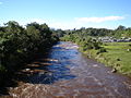
Cauca River
View on Wikipedia| Cauca River | |
|---|---|
_(7241470126).jpg) | |
 | |
| Location | |
| Country | Colombia |
| Physical characteristics | |
| Source | |
| • location | Colombian Massif |
| Mouth | |
• location | Magdalena River |
| Length | 965 km (600 mi) |
The Cauca River (Spanish: Río Cauca) is a river in Colombia that lies between the Occidental and Central cordilleras. From its headwaters in southwestern Colombia near the city of Popayán, it joins the Magdalena River near Magangué in Bolívar Department, and the combined river eventually flows out into the Caribbean Sea. It has a length of 965 km (600 mi) to its junction with the Magdalena, for a total length of 1,350 km (840 mi). The river is under the supervision of the Cauca Regional Corporation and the Cauca Valley Regional Autonomous Corporation, and is navigable for 640 km (400 mi) above its junction with the Magdalena.
- Cauca River
-
-
-

-

-

-

-


._Cartago_-_Ansermanuevo,_Valle,_Colombia.JPG)


Environmental issues
[edit]On November 18, 2007, Colombian newspaper El Tiempo reported that the river was receiving an average of 500 tons of residual waste a day. Pollution from the city of Popayán, seven gold mines that also add industrial pollutants such as mercury, some 8 sand mills, plus a couple of mines of coal and bauxite. Cali, the largest city on the river, depends on the river for 76 percent of its water supply. Adding to this, other affluent rivers collect residual waters from other major cities and deposit an approximate 330 tons of residual waste into the river. By the time it gets to Yumbo, the river has no oxygen.[1]
The Hidroituango energy dam project has seriously affected the Cauca River.[2] The dam has decreased its flow, in some parts by up to 80%.

References
[edit]- ^ (in Spanish) eltiempo.com: Al río Cauca lo están matando las 500 toneladas de contaminantes que le caen cada día
- ^ Miranda, Boris (2019-02-08). "Hidroituango seca el río Cauca: cómo la controversial represa redujo en 80% el caudal del segundo río de Colombia". BBC. Retrieved 2019-03-19.
External links
[edit]- (in Spanish) Corporación Regional del Cauca Archived 2020-11-01 at the Wayback Machine
- (in Spanish) Corporación Autonoma Regional del Valle del Cauca
- Río Cauca at GEOnet Names Server
| International | |
|---|---|
| National | |
Cauca River
View on GrokipediaGeography
Physical characteristics
The Cauca River measures approximately 1,350 kilometers in length from its headwaters to its confluence with the Magdalena River.[7] Its drainage basin spans 63,300 square kilometers, representing about 5.5 percent of Colombia's total land area and traversing nine departments.[7] [4] The river originates in the Andean highlands of the departments of Cauca and Huila at elevations around 3,800 meters above sea level, where steep gradients foster incised canyons and high sediment loads from erosion-prone volcanic and metamorphic terrains.[8] In its upper reaches, the river exhibits narrow, V-shaped valleys with widths often under 50 meters and depths exceeding 10 meters in riffle-pool sequences, reflecting active downcutting into fractured bedrock.[9] Transitioning to the middle basin in the Cauca Valley, the channel broadens to an average width of 105 meters between the Salvajina Dam and La Virginia, with a mean bankfull depth of 7.4 meters, accommodating alluvial deposition and meandering patterns amid tectonic subsidence.[10] Lower sections feature wider floodplains up to several kilometers across, where the river slows and aggrades sediments, forming braided channels influenced by seasonal sediment pulses from upstream tributaries.[11] Overall, the river's morphology reflects a longitudinal profile of high-gradient headwaters yielding to low-gradient valleys, with geomorphic processes driven by tectonic uplift, seismic activity, and variable precipitation regimes.[12]Course and basin
The Cauca River originates in the southern Andean highlands of Colombia, in the department of Cauca, from the confluence of streams draining the Macizo Colombiano between the Central and Western Cordilleras, near the Puracé National Natural Park.[3] It flows northward for 1,204 kilometers through intermontane valleys and canyons, traversing the departments of Cauca, Valle del Cauca, Risaralda, Quindío, Caldas, Antioquia, and Bolívar.[4][13] The river's course is characterized by a high-gradient upper reach in mountainous terrain, transitioning to broader alluvial valleys in the middle section, and narrowing into canyons such as the Cauca River Canyon in Antioquia before widening near its confluence with the Magdalena River in the Caribbean lowlands of Bolívar department.[11][14] The Cauca basin spans approximately 63,300 square kilometers, representing about 5% of Colombia's national territory and supporting roughly 25% of the country's population across its urban and rural areas.[4][15] The drainage network includes diverse sub-basins with varying drainage densities, from well-drained Andean headwaters (around 3.5 km/km²) to lower-gradient plains. Major tributaries contribute significantly to the basin's hydrology: on the right bank (eastern side), key inflows include the Ovejas, Palo, Amaime, Guadalajara, and Tuluá rivers in the upper-middle valley; on the left bank (western side), prominent ones are the La Vieja, Risaralda, and San Juan rivers, with the Nechí joining in the lower basin.[3][1] The upper basin alone encompasses 23 hydrographic subzones supplying over 55 municipalities.[2]Hydrology
Flow regime and discharge
The Cauca River displays a bimodal pluvial flow regime, primarily driven by seasonal precipitation patterns in its Andean catchment and intermontane valleys, with peak discharges occurring during the two principal wet seasons—April to May and October to November—while low-flow periods align with the dry seasons of January to March and July to September.[3][16] This regime reflects the twice-yearly northward and southward passages of the Intertropical Convergence Zone (ITCZ) over Colombia, which generate bimodal rainfall distributions averaging 1,500–2,500 mm annually in the basin. Interannual fluctuations are pronounced, with El Niño-Southern Oscillation (ENSO) exerting dominant control: La Niña events enhance precipitation and elevate discharges by 20–50% above normal, whereas El Niño phases suppress rainfall, reducing flows and exacerbating droughts.[17][18] Mean annual discharge increases substantially downstream due to contributions from over 100 tributaries draining the Central and Western Cordilleras, transitioning from headwater values of 188 m³/s at the La Balsa gauging station to 381 m³/s at La Victoria, reflecting a 102% augmentation from lateral inflows alone.[19] In the middle valley near Cali, averages reach approximately 467 m³/s, sustained by rivers such as the Aguablanca and Claro.[20] At the confluence with the Magdalena River near Plato, Bolívar Department, the Cauca delivers an average of 2,275 m³/s, accounting for roughly 32% of the Magdalena's total flow.[21] Historical records from gauging stations indicate high variability, with maximum instantaneous peaks exceeding 10,000 m³/s during extreme floods (e.g., 1989 and 2010 events) and minima dropping below 100 m³/s in severe dry years.[22] Hydropower infrastructure, notably the Salvajina Dam (operational since 1985), has significantly altered the natural regime downstream, imposing rapid hydropeaking operations that generate diurnal discharge fluctuations up to 300–600 m³/s for power output, with regulated minimum environmental flows of 60 m³/s to mitigate ecological impacts.[23][7] This regulation dampens flood peaks but amplifies low-flow variability, complicating downstream water management and contributing to complex stage-discharge relationships at stations like Sonso and Juanchito. Pre-dam hydrographs showed more sustained high flows during wet seasons, whereas post-regulation patterns exhibit sharper rises and falls, reducing natural floodplain inundation.[24] Recent hydrological monitoring by Colombia's IDEAM and regional authorities like CVC confirms that while average annual volumes remain stable, intra-daily and seasonal extremes are increasingly managed to balance energy demands against irrigation and ecological needs.Flood dynamics
The flood dynamics of the Cauca River are driven primarily by intense seasonal rainfall in the Andean headwaters, exacerbated by the river's meandering alluvial morphology in the upper and middle valleys, which promotes channel migration and overbank spilling during high flows. Peak flood events typically occur during the bimodal rainy seasons, with major pulses from October to December and secondary rises in April to May, fueled by the Intertropical Convergence Zone and orographic precipitation, leading to rapid runoff and sediment-laden discharges that can exceed 10,000 cubic meters per second at key gauging stations like Sonso. This hydrological regime results in frequent inundations of floodplain agriculture and settlements, with flood waves propagating downstream over 1-2 days from the upper basin to the Cauca Valley, where flat topography amplifies slow-onset flooding lasting weeks.[19][22] La Niña phases intensify flood magnitude and duration, as seen in the 2010-2012 events, when prolonged heavy rains caused extreme overflows affecting over 2.8 million Colombians nationwide, including widespread Cauca Valley immersion that destroyed thousands of homes and infrastructure. Hydrological analyses of historical crecidas identify at least nine major flood windows in the upper valley over the past 25 years, with return periods for damaging events estimated at 5-10 years, underscoring the river's limited natural conveyance capacity due to aggradation from high sediment loads (up to 500 million tons annually basin-wide). Dams like Salvajina, operational since 1985, provide partial attenuation by storing peak flows, but their efficacy has waned, as evidenced by persistent large floods between 1988 and 2011, where regulated peaks still surpassed safe thresholds, highlighting engineering limits against climatic variability.[25][19][26] Anthropogenic factors, including upstream deforestation and informal floodplain encroachment, accelerate flood onset by reducing infiltration and constricting channels, while events like the 2018 Hidroituango dam crisis—triggered by a diversion tunnel collapse on April 28—demonstrated how construction disruptions can mimic natural floods, displacing thousands and altering downstream sediment dynamics for months. In the lower basin, extensive wetlands and low-gradient plains facilitate natural inundation as a retention mechanism, but ongoing land-use changes have diminished this buffer, prolonging recovery times and amplifying economic losses estimated in billions of pesos per major event. Despite these patterns, flood forecasting relies on gauging networks from entities like the Valle del Cauca Corporation, which model propagation using HEC-RAS hydraulics to predict inundation extents up to 5-10 km beyond banks during extremes.[27][28][29]History
Indigenous and pre-colonial periods
The Cauca River valley supported early human occupation during the Holocene, with archaeological evidence indicating hunter-gatherer adaptations to the region's fluvio-volcanic landscapes and riverine resources as far back as the preceramic period. Multidisciplinary studies of valley floor sediments and artifacts reveal gradual shifts toward settled farming communities, leveraging the river's fertility for crop cultivation and seasonal flooding for soil enrichment. These early inhabitants utilized the Cauca's waterways for mobility and resource extraction, including alluvial gold deposits that later influenced metallurgical traditions.[30][31] The Quimbaya culture, one of the dominant pre-Columbian societies in the middle Cauca River valley, flourished from approximately 500 BCE to 600 CE, occupying territories along the river's eastern slopes in present-day departments of Quindío, Risaralda, Caldas, and northern Valle del Cauca. These groups established dispersed settlements suited to the valley's temperate microclimates, practicing slash-and-burn agriculture for maize, beans, and tubers, supplemented by hunting, fishing in the Cauca's tributaries, and gathering. Their economy featured advanced goldworking, with techniques like depletion gilding applied to nuggets likely panned from river gravels, yielding intricate artifacts such as tumbaga figurines and vessels recovered from burial contexts. The Quimbaya Treasure, comprising over 100 gold objects from two valley tombs, exemplifies this craftsmanship and social hierarchy, dated to the late pre-Columbian phase.[32][33] Adjacent to the lower Cauca valley, the Calima (or Ilama-Yotoco) culture occupied the Calima River basin feeding into the broader system from around 1000 BCE to 700 CE, with settlements emphasizing raised-field agriculture and ceremonial mound complexes near waterways. These societies, known for shamanistic practices and early metallurgy, interacted with Cauca valley networks through trade in gold, ceramics, and salt, fostering cultural exchanges evident in shared stylistic motifs. Further south in the mountainous Cauca department, the Tierradentro culture (circa 200 BCE–900 CE) developed underground hypogea tombs in volcanic tuff, reflecting ritual responses to the rugged terrain bordering the river's upper reaches, though their direct riverine dependence was limited compared to lowland groups.[34][35] These pre-colonial societies demonstrated adaptive resilience to the Cauca's variable hydrology, with ridged-field systems and canalization precursors mitigating floods while exploiting alluvial soils, as inferred from paleoecological proxies. Population densities supported chiefdom-like organizations, with the river serving as a corridor for inter-group alliances and conflicts, though no unified polity spanned the entire basin. Spanish chronicles, corroborated by archaeology, note the Quimbaya and related groups' resistance and demographic scale upon contact, underscoring the valley's role as a cradle of regional complexity.[36][37]Colonial and republican eras
In 1535, Spanish conquistador Sebastián de Belalcázar entered the Cauca River Valley while advancing northward from Quito in search of El Dorado, establishing military outposts and facilitating the conquest of indigenous territories along the river's course.[38] He founded the city of Popayán in January 1537 near the river's upper reaches, followed by Cali in 1536 downstream, which served as bases for further exploration and administration of the surrounding Andean valleys. These settlements leveraged the river for initial transportation of supplies and tribute, though its rapids limited extensive navigation, prompting reliance on overland trails supplemented by indigenous labor.[39] Gold extraction dominated the colonial economy in the Cauca basin from the 1540s onward, with alluvial mining along the river and its tributaries employing indigenous and later African enslaved workers, yielding significant output that positioned New Granada as Spain's primary gold producer until the 19th century.[40] Hacendados established large cattle estates in the upper valley to provision miners, while tobacco cultivation emerged as a secondary export, transported sporadically via the river to connect with the Magdalena system for shipment to Cartagena.[41] Enslaved Africans, imported for mining and agricultural labor, formed communities whose descendants persisted in the valley, amid haciendas concentrated downstream where fertile floodplains supported coerced production.[42] Following Colombia's independence in 1819, the Cauca Valley's economy persisted with mining and haciendas but suffered disruptions from wartime destruction of infrastructure and capital flight, hindering recovery until mid-century export booms.[43] Republican land policies from 1825 recognized colonial titles while promoting internal colonization, drawing migrants from Antioquia into sparsely settled Cauca frontiers, which boosted smallholder farming and gradual integration into national markets via improved valley roads rather than riverine routes. By the 1850s, credit networks financed agrarian expansion in sugarcane and other staples, though the river's role remained ancillary for irrigation and local goods flotation, constrained by seasonal floods and navigational hazards that exacerbated vulnerabilities during civil conflicts like the War of a Thousand Days (1899–1903).[43] This era saw elite Caucanos mediate demographic shifts, favoring mestizo settlers over European immigrants, which altered the region's social composition amid persistent extractive dependencies.[44]20th-century developments
The Corporación Autónoma Regional del Valle del Cauca (CVC) was established on October 22, 1954, as one of Colombia's first autonomous regional corporations tasked with integrated management of the upper Cauca River basin, including flood mitigation, irrigation expansion, and hydropower development.[45] This initiative followed a 1952 plan for the economic development of the Upper Cauca River Basin, which proposed coordinated infrastructure to harness the river's potential amid recurring floods and agricultural demands.[46] Throughout the mid-20th century, the CVC oversaw levee reinforcements, dike constructions, and drainage systems to protect the fertile Cauca Valley from seasonal inundations that historically disrupted farming and settlements.[25] These efforts supported the modernization of haciendas into large-scale sugarcane and coffee operations, altering riparian dynamics through intensified land use and water diversion.[47] Frequent floods, occurring almost annually in the unregulated upper valley, necessitated such interventions to sustain economic growth in the region.[48] A pivotal project was the Cauca River Regulation initiative, culminating in the Salvajina Dam's completion in 1985, which created a reservoir for flow regulation, flood control in downstream flatlands, and hydroelectric generation of 270 megawatts.[49][50] The dam diluted pollutants during low-flow periods and facilitated irrigation, though it displaced communities and modified ecosystems in the Cauca Canyon.[51] Concurrently, planning for the larger Hidroituango hydroelectric project began in 1969 under engineer José Tejada Sáenz, aiming to further tame the river but facing delays into the 21st century. These developments reflected a shift toward engineering solutions for harnessing the river's hydropower and agricultural utility, amid ongoing challenges from sedimentation and variable precipitation.[19]Economic significance
Agricultural contributions
The Cauca River sustains irrigation-dependent agriculture in the Valle del Cauca, Colombia's premier sugarcane-producing region, where river water enables cultivation on fertile alluvial plains amid a semi-arid climate. Approximately 2,750 family-operated sugar plantations and 13 mills operate along the valley's narrow flatlands, drawing on the river for consistent water supplies critical to crop yields.[53] This infrastructure supports national sugarcane output, with the valley accounting for a dominant share due to its irrigated systems that mitigate seasonal rainfall variability.[54] In marketing year 2023/2024, sugarcane planted area in the Cauca River Valley expanded to 244,000 hectares, up 2.4% from prior levels, reflecting the river's role in enabling land expansion and high productivity. Regional yields average 113 metric tons per hectare, among South America's highest, facilitated by gravity-fed and pumped irrigation networks that distribute river water efficiently across fields.[55] [56] Private irrigation schemes, concentrated in the valley's soils, comprise nearly half of Colombia's such systems, often lifting water directly from the river via open channels and diesel pumps for on-farm application.[57] Beyond sugarcane, the river irrigates rice, cotton, and other crops, with 79% of upper basin surface water allocated to agricultural and industrial uses, underscoring its foundational economic role. Sugarcane agribusiness in the valley exemplifies water efficiency, employing technologies like precision irrigation to optimize river-derived supplies amid growing demands.[4] [58] These contributions have driven agricultural intensification since mid-20th-century hydraulic developments, though they intensify competition for the river's finite flows.[57]Hydropower generation
The Cauca River hosts significant hydroelectric infrastructure, primarily through the Salvajina and Hidroituango power plants, which harness the river's flow for electricity generation. The Salvajina Hydroelectric Plant, located in Cauca department and operational since 1985, features an installed capacity of 285 MW and serves dual purposes of power production and flood control. Operated by Celsia Colombia SA ESP, it utilizes a conventional storage reservoir to generate reliable baseload power from the river's Andean descent.[59][60] Hidroituango, situated in Antioquia department, represents Colombia's largest hydroelectric facility with a 2,400 MW installed capacity. Construction began in 2010, with initial turbine units entering commercial operation in December 2022, delivering up to 600 MW initially and scaling to full output as additional units come online by 2027. The plant is projected to produce approximately 13,900 GWh annually, leveraging the Cauca's high hydraulic head in the canyon region. Managed by Empresas Públicas de Medellín (EPM), it bolsters national grid stability amid Colombia's reliance on hydropower for roughly 70% of electricity needs.[61][62][63] These installations collectively contribute over 2,600 MW to Colombia's capacity, emphasizing the Cauca's strategic value in renewable energy production despite variable seasonal flows influenced by upstream precipitation. Smaller run-of-river schemes exist along tributaries, but the main-stem dams dominate output, supporting industrial and urban demand in the northwest.[64]Mining and resource extraction
The Cauca River basin, particularly in the Alto Cauca region encompassing departments such as Cauca and Valle del Cauca, supports significant artisanal and small-scale gold mining (ASGM) as the dominant form of mineral resource extraction. These operations primarily target alluvial gold deposits in riverbeds and adjacent streams, employing manual panning, sluicing, and mechanized dredging techniques.[65][66] Gold extraction in this area traces to colonial-era traditions, with modern activities concentrated in municipalities like Suárez, where mining clusters near the La Salvajina Dam.[65] In Suárez, alluvial methods account for 82% of local gold output, though approximately 95% of this production occurs through unregulated or illegal channels, bypassing formal licensing and environmental oversight.[67] Nationally, Colombia's gold mining sector expanded by an average of 6% annually from 2000 to 2017, with the Cauca basin contributing via informal economies that employ thousands in rural communities amid limited alternative livelihoods.[67] Processing often involves mercury amalgamation to separate gold from sediments, yielding fine particles but generating tailings discharged directly into waterways.[66] Beyond gold, riverbed aggregates such as sand and gravel are extracted for construction aggregates, supporting regional infrastructure but contributing to channel erosion and sediment dynamics alterations.[7] Formal large-scale mining remains minimal along the river, overshadowed by ASGM's prevalence, which ties into broader economic reliance on extractive activities despite associated risks of armed group involvement and resource depletion.[41]Infrastructure
Major dams and reservoirs
The Cauca River hosts several significant dams primarily constructed for hydroelectric power generation, flood control, and irrigation support. The two most prominent are the Salvajina Dam and the Hidroituango Dam, which together represent key infrastructure for managing the river's flow in southwestern Colombia. These structures have reservoirs that store substantial volumes of water, influencing downstream hydrology and energy production.[59][64] The Salvajina Dam, located in the municipality of Suárez, Cauca Department, was completed in September 1985. It features an installed hydroelectric capacity of 270 megawatts and a reservoir with a capacity of 906 million cubic meters, supporting annual electricity generation of approximately 1,050 gigawatt-hours. The dam's gross head measures 92 meters, and its primary functions include flood mitigation, drought prevention, and facilitation of agricultural irrigation in the upper Cauca Valley.[59][68] Further upstream, the Hidroituango Dam (also known as Ituango Dam) near Ituango in Antioquia Department stands as Colombia's largest hydroelectric project, with a planned capacity of 2,400 megawatts. Construction began in 2010, with the structure reaching a height of 225 meters and designed to harness the river's average flow of 1,100 cubic meters per second in the Cauca Canyon. Its reservoir is intended to provide substantial storage for power generation and flow regulation, though the project has faced delays and partial operational challenges. Initial turbine operations commenced following emergency stabilizations, contributing to national energy needs.[64][63]| Dam Name | Location | Completion Year | Installed Capacity (MW) | Reservoir Capacity (million m³) | Primary Purposes |
|---|---|---|---|---|---|
| Salvajina | Suárez, Cauca Department | 1985 | 270 | 906 | Hydroelectric, flood control, irrigation |
| Hidroituango | Ituango, Antioquia Department | Under construction (partial ops.) | 2,400 (planned) | Not fully operational | Hydroelectric, flow regulation |
Irrigation and navigation systems
The Cauca River supplies water for key irrigation districts in the Valle del Cauca region, where pumping stations lift river flow for distribution to agricultural lands. The Roldanillo-Union-Toro (RUT) Irrigation District covers 9,742 hectares, utilizing stations such as Tierrablanca with a capacity of 6.8 cubic meters per second to draw from the river's average flow of 320 cubic meters per second. Water is conveyed through 72 kilometers of open-channel interceptor and marginal canals, with farmers applying it via diesel-powered pressurized sprinklers; management transitioned to water users' associations around 1989, incorporating flood protection dikes and 144 kilometers of drainage.[57] The Corporación Autónoma Regional del Valle del Cauca (CVC) oversees these and other systems, regulating river flow via upstream dams like Salvajina to mitigate floods and ensure dry-season availability across the valley's 336,000 hectares of farmland, predominantly for sugarcane on Colombia's largest producing plains. Initiatives such as the Agua por la Vida water fund engage upstream farmers in erosion control and reforestation to sustain irrigation amid population growth to 1.2 million and climate variability.[69] Navigation systems on the Cauca River remain limited, with no extensive modern commercial infrastructure due to rapids, variable depths, and dams impeding larger vessels. Historical efforts included 19th-century steamboats for regional trade, but contemporary use focuses on small boats for local transport and recreational rafting, such as guadua-bamboo rafts from Puerto Samaria.[70][71]Environmental aspects
Biodiversity and ecosystems
The Cauca River basin encompasses a variety of ecosystems, including montane forests, tropical dry forests, riparian zones, and wetlands, which collectively support high levels of biodiversity in southwestern Colombia. The Cauca Valley Montane Forests, situated along the river's upper reaches, consist of humid premontane and montane forests at elevations between 500 and 2,500 meters, characterized by diverse vegetation such as epiphyte-laden trees and understory shrubs adapted to seasonal rainfall.[72] These forests transition into Cauca Valley Dry Forests along the lower river valley, forming narrow strips of deciduous woodland in Risaralda and Valle del Cauca departments, where species endure pronounced dry seasons through leaf shedding and dormancy.[73] Wetlands associated with the Cauca River, including oxbow lakes, marshes, lagoons, and floodplain zones, play critical roles in water retention, sediment deposition, and nutrient cycling, forming dynamic interfaces between aquatic and terrestrial habitats.[74] Riparian buffer zones along the river, often spanning tens of meters from the banks, harbor specialized vegetation communities that stabilize soils, filter pollutants, and provide corridors for species movement, with studies indicating requirements for zones up to several kilometers wide in certain stretches to maintain ecological integrity.[75] Tropical dry forests in the Cauca River geographic valley further contribute to ecosystem diversity, featuring flora and fauna adapted to alternating wet and dry periods, such as drought-resistant trees and herbs that support pollinators and seed dispersers.[76] Faunal biodiversity in the basin includes numerous endemic species, particularly in avian and aquatic taxa. The Cauca guan (Penelope perspicax), a large cracid bird measuring 75-85 cm in length with a distinctive red dewlap, is endemic to the humid forests of the Cauca Valley, relying on fruit-bearing trees and understory cover for foraging and nesting.[77] The upper Cauca River hosts a high diversity of fish species, many of which are endemic, with ongoing research highlighting the need for targeted biological studies to assess their conservation status amid habitat alterations.[78] Aquatic amphibians such as the Rio Cauca caecilian (Typhlonectes natans), a limbless, eel-like species native to the Cauca and Magdalena drainages, inhabit river floodplains, migrating upstream during wet seasons to exploit flooded areas for reproduction and feeding on invertebrates.[79] Invertebrate communities, including ants in the tropical dry forests, exhibit species richness with unique assemblages tied to the biome's seasonal dynamics.[80] These elements underscore the river's role in sustaining Colombia's megadiverse aquatic and terrestrial networks, though fragmentation poses risks to connectivity.[4]Water quality trends
The water quality of the Cauca River has exhibited a trend of progressive degradation since the mid-20th century, primarily attributable to untreated urban and industrial effluents, agricultural nutrient runoff, and heavy metal discharges from mining operations. Biochemical oxygen demand (BOD) levels, indicative of organic pollution, have remained elevated downstream of population centers such as Cali, with the river receiving an estimated 149.3 metric tons per day of BOD5, of which Cali alone contributes 77 metric tons per day from sewage and industrial sources.[81] This organic loading has intensified eutrophication risks, reducing dissolved oxygen availability for aquatic life in lower reaches.[82] Heavy metal concentrations, including mercury (Hg), arsenic (As), cadmium (Cd), lead (Pb), zinc (Zn), copper (Cu), and manganese (Mn), have shown chronic exceedances of national standards, particularly in segments influenced by artisanal gold mining using mercury amalgamation. A 2021 evaluation of water and total suspended solids in a mining-affected stretch documented levels surpassing permissible limits for Hg (up to 0.002 mg/L threshold) and other metals, correlating with sediment bioaccumulation and downstream transport during high flows.[83] Historical patterns indicate these inputs have persisted since the 1970s expansion of informal mining, with episodic spikes during flood events mobilizing stored contaminants.[84] Infrastructure interventions, notably the Salvajina Dam completed in 1985, have introduced partial improvements by trapping sediments and reducing total suspended solids (TSS) by 50–99% seasonally in reservoir-influenced sections, thereby lowering turbidity and associated pollutant transport.[85] However, this has not mitigated dissolved pollutants, as evidenced by post-dam analyses showing stable or increasing nutrient and metal loads due to ongoing basin-wide discharges. The Instituto de Hidrología, Meteorología y Estudios Ambientales (IDEAM) classified the river's quality as "regular" across monitored points in its 2023 assessment, signifying moderate impairment compatible with irrigation and industrial uses but necessitating advanced treatment for potable supply.[86] Recent evaluations of historical monitoring data from four stations highlight persistent contamination signals, with non-parametric analyses revealing statistically significant upward trends in key indicators like electrical conductivity and metal proxies from the 1990s onward, despite sporadic regulatory efforts.[87] These trends underscore causal linkages between anthropogenic pressures—urban growth exceeding wastewater treatment capacity and unregulated mining—and biophysical responses, such as elevated coliforms and toxicity in biota, without evidence of basin-wide recovery as of 2024.[88]Controversies and impacts
Development versus conservation debates
The Cauca River basin has been a focal point for tensions between economic development imperatives and environmental conservation priorities, driven by Colombia's need for hydropower, irrigation, and resource extraction amid a backdrop of high biodiversity. Development advocates, including government and industry stakeholders, emphasize the river's role in generating approximately 70% of the nation's hydroelectricity through dams like Salvajina and Prado, which support national energy security and agricultural productivity in the fertile Cauca Valley, where sugarcane and other cash crops contribute significantly to GDP.[89][90] Conservationists counter that such infrastructure fragments ecosystems, reduces sediment flow essential for downstream wetlands, and exacerbates flood risks, with empirical data showing dams associated with decreased oxygen levels and altered thermal regimes in the basin.[85] Agricultural expansion, particularly monoculture plantations in the upper and mid-Cauca, exemplifies the debate, as large-scale sugarcane cultivation—covering over 300,000 hectares in the Cauca Valley by 2020—has driven economic growth but eroded biodiversity through habitat conversion and soil degradation, threatening endemic species and Afro-Colombian cultural practices tied to diverse land uses.[91] Critics, including local communities and researchers, describe this as "water grabbing," where privatized irrigation diverts river flows for export-oriented agribusiness, leading to reduced water availability for smallholders and ethnic groups, with studies documenting ethnicized dispossession in the Alto Cauca since the 1980s.[41] Pro-development arguments highlight yield increases from modern irrigation, yet data indicate a 88% loss of Cauca wetlands between 1950 and 1980 due to such land-use changes, underscoring long-term ecological costs.[92] Mining activities along tributaries further polarize stakeholders, with proponents citing job creation and mineral exports (e.g., gold and copper), while conservation efforts focus on pollution's role in bioaccumulating heavy metals that impair aquatic food webs and human health in indigenous territories.[4] Collaborative governance models, such as the 2015 Commission for Upper Cauca Basin Recovery, seek reconciliation by integrating stakeholder input for sustainable water management, achieving modest gains in monitoring and restoration funding, though implementation challenges persist amid competing interests.[4] Organizations like The Nature Conservancy advocate "no net impact" infrastructure via decision-support tools for the Magdalena-Cauca system, aiming to quantify trade-offs, but debates continue over whether such compromises adequately address cumulative basin degradation.[90] ![Salvajina Dam on the Cauca River][float-right]These conflicts reflect broader causal dynamics: upstream damming and land conversion for development alter hydrology and nutrient cycles, cascading into downstream biodiversity declines and social inequities, with empirical models from basin simulations underscoring the need for integrated planning to avoid zero-sum outcomes.[93] Despite rights-of-nature recognitions in Colombian law since 2016, enforcement remains limited, as extractive pressures prioritize short-term gains over long-term resilience in a climate-vulnerable region.[92]
Hidroituango dam project
The HidroItuango hydroelectric project, situated on the Cauca River in Antioquia Department, Colombia, is designed to generate 2,400 megawatts of electricity upon full completion, equivalent to approximately 17% of the country's energy demand and sufficient to power around 6.5 million households.[94][64] The facility features a 245-meter-high roller-compacted concrete gravity dam forming a reservoir with a storage capacity of 2,720 million cubic meters over a 76-kilometer length, supported by eight 300-MW turbines and associated diversion tunnels for river flow management.[95] Developed primarily by Empresas Públicas de Medellín (EPM) in partnership with entities like ISA and international financiers including IDB Invest, the project aims to bolster Colombia's hydropower-dependent grid amid growing demand.[96] Construction commenced in 2010 following initial planning dating to 1969, with an original operational target of late 2018.[64][97] Delays arose from geological challenges, including unstable terrain prone to landslides, and decisions to divert the Cauca River through auxiliary tunnels before completing the main spillway, which engineering analyses later identified as a causal factor in heightened risks. By 2018, costs had escalated significantly from initial estimates, reaching around $5 billion USD due to overruns tied to remediation and halted progress.[98] A major crisis unfolded in April 2018 when heavy rainfall caused sediment buildup and blockages in the diversion tunnels, rapidly elevating reservoir levels behind the incomplete structure and threatening structural failure.[99] This prompted emergency evacuations of over 10,000 residents downstream, widespread flooding that submerged homes, bridges, and farmland, and a national state of alert as water surges risked inundating Medellín, 80 kilometers away.[97][100] Partial unblocking of tunnels on May 12 released pent-up waters, averting immediate collapse but causing downstream flash floods and reported deaths, though official tallies remain disputed amid claims of undercounting by affected communities.[101] The incident exacerbated environmental degradation, including mass fish kills from oxygen depletion in impounded waters, downstream flow reductions that dried river sections in 2019, deforestation for access roads, and landslides eroding hillsides.[102][103] Social controversies intensified, with groups like Movimiento Ríos Vivos alleging inadequate prior consultation, forced displacements of thousands without fair compensation, and links to prior armed conflict violence in the region, where project opposition intertwined with paramilitary threats against protesters.[104] Critics, including international observers, have highlighted deficiencies in environmental impact assessments and human rights due diligence, while project proponents emphasize its long-term role in reducing fossil fuel reliance.[105] As of 2024, the project operates partially with four turbines online since 2022, generating 1,200 MW, following remediation of tunnels and spillways; full synchronization of all units is targeted for 2027, contingent on ongoing geological stabilization and regulatory approvals lifted in early 2025.[106][107][108] Despite persistent legal disputes over liabilities and mitigation, the facility's phased commissioning has begun contributing to grid stability, underscoring trade-offs between rapid infrastructure development and risk management in seismically active, high-precipitation zones.[109]Mining pollution disputes
Artisanal and small-scale gold mining (ASGM) along the Cauca River basin, particularly in the Alto Cauca region, has been a primary driver of heavy metal pollution, with mercury used in the amalgamation process directly discharged into tributaries and the main river stem. This activity, often informal or illegal, releases mercury at concentrations exceeding Colombian environmental standards, contributing to bioaccumulation in aquatic ecosystems and fish stocks consumed by local communities. Studies indicate that streams draining mining areas into the Cauca exhibit total mercury levels up to 0.1 mg/L in water and over 1 mg/kg in sediments, far above the 0.001 mg/L threshold for safe discharge.[5][66] Disputes over this pollution intensified in the 2010s, pitting mining-dependent communities against environmental regulators and indigenous groups, who argue that mercury contamination causes neurological damage and disrupts traditional livelihoods. Hair samples from residents along the Cauca revealed total mercury concentrations averaging 2.5 µg/g in mining-adjacent areas, linked to chronic exposure via contaminated fish, prompting calls for mining formalization rather than outright bans to balance economic survival with mitigation. Government crackdowns on illegal operations, such as those in 2014 identifying mercury use in nearly 100 Colombian municipalities including Cauca basin sites, have sparked protests from miners claiming lost income without viable alternatives, while NGOs advocate stricter enforcement under the Minamata Convention.[110][111][112] Legal battles highlight the tensions, including a 2018 lawsuit by activists framing the Cauca River's degradation—exacerbated by mining effluents alongside agricultural runoff—as a violation of emerging "rights of nature" doctrines, leading to a 2019 Medellín court ruling granting the river legal personhood and mandating pollution controls. Critics of such rulings contend they overlook causal complexities, as armed conflict-era dumping and upstream dams also impair water quality, with mercury from mining representing only one vector amid broader anthropogenic pressures like endocrine-disrupting micro-pollutants detected in basin monitoring. Transdisciplinary analyses of these conflicts emphasize governance failures, where informal mining persists due to weak enforcement and economic incentives, fueling ongoing debates over technology transfers for mercury-free extraction versus relocation of operations.[113][92][4][114]Recent developments
Flood events 2020s
In April 2020, torrential rains triggered flash flooding along the Cauca River in Santander de Quilichao municipality, Cauca Department, with social media images documenting submerged areas and infrastructure damage.[115] Heavy precipitation also caused related landslides in Argelia municipality, Cauca, destroying one house and prompting evacuations on April 25.[116] The Cauca River overflowed on August 27, 2021, in Colombia's northern La Mojana subregion, inundating five municipalities and causing extensive damage to homes and agriculture due to atypical rains from the Central American hurricane season.[117] A subsequent breach on September 2 affected Nechí municipality, impacting 5,285 people and damaging 1,057 homes as the river exceeded red alert levels.[118] Further floods on November 12 struck Caloto, El Tambo, and López de Micay in Cauca Department, affecting over 1,000 families.[119] In May 2022, overflows in Tarazá municipality, Antioquia Department, resulted in one death, 2,100 people affected, 10 homes destroyed, and 470 damaged along the Cauca River.[120] October events in Dagua municipality, Valle del Cauca, flooded areas near the river, impacting 34 families and destroying 14 houses while damaging highway sections.[121] Heavy rains from May 16, 2024, caused the Cauca River to overflow in northern Colombia, affecting 18 municipalities and breaching a containment dike at Cara e' Gato in Bermúdez on May 6, leading to widespread inundation in the La Mojana subregion that impacted 32,000 people, drowned crops, and flooded grazing lands.[122][123][124] In March 2025, rising Cauca River levels from 8.56 to 9.65 meters within 24 hours prompted an orange alert in Cali, Valle del Cauca, causing inundations and displacing families in nearby communities.[125] April overflows in La Pintada, Antioquia, affected 3,000 residents, including 100 isolated individuals, and damaged over 2,200 homes across the region.[126][127] By mid-April, the river's surge led to 20 inundation sites in Antioquia, leaving 450 families homeless.[128] These events in La Mojana and Antioquia highlighted recurring vulnerabilities from intense rainy seasons and embankment failures.[129]Governance and restoration efforts
The governance of the Cauca River basin involves regional autonomous corporations established under Colombia's environmental framework, with the Corporación Autónoma Regional del Valle del Cauca (CVC) serving as the primary authority for the Valle del Cauca segment, overseeing flood regulation, water allocation, and ecosystem management through agreements like the 1978 Project for Regulating the River Cauca.[41] [130] The CVC collaborates with national bodies and international partners, such as Dutch consortia, to develop master plans for integrated water resources, including dike reinforcements and wetland preservation to mitigate flood risks affecting over 1 million residents in the basin.[131] [25] A landmark judicial development occurred on June 17, 2019, when Colombia's Superior Court of Medellín granted legal personhood to the Cauca River, its basin, and tributaries, imposing obligations on authorities to prevent degradation and enforce restoration, drawing on the rights of nature doctrine amid documented declines in water quality over the prior three decades.[92] [132] This ruling complements the broader Magdalena-Cauca basin framework, emphasizing enforceable duties for pollution control and habitat recovery, though implementation faces challenges from territorial disputes with non-state actors undermining policy legitimacy.[133] Restoration initiatives emphasize collaborative and science-driven approaches, exemplified by the Commission for the Upper Cauca River Basin Recovery, launched to foster multi-stakeholder governance integrating biocultural perspectives and water security metrics, with progress reported in aligning local communities, agencies, and industries toward sustainability targets as of 2022.[4] The Water for Life and Sustainability Fund, operational in the Cauca Valley since the mid-2010s, allocates resources—derived from water user fees—for priority actions like reforestation on degraded slopes above 1,000 meters elevation, spring protection, and agroecological practices, using InVEST modeling to target investments that enhance sediment retention and water yield in the upper basin.[134] [135] Additional efforts include the HERMANA digital platform, implemented by the CVC in 2021, which facilitates equitable water permitting and monitoring to reduce overuse in agricultural zones, integrating real-time data on abstractions exceeding 72 million cubic meters annually.[136] The Hidroituango hydroelectric project, despite delays, incorporated restoration components by acquiring 17,471 hectares of canyon land by 2025 for reforestation and biodiversity offsets, aiming to compensate for hydrological alterations affecting downstream flows.[137] Outcomes remain mixed, with peer-reviewed assessments noting partial gains in vegetative cover but persistent gaps in addressing mining-derived contaminants and enforcement amid competing extractive pressures.[4]References
- https://storymaps.[arcgis](/page/ArcGIS).com/stories/77236e2521ac4138bc6b1fae51a94f45