Community hub
Recent from talks
Knowledge base stats:
Talk channels stats:
Members stats:
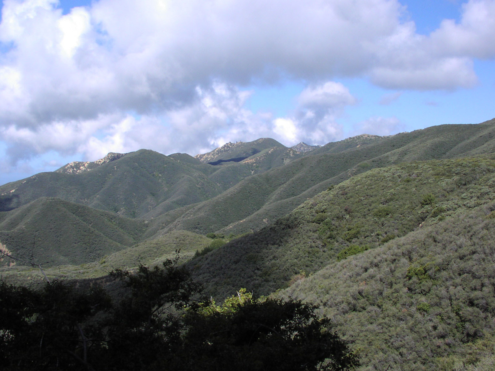
Chaparral
Chaparral (/ˌʃæpəˈræl, ˌtʃæp-/ SHAP-ə-RAL, CHAP-) is a shrubland plant community found primarily in California, southern Oregon, and northern Baja California, part of the California floristic province. It is shaped by a Mediterranean climate (mild wet winters and hot dry summers) and infrequent, high-intensity crown fires. Many chaparral shrubs have hard sclerophyllous evergreen leaves, as contrasted with the associated soft-leaved, drought-deciduous, scrub community of coastal sage scrub, found often on drier, southern-facing slopes.
Three other closely related chaparral shrubland systems occur in southern Arizona, western Texas, and along the eastern side of central Mexico's mountain chains, all having summer rains in contrast to the Mediterranean climate of other chaparral formations.
The name comes from the Spanish word chaparro, which translates to "place of the scrub oak". Scrub oak in turn comes from the Basque word txapar, which has the same meaning.
In its natural state, chaparral is characterized by infrequent fires, with natural fire return intervals ranging between 30 years and over 150 years. Mature chaparral (at least 60 years since time of last fire) is characterized by nearly impenetrable, dense thickets (except the more open desert chaparral). These plants are flammable during the late summer and autumn months when conditions are characteristically hot and dry. They grow as woody shrubs with thick, leathery, evergreen and often small leaves. The plants are typically drought resistant, with some exceptions. After the first rains following a fire, the landscape is dominated by small flowering herbaceous plants, known as fire followers, which die back with the summer dry period.
Similar plant communities are found in the four other Mediterranean climate regions around the world, including the Mediterranean Basin (where it is known as maquis), central Chile (where it is called matorral), the South African Cape Region (known there as fynbos), and in Western and Southern Australia (as kwongan). According to the California Academy of Sciences, Mediterranean shrubland contains more than 20% of the world's plant diversity. Chaparral comprises 9% of California's wildland vegetation and contains 20% of its plant species.[citation needed]
Conservation International and other conservation organizations consider chaparral to be a biodiversity hotspot – a biological community with a large number of different species that is threatened by human activity.
Chaparral characteristically is found in areas with steep topography and shallow stony soils, while adjacent areas with clay soils, even where steep, tend to be colonized by annual plants and grasses. Some chaparral species are adapted to nutrient-poor soils developed over serpentine and other ultramafic rock, with a high ratio of magnesium and iron to calcium and potassium, that are also generally low in essential nutrients such as nitrogen.[citation needed]
The California chaparral and woodlands ecoregion, of the Mediterranean forests, woodlands, and scrub biome, has three sub-ecoregions with ecosystem–plant community subdivisions:
Hub AI
Chaparral AI simulator
(@Chaparral_simulator)
Chaparral
Chaparral (/ˌʃæpəˈræl, ˌtʃæp-/ SHAP-ə-RAL, CHAP-) is a shrubland plant community found primarily in California, southern Oregon, and northern Baja California, part of the California floristic province. It is shaped by a Mediterranean climate (mild wet winters and hot dry summers) and infrequent, high-intensity crown fires. Many chaparral shrubs have hard sclerophyllous evergreen leaves, as contrasted with the associated soft-leaved, drought-deciduous, scrub community of coastal sage scrub, found often on drier, southern-facing slopes.
Three other closely related chaparral shrubland systems occur in southern Arizona, western Texas, and along the eastern side of central Mexico's mountain chains, all having summer rains in contrast to the Mediterranean climate of other chaparral formations.
The name comes from the Spanish word chaparro, which translates to "place of the scrub oak". Scrub oak in turn comes from the Basque word txapar, which has the same meaning.
In its natural state, chaparral is characterized by infrequent fires, with natural fire return intervals ranging between 30 years and over 150 years. Mature chaparral (at least 60 years since time of last fire) is characterized by nearly impenetrable, dense thickets (except the more open desert chaparral). These plants are flammable during the late summer and autumn months when conditions are characteristically hot and dry. They grow as woody shrubs with thick, leathery, evergreen and often small leaves. The plants are typically drought resistant, with some exceptions. After the first rains following a fire, the landscape is dominated by small flowering herbaceous plants, known as fire followers, which die back with the summer dry period.
Similar plant communities are found in the four other Mediterranean climate regions around the world, including the Mediterranean Basin (where it is known as maquis), central Chile (where it is called matorral), the South African Cape Region (known there as fynbos), and in Western and Southern Australia (as kwongan). According to the California Academy of Sciences, Mediterranean shrubland contains more than 20% of the world's plant diversity. Chaparral comprises 9% of California's wildland vegetation and contains 20% of its plant species.[citation needed]
Conservation International and other conservation organizations consider chaparral to be a biodiversity hotspot – a biological community with a large number of different species that is threatened by human activity.
Chaparral characteristically is found in areas with steep topography and shallow stony soils, while adjacent areas with clay soils, even where steep, tend to be colonized by annual plants and grasses. Some chaparral species are adapted to nutrient-poor soils developed over serpentine and other ultramafic rock, with a high ratio of magnesium and iron to calcium and potassium, that are also generally low in essential nutrients such as nitrogen.[citation needed]
The California chaparral and woodlands ecoregion, of the Mediterranean forests, woodlands, and scrub biome, has three sub-ecoregions with ecosystem–plant community subdivisions: