Hubbry Logo
Grey LynnGrey LynnMain
Open search
Grey Lynn
Community hub
Grey Lynn
logo
8 pages, 0 posts
0 subscribers
Be the first to start a discussion here.
Grey Lynn
Grey Lynn
from Wikipedia

Key Information

Westmere Herne Bay Ponsonby
Point Chevalier
Grey Lynn
Newton
Western Springs Morningside Arch Hill, Kingsland

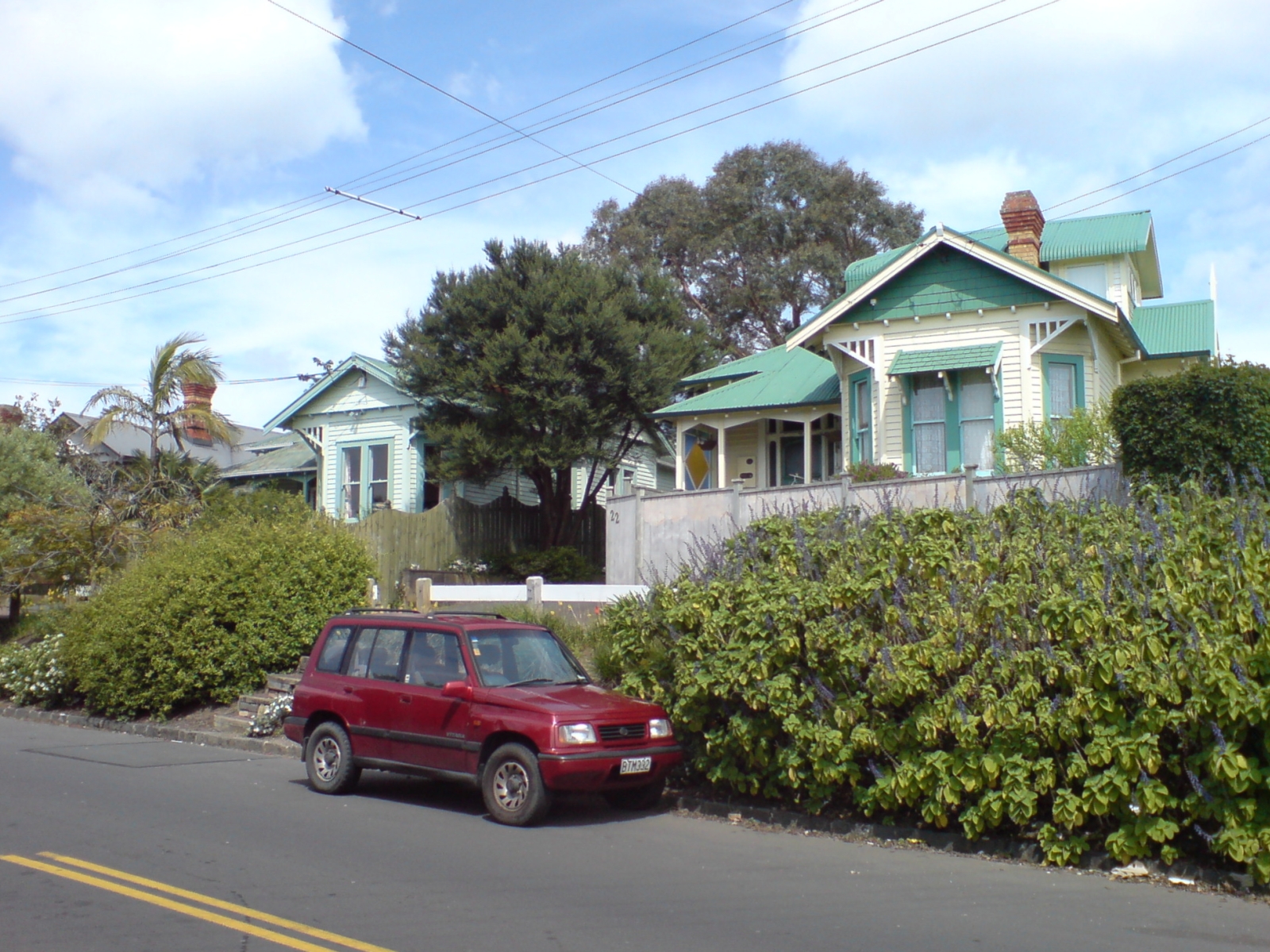
Grey Lynn is an inner suburb of Auckland, New Zealand, located 3 kilometres (1.9 mi) to the west of the city centre. Originally a separate borough, Grey Lynn amalgamated with Auckland City in 1914.

Grey Lynn is centred on Grey Lynn Park, which was not part of the original subdivision of 1883, since the land was too steep and too wet for house construction. In 1915, the land was drained and levelled for playing fields.[3] The park is home to the annual Grey Lynn Park Festival, which attracts around 100,000 visitors on the third Saturday in November.[4]

History

[edit]

Prior to the arrival of Europeans in Auckland, Grey Lynn was a frequent transit point with abundant food sources and access to freshwater.[5] Food sources included several kūmara plantations in Grey Lynn, on the hill slopes above Opoutukeha, Coxs Creek.[3] In the late 17th or early 18th century, there were a series of raids in the area led by Kāwharu (Tainui), known as Raupatu Tīhore.[6] Kāwharu reportedly rested his head on the ridge that is now the location of Surrey Crescent, leading to it being called Te Rae o Kāwharu (Kāwharu's brow), which was later adopted as the Māori name of Grey Lynn School.[7][8]

Early European settlements and farming

[edit]

Grey Lynn was part of the first 3000-acre block of land gifted by Ngāti Whātua Ōrākei in October 1840.[9] The Grey Lynn area was originally known as Newton until being renamed in August 1899.[10]

In 1844 and 1845, blocks of land in the western part of Grey Lynn were auctioned off.[11] In the early 1840s, John Monteforte bought Surrey Hills, which encompassed much of the land from Ponsonby to Richmond Roads, totalling 198 acres (80 hectares).[12] In 1847, Thomas Crummer and James Williamson bought Surrey Hills and eventually owned all the land bounded by Ponsonby, Great North and Richmond Roads, except for "three blocks at the northern end where Tutanekai, Hakanoa and Sackville streets run," the majority of modern Grey Lynn.[13][14]

The Surrey Hills was leased from the early 1840s to the mid-1880s, and housed a farm and a sheep run.[15] Notably, in 1871, Frank Lawry leased part of the Surrey Hills and created a dairy farm.[16][17] Following Crummer's death, Williamson bought the Crummer's children's share in Surrey Hills.[14] When Williamson was facing financial hardship in the early 1880s, Surrey Hills was bought by the Auckland Agricultural Company.[18][19]

Early industry and infrastructure

[edit]

Grey Lynn had a number of brickyards, particularly along the Great North Road.[20] In 1871, Thomas Faulder was appointed night soil contractor for Auckland, and used his land between Surrey Crescent and Tuarangi Road for its disposal.[21][22] During the early 1870s, there were numerous complaints over the use of this land for this purpose, including to the Central Board of Health in 1874.[23] The depot was relocated to Avondale in 1875.[24] In 1906, James Tattersfield set up a mattress factory on the corner of Sackville and Richmond Road.[25] The factory was later expanded to produce carpets.[25]

Initial subdivisions

[edit]

In 1883, the 127 hectares (310 acres) that was the Surrey Hills Estate was subdivided for residential purposes, the largest subdivision in the area at the time.[10][26] In 1885, there was a depression in the economy which slowed building on the estate.[27] In the late 1890s-early 1900s, building resumed and, by 1903, there were 1040 dwellings.[28] With the extensions of the tramlines to West Lynn in 1910, there was another wave of subdivisions.[29] There was also the development of shops - notably on Great North Road, Williamson Avenue and Tuarangi Road.[30]

Post World War One

[edit]

In 1902, Grey Lynn electorate voted to be dry, and this continued until 1937.[31][32][33] This resulted in a number of non-alcoholic beverage manufacturers to establish operations in the Grey Lynn area.[31] In addition to these businesses, in 1925, Dominion Compressed Yeast Company set up a factory in Grey Lynn to supply their North Island market, and, in 1929, Auckland Laundry Company moved its operations to Surrey Crescent.[34][35][36] In 1938, the existing store fronts on the corners of Williamson Avenue, were replaced with the Grey Lynn Post Office and the ASB Bank.[37][38]

In the 1920s, Auckland City Council began building workers housing with 60 houses built on Old Mill and West View Roads.[39][40] In the 1930s, with the Great Depression, the demand for workers decreased.[41] In the 1940s, state-owned units for pensioners were built on the Great North Road and on the corner of Surrey Crescent and Gilbert Avenue.[42] After World War Two, Auckland's manufacturing businesses started booming, existing factories in Grey Lynn expanded, new factories were established in the area, and there was significant demand on housing.[43] Grey Lynn remained a largely working-class suburb until the 1970s.[44]

Modern history

[edit]

The 1970s saw a renewed interest in older Victorian properties, and from that period onwards many young professionals began buying dilapidated kauri villas in areas like Grey Lynn and renovating them.[44] From the early 1980s, this gentrification began to visibly change the area, resulting in an increase in house prices and in higher rents.[45] This also led to an increase in the number of people renting in Grey Lynn. In 1961, 31% of people in Grey Lynn were renting, by 1981 this had already increased to 45%.[46]

In the 1980s and 1990s, businesses in the creative fields started developing in Grey Lynn, including the Gow Langsford Gallery on the corner of Richmond Road and Warnock Street in 1987 and Mai FM on Crummer Road in 1992.[47] The offices of Recorded Music New Zealand are still located on Hakanoa Street.[48][49] Other businesses, such as Burrell Demolition and Wilton Motor Body factory, moved out of the area, and were replaced with housing or businesses and shops that reflected the gentrification of the area.[50]

In 1972, the Grey Lynn community requested a community centre which opened in 1975.[51] It was redeveloped in 2000, and remains open to this day.[52][53]

Local governance

[edit]
The Grey Lynn Council Chambers and Fire Station circa 1910. To the right is Rose Road

In 1867–1869, the Newton Highway District was formed, encompassing the land bordered by Great North Road, Tuarangi Road and Motions Creek.[54][55] The Newton Highway Board originally administered an area of 366 hectares (900 acres). In November 1885, the Newton Borough Council was formed and took over administration from the Highway Board.[10] In 1878 the road board was recorded with the name Richmond but later records continued to use the name Newton.[54] In 1901 the borough was renamed to Grey Lynn, in honour of Sir George Grey.[10][54] In 1914 Grey Lynn was amalgamated with the City of Auckland.[10]

Mayors

[edit]
  • Richard T. Warnock, 1885–1887
  • F. J. Jones, 1887–1888
  • S. J. Ambury, 1888–1890
  • Samuel Carey Brown, 1890–1893
  • Thomas English, 1893–1894
  • Richard T. Warnock, 1894–1896
  • John Wisdom Shackelford, 1896–1899
  • Richard T. Warnock, 1899–1903
  • John Wisdom Shackelford, 1903–1904
  • John Farrell, 1904–1907
  • George Sayers, 1907–1909
  • William John Holdsworth, 1909–1912
  • George Baildon, 1912–1914

Grey Lynn Park

[edit]
The Grey Lynn Festival in 2008

Grey Lynn Park was established in the 1883, at the site of a former dairy farm.[56][57] The Grey Lynn Park Festival has been held in early summer since 1984,[58] and celebrated its 25th anniversary in 2009.[59] The event, which attracts on average 100,000 visitors each year, is organised by four people who raise money from stall fees and charitable grants.[60] It started as a local community get-together with working-class and Pasifika roots, though the appeal has broadened through the decades.[61] Local band Unity Pacific first performed at the festival in 1987, and have appeared many times since. They headlined in 2009.[59]

Education and sports

[edit]

Grey Lynn School and Newton Central School are contributing primary (years 1–6) schools with rolls of 262[62] and 331,[63] respectively.

St Joseph's School is a Catholic state-integrated full primary (years 1–8) school with a roll of 68.[64]

All these schools are coeducational. Rolls are as of October 2025.[65]

Secondary schools serving the area include Auckland Girls' Grammar School, Mount Albert Grammar School, and Western Springs College.

Grey Lynn Park is the home ground of the Richmond Rovers rugby league club, one of the oldest Rugby League clubs in Auckland.[56]

Demographics

[edit]

Grey Lynn covers 2.82 km2 (1.09 sq mi)[1] and had an estimated population of 11,600 as of June 2025,[2] with a population density of 4,113 people per km2.

Historical population
YearPop.±% p.a.
200610,242—    
201310,842+0.82%
201811,736+1.60%
202311,052−1.19%
Source: [66][67]

Grey Lynn had a population of 11,052 in the 2023 New Zealand census, a decrease of 684 people (−5.8%) since the 2018 census, and an increase of 210 people (1.9%) since the 2013 census. There were 5,406 males, 5,559 females and 87 people of other genders in 4,266 dwellings.[68] 10.6% of people identified as LGBTIQ+. The median age was 34.7 years (compared with 38.1 years nationally). There were 1,551 people (14.0%) aged under 15 years, 2,838 (25.7%) aged 15 to 29, 5,718 (51.7%) aged 30 to 64, and 942 (8.5%) aged 65 or older.[67]

People could identify as more than one ethnicity. The results were 79.0% European (Pākehā); 10.9% Māori; 11.6% Pasifika; 10.2% Asian; 3.1% Middle Eastern, Latin American and African New Zealanders (MELAA); and 1.3% other, which includes people giving their ethnicity as "New Zealander". English was spoken by 97.1%, Māori language by 3.0%, Samoan by 2.6%, and other languages by 17.1%. No language could be spoken by 1.7% (e.g. too young to talk). New Zealand Sign Language was known by 0.3%. The percentage of people born overseas was 29.3, compared with 28.8% nationally.

Religious affiliations were 23.1% Christian, 1.4% Hindu, 0.8% Islam, 0.4% Māori religious beliefs, 0.8% Buddhist, 0.5% New Age, 0.4% Jewish, and 1.6% other religions. People who answered that they had no religion were 65.9%, and 5.3% of people did not answer the census question.

Of those at least 15 years old, 4,956 (52.2%) people had a bachelor's or higher degree, 3,327 (35.0%) had a post-high school certificate or diploma, and 1,224 (12.9%) people exclusively held high school qualifications. The median income was $63,500, compared with $41,500 nationally. 2,745 people (28.9%) earned over $100,000 compared to 12.1% nationally. The employment status of those at least 15 was that 6,099 (64.2%) people were employed full-time, 1,263 (13.3%) were part-time, and 282 (3.0%) were unemployed.[67]

Individual statistical areas
Name Area
(km2)
Population Density
(per km2)
Dwellings Median age Median
income
Grey Lynn North 0.73 2,913 3,990 1,047 35.9 years $64,700[69]
Grey Lynn West 0.80 2,865 3,581 1,080 35.9 years $54,800[70]
Grey Lynn Central 0.71 3,471 4,889 1,317 34.2 years $66,100[71]
Grey Lynn East 0.58 1,800 3,103 819 32.8 years $66,400[72]
New Zealand 38.1 years $41,500

Notable buildings

[edit]
Carlile House
Grey Lynn Public Library
St Joseph's Church
  • Grey Lynn Council Chambers and Fire Station: The former Borough Council Chambers and Fire Station. This building is distinguished by a wooden spire (recently restored) which originally housed the fire bell. Standing at the Ponsonby Road end of Williamson Avenue, this brick building dates from 1889, was designed by John Mitchell.[73]
  • Former Auckland Savings Bank: Located on Ponsonby Road near the intersection with Karangahape Road.[74] This italianate building was designed in 1885 by Edward Bartley – originally a single story building it received a second story designed by the same architect in 1900. The former banking chamber is distinguished by the use of New Zealand marble. In the 1920s the lower part of the room was lined with panelling made of Cloudy Bay Marble from Nelson.[citation needed] Currently occupied by an Art Gallery.
  • Allendale House: At the corner of Crummer Road and Ponsonby Road stands the large 1890s Italianate house of George Allen, a saddle and harness maker.[75] Allendale is a local landmark, having been successively a doctor's surgery, Māori girls hostel, boarding house, refuge for alcoholic men, and a restaurant.[75] In 1989, it was purchased by the ASB Community Trust, now Foundation North, as its headquarters and was the subject of a large restoration and extension project from 2013 to 2015.[76]
  • Carlile House: A large Italianate building at 84 Richmond Road, designed by Robert Jones Roberts.[77] Built in 1886 as an industrial school named the Costley Training Institute as part of the bequest of Edward Costley who left money for several Auckland charities.[77] Owned by the adjacent church, it is now in poor condition and vandalised.[78] The original stables are still visible on the Chamberlain Street side.
  • Grey Lynn Public Library: Located at the Surrey Crescent shop at 474 Great North Road. This Neo-Georgian building was designed by architect William Gummer, and was opened in December 1924 by the then Mayor Sir James Gunson.[79] It continues to be used as a public library and community hall today, and the inside now includes murals painted by artist Murray Grimsdale.[80]
  • Former Cameo Cinema: Located at the Surrey Crescent shops, built in 1928, this Art-Deco building has been subdivided into several spaces and is occupied by a variety of businesses.[81] The arched entrance is still a feature of the streetscape facing down Great North Road towards Western Springs.
  • St Joseph's Church: Located on the Great North Road at Surrey Crescent. This modernist Roman Catholic Church from 1958 was designed by Guy Chambers and is distinguished by stained glass windows by Milan Mrkusich.[82][additional citation(s) needed]
  • St Joseph's Convent: Adjacent to the church on Great North Road is a school with modern buildings. One building is the former Convent built in the 1920s to replace an earlier wooden structure which burnt down.[83] It is currently used as a hostel.

Notable people

[edit]

Notable people who have grown up, lived or worked in Grey Lynn include:

References

[edit]

Bibliography

[edit]
[edit]
Revisions and contributorsEdit on WikipediaRead on Wikipedia
from Grokipedia
Grey Lynn is an inner residential suburb of Auckland, , located three kilometres southwest of the . The area, originally subdivided in the 1880s as part of larger estates including Newton and renamed Grey Lynn in 1899, derives its name from , who served as Governor of on two occasions. It features a concentration of early twentieth-century buildings, reflecting its development as a working-class residential zone that transitioned through phases of decline and subsequent revitalization. The suburb encompasses Grey Lynn Park, a central green space established on land too steep and wet for early , which now hosts the annual Grey Lynn Park Festival originating in 1984 and attracting substantial community participation. As of the , Grey Lynn had a of 11,052, with recent estimates placing it around 11,500, characterized by a median age below the national average and a stock predominantly constructed between 1910 and 1919. Its proximity to the has contributed to ongoing urban intensification and economic activity, including the recent establishment of a to support local commerce.

History

Māori occupation and early European contact

The Grey Lynn area, situated on the , was traditionally occupied and utilized by including subgroups Te Tāou and Ngāoho, as well as earlier groups such as Te Waiohua. These communities exploited the region's fertile volcanic soils for kumara () cultivation on north-facing slopes, notably at Cox’s Bay (Ōpoutūkeha), adjacent to Grey Lynn. The area also supported fisheries and shellfish gathering in the , flax harvesting for fibre (tuki-tuki-muka), and portages linking the Waitematā and harbours, with nearby settlement sites like Te Rehu (near Waiorea/Western Springs) and fortified such as Ngā Kauaewhati evidencing sustained habitation. The signing of the on 20 March 1840 by chief Āpihai Te Kawau at Harbour facilitated initial European engagement, as he extended an invitation to Lieutenant-Governor to establish a settlement on the for mutual protection against inter-tribal rivals. In September 1840, transferred approximately 3,000 acres centred on the future Auckland township, with the Grey Lynn vicinity—encompassing the Mataherehere, Opou, and Whau Block—acquired by the that year, followed by the expansive Waitematā to Block in 1841. These transactions, intended to foster alliance and trade, enabled Crown surveys and the auctioning of portions of the Grey Lynn area from 1844 onward, initiating European land access and displacing traditional occupation.

Agricultural settlement and land use (1840s–1880s)

Following the Crown's acquisition of the Mataherehare, Opou, and Whau Block in 1840 and the expansive Waitemata to Manuka Block in 1841, the lands encompassing Grey Lynn transitioned to European control and were allocated for . These parcels, part of Auckland's early suburban sections, supported small-scale leasing for and arable uses amid the colony's nascent settlement patterns. A prominent feature was the Surrey Hills Estate, a 127-hectare established under the ownership of Hon. James Williamson, whose original farmhouse persists at the corner of Picton and Paget Streets. This operation focused on dairy production, leveraging the area's proximity to for and related supply, reflecting broader 19th-century patterns where peripheral sustained urban despite challenging soils and limited . By the 1870s, the encompassing Newton region—spanning 366 s under the Newton Highway Board's administration—retained a rural character, with just 16 houses amid predominantly agricultural holdings. Board-led enhancements to roads and drainage mitigated swampy terrain, enabling sustained viability for and potential market gardening, though farm sizes varied from large estates like Surrey Hills to smaller settler allotments without recorded yields exceeding general colonial averages of modest outputs per . Economic dependence centered on carting perishables to Auckland's markets, underscoring the suburb's role as a productive until subdivision pressures emerged in the early 1880s.

Industrial expansion and infrastructure development (1880s–1910s)

Grey Lynn underwent a marked shift toward light industrial uses in the 1880s, following the subdivision of the Surrey Hills Estate, which enabled the establishment of factories and workshops catering to Auckland's expanding urban requirements. Industries such as slaughterhouses, tanneries, timber mills, and industrial laundries emerged, reflecting the suburb's proximity to arterial routes like Great North Road and Richmond Road. In 1874, Warnock Brothers founded a soap and candle factory on Richmond Road, one of the area's earliest manufacturing ventures. Boot and shoe production gained traction, with enterprises like W. H. Murray & Co. commencing operations in the late 19th century, aligning with national growth in the sector—from 65 footwear factories in New Zealand by 1895 to 74 by 1910. Infrastructure enhancements facilitated this industrial foothold. Water supply from Western Springs reservoir reached Grey Lynn and adjacent areas starting in 1877, supporting operational needs until extensions in 1906. Sewerage reticulation advanced city-wide in the early 1900s, with local boards like Arch Hill funding drains and pipes alongside street leveling to accommodate development. Horse-drawn trams connected Queen Street to Ponsonby by 1884, evolving into electric lines from 1901 that improved freight and worker mobility. Tram extensions specifically to West Lynn in Grey Lynn were completed in 1910, spurring further economic activity along key thoroughfares. These advancements drew working-class laborers, including British and European immigrants, to factories and warehouses, fostering employment in processing and assembly trades. Proximity to rail extensions on the Western Line, reaching nearby by 1880, indirectly aided goods transport, though Grey Lynn itself lacked direct trackage. By the , the suburb's industrial cluster had solidified its role in Auckland's light manufacturing economy, distinct from heavier operations in outer zones like Penrose.

Residential subdivisions and interwar growth (1910s–1940s)

During the , Grey Lynn experienced initial residential subdivisions of peripheral lands previously held for industrial or agricultural use, enabling the of bungalow-style villas and modest worker cottages suited to the suburb's working-class population. These developments featured low-pitched roofs, wide verandas, and native with corrugated iron, aligning with 's broader shift toward accessible suburban amid rising urban demand. Specific examples include early bungalows on sites like Firth Road, where developers released plots for single-family homes on sections averaging 400-500 square meters. Post-World War I housing shortages prompted to initiate public interventions, constructing 60 concrete bungalow-style homes on Road and West View Roads in the early using a ; these were offered for purchase by young working families at affordable rates to alleviate overcrowding. This marked one of the council's earliest systematic efforts to expand worker housing stock, contributing to a population influx as families relocated from central tenements. Interwar growth accelerated through private and municipal builds, with bungalows dominating new estates and reflecting economic optimism until the late . The curtailed construction across , including Grey Lynn, where building permits dropped sharply after 1929, leading to stalled subdivisions and urban-rural migration that slowed local population gains. Recovery in the late 1930s saw resumed activity, bolstered by government lending schemes and early state housing prototypes, though output remained limited by material shortages and economic constraints until wartime demands redirected resources. By the early 1940s, these efforts had solidified Grey Lynn's transition to a dense residential enclave, with over 70% of lots infilled by modest interwar homes.

Post-World War II transformations (1940s–1970s)

Following , Grey Lynn saw significant demographic changes due to labor recruitment addressing shortages in Auckland's industries, drawing migrants particularly from Pacific Islands such as , , and the . These arrivals began in the late 1940s and intensified through the and , with families favoring the suburb's proximity to central city jobs in manufacturing and ports while renting affordable older housing. By the , this influx had fostered multicultural enclaves in Grey Lynn, as Pacific communities formed social and religious networks amid the existing working-class European population, altering the suburb's cultural fabric through shared spaces like churches and markets. Government efforts to mitigate acute postwar housing shortages included state-sponsored builds via the State Advances Corporation, predecessor to ; in Grey Lynn, this manifested in pensioner housing units constructed on Great North Road from 1945 to 1947, providing modest rental options for elderly residents and supplementing the suburb's limited new developments. Rental stock expanded modestly, but the emphasis remained on utilizing existing villas, which accommodated growing numbers of tenants. Pacific migrant households, often extended kin groups averaging 6-8 members, strained the early-20th-century villas originally built for smaller families, prompting informal subdivisions, rear extensions, and in some cases. Maintenance issues emerged as landlords focused on high occupancy yields over repairs, with properties deteriorating under deferred upkeep amid surging rental demand.

Urban decline and early revitalization (1970s–1990s)

In the 1970s, Grey Lynn experienced urban decline amid New Zealand's economic challenges, including the global crises that triggered recessions and rising in sectors reliant on working-class labor. The suburb's aging villas deteriorated, with reports of flaking paint, black mould, and among large Pacific Island families who had migrated for jobs in the period. This stagnation intensified with the Dawn Raids of 1974–1976, when police targeted Pacific overstayers in suburbs like Grey Lynn, deporting hundreds and instilling widespread fear that disrupted community stability and exacerbated housing discrimination by landlords raising rents or evicting tenants. Economic pressures from job losses and fuel price hikes further strained residents, leading to social issues such as and the loss of over 100 inner-city dwellings annually to or conversion. By the mid-1980s, the Pacific population in adjacent areas had declined notably, from around 40% to 24% in some locales, as families relocated to outer suburbs amid these hardships. Early revitalization emerged in the late , driven by neoliberal reforms under from 1984, which deregulated financial markets and reduced state intervention in , enabling private in rundown properties. Affordable villas attracted young professionals and alternative residents seeking inner-city proximity amid rising fuel costs and motorway congestion, sparking community-led renovations that restored decaying structures without heavy reliance on government programs. This shift marked the onset of , transforming Grey Lynn from a gritty working-class enclave toward a more diverse demographic, though it accelerated the displacement of original Pacific and communities through escalating property values and rates.

Gentrification and contemporary changes (2000s–present)

In the , Grey Lynn experienced accelerated , characterized by extensive renovations of its older villa stock and the proliferation of cafes and boutique shops, fueled by its proximity to Auckland's and favorable low-interest-rate environments that encouraged property investment. This shift transformed parts of the suburb from a historically working-class and migrant-dominated area into a more affluent enclave, with increased appeal to young professionals and families seeking urban proximity. Property values in Grey Lynn rose significantly during this period, reflecting broader Auckland housing market dynamics. Median sale prices climbed to approximately $1.61 million in the 12 months prior to mid-2024, down slightly by 2.3% from the previous year amid national market corrections, while average values stood at $1.626 million as of September 2024, a 6.01% decline year-over-year. Earlier growth was robust; for instance, the suburb saw a 47% increase in median values from 2016 to 2021, contributing to debates over displacement of long-term lower-income residents, particularly Pacific families, who faced pressures to relocate due to unaffordable rents and sales. While critics attribute rising costs directly to gentrification-induced demand, proponents note that high prices stem primarily from supply constraints and city-wide affordability issues rather than local commercial developments alone. This has boosted local council rates revenue through elevated property assessments, supporting infrastructure improvements, though empirical data on net socioeconomic benefits remains contested without comprehensive longitudinal studies. The January 2023 Auckland floods severely impacted Grey Lynn's housing stock, particularly in low-lying areas along streets like Dryden, Hakanoa, Cockburn, Tutanekai, and Sackville, where a cluster of around 20 homes suffered significant inundation. In response, acquired seven flood-damaged properties for over $13 million as part of its buyout scheme, leading to demolitions that created new green corridors and open spaces in affected zones. These changes have prompted ongoing rebuild discussions, with some properties rebuilt to higher standards and others repurposed, potentially accelerating further upscale transformations while highlighting vulnerabilities in the suburb's aging infrastructure.

Geography

Location, boundaries, and urban layout

Grey Lynn occupies an inner-city position in Auckland, , approximately 3 kilometres west-southwest of the (CBD). The suburb's boundaries are defined by neighbouring areas including Ponsonby to the east, Kingsland to the north, and Arch Hill and the vicinity of to the south, with extensions towards Westmere along its western edge. This configuration places Grey Lynn within the broader Waitematā local board area, spanning a total land area of 2.82 square kilometres. The urban layout reflects late 19th-century planning principles, characterised by a radial grid pattern that organises streets into regular rectangular blocks of consistent size and shape. Major arterials such as Road serve as primary north-south corridors, facilitating connectivity to surrounding suburbs and the CBD, while secondary streets like Richmond Road and Surrey Crescent support local residential and commercial flows. This grid structure enhances permeability, with short block lengths promoting efficient pedestrian and vehicular movement within the suburb's compact footprint. Proximity to the CBD—typically a 10-15 minute drive or accessible via frequent bus services along Road—contributes to Grey Lynn's strong accessibility metrics, including favourable conditions for walking to amenities in adjacent Ponsonby or the . assessments note the suburb's grid aids in defining walkable catchments of up to for daily needs, aligning with international standards for inner-urban environments.

Topography, parks, and environmental features

Grey Lynn occupies a relatively low-lying portion of Auckland's , characterized by gently undulating terrain shaped by sedimentary formations including tertiary clays and Waitemata sandstone, with influences from the broader contributing to regional drainage patterns. The suburb's layout reflects historical stream courses and floodplains, rendering lowlands susceptible to inundation during heavy rainfall events. These vulnerabilities were starkly demonstrated in the January , which delivered over 300 mm of rain in 24 hours and severely impacted Grey Lynn, submerging streets, homes, and green spaces while prompting the demolition of approximately 100 properties citywide, including in flood-prone pockets of the suburb. The event highlighted ongoing environmental challenges from impervious urban surfaces exacerbating runoff into natural watercourses, though specific stream restoration initiatives in Grey Lynn remain limited compared to broader wetland efforts. Grey Lynn Park serves as the suburb's principal green space, encompassing 10.5 hectares of managed originally derived from similar clay and soils, with development commencing in the late and significant leveling occurring by 1915 to accommodate recreational use. Surrounded by mature exotic and native tree cover, the park supports localized through shaded canopies and grassy areas, though it experienced and during the 2023 floods, underscoring its role in absorption amid urban pressures. Conservation measures emphasize maintenance of existing vegetation rather than expansive native , aligning with Auckland's fragmented indigenous ecosystems.

Demographics

Grey Lynn's population, based on usually resident census counts from Statistics New Zealand, increased from 10,842 in 2013 to 11,736 in 2018, reflecting a growth rate of 8.2 percent over that period. This expansion aligned with broader revitalization trends in inner Auckland suburbs, where proximity to the central business district supported residential demand amid the city's overall population surge from migration and natural increase. However, the population then decreased to 11,052 by the 2023 census, a drop of 684 people or 5.8 percent from 2018, indicating a reversal possibly influenced by Auckland's suburban sprawl offering more affordable housing options compared to the high costs of inner-city living. Estimated resident population figures, which adjust data for undercounts and timing, show a similar pattern: 11,400 in 2013, peaking at 12,200 in 2018, and falling to 11,450 in 2023. Over the full decade from 2013 to 2023, the usually resident population rose by just 210 people, or 1.9 percent, underscoring relatively stagnant growth relative to Auckland's regional increase of over 10 percent in the same timeframe. These trends highlight Grey Lynn's role as a dense , with a approximating 3,920 people per square kilometer in 2023, calculated from the count and the suburb's land area of 2.82 square kilometers. The suburb's density remains notably higher than Auckland's urban average of around 2,500 people per square kilometer, sustained by its compact urban layout and appeal to those preferring walkable access to employment and amenities over peripheral expansion. While verifiable projections are limited, recent estimated resident figures suggest potential stabilization, contingent on ongoing urban consolidation policies balancing inner-city desirability against outward migration pressures.

Ethnic composition and cultural diversity

In the , Grey Lynn's ethnic composition was dominated by individuals identifying as European, comprising 79.0% in Grey Lynn East and 83.3% in Grey Lynn North, the suburb's primary statistical areas. identification stood at 11.5% in the east and 10.2% in the north, while Pacific peoples accounted for 9.0% and 9.9%, respectively. Asian groups represented 13.5% in the east and 8.1% in the north, with Middle Eastern/Latin American/African (MELAA) at 3.8% and 2.6%, and other ethnicities under 1% in both. These figures reflect multiple ethnic identifications permitted under , resulting in totals exceeding 100%. Historically, Grey Lynn experienced a substantial influx of Pacific Islanders from the to , as migrants from , , and other islands arrived for low-skilled manufacturing and labor roles in Auckland's expanding economy. This period saw Grey Lynn and neighboring Ponsonby host dense Pasifika communities, evidenced by the establishment of churches such as St. Joseph's Catholic Church, which catered to Samoan and Tongan congregations reflecting enduring Pacific religious practices like and Catholicism. However, policies, property redevelopment, and social pressures—including reported instances of neighbor hostility toward non-European residents—prompted a decline in Pacific presence from the onward, coinciding with early waves. Contemporary diversity stems partly from post-2000 Asian immigration, particularly from China, India, and Southeast Asia, driven by skilled migration policies and economic opportunities in central Auckland. Language data from the 2023 census underscores this, with English predominant but notable speakers of Samoan (reflecting residual Pacific ties), Mandarin, and Hindi in the suburb. Religious affiliations align with ethnic patterns, including higher proportions of Christian denominations linked to Pacific heritage alongside secular and non-Christian minorities from recent arrivals. Overall, the shift toward European-majority composition marks a reversal from mid-century Pacific concentrations, attributable to demographic displacement and selective in-migration.

Socioeconomic indicators and age distribution

Grey Lynn displays a youthful , with a age of 35.9 years recorded for Grey Lynn North, lower than the national of 38.1 years from the 2023 Census. This skew toward younger residents aligns with the suburb's appeal to professionals and families in an inner-city setting, where the proportion of individuals under 15 years was approximately 15.8% in recent census data for the broader Grey Lynn area. Working-age adults (15–64 years) dominate, comprising the majority of the population, while those aged 65 and over represent a smaller share, consistent with urban revitalization patterns favoring mid-career households over retirees. Socioeconomic indicators reflect above-average attainment levels. In Grey Lynn North, 70.8% of people aged 15 years and over possess post-school qualifications, exceeding national benchmarks and underscoring a highly educated resident base. The median reached $64,700, surpassing the national figure of $41,500 and indicative of professional employment concentrations. rates have historically been lower than the regional average, at 5.7% in Grey Lynn East per 2018 data, with no evidence of elevated welfare dependency given the income and qualification metrics. Housing tenure data highlights rental prevalence typical of gentrifying urban zones, with homeownership rates lagging national levels of 66%. remains limited, as metrics for similar inner-suburb profiles show lower incidence compared to more deprived areas, supported by the suburb's stable household incomes and reduced reliance on public assistance. These patterns reveal minimal socioeconomic disparities within Grey Lynn, driven by selective influxes of skilled workers rather than entrenched deprivation.

Housing and Economy

Residential character and property market dynamics

Grey Lynn's residential character is defined by its heritage housing stock, predominantly comprising Edwardian villas and Arts & Crafts bungalows constructed around the turn of the . These structures, often featuring ornate detailing and spacious lots, reflect the suburb's early development as a working-class enclave that has since preserved much of its pre-1910 built form amid pressures for densification. Local heritage guidelines and advocacy have prioritized restoration over demolition, maintaining the area's architectural homogeneity despite Auckland's housing shortages. Property values in Grey Lynn have escalated significantly, with the average house price reaching $1,626,000 as of September 2024, surpassing $1.5 million amid broader market trends. sale prices hovered around $1,610,000 over the preceding year, driven by limited from professionals seeking proximity to the . Transaction volumes remain steady, but post-2023 events have introduced variability; for instance, a -damaged on Cockburn Street, previously impacted by water ingress and other issues, sold for $1.351 million in February 2024, potentially at a discount to its capital value. The rental market exhibits low yields, averaging 2.2% in , with median weekly rents for houses at $900, reflecting high costs relative to income streams. Vacancy rates are minimal, consistent with 's tight conditions, though investor participation has risen to about 22% of new lending nationally, with Grey Lynn's stock showing roughly 6% dedicated to investment properties versus 94% owner-occupied. Regulatory barriers, including restrictive zoning and land-use rules under the Auckland Unitary Plan, constrain new supply, exacerbating price pressures and incentivizing preservation of existing villas over subdivision or replacement. These constraints limit responsiveness to demand, perpetuating high entry costs for owner-occupiers while curbing investor-driven development.

Commercial activity and employment patterns

Grey Lynn features a modest commercial sector concentrated along Great North Road and surrounding streets, including cafes, small retail outlets, and boutiques that cater to local residents and visitors. Notable establishments include La Belle Poste Café at 537 Great North Road, offering plant-based and traditional fare, and Coffee Supreme's roastery and retail presence on the same road. A Countdown supermarket at 144 Williamson Avenue provides essential retail services and employs local staff. The Grey Lynn Business Association actively promotes these enterprises through marketing, events, and advocacy as a Business Improvement District, facilitating shop leasing and community networking to sustain vibrancy. Remnants of historical persist in pockets, though contemporary commercial activity has shifted toward service-oriented retail and rather than . Proximity to Ponsonby Road's commercial fringes supports spillover effects, with Grey Lynn hosting shops emphasizing artisanal goods and . Approximately 985 es operate in the area, spanning food services, professional offices, and small-scale trade, though detailed turnover data remains limited. Employment patterns among residents reflect a highly skilled , with 2018 data for Grey Lynn North indicating a 65.8% full-time rate, exceeding the national average of 50.1%, alongside low at 3.0% versus New Zealand's 4.0%. By the 2023 , dominant occupations included professionals (44.5% of females and 41.9% of males, compared to national figures of 31.2% and 22.8%) and managers (around 23% for both genders, above national averages). Key industries encompass professional, scientific, and technical services at 21.4% of (versus 9.9% nationally), underscoring a concentration in knowledge-based roles rather than local manual labor. Many residents commute short distances to Auckland's , aligning with Waitematā area's fringe dynamics proximate to the city center. Self-employment rates appear elevated implicitly through high managerial and professional profiles, though suburb-specific figures are unavailable; national trends show self-employment comprising about 18.9% of total in 2023. Local commercial resilience post-COVID mirrors broader patterns, with the regional expanding 10% from 2019 to 2023 despite lockdowns, supported by service sector adaptability.

Gentrification processes and economic impacts

Gentrification in Grey Lynn began in the late 1970s, spurred by initiatives and growing appeal to middle-class buyers drawn to its central location and affordable heritage housing stock. This marked a shift from its prior role as a working-class migrant enclave, with private renovations of older villas initiating the upscale transformation as demand from professionals and creatives rose through the and . By the , the suburb had evolved into a high-value residential zone, evidenced by annual house sales totaling $383 million in 2017, reflecting sustained private investment over council-directed interventions. Economically, these processes have generated substantial wealth, with average house values reaching $1,626,000 by September 2024, up significantly from prior decades and enabling homeowners to capture appreciation equivalent to three years of average worker earnings in a single year as of 2019. Higher capital values have expanded the local tax base via elevated property rates, funding while stimulating private commercial developments such as boutique shops and cafes catering to affluent residents. Conversely, rising costs have displaced lower-income households, particularly families who saw their share in nearby Greater Ponsonby fall from around 40% pre-1986 to 24% by 1986 amid and housing competition. Median weekly rents climbed to $797 by recent measures, with historical escalations prompting evictions and relocations to peripheral suburbs like for affordability. This tenant turnover correlates directly with property value surges, as market-led demand outpaced supply without early regulatory offsets. Recent zoning relaxations under Auckland's Plan Change 78, implemented from , have permitted higher-density developments near local centers, potentially amplifying these dynamics through increased housing stock but primarily building on established private-led momentum rather than initiating it. Overall, empirical patterns underscore causal effects of proximity-driven demand on economic upgrading, with verifiable private renovations preceding and sustaining value growth over top-down policies.

Social Dynamics and Challenges

Community cohesion and activism

The Grey Lynn Residents Association (GLRA), established in 2013, emerged as a key resident-led initiative in response to proposed changes under Council's Unitary Plan, which residents viewed as threats to the suburb's heritage character and residential scale. Comprising a of eight members who convene bimonthly, the GLRA advocates for planning decisions that preserve Grey Lynn's liveability, including protections for its collection of late-nineteenth and early-twentieth-century timber villas, and addresses issues related to roads, parks, and reserves. In 2019, the GLRA mobilized opposition to Auckland Council's proposed amendments to the Unitary Plan's heritage zone rules, which aimed to facilitate developer access by easing restrictions on alterations to protected buildings; residents argued these changes prioritized intensification over the suburb's historical integrity, gathering submissions to influence policy outcomes. The association's efforts underscore a preference for input into , contrasting with broader council-driven development agendas. Complementing this, the Grey Lynn 2030 group, active since around 2015, has organized self-funded projects to foster cohesion, such as establishing local markets, community gardens, and waterway restoration initiatives to enhance and neighborly connections without relying on municipal funding. Following the severe flooding from Auckland's 2023 weather events, which inundated parts of Grey Lynn including clusters of homes and Grey Lynn Park, resident groups like the GLRA contributed to recovery by disseminating council updates on hazard mapping and advocating for localized measures, such as variations informed by resident feedback. These actions highlight patterns of resident , though assessments indicate ongoing vulnerabilities in , with Grey Lynn receiving comparatively limited council support relative to other affected areas. While these initiatives promote unity around shared goals like heritage safeguarding and environmental resilience, underlying frictions have surfaced in association meetings and submissions, particularly between long-term residents prioritizing preservation and newer arrivals favoring adaptive intensification to accommodate , as noted in needs assessments documenting strains from rising visitor numbers and housing pressures. Such dynamics reflect broader effects, where Grey Lynn's transition from a stigmatized area in the to a high-demand has amplified debates over change, yet resident associations continue to channel these into structured advocacy rather than fragmentation.

Crime rates, safety concerns, and policing

Grey Lynn exhibits varying crime rates across its sub-areas, with Grey Lynn East recording an annual total of 262.6 crimes per 1,000 residents as of late 2024, ranking it 42nd highest among suburbs. In contrast, Grey Lynn North reports 46.3 crimes per 1,000 residents, placing it 205th in , while Grey Lynn West logs 55.0 per 1,000, ranking 173rd. These figures, derived from data, indicate that eastern portions face elevated risks compared to northern and western areas, particularly in property offenses and assaults, though overall trends in Grey Lynn East have remained stable since peaks in late 2022 and early 2023. Safety concerns in Grey Lynn stem from persistent violent incidents, including a documented non-fatal in July 2022 involving an armed individual firing shots, which highlighted vulnerabilities from illegal firearms. Auckland-wide, firearms offenses surged to 879 in the first half of 2024, a rise attributed primarily to unlicensed guns linked to activity, with only 18 cases involving legal owners. While Grey Lynn-specific gun data is limited, such regional escalations—coupled with factors like prohibited weapons circulation—contribute to localized fears of escalation, countering narratives of uniform decline despite some national reductions in ram raids and overall reported crime post-2023. Policing responses in Grey Lynn emphasize targeted interventions, as evidenced by the Independent Police Conduct Authority's 2024 ruling that a 2022 officer-involved shooting was justified after multiple 111 calls reported an armed suspect firing in the area. Community-oriented efforts include heightened patrols and public engagement following serious assaults, such as a May 2019 stabbing incident that prompted localized safety briefings. Broader Auckland policing has seen increased use of force in 7,719 interactions in 2023, up 9% from prior years, reflecting proactive measures against rising violence amid stable public trust levels at 83% for professional conduct. These approaches prioritize causal factors like illegal arms proliferation over excuses, aiming to deter gang-influenced offenses through enforcement and resident cooperation.

Major incidents and public responses

On September 5, 2024, a shooting on Tuarangi Road in Grey Lynn resulted in the death of 18-year-old Maxwel-Dee Repia and serious gunshot injuries to three associates, amid an escalation of an ongoing neighborhood dispute between two rival groups. Police attributed the attack to prior feuds, with an investigation team formed to examine the sequence of events leading to the violence. Kayden Stanaway, 19, was arrested days later, charged with murder, and pleaded guilty in October 2025, highlighting the role of interpersonal conflicts in the suburb's occasional outbreaks of gun violence. In 2018, the at 451 Great North Road, known as or St Joseph's Lodge, closed permanently after years of notoriety for safety issues, including a resident's from an overdose just days before notices took effect. The facility, a former nunnery housing vulnerable tenants, had drawn complaints over unchecked criminal activity, prompting authorities to enforce closure and relocate approximately 50 residents amid fears of further incidents like stabbings and drug-related emergencies. The Grey Lynn Returned Services Club (RSC) on Francis Street faced prolonged disputes in 2024, culminating in a successful defense of its against neighbor objections centered on noise disturbances from patrons. After a three-year legal battle, the club retained its operations, with community supporters emphasizing its role as a longstanding veterans' venue despite resident campaigns for stricter controls. Public responses to these events included calls for heightened police presence and tougher enforcement on gang feuds following the 2024 shooting, with local authorities increasing patrols in response to community safety concerns. Residents expressed frustration over perceived leniency in addressing repeat offenders in neighborhood disputes, though specific policy changes remained deferred to broader governance discussions. The closure elicited mixed reactions, with advocacy groups highlighting tenant displacement challenges while endorsing the move to curb associated risks.

Governance and Infrastructure

Local administration and political representation

Grey Lynn is administered as part of the , New Zealand's largest territorial authority, following the 1 November 2010 amalgamation of seven city and district councils plus the Auckland Regional Council into a single unitary body under the Local Government (Auckland Council) Act 2009. This restructuring dissolved the prior Auckland City Council, under which Grey Lynn had been governed since the suburb's borough status ended with its in 1915. The supersized council structure centralized decision-making, reducing local autonomy and drawing criticism for diluting community-specific governance, as former city identities were subsumed, leading to perceptions of lost local responsiveness. At the local level, Grey Lynn falls within the Waitematā Local Board area, which encompasses the suburb alongside Ponsonby, Westmere, and parts of the . The board, comprising six elected members serving three-year terms, advises the governing body on local issues, allocates targeted budgets for community facilities and services, and advocates for residents, but lacks veto power over regional decisions, constraining its influence amid the council's hierarchical model. Following the 2025 local elections, board members represent diverse wards within Waitematā, with voting determining composition via first-past-the-post for members and for the chairperson. For broader political representation, Grey Lynn residents contribute to electing councillors in the Waitematā and Gulf ward, which sends members to the 20-person overseeing council-wide , including the annual plan and long-term strategy. Ratepayers in Grey Lynn face council rates funding these operations, with demands driving fiscal pressures; the council's 2024/2025 reached a record $3.9 billion across roads, water, and facilities, correlating with a proposed 5.8% residential rates rise for 2025/2026 amid ongoing debt servicing for legacy and new projects. Critics attribute part of this burden to amalgamation-induced administrative bloat, where have not fully offset higher coordination costs in a serving 1.7 million residents.

Community organizations and resident initiatives

The Grey Lynn Residents Association (GLRA), established in 2013, serves as a key grassroots body advocating for residents' interests, particularly in preserving the suburb's heritage character amid development pressures. The group has engaged in extensive submissions during the Auckland Unitary Plan process, opposing excessive intensification that could erode historic villas and neighborhood cohesion, with efforts spanning hundreds of hours from initial community meetings in 2013 through hearings concluding in 2016. In a 2015 needs assessment conducted by the association, residents expressed significant concerns over heritage loss due to rapid property market changes, recommending strengthened protections for artistic and architectural legacies. Grey Lynn 2030, active since around 2005 as part of the global Transition Towns movement, focuses on building through voluntary environmental initiatives, including local sustainability projects and responses to climate-related risks like flooding. The group has facilitated neighborhood gatherings and resilience-building activities, such as post-2023 flood assessments in Grey Lynn Park, emphasizing over reliance on municipal interventions. Other resident-led efforts include the Grey Lynn Pump Track Association, formed by local parents in the early 2010s to repurpose underused space into a skate facility, demonstrating successful volunteer coordination for recreational improvements. The Grey Lynn , operational since 1999, supports diverse resident initiatives through space provision for meetings and skill-sharing, fostering self-organized responses to local needs without formal ties. These organizations highlight voluntary successes in and practical enhancements, often filling gaps in official .

Transport, utilities, and urban planning

Grey Lynn benefits from its central location within Auckland, providing access to multiple transport modes. The suburb is proximate to State Highway 16 (Northwestern Motorway), facilitating quick vehicular connections to the broader motorway network and reducing commute times to the city centre via the Waterview Tunnel, completed in 2017. Public bus services, operated by Auckland Transport, include frequent routes such as the Outer Link (NX1 and NX2) along Great North Road, linking Grey Lynn to the CBD and western suburbs, with stops enhanced by recent infrastructure upgrades including raised speed tables for safety. Cycling infrastructure has seen targeted improvements, with 5.6 km of protected cycleways implemented in Grey Lynn and adjacent Westmere as part of Auckland Transport's inner-west enhancements, connecting to existing paths along Meola Road and Great North Road toward the . These additions include new pedestrian crossings and integrations to prioritize modes amid growing urban density. Local advocacy groups like Grey Lynn 2030 have influenced measures and safer speeds since 2008, though reliability can vary with Auckland's congestion challenges. Utilities in Grey Lynn are managed by Watercare, with ongoing wastewater infrastructure projects addressing overflow risks; the Grey Lynn Tunnel, part of the Central Interceptor extension approved in 2024, spans additional 1.5 km to improve water quality by reducing discharges. The suburb's ageing system, much of which dates to earlier eras, has been prone to contamination during heavy rain, as evidenced by modelled flooding data. The January 2023 Auckland floods severely impacted Grey Lynn, overwhelming stormwater networks and causing contaminated flooding in low-lying areas like Grey Lynn Park due to extreme rainfall exceeding pipe capacities and a failed bund. Post-flood responses included buyouts of seven flood-damaged properties by for over $13 million by mid-2025, alongside upgrades such as the Edgars Creek stormwater relining and pipe replacements, and the to Fife network extension to mitigate future risks. Watercare's 70-year , informed by input, commits $18.5 billion region-wide through 2041 for resilient and systems, with Grey Lynn prioritized for these interventions amid of vulnerabilities. Urban planning in Grey Lynn centers on intensification debates under Auckland's Unitary Plan modifications. Plan Change 78, proposed in 2022 to rezone inner suburbs for higher density, directly affected Grey Lynn by enabling three-storey developments in Terrace Housing and Apartment Buildings zones, sparking resident concerns over character loss and strain; submissions closed in September 2022. By October 2025, PC78 was largely withdrawn following legislative changes via the Resource Management (Consenting and Other System Changes) Amendment Act, replaced by Plan Change 120, which refines housing intensification with added resilience controls for hazards like flooding, including variations to dwelling consents data showing increases in urban local boards from 2020-2025. Local groups continue advocating for balanced growth, emphasizing empirical limits over unchecked upzoning.

Culture and Amenities

Arts, festivals, and social life

The Grey Lynn Park Festival, established in 1984, occurs annually in November and features music performances, arts workshops, and community stalls, attracting up to 100,000 visitors as one of 's largest independent events. The 2025 edition is scheduled for November 22 from 9:30 a.m. to 6 p.m. at Grey Lynn Park. Festival activities include hands-on sessions in , , , and metalwork, involving participants across age groups. Grey Lynn sustains a community-oriented arts scene with active musicians, filmmakers, and other creatives contributing to local events and productions. The weekly Grey Lynn Farmers Market, held at the Community Centre, offers produce from local growers and fosters social exchanges among residents. Pacific cultural practices endure through church-based music traditions, including choirs at the Samoan Congregational Christian Church that perform hymns in Samoan, as documented in recordings from the mid-20th century onward. Tongan kava clubs, such as one operating for 45 years in a family home, serve as venues for social gatherings emphasizing cultural continuity. Local nightlife faces regulatory challenges, as seen in the Grey Lynn Returned Services Club's successful retention of its in 2024 following a three-year dispute with neighbors over and operations. Such conflicts highlight tensions between traditional venues and residential preferences amid evolving .

Education institutions

Grey Lynn primarily features primary-level education institutions, with no secondary schools located within the suburb boundaries. The state co-educational Grey Lynn School, established as a contributing primary for Years 1-6, enrolls over 260 students from a diverse multicultural background in its inner-city residential setting. St Joseph's Catholic School (Grey Lynn), a state-integrated institution, caters to boys in Years 1-6 and girls up to Year 8, with an emphasis on faith-based education and smaller class sizes to foster individual attention. School performance metrics, historically gauged by ratings indicating socio-economic community profiles, place at decile 10 and St Joseph's at decile 5 in independent recalculations for 2025, reflecting varying levels of equity funding needs post the Ministry of Education's 2023 shift from deciles to an Equity Index system. Specific achievement data from Education Review Office reports highlight ongoing focuses on equity and student progress, though national trends show persistent gaps in inner-urban schools serving mixed demographics. Secondary education for Grey Lynn residents draws from nearby zoned or accessible schools such as Western Springs College or Auckland Girls' Grammar School. Tertiary access remains strong due to the suburb's 3 km proximity to Auckland's , home to the and , facilitating commuting for higher education.

Sports, recreation, and public spaces

Multi-use courts in Grey Lynn Park accommodate organized , , , and activities, enabling community members to participate in racket and team sports on public facilities managed by . The Richmond Rovers Rugby League Club, established in Grey Lynn over a century ago and utilizing the park's changing rooms and fields, fields senior and junior teams in competitions, promoting structured physical training and competition that supports community health through regular aerobic and strength-building exercise. A community-led asphalt pump track in the park, developed in collaboration with local parents, Sport Auckland, and the Waitematā Local Board, facilitates non-motorized and boarding skills for children and youth, encouraging sustained and skill development in an accessible urban setting. Fitness centers including Jetts Grey Lynn and Grey Lynn offer group classes focused on and functional fitness, reflecting the suburb's emphasis on individualized and collective wellness programs for adults.

Notable Landmarks and Buildings

Architectural heritage and preserved structures

Grey Lynn is characterized by a dense array of late 19th- and early 20th-century timber villas, predominantly Victorian and transitional styles built between the 1880s and 1910s, featuring weatherboard cladding, hipped roofs, and ornate detailing. These structures form intact streetscapes that represent one of the world's largest collections of such , valued for their contribution to Auckland's suburban identity. Preservation has focused on individual listings under the Auckland Unitary Plan's Schedule of Historic Heritage, including the former Grey Lynn and Offices at 1 Williamson Avenue, a 1914 dual-purpose building noted for its striking civic design and intact features. Community-led efforts have prioritized heritage against urban densification pressures, with activists successfully advocating for listings of key villas to prevent for multi-unit developments. In 2004, three historic homes in the suburb gained formal shortly after council decisions highlighted tensions between conservation and growth. Ongoing debates pit retention of these low-density assets against housing intensification needs, with heritage zones like Grey Lynn's providing overlays to limit alterations while allowing sensitive additions. The villas' kauri and elevated pile foundations offer inherent durability suited to Auckland's , mitigating moisture ingress through natural ventilation, though periodic re-piling and weatherboard maintenance are required to address and rot from heavy rainfall averaging 1,200 mm annually. Original materials demonstrate resilience, with many structures enduring over a century when upkeep counters environmental wear, underscoring the efficacy of traditional construction in temperate conditions despite modern densification incentives favoring replacement.

Key community and cultural sites

The Grey Lynn Community Centre, located at 510 Richmond Road, functions as a primary venue for social gatherings, accommodating events including markets, church services, and school holiday programs to strengthen local ties. Established in 1999, it provides spaces like a main hall for community functions and hosts regular activities that promote intergenerational interaction. The Grey Lynn Farmers Market, operating every Sunday from 8:30 a.m. to 12:00 p.m. at the , serves as a vibrant social hub where residents access fresh local produce, artisan foods such as cheeses, breads, and preserves, alongside live music that enhances communal engagement. This market emphasizes direct farmer-producer connections and draws crowds for its relaxed atmosphere amid seasonal offerings. Churches in Grey Lynn reflect the suburb's deep Pacific Island connections, with congregations often centered on immigrant communities from the mid-20th century onward. The Ekalesia Fa'apotopotoga Kerisinao i Sāmoa (EFKS) Grey Lynn, founded on December 29, 1962, as New Zealand's first EFKS church, initially gathered 16 and continues to support cultural and spiritual continuity for Pacific migrants. Similarly, the Grey Lynn Presbyterian Church maintains dedicated Tokelauan, Tuvaluan, and Samoan services, contributing to the area's ethnic diversity shaped by post-World War II Pacific settlement patterns. The Grey Lynn Returned Services Club (RSC) at 1 Francis Street operates as a multifaceted community venue, featuring a bar open 365 days annually, a serving evenings from to , and regular live music on Fridays without . Housed in a building originally constructed in 1902 as Grey Lynn School, it supports social activities including pool, , and function spaces for up to 130 people, maintaining its role as an accessible local gathering point.

Notable People

Stella Rose Bennett, known professionally as , is a who grew up in Grey Lynn. Born on 30 January 2000, she was raised in a musical family in the suburb before achieving international success with singles like "" in 2019. Actor and former professional wrestler resided briefly in Grey Lynn as a child with his mother's family. During this period in , he attended Richmond Road Primary School and played rugby, later reflecting on as a special place in his upbringing. Frederick Notley Bartram served as the Labour Member of Parliament for the Grey Lynn electorate from 1919 to 1928. He resided in the suburb and died at his home there on 21 December 1948 at age 79. Norman Vazey Douglas, a Labour politician and later MP for Eden, joined the Grey Lynn branch of the Labour Party in 1932 while unemployed and became its president in 1935. His early political activity in the suburb included close association with MP John A. Lee.

References

Add your contribution
Related Hubs
User Avatar
No comments yet.