
Community hub
Recent from talks
Contribute something
Nothing was collected or created yet.
Hadejia
View on Wikipedia
Haɗejiya (also Haɗeja, previously Biram) is a Hausa town in eastern Jigawa State, northern Nigeria. [1] Hadejia lies between latitude 12.4506N and longitude 10.0404E.[2] It shares boundary with Kiri Kasama Local Government to the east, Mallam Maɗori Local Government from to the north, and Auyo Local Government to the west. The Hadejia Local Government consist of eleven (11) political wards, namely: Atafi, Dubantu, Gagulmari, Kasuwar Ƙofa, Kasuwar Kuda, Matsaro, Majema, Rumfa, Sabon Garu, Ƴankoli and Yayari. Inhabitants are dominantly Hausa, Fulani and Kanuri with some other groups such as Tiv, Yoruba, Igbo, Igala etc. The dominant occupation of the inhabitants is crop-farming and animal rearing which a considerable percentage, engaged in trading, fishing and services including civil service.[3] The people of Haɗeja are largely Muslims, although some follow indigenous belief systems. The town lies to the north of the Hadejia River, and is upstream from the Hadejia-Nguru wetlands. Hadejia is an internationally important ecological and sensitive zone.[4]
Key Information


Hadejia was once known as Biram, and is referred to as one of the "seven true Hausa states" (Hausa Bakwai),[5] because it was ruled by the descendants of the Hausa mythological figure Bayajidda and his second wife, Daurama.[6] By 1810, during the Fulani War, the Hausa rulers of the Hausa Bakwai had all been overcome by the Fulani.[7] Haɗeja had been transformed into an emirate two years earlier, in 1808. In 1906 Haɗeja resisted British occupation, under the then Emir (Muhammadu Mai-Shahada). Haɗejiya was absorbed into Jigawa State in 1991 from Kano State.
The Haɗeja is home to majorly 4 tertiary institutions, which are: Binyaminu Usman Polytechnic Hadejia,[8] School of Nursing Hadejia,[9] National Teachers Institutes Hadejia Study Centre.[10]
Agricultural products
[edit]Hadejia town, a market center for cotton, millet, sorghum, fish, and rice, is an export crop for peanuts. Locals maintain cattle, goats, guinea fowl, sheep, and donkeys. It is connected to the main highway and railway.[11][12][13]
Climate
[edit]The climate has a blistering, cloudy dry season with temperatures ranging from 59°F to 105°F, as well as a hot, oppressive rainy season with predominantly cloudy skies.[14]
Air pollution
[edit]Hadejia's air undergoes significant changes due to the presence of dust and particulate matter, which pose significant health risks due to their small size and potential inhalation into the lungs.[15][16][17]
Gallery
[edit]- Commerce and administration
-
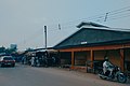 Meat market Hadejia
 -
 Hadejia fish market
 -
 Milk market Hadejia
 -
 Toward the entrance to the Hadejia Market
 -
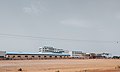 Abandoned Sugar refinery company in Hadejia
 -
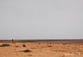 Farmland in eastern Hadejia
 -
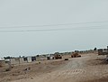
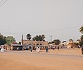
 Downtown Hadejia
 -
 The Central Office, Hadejia
 -
 Hisbah Office


- GLAM and educational institutes
-
 Hadejia Museum
 -
 IZALA University, under construction
 -
 The old primary school


- Culture
-
 Hadejia Cemetery
 -
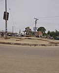 A roundabout in central Hadejia, past Gate Western
 -
 A colonial residence near Hadejia city
 -
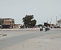
 Nguru Road toward NATO Motor Park
 -
 A roundabout at Gumel-Madana-Malam Maduri-Hadejia
 -
 Outside Koga Market Mosque, Hadejia
 -
 Emir's Palace Hadejia
 -
 Grave of Captain Phillips (kabarin mai tumbi)


References
[edit]- ^ "Hadejia". Encyclopædia Britannica. Encyclopædia Britannica, Inc. Retrieved 22 December 2006.
- ^ GPS Coordinates: "https://latitude.to/map/ng/nigeria/cities/hadejia"
- ^ Isah Abubakar (2018) "Use of ICT among Extension Agents in Hadejia Local Government" Unpublished work
- ^ Chiroma, Muhammad J.; Kazaure, Yahaya D.; Karaye, Yahya B.; Gashua, Abba J. "Water Management Issues in the Hadejia-Jama'are-Komadugu-Yobe Basin: DFID-JWL and Stakeholders Experience in Information Sharing, Reaching Consensus and Physical Interventions" (PDF). International Water Management Institute. Archived from the original (PDF) on 9 June 2012. Retrieved 3 October 2009.
- ^ "Daura". Encyclopædia Britannica. Encyclopædia Britannica, Inc. Retrieved 21 December 2006.
- ^ Lange, Dierk. "Oral version of the Bayajidda legend" (PDF). Ancient Kingdoms of West Africa. Retrieved 21 December 2006.
- ^ Johnston, H. A. S (1967). "The Consolidation of the Empire". The Fulani Empire of Sokoto. Amana Online. Retrieved 21 January 2007.
- ^ "BINYAMINU USMAN POLYTECHNIC – P.M.B 013 Hadejia, Jigawa State".
- ^ "Jigawa State School of Nursing Hadejia - ONLINE APPLICATION". jisconmhadejia.admissions.cloud.
- ^ "National Teachers' Institute Kaduna". Archived from the original on 26 May 2022. Retrieved 7 May 2020.
- ^ Angbulu, Stephen (25 January 2023). "FG approves N10bn for Hadejia airstrip, Enugu control tower". Punch Newspapers. Retrieved 21 August 2023.
- ^ "Hadejia Valley irrigation will improve investment in agric, says minister". The Guardian Nigeria News - Nigeria and World News. 1 February 2023. Retrieved 21 August 2023.
- ^ "FULL LIST: Ikorodu, Ota, Wamba, Hadejia, areas that may experience flooding this week - Daily Trust". dailytrust.com. Retrieved 21 August 2023.
- ^ "Hadejia Climate, Weather By Month, Average Temperature (Nigeria) - Weather Spark". weatherspark.com. Retrieved 8 September 2023.
- ^ "Air Quality & Pollen Forecast for Hadejia". meteoblue. Retrieved 24 September 2023.
- ^ "Hadejia Air Quality Index (AQI) and Nigeria Air Pollution | IQAir". www.iqair.com. 24 September 2023. Retrieved 24 September 2023.
- ^ "Air Quality Hadejia: Live air quality and pollution Forecasts". Plume Labs Air Report. Retrieved 24 September 2023.
External links
[edit]- Official website Website of the Hadejia Emirate (archived)
12°27′N 10°02′E / 12.45°N 10.04°E
State capital: Dutse | ||
| Local government areas |  | |
Hadejia
View on GrokipediaHadejia is a town and traditional emirate in eastern Jigawa State, northern Nigeria, situated on the northern bank of the Hadejia River.[1] The emirate was officially founded in 1808 by Emir Sambo, who moved the headquarters to the town after his brother Umaru's leadership in the Fulani jihad against local kingdoms, consolidating seven pre-existing territories including Auyo and Gatarwa into a unified structure under Sokoto Caliphate influence.[1][2] With a projected population of around 179,000 in its local government area as of 2022, Hadejia functions as a primary market center for agricultural commodities such as cotton, millet, sorghum, rice, and fish, supporting the regional economy through farming, herding, trading, and wetland resources in the adjacent Hadejia-Nguru Wetlands, a UNESCO-recognized biosphere reserve vital for biodiversity and livelihoods.[3][1][4] The town remains the seat of the Emir of Hadejia, preserving Hausa-Fulani cultural heritage amid ongoing urbanization and irrigation potential from the river system.[2]