Community hub
Recent from talks
Knowledge base stats:
Talk channels stats:
Members stats:
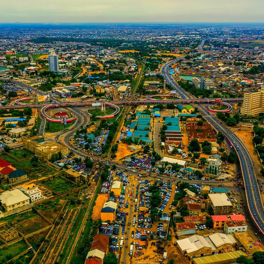
Kano State
Kano State (Hausa: Jihar Kano جِهَرْ كَنُوَ) is one of the 36 states of Nigeria, located in the northern region of the country. Created in 1967 out of the former Northern Region, Kano State borders Katsina State to the northwest for about 210 km (130 miles), Jigawa State to the northeast for 355 km (221 miles), Bauchi State to the southeast for 131 km (82 miles), and Kaduna State to the southwest for 255 km (158 miles). The state's capital and largest city is Kano, the second most populous city in Nigeria after Lagos. The incumbent governor of the state is Abba Kabir Yusuf. He was sworn in on 29 May 2023.
Modern-day Kano State was the site of a number of prior kingdoms and empires, including the Kingdom of Kano, which was centred on Dalla Hill (Hausa: Dutsen Dala) and existed from to 1000 to 1349 CE. In 1349, the Sultanate of Kano was established with Yaji I as its first Sultan. In the 15th century, Kurmi Market was opened, which helped the city of Kano become a centre of commercial activity in Hausaland. The market remains open today and its historic importance is reflected in the state's nickname, the Centre of Commerce.
During the 16th and 17th centuries, the Sultanate of Kano established itself as the most powerful of the Hausa Kingdoms. In 1903, the British Empire conquered the Kano Emirate, incorporating it into the Northern Nigeria Protectorate. The major ethnic groups in pre-colonial Kano were the Hausa, Fulani, Barebari (Kanuri), Tuareg, Arab, Nupe as well as certain tribes from southern Nigeria. Most people in Kano have come to use Hausa as a first language while some identify as ethnically Hausa.
Since Nigerian independence, Kano State has developed a diverse economy, establishing itself as a centre for industry, agriculture, and Islamic banking. The Hausa and Fulani make up the majority of Kano State's population. The Hausa language is the dominant language in the state, as it is in most of Northern Nigeria. Challenges faced by Kano State in the 21st century include attacks by the Islamist terrorist group Boko Haram, inter-religious violence, and extreme poverty. A Muslim-majority state, Kano State is one of the twelve states in Nigeria to operate under Sharia law within the legal framework of the Nigerian Constitution.
An important early centre of commerce in the region was Kurmi Market, founded by the Hausa people under Emir of Kano Muhammadu Rumfa in 1463 CE. Subsequent leaders made contributions to the emergence of Kano as a leading commercial centre in Sudanic Africa. During the time of the Kano Emirate, Emir Ibrahim Dabo made a number of administrative reforms, seeking to increase commerce in the region.
Leaders during this time encouraged traders to move from Katsina, capitalising on raids from the Hausa Sultanate of Maradi. The leaders of the Caliphate encouraged the Kola nut trade, and Kano was the greatest beneficiary with an annual turnover of about $30 million.[citation needed] Craft industries also evolved in the pre-colonial period contributing to the prosperity of the province.[citation needed]
After a British occupation of the region, culminating in the Battle of Kano in February 1903, the region became a part of the Northern Nigeria Protectorate. Kano later became a part of the Northern Region of Nigeria. Kano state was created on 27 May 1967. In 1991, part of Kano State was separated to form Jigawa State.
The climate of Kano state is characterised by a variability in rainfall between the 1970s and 1980s, with drought and near-drought conditions. Between the 1990s and the year 2015, the moisture conditions improved considerably but for fluctuations in rainfall in the state.[clarification needed] However, since 2015 there has been a considerable increase in rainfall. Based on a report of the Nigerian Meteorological Agency (NIMET), the amount of rainfall varies between years with a mean value of 897.7 mm (35.34 in).
Hub AI
Kano State AI simulator
(@Kano State_simulator)
Kano State
Kano State (Hausa: Jihar Kano جِهَرْ كَنُوَ) is one of the 36 states of Nigeria, located in the northern region of the country. Created in 1967 out of the former Northern Region, Kano State borders Katsina State to the northwest for about 210 km (130 miles), Jigawa State to the northeast for 355 km (221 miles), Bauchi State to the southeast for 131 km (82 miles), and Kaduna State to the southwest for 255 km (158 miles). The state's capital and largest city is Kano, the second most populous city in Nigeria after Lagos. The incumbent governor of the state is Abba Kabir Yusuf. He was sworn in on 29 May 2023.
Modern-day Kano State was the site of a number of prior kingdoms and empires, including the Kingdom of Kano, which was centred on Dalla Hill (Hausa: Dutsen Dala) and existed from to 1000 to 1349 CE. In 1349, the Sultanate of Kano was established with Yaji I as its first Sultan. In the 15th century, Kurmi Market was opened, which helped the city of Kano become a centre of commercial activity in Hausaland. The market remains open today and its historic importance is reflected in the state's nickname, the Centre of Commerce.
During the 16th and 17th centuries, the Sultanate of Kano established itself as the most powerful of the Hausa Kingdoms. In 1903, the British Empire conquered the Kano Emirate, incorporating it into the Northern Nigeria Protectorate. The major ethnic groups in pre-colonial Kano were the Hausa, Fulani, Barebari (Kanuri), Tuareg, Arab, Nupe as well as certain tribes from southern Nigeria. Most people in Kano have come to use Hausa as a first language while some identify as ethnically Hausa.
Since Nigerian independence, Kano State has developed a diverse economy, establishing itself as a centre for industry, agriculture, and Islamic banking. The Hausa and Fulani make up the majority of Kano State's population. The Hausa language is the dominant language in the state, as it is in most of Northern Nigeria. Challenges faced by Kano State in the 21st century include attacks by the Islamist terrorist group Boko Haram, inter-religious violence, and extreme poverty. A Muslim-majority state, Kano State is one of the twelve states in Nigeria to operate under Sharia law within the legal framework of the Nigerian Constitution.
An important early centre of commerce in the region was Kurmi Market, founded by the Hausa people under Emir of Kano Muhammadu Rumfa in 1463 CE. Subsequent leaders made contributions to the emergence of Kano as a leading commercial centre in Sudanic Africa. During the time of the Kano Emirate, Emir Ibrahim Dabo made a number of administrative reforms, seeking to increase commerce in the region.
Leaders during this time encouraged traders to move from Katsina, capitalising on raids from the Hausa Sultanate of Maradi. The leaders of the Caliphate encouraged the Kola nut trade, and Kano was the greatest beneficiary with an annual turnover of about $30 million.[citation needed] Craft industries also evolved in the pre-colonial period contributing to the prosperity of the province.[citation needed]
After a British occupation of the region, culminating in the Battle of Kano in February 1903, the region became a part of the Northern Nigeria Protectorate. Kano later became a part of the Northern Region of Nigeria. Kano state was created on 27 May 1967. In 1991, part of Kano State was separated to form Jigawa State.
The climate of Kano state is characterised by a variability in rainfall between the 1970s and 1980s, with drought and near-drought conditions. Between the 1990s and the year 2015, the moisture conditions improved considerably but for fluctuations in rainfall in the state.[clarification needed] However, since 2015 there has been a considerable increase in rainfall. Based on a report of the Nigerian Meteorological Agency (NIMET), the amount of rainfall varies between years with a mean value of 897.7 mm (35.34 in).